Tags
Baltimore, engineering, HISTORY, Jones Falls, sewage, water, water history
When I first saw the structure below, in the color photographs, I thought it was some sort of old pedestrian bridge. After some research, and a look through the DPW Archives, I found the following information:
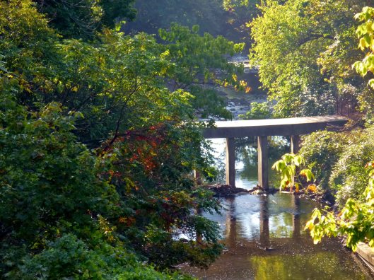
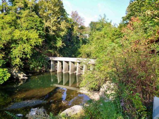
On June 9 and 10, 1911, Messrs. Hering, Gray and Stearns again visited Baltimore for the purpose of inspecting Jones’ Falls above North Avenue Bridge, also to examine the plans for a drift-catcher, and on July 27 reported to the Commission approving the plans, etc., of the Chief Engineer. The drift-catcher, or interceptor, will be constructed at a point south of the Cedar Avenue Bridge, most available from an engineering and practical standpoint, rights having been obtained, without cost, from the Northern Central Railway, which owns the property on the west side of the Falls, and from Mrs. Fannie A. Timanus, on the east side
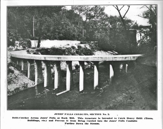
Appendix A: Report of the Consultant Engineers. Concerning a drift catcher and Jones Falls conduits. We have considered Mr. Hendrick’s suggestion of the possible obstruction of these conduits by trees, bridges, small buildings or other things which might be washed away by a phenomenal flood, such as is provided for in this case, and while it seems probable that with conduits of such magnitude nearly all large objects would pass through without obstructing them, some large objects, if not intercepted elsewhere, might lodge on the dividing walls at the head of the triple conduit and cause an obstruction. We, therefore, approve the adoption of some plan which will provide at a suitable place above the head of the conduits means for intercepting large floating objects.
The arch and pier type of structure, which we approve, is shown in part upon the preliminary plan furnished by Mr. Hendrick, entitled “Studies for Drift-Catcher,” and in part upon a plan, dated July 12, 1911, giving alternate designs of the drift-catcher. The general design consists of narrow piers about 20 feet high, spaced 8 feet apart from center to center, held at the bottom by being concreted into pits excavated in the rock, and at the top by a horizontal concrete arch extending from one side of the valley to the other and abutting against the ledge.
Completed in 1912.