• About
  • History Writings

Water and Me

Water and Me

Tag Archives: Liberty Dam

North Patapsco Bridges

25 Wednesday Apr 2018

Posted by Ronald Parks in Baltimore, Dams, engineering, water history

≈ 4 Comments

Tags

Baltimore, bridges, Dams, engineering, HISTORY, Liberty Dam, mills, Public Works, water history

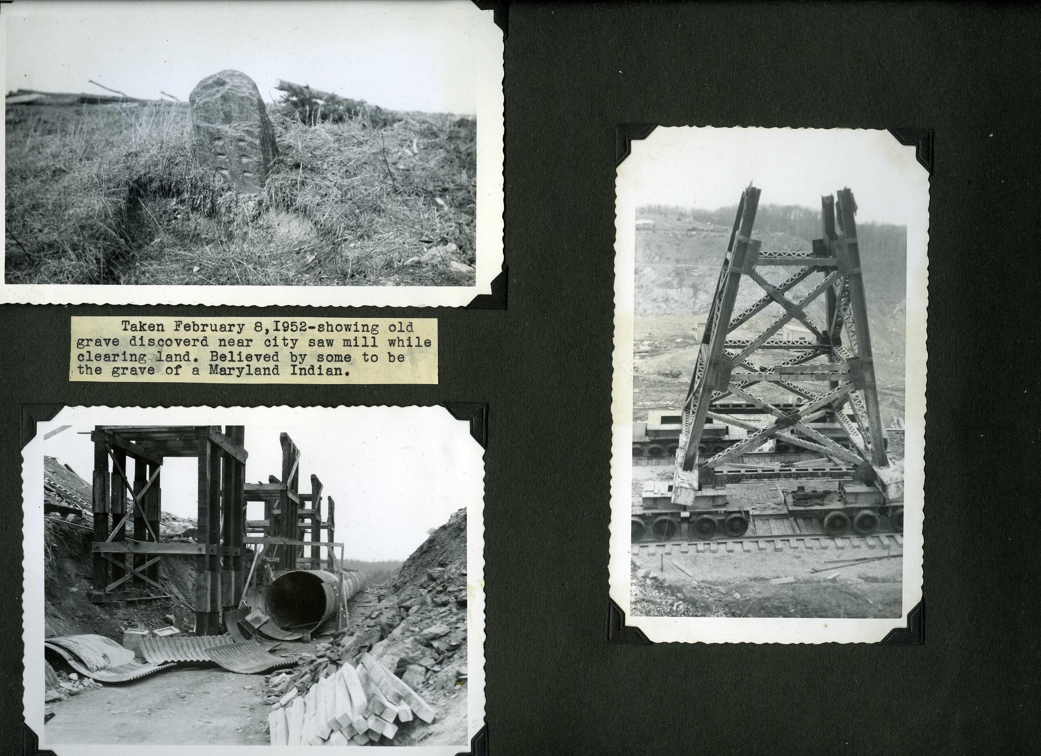
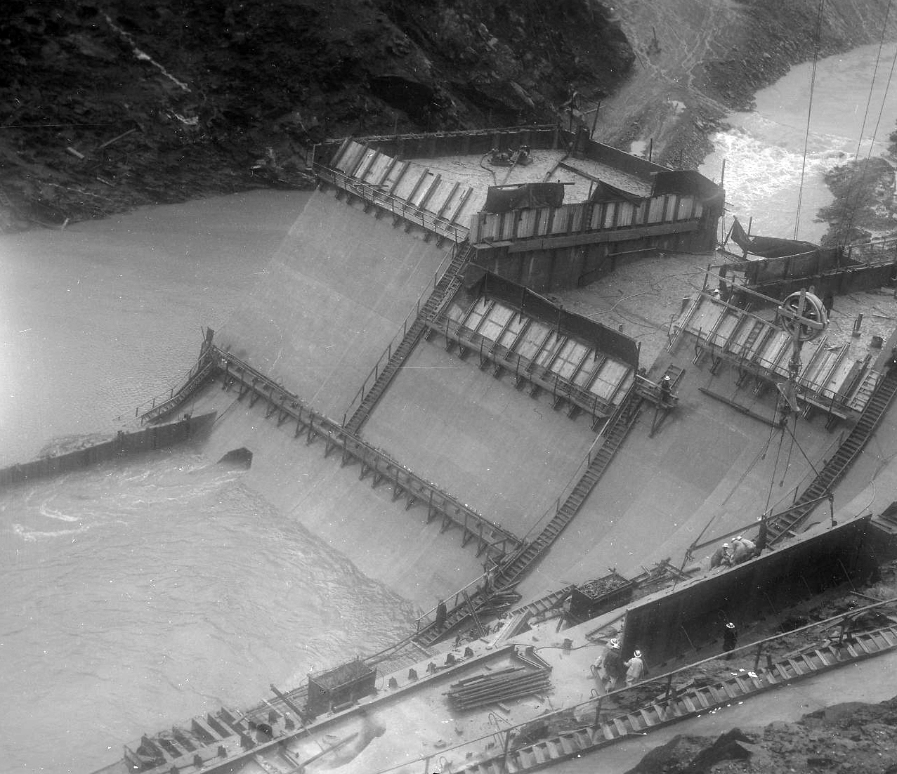
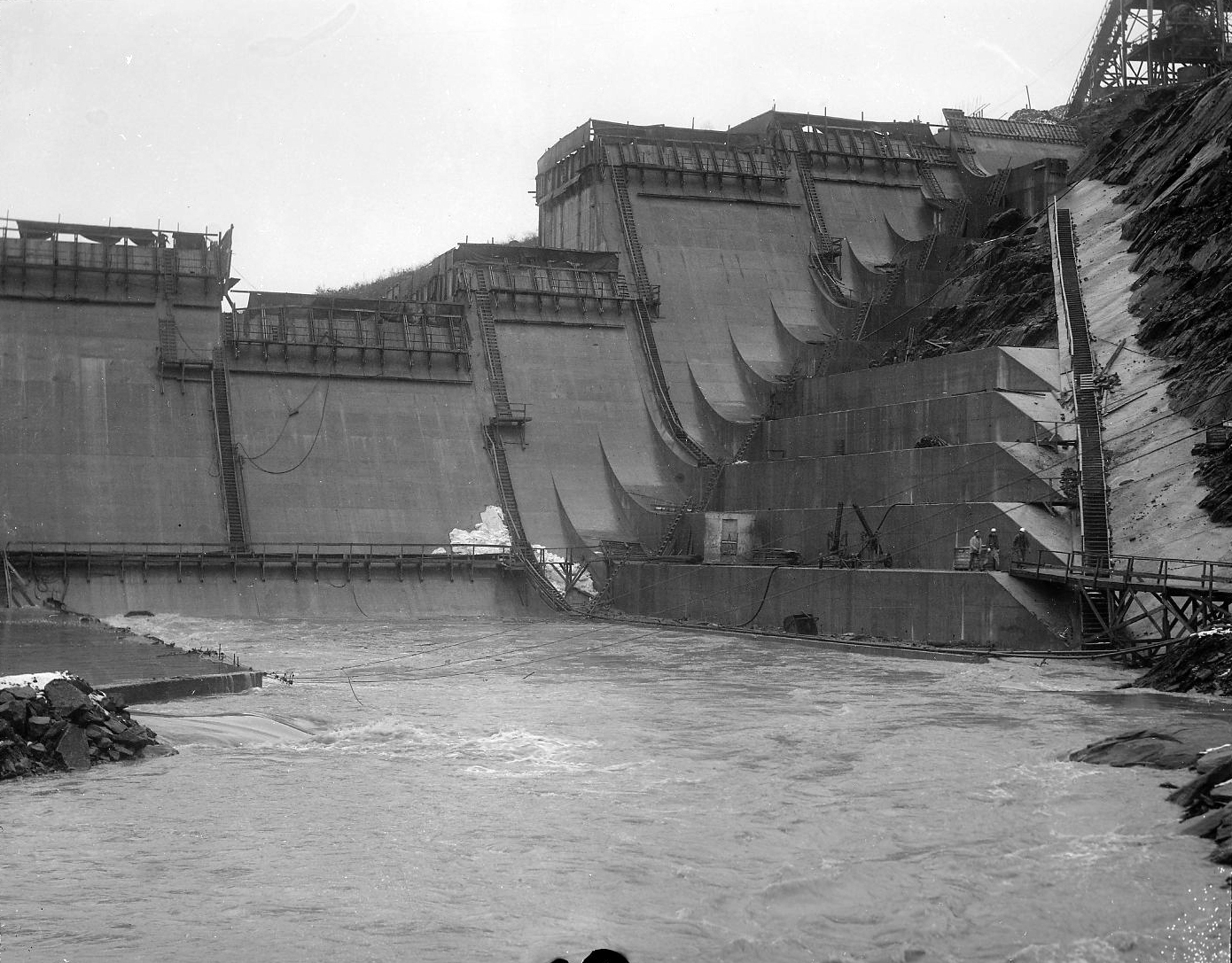
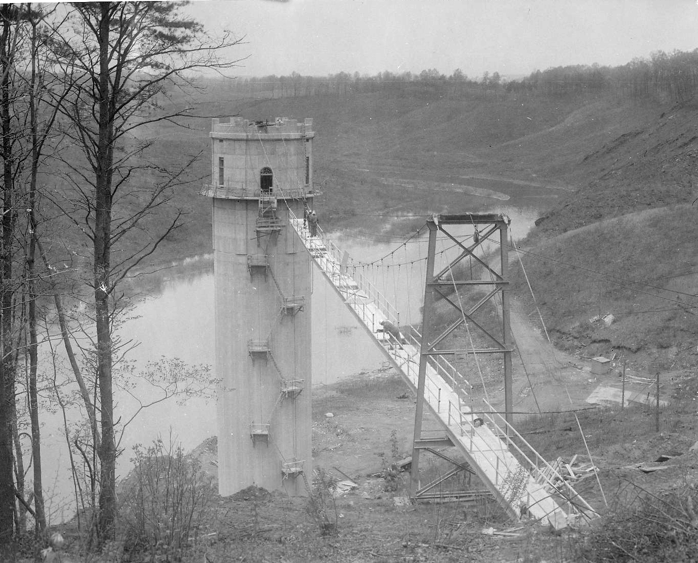
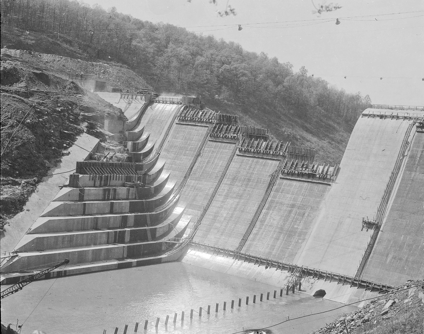
More from the Loose Ends Never Ends files. I have about 500 more negatives to scan in this one collection. Just finished up more of the Liberty Dam and adjacent bridges. I must confess, I have never really done a lot of research concerning these bridges. Over the years I have found hundreds of photographs/negatives, and only found a few of them interesting; like Liberty Lumber, the Indian grave marker and the dam itself. Although I really like climbing on and under bridges, I never gave these photos much thought. Looking at Google Maps, it is hard to place the original/present location of these bridges. I’m just not familiar with the area’s history. Most are from the early 1950s.

Ivy Mill Bridge is first. I like this one because it shows the old structure in the background. This photo is one of the few with a description attached.

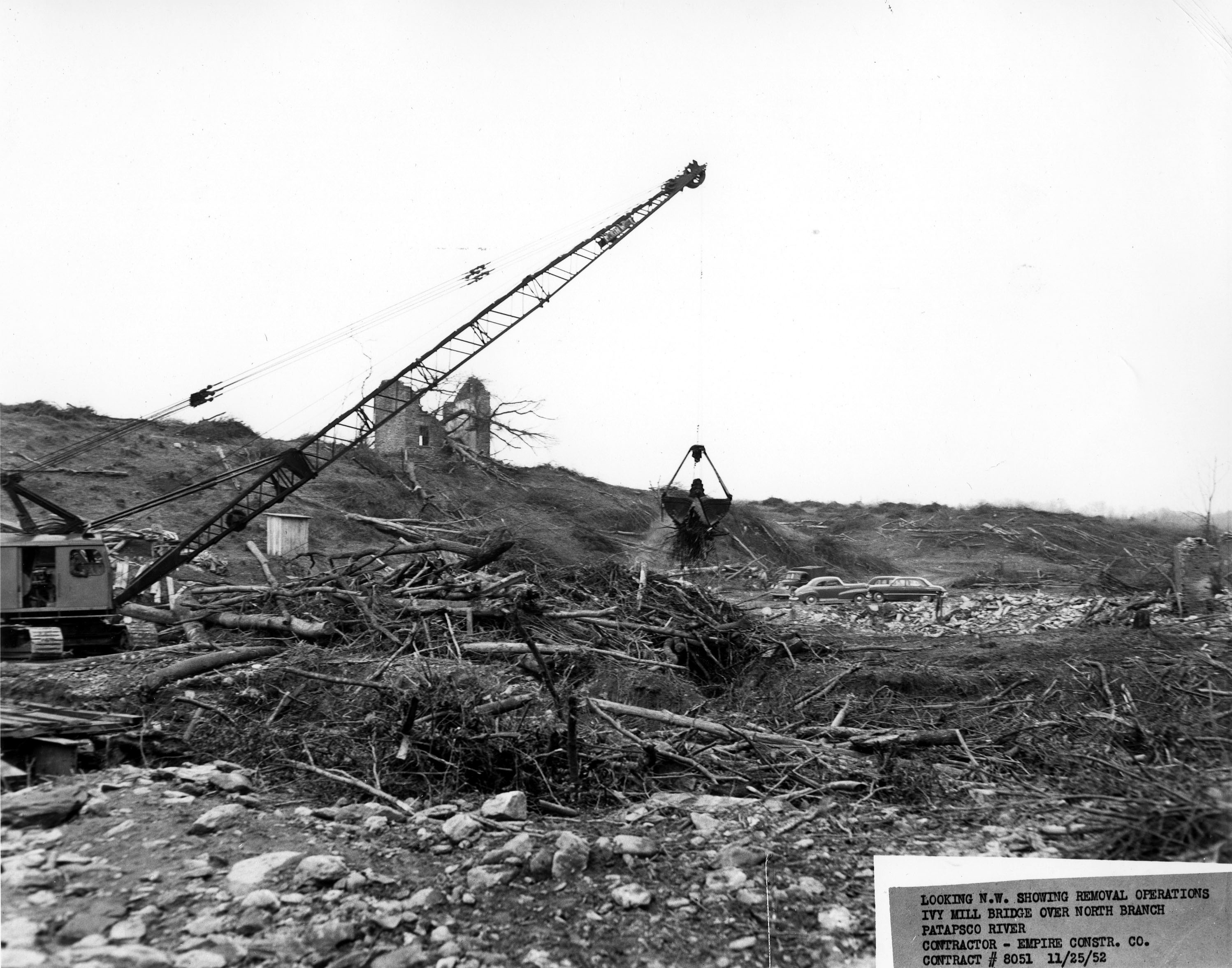
Beginning construction, temporary bridges were built.

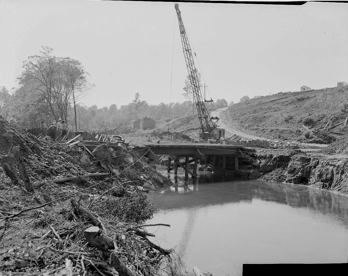
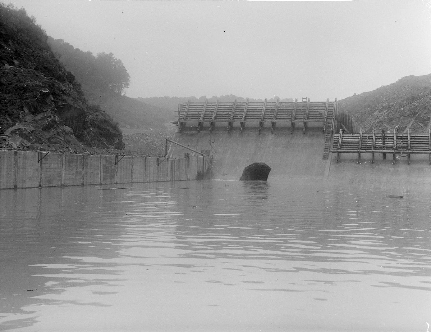
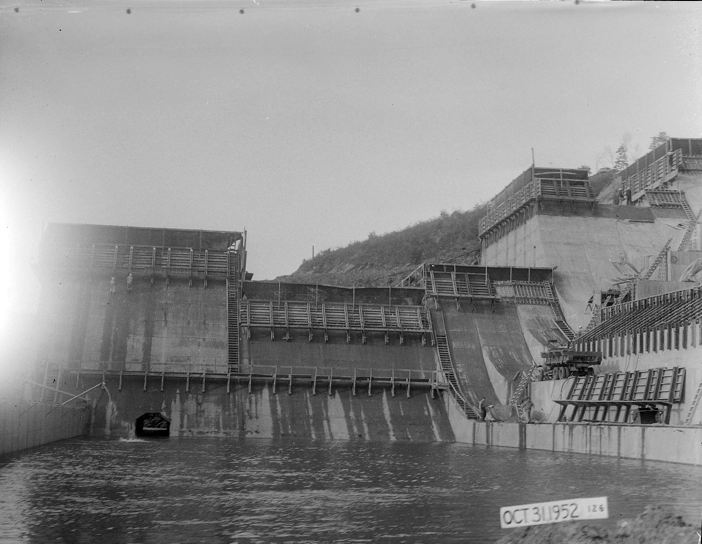
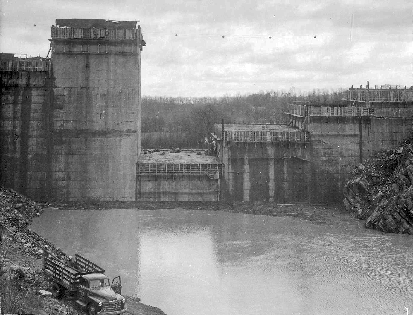
Foundation and columns poured.

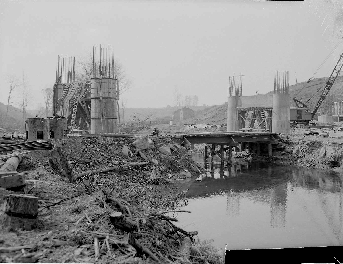
As can be seen, these photos are missing the contractor’s descriptions of work – black rectangular areas on photos.

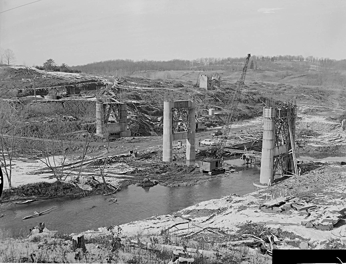
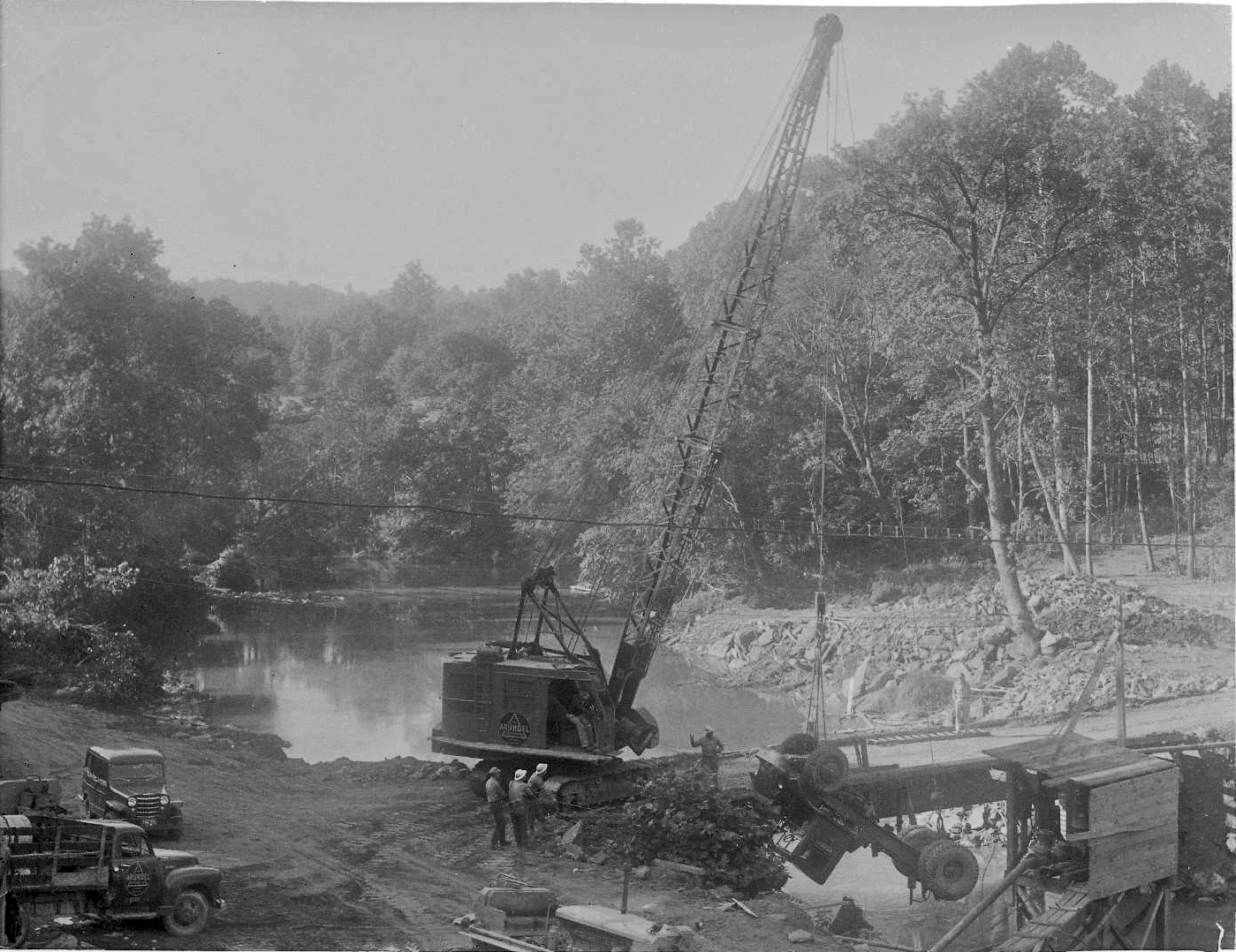
Moving right along with progress.

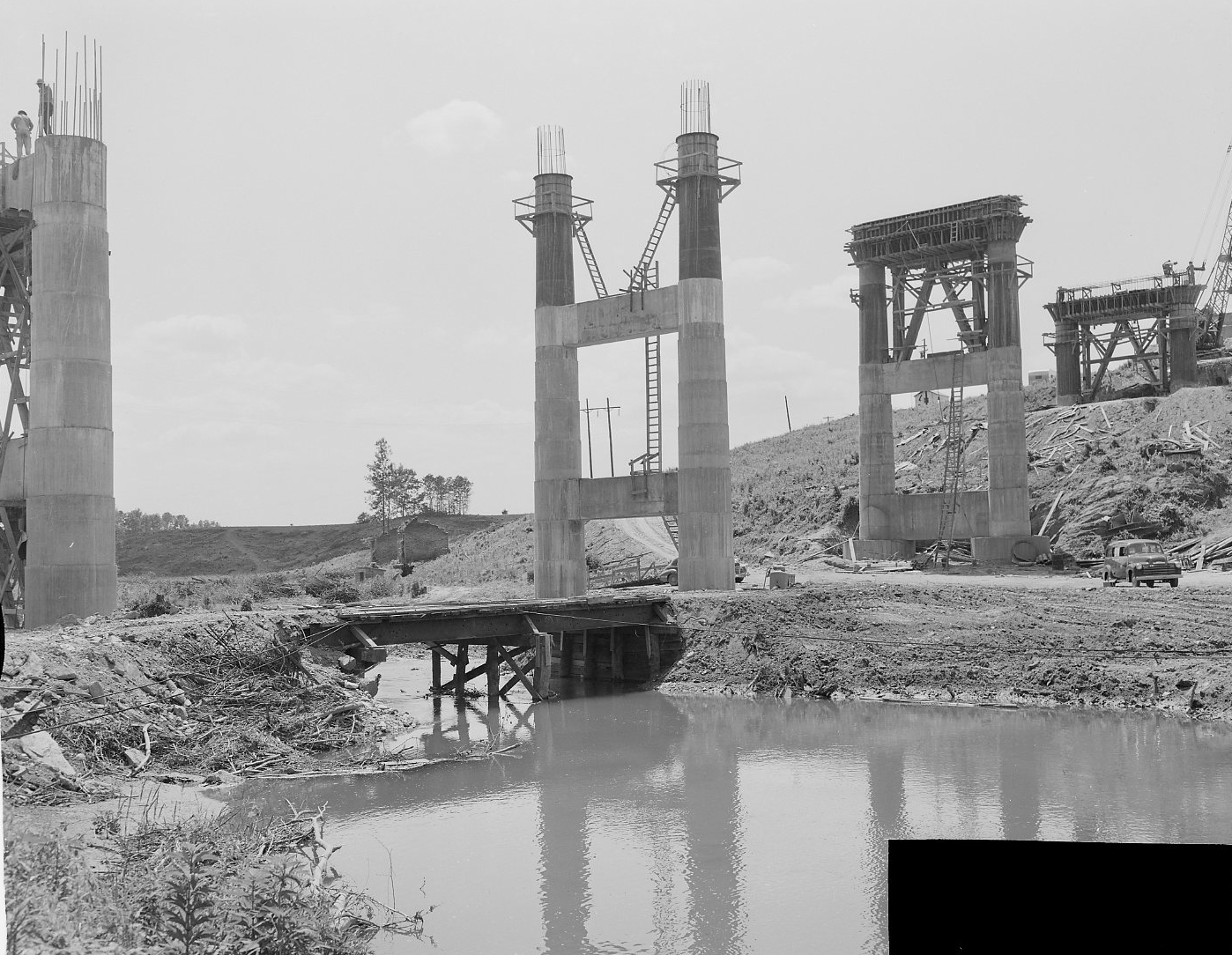
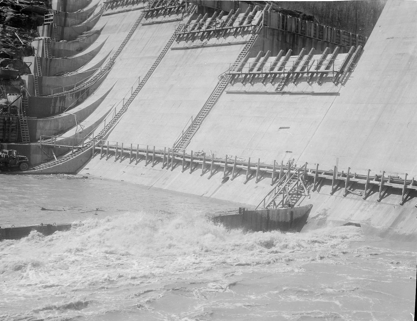
Reaching the final height and then comes the decking.

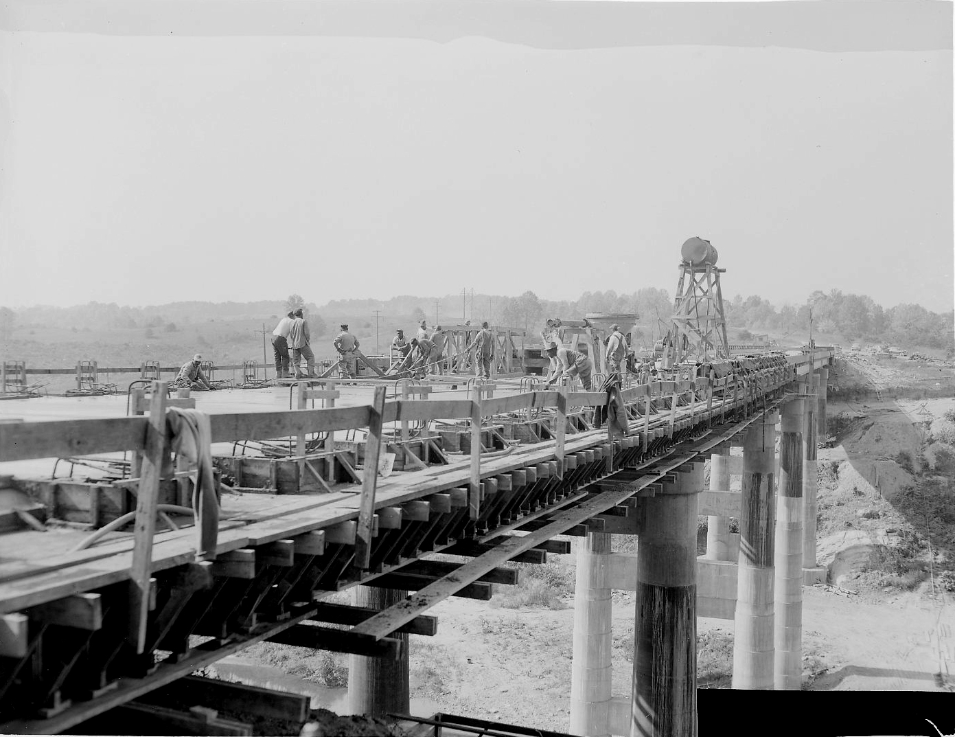
The finished bridge.

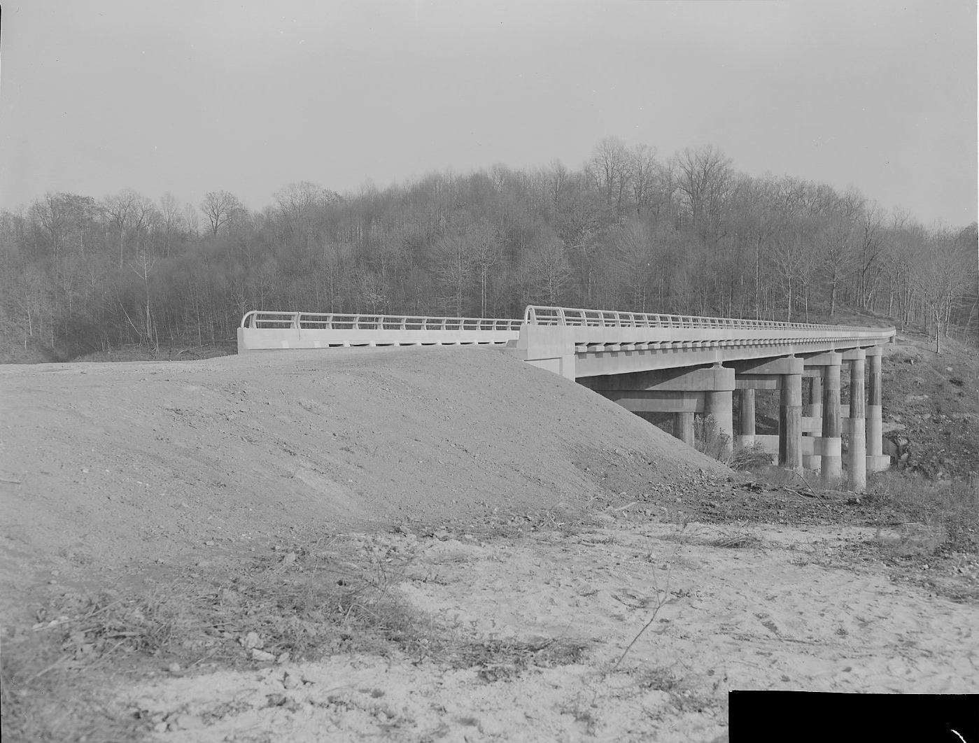
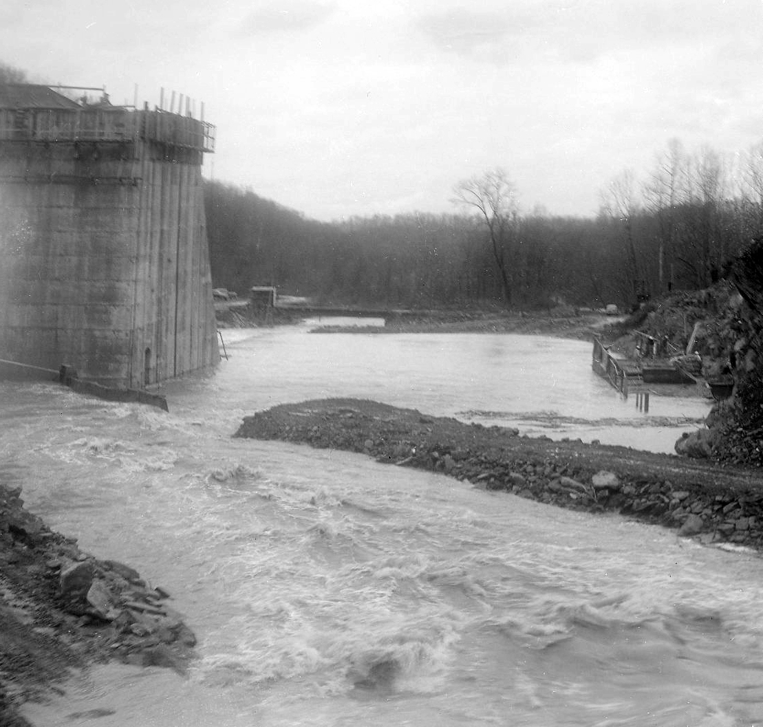
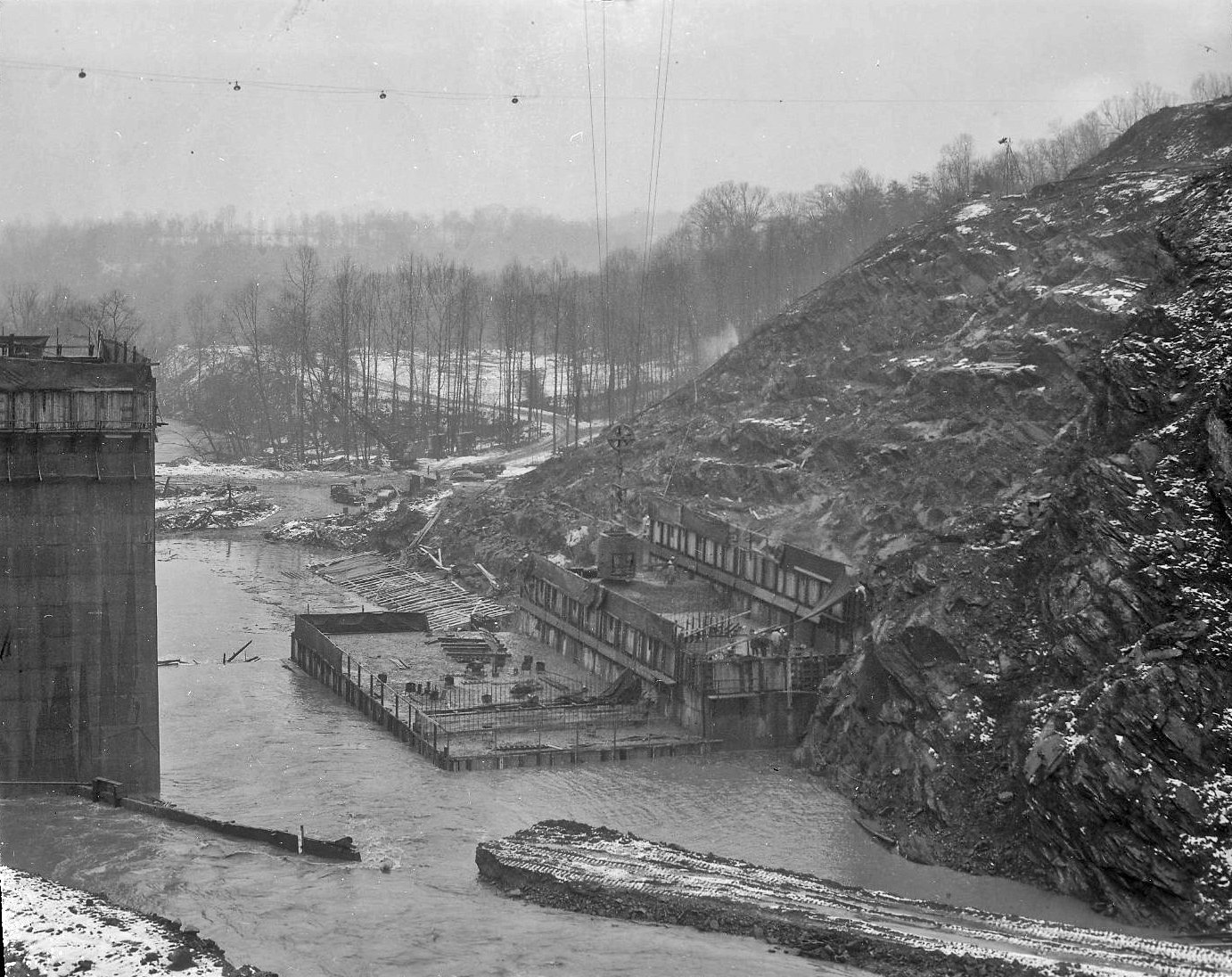
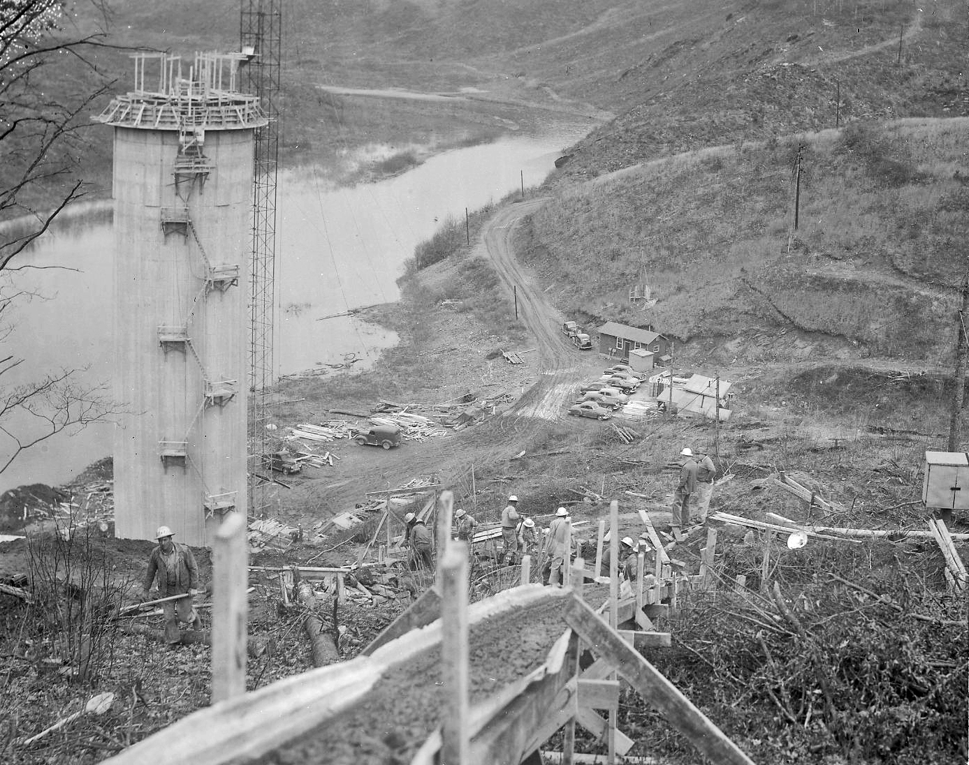
Next collection of negatives were marked as North Branch Over Patapsco, including Morgan Run. General view of the area.

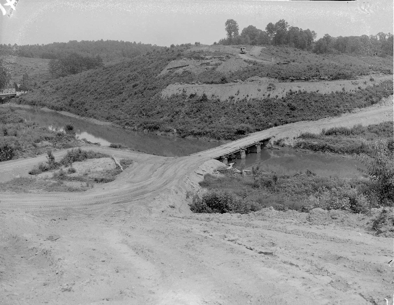
Setting forms for foundations.
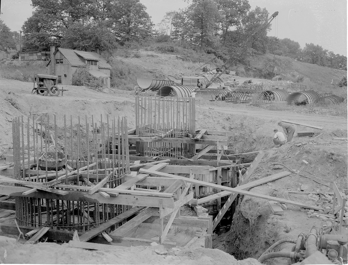
Columns.

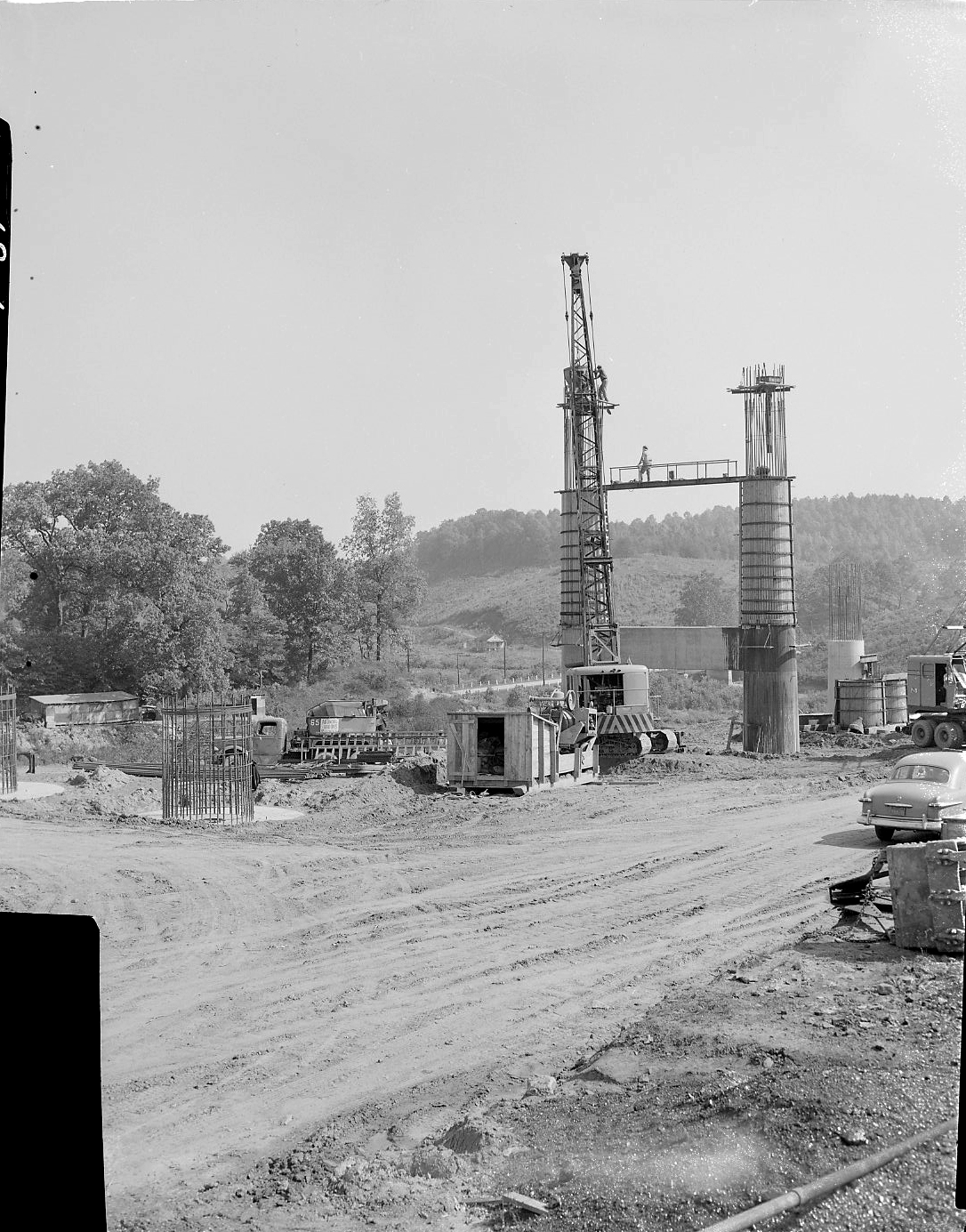
Ready to place decking.

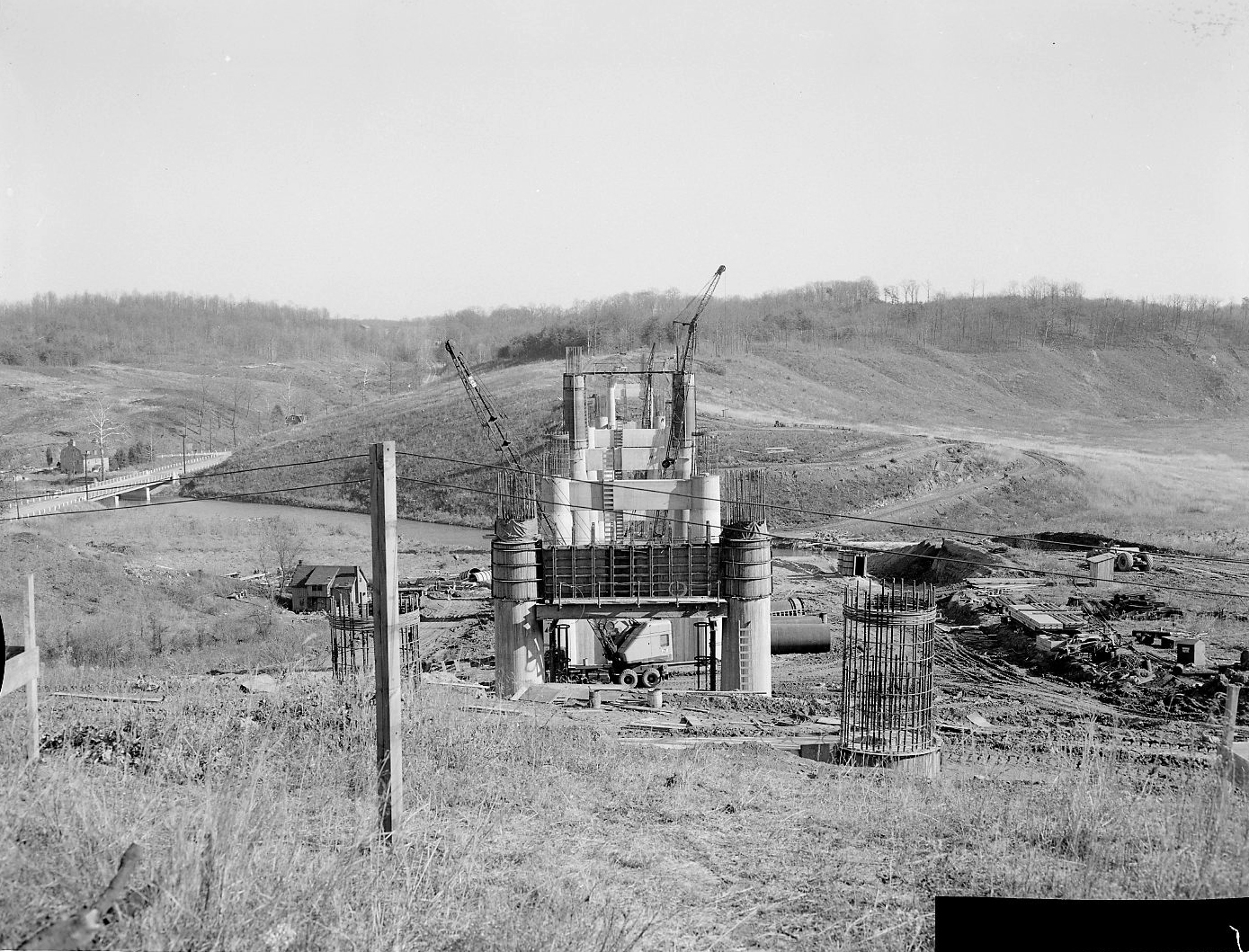
Putting on final touches.

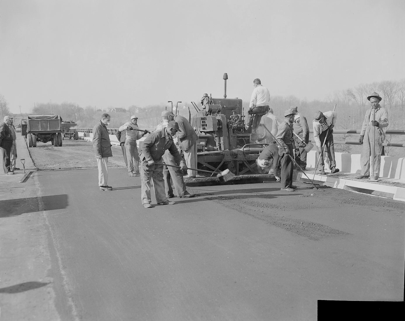
Finished bridge from old bridge. (I wonder if this old one is underwater?)

The next group I found were of the Snowden Creek Bridge. Not many photos in this collection. It must be way up there because it looks pretty shallow. Forms poured and ready for decking.
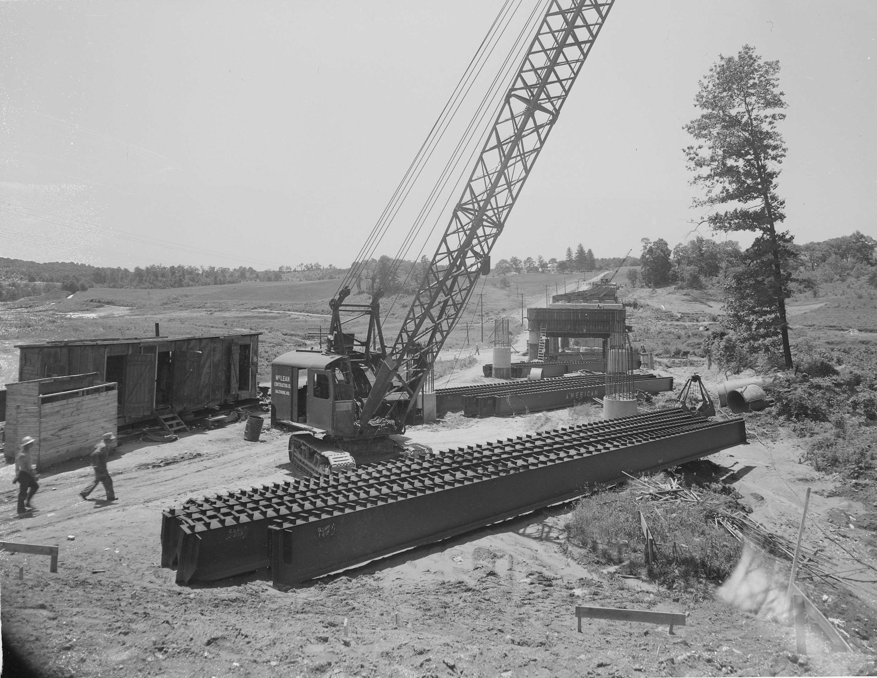
Near completion. 

The next 500+ negatives to document are of building the Susquehanna Tunnel.

Here is the photo of the grave marker, taken from an engineer’s scrapbook. 


Liberty Dam Continued

10 Tuesday Apr 2018

Posted by Ronald Parks in Baltimore, engineering, water history

≈ 6 Comments

Tags

Baltimore, Dams, engineering, HISTORY, Liberty Dam, nature, Public Works, water, water history

There were another 120 negatives in the Liberty Dam collection. I scanned all of those. The file drawer also contained about 250 negatives, building the Ashburton Filtration Plant. Fortunately I had previously scanned these from photo albums – all but 22 that were missing from those albums. I hope when and if they get someone to take my place doing this archiving, they will be able to put all like albums/negatives/photos together in proper groups. I am not sure I will have the time. As it has been, I just scanned and documented them as I pulled them from shelves, dusted them off, documented and then packed them back up for storage.

Here are some more from Liberty Dam 9/1/1952 – 10/6/1953 (The next drawer has a bunch of negatives from building the bridges across the reservoir).

Another accident. A truck went off the bridge and is being hoisted out by crane.

Man, I wish I was there with my kayak! This is the relief opening so the contractor can start building on the opposite side of the river.

Images 125 through about 180, the negatives all have this overexposed spot on the left hand side. Some I trimmed but others I was not able to.

And then the floods came.

This one was strong enough to wipe out the coffer dam, but the men are steadily working on the right, placing forms for this portion of the dam.

While one crew is placing the foundation to the west, the east gang continues to raise the elevation of the dam.

Still working against the floods and snow.

Meanwhile, upstream a ways, the intake structure is almost done. A couple things about this photo – how tall the structure is and how deep the water will be at this point of the reservoir. Also, I’m not sure why they didn’t grub, remove the plant growth that will eventually be underwater?

After a few months, the base areas of the dam are completed. Not seen here, underwater, is a relief opening (Kayak hole). Another flood has happened and the water has risen.

Wow – kind of looks like Conowingo Dam on a small scale. I wonder how much sediment is in this reservoir, against the face of this dam?? Since 1956??

The water just rages through. eventually the relief opening will be closed and water will either go over the top of the dam or through the intake structure and head to the Ashburton Filters.

Putting the finishing touches on the intake structure.

Almost done. I have posted on another blog (or Facebook) the finished dam and that engineers were wagering on when the reservoir would fill and the dam would crest? The Liberty Reservoir reached the crest point of four hundred and twenty feet on February 6, 1956, approximately nineteen months after the filling of the reservoir began on July 22, 1954

Blogroll

  • Flouride Action Network
  • lulu
  • My Book
  • WordPress.com
  • WordPress.org

Recent Posts

  • In Search of The Skipjack Ada Mae
  • Trap Pond Kayak
  • Pusey Trail and Cemeteries
  • Chandler Tract (White Trail) 4 3 21
  • Oyster Fritters, Antiques, a Hike (and a bad sign)

Blog at WordPress.com.

  • Follow Following
    • Water and Me
    • Join 228 other followers
    • Already have a WordPress.com account? Log in now.
    • Water and Me
    • Customize
    • Follow Following
    • Sign up
    • Log in
    • Report this content
    • View site in Reader
    • Manage subscriptions
    • Collapse this bar
 

Loading Comments...