• About
  • History Writings

Water and Me

Water and Me

Category Archives: engineering

(Un)Haunted Road Trip

08 Monday Mar 2021

Posted by Ronald Parks in Cemetery, Covered Bridge, Eastern Shore, engineering, HISTORY, Road Trips

≈ 1 Comment

Tags

Bay, cell tower, Cemetery, Ghost, hanging tree, Haunted, historical markers, peach blossom, skipjack, Tilghman

During winter lock-down, I have been able to catch up on a lot of reading. I have always enjoyed local history books. Read quite a few of Baltimore’s History while living up there, so now I read a lot of Eastern Shore History. Right now I am reading The Rivers of the Eastern Shore while also reading The Lord’s Oysters. I mention places to Kathy that are in the books and she says, well, let’s go check them out. For this outing I referred to Haunted Eastern Shore.

First stop on the list was the White Marsh Cemetery, also known as the Hole in the Wall Cemetery. I guess a doorway could also be called a hole?

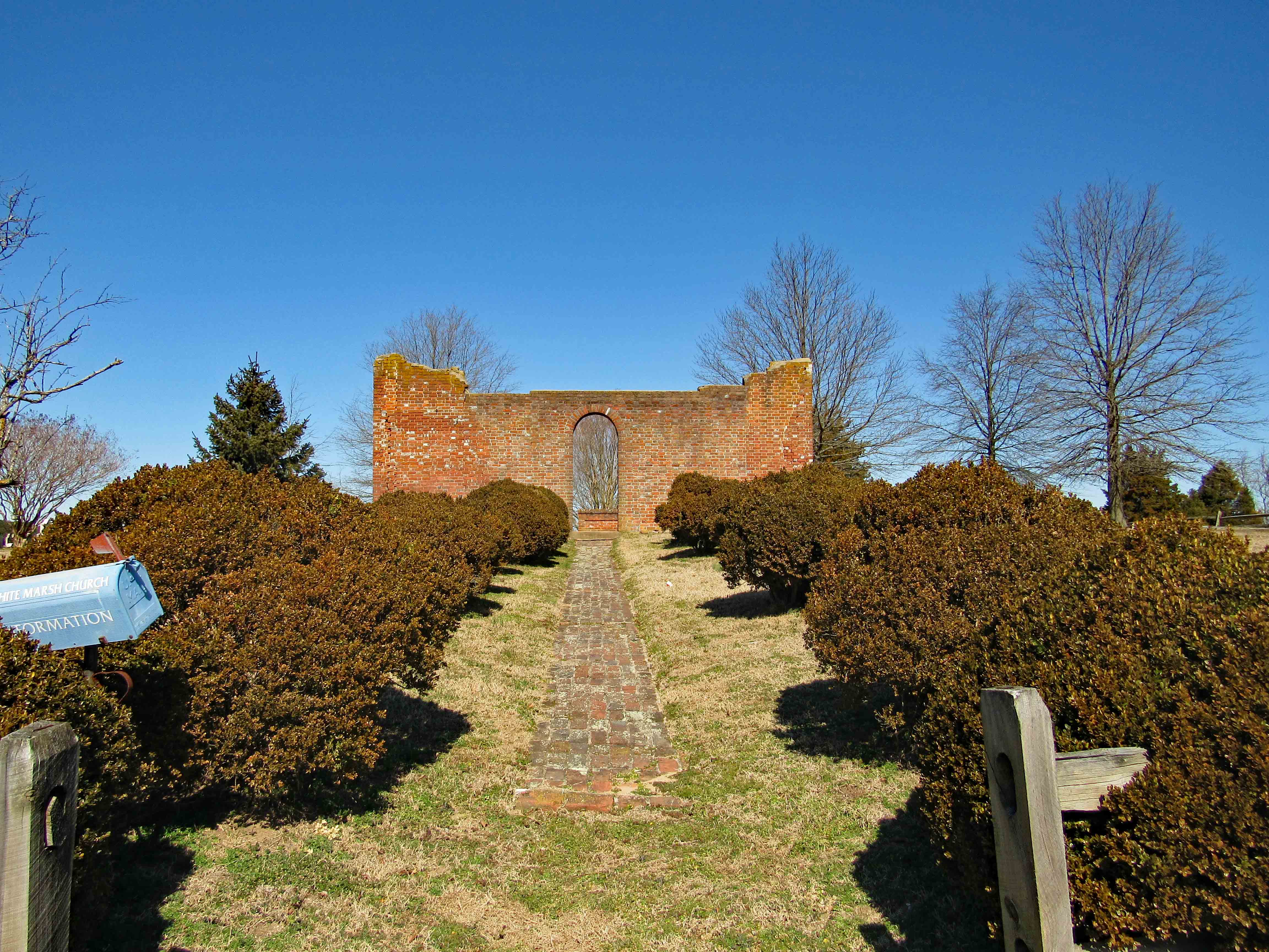
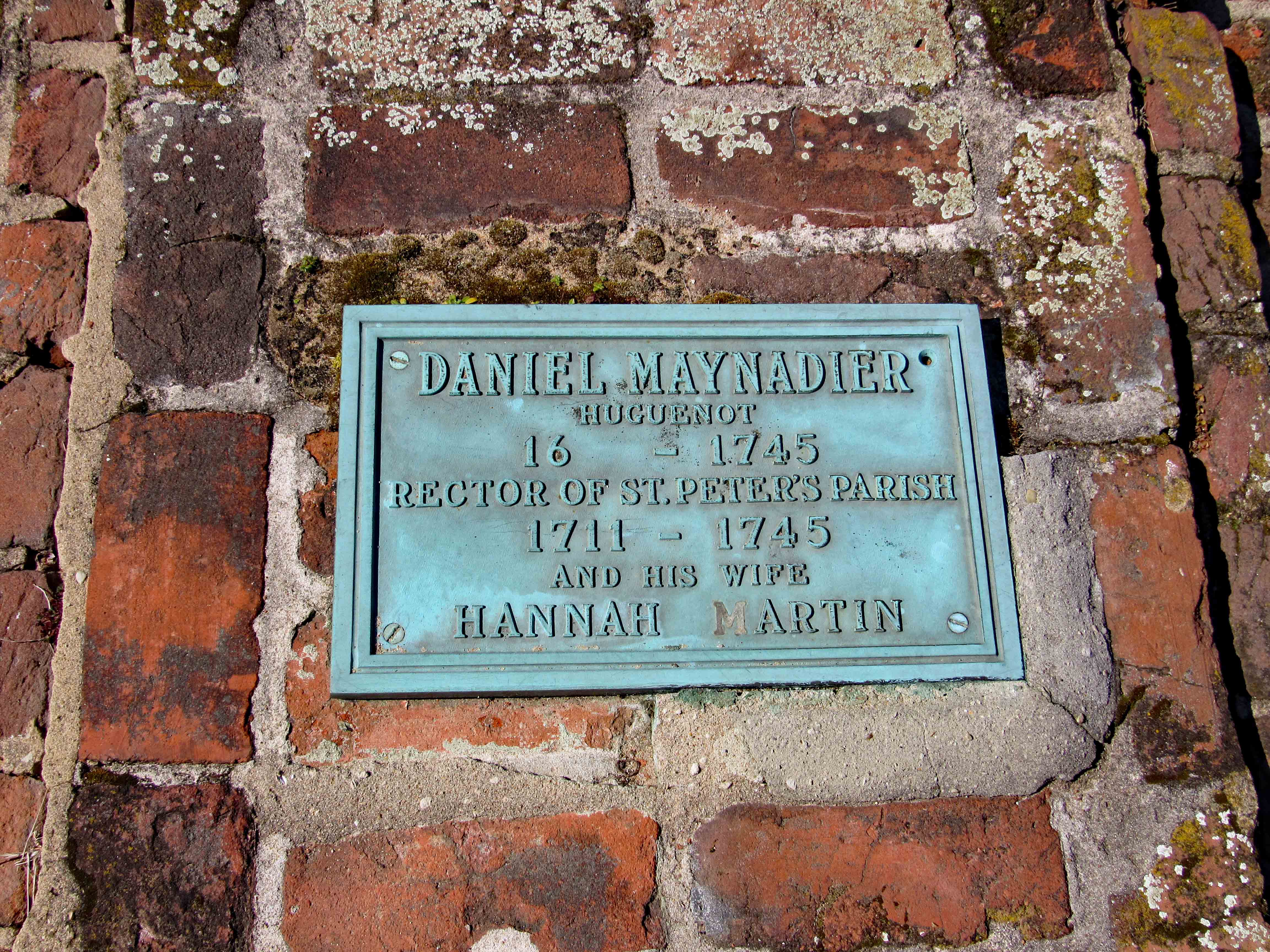
This cemetery is quite visible from Rte. 50 heading west from Trappe. Right hand side. Here is the historical marker.

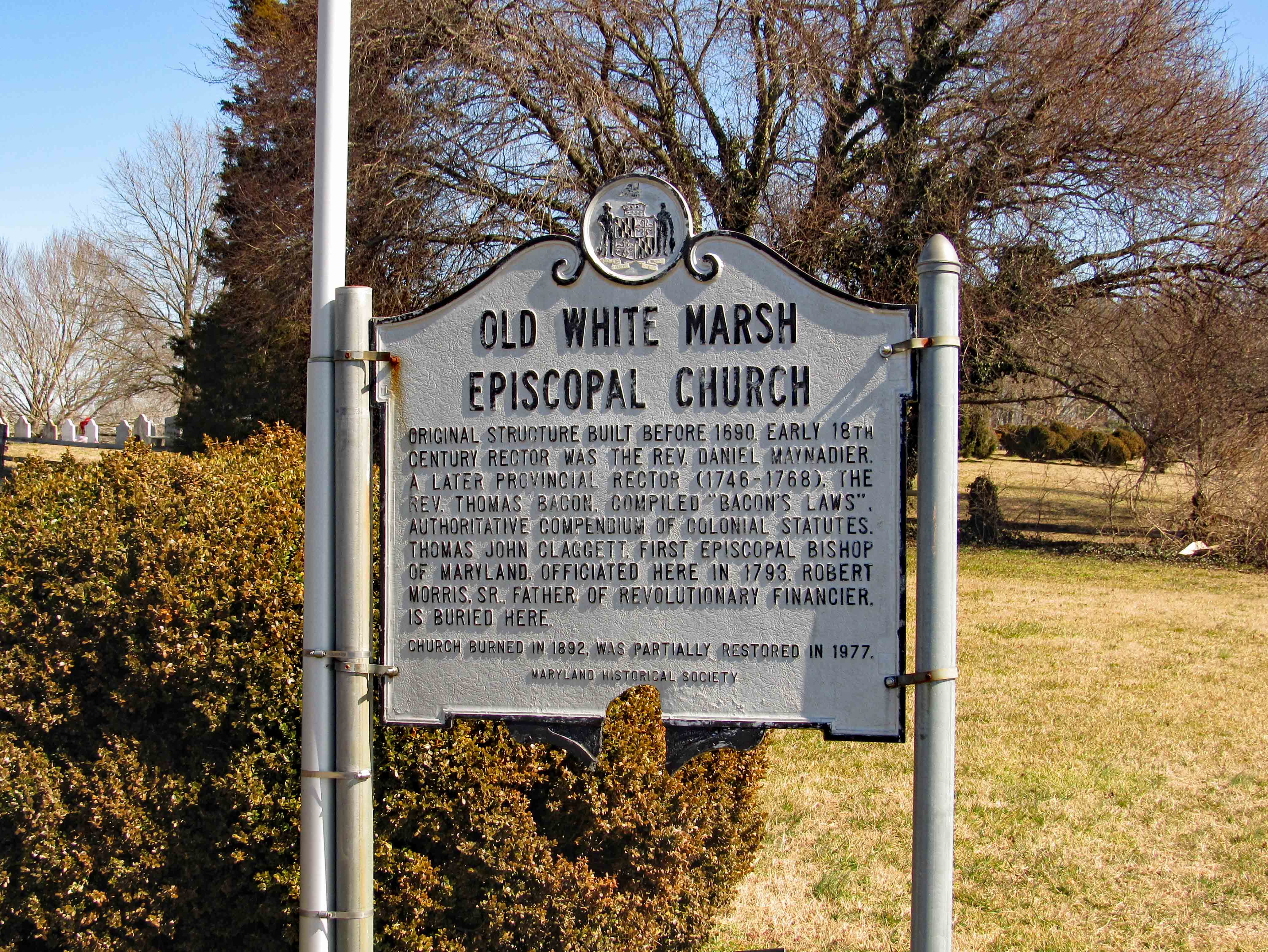
A couple notable haunted stories about this place are that the wife, Hanna, of the Reverend Maynadier of this church took ill and died. People knew she wanted to be buried with her favorite (expensive) ring and she was. The night after her burial two grave robbers dug her up and tried to pull the ring off her finger with no luck. The one robber pulled out his pocket knife and as he was trying to cut her finger off, she awoke from a coma and screamed – scaring them off. She made it home where she recovered. Supposedly you can see her roaming around the cemetery. We did not. It may have been too windy. She is buried with her husband.

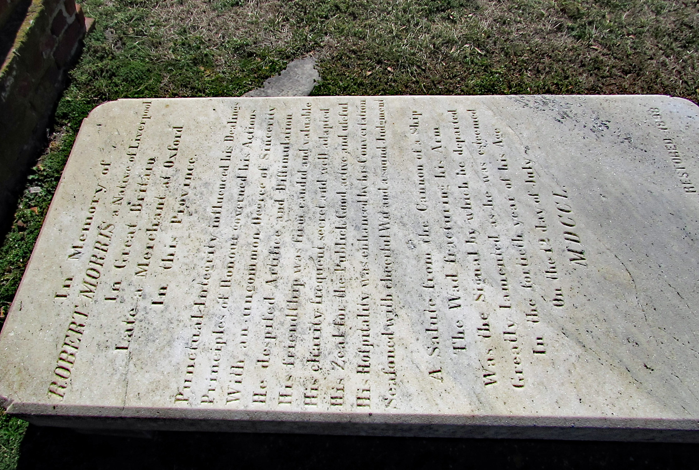
Another story is that of Robert Morris whose fate is described in the last paragraph of his burial stone/marker: A salute from the cannon of a ship, the wad fracturing his arm, was the means by which he departed July 12, 1750. Someone on the ship was to fire the cannon at the Captains signal – finger to nose. But a fly landed on his nose and when he shooed it off with his finger…well, you get the picture!

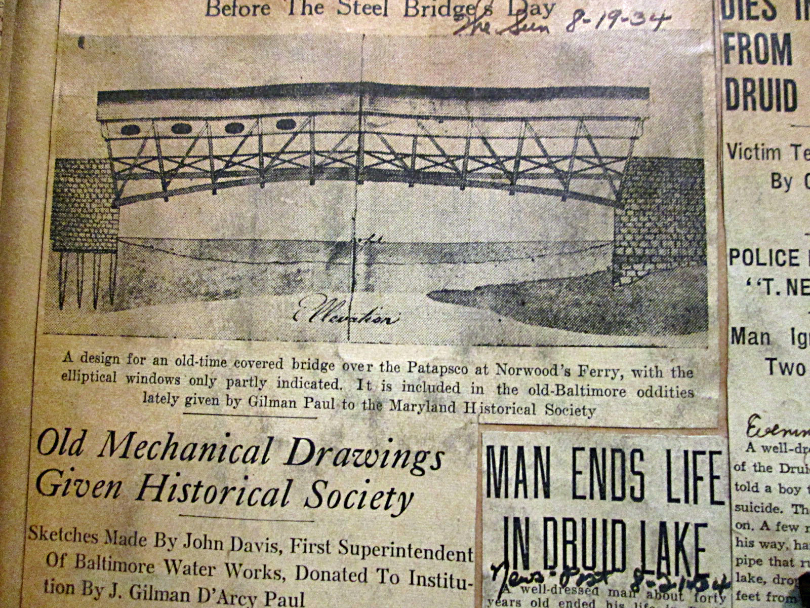
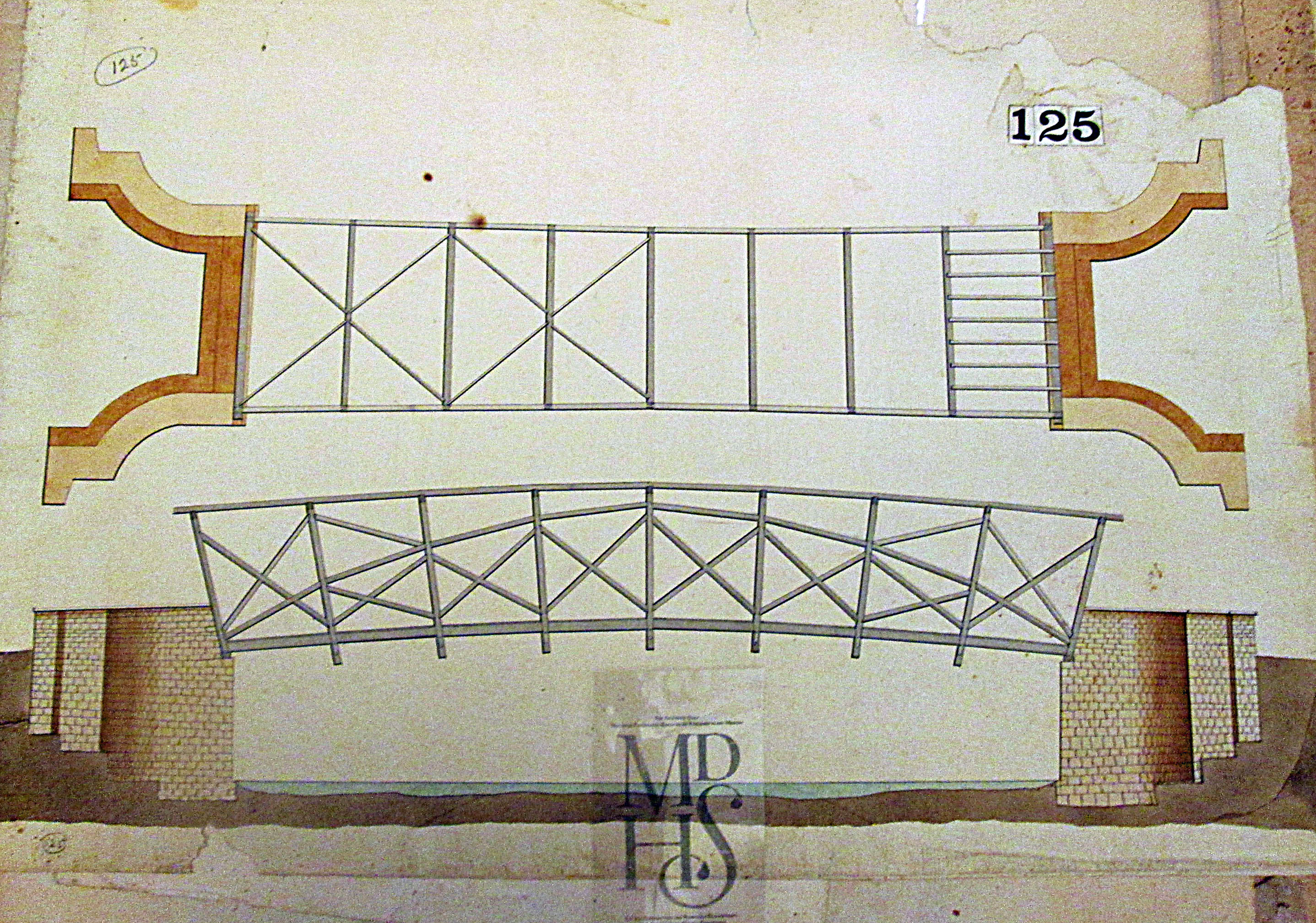
Next stop on our trip was Koon’s Easton Toyota about 3 miles north on Rte. 50. The Peach Blossom Creek Covered Bridge is another one of those places you see heading to and fro on Rte. 50. We tried once before to seek out a route to this bridge but ended up on private property and stopped.

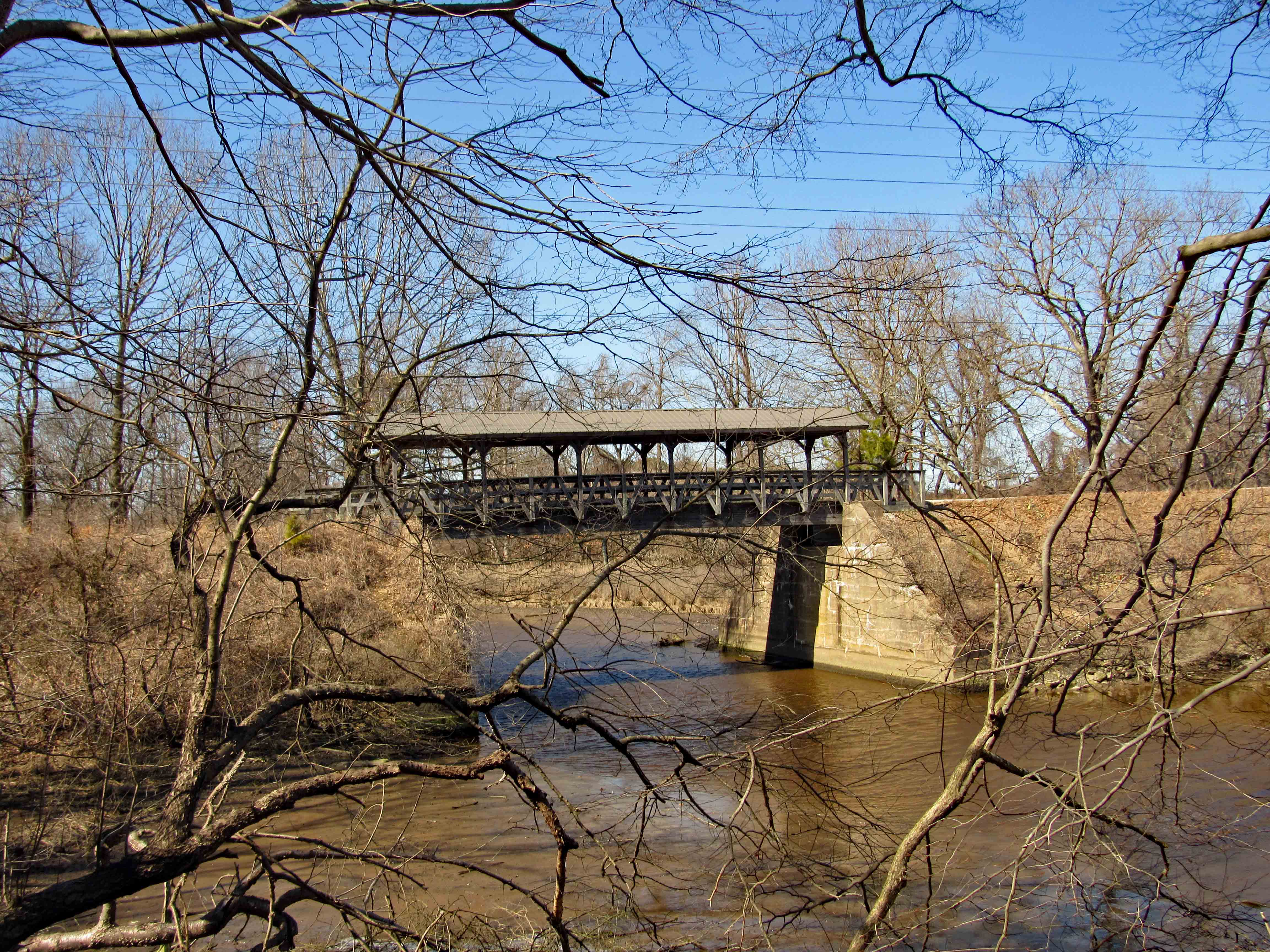
I decided to go into the dealership and ask permission to park in their lot and try to find a way through the marsh/woods. They said we could park there but didn’t think it was possible to get thru the marsh. One of the guys suggested walking up to the St. Michaels bypass and look for a path. That was a little too far to go so we headed behind the store and was stopped by the marsh, headed north to an opening and headed through the woods to a clearing and to the bridge.

Spirits but no ghost.

Finally to the bridge. Looking back at Koon’s and no, we would not have made it through the marsh.

We didn’t see this going in, but this is where we came out next to Rte. 50.

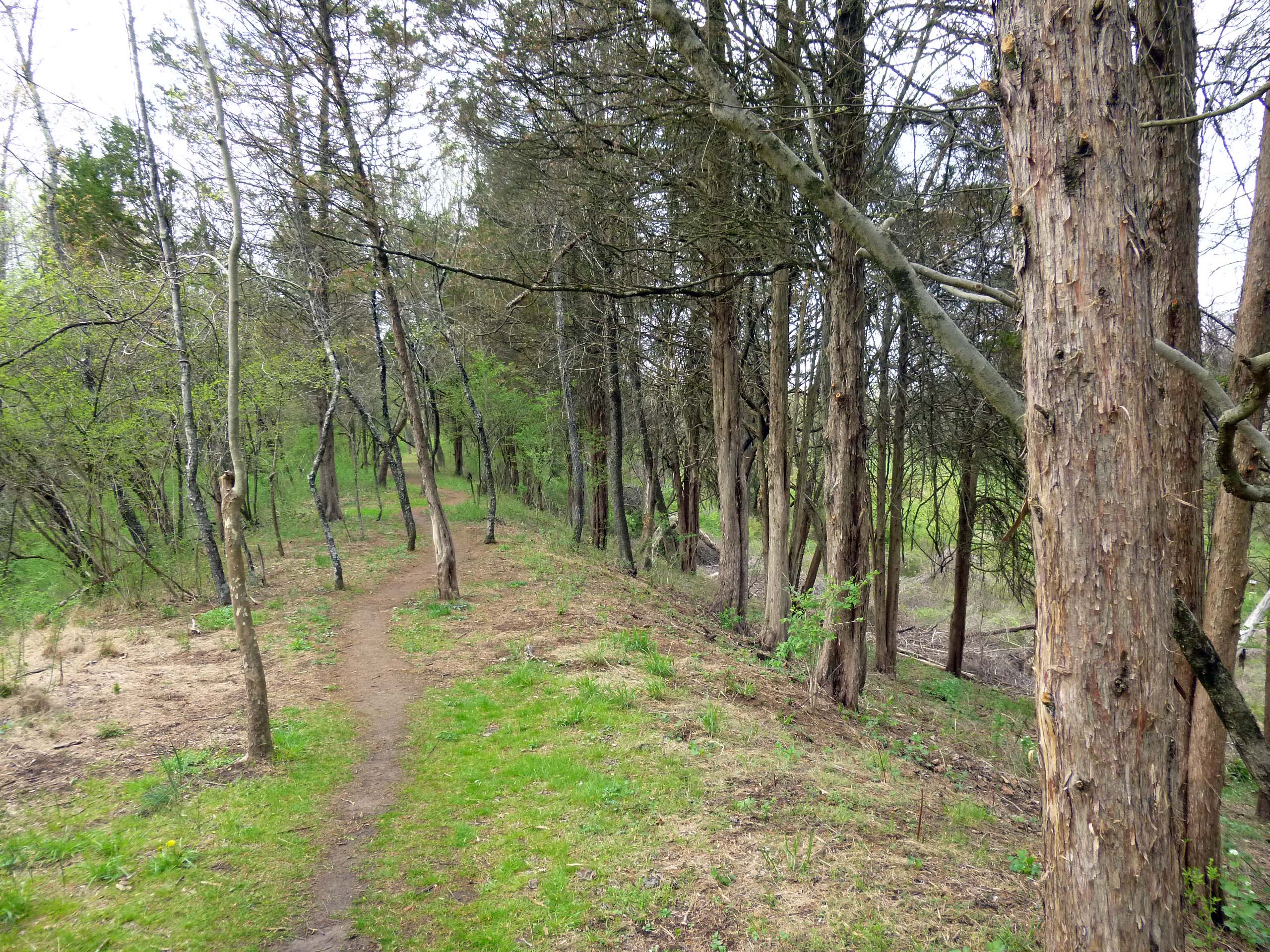
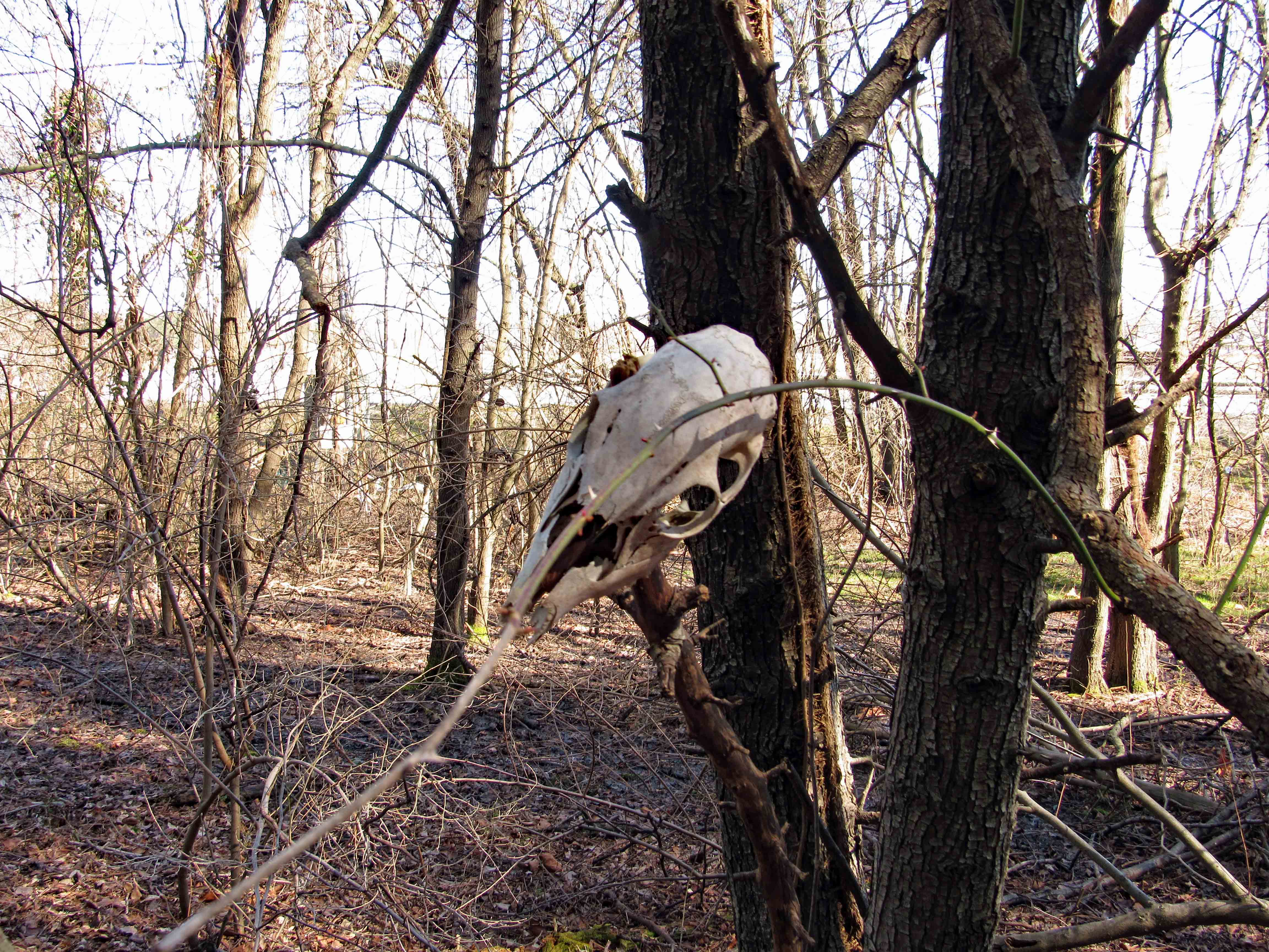
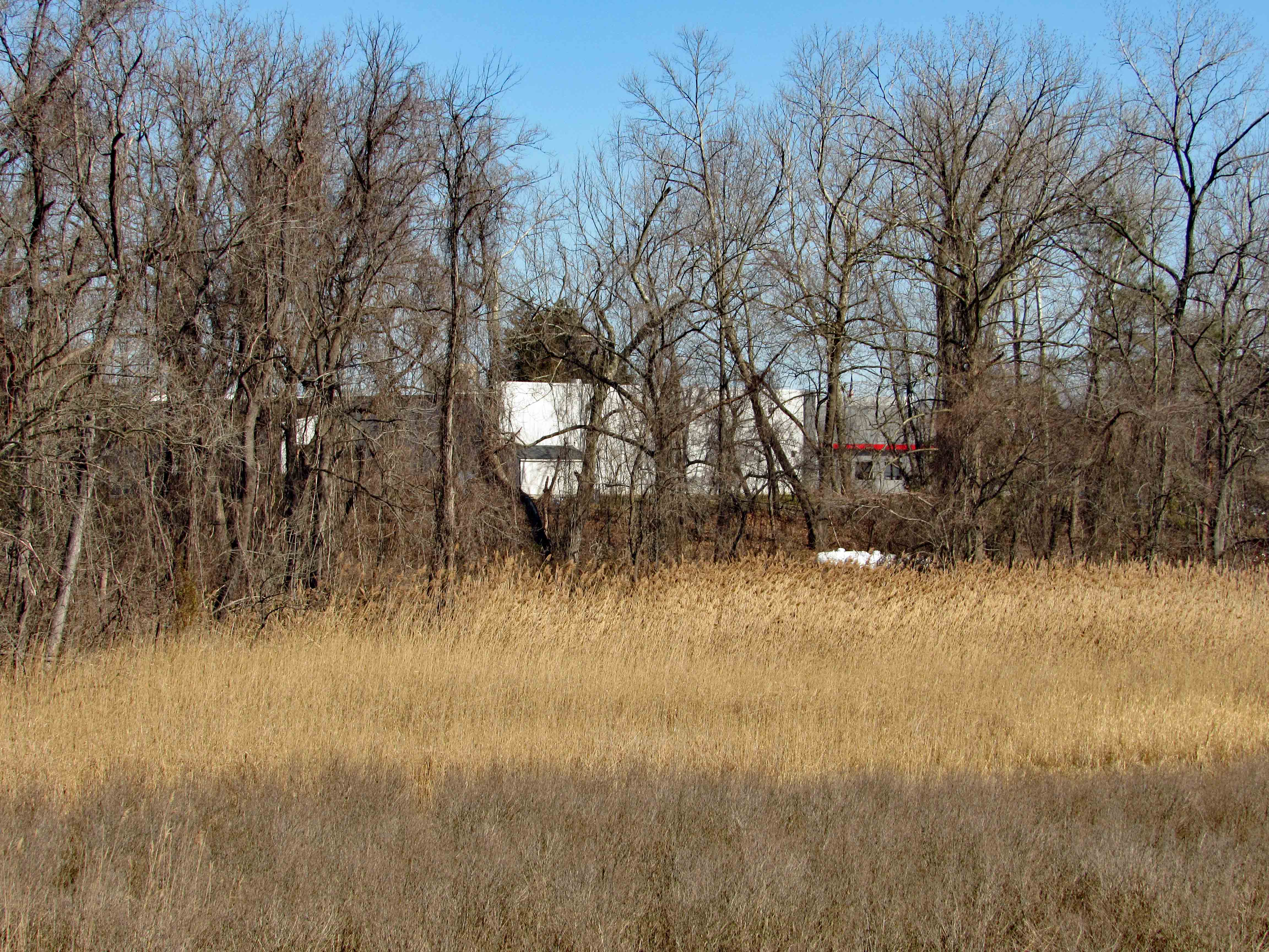
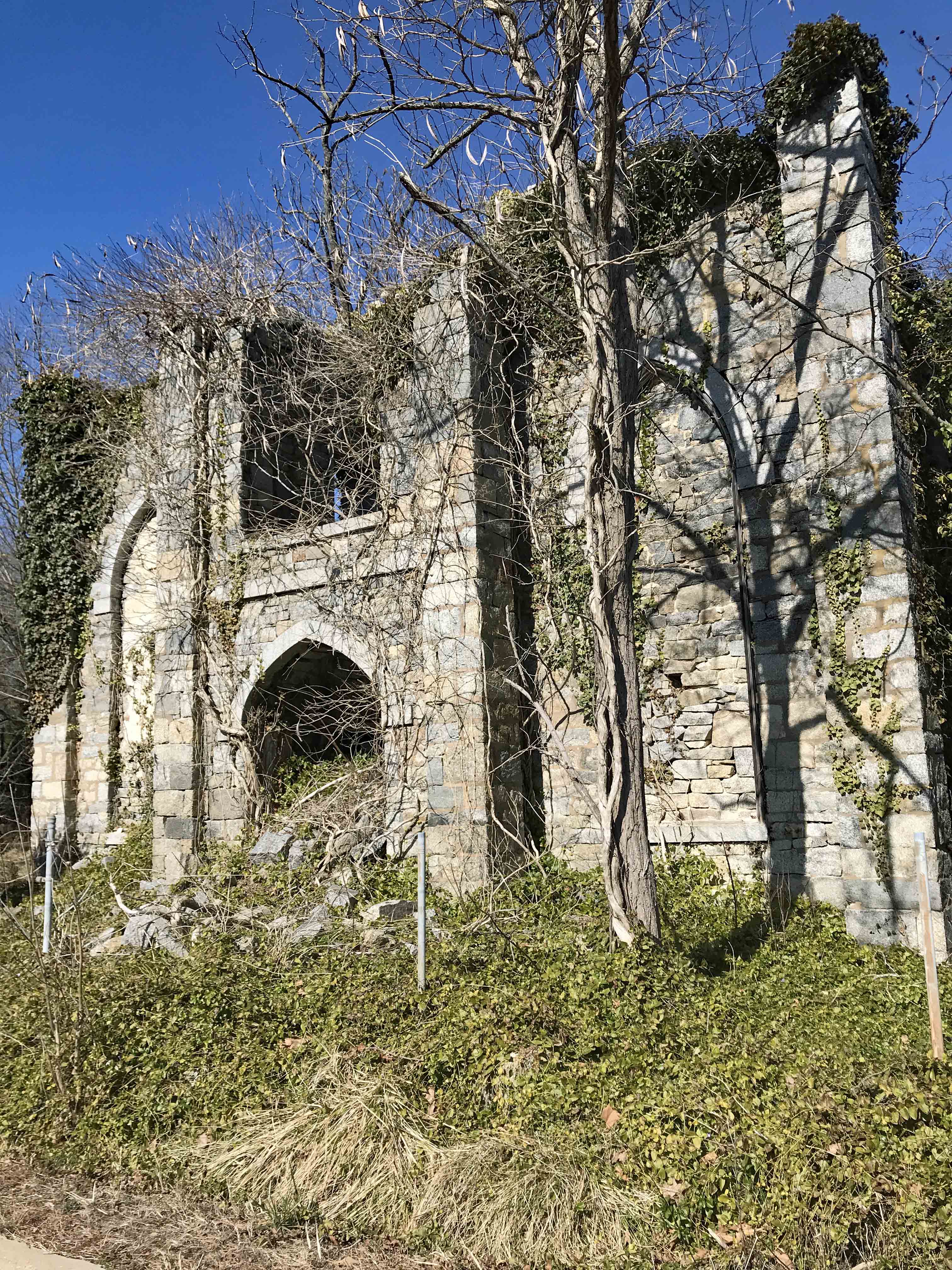
Next stop on our trip was to the Tunis Mills Hanging Tree on Miles River Rd. This is near an area called “The Rest”. Wonder how long this sign will stay up?

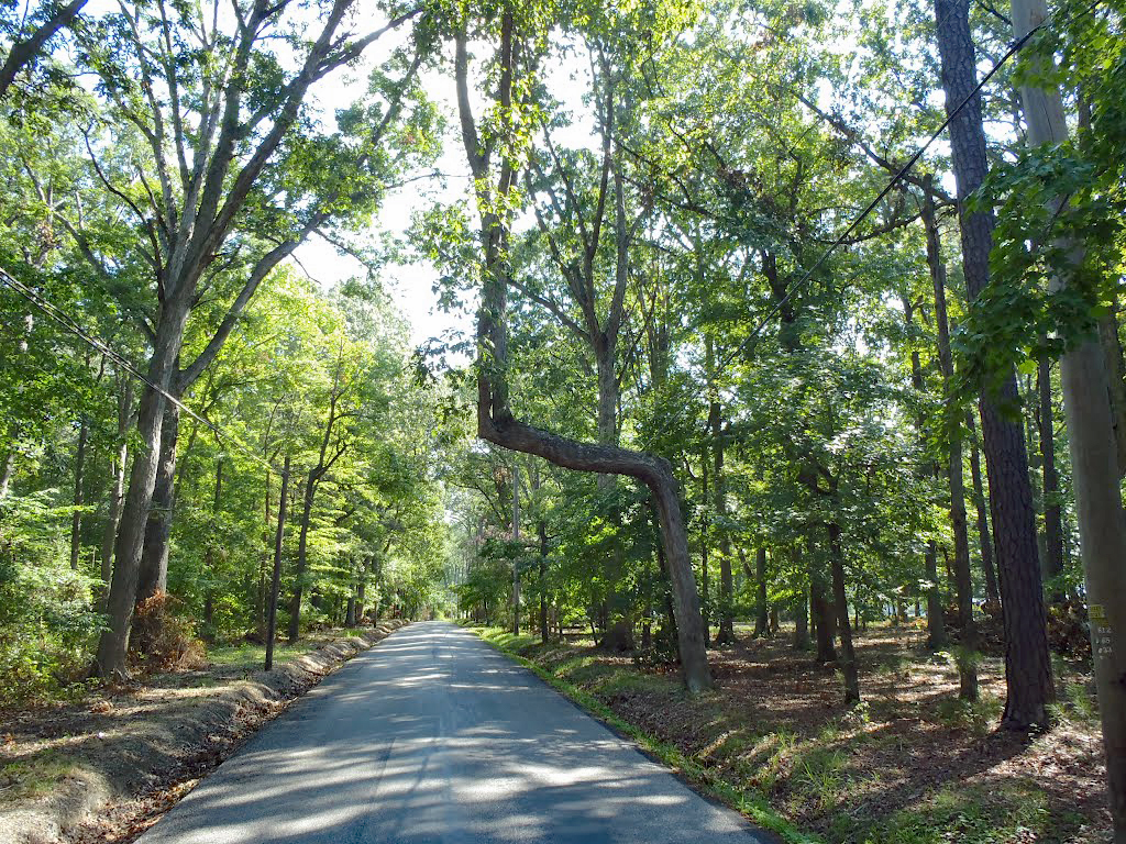
This is what the tree is supposed to look like. Lots of people were hung here. Not sure whom, but a lot. You are supposed to sit in your car under the tree, motor off and listen for the faint screams of those hung! I couldn’t wait!!

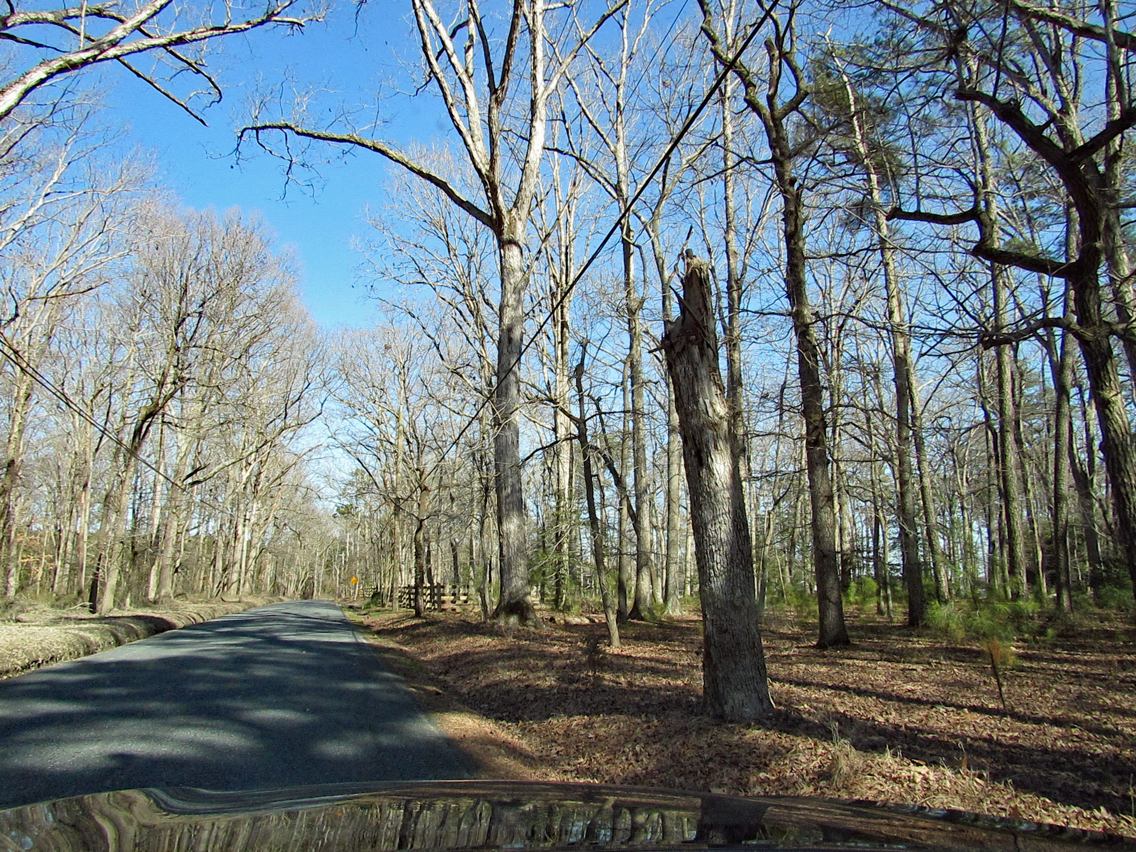
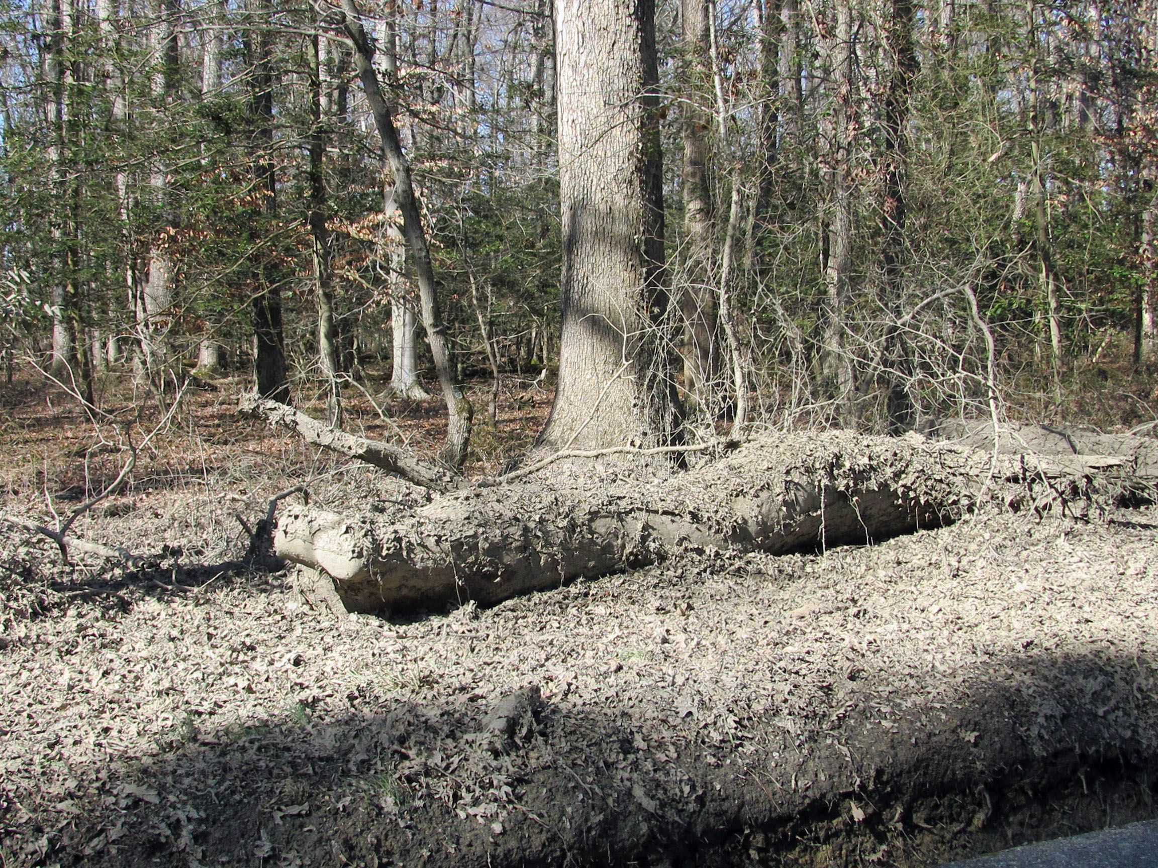
Well, this is what the tree looks like now! And over on the side of the road is the hanging limb.

Leave there, disappointed I must add, and head back over the Miles River draw bridge. Pull off the road onto a dirt road.

And of course I had to climb under the bridge.

Kathy took this photo of an old church just over the bridge.

Unionville Historical marker – self explanatory.

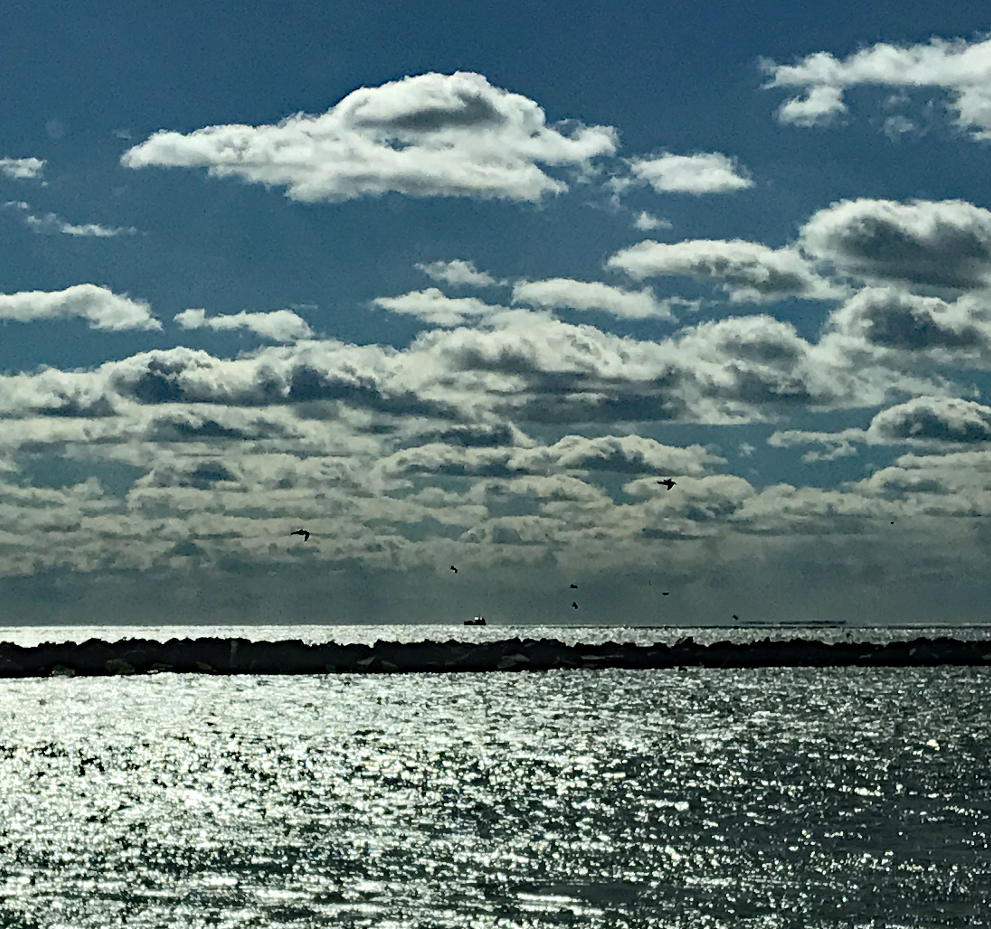
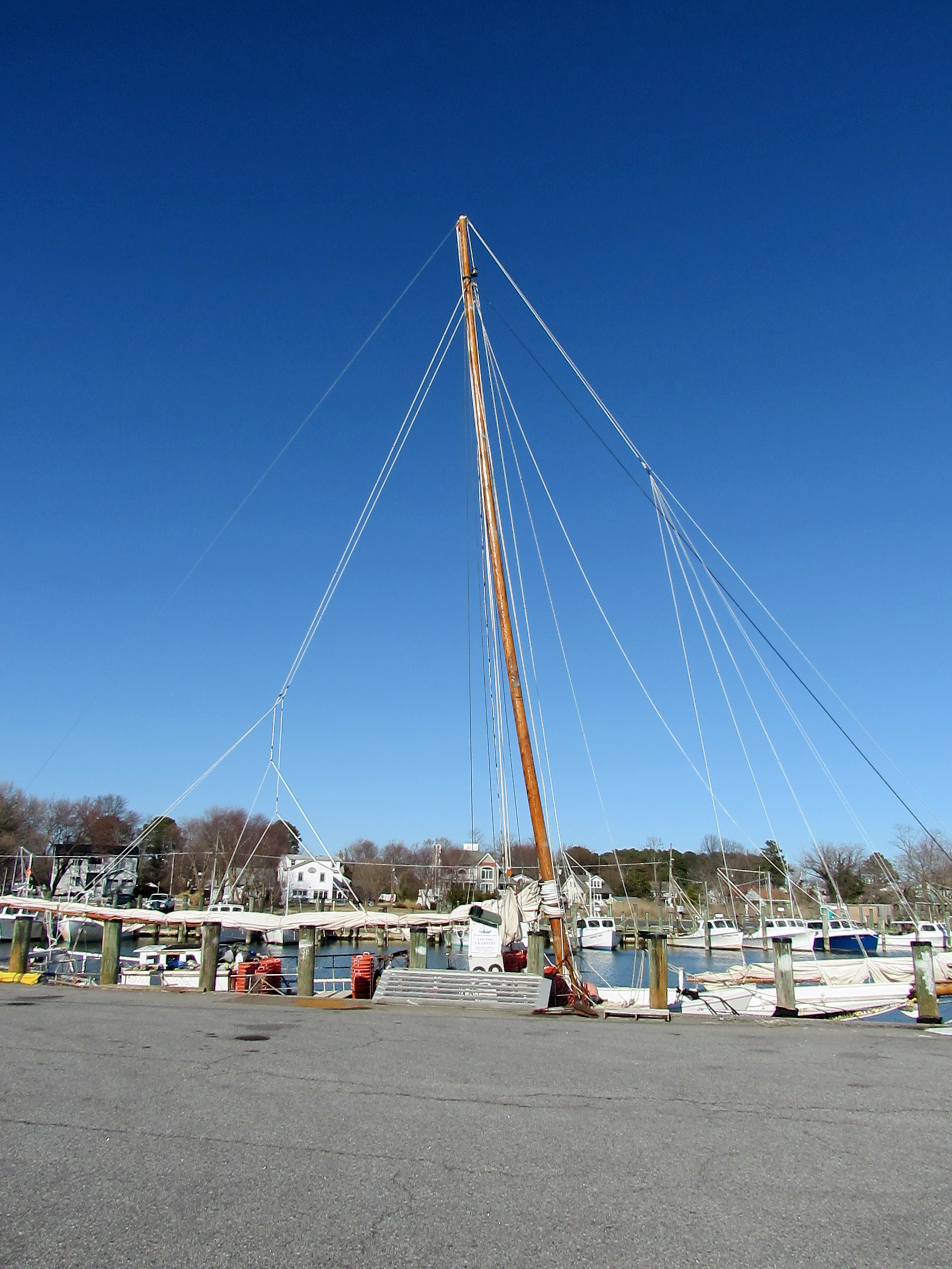
Decided then to head to Tilghman Island and St. Michaels. Checked out the Lowes Wharf. Tide is out.

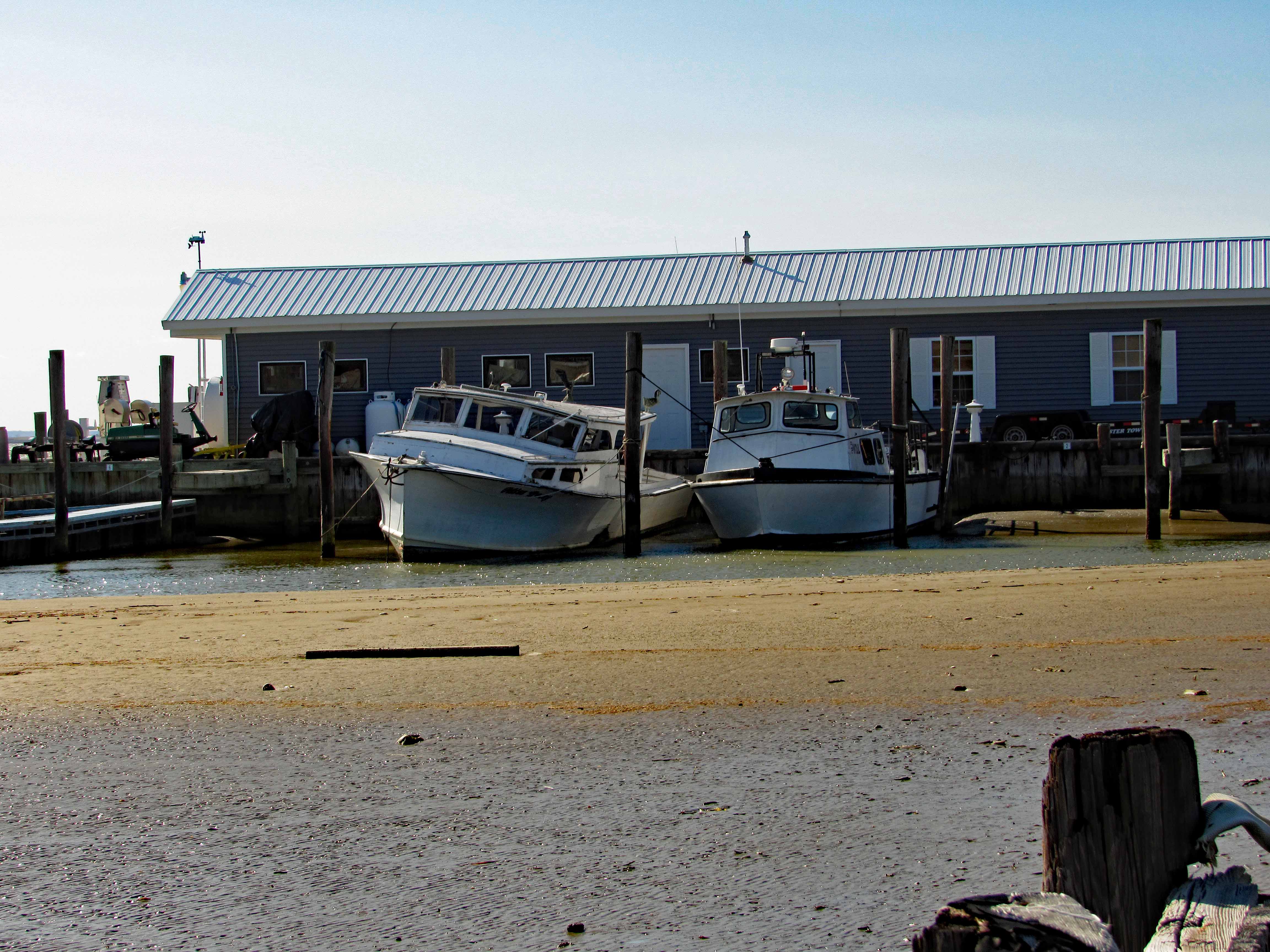
Looks like they are installing a new bulkhead or something.

Follow the road through St. Michaels to where you cannot go any further. I was hoping we could but the road is closed at the entrance to Black Walnut Point.

There is a naval lab here also.

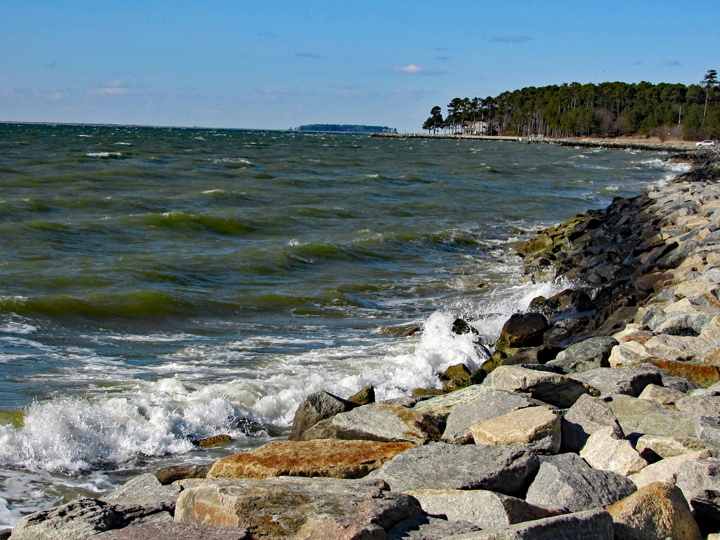
The shoreline at the parking lot.

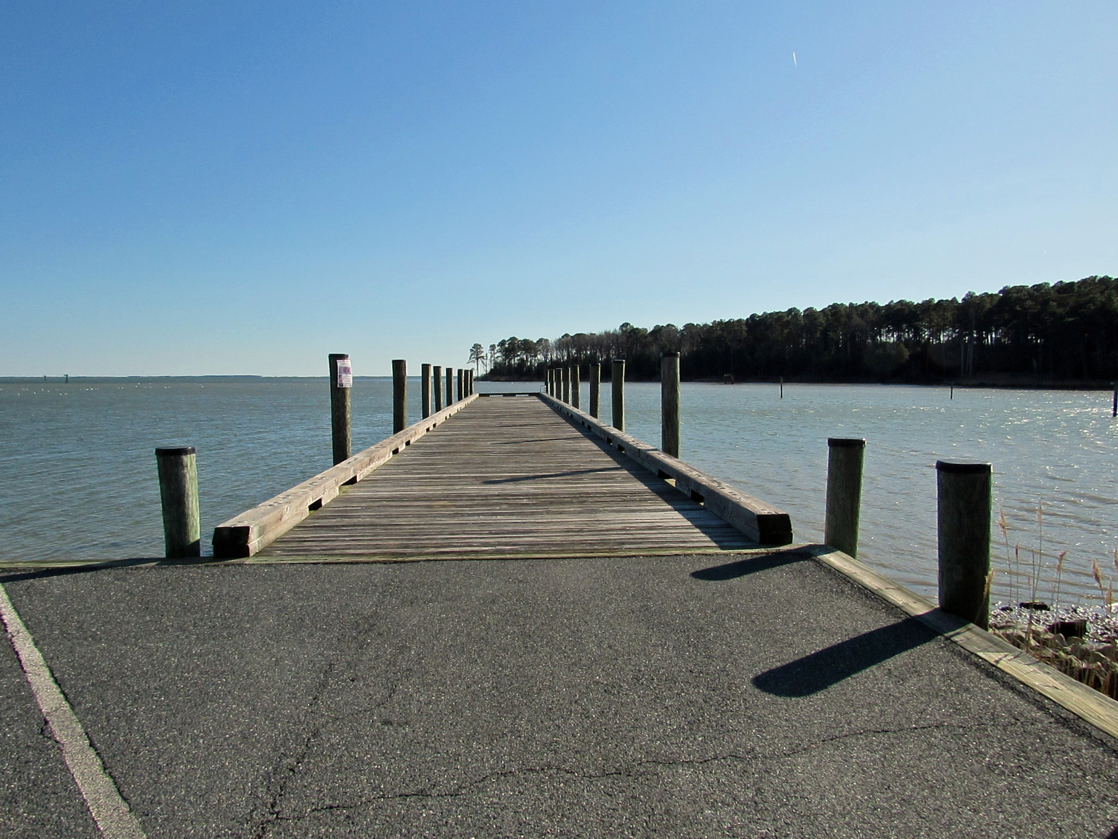
A public dock up the road.

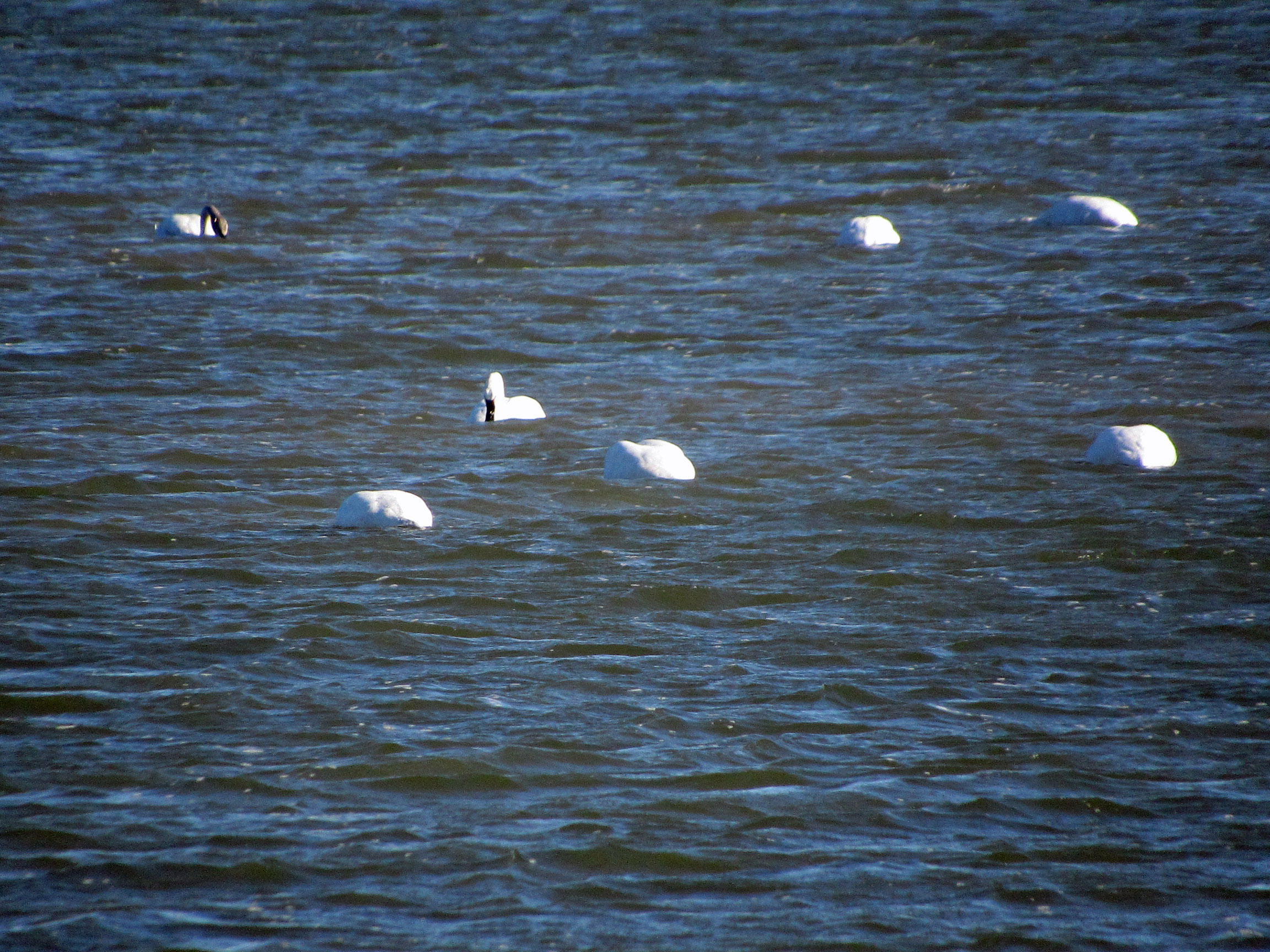
With swans trying to do some synchronized swimming.

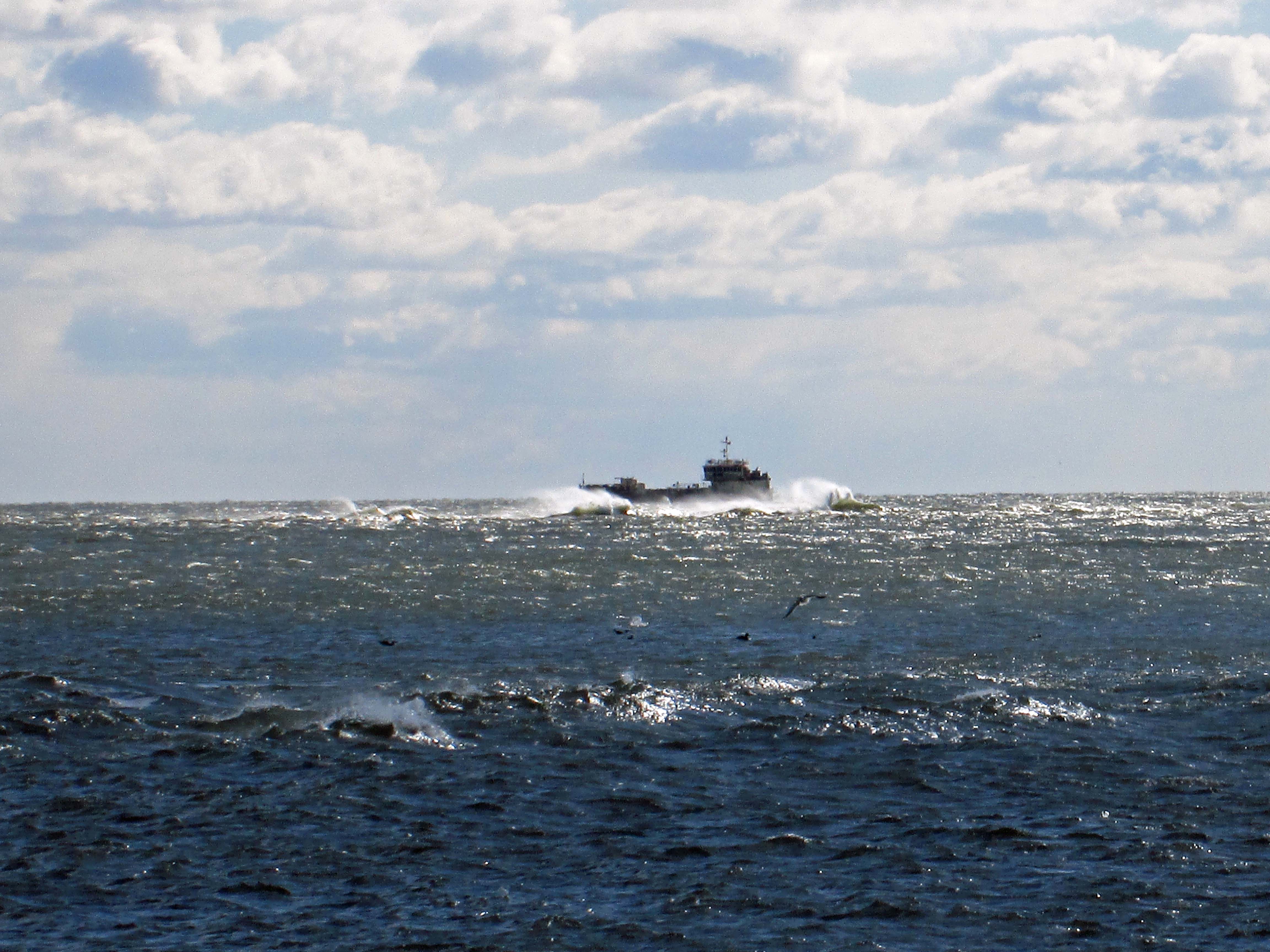
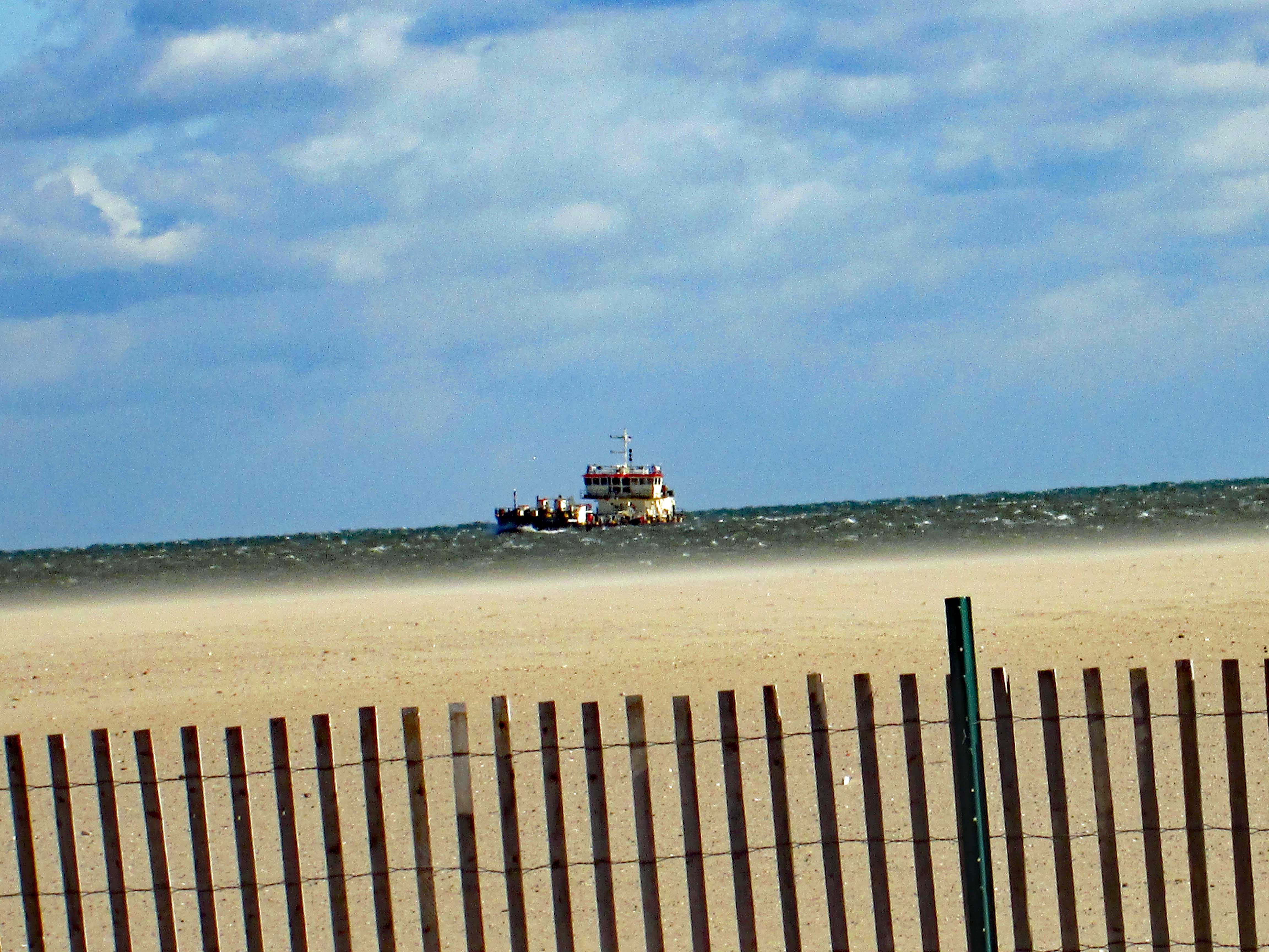
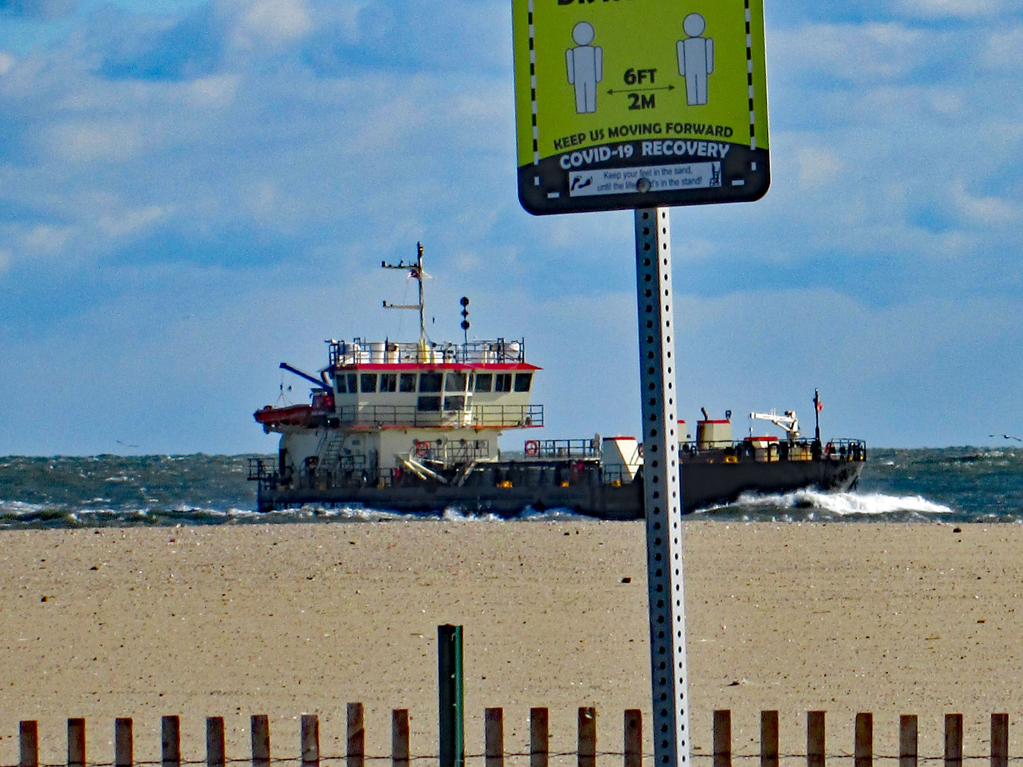
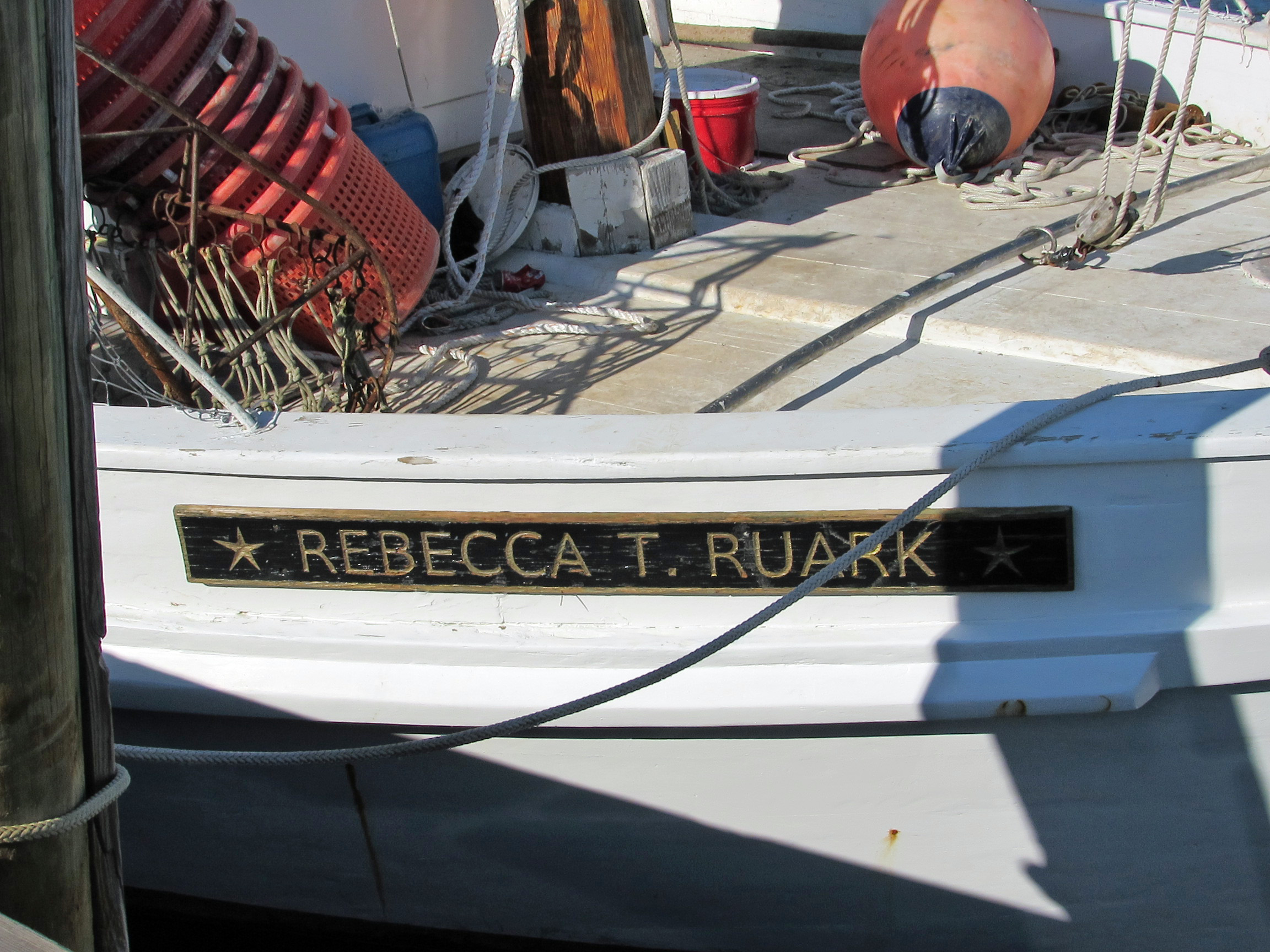
By this time of the day it was getting rather windy and chilly. Only a couple more stops (We gave up on the ghost hunting). This is an interesting sign. I thought Deal Island was home for the skipjacks.

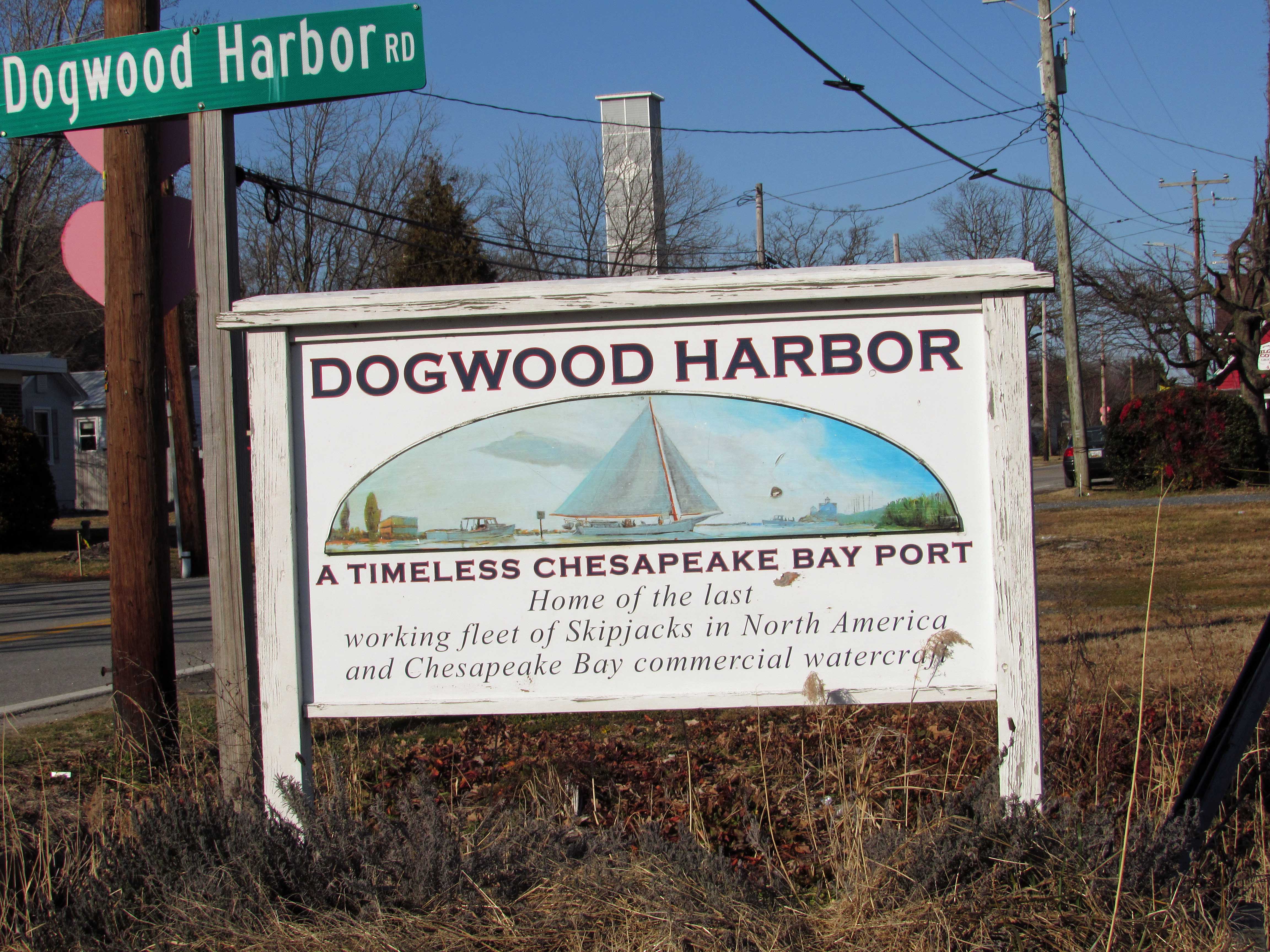
Interesting info… https://en.wikipedia.org/wiki/Rebecca_T._Ruark

Roadside attraction.

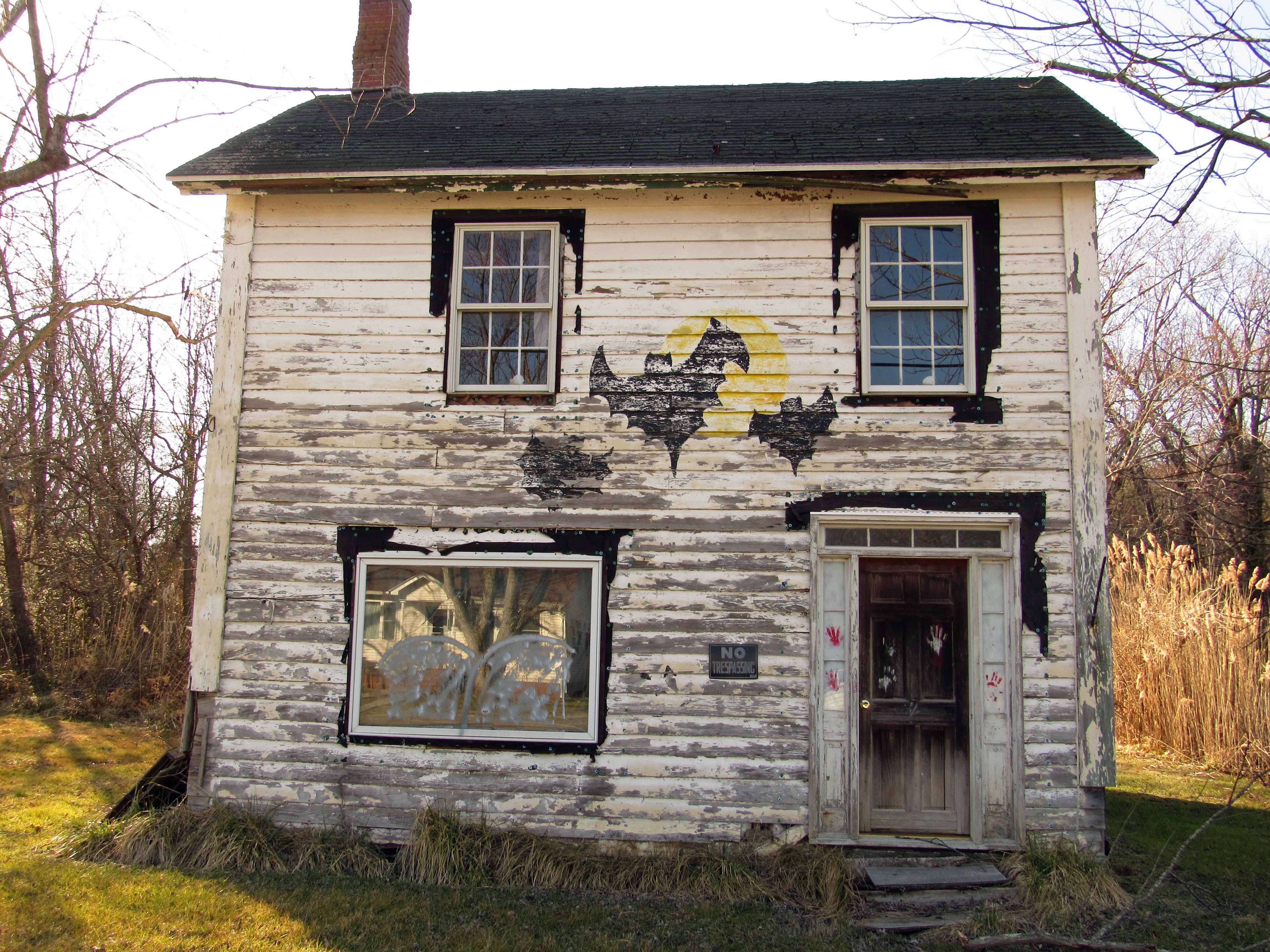
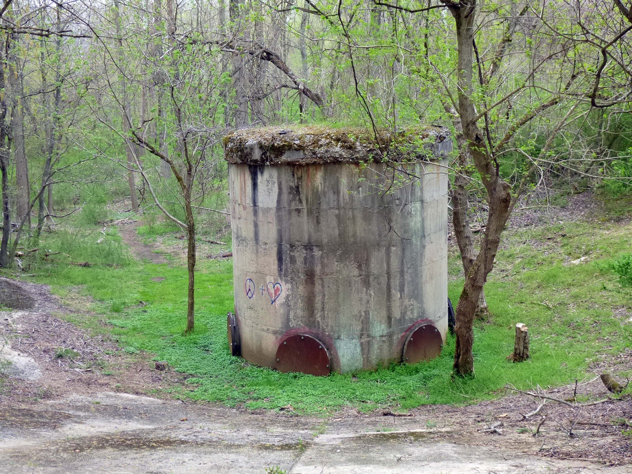
And another. Anyone know what this is? We do and it was surprising.

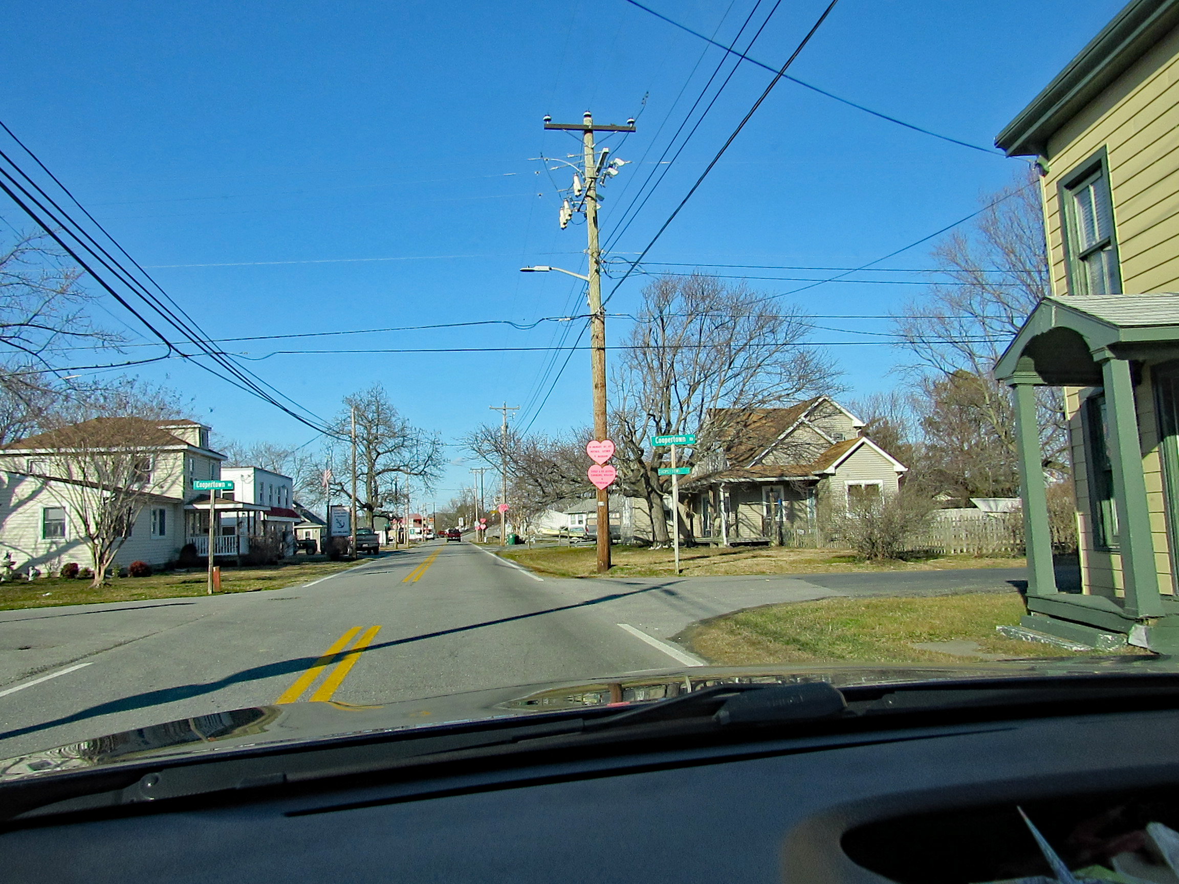
Most telephone poles had Valentine hearts throughout TI.

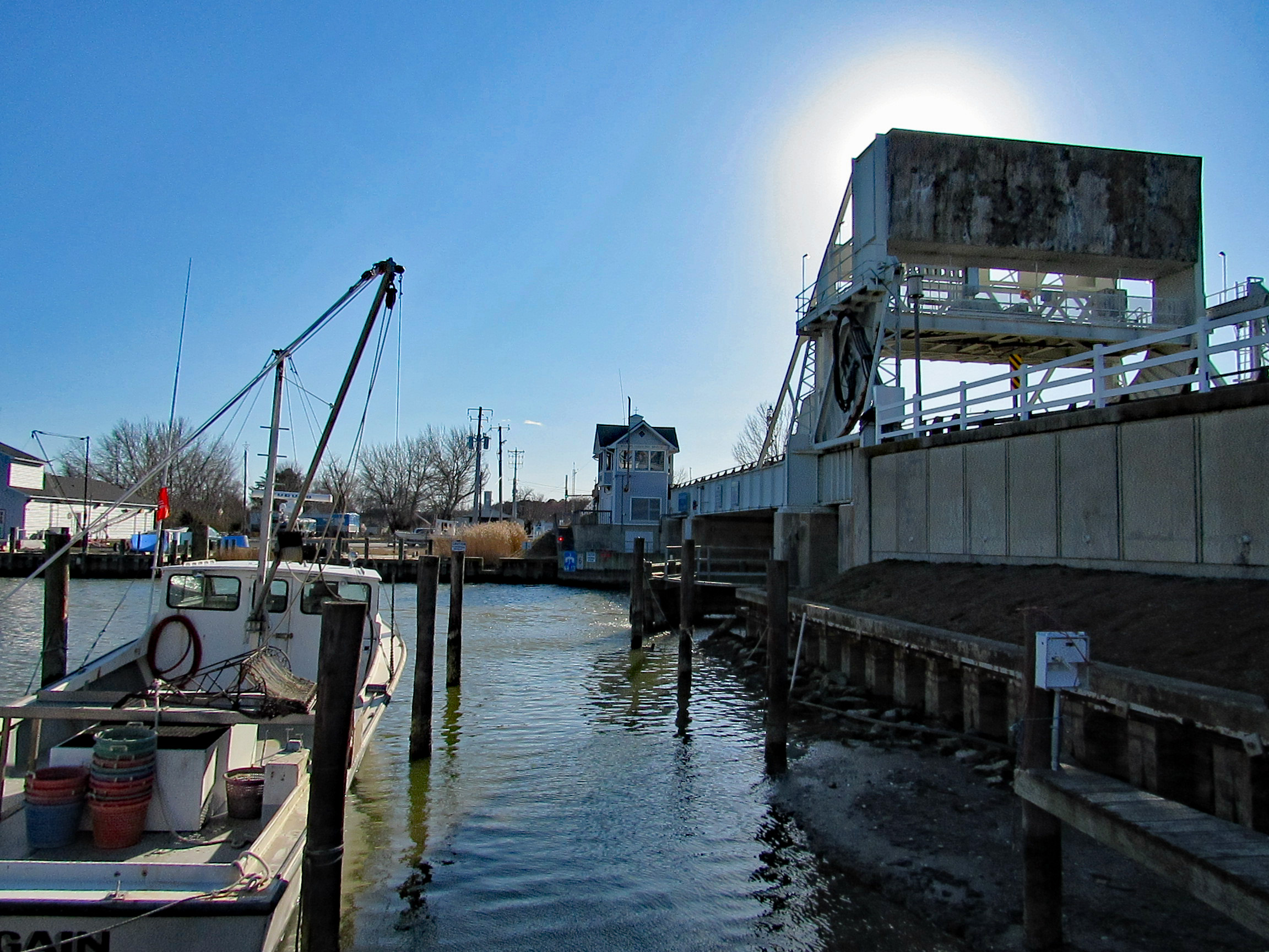
Finally heading home and a quick stop at the TI Drawbridge. Constructed in 1934, it is Maryland’s only overhead counterweight bascule span and one of only fifteen moveable bridges throughout the state road network. This type of bridge a heel trunion rolling lift bridge with a counterweight suspended above the roadway was constructed at the Knapps Narrows site because of its ease and speed of operation. The bridge opened approximately 12,000 times a year, more often than most East Coast bridges.

Another wonderful road trip with so much seen and appreciated!! Always an adventure with Kathy. No ghost but lots of sights.

The Murden

15 Monday Feb 2021

Posted by Ronald Parks in Assateague, boating, Eastern Shore, engineering, Harbor, ocean city, Road Trips

≈ Leave a comment

Tags

Assateague, Corps of Engineers, dredge, inlet, Murden, OC, sand, Thrashers

Headed down to Ocean City, Md. the other day. It was cold and windy but a nice day to be out. We parked at the Inlet Parking Lot after checking to see if Thrasher’s Fries was open. They were not. Off in the distance we saw some sort of ship way down near Assateague.

The ship started to head back towards the Inlet Channel – some rough seas

Suddenly he headed towards the beach adjacent to the fishing pier.

Did a u-turn and we thought he was going to hit the beach.

He straightened himself (or herself) out and then headed into the channel.

Where the seagulls and I could get a good look.

The cars lined up for lunch and the gulls waiting for some Thrashers. Disappointed.

Back in the car with a view one way…

Then the other.

Here is a stock photo of the ship and some info.

The split hull dredger Murden is currently very busy working in and around Ocean City Inlet as part of the Assateague Island Restoration project, conducted in partnership with the Assateague Island National Seashore, the U.S. Army Corps of Engineers’ Baltimore District said in its latest announcement. This project involves dredging sand from in and around the Ocean City Inlet navigation channel and beneficially placing it south of the inlet just offshore of Assateague Island. The work is being done to mitigate the impacts on sediment transport and erosion caused by the the inlet and associated jetties. According to USACE, this work generally takes place twice a year. The Murden arrived at Ocean City Inlet at the end of May (2019) and is expected to continue working in the area until mid-June. The USACE’s shallow draft dredger is based out of the the U.S. Army Corps of Engineers’ Wilmington District in North Carolina.

Tiffany Reservoir

11 Tuesday Sep 2018

Posted by Ronald Parks in Baltimore, engineering, water history

≈ 3 Comments

Tags

Baltimore, bridges, Dams, engineering, Gunpowder Falls, HISTORY, Jones Falls, Lake Montebello, Lake Roland, maps, POLITICS, Public Works, Research, water history

Quite an interesting find: A map from 1867. What makes this map so interesting is that in all my research I never came across any references for having the Gunpowder Falls connected to a reservoir called Tiffany. Everything I read said it would flow by gravity to a new reservoir, Lake Montebello.

First off, let my give a little history on how this water supply came about. Starting in 1836: Samuel Smith, Mayor, appoints a committee to hire the services of a Delaware Engineer named John Randall, to study and recommend a plan for the Baltimore Water Supply. In 1837 John Randall proposed that the City of Baltimore gets its water from the Great Gunpowder Falls. Suggested building two dams, one dam on the Gunpowder near Tysons Mill and the second dam on the Western Run near York Road. Water from these dams was to flow by gravity into the valley of Jones Falls to a receiving reservoir at about Elevation 300. Lake Roland is at 300’

In 1850 consulting engineers are hired to look into Randall’s proposal and then in 1852 a water commission is formed.

1854 Mr. John Smith Hollins, Mayor. Mr. Alfred Duval, Civil Engineer of Baltimore and a private citizen, presented a report to the Council recommending the development of a water supply from the Gunpowder Falls. Duval recommended the building of a dam at Raven’s Rock, the closest point on the Gunpowder Falls to the City, and a tunnel to convey the water by gravity from the dam to a receiving reservoir near Montebello. Mr. Sickles recommended to the Council the adoption of a modified version of the Duval proposal. Mr. Sickles had made extensive surveys and reported to the Mayor and City Council a plan for an ‘air-lined tunnel’ to convey the water of the Gunpowder to the City. An ordinance authorizing such a development was passed by the Council in October but was never signed by the Mayor.

1857 Mr. Thomas Swann, Mayor. Mr. James S. Suter, Water Engineer (April 14, 1857). Original plan for the Jones Falls development was modified by an ordinance adopted in July.  Ordinance instructed Water Commissioners to procure an increased supply of water from Jones Falls “agreeably to a plan heretofore reported to the Council by James Slade, Civil Engineer”. The Water Board is reorganized on April 14 and the first Water Engineer appointed was James Suter.

1860 Swann Lake, (Lake Roland) is completed on the Jones falls.

1861 both the Hampden and Mt Royal Reservoirs are completed.

1866 Mayor John Lee Chapman realizes the approaching inadequacy of Jones Falls as a continuing source of future water supply.

1867 A map of Tiffany Reservoir is drawn up.

As can be seen in this portion of the map below, the location is on the western side of Hillen Road. On a 2018 map it would be the area of Hillen Rd. and 35th St. Where Mergenthaler school is and the area where the houses are on 35th. 

Here is an early photograph of the area where Lake Montebello would be. I am assuming that this is looking east from Hillen Rd to the site of the lake.

And here is an 1880s map showing how the lake and Loch Raven Conduit was (and is) laid out. 

Returning to the Tiffany Reservoir map, a couple things of interest: On the Tiffany map you can see it says Tiffany Conduit connected to Tiffany T (tunnel) then to Herring Run Conduit. Looking close you can see that there are two colorings of this conduit; the first and third sections being blue. The middle section (Tiffany T) is black. All the black sections in this conduit are underground. All the blue ones are open channels. I believe this is where the term ‘Air-lined Tunnel’ came from? That there was not enough head pressure to completely fill the underground portions. Following the tunnel north. The Herring Run Conduit becomes the Sater’s Ridge Tunnel.

And that turns into the Mine Bank Conduit, to the dam at Loch Raven. Another symbol on this map I like is that all the roads pass over the river and streams as regular bridges. On the one below you can see where the road passes over the Gunpowder, below the dam and around the corner, it is colored in, which shows that back in 1867 there was a covered bridge at Cub Hill and Cromwell Bridge roads. 

A couple more items of interest on this map – The location of Glenn Ellen Castle.

Swann Lake (Lake Roland). The title of the Tiffany Map is somewhat wrong. It states “In connection with the Swann Lake Aqueduct.” I believe it should say “In relation to”. On this map I do not see it connected.

The Hampden (Noted as Hampton on map) and Mt. Royal Reservoirs.

And this map portion that shows the Johns Hopkins property before it became Lake Clifton, and a race track in the lower right corner. In a few years from this map’s date, a Baltimore County water filtration plant will be built near the track; using ozone filtering technology. (I forget off hand what the date was – maybe 1907?)

And finally, on the map title is HMF v Stamp as the Chief Engineer. I could not find anything about this person until 1873 where he is listed as the contractor to build the Temporary Water Supply, from the Gunpowder to Roland Run, which fed Lake Roland. It consisted of a couple pumps near Meredith Bridge, running some pipes to dump into Roland Run.

The Tiffany Run Reservoir was never built. Lake Montebello was. Many droughts, flooding of the Jones Falls and finally and over polluted Jones Falls required the new, permanent Gunpowder Works to be built – and is still in service today.

Note: This map is too brittle and too large for my scanner.

Highlights in Public Works History part 2

11 Monday Jun 2018

Posted by Ronald Parks in Archives, Baltimore, engineering, HISTORY

≈ Leave a comment

Tags

Baltimore, bridges, Dams, engineering, Gunpowder Falls, HISTORY, Latrobe, Montebello, POLITICS, Public Works, Research, Route 40, water history, White wings

Some more flyers from the DPW Museum.

Bollman, bridge engineer:

B.H. Latrobe:

Centre Fountain:

Loch Raven-Montebello Tunnel:

The Baltimore Pike:

City Hall:

The white Wings:

Back River:

Montebello Filters:

C.H. Latrobe:


Highlights in Public Works History part 1

05 Tuesday Jun 2018

Posted by Ronald Parks in Archives, Baltimore, engineering, HISTORY

≈ Leave a comment

Tags

Baltimore, bridges, engineering, FILTRATION, HISTORY, Museum, POLITICS, Public Works, Research, water history

Continuing with documenting and archiving, I found a collection of small posters concerning Public Works. I believe these were given out at the DPW Museum in Baltimore back in the 1980s during the time it was open. There are some missing and I hope to be able to find them, to complete the collection. Here are issues #1,3,4,6 and 7.  #1 has some misinformation. The Roland Tower was completed in 1905 according to Annual Reports. Not sure what the word exhaneous, which is handwritten on the poster, means?

#3 comes from Abel Wolman’s booklet, “The Livable City”.

#4 from the exhibit: Baltimore’s Bridges and Their Builders.

#6 from 1985’s Women’s Week.

#7 is about our infrastructure.

Over the years there have been many attempts at posters, exhibits, newsletters etc. I wish they would start doing more of the history in a poster like the above or a new newsletter… The City attempted to try a new format of the Annual Report, but it is inconsistent and sporadic at best.

Good Intentions, Not Always Good Results

04 Friday May 2018

Posted by Ronald Parks in engineering, Hopkins, Reservoir, water history

≈ Leave a comment

Tags

Baltimore, Cromwell Park, Dams, engineering, Hiking, Loch Raven, maps, nature, photography, Research, water history

A couple weeks ago I was drawn into a discussion concerning the Balancing Reservoir adjacent to Cromwell Valley Park. I say adjacent because it is City property, in Baltimore County, part of the City’s watershed. This past weekend was the first chance that Kathy and I had to take a hike through CVP and this is what greeted us:

A poem about graffiti. What the hell? So I looked down at the balancing reservoir shaft and understood.

Someone drew, what I guess they thought, was a peace symbol and a heart. Going down the slope we saw even more.

Now I understand the reason for the poem. What idiots! I have never understood graffiti. Some that are murals are nice, but this makes no sense to me. And no, I don’t believe in that sort of “Freedom of Expression”

What does this have to do with my Post Title and opening statement? The discussion I had was with City Watershed personnel, the County, the Park and the volunteers at CVP. The area has been nicely cleared around this structure and throughout the reservoir. Unfortunately by clearing it out, it made it more accessible to more people and more people means more risk of vandalism. The discussion, both pros and cons, concerned restoring the site. Pros – historical water history. Cons – disruption to the wildlife and native plants.

Here is a 1921 partial drawing of the Balancing Reservoir.

We walked down the shaft slope and went over to the quarry, then to the spillway. View from the beginning of spillway looking toward Mine Bank Run.

A close up of the Spillway.

And of Molly not wanting to get too close. It is about a 20′ drop. There use to be a rope across there saying “Danger”

From the spillway we walked over to the dam. This dam actually has a concrete apron that extends partially down the slope towards the surge shaft. It has been pretty much cleared out, to the bird watchers and rangers dismay.

Here is the balancing reservoir in use 1922. This view is from the shaft to the dam.

This other view is looking over the old quarry. Both of these photos come from the Maryland Historical Society.

No trip to CVP would be complete without a hike to the Kilns.

New signage everywhere – kind of reminds me of an old 70s song! Descriptive signs.

My take on all this? Originally I thought it would be great to restore the complete balancing reservoir to its original construction, but I’m not so sure now. It would be nice to clear the concrete apron around the surge shaft and the concrete spillway. Not sure it would be worth clearing the dam face. Too many animals and birds in that area. And as the poem states, “volunteers…in their older years…” Who will maintain it 20 years from now? The City won’t and they haven’t. The place is only historical in the minds of people who appreciate their water source. Most people that turn on their faucets could care less about the history of how it gets there!

And for my history friends, here is a map from 1915 of the area. When the City built the new dam.


North Patapsco Bridges

25 Wednesday Apr 2018

Posted by Ronald Parks in Baltimore, Dams, engineering, water history

≈ 4 Comments

Tags

Baltimore, bridges, Dams, engineering, HISTORY, Liberty Dam, mills, Public Works, water history

More from the Loose Ends Never Ends files. I have about 500 more negatives to scan in this one collection. Just finished up more of the Liberty Dam and adjacent bridges. I must confess, I have never really done a lot of research concerning these bridges. Over the years I have found hundreds of photographs/negatives, and only found a few of them interesting; like Liberty Lumber, the Indian grave marker and the dam itself. Although I really like climbing on and under bridges, I never gave these photos much thought. Looking at Google Maps, it is hard to place the original/present location of these bridges. I’m just not familiar with the area’s history. Most are from the early 1950s.

Ivy Mill Bridge is first. I like this one because it shows the old structure in the background. This photo is one of the few with a description attached.

Beginning construction, temporary bridges were built.

Foundation and columns poured.

As can be seen, these photos are missing the contractor’s descriptions of work – black rectangular areas on photos.

Moving right along with progress.

Reaching the final height and then comes the decking.

The finished bridge.

Next collection of negatives were marked as North Branch Over Patapsco, including Morgan Run. General view of the area.

Setting forms for foundations.

Columns.

Ready to place decking.

Putting on final touches.

Finished bridge from old bridge. (I wonder if this old one is underwater?)

The next group I found were of the Snowden Creek Bridge. Not many photos in this collection. It must be way up there because it looks pretty shallow. Forms poured and ready for decking.

Near completion. 

The next 500+ negatives to document are of building the Susquehanna Tunnel.

Here is the photo of the grave marker, taken from an engineer’s scrapbook. 


Liberty Dam Continued

10 Tuesday Apr 2018

Posted by Ronald Parks in Baltimore, engineering, water history

≈ 6 Comments

Tags

Baltimore, Dams, engineering, HISTORY, Liberty Dam, nature, Public Works, water, water history

There were another 120 negatives in the Liberty Dam collection. I scanned all of those. The file drawer also contained about 250 negatives, building the Ashburton Filtration Plant. Fortunately I had previously scanned these from photo albums – all but 22 that were missing from those albums. I hope when and if they get someone to take my place doing this archiving, they will be able to put all like albums/negatives/photos together in proper groups. I am not sure I will have the time. As it has been, I just scanned and documented them as I pulled them from shelves, dusted them off, documented and then packed them back up for storage.

Here are some more from Liberty Dam 9/1/1952 – 10/6/1953 (The next drawer has a bunch of negatives from building the bridges across the reservoir).

Another accident. A truck went off the bridge and is being hoisted out by crane.

Man, I wish I was there with my kayak! This is the relief opening so the contractor can start building on the opposite side of the river.

Images 125 through about 180, the negatives all have this overexposed spot on the left hand side. Some I trimmed but others I was not able to.

And then the floods came.

This one was strong enough to wipe out the coffer dam, but the men are steadily working on the right, placing forms for this portion of the dam.

While one crew is placing the foundation to the west, the east gang continues to raise the elevation of the dam.

Still working against the floods and snow.

Meanwhile, upstream a ways, the intake structure is almost done. A couple things about this photo – how tall the structure is and how deep the water will be at this point of the reservoir. Also, I’m not sure why they didn’t grub, remove the plant growth that will eventually be underwater?

After a few months, the base areas of the dam are completed. Not seen here, underwater, is a relief opening (Kayak hole). Another flood has happened and the water has risen.

Wow – kind of looks like Conowingo Dam on a small scale. I wonder how much sediment is in this reservoir, against the face of this dam?? Since 1956??

The water just rages through. eventually the relief opening will be closed and water will either go over the top of the dam or through the intake structure and head to the Ashburton Filters.

Putting the finishing touches on the intake structure.

Almost done. I have posted on another blog (or Facebook) the finished dam and that engineers were wagering on when the reservoir would fill and the dam would crest? The Liberty Reservoir reached the crest point of four hundred and twenty feet on February 6, 1956, approximately nineteen months after the filling of the reservoir began on July 22, 1954

Loose Ends Never End

05 Thursday Apr 2018

Posted by Ronald Parks in Archives, engineering, water history

≈ 6 Comments

Tags

Baltimore, Construction, Dams, engineering, Patapsco, photography, POLITICS, Public Works, Research, scanning, water history

Loose Ends Never End sounds like some spiritual/metaphysical quote (It does come from the Bhagavad Gita, chapter 9). But in my case it is more about my trying to tie up some loose ends before I retire. Just when I think I’m about done documenting and scanning the archives – Poof!! More just appear out of nowhere. Well actually I found a bunch more under my work bench. Three index drawers full of 3-1/2″ x 5″ photographic negatives. At first I thought there was only 500 or so. There are over 1,500 of them! I started scanning them yesterday and got about 100 done. Below is a sampling of those. 

Just glancing through the first couple hundred, it appears these are from the building of the Liberty Dam, starting in 1952. This photo shows a happy foreman on top of the intake structure as it is being built.

The Engineer’s Office – must be before MBE/WBE requirements. Not sure why the one guy has his arm around the other one?

There were four floods on the Patapsco during 1952, all stopping work for a few days – Change Order!

The coffer dams held back some of the water.

The Arundel Corporation’s cement plant.

Ooopps! Not looking too happy now. There were a lot of accidents on the job site in 1952. Most notably a crane fell, crushing one of the workers. There are actually a few photos in this group of that, but I am not posting those. One shows the worker’s head crushed under the I-beam. I cannot believe someone took that photo.

This looks like an accident waiting to happen. I don’t think that truck is capable of holding that bucket safely.

These guys are working. Trying to make up for lost days due to flooding.

The intake structure rising from the river.

I have been using an Epson 4990 scanner for a few years now. It works pretty good, except the software that came with it is a little off. By that I mean, if I scan a photo negative, it automatically turns it into a positive in a file, but it is too dark and takes a lot of work in the Photoshop Elements software. So I scan it as a positive, which it converts to a negative. Then in PE I invert it and hit auto levels and it looks just right. Some of course will never look right, only because of what the photographer did when taking the photo.

I guess taking care of these loose ends will give me something to do for a while!

John Davis – Engineer and Architect

27 Tuesday Mar 2018

Posted by Ronald Parks in Archives, engineering, water history

≈ 1 Comment

Tags

Baltimore, bridges, Dams, engineering, HISTORY, Jones Falls, Latrobe, Public Works, Research, water history

On April 30, 1804, the Baltimore Water Company, a private company, was formed. Their first task is to furnish water to a portion of Baltimore City. It now became necessary to secure a site for the erection of the works, and in 1806 a purchase was made of a lot now occupied by the office of the Northern Central railroad, on Calvert street. The works, which were erected under direction of Mr. John Davis, consisted of a wheel and pumps, which forced the water into a reservoir on the southwest corner of Cathedral and Franklin streets. The water was obtained through a common mill race from what was known as Keller’s Dam, which supplied Salisbury Mill, the site of which was near the site of the old Belvedere bridge. (Baltimore History by Clayton Hall).

Photo of drawing from MdHS. The City does not reimburse me for digital copies, these start at about $50 each, so MdHS let me photograph them.

From John Davis’ Autobiography; Maryland Historical Society Magazine Volume xxx, 1935: “I at once entered into an Engagement, with Mr. Latrobe, and the City, Corporate authorities, to Superintend and aid therein, as Clerk of the works [in Philadelphia]. In the situation aboved named, I continued connected with Mr. Latrobe about three years, until sundry other engagements, required both the service and talents of Mr. Latrobe in other portions of the United States, more Especially at the Cross Cut Canal between the Chesapeake and Delaware Bays, and the water works in New Orleans. After this period, the entire direction and management and the Execution of the works, for watering the City, of Philadelphia, Devolved on me. In that capacity I continued until the Spring of 1805. In the autumn of 1804, I received an Invitation to proceed to the City of Baltimore, to give some advice and aid in an Examination that had been made in relation to the contemplated means as to the supplying that city with water. A company had been organized and a capital of 250,000 Dollars provided, A President and Managers, Chosen, water rights and water Power had been purchased, and various suggestions given as to the manner and plans to accomplish the object, and to appoint an Engineer, and Manager, to Execute the requisite works. I repaired to Baltimore, to impart such views, and advise such measures, as appeared to me proper, for the furtherance, of the object this company had in view. Under these circumstances and considerations I could not comply and entertain a New engagement. But these Baltimore Gentlemen made strong appeals and almost insisting that I should be Employed by them they likewise desired me to endeavor to propose or point out some way or means to relieve them of their difficulty and it was agreed to adjourn the meeting until the following evening and then to receive my views and see if I could suggest some manner or means to meet the Case. At the Meeting of the Board on the next evening, I submitted this proposition, That I would still attend to the business and continue to direct the Superintendence of the Philadelphia works, endeavor to select and appoint a competent person to take my situation and place and Impart to such person, every necessary Instruction, and information that would enable and render him capable to perform and attend to the duties that would be required in the water works at Phila until the managers of that concern were fully satisfied that my Successor was Qualified and efficient to the performance of the required duty and as soon as such assurance was by the watering Committee of Phila agreed to Then I was willing to accept of the proposition of the Gentlemen in Baltimore. These conditions was accordingly agreed to and strongly urging me to make all my arrangements as soon as the nature of the business would permit.” [Davis states that he has twenty year old Frederick Graff replace him in Phila. under B.H. Latrobe] “I received the cordial thanks and a kindly parting* dismissal from the managers of the water company, and Mr. Graff commenced his services on May 1st 1805 and he continued in the same situation of Superintendent of the Phila water works until his Death in 1848, a period of 43 years.” [A statue was erected to Graff at Fairmount Water works]. Davis goes on to talk about how two years later he went back to Phila to write a report with Graff for the recommendation of a new water works at Fair Mount.

*Interesting to note here, from the book Benjamin Henry Latrobe by Talbot Hamlin: September 24, 1805 Nicholas Roosevelt (friend and partner of Latrobe) had turned the water off for three hours, at about the time that a serious fire was burning in Philadelphia. Latrobe wrote Roosevelt in panic, “I hear the spread of the fire was owing to the withholding of the water. I hope this representation is not true.” The city was enraged; a mob led by the sheriff charged the water works, threw out Roosevelt and the men working under him, turned the whole works over to municipal operation replacing Davis with Graff. [Perception of events]

A photo I took a couple years ago of the Philadelphia water works.

“I entered into a new arrangement with the Baltimore water company, Their works being then in successful operation and not requiring all my time and attention, I was appointed President, of the Company, at a reduced compensation and devoting only such portion of my time as their services demanded. In this capacity, I resided and continued during the whole period that I lived in Baltimore and until I removed to the Country in Washington County, Md. I will now proceed to give a little diversified statement of some of the objects, engagements and employments in which I may say I was almost incessantly occupied; Say at the Susquehanna Canal, from Tide water unto peach Bottom; a distance of about 10 miles, pulling down and rebuilding the Locks, Both widening and Deepening the Canal and other improvements there occupying a period of about 2 years; Surveyed and Leveled and attended the Improvements of Gwynns Falls by a mill Race of about 3 miles, in length terminated, by the building in succession, 4 large Merchant Mills, each carrying 4 Pair of Millstones; aided, and assisted in the erecting, Large Cotton manufactory; and a large Merchant Mill on Jones Falls, 6 miles north of Baltimore, Superintended the erection, and other Improvements, a little South of Havre de Grasse, Leveled the water & aided in building a Large Mill on Elkridge about 15 Miles west of Balt., Leveled and surveyed several streams and Located many Cotton Manufactories and other improvements that was either designed or Executed by my Direction.” 

Gwynn’s Falls improvements.

“There is one Improvement kept in fine order and is still a favorite spot and frequented by many persons, called the City Spring, situate on North Calvert Street city of Baltimore about 2 squares south [North] of the Battle Monument near Barnums Hotel.” [Also known as the Northern Fountain]

Print from DPW museum archives.

[Davis states that his crowning achievement was the sinking of a well at Fort McHenry in 1814]. “I must say that the success of this undertaking gave me some gratification, especially as it was stated by some Engineer’s impossible to be done But Major Bentelow still insisted on it that John Davis should pursue his own views, and the Exulting Major said to the Secretary of War. Did not I tell you, Genl. Armstrong that Mr. Davis would succeed and we would have good water at the Fort, uttered in his broken French language.” In 1813 the Board of City Commissioners, in conjunction with Mr. John Davis, examined the spring at the head of the Basin (known as Clopper’s Spring) and decided that it could be reclaimed and made to afford a copious supply of pure and wholesome water. August 19, 1934 Sun Paper Article in Scrapbook: Donation of drawings from first superintendent of Baltimore Water Works to Maryland Historical Society. Sketches were made by John Davis (1770-1864). 160 drawings depicting first water works. I did not see the drawing below from the article, but a similar one.

Sunpaper article.

Drawing from MdHS

← Older posts

Blogroll

  • Flouride Action Network
  • lulu
  • My Book
  • WordPress.com
  • WordPress.org

Recent Posts

  • ICELAND April 2023
  • George Chalmers of Fochabers
  • In Search of The Skipjack Ada Mae
  • Trap Pond Kayak
  • Pusey Trail and Cemeteries

Blog at WordPress.com.

  • Follow Following
    • Water and Me
    • Join 226 other followers
    • Already have a WordPress.com account? Log in now.
    • Water and Me
    • Customize
    • Follow Following
    • Sign up
    • Log in
    • Report this content
    • View site in Reader
    • Manage subscriptions
    • Collapse this bar
 

Loading Comments...