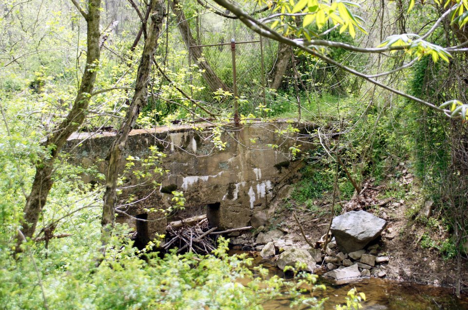
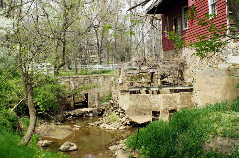
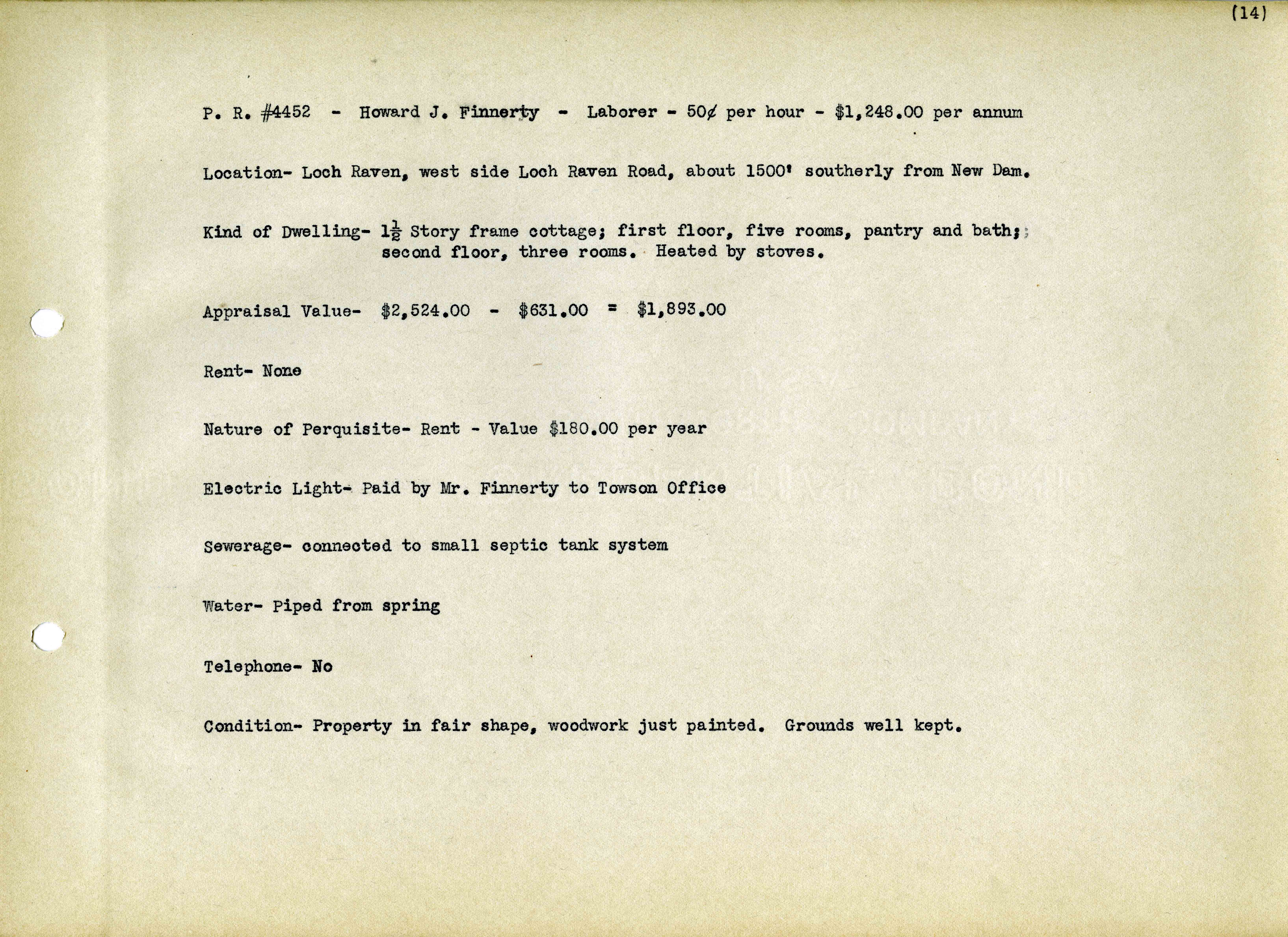
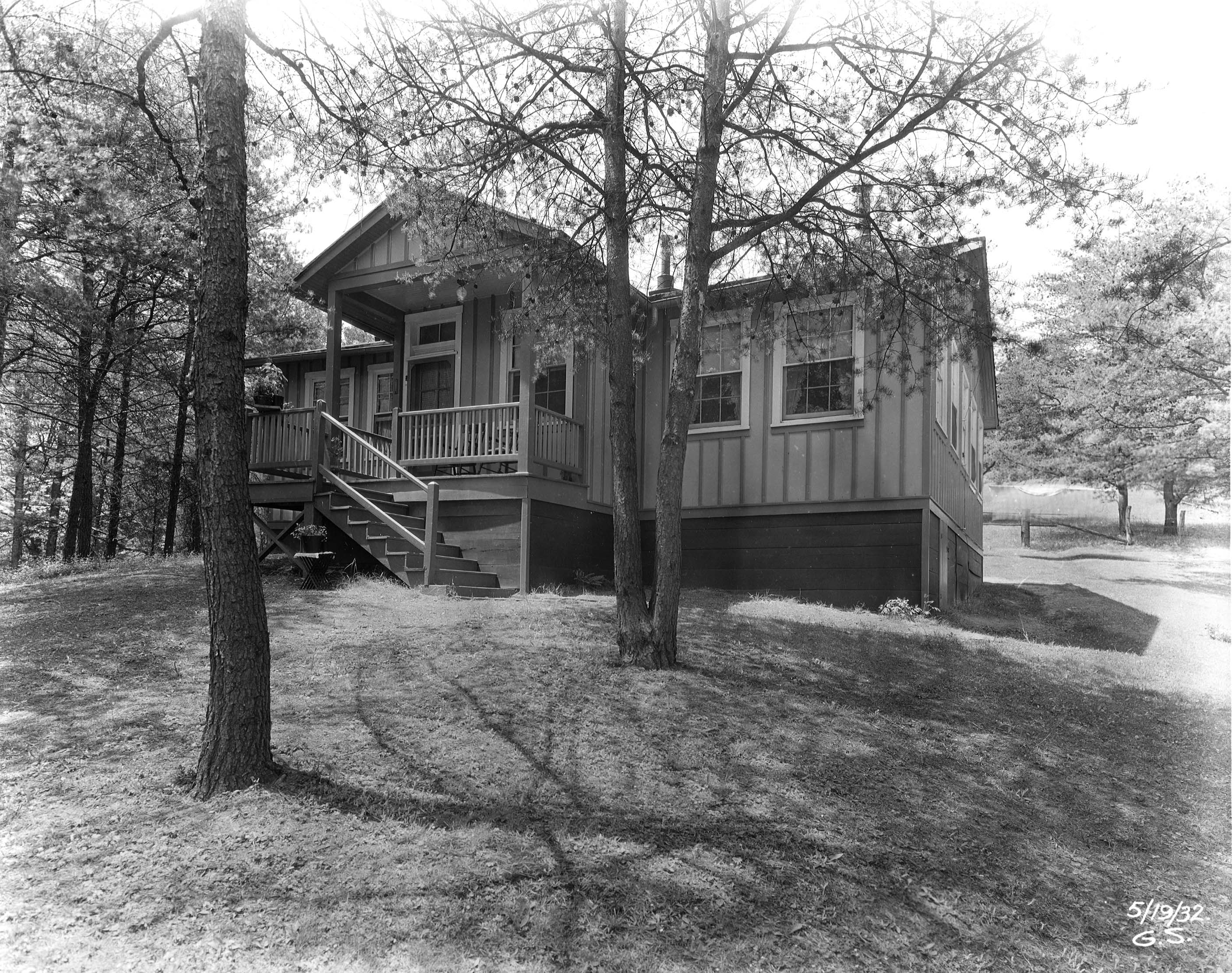
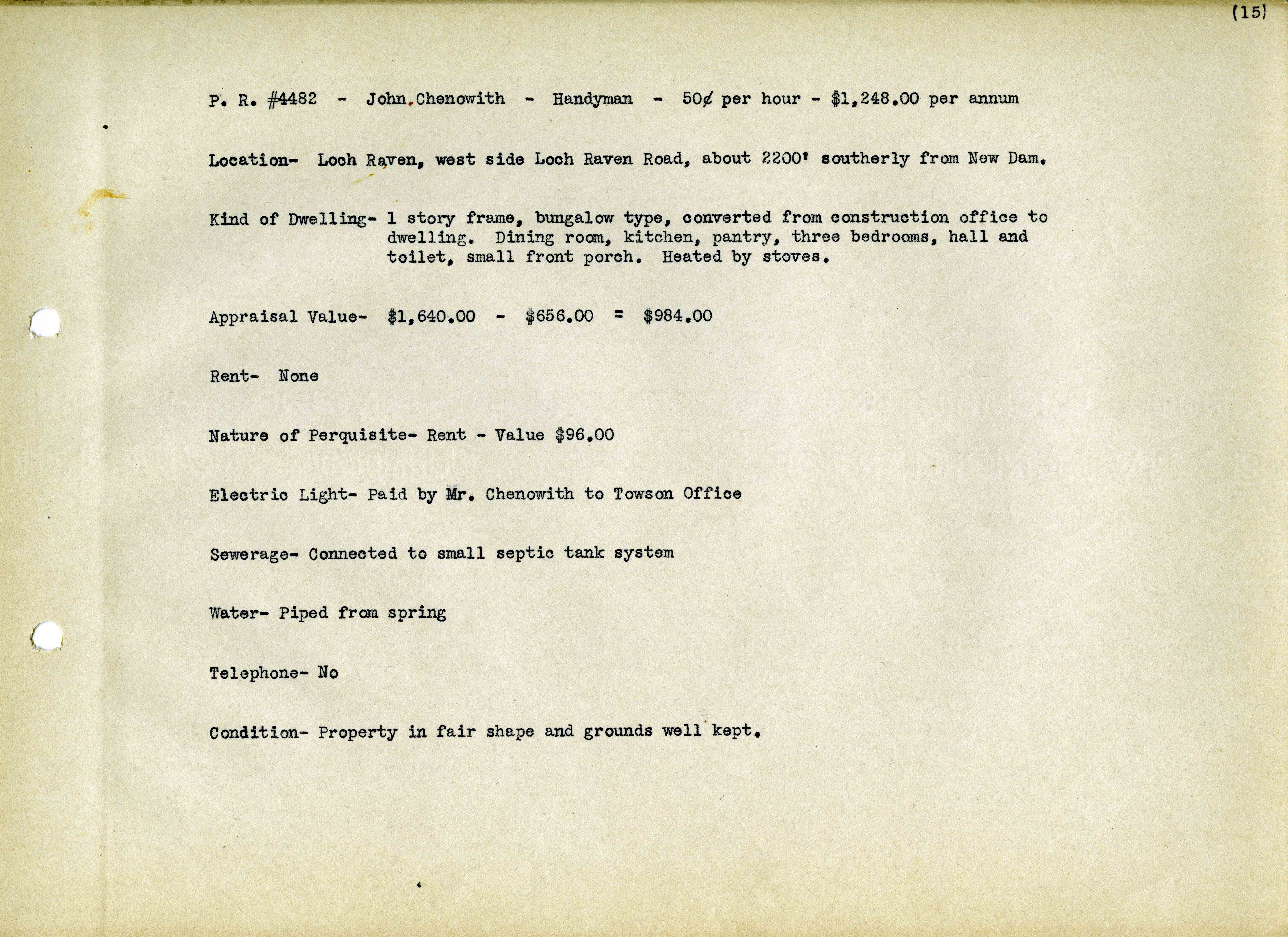
• About
  • History Writings

Water and Me

Water and Me

Category Archives: Dams

Photogravure – Copper Plates

21 Tuesday Aug 2018

Posted by Ronald Parks in Archives, Dams, Photography, water history

≈ 5 Comments

Tags

Baltimore, Dams, engineering, glass plate negatives, Gunpowder Falls, HISTORY, Loch Raven, photography, photogravure, water history

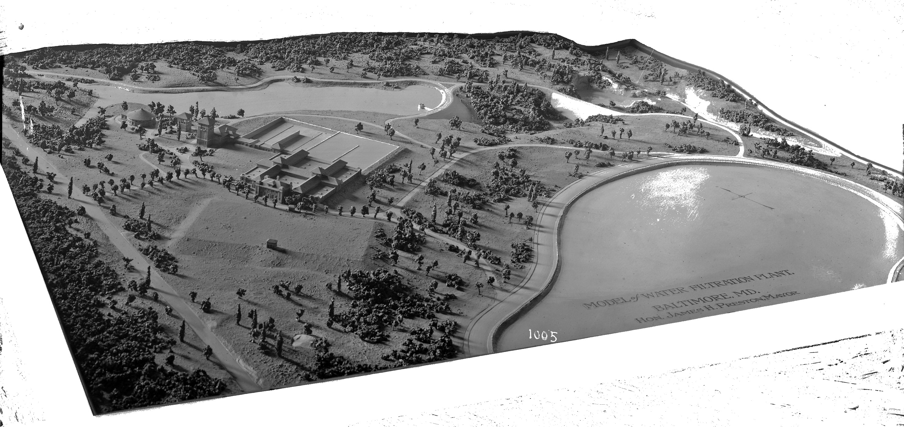
Doing some more packing of my office and here is another pile that needs documenting. I thought these were pretty neat looking when I found them about 10 years ago. I placed them in ziplocks to keep them from getting scratched and then put them away for another day. That day has come.

The three piles on the left are each about 5″ x 7″ x 7/8″ thick. The smaller ones to the right vary.

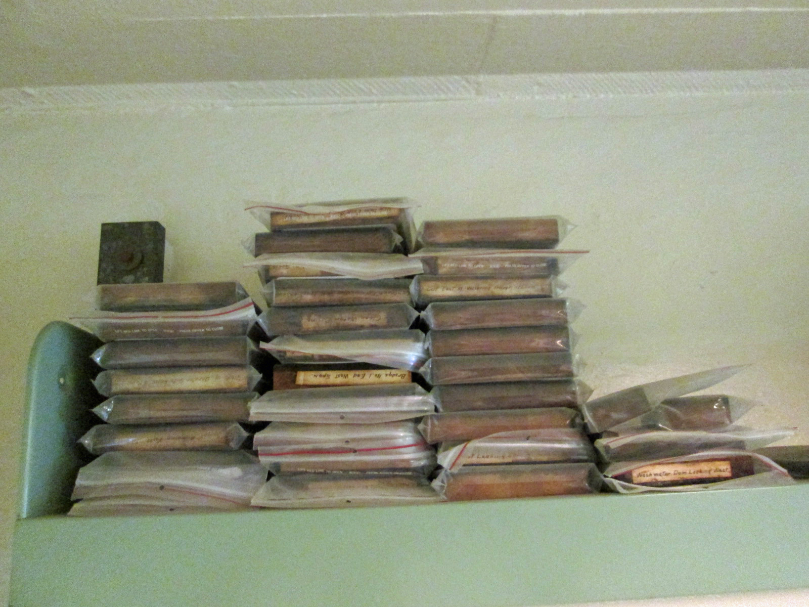
Here is one removed from its sleeve and placed on shelf to be photographed. 

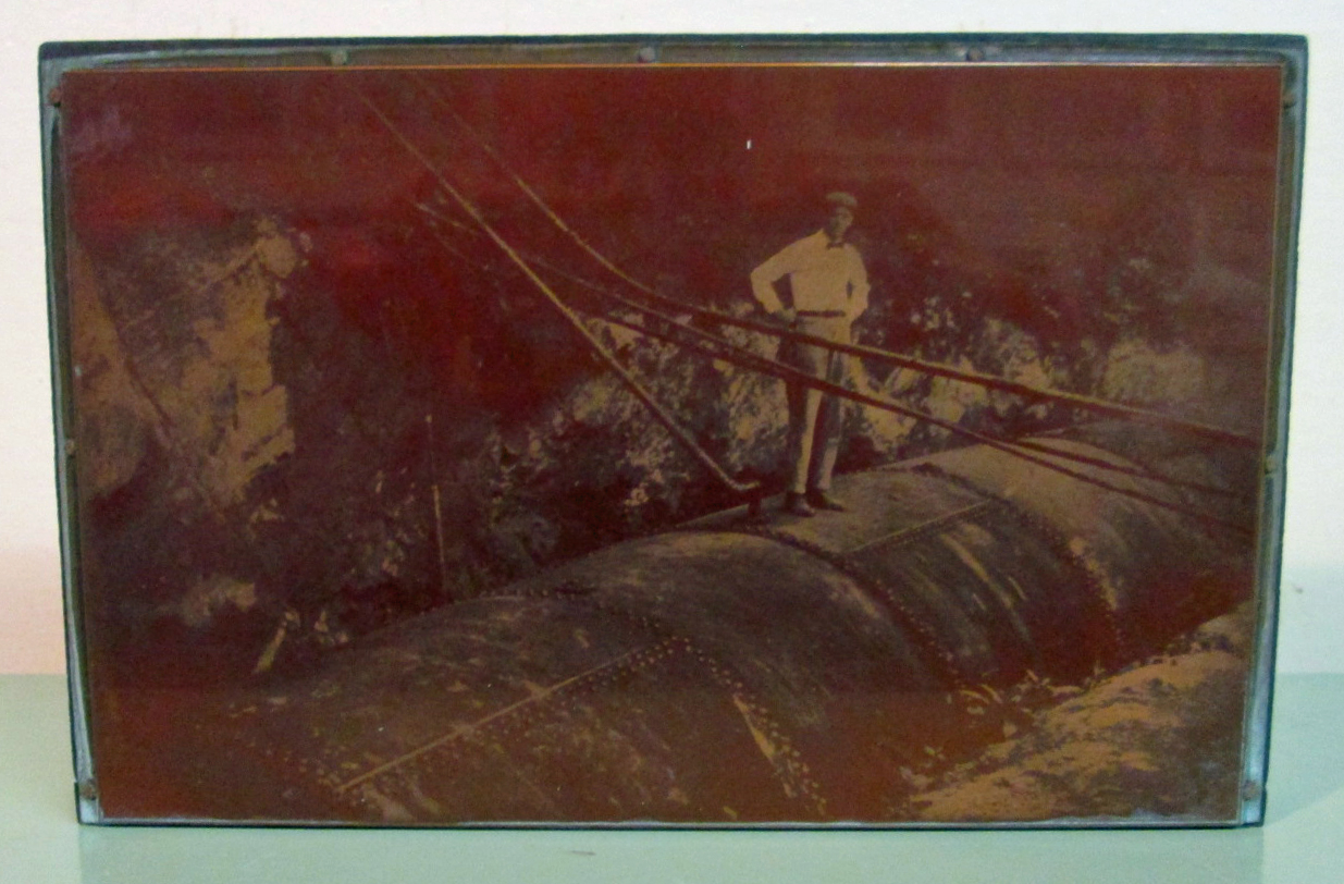
Same copper plate scanned with color settings at 300dpi. Trying to be careful not to scratch the glass surface of the scanner.

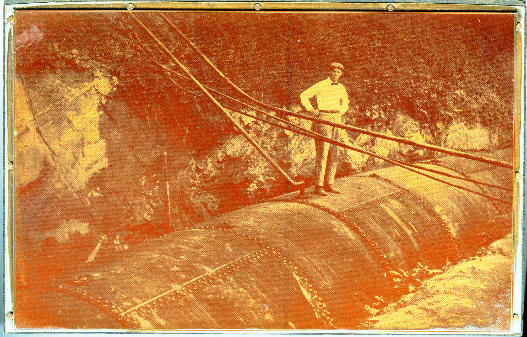
Kind of shabby looking, so I scanned it in Black and White.

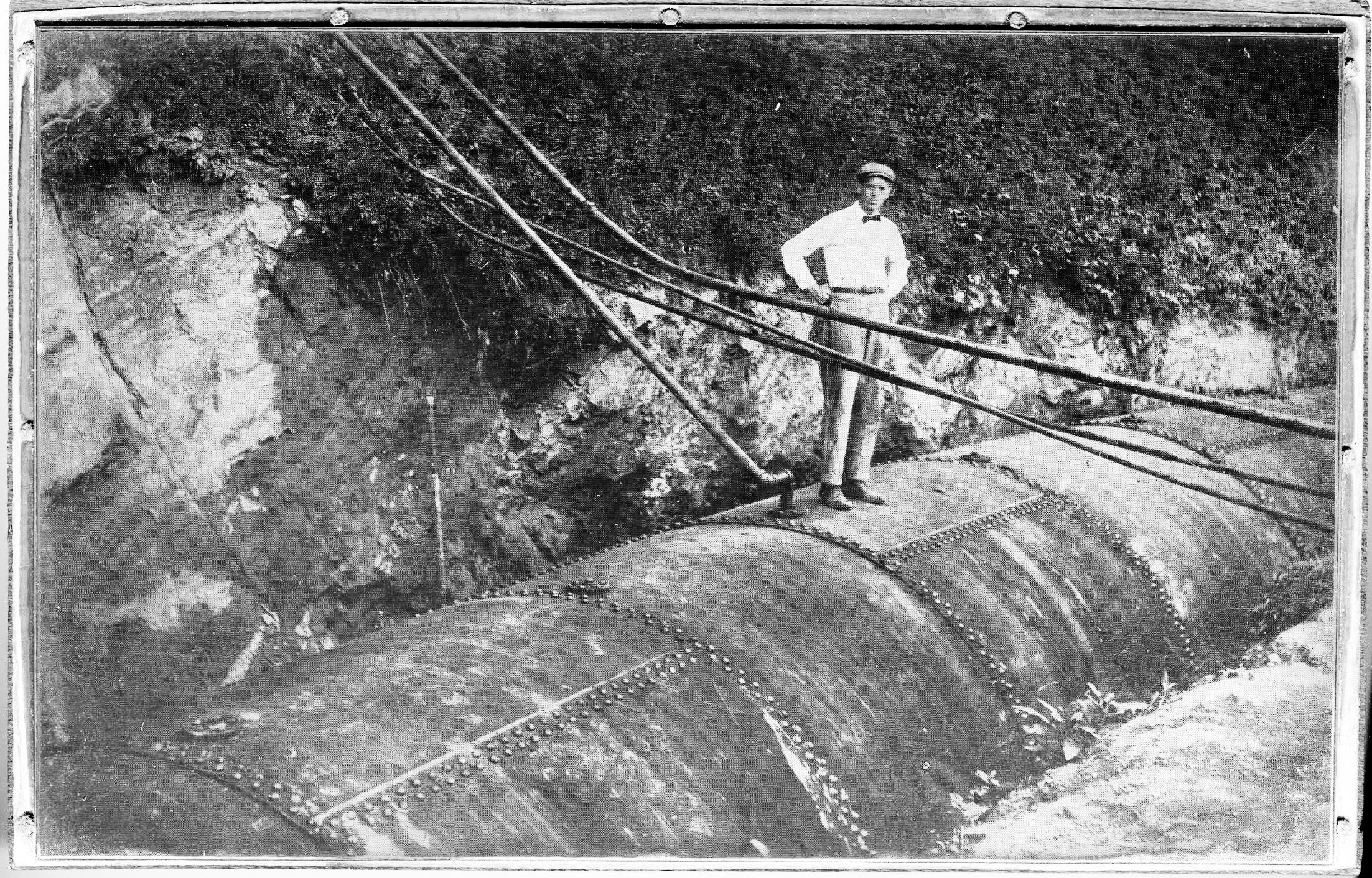
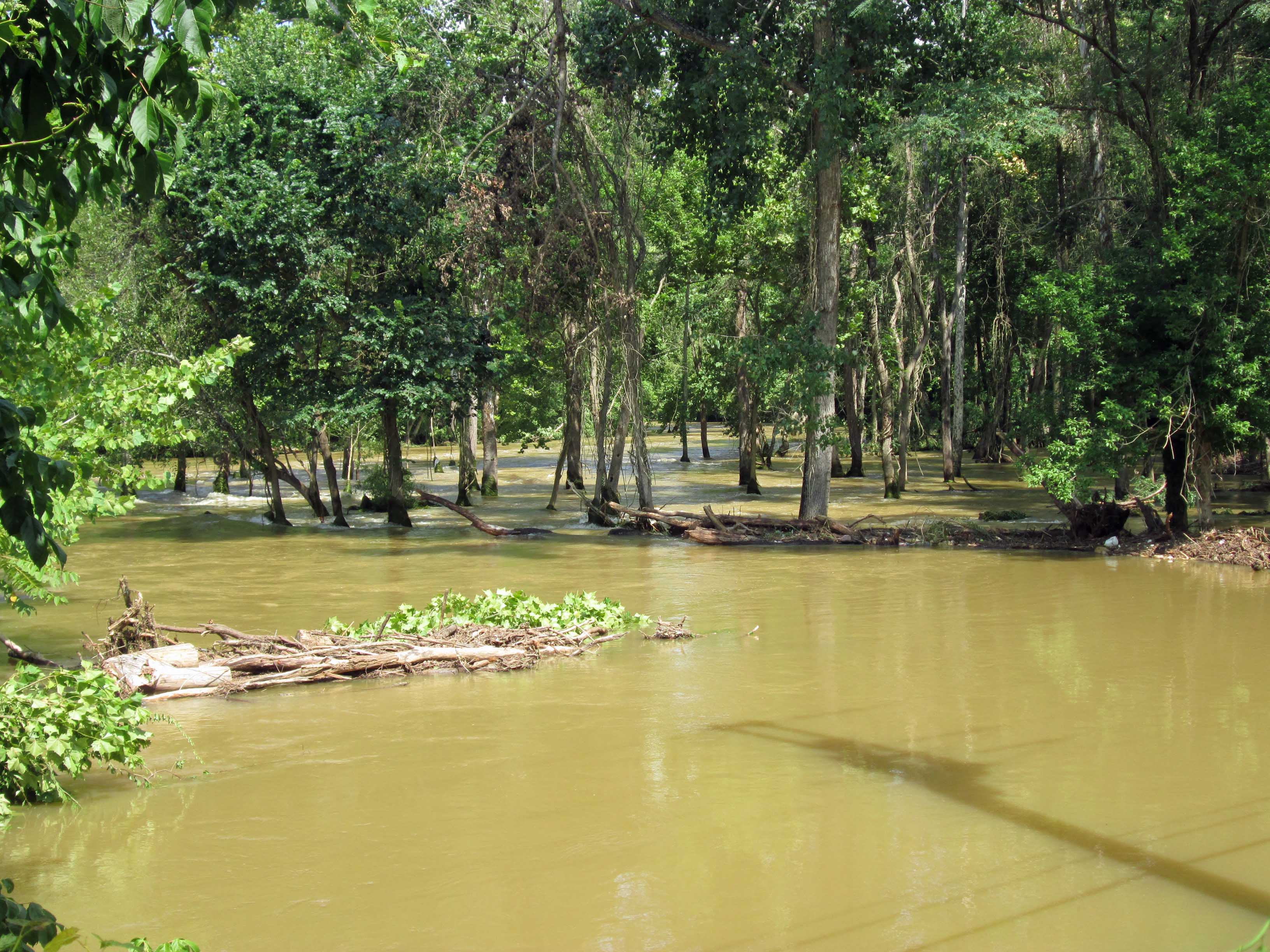
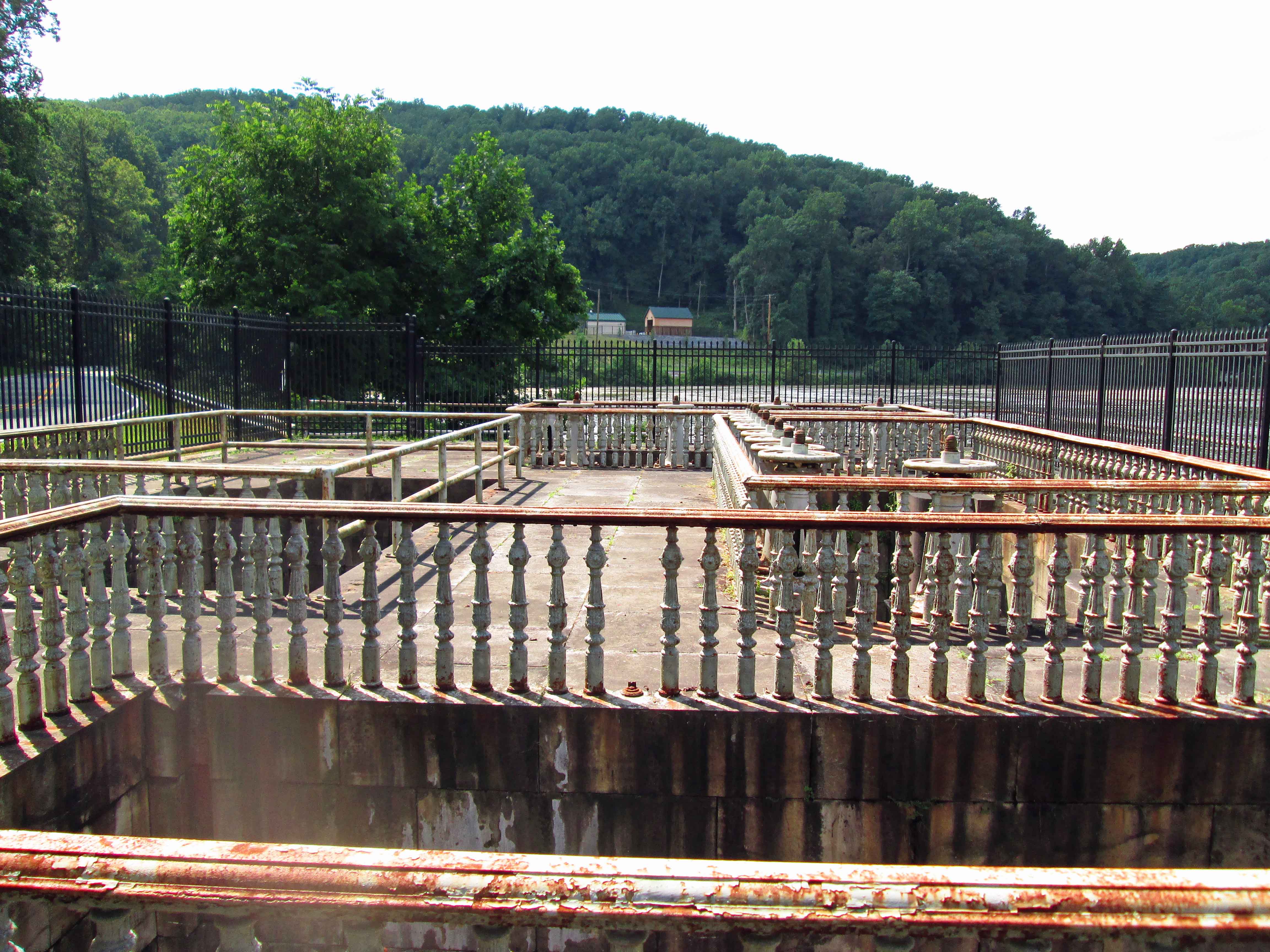
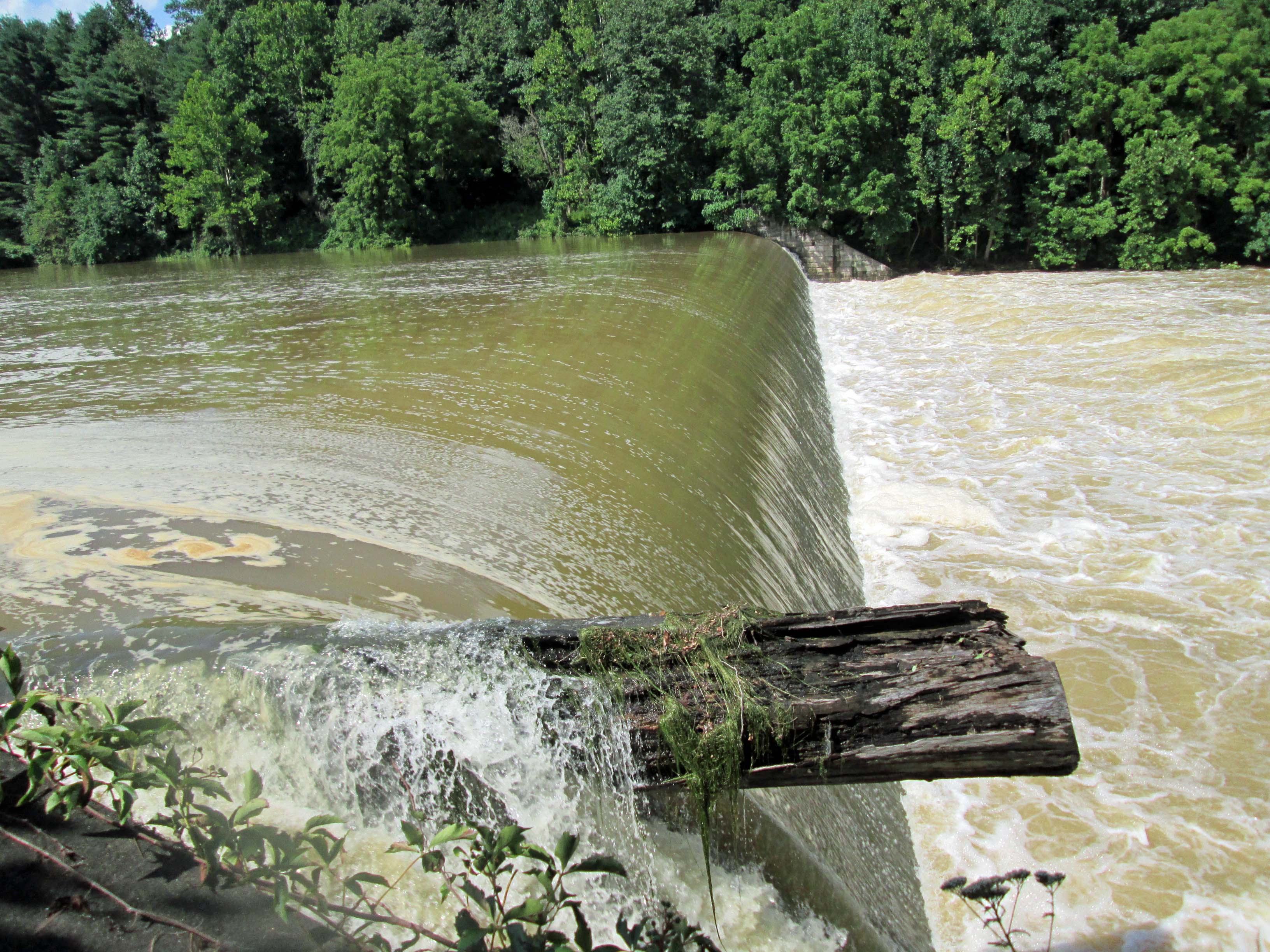
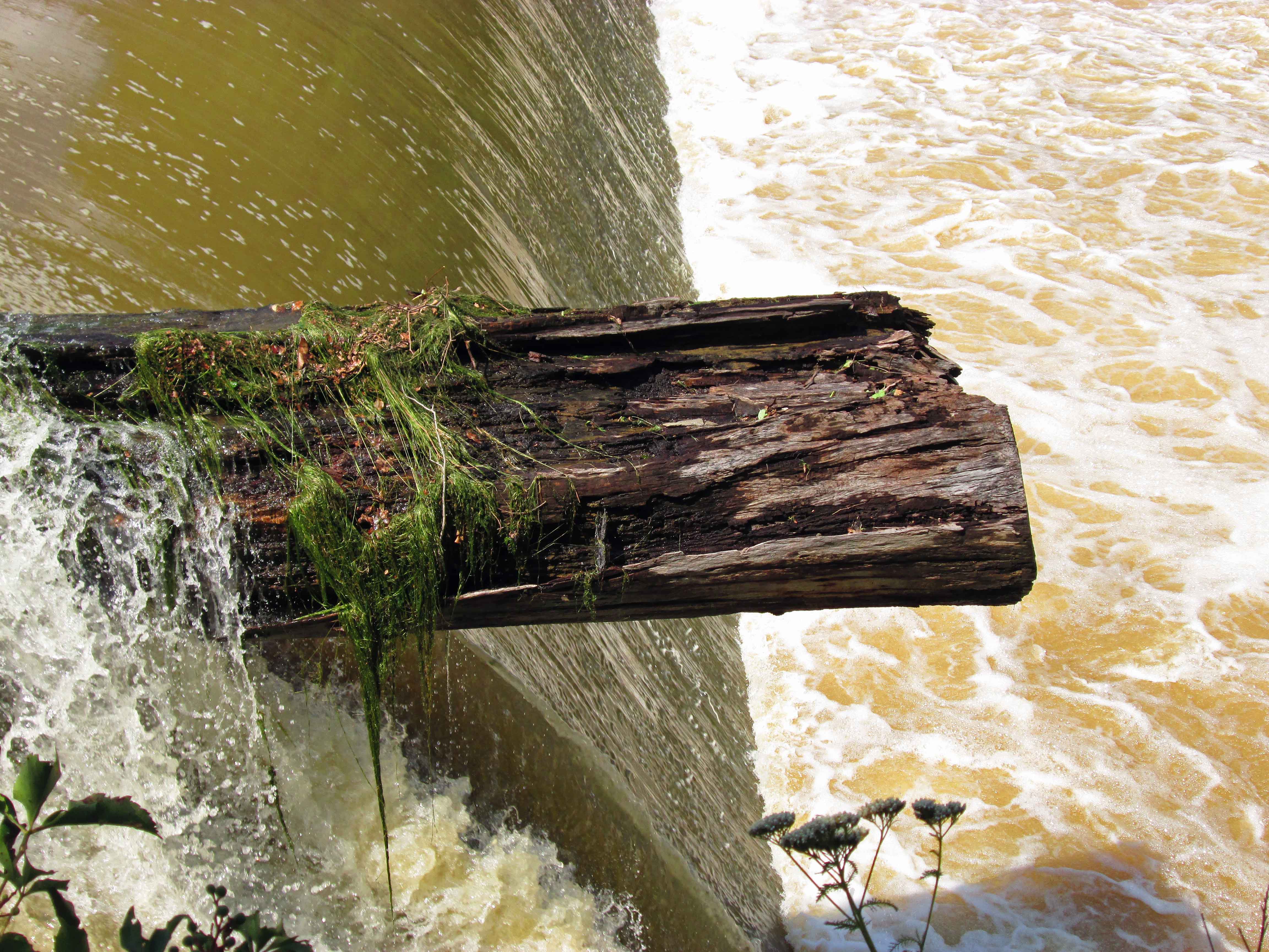
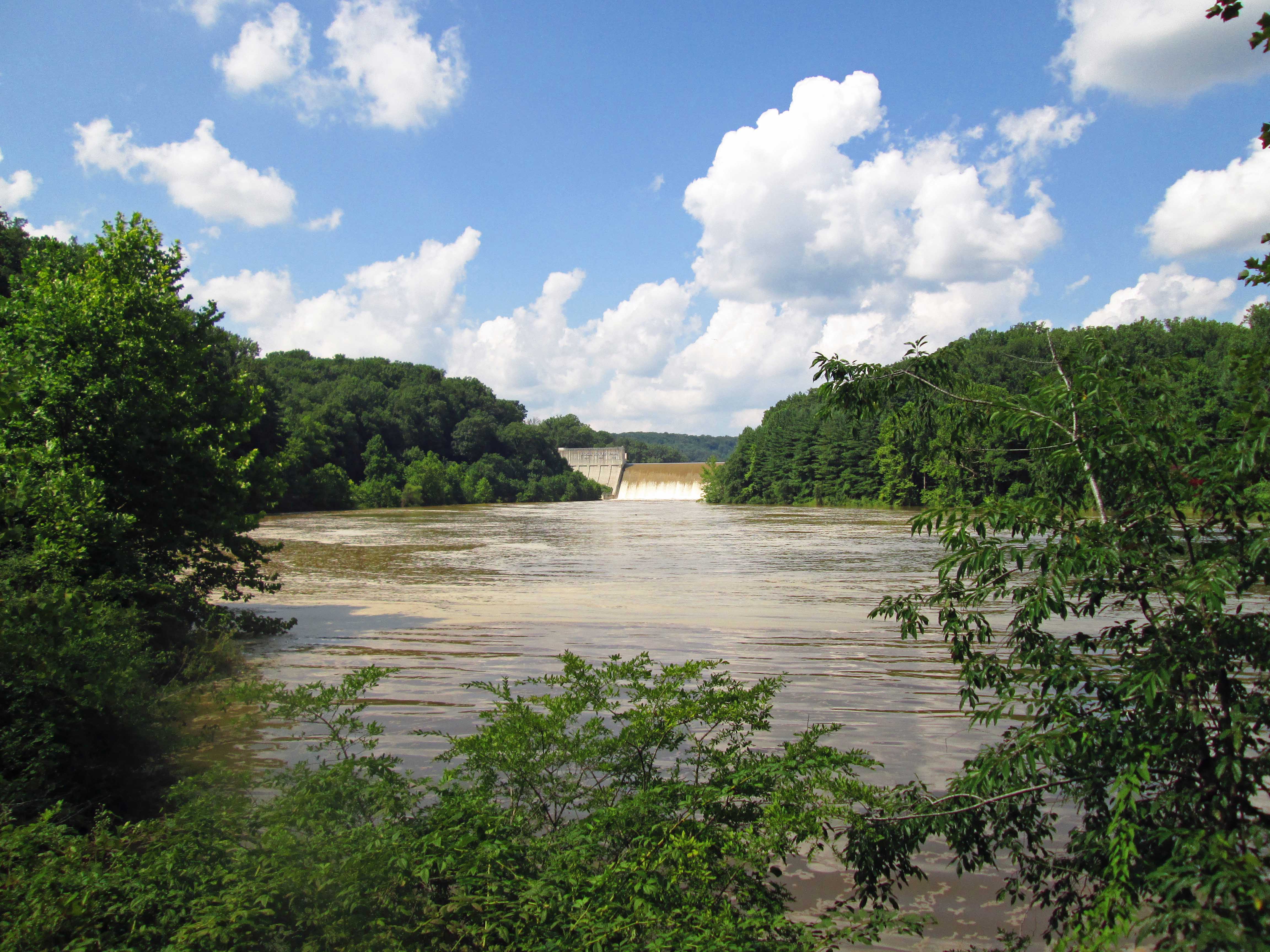
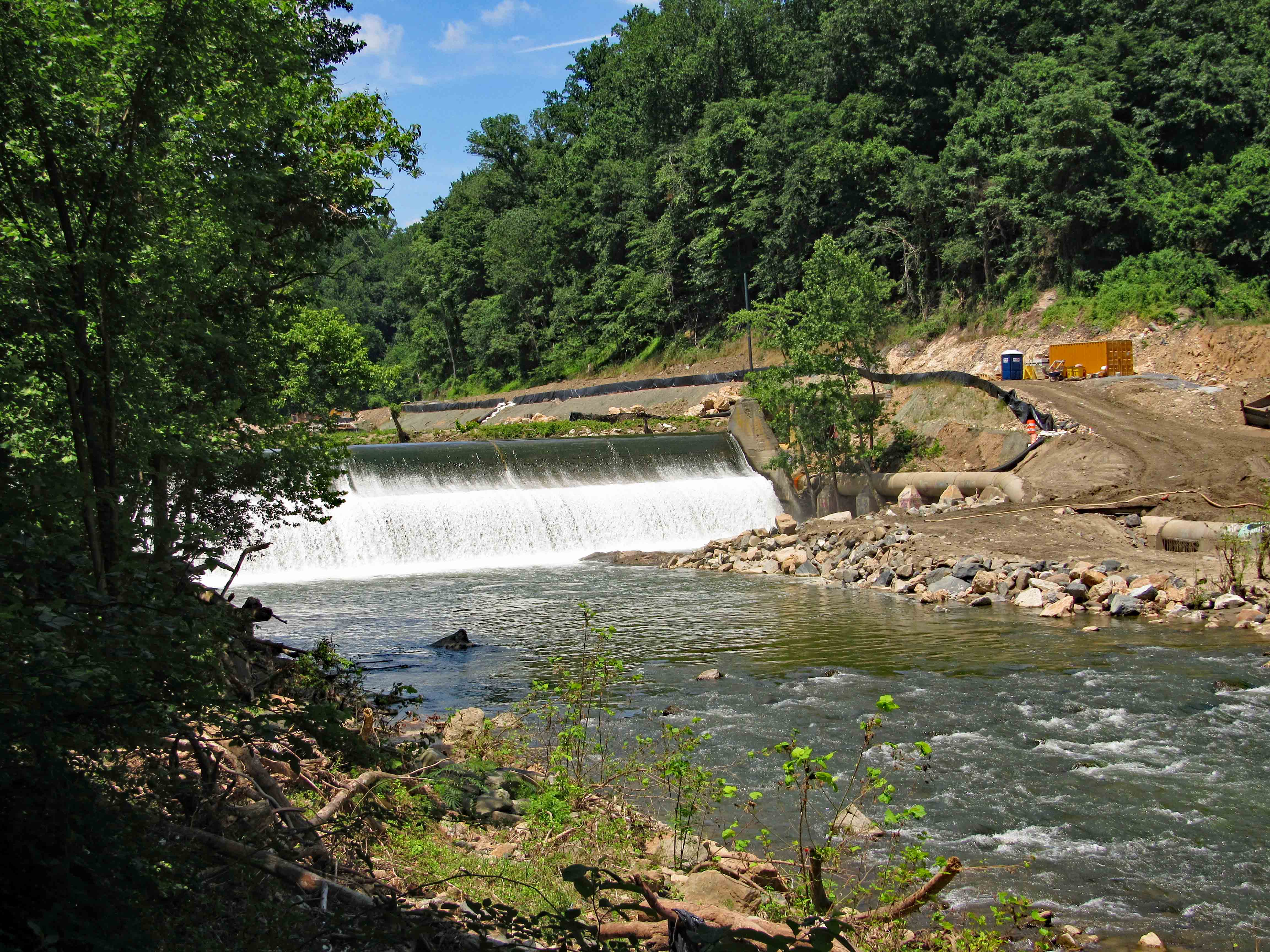
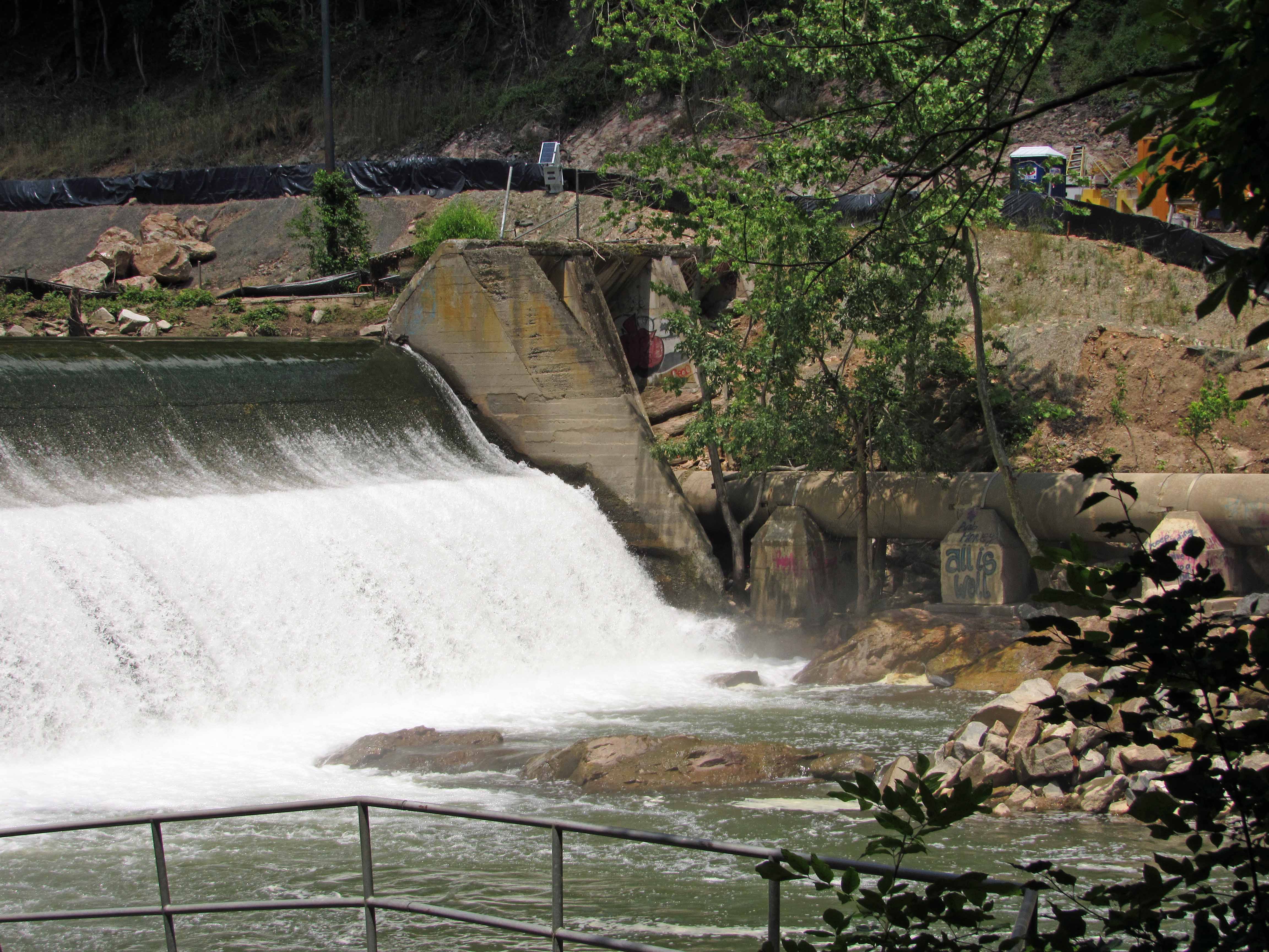
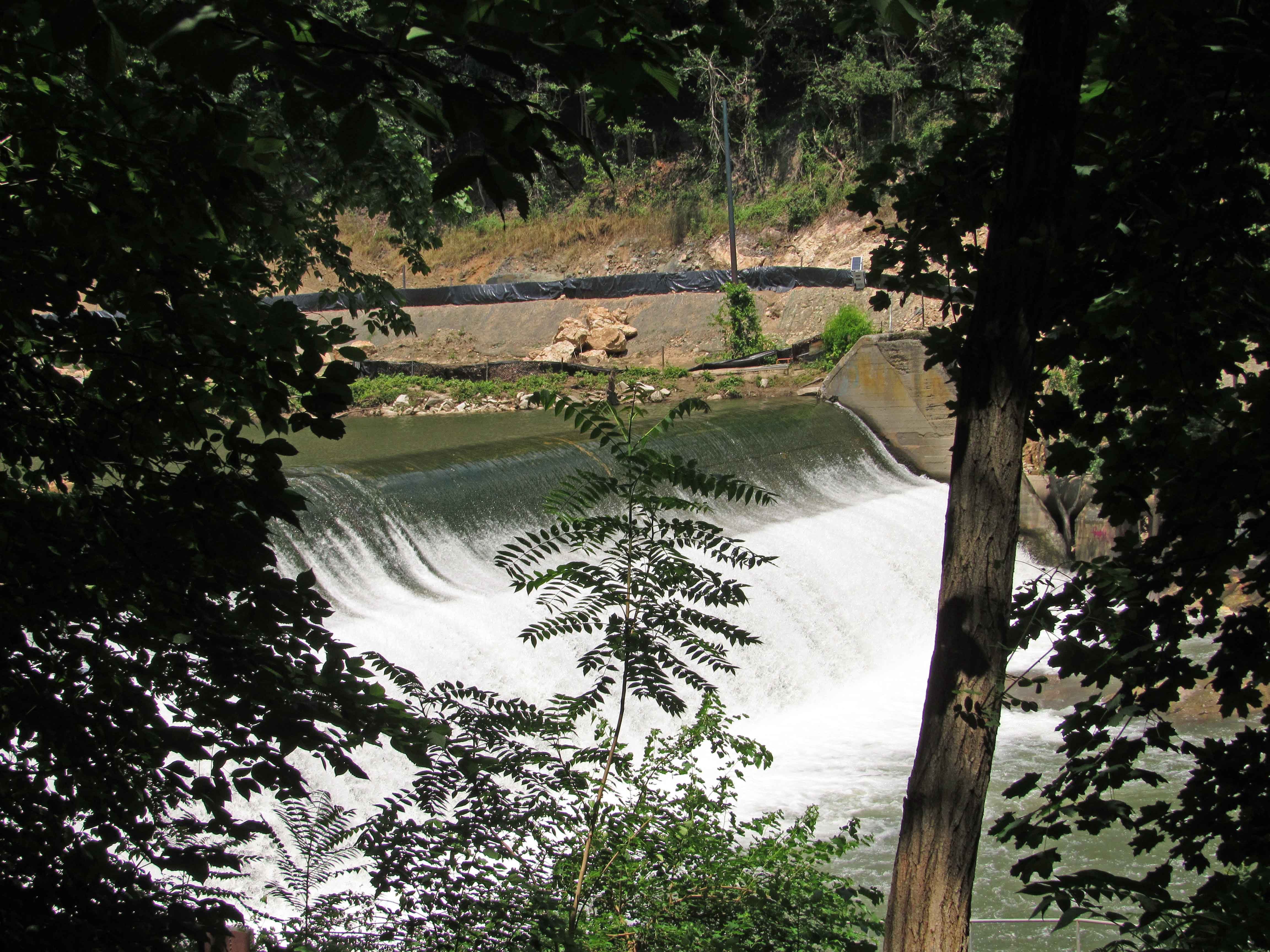
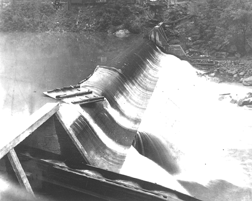
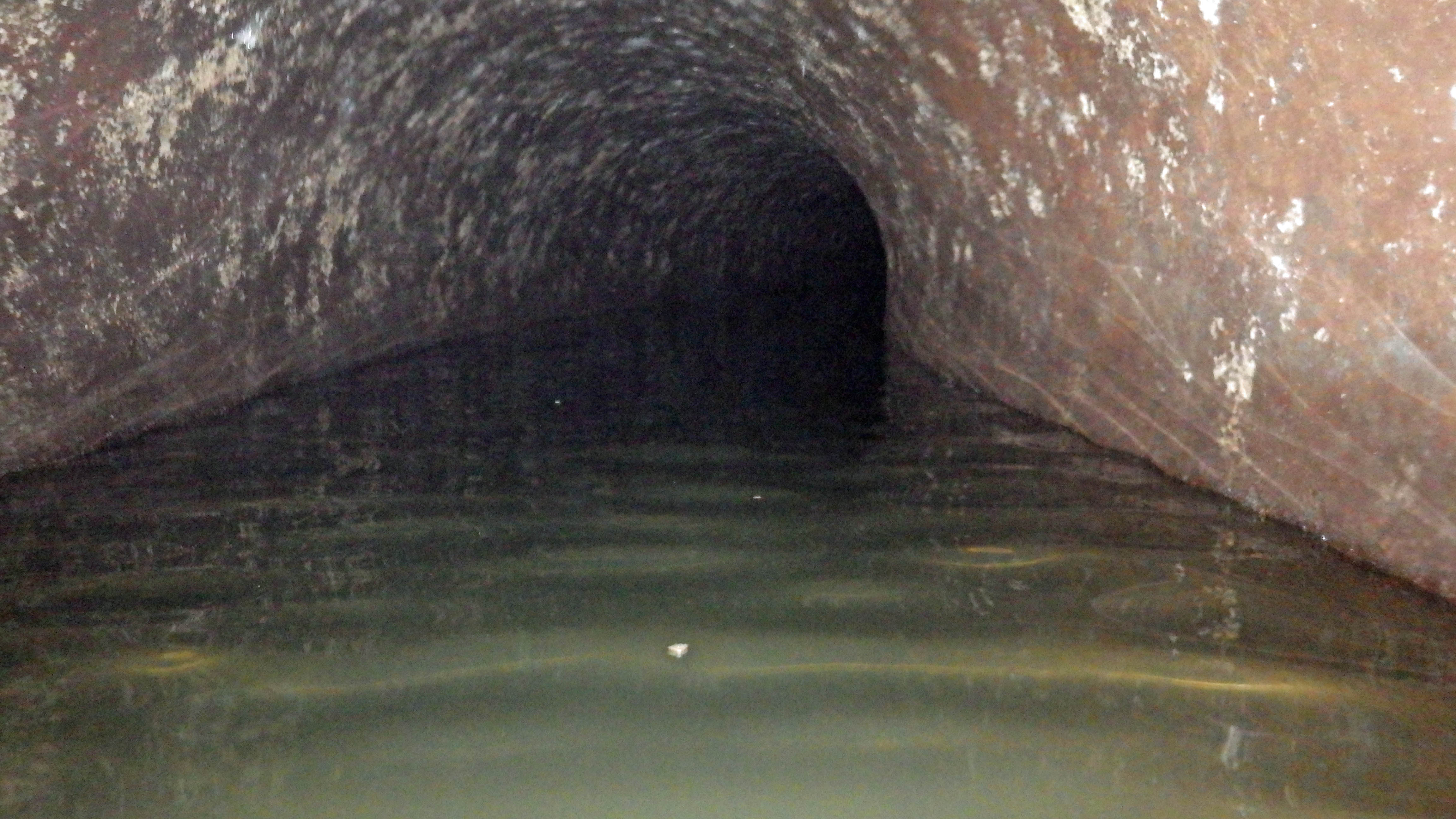
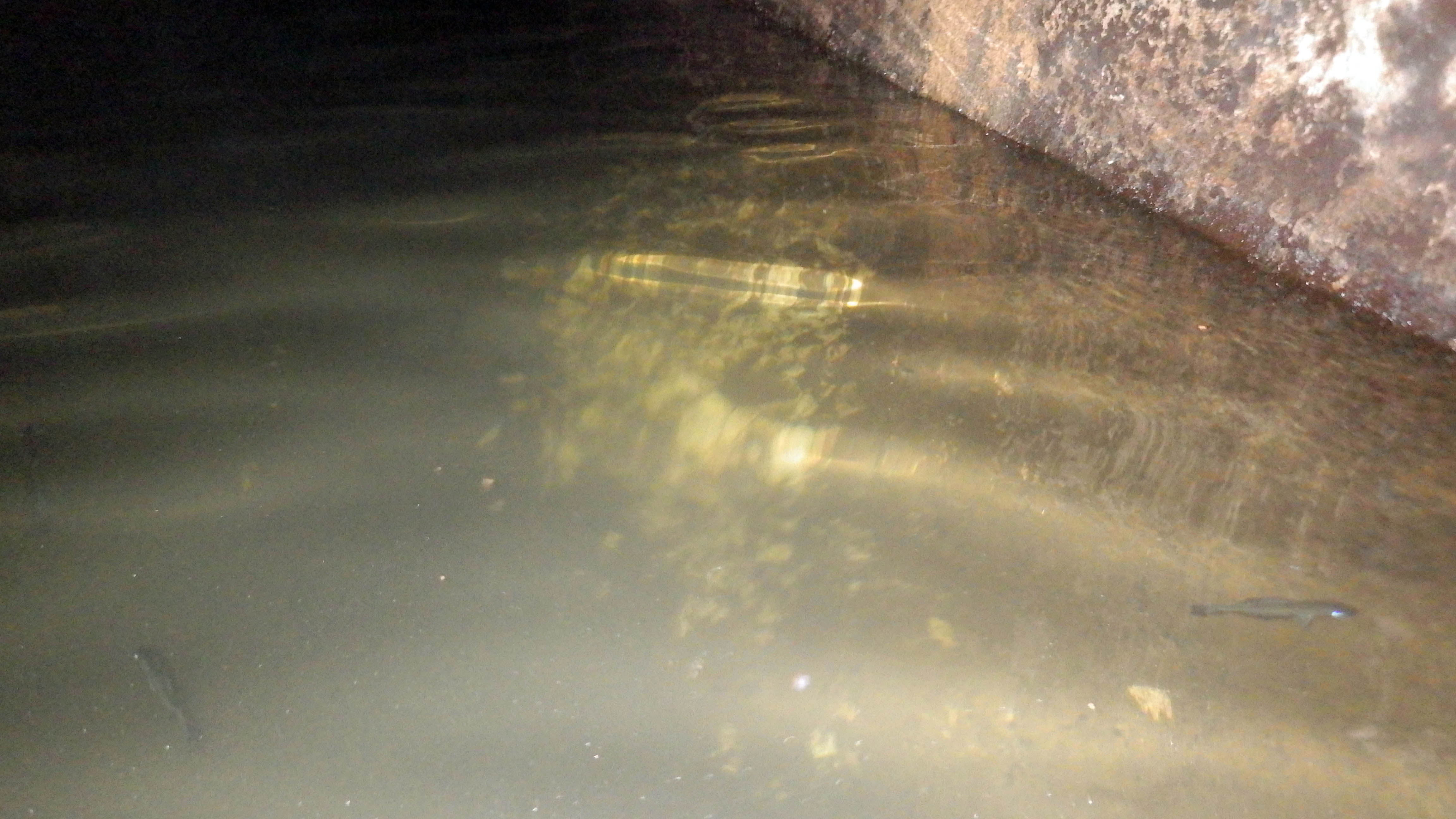
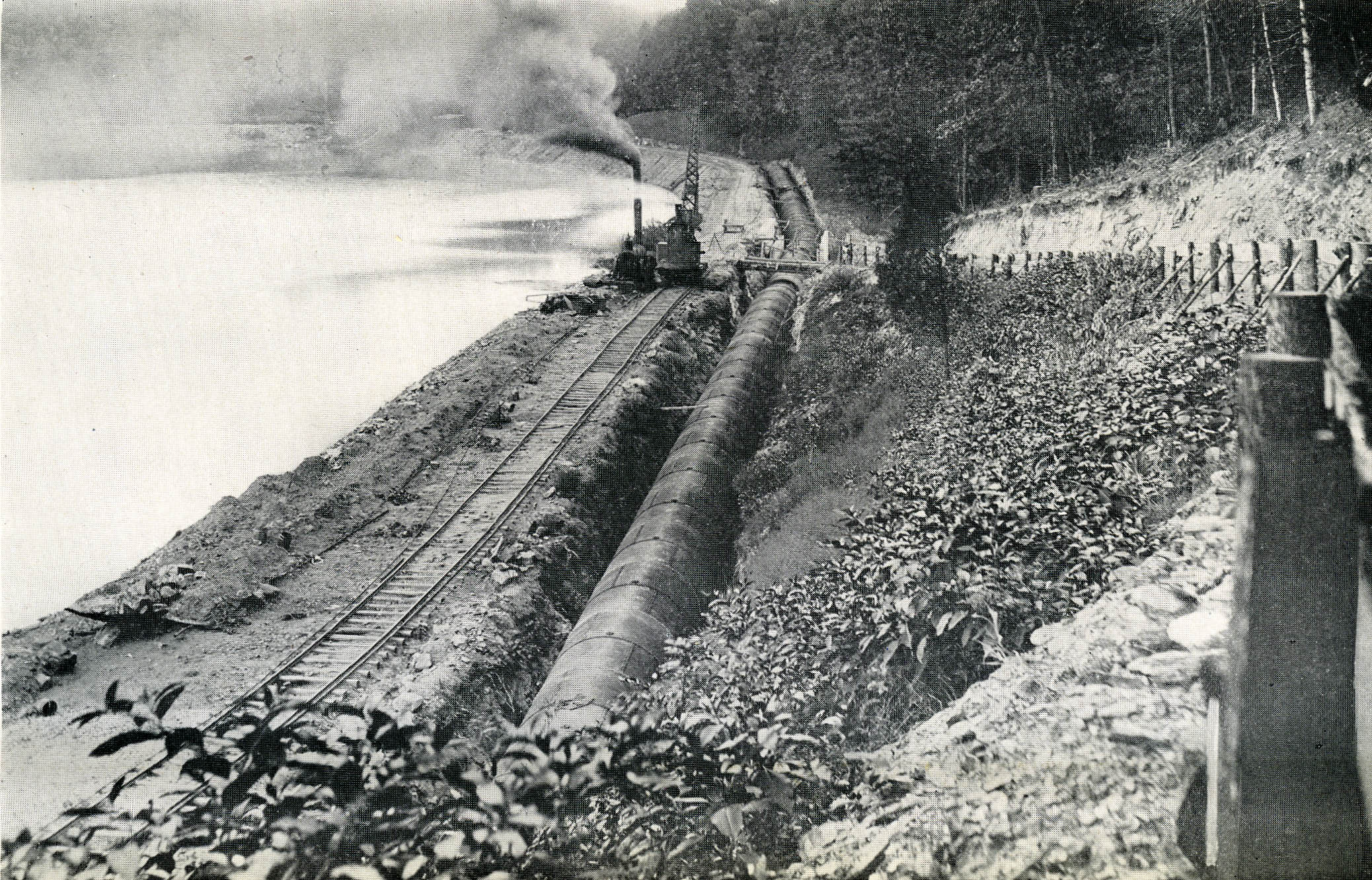
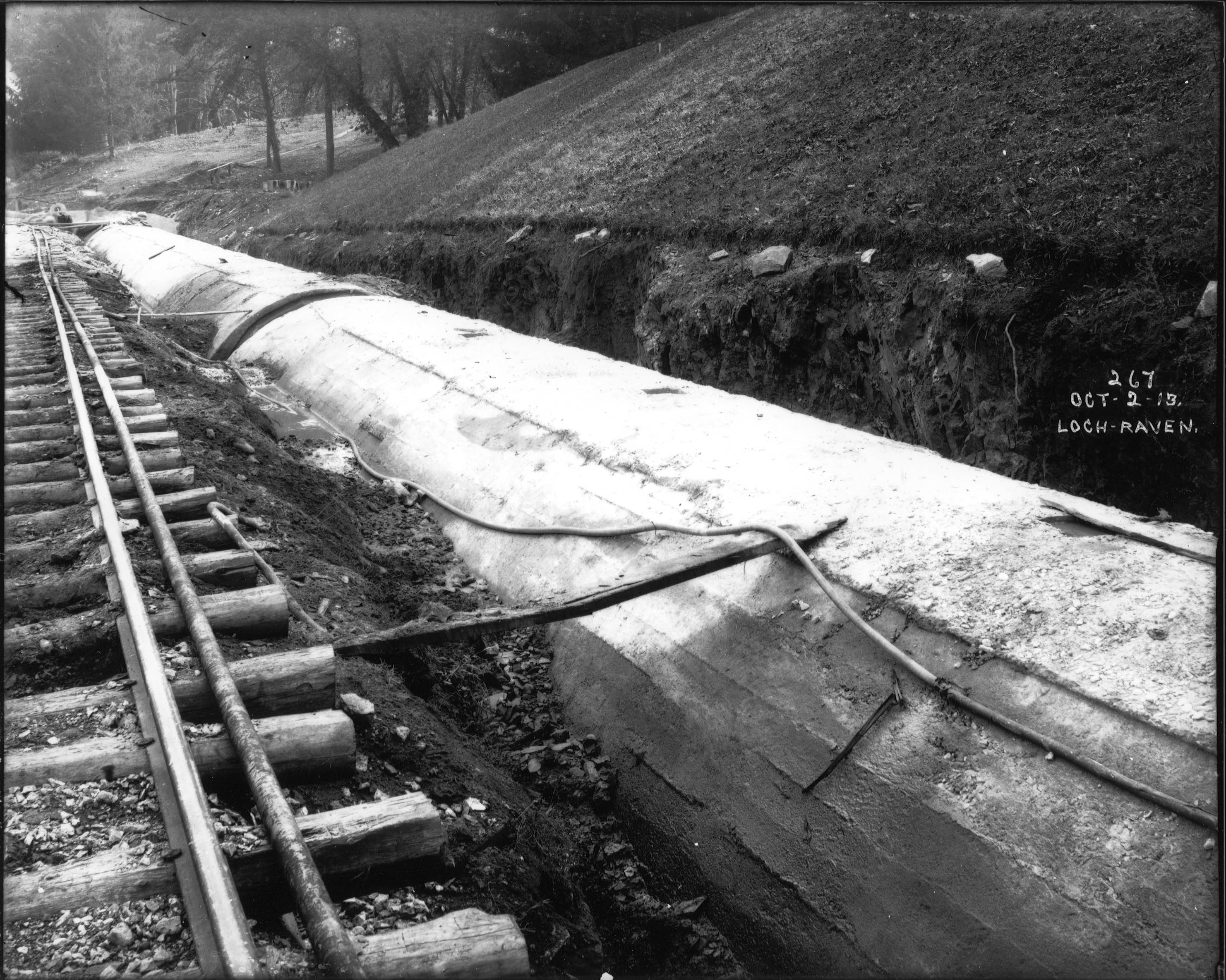
Better, but not as good as the original below. This one is an electronic copy from a glass plate negative I scanned back in 2007. In 1913 (I know, it looks like 1915 but it is not) the contractors performed a pressure test on the 10′ conduit from the new dam at Loch Raven to the old dam. 

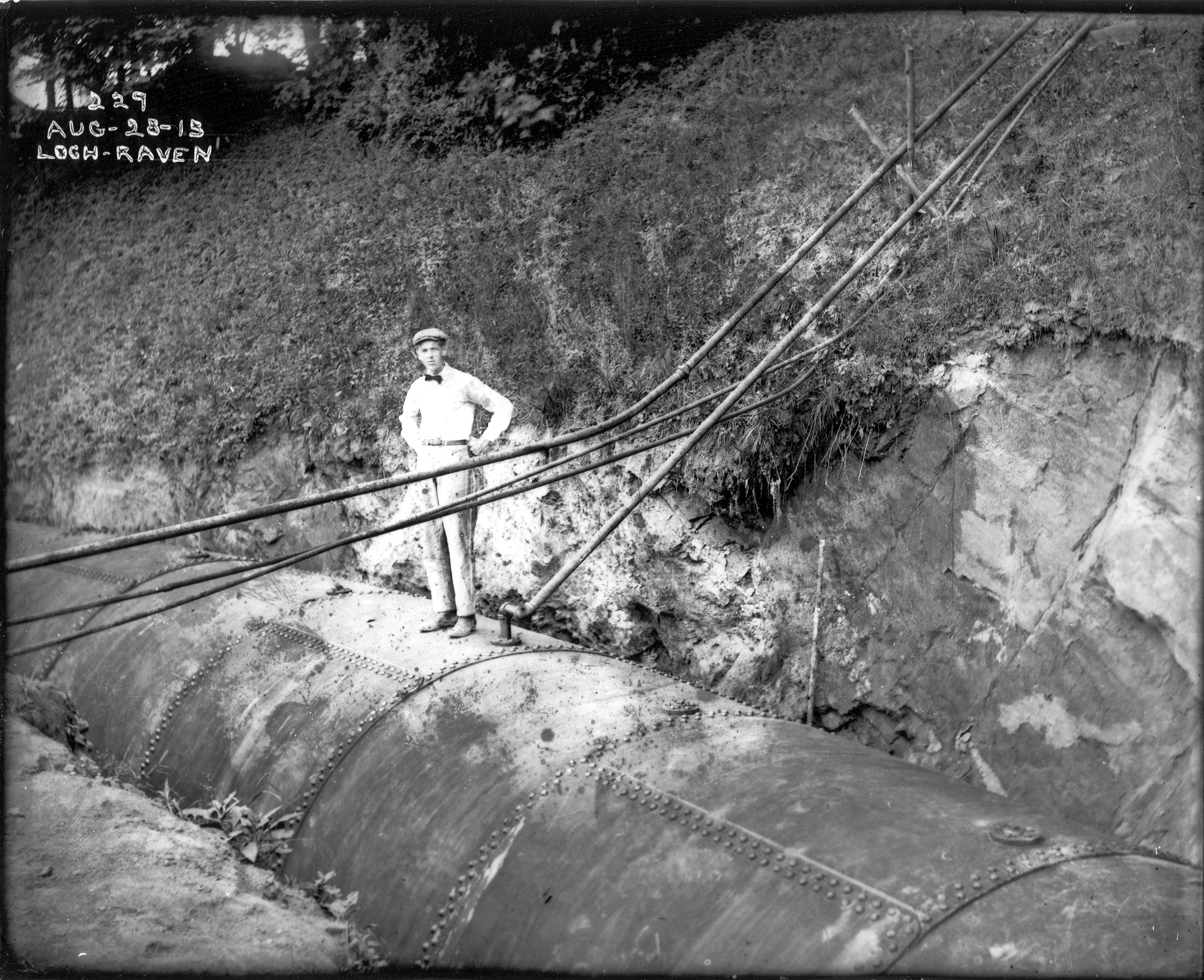
Tried another one. Color scan first, but at 720 dpi. Pretty bad looking. 

Now in b&W.

Still no good. I had trouble finding a good copy of this. It was not in the glass plate negative groups and not to mention the difficulty of looking for a reverse image. Looked in the lantern slides and there it was.

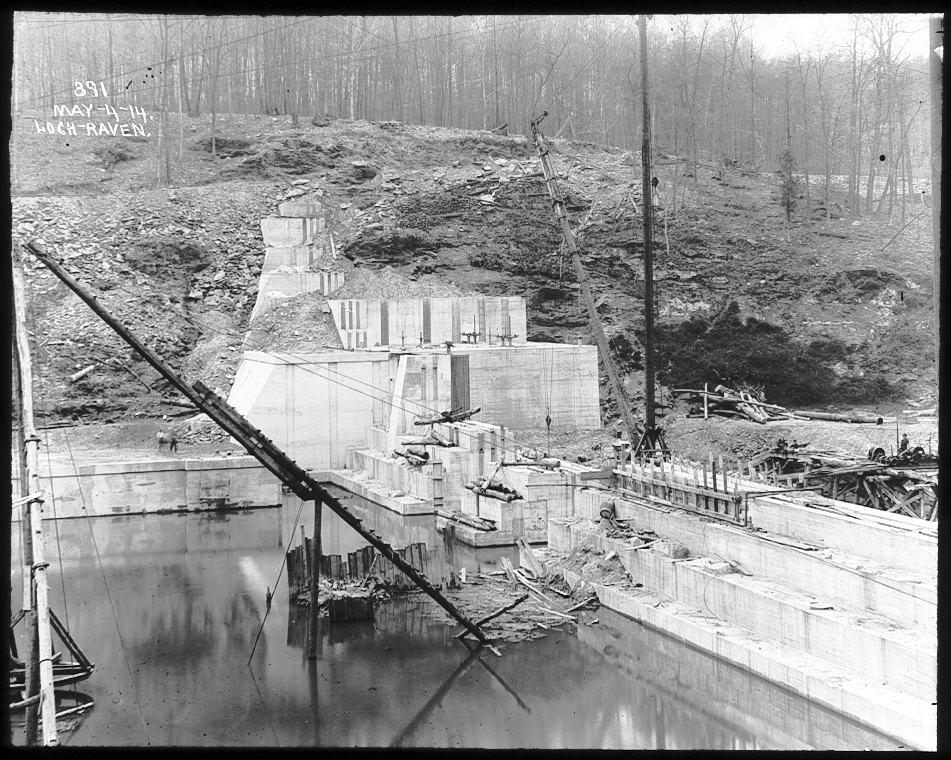
There is a nice video at this link which shows the Photogravure Process. Glad we have progressed into the digital art stage!

https://photogravure.com/process/

Loch Raven and the Rain

27 Friday Jul 2018

Posted by Ronald Parks in Dams, Floods, Reservoir, water history

≈ Leave a comment

Tags

Baltimore, Cromwell Park, Dams, engineering, FILTRATION, Gunpowder Falls, Hiking, Loch Raven, Montebello, Public Works, water history

The never-ending rains are here so I decided to check out the water works and see what is going on. Montebello Lake has risen quite a bit. If the grounds crew does not cut all the way to the water line, the phragmites will once again encroach the banks.

A look in the gate house on the lake. This flow is normally about 11-13 mgd. Today it is at 21 mgd. And for those of you who do not know – no, this is not drinking water going to waste. The Montebello Lake is where the impurities from the treatment plant settle out along with the dissipation of the chlorine before it goes into Herring Run. 

On my way over to Kathy’s for some steamed crabs, she calls me and says I should check out Loch Raven before coming to her house, so I did. I parked behind Sander’s and walked over to where Mine Bank Run and the Gunpowder Falls meet. Wow!

It hasn’t been this high for a while. On Loch Raven Drive, the bridge over Mine Bank Run. This is the stream we were walking in the other day, towards Cromwell Park.

Heading up the Drive a little farther and looking back towards Cromwell Bridge Road.

Back to my car and headed to the 1881 dam. One of these days someone will fulfill their promise to me and let me in to photograph looking down into these chambers. Not holding my breath! The new, unused maintenance facility up in the background.

From the top of the dam, looking across – that is a lot of water.

I am amazed that this log is still here after all these years. I just want to jump up and down on it to get it the hell off the top of the dam! Damn log! Log jam at the dam.

Climbed down to the bottom of the dam, along the retaining wall. The water is lapping along the top of the wall.

Here we can see that the integrity of the wall is starting to give a little bit. The water is gurgling up through the wall on the left, which means there are holes in the wall. Overall, not bad for a wall that was built in the 1880s.

Looking across the Gunpowder to the opposite shore.

Then towards the dam itself. Remembering when Kathy and I were able to gingerly stroll across here, to get to the other side!

On Loch Raven Drive, looking towards the new dam.

If there is this much mud and silt from the small streams that feed the Gunpowder, can you imagine all the crap in the waters of the Susquehanna River! 444 miles of dirty water emptying into that river and then our Bay!

The water above the new dam is our drinking water. And even though this water looks pretty muddy and full of debris, once filtered at Montebello, it is still some of the best drinking water in the country. (Think I will get a raise for that promo! Ha!!)

Patapsco State Park Bloede’s Dam

25 Monday Jun 2018

Posted by Ronald Parks in Dams, Floods, Hiking

≈ 2 Comments

Tags

Avalon, Baltimore, Bloede Dam, engineering, Hiking, HISTORY, nature, Patapsco, photography, Public Works

Sunday was a nice day for a hike so we seized the moment and headed to Patapsco State Park. Because of all the flooding and the on-going construction to remove the Bloede’s Dam, a lot of the areas were closed off, which meant the same amount of people trying to cram the smaller accessible areas. Good thing we went early. Other than some parking at the Avalon side, the only other parking was on River Road near the swinging bridge, which was also closed off.

So we parked and took this trail.

I remember seeing this a few years ago. still not sure what it is. I think it may have been a water fountain, that by river pressure through a pipe, supplied water?

A Maryland Department of Natural Resources Geological Survey marker off the side of the trail.

The devastation from the flooding was unbelievable. This area is a few miles downstream from Ellicott City. Part of someone’s fence.

Part of a car.

Trees wrapped around trees…

Or just snapped off

Snap…

Debris everywhere, unless maybe brought here by a fisherman? Did find a bunch of sea glass (or stream glass!)

Heading to the dam, which is just under a mile away, we can see some construction debris on the other side.

Along with some debris you really don’t want to see in a stream.

Approach to the dam and construction site. From what I read, they are moving the sewer line, putting the Grist Mill Trail over it and removing the dam. 

The fish lift. Trees in the fence. 

The sewer line that needs moving.

Another view of dam.

Above the dam. The construction site, which a lot was washed away in the flood. I like how in this photo the sky is white but the reflection is blue.

On top of dam abutment. Debris just rolled right over the fence.


Historic photo of dam about 1907. Good history on Wiki.

These two photos courtesy of Baltimore County Public Library and Wikipedia.

If you read the Wiki article you can see that this was a world’s first hydro dam, 1906.

https://en.wikipedia.org/wiki/Bloede%27s_Dam


Noble Mill on Deer Creek

06 Wednesday Jun 2018

Posted by Ronald Parks in Dams, HISTORY, water history

≈ Leave a comment

Tags

Baltimore, bridges, Dams, Deer Creek, engineering, kayaking, mills, Noble Mill, Research, water history

Somehow or another I ended up on a mailing list for an organization called S.P.O.O.M. – Society for the Preservation of Old Mills. I just received their latest posting and I see they are visiting Eden Mill on Deer Creek this weekend. Nice mill that I have written about before. (A favorite kayak spot) Back in 1933 when Baltimore City was looking for a new water source, Deer Creek was on the list of possible dam sites. If the dam was built at Rocks State Park, Eden Mill would be flooded. There were quite a few mills below that area which would have lost water power needed for the mills. One of which was Noble’s Mill, which I visited in 2012.

Here is the drawing of Noble’s Mill.

And what the Mill looked like in 1933.

And in 2012.

The water race sluice gates.

Water to the mill via the sluice gates.

And where it enters the mill.

Sluice gate rack and pinion.

One of the best parts of my 2012 trip was being able to go into the mill. The owner saw me poking around outside and offered to give me a tour. 

Besides his artwork, he has been restoring some of the mill works.

Got to love this old pulley system and how you can watch the grain go through the chutes.

The old bridge over Deer Creek.

Maker of the bridge.

Map of the other mills along Deer Creek.

The Noble Mill map shows the road in front of the mill, between Deer Creek and the mill. Google Earth shows the road behind the mill.

North Patapsco Bridges

25 Wednesday Apr 2018

Posted by Ronald Parks in Baltimore, Dams, engineering, water history

≈ 4 Comments

Tags

Baltimore, bridges, Dams, engineering, HISTORY, Liberty Dam, mills, Public Works, water history

More from the Loose Ends Never Ends files. I have about 500 more negatives to scan in this one collection. Just finished up more of the Liberty Dam and adjacent bridges. I must confess, I have never really done a lot of research concerning these bridges. Over the years I have found hundreds of photographs/negatives, and only found a few of them interesting; like Liberty Lumber, the Indian grave marker and the dam itself. Although I really like climbing on and under bridges, I never gave these photos much thought. Looking at Google Maps, it is hard to place the original/present location of these bridges. I’m just not familiar with the area’s history. Most are from the early 1950s.

Ivy Mill Bridge is first. I like this one because it shows the old structure in the background. This photo is one of the few with a description attached.

Beginning construction, temporary bridges were built.

Foundation and columns poured.

As can be seen, these photos are missing the contractor’s descriptions of work – black rectangular areas on photos.

Moving right along with progress.

Reaching the final height and then comes the decking.

The finished bridge.

Next collection of negatives were marked as North Branch Over Patapsco, including Morgan Run. General view of the area.

Setting forms for foundations.

Columns.

Ready to place decking.

Putting on final touches.

Finished bridge from old bridge. (I wonder if this old one is underwater?)

The next group I found were of the Snowden Creek Bridge. Not many photos in this collection. It must be way up there because it looks pretty shallow. Forms poured and ready for decking.

Near completion. 

The next 500+ negatives to document are of building the Susquehanna Tunnel.

Here is the photo of the grave marker, taken from an engineer’s scrapbook. 


History Hike Part 2

23 Tuesday Jan 2018

Posted by Ronald Parks in Baltimore, Dams, water history

≈ 4 Comments

Tags

Baltimore, Dams, engineering, Gunpowder Falls, Hiking, HISTORY, mills, nature, POLITICS, Public Works, Research, water history

Now the good stuff! In yesterday’s post I shared about our hike along the Little Gunpowder Falls, from Jerusalem Mill to the old iron bridge at Franklinville. On the way we stopped and explored an abandoned mill race and structure that appeared to be for valving or damming up the water flow. Back at my office on Monday I found a report from 1933 concerning the mill and property.

Here is a photograph of the mill that use to be there:

The 1933 report gives this description of the mill – Wm. Barton Mill in Franklinville, Little Gunpowder Falls. Several mill buildings used for the manufacturing of cotton duck. Mill race and dam have been broken thru since about 1926. Mill was built in 1883. All manufacturing equipment has been removed except for turbine. Barton purchased property from Mt. Vernon-Woodberry Mills on August 5, 1930. Information is sketchy on ownership. 1899 sold to Mt. Vernon-Woodberry Mills, yet they sold it twice. Once to Oak Tire and Rubber in 1925 and to Barton, but notes ownership to Marvin Merryman in 1929. No info on size of mill pond since dam was broken through. Supplementary water reservoir of 20,000 gallons in center of square in tenement section to furnish water for automatic sprinkler system in mills. Dam, made of timber, was about 800’ from mill. There was a water wheel at one time, with 140hp capacity.
Buildings at mill included: the main mill, waste house, store house, boiler house, and wheel house. There were also 3, two family two story houses on property. And more, according to tax records at Baltimore county. Records mention a mill adjacent to this one, to the north, known as Jericho mill. no traces of mill could be found.
Along with the report is this plat which shows the layout of the buildings:


And this plat:


As stated before, we climbed down into the mill race where we saw holes in the structure. I told Kathy I believed them to be supports to hold valves or gates.

In the report was this photo. The center part of this structure on the left is missing, along with the dam itself on the right.

Below is a photograph of the area today, where the mill use to be. A sign on the fence says it is managed by Carnegie Express Construction Managers, Builders and Developers:

What does this have to do with Baltimore’s Water Supply History?

Typhoid cases, which had decreased by the mid-1920s, would re-emerge by the early 1930s along with a long period of drought. In 1932, the City Government hires consultants to review the status of its water supply. These consultants would form a board of engineers known as The Advisory Engineers on Water Supply. The engineers were Messrs. John H. Gregory, Gustav J. Requardt and Abel Wolman9. On December 19, 1934, the Advisory Engineers released their report:
1) Immediate construction of a new Gunpowder Falls Montebello Tunnel.
2) Immediately following the completion of the new Gunpowder Falls – Montebello Tunnel, the existing Loch Raven – Montebello Tunnel should be strengthened.
3) Conduct surveys, land purchases, sub-surface explorations and preparation of plans and specifications for the development of an additional water supply should be undertaken at once. (Areas of development looked at by the Board were the Patapsco River; the Little Gunpowder Falls, Winters Run and Deer Creek, and the Susquehanna River).

They were going to dam up the Little Gunpowder Falls and all the mills and property along the Falls would need to be bought (or taken). It was decided to go with Item #1 above.


Montebello and the Panama-Pacific Exposition 1915

22 Friday Dec 2017

Posted by Ronald Parks in Baltimore, Dams, HISTORY, water history

≈ 2 Comments

Tags

Baltimore, Dams, engineering, FILTRATION, glass plate negatives, Gunpowder Falls, HISTORY, Lake Montebello, Loch Raven, maps, Montebello, Public Works, Research, water history

Finishing up documenting a Water Board Minutes of Meetings Journal, I came across a couple of interesting tidbits concerning the connection between Baltimore and San Francisco. In 2015 we both celebrated a 100 year anniversary. Them celebrating the 1915 World’s Fair and us the building and opening of the Montebello Filtration Plant. The connection being this – February 11, 1915 It was resolved by the Water Board to send the Filtration and Dam models to the Panama-Pacific Exposition. According to the model itself, it was completed in December, 1914.

Here is a lantern slide copy of the model. If you visited Montebello during our 100th anniversary and took a tour, you would have saw the actual model.

The lighting in the hallway is terrible with all the reflections. It was too dark with the lights out and too reflective with a flash.

Here is the nameplate data on the model.

Along with this one. I did a search for information on this company but could not find much. And something else I could not find is – where is the model of Loch Raven?

Howell’s did a pretty good job replicating the filtration plant.

The plant as it looked in the 1920s.

I don’t know about anybody else, but I’d like to put little people in here…and maybe Godzilla!!

Showing what the waste lake looked like.

And the detail of the outfall structure.

The waste lake dam and outfall structure being built. Notice the date – October 1914. This means that the model was built conceptually, like an artist’s rendition of something before it is there.

Of course, one research item always leads to more.

In 1884 models of the substructures were built and placed in each gatehouse, Loch Raven and Lake Montebello, to give visitors a better understanding as to how each works. (What happened to them?)
February 6, 1893 the Water Board resolved to send a display to the Columbian Exposition. This was 21 years before the Howell Microcosms were built. so what did they send?
November 18, 1935 letter from M.P. McNulty, he has just completed creating a model of the Loch Raven dams and inquires as to the dates the real dams were built. Small replies that the lower dam was built between 1875 and 1881 by Fenton and Jones, Contractor. The upper dam was constructed by King-Ganey starting in 1912 and finished in 1914 and then raised between 1920 to 1922 by Whiting-Turner. Attached to the letter was a newspaper clipping which shows a picture of the model. (This clipping is at the City Archives)
December 31, 1952 letter from William Eichbaum Scale Models informing Hopkins that they will build a new, Montebello Plant model in the existing case for $1,000.00. This was not done.
And for what appears to be a wonderful book – San Francisco’s Jewel City: The Panama-Pacific International Exposition of 1915 by Laura Ackley


Loch Raven Property Part 2

14 Wednesday Jun 2017

Posted by Ronald Parks in Baltimore, Dams, HISTORY, water history

≈ 6 Comments

Tags

Baltimore, Dams, FILTRATION, glass plate negatives, Gunpowder Falls, HISTORY, Loch Raven, nature, Public Works, water, water history

Back in December I posted information about a house that was being torn down to make way for a new Loch Raven Reservoir Maintenance building(s). Some questions came up as to who owned the house originally and how long had it been there. Just recently my blog had been read and I have been in communication with two brothers that lived there. Their grandfather was the superintendent of the property from the fifties to the eighties.

I found this photo and the accompanying info sheet on the property.

Back in 1932 a handyman lived there named William Butcher. The brother’s names are Joe and Jim Greenwood. Their grandfather’s name was William Farrell. They are going to try and find some photographs of when they lived there.

In my records is this house, occupied by Howard Finnerty.

As can be seen, this house was 1500 feet south of the dam, which puts it just north of the Butcher property.

Enlarging this photo from about 1914, you can see both houses to the left.

Another interesting house adjacent to the property was occupied by John Chenowith.

According to this record, the house was 2200 feet from the dam which kind of puts it just south of Shanghai Run, on the hill. I did find a photo that LOOKS like this house from 1914 but I am not sure.

Here is some of what the brothers said about growing up on Loch Raven:

• Jim Greenwood said: June 12, 2017 at 4:15 pm
According to family history, the home was built in stages sometime before the Civil War. The kitchen section was built first, then the center section, then finally the large section up front, including the porch. It was later bought by the city.
The house was always occupied by the Superintendent up until 1980 when my grandfather retired. Legend has it that General Harry Gilmor spent time in the house during his adventures in the area.
Many, many stories. I remember evacuating the house during Agnes, and ice skating below the lower dam in the winter, and hearing about Chuck Thompson at the fishing center (a celebrity!) In the 60s we’d get trapped in the house as the road became gridlocked with folks cruising in their cars and flat lands below the dam became a big parking lot/beach party every weekend. In the mid-seventies they planted trees below the lower damn and closed the road on the weekends and the hippies were replaced by bicyclists.
Despite the beautiful photos, the area between the dams was usually a mud pit with a stream of water trickling down the middle.
My grandfather kept a close eye on the place, and we always enjoyed him shouting from the front porch at people getting into things they shouldn’t get into.

• Joe Greenwood said: June 13, 2017
I think Chuck Thompson came to one of the crab feasts. Several barrels of steamed crabs from Hale’s for the then crazy sum of $100 each.
Winter was always fun for us with the salt trucks going in and out and never understood why our grandfather hated snow. Greatest sled hill in the world up behind the pumps and the old foundation up on the hill. We somewhat had the run of the place since all the workers knew us and we would despoil Uncle Bill’s penny jar and walk to Sanders’ at the juncture of Cromwell Valley. If nothing else, we could check on the dead cat along the way and occasionally didn’t catch fish off the little dam while the hippies jumped off it. It was always fascinating to talk to Clarence, who tended to come on duty in the evening to patrol and was missing a finger and was always happy to show us his pistol.
We did get in a little trouble like accidentally throwing kerosene on the workers’ wood stove.

So now the question comes up! Should this house have been torn down before doing a thorough investigation? Gilmor??

This is a historic marker up off of Mountain Road, not too far from Loch Raven. Which brings up another question – since a lot of people are so hell bent on erasing history, by removing Confederate statues – should all the Highway Markers also be removed?

Thanks to Joe and Jim Greenwood for your stories. This is what makes my job so interesting.


Ghost in the Conduit

18 Thursday May 2017

Posted by Ronald Parks in Dams, engineering, HISTORY, water history

≈ 7 Comments

Tags

Baltimore, Dams, engineering, FILTRATION, fishing, Gunpowder Falls, HISTORY, Loch Raven, Montebello, Public Works, water history

Awhile back I had posted some photographs of the construction work at Loch Raven. The contractor hit and poked a hole through the ten foot conduit that supplies water to Baltimore from the Loch Raven Reservoir. Fortunately, another one of the conduits was in service, so the damage did not affect our drinking water supply. This conduit was installed in 1915. It is riveted, welded steel. Some portions are encased in concrete and a good portion is lined with cement.

I would like to thank Pure Technologies for giving me permission to use their photographs.

Pure crew heading into the conduit. This is near Mine Bank Run, heading towards the dam. The water would eventually be at chest level.

This was interesting and took a little research to figure it out. The smaller opening on the right connected to the 1880 rock and brick tunnel. In 1937 they built a parallel pipe line from Loch Raven to Baltimore and that is the conduit on the left. There is a valve in the smaller pipe stopping the flow of water towards Baltimore. Down stream further, the raw water pipeline becomes potable water from Baltimore, to Towson, at Cromwell.

Continuing the inspection of the conduit. Pretty good shape for being over 100 years old.

The fish like the water (Baltimore water finished in the top ten again this year in a national taste test)

Not sure what this is. Looking at the drawings I saw where there is a drainage system under the steel conduit. But didn’t see this in the drawings.

Pure finally reached their destination. The damage is a little more than we thought. The cement lining has been knocked off.

It is about a 3’x4′ section of damage.

This is the hole that the excavator punched through. There are also about 5-6 dents in the pipe.

When the inspection crew climbed out, I think they brought something with them…

Busted Pipe

17 Friday Mar 2017

Posted by Ronald Parks in 1972, Baltimore, Dams, water history

≈ Leave a comment

Tags

Baltimore, bridges, Cromwell Park, Dams, engineering, Gunpowder Falls, Hiking, HISTORY, Loch Raven, nature, photography, Public Works, water, water history

As I mentioned a few weeks ago, the contractor building a new maintenance facility at Loch Raven, busted a hole in the 10′ water pipe.

The site of the new complex, along the west bank of the Gunpowder River. The caution sign is the area where they broke the pipe. It is now covered with steel plates.

Here is what the conduit looked like when it was installed in 1913. It is a steel pipe, welded and riveted together.

As the conduit was installed, they encased some sections of it in concrete, to give it some strength. Loch Raven Drive is directly above this pipe in some areas.

Looking under the steel plate I ask – how the hell do you NOT know that this pipeline is there?? In the photo can be seen above the wood stake, water pouring out of the pipe. Surrounding the stake is the rebar the contractor had to break thru in the cement to strike the steel pipe. The contractor is lucky that the dam has two independent conduits coming out of it.

There was built a parallel pipeline back in 1972. I’m not sure why or even why it is called the Parallel Pipeline. It kind of zig-zags across the river.

The contractors of 1972 had their fair share of problems – like the worksite getting flooded. The lower, smaller dam is in the background.

In order for the present day contractor to fix the hole he made, the City was asked to drain the pipe.

After searching thru some old drawings, we were able to find the location of the drain pipe. This is a 12″ drain connected to a 10′ pipe.

My favorite valve guys came out to try and open it by hand but were unable to. It has been a very long time since this was open. They ended up having the contractor core drill a hole in the vault roof above the valve. They then used their valve truck to turn it.

This is at 8 turns, 20% open. This will take quite a while to drain. The contractor is impatient.

But. as you can see, opening it up too far will erode the stream bank right under this bridge. Today the contractor was given the ok to place steel plates in the stream to divert the flow away from the bank.

Meanwhile, I roamed around some and took some pics – of other than work related stuff. A stone snowman walking his stone snow duck.

Root system.

View across the reservoir. Days like this, I like my job…


← Older posts

Blogroll

  • Flouride Action Network
  • lulu
  • My Book
  • WordPress.com
  • WordPress.org

Recent Posts

  • ICELAND April 2023
  • George Chalmers of Fochabers
  • In Search of The Skipjack Ada Mae
  • Trap Pond Kayak
  • Pusey Trail and Cemeteries

Blog at WordPress.com.

  • Follow Following
    • Water and Me
    • Join 226 other followers
    • Already have a WordPress.com account? Log in now.
    • Water and Me
    • Customize
    • Follow Following
    • Sign up
    • Log in
    • Report this content
    • View site in Reader
    • Manage subscriptions
    • Collapse this bar
 

Loading Comments...