
Tags
Baltimore, engineering, glass plate negatives, HISTORY, Jones Falls, Public Works, Research, Sewage History
Sometimes the requests I receive for historical information have nothing to do with Water and Sewage. A friend from the Pratt Library and then one from the Baltimore City Archives both sent me request for information on a 1990 article in the Maryland Historical Society Magazine. The article concerned rye whiskey made in Maryland. Accompanying the article was this photograph.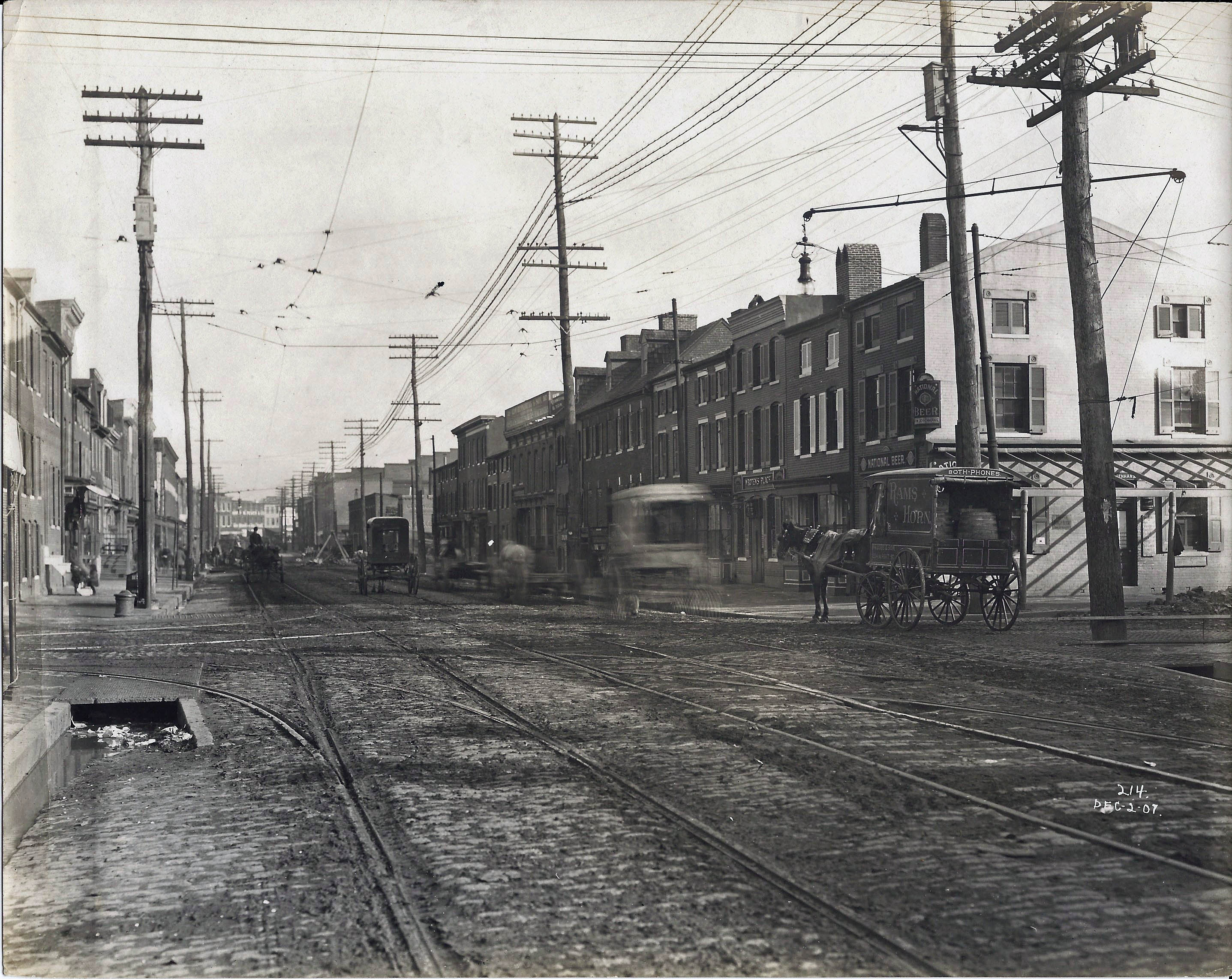
The caption underneath states: “At Wolfe and Aliceanna streets, about 1910 (Actual 1907), a Phillip Lobe Co. vehicle speeds barrels of Ram’s Horn whiskey to saloons. Photograph courtesy Baltimore Public Works Museum.” The person seeking the information wrote me this: I am a relative of Phillip Lobe and am writing an article about his business for a national bottle collector’s magazine. I would love to use this photo in my article as well as getting a nice, clean version of the photo if possible.
Could you help me with that pursuit?
Sincerely,
Susan Adler Davis
Since the photo came from the DPW Museum, of which I have been documenting, I was able to find a much clearer photograph. On the side of the wagon to the right, Rams Horn, it has written; Lobe and Son W. Pratt Street. The caption in my notes states: SWC 2. Wolf and Aliceanna Sts. showing gutter plates and openings.
While searching for the above, I came across some other photographs that I forgot about. And this is how my mind wanders, from one thing to another!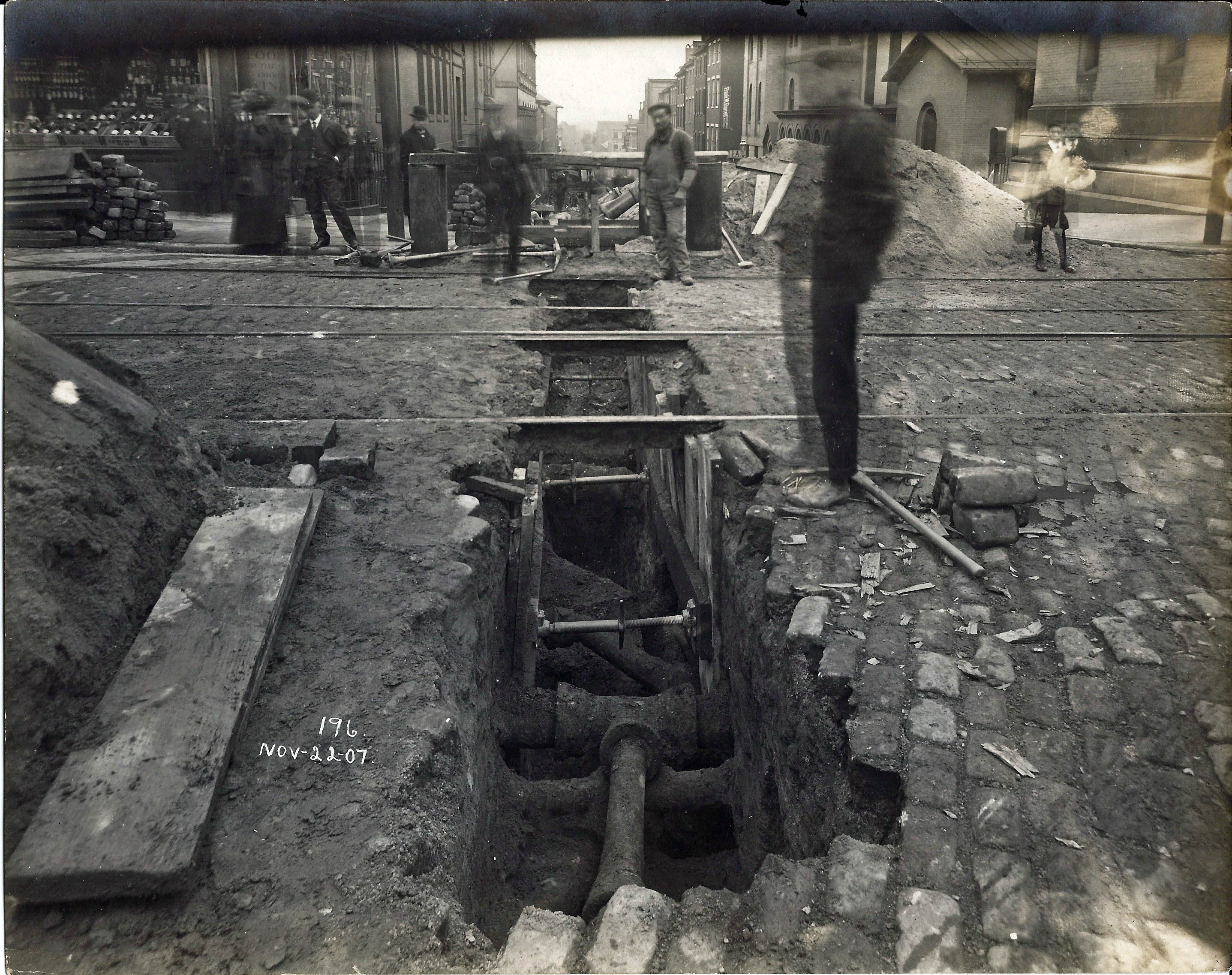
From the same time period, you can see the obstacles that the water department faced in the installation of mains and drains. Caption in notes for the above: SWC 3. Charles and Saratoga Sts. Obstructions in trench. (Storm Water Contract #3)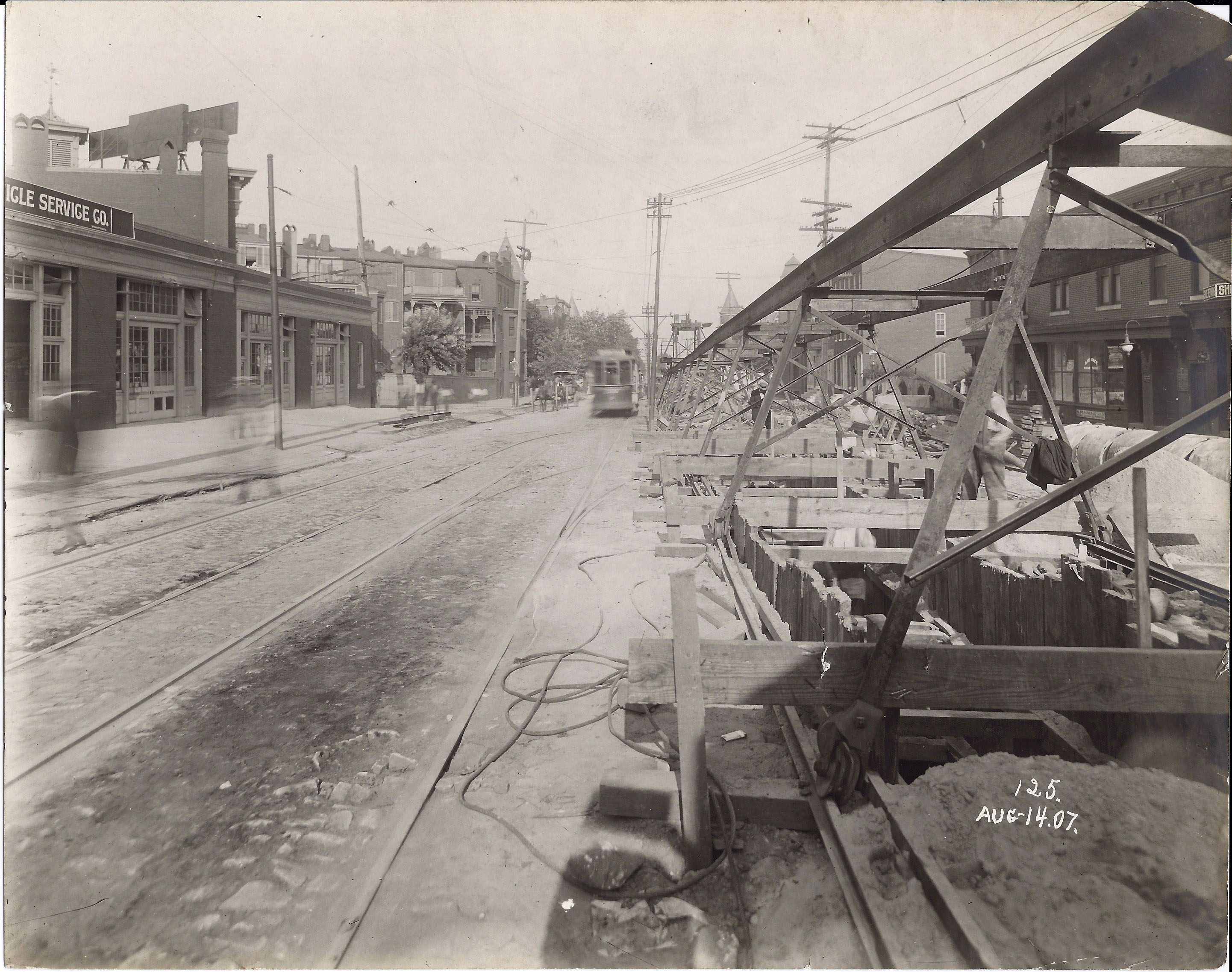
Another concern while installing mains was trolleys zipping by: SWC 1. Showing excavation at North and Madison Aves. 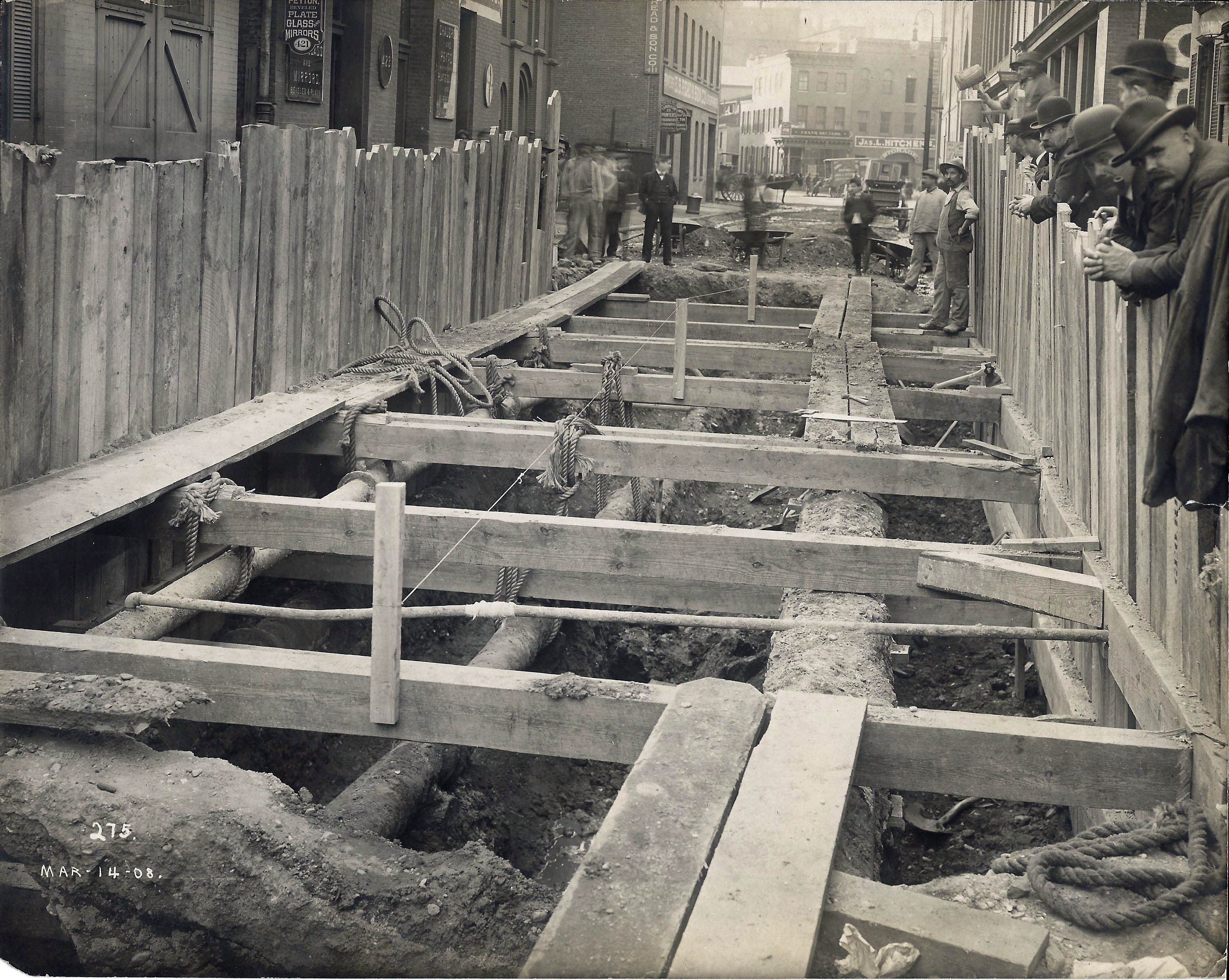
Of course there was always a crowd watching: SWC 3. Saratoga St above Gay showing obstructing pipes and conduit.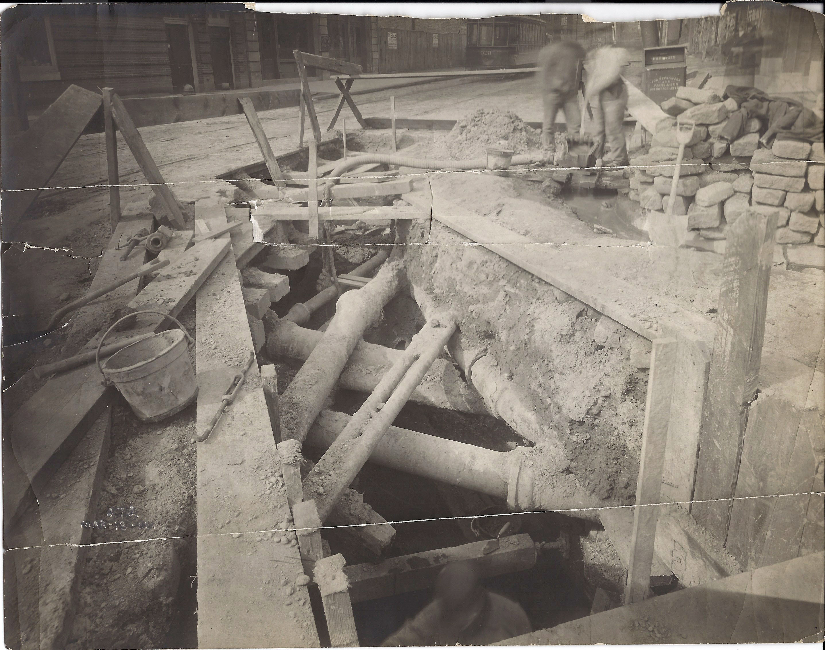
More pipes: SWC 2. South St at Pratt showing nest of pipes encountered in SW trench.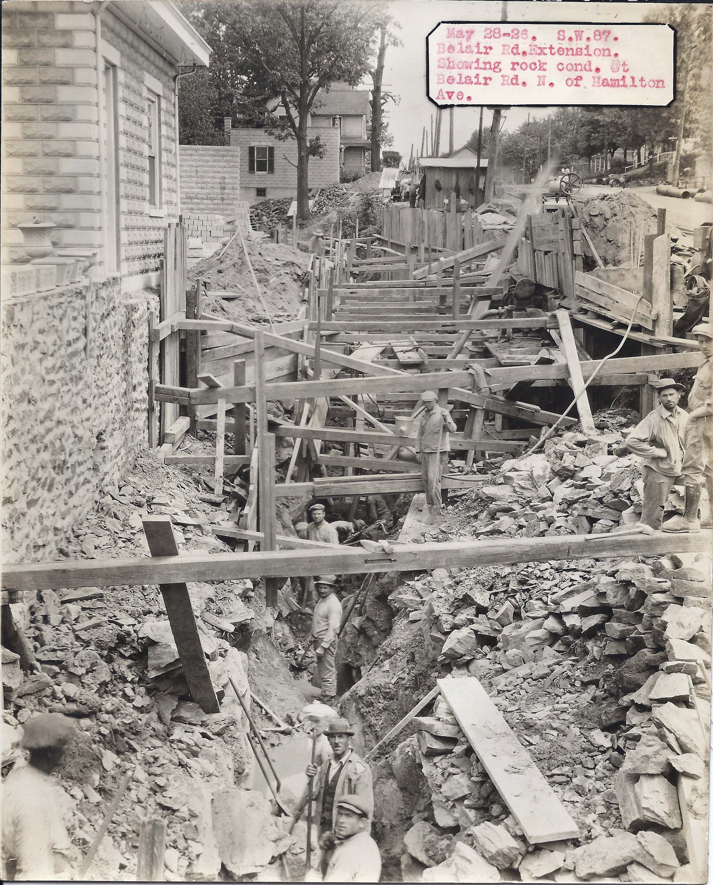
There was always the possibility of adjacent homes crashing down on the workers: SW87. Belair Rd extension, N of Hamilton, showing rock condition.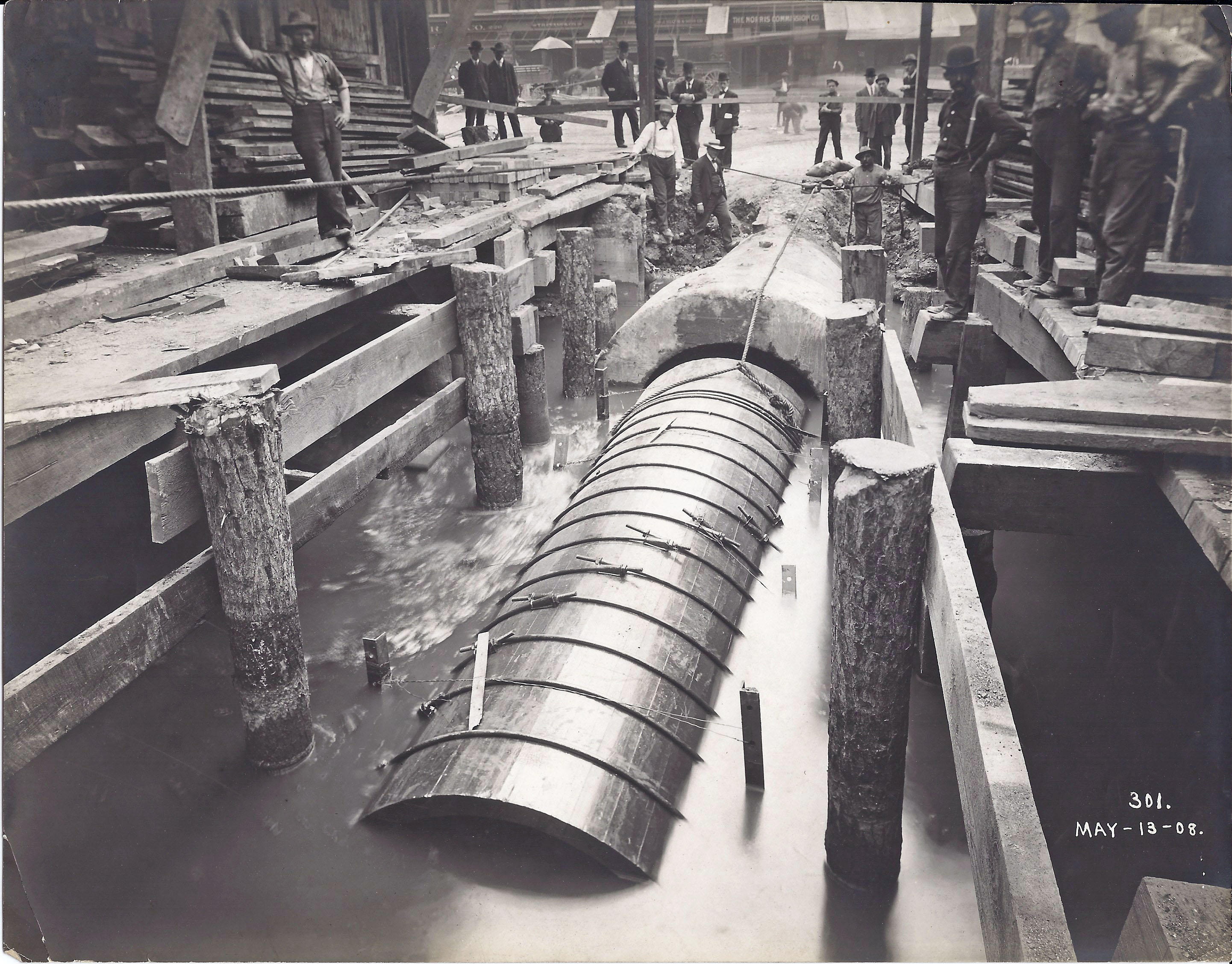
And you also had the placing of wood pipe connections to concrete ones: SWC 2. 62” wooden stave pipe at outlet of Light St drain. (Other marking: Showing barrel construction of outlet).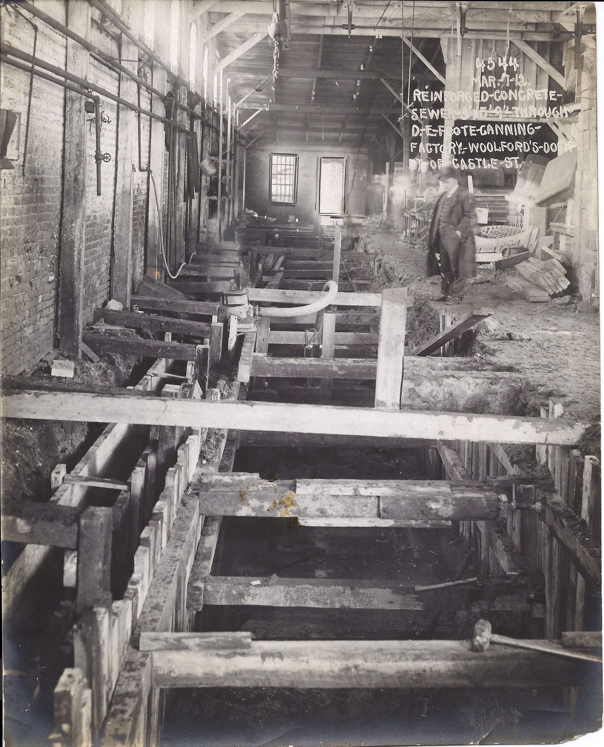
But one of the bigger problems was when you had to go through someone’s house or business: Reinforced concrete sewers through D.E. Foote Canning Factory, Woolford’s Dock, foot of Castle St.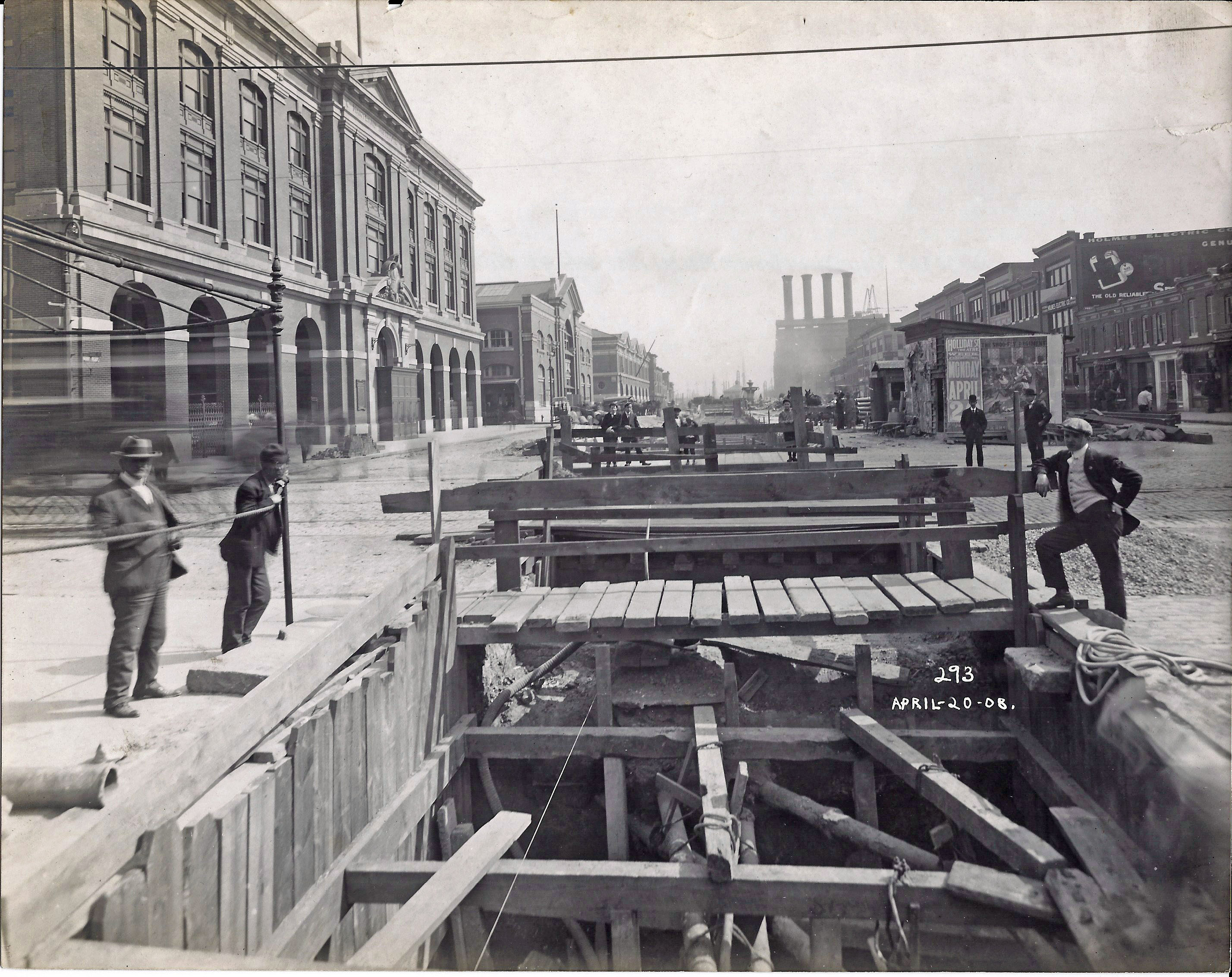
More pipes to work around: SWC 3. Double 50”x69” storm water drain in Market Place at Baltimore, looking towards outlet.
So my mind wanders more times than not, but it is always fun and a pleasure to research these sort of things! I look forward to reading Ms Davis’ article.

Thank you for posting that great pic of Belair Rd. above Hamilton Ave. Wonderful to see a glimpse of what my neighborhood looked like!
You are welcome. I use to hang around here in the late 60s. Somewhere on this blog or Facebook I posted some photos of Frankford and Belair, before the shopping center was built. Thanks for visiting my blog!
I saw in the second photo, in the center rear, a banner bearing the name “Frank M Barrett” – I think that was my grandfathers brother! I’d like to learn more about that sign and location – any help?
The caption on the reverse says Charles and Saratoga. Not sure of the business. Maybe someone on the Facebook page, Baltimore City Historical Society can help you out.