Tags
Baltimore, Cromwell Park, Dams, engineering, Hiking, Loch Raven, maps, nature, photography, Research, water history
A couple weeks ago I was drawn into a discussion concerning the Balancing Reservoir adjacent to Cromwell Valley Park. I say adjacent because it is City property, in Baltimore County, part of the City’s watershed. This past weekend was the first chance that Kathy and I had to take a hike through CVP and this is what greeted us: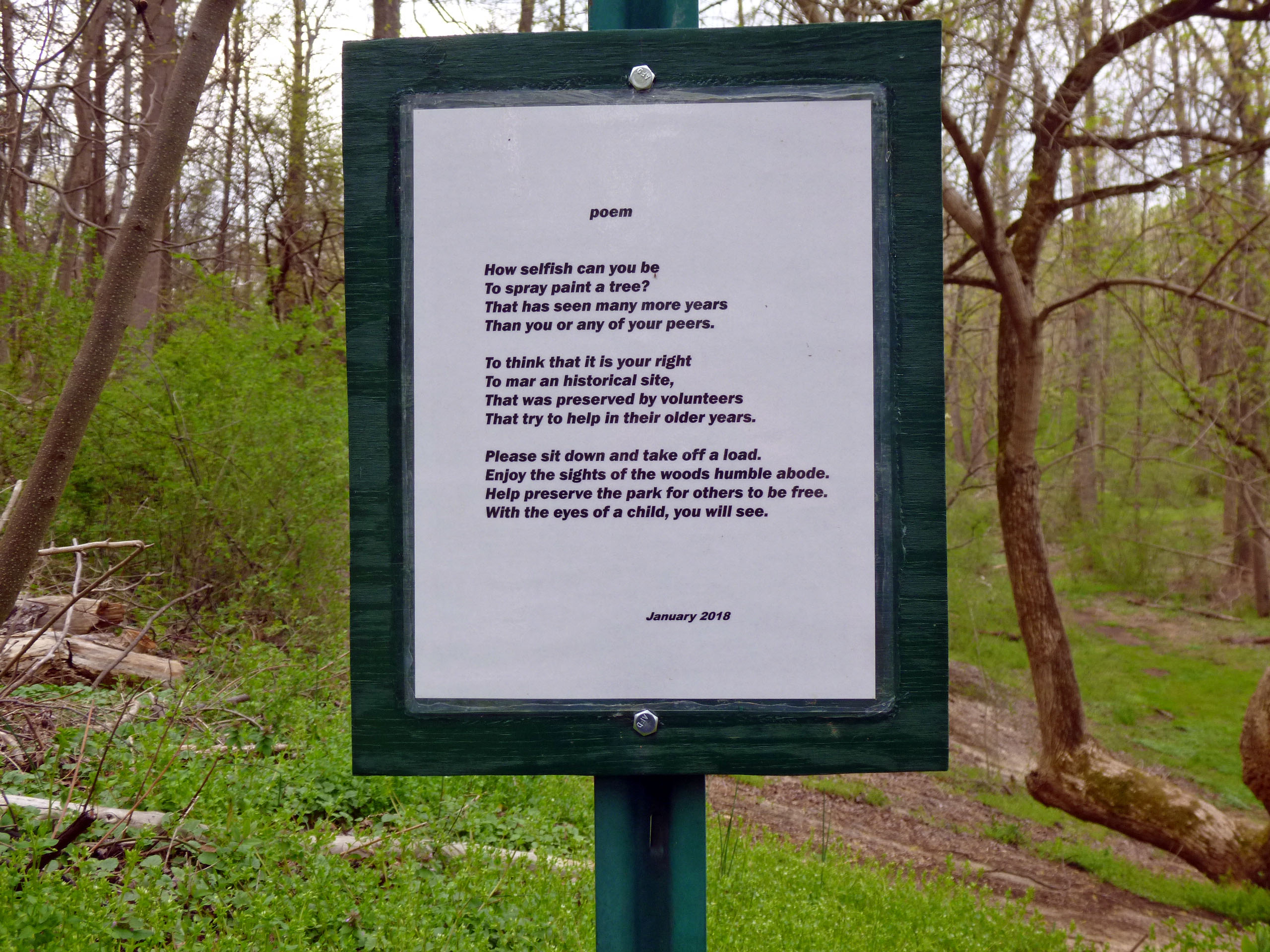
A poem about graffiti. What the hell? So I looked down at the balancing reservoir shaft and understood.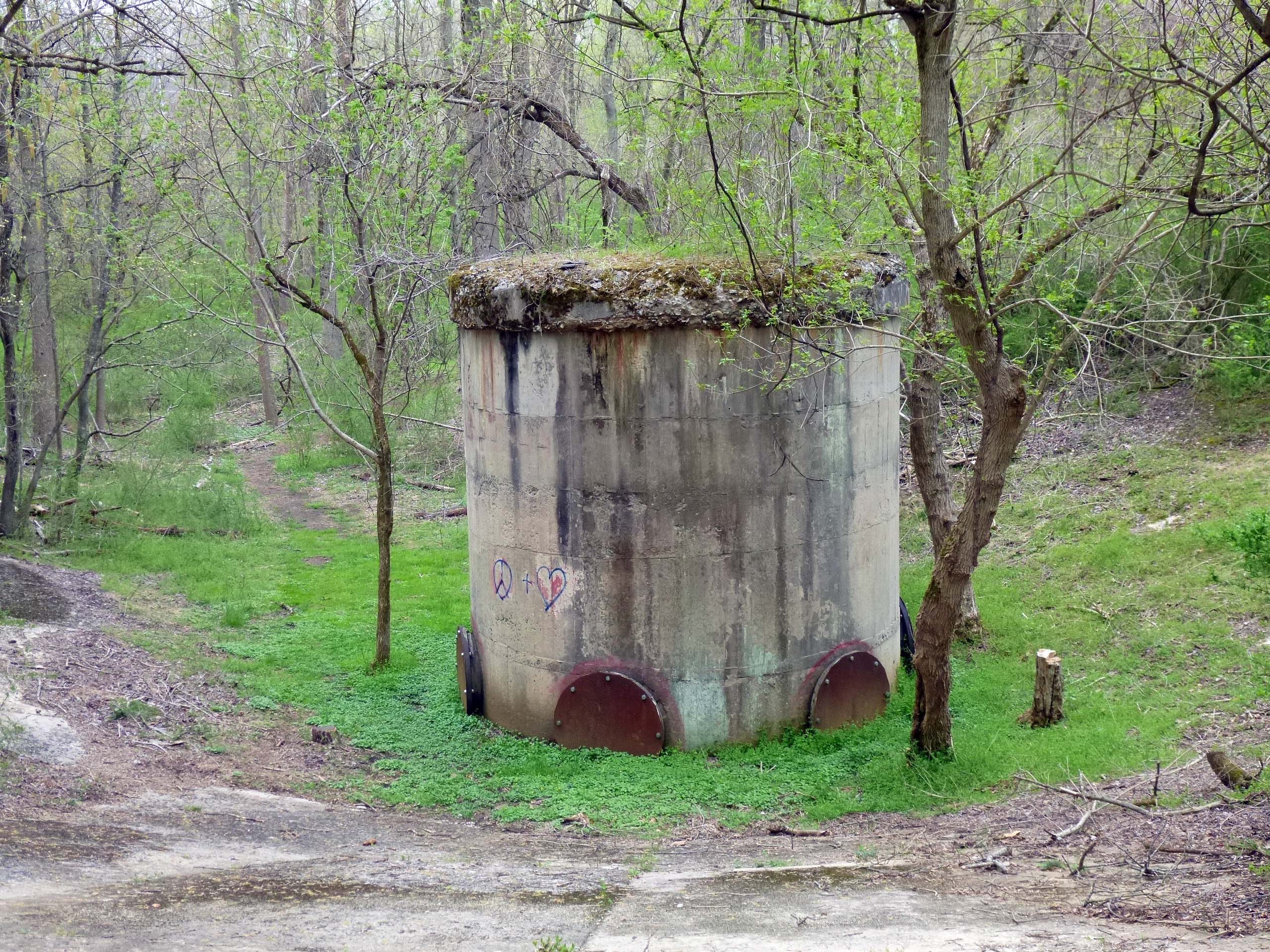
Someone drew, what I guess they thought, was a peace symbol and a heart. Going down the slope we saw even more.
Now I understand the reason for the poem. What idiots! I have never understood graffiti. Some that are murals are nice, but this makes no sense to me. And no, I don’t believe in that sort of “Freedom of Expression”
What does this have to do with my Post Title and opening statement? The discussion I had was with City Watershed personnel, the County, the Park and the volunteers at CVP. The area has been nicely cleared around this structure and throughout the reservoir. Unfortunately by clearing it out, it made it more accessible to more people and more people means more risk of vandalism. The discussion, both pros and cons, concerned restoring the site. Pros – historical water history. Cons – disruption to the wildlife and native plants.
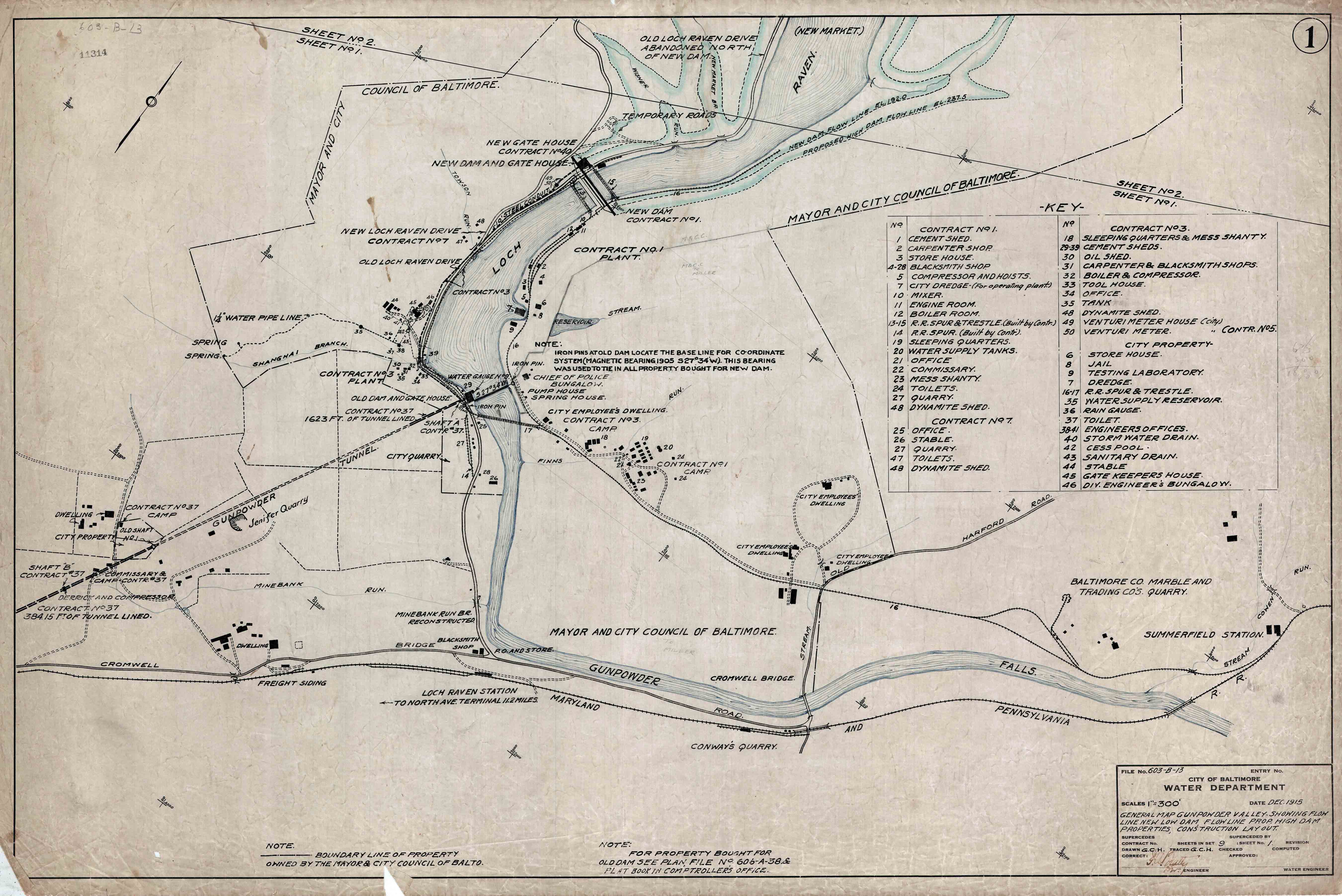
Here is a 1921 partial drawing of the Balancing Reservoir.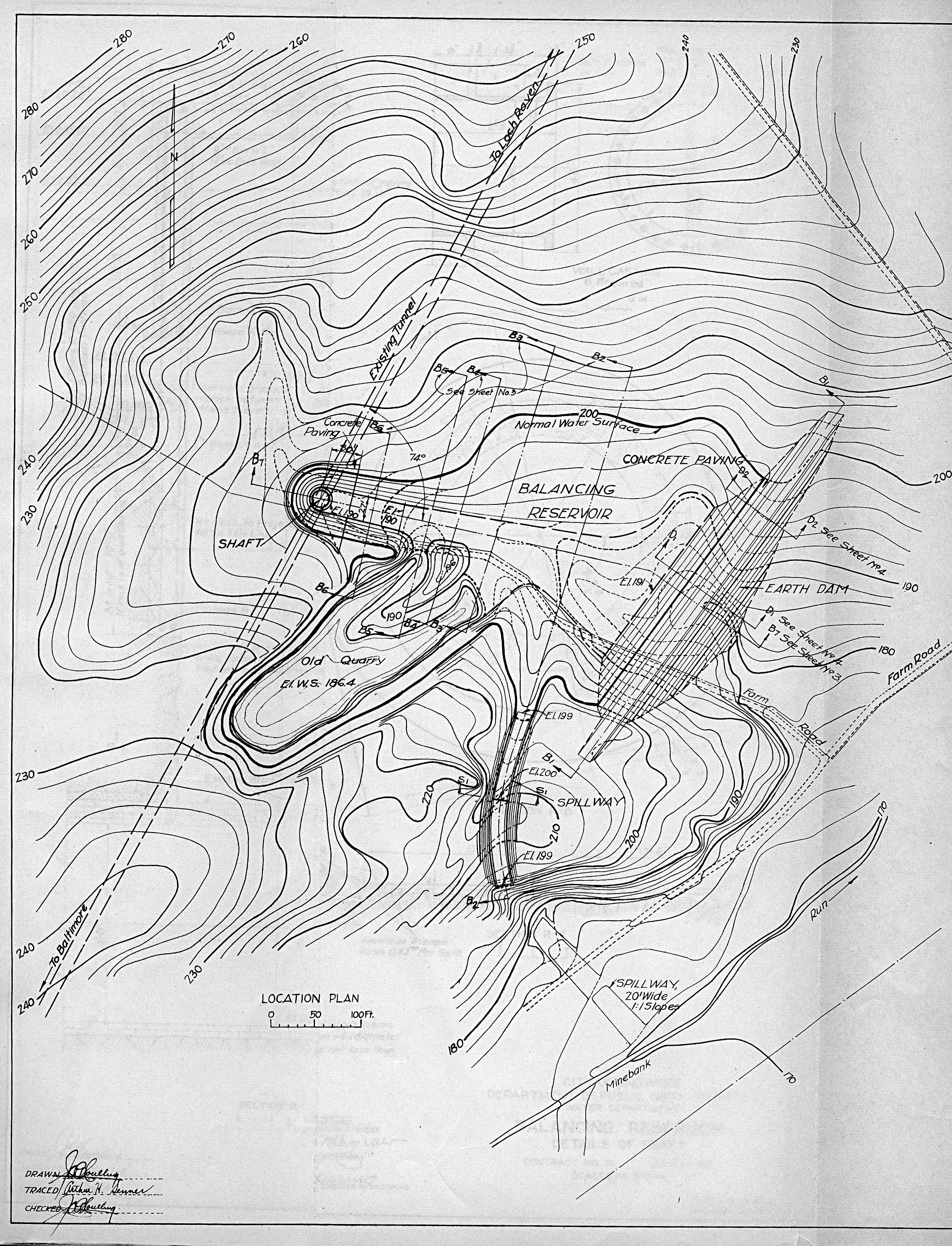
We walked down the shaft slope and went over to the quarry, then to the spillway. View from the beginning of spillway looking toward Mine Bank Run.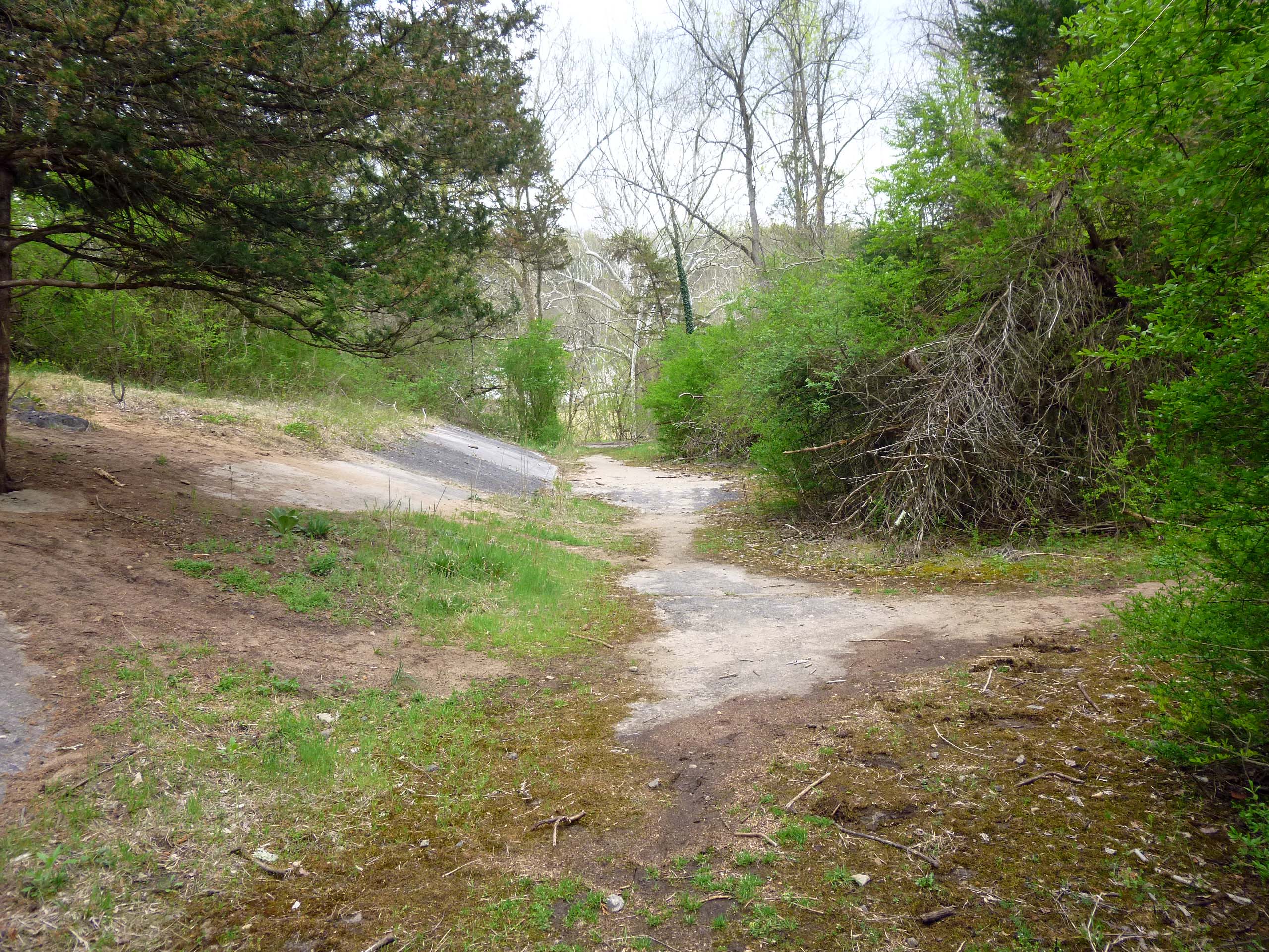
A close up of the Spillway.
And of Molly not wanting to get too close. It is about a 20′ drop. There use to be a rope across there saying “Danger”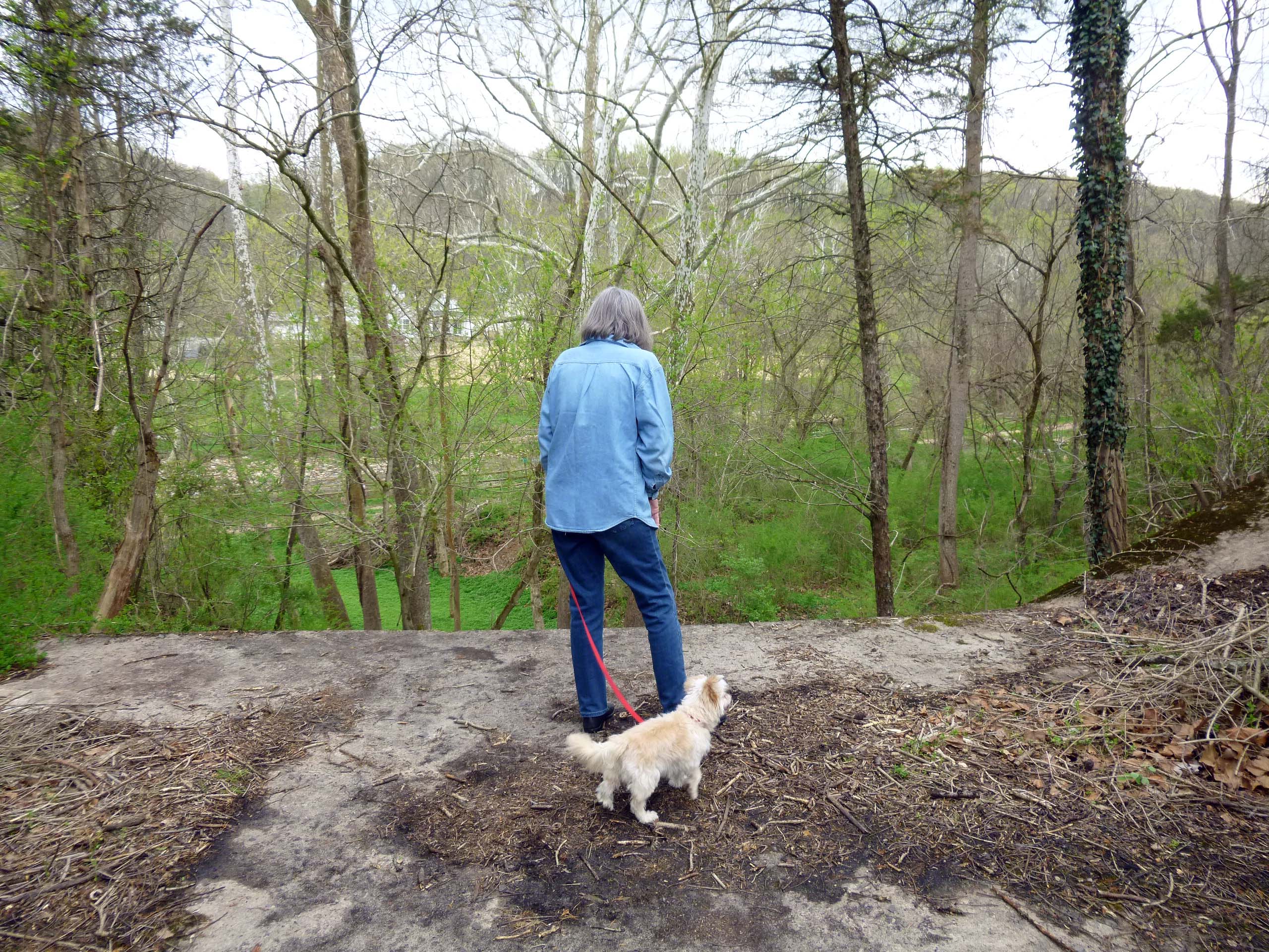
From the spillway we walked over to the dam. This dam actually has a concrete apron that extends partially down the slope towards the surge shaft. It has been pretty much cleared out, to the bird watchers and rangers dismay.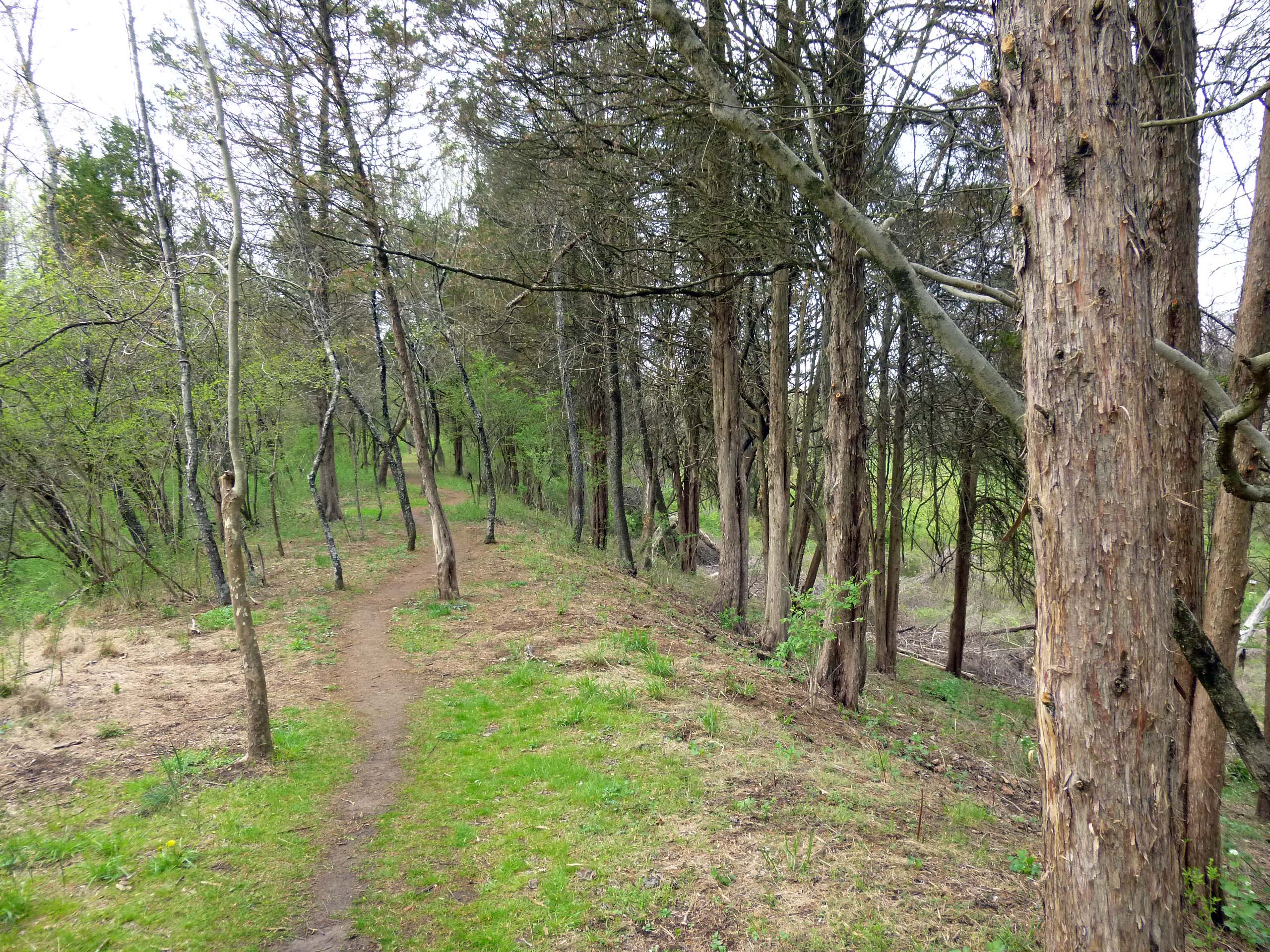
Here is the balancing reservoir in use 1922. This view is from the shaft to the dam.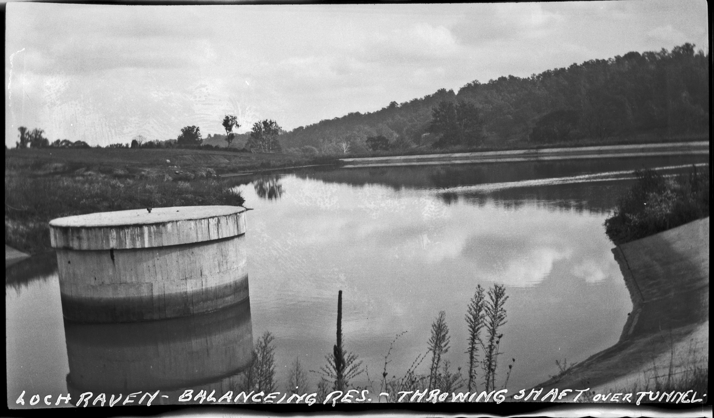
This other view is looking over the old quarry. Both of these photos come from the Maryland Historical Society.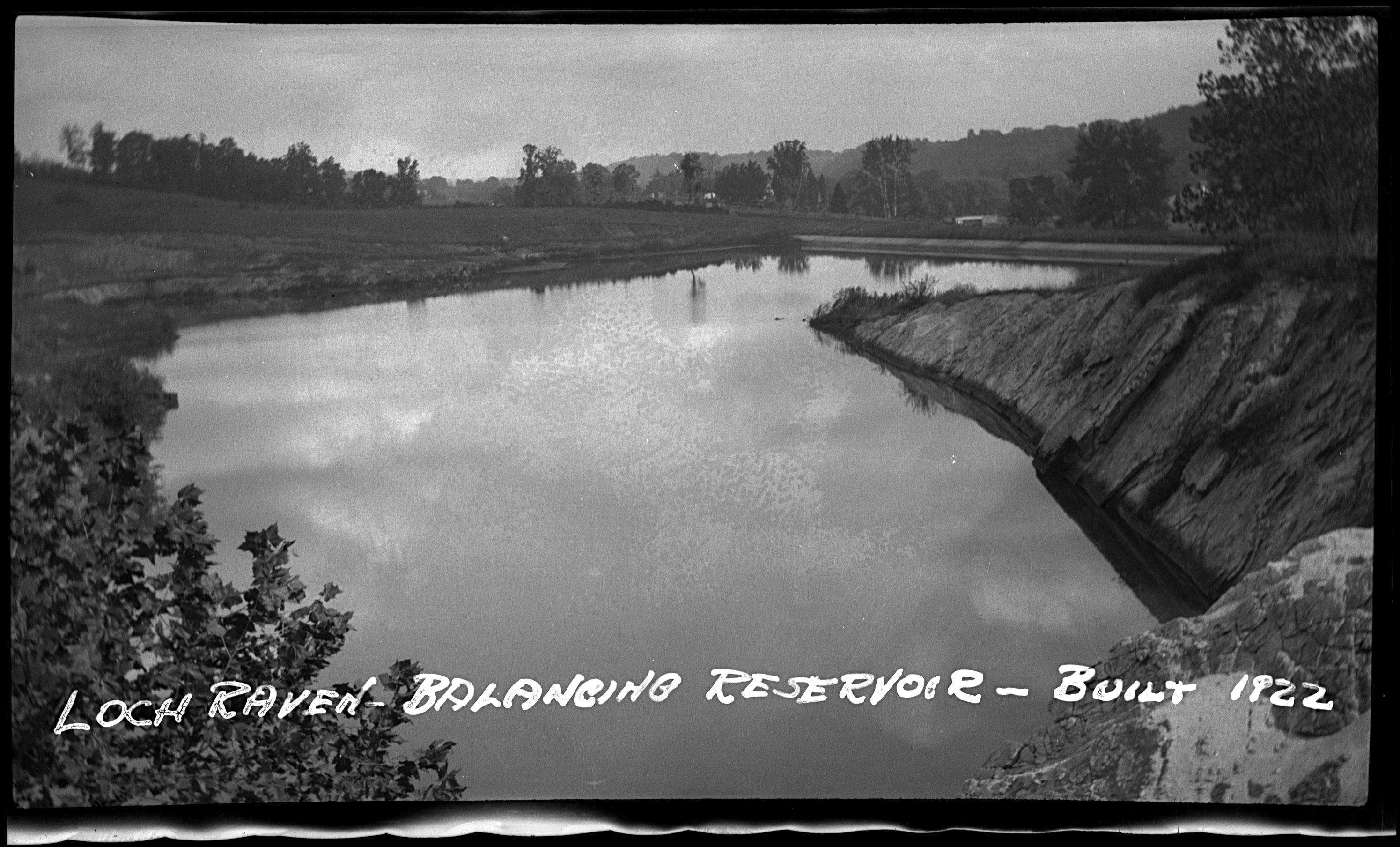
No trip to CVP would be complete without a hike to the Kilns.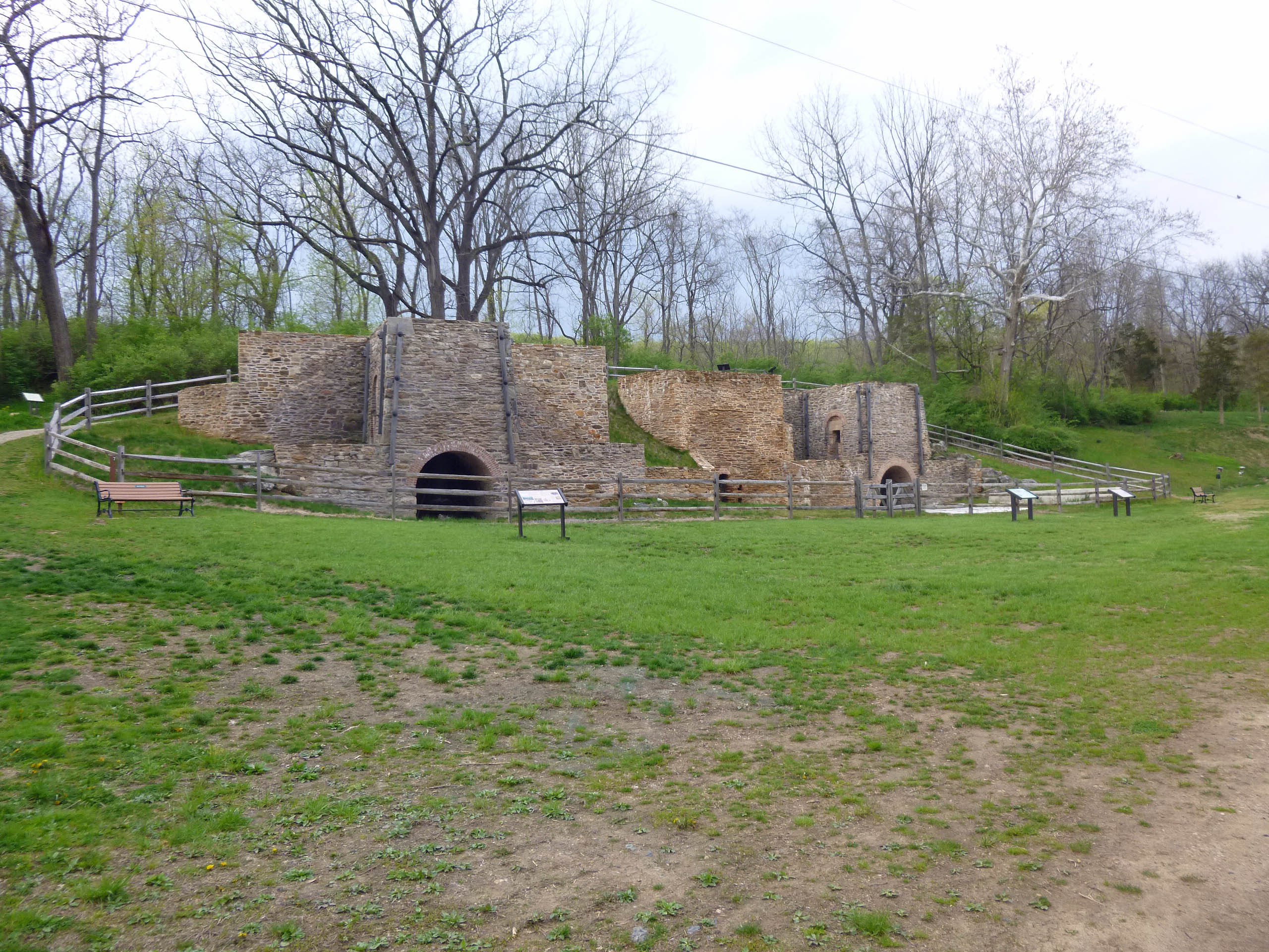
New signage everywhere – kind of reminds me of an old 70s song! Descriptive signs.
My take on all this? Originally I thought it would be great to restore the complete balancing reservoir to its original construction, but I’m not so sure now. It would be nice to clear the concrete apron around the surge shaft and the concrete spillway. Not sure it would be worth clearing the dam face. Too many animals and birds in that area. And as the poem states, “volunteers…in their older years…” Who will maintain it 20 years from now? The City won’t and they haven’t. The place is only historical in the minds of people who appreciate their water source. Most people that turn on their faucets could care less about the history of how it gets there!
And for my history friends, here is a map from 1915 of the area. When the City built the new dam.