• About
  • History Writings

Water and Me

Water and Me

Category Archives: Photography

Chandler Tract (White Trail) 4 3 21

04 Sunday Apr 2021

Posted by Ronald Parks in biking, Eastern Shore, nature, Photography, State Parks, Trails

≈ Leave a comment

Tags

cypress, Hiking, Pocomoke, State Parks, trail signs, Trails

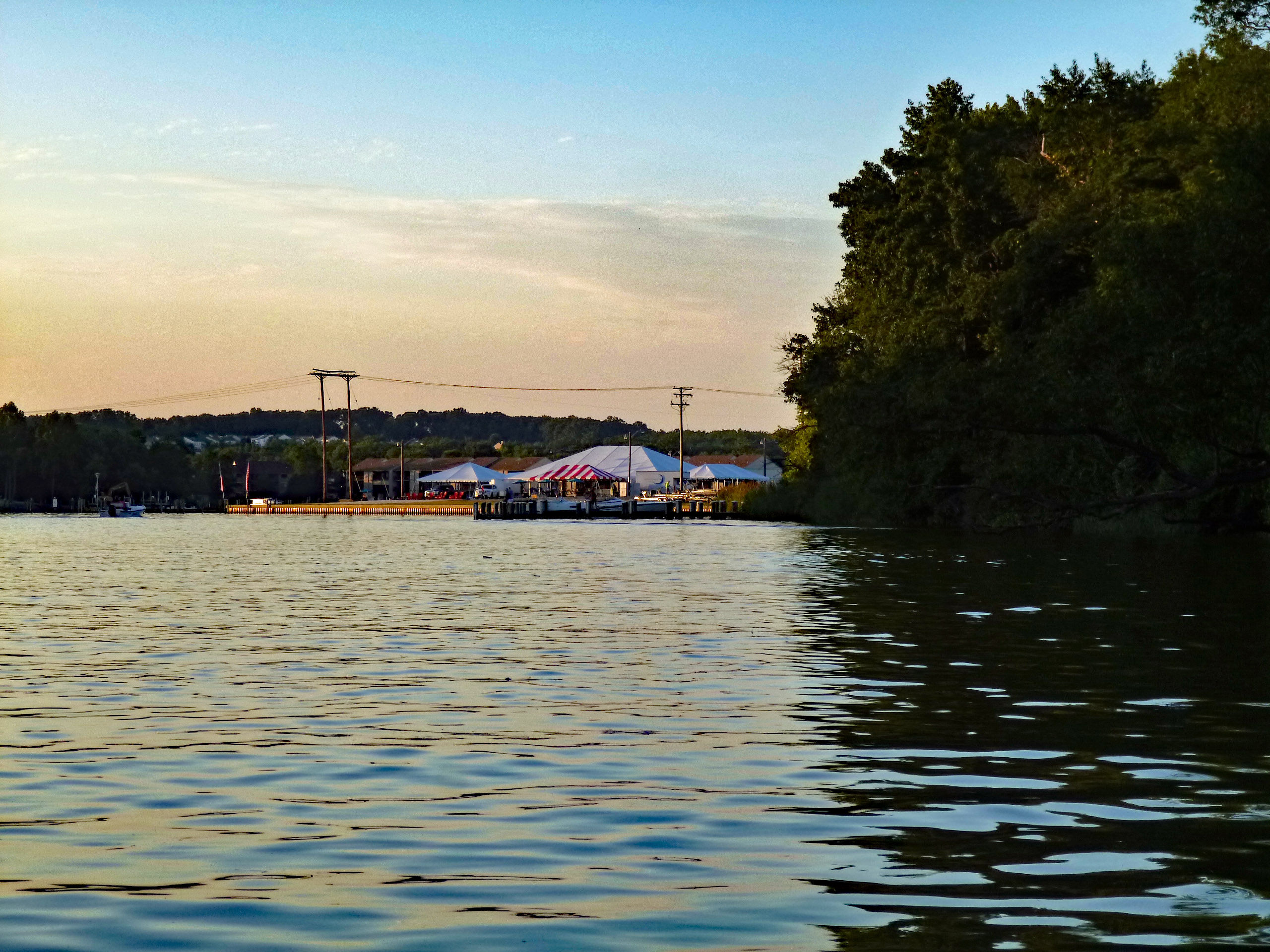
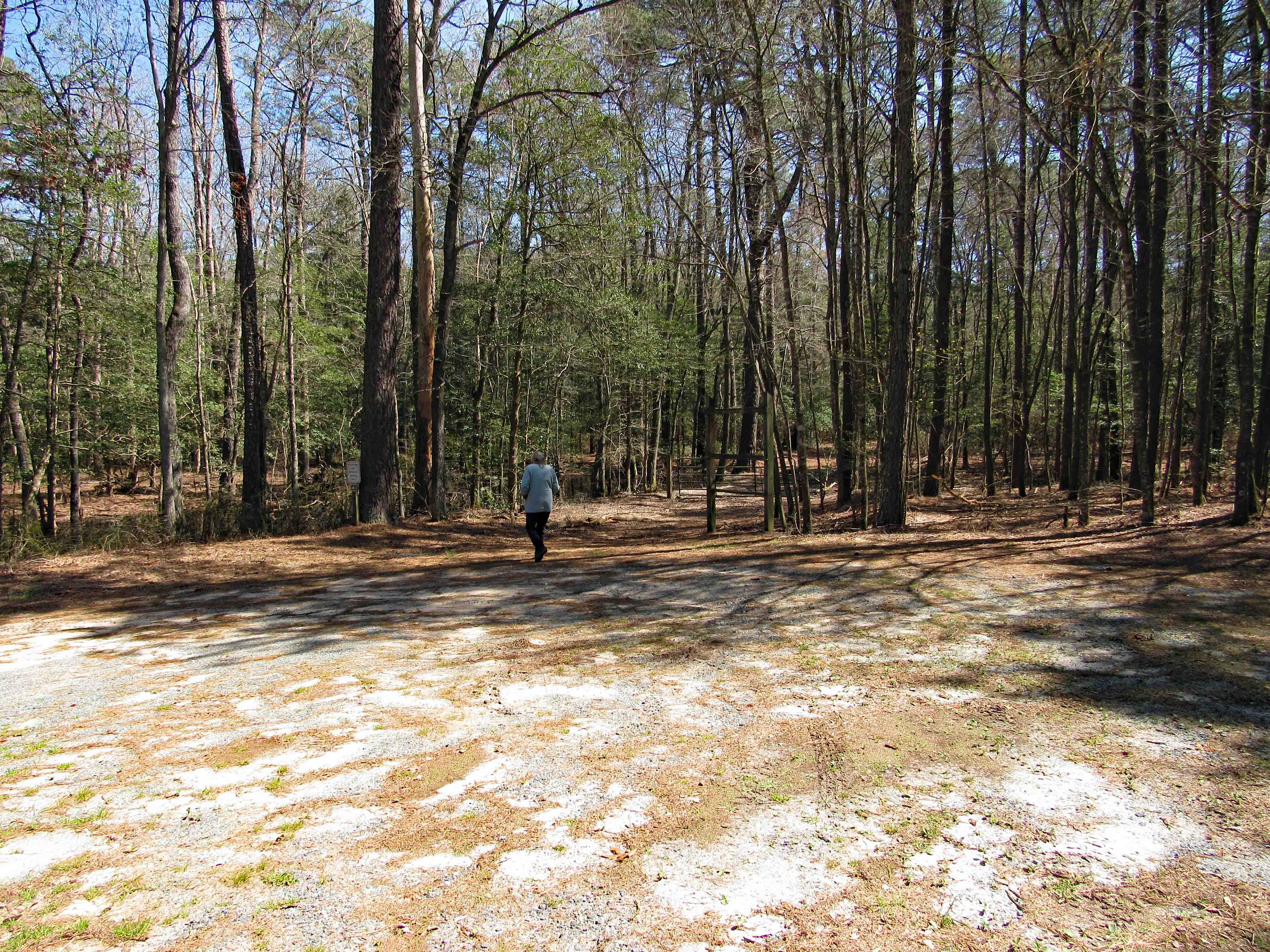
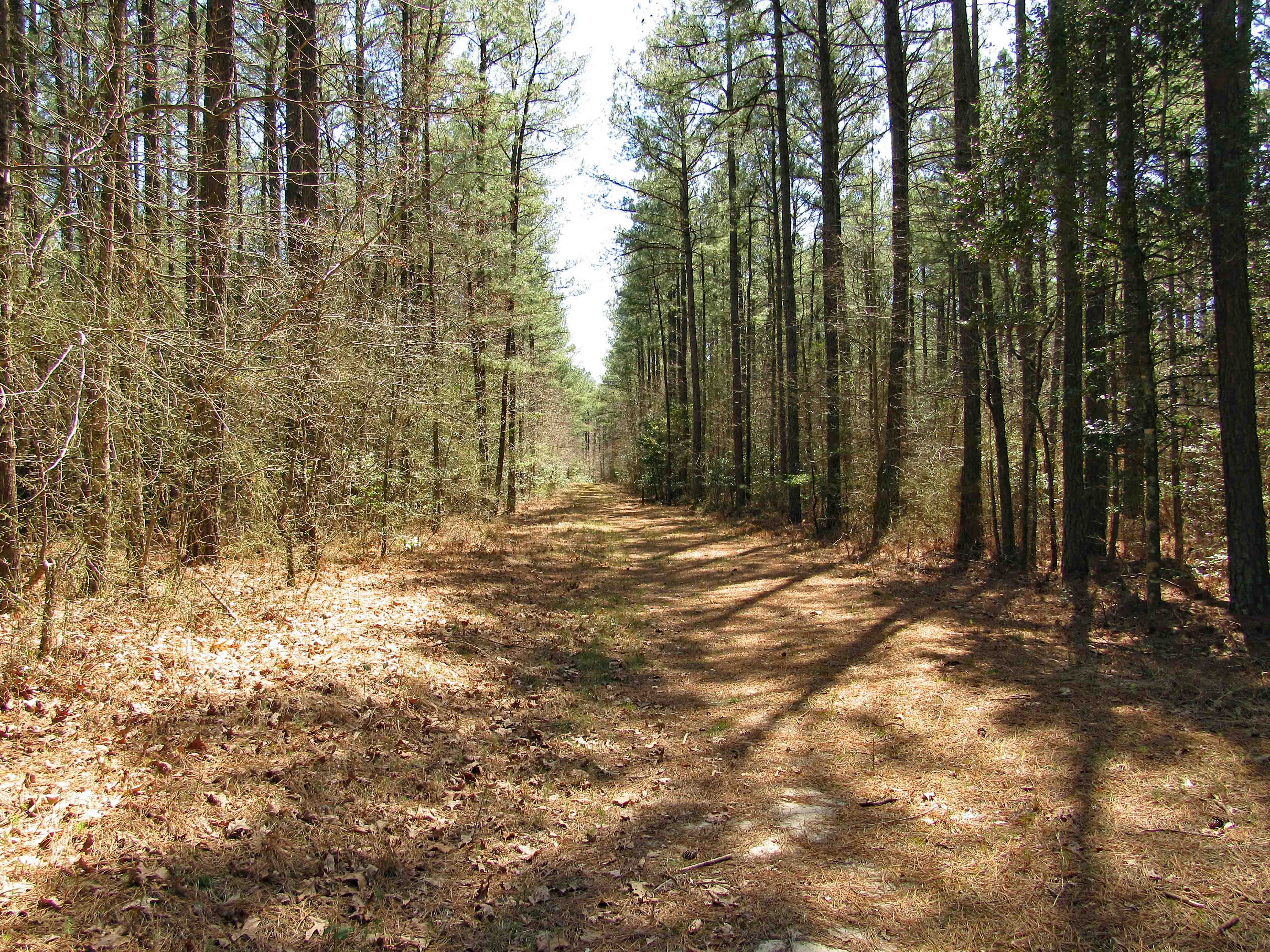
This was a 3.6 mile or a 4.1 mile hike, depending on which map you use, in the Pocomoke State Forest. There is also a Green Trail (4.4 mi) and a Blue Trail (5.2 mi) in the same area. We chose the White Trail because it heads towards a creek – Corkers Creek. The entrance is across Rte. 113, from Shad Landing. Nice empty parking lot.

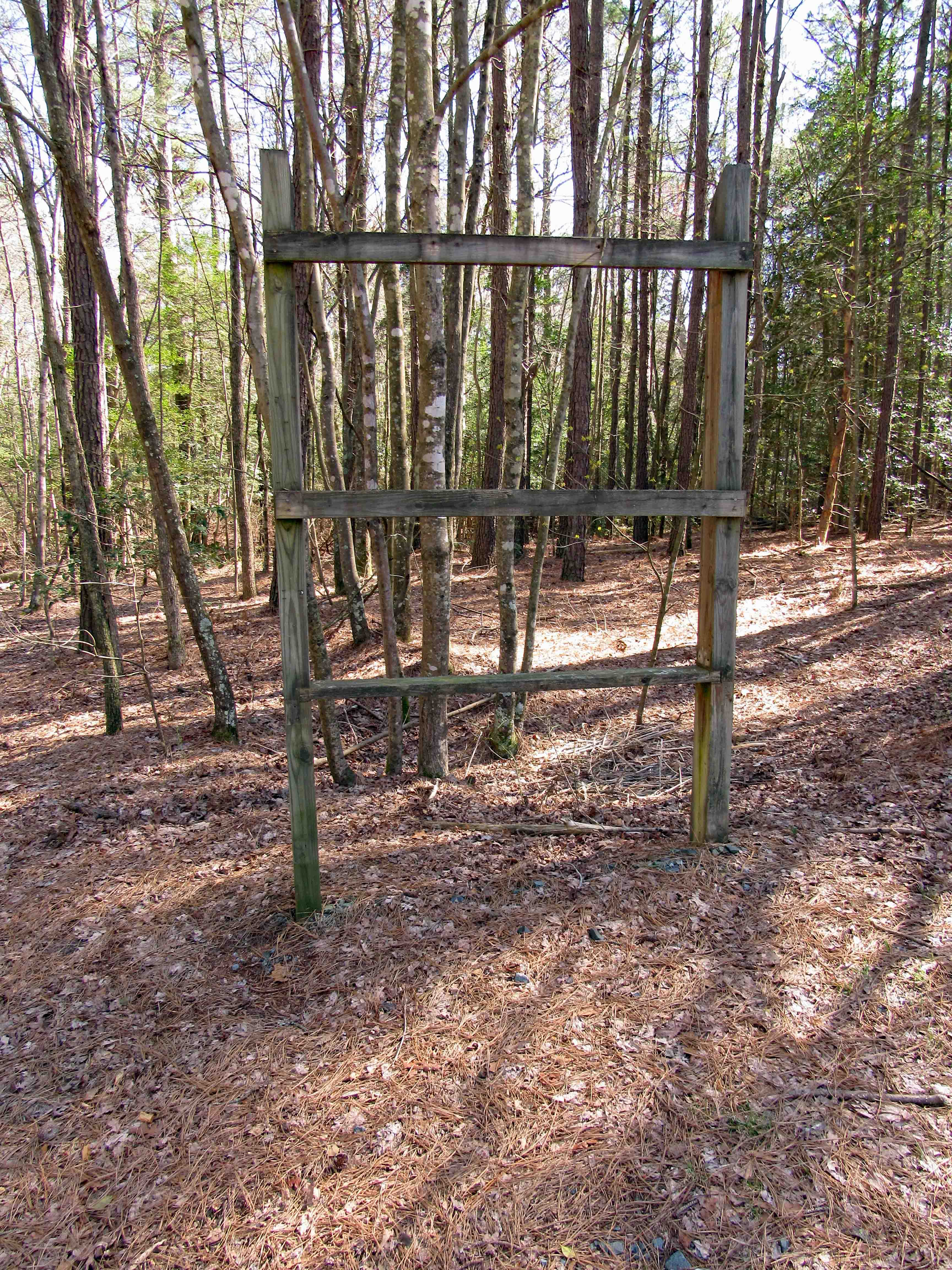
Maybe they will put up a trail map here one day.

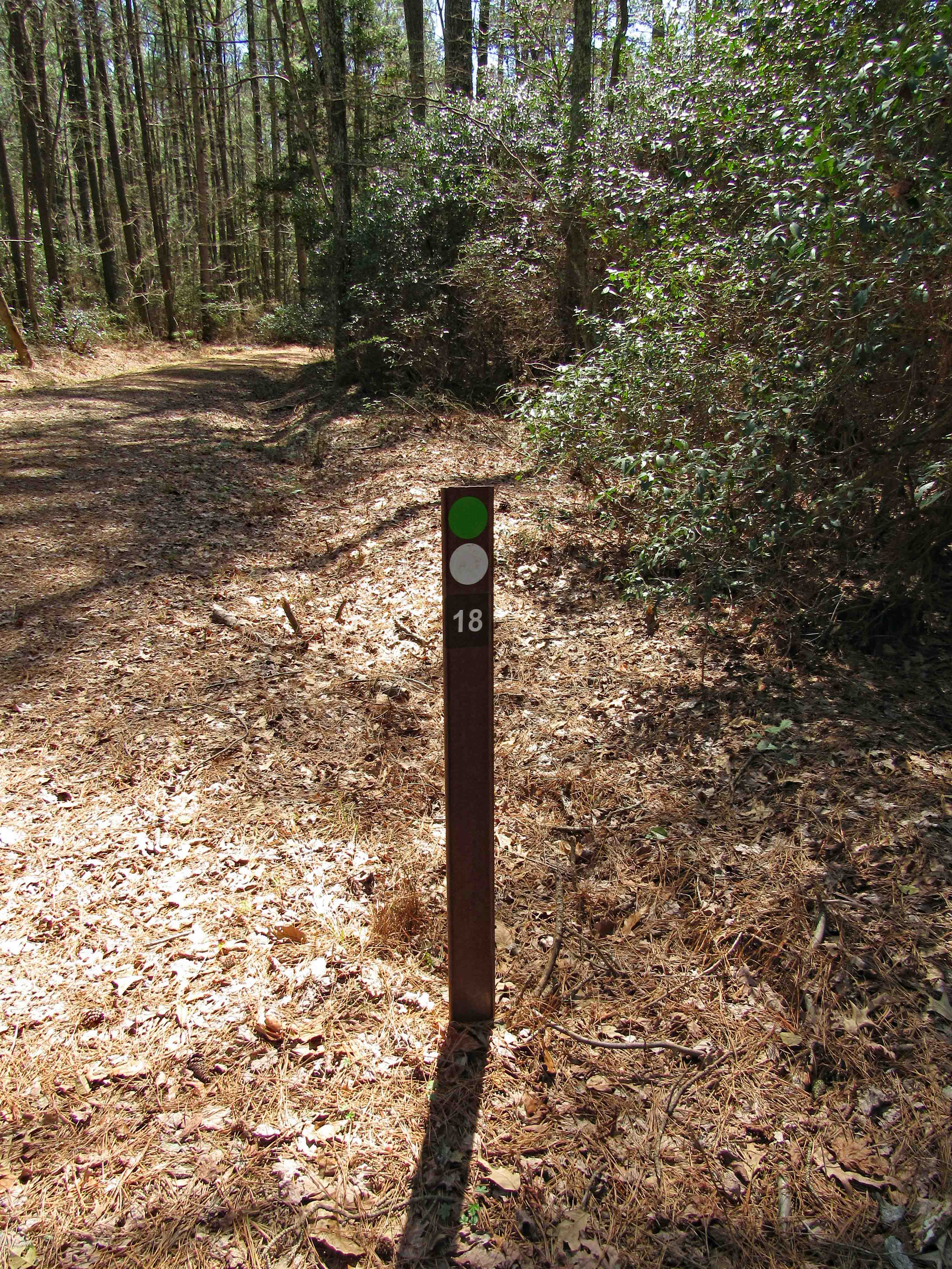
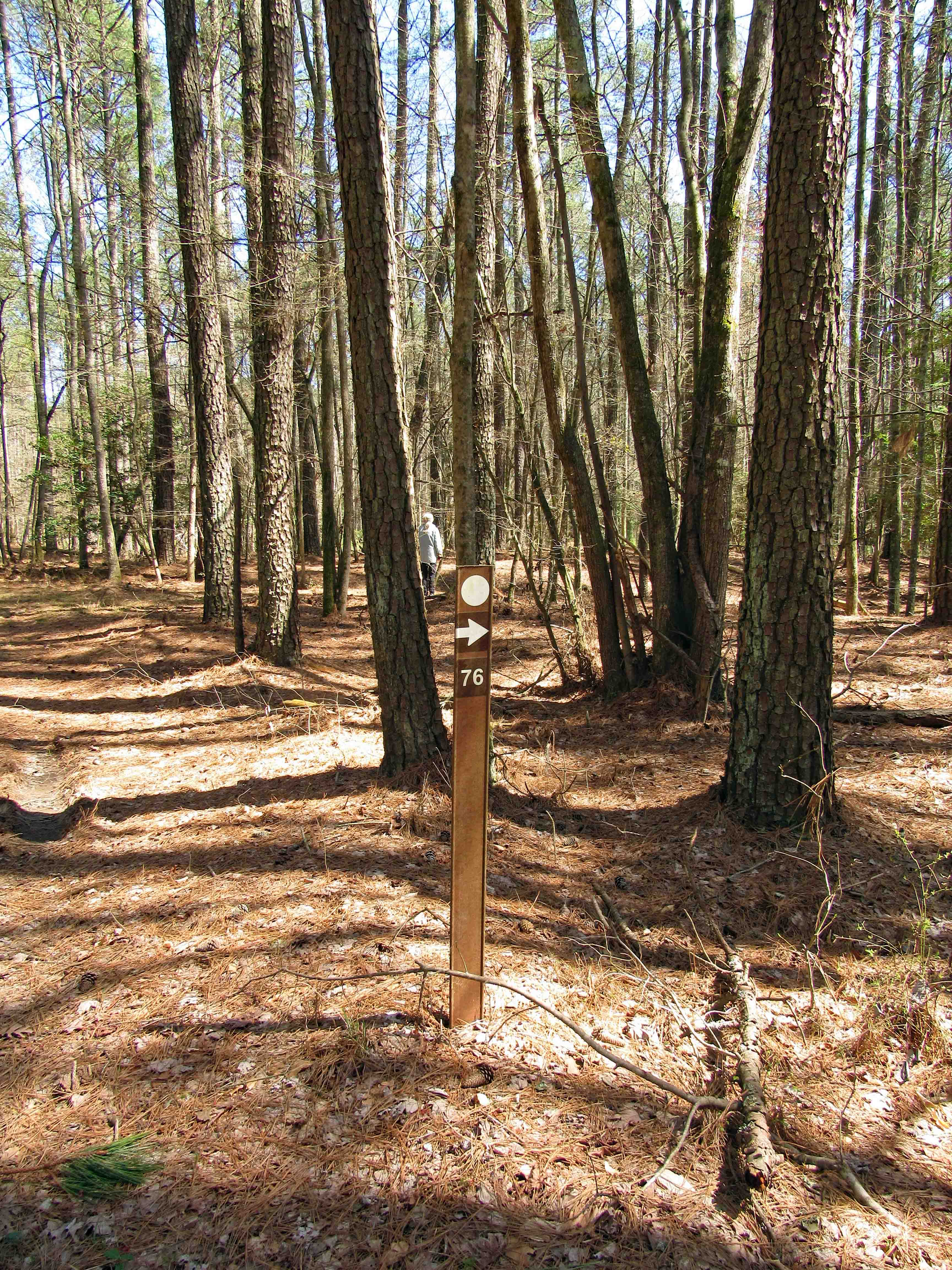
Only saw a couple cyclist on the trail. Otherwise a nice quiet hike. The Green and White trails intersect for a short distance. We know what the dots mean, unsure of the numbers though. I wrote the park service to ask them. Waiting to hear back.

A few muddy spots starting off, but mostly dry. It is the Eastern Shore and there will be mud!

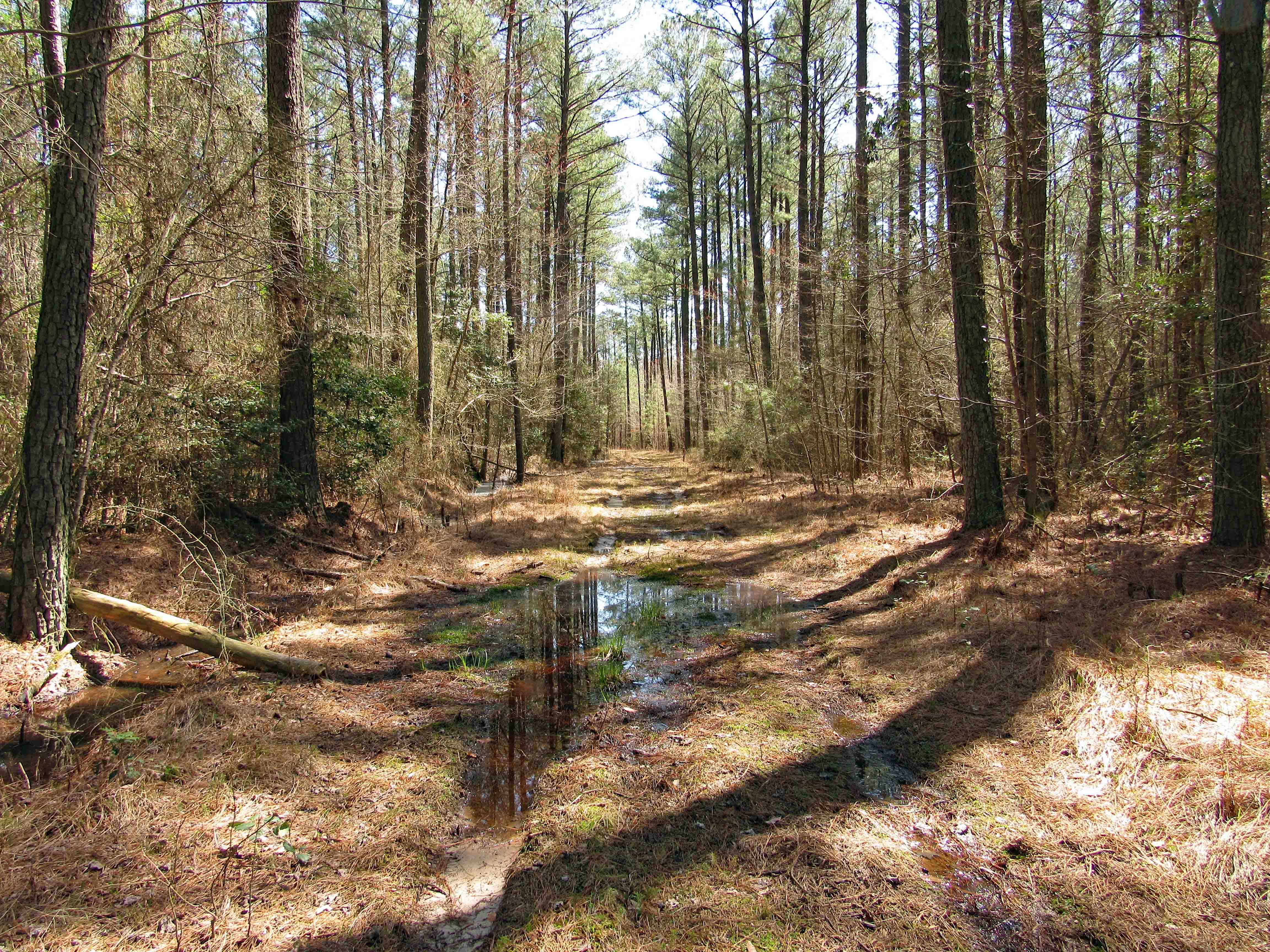
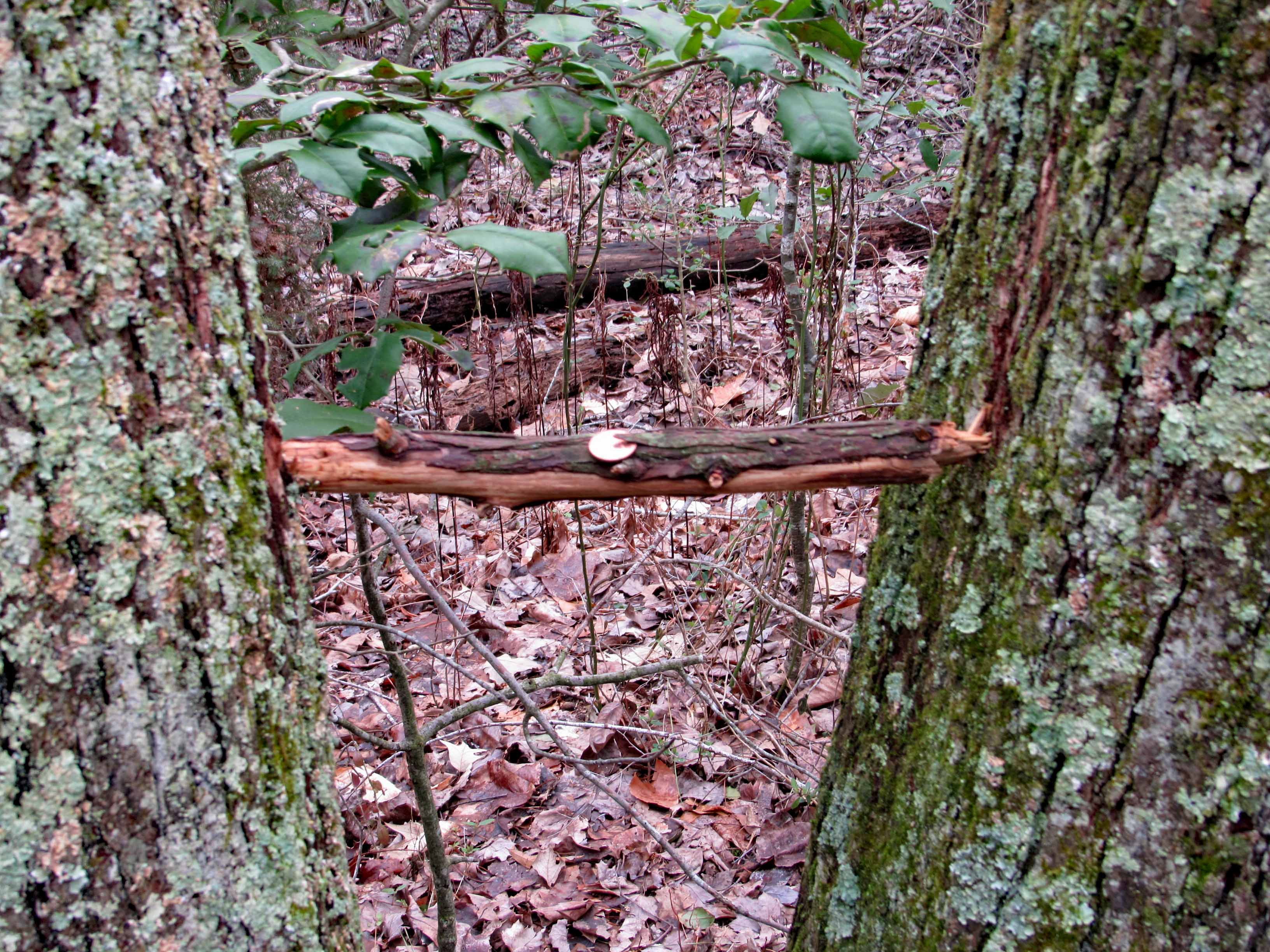
Buckshot warning about straying away from the trail…

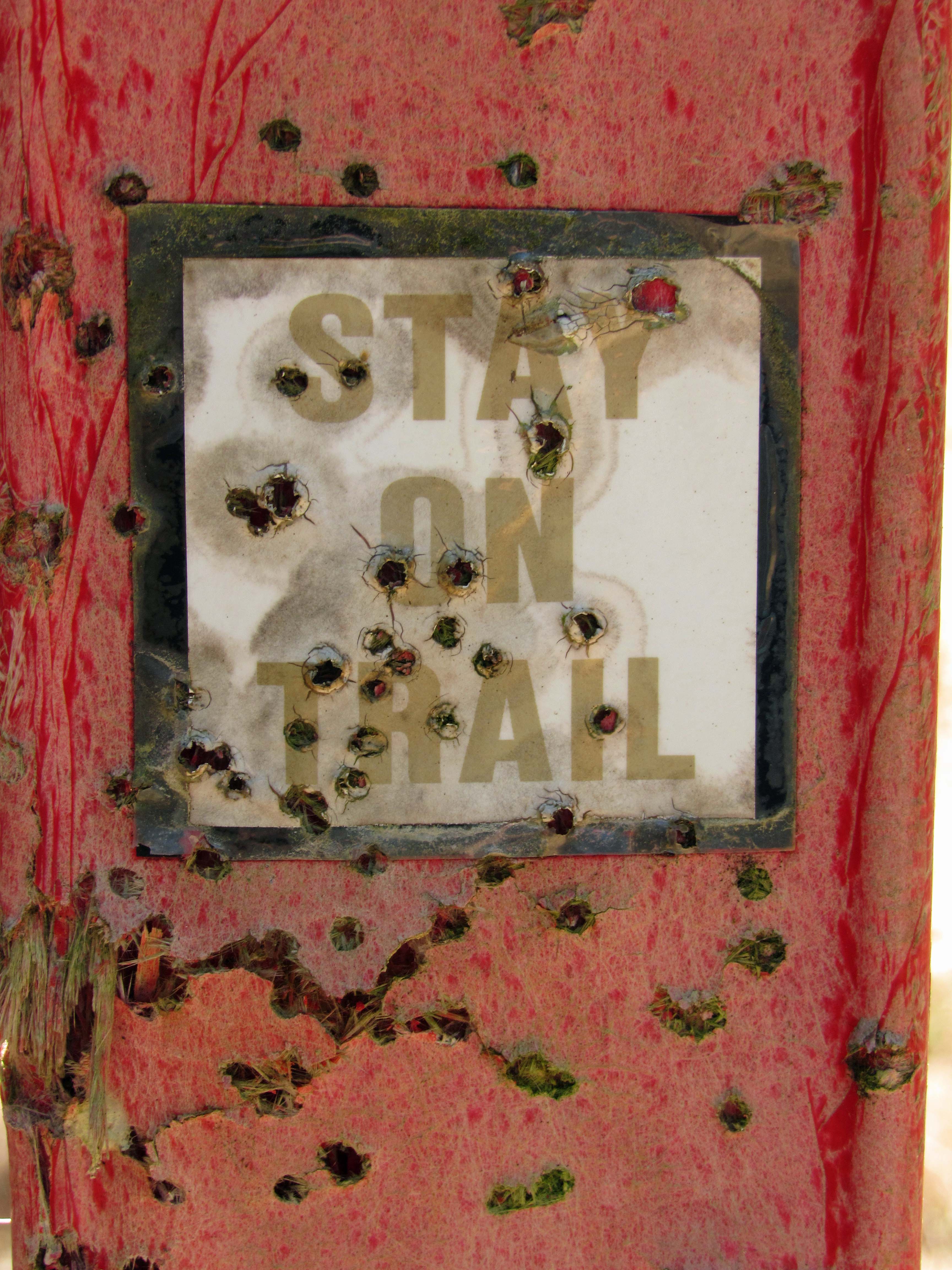
But where would you go? Lots of thickets on one side and a swamp on the other. But I do know what they mean. Up on the Gunpowder Trails they don’t want you straying off – it can and will cause erosion.

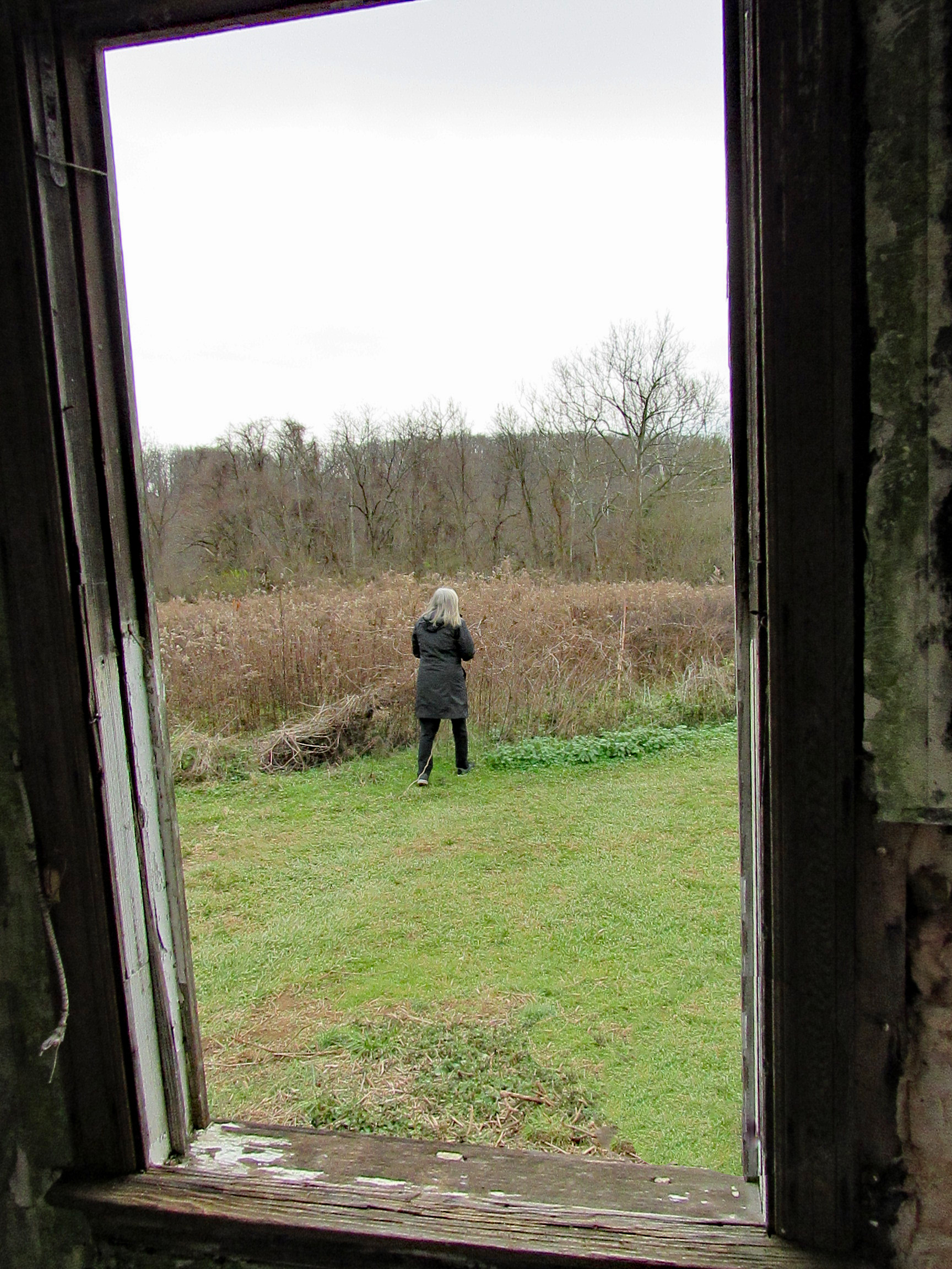
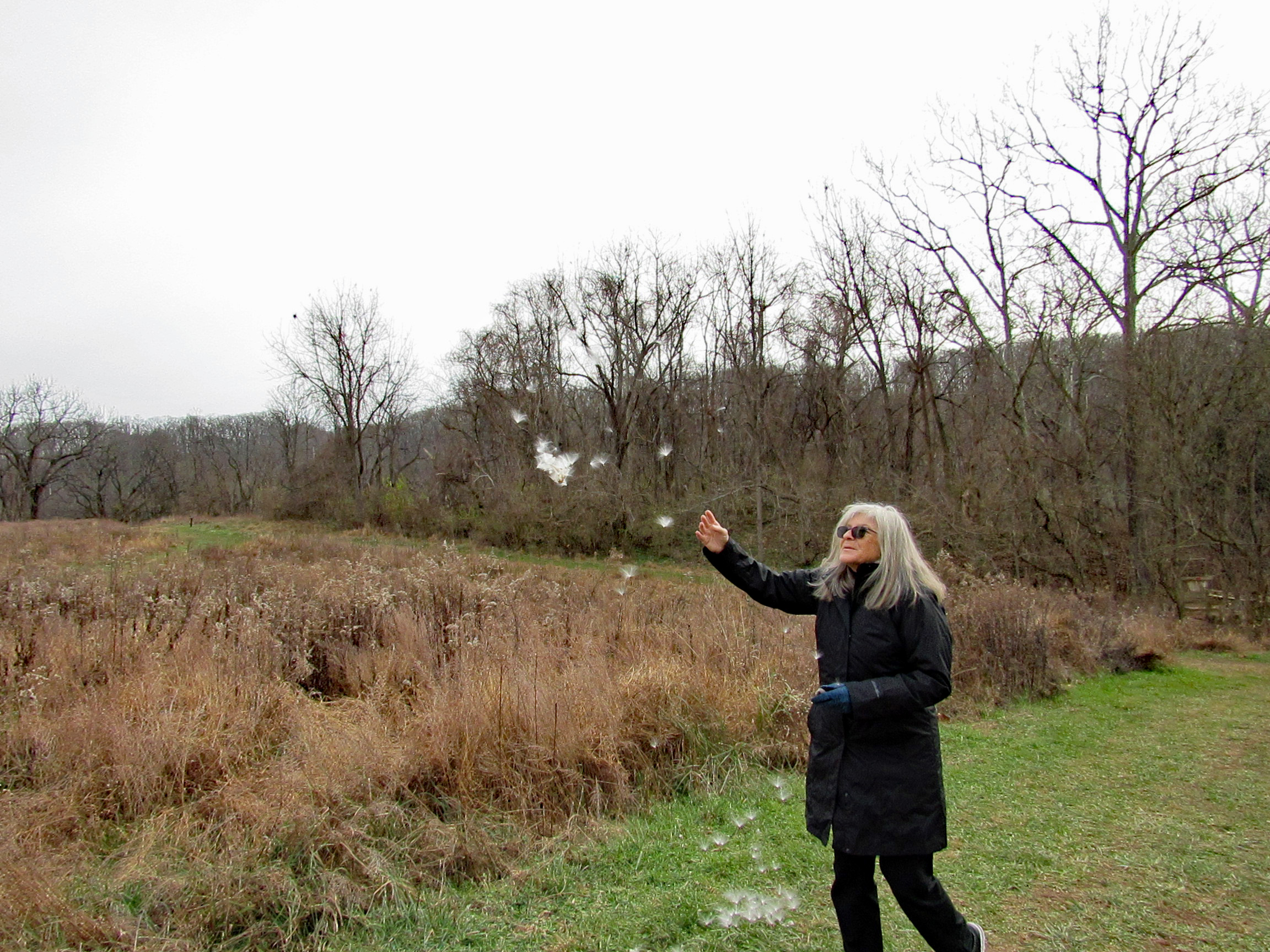
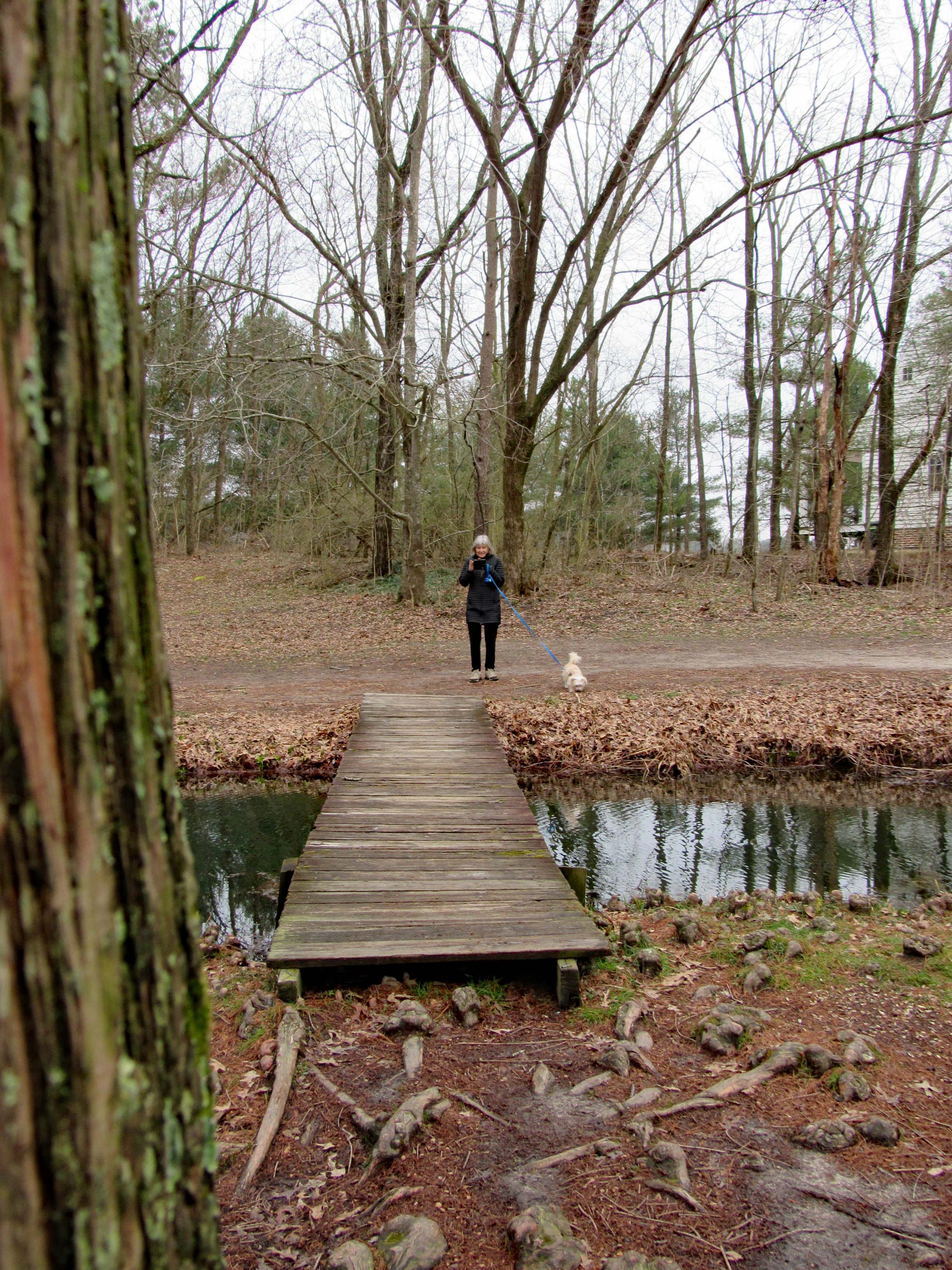
Up ahead where Kathy is, take a sharp right.

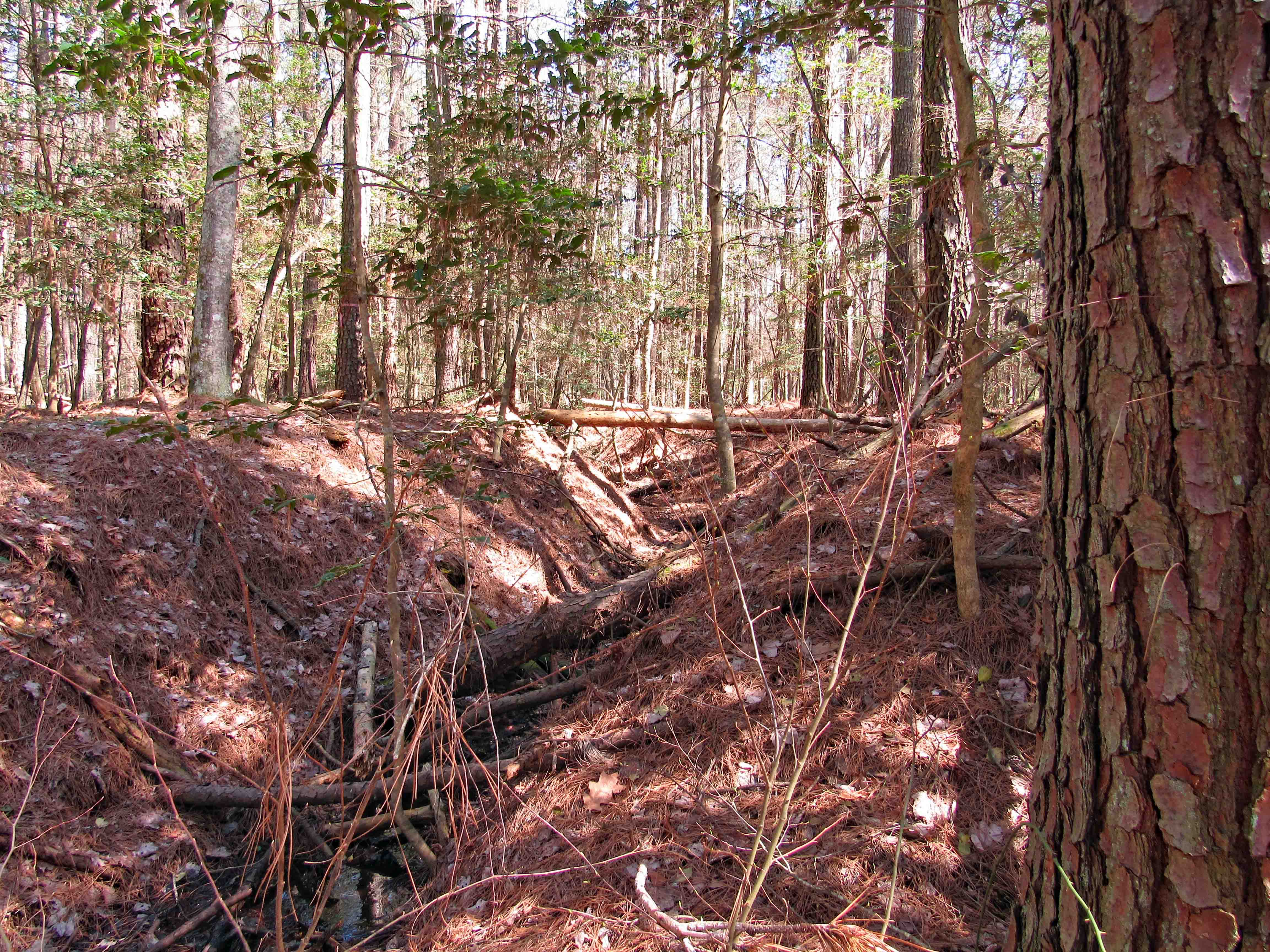
Which didn’t seem right. We ended up at a ditch. On the other side in the distance I saw a trail marker…so let’s go.

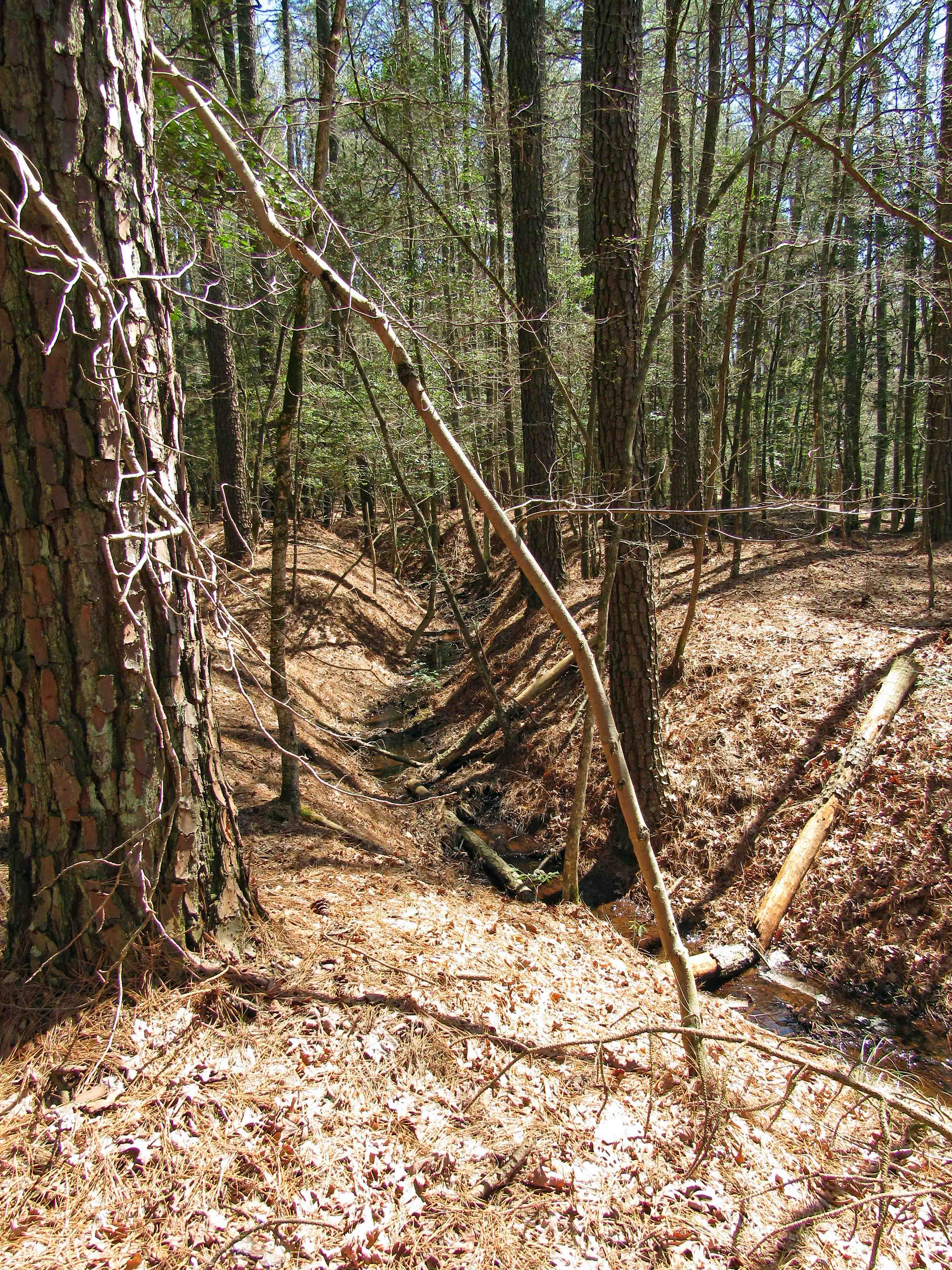
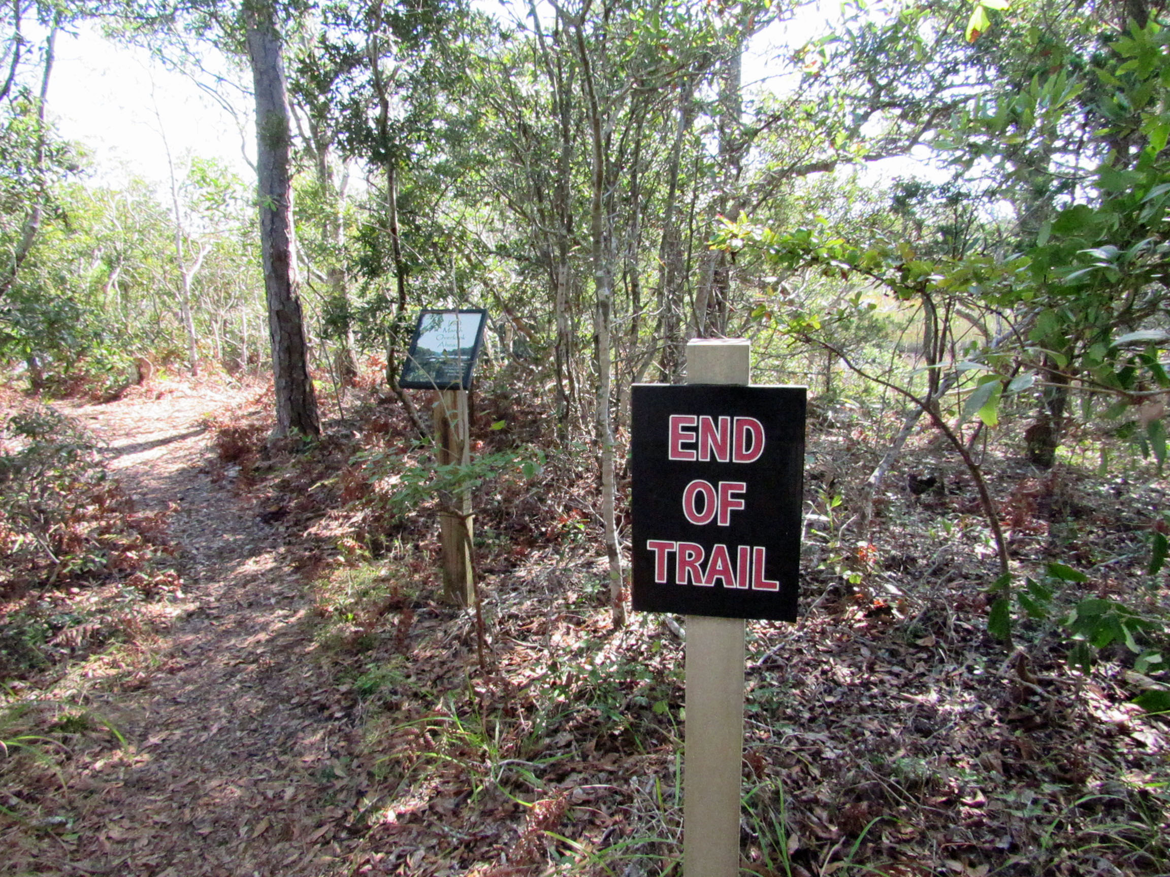
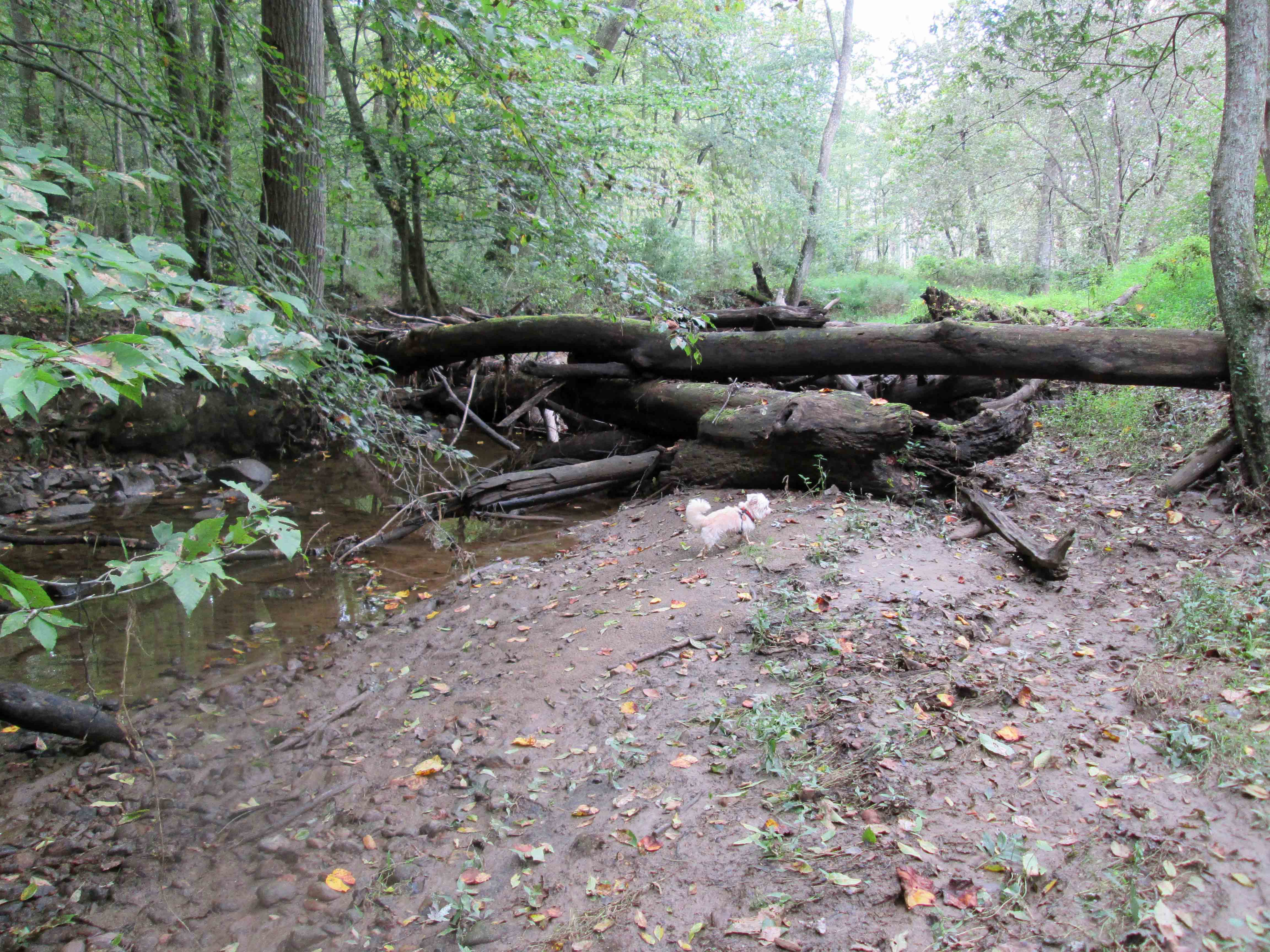
Up the other side and a few 100 yards ahead we came to marker 77. End of the ‘Official’ trail.

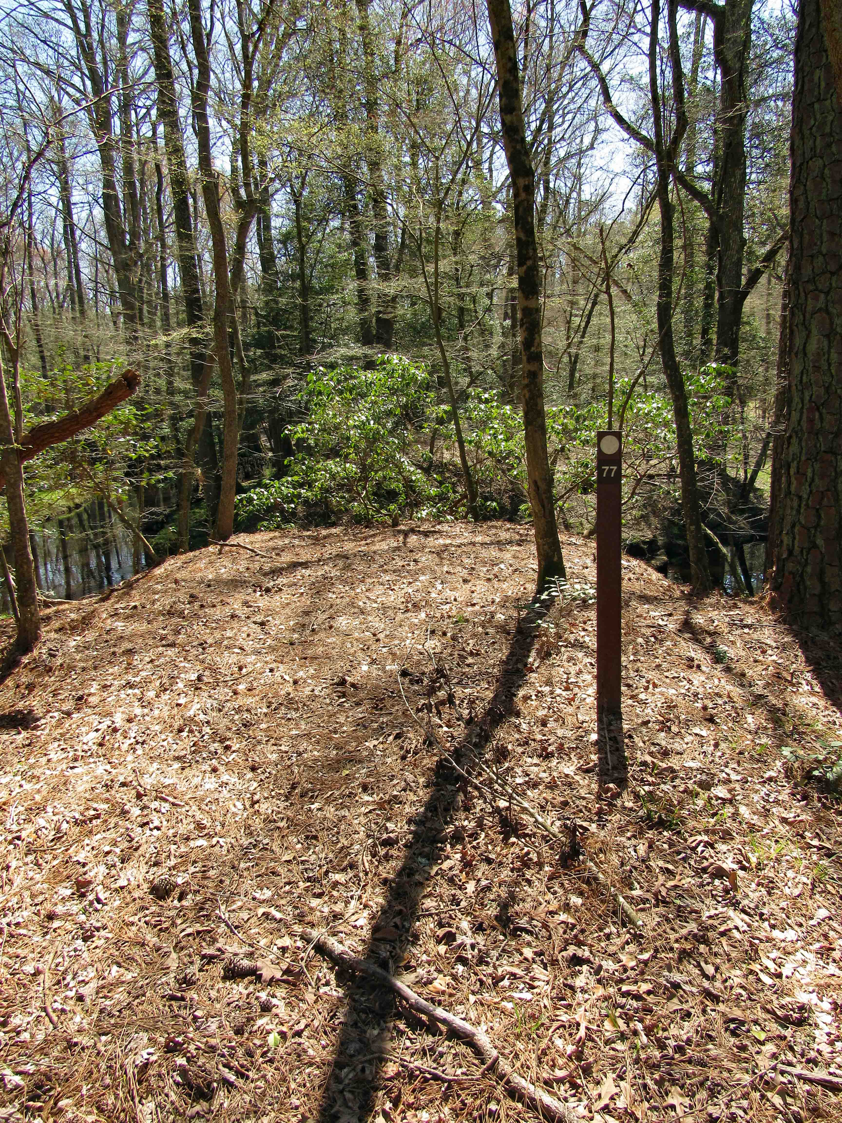
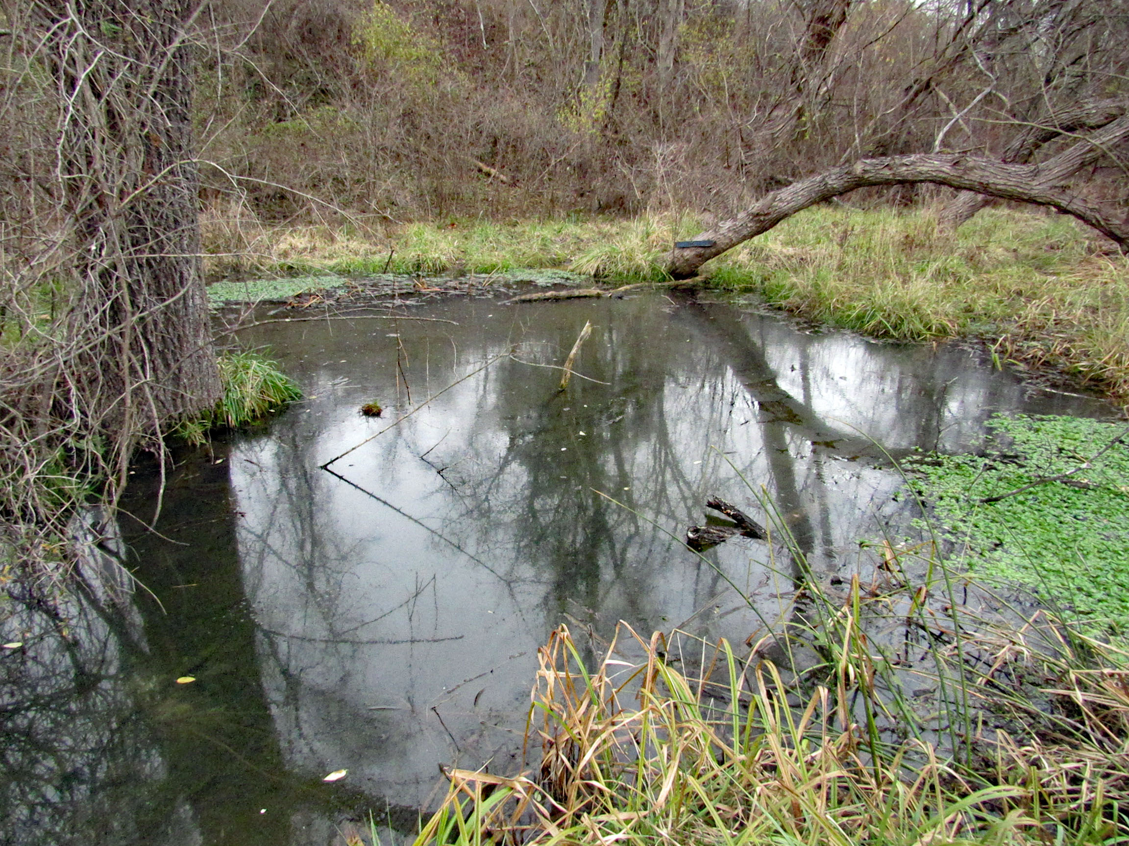
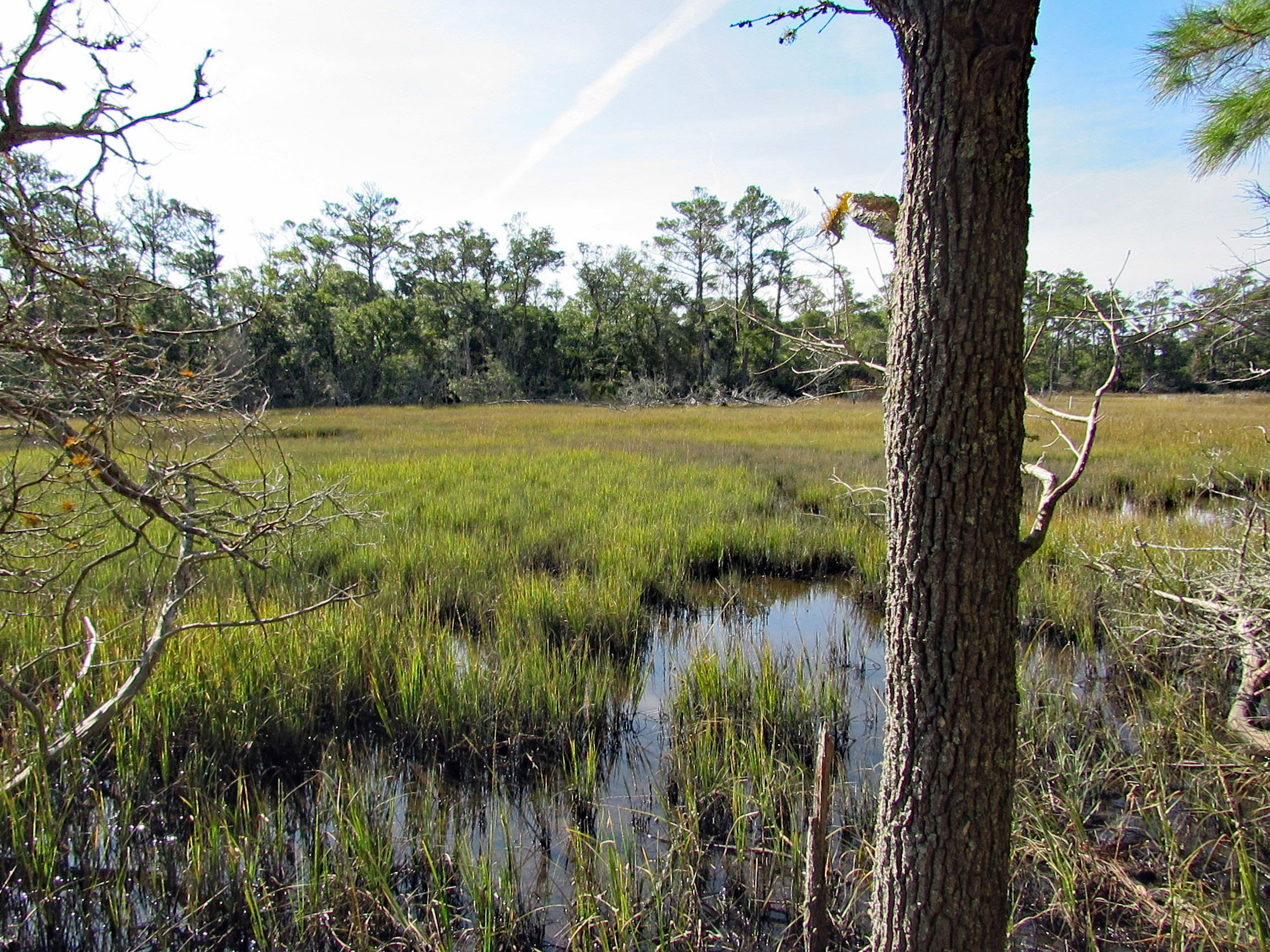
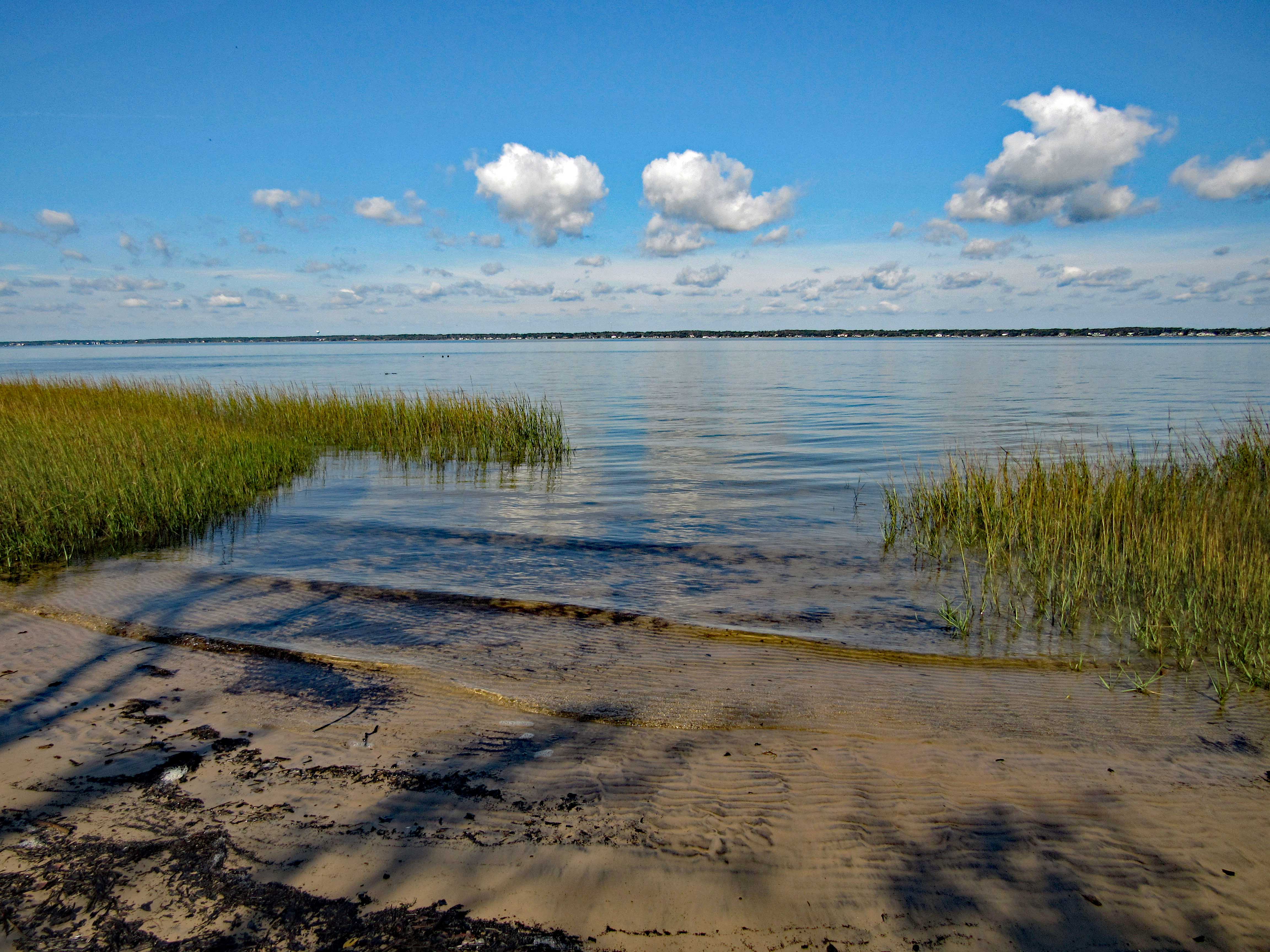
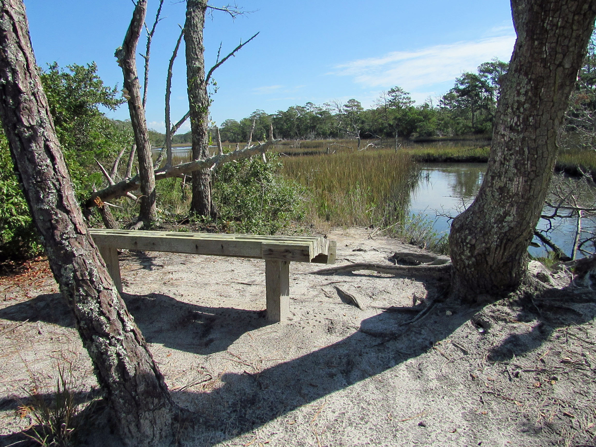
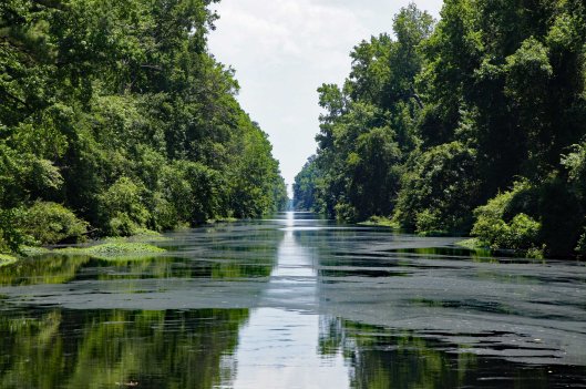
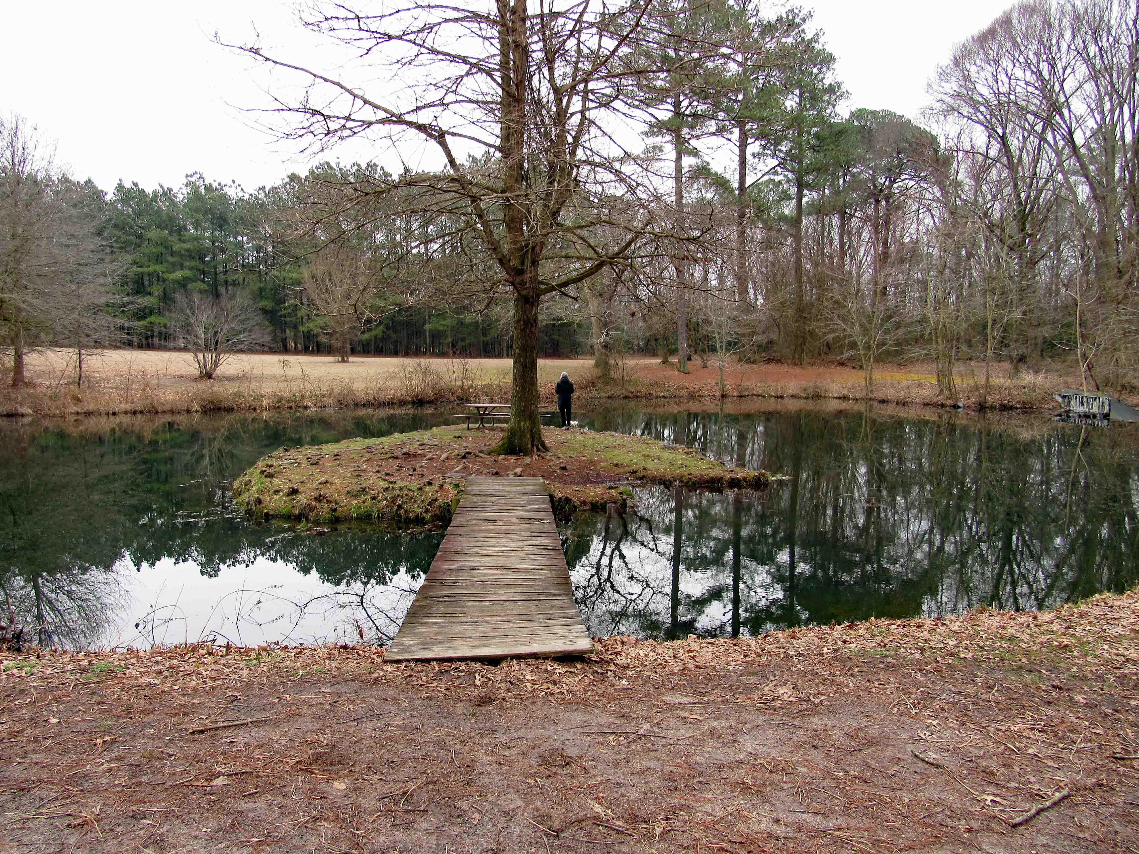
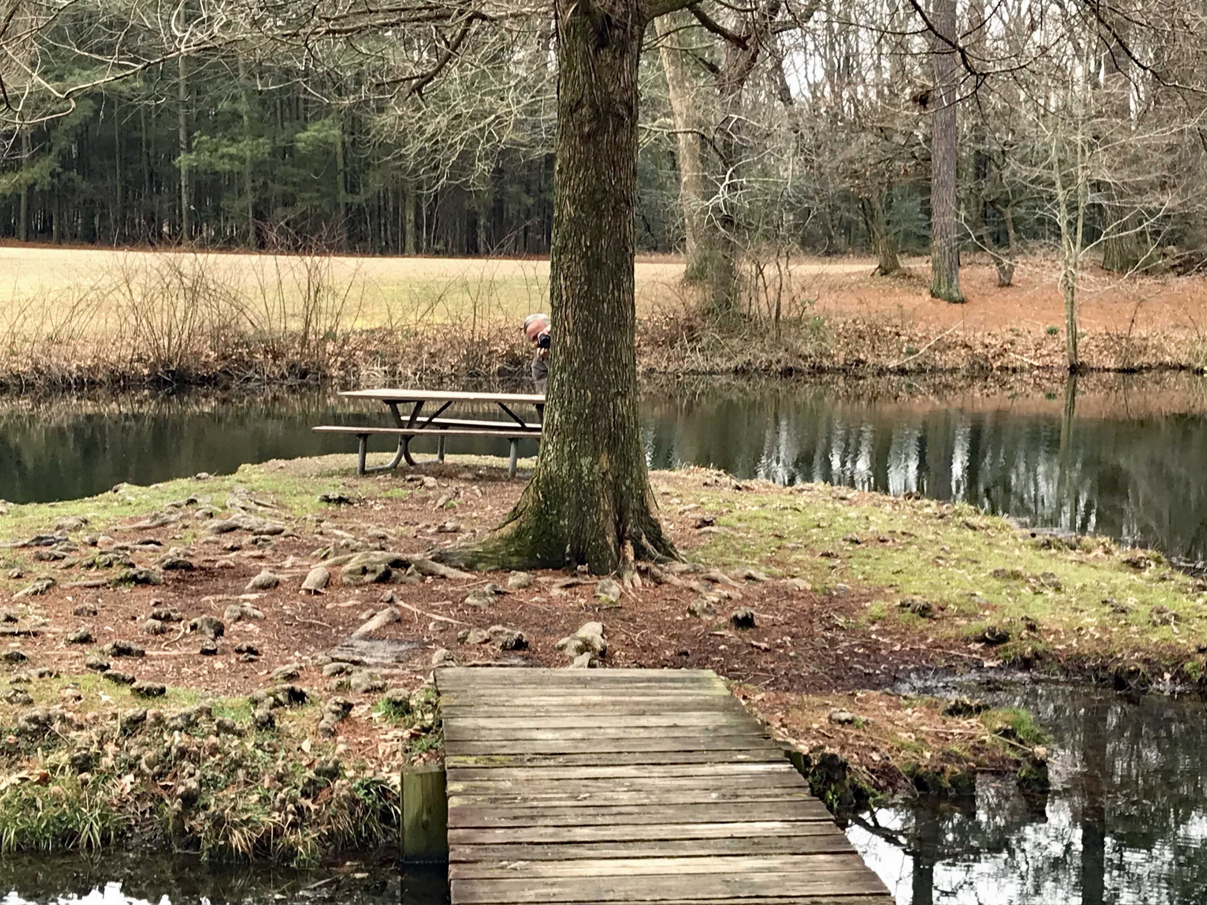
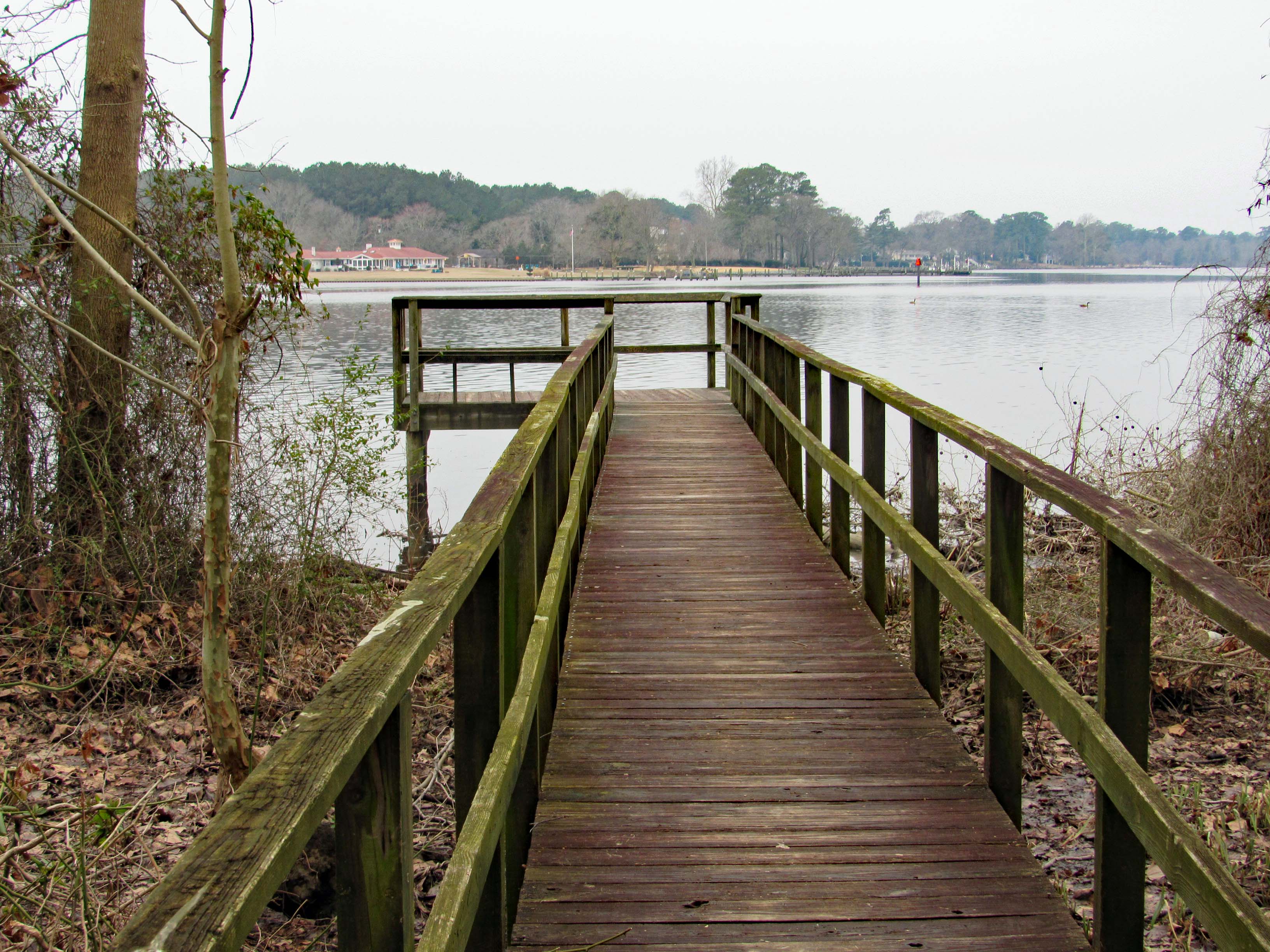
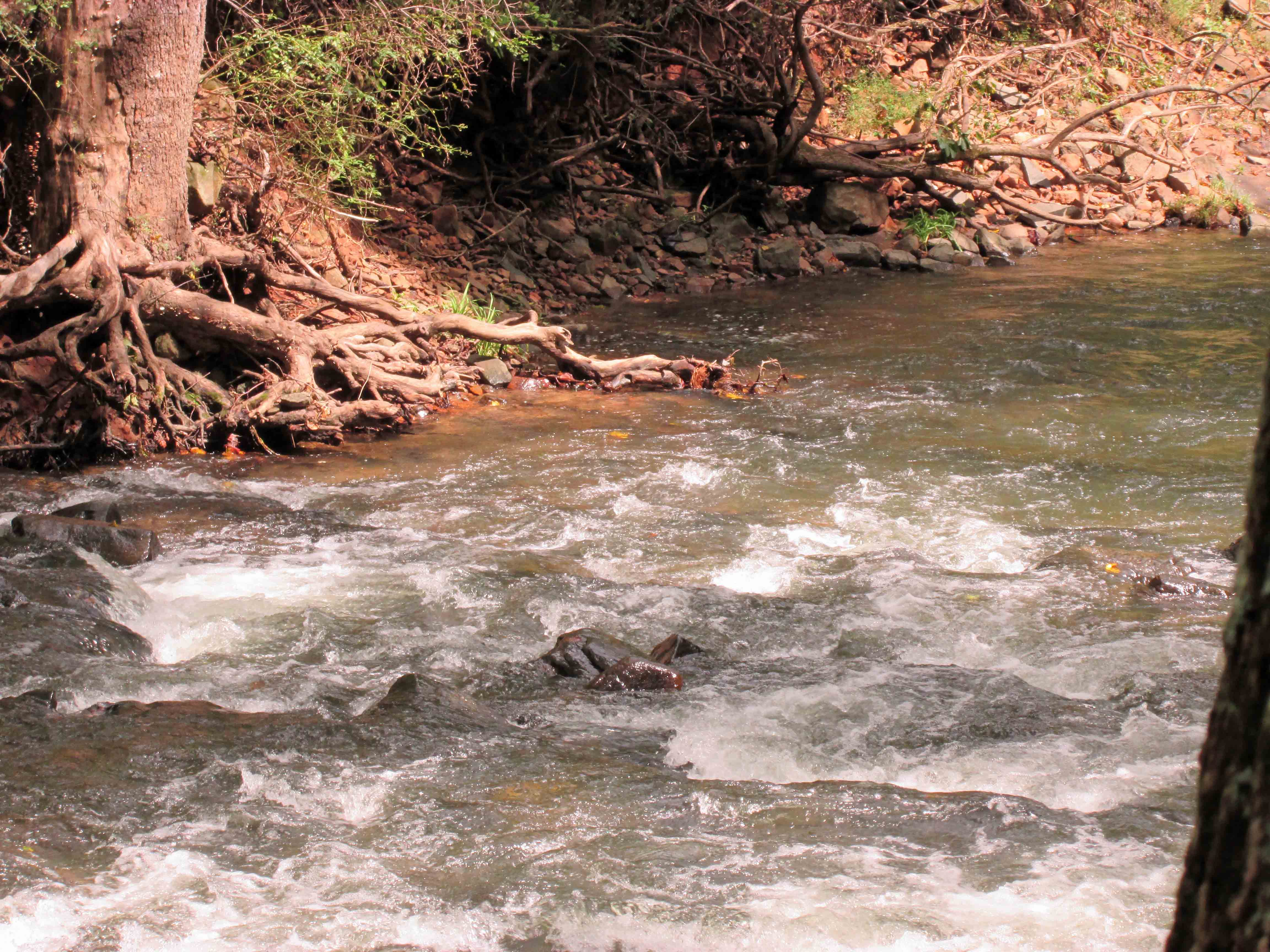
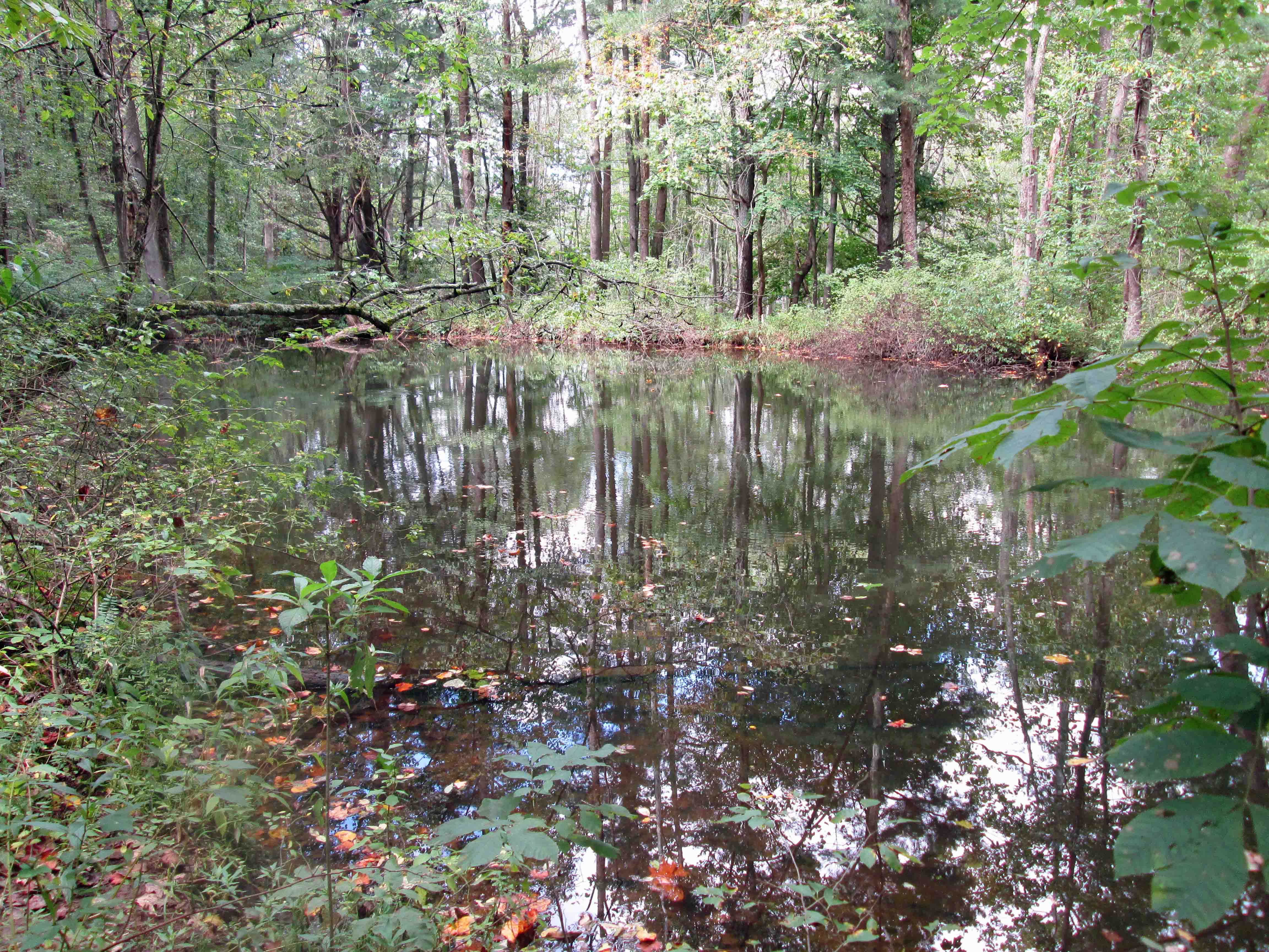
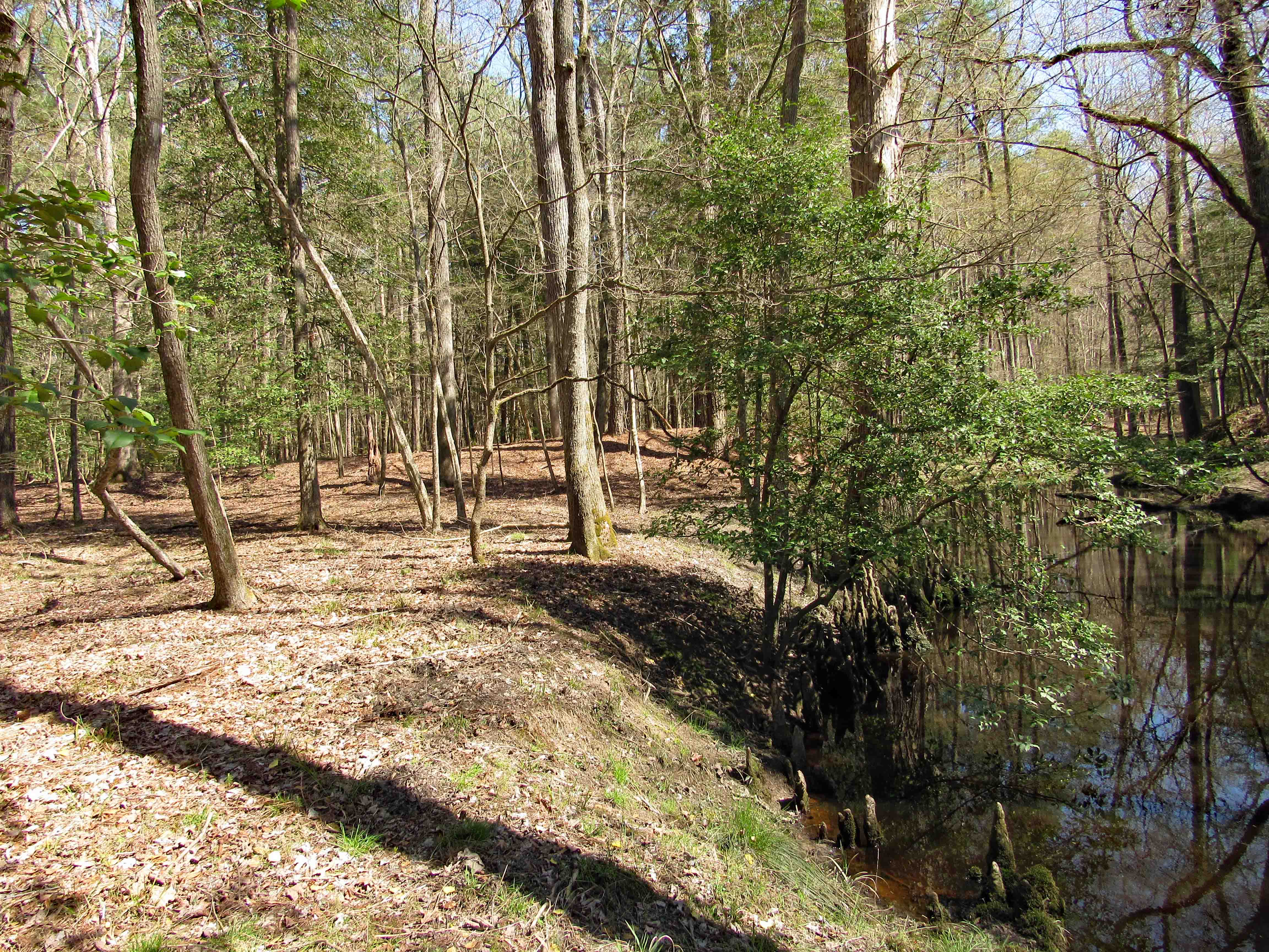
Corkers Creek passes down below and across the way we see another mound. (Wondering if at one time a bridge crossed here?) One of our maps says Colburn Trail is over there.

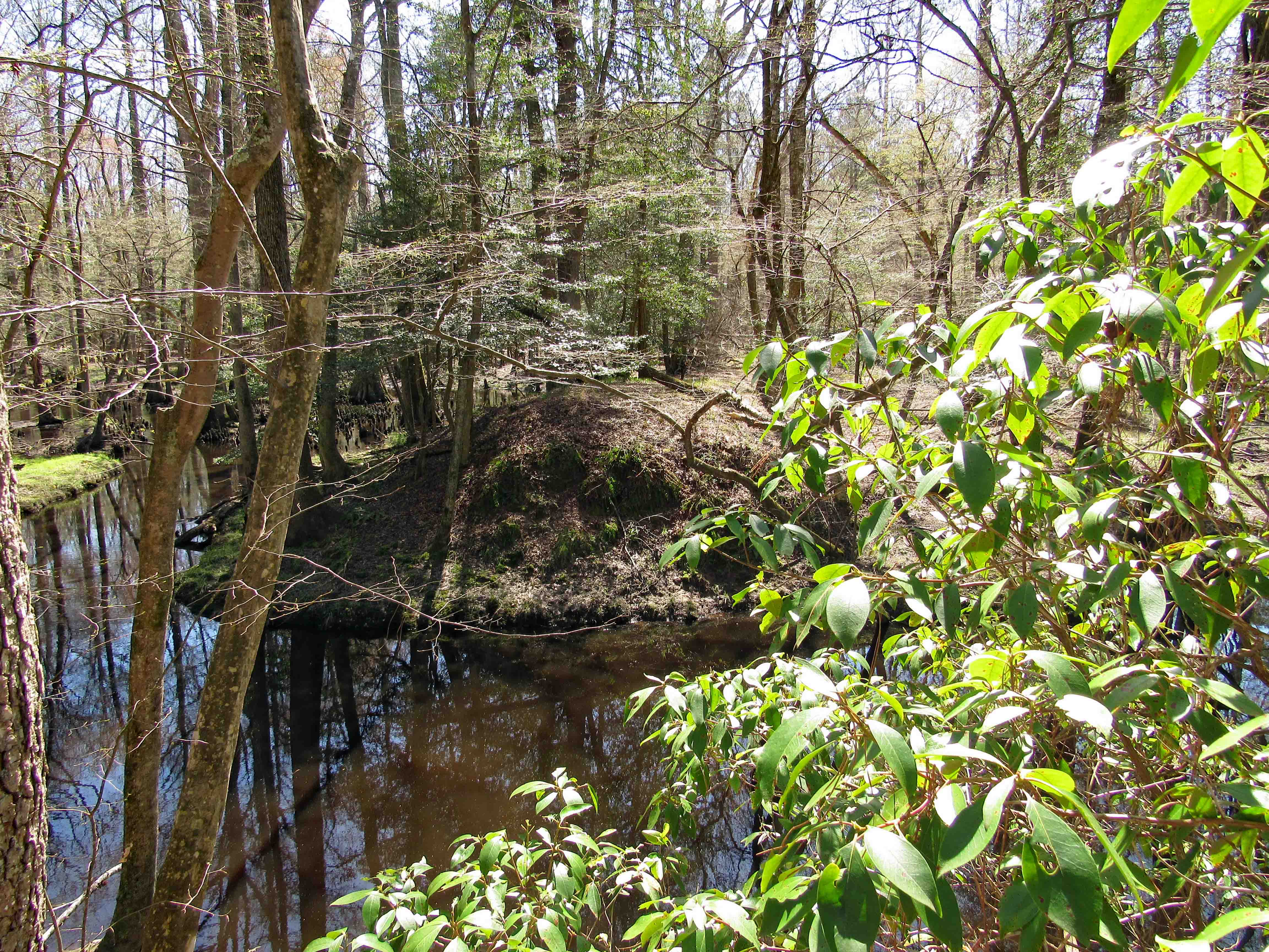
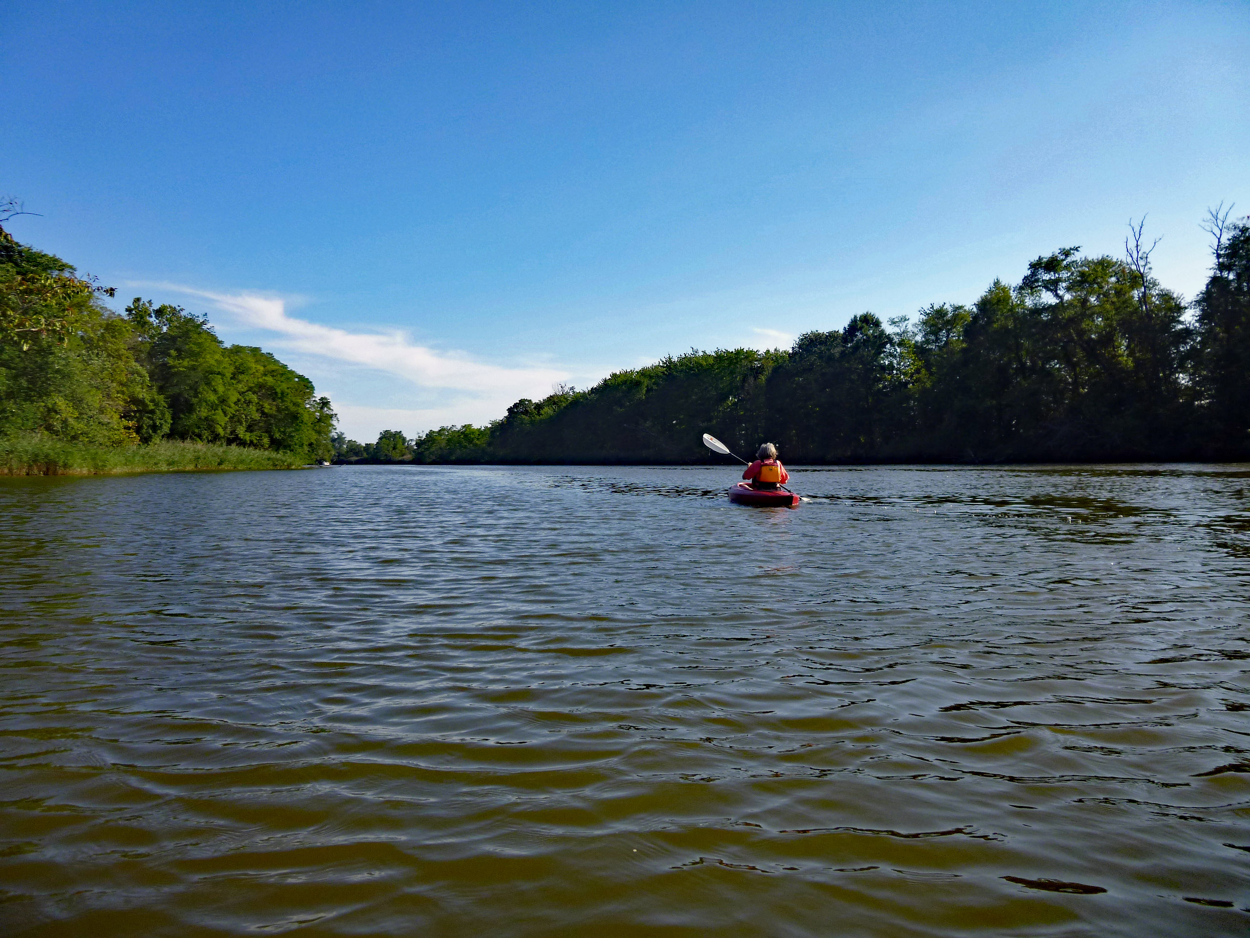
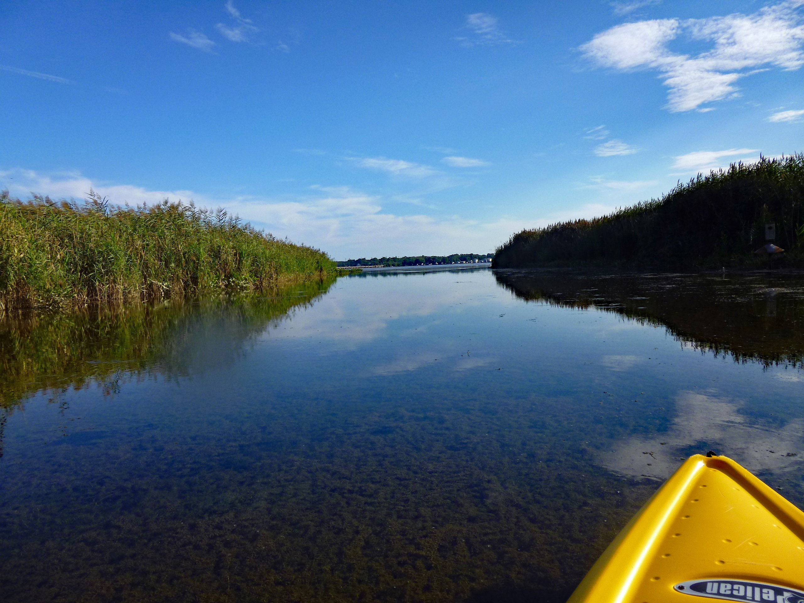
We look to the right and head down to a nice area.

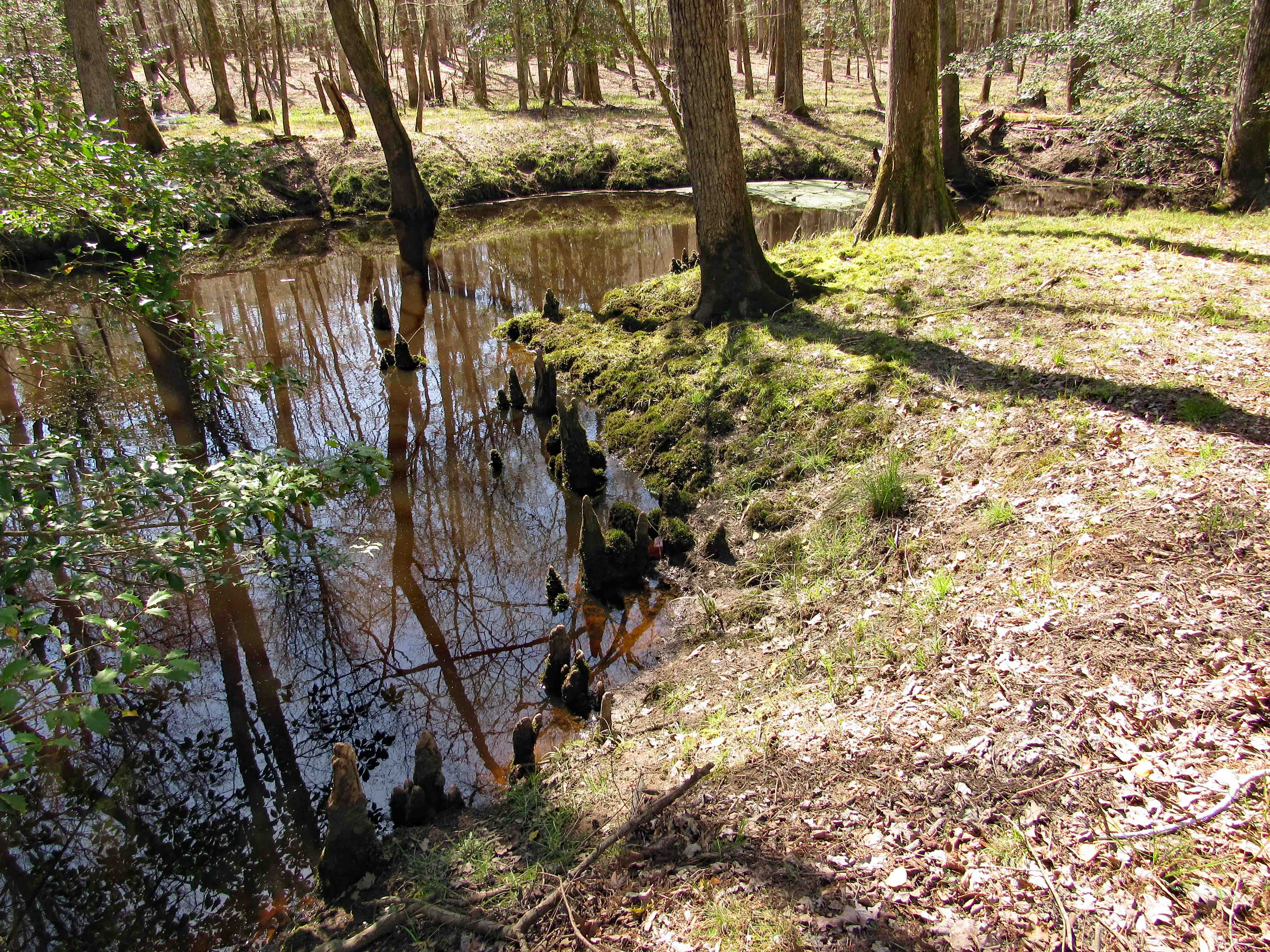
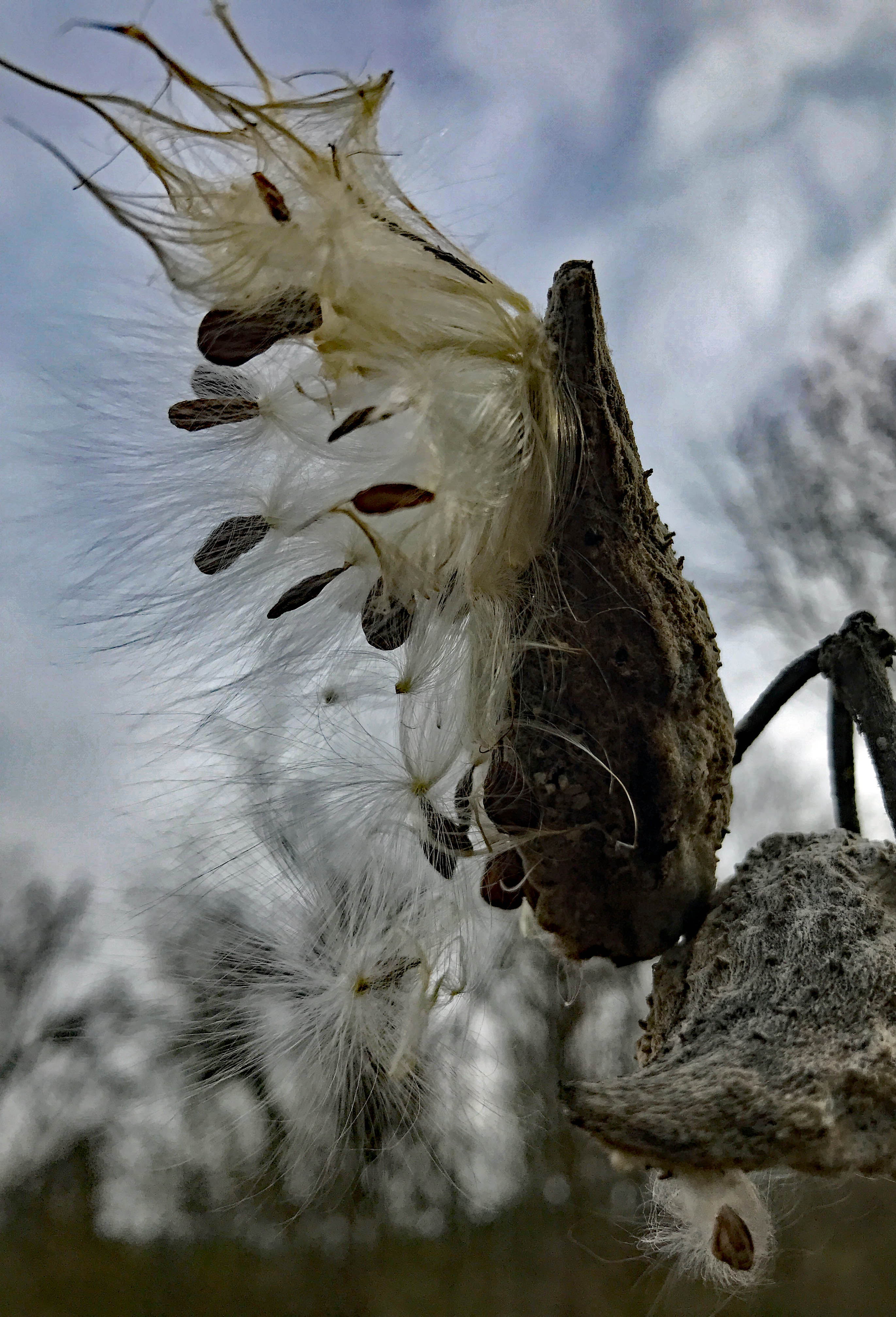
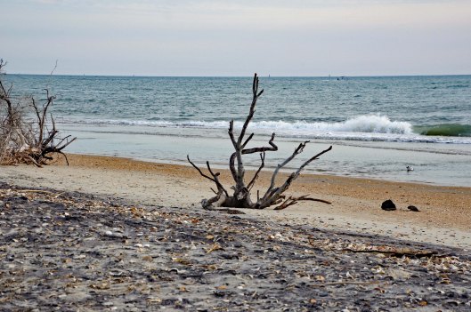
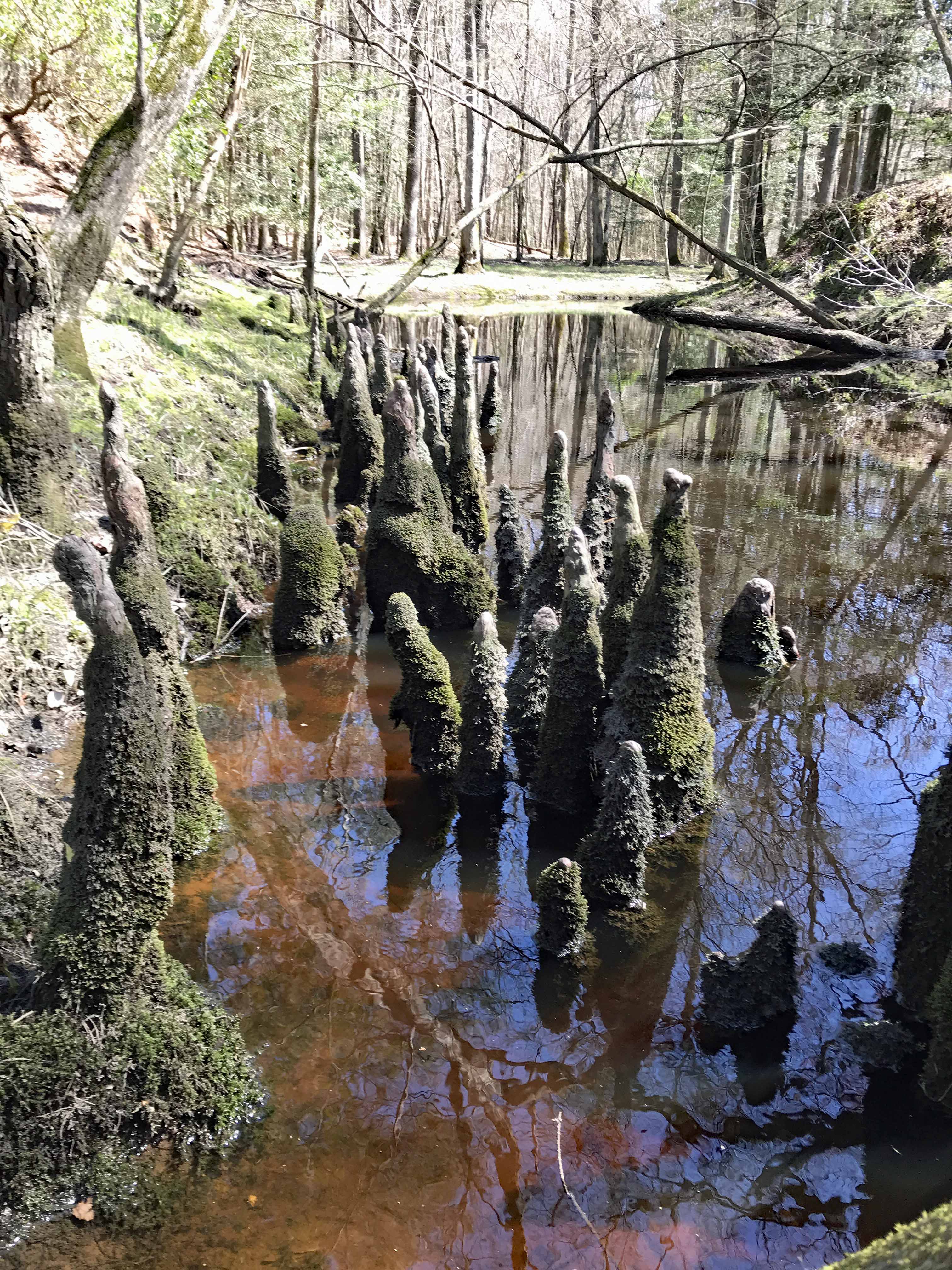
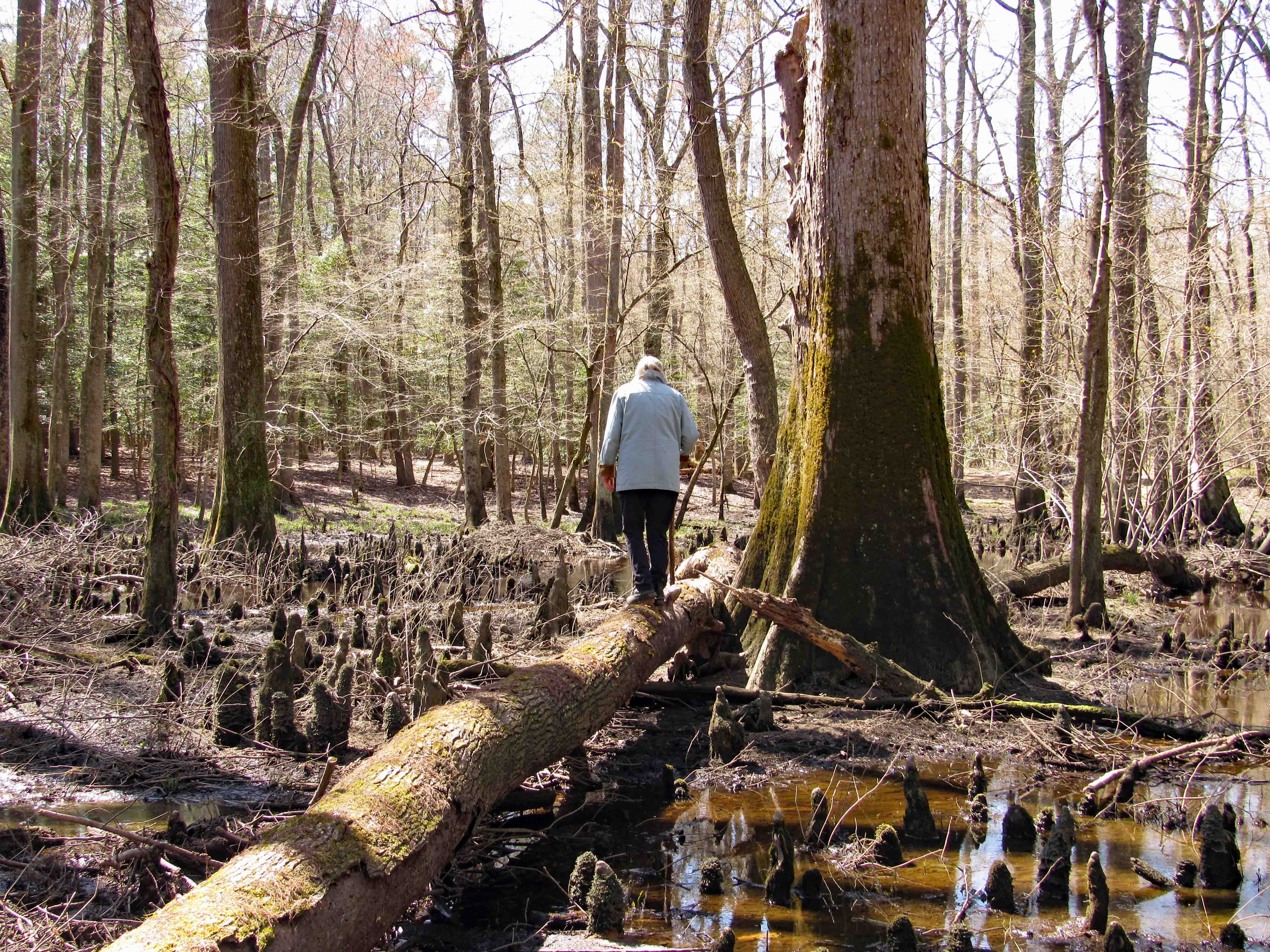
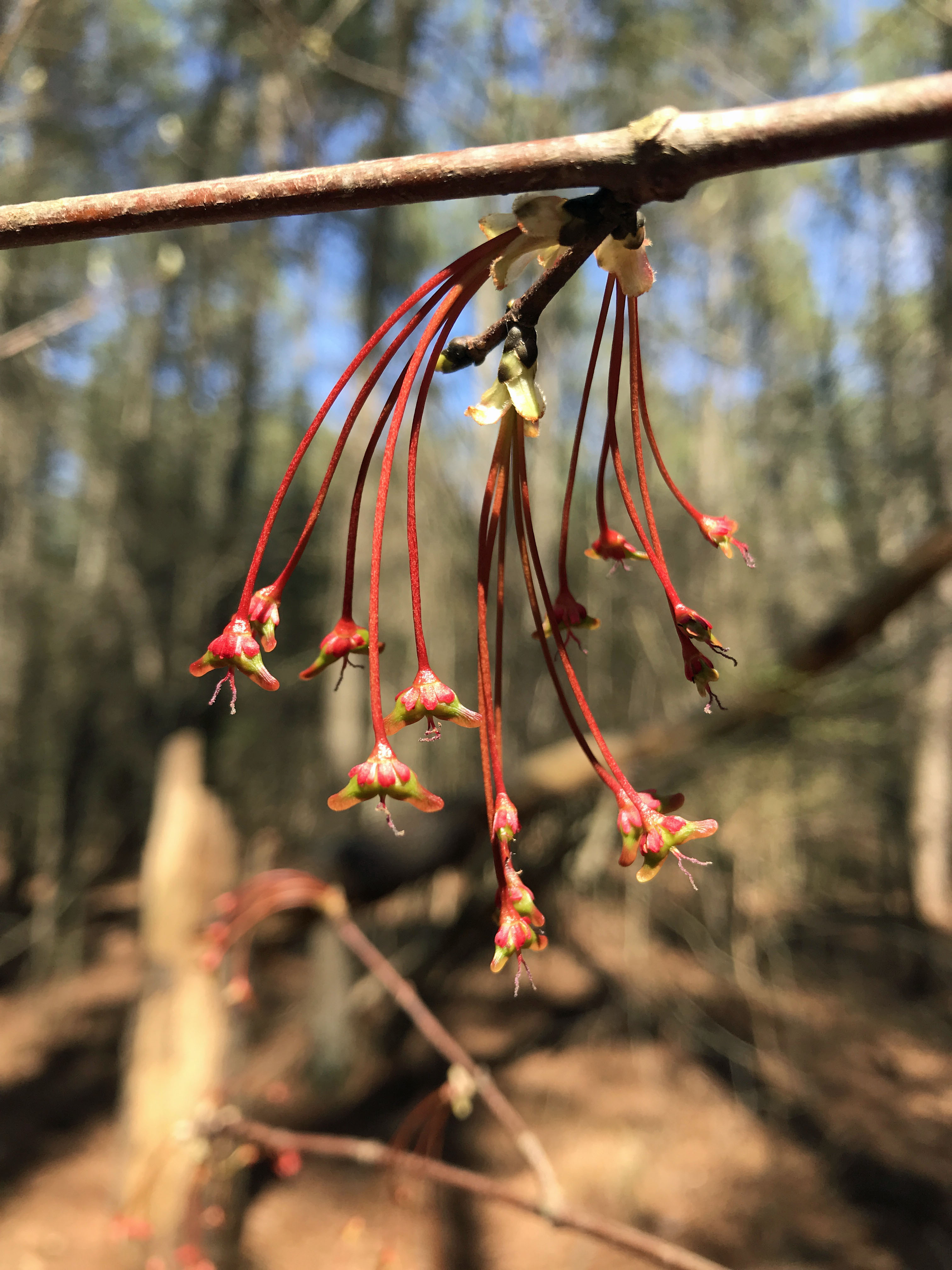
Kathy’s photo of some of the Cypress Knees.

Back up the mound and then down the left side.

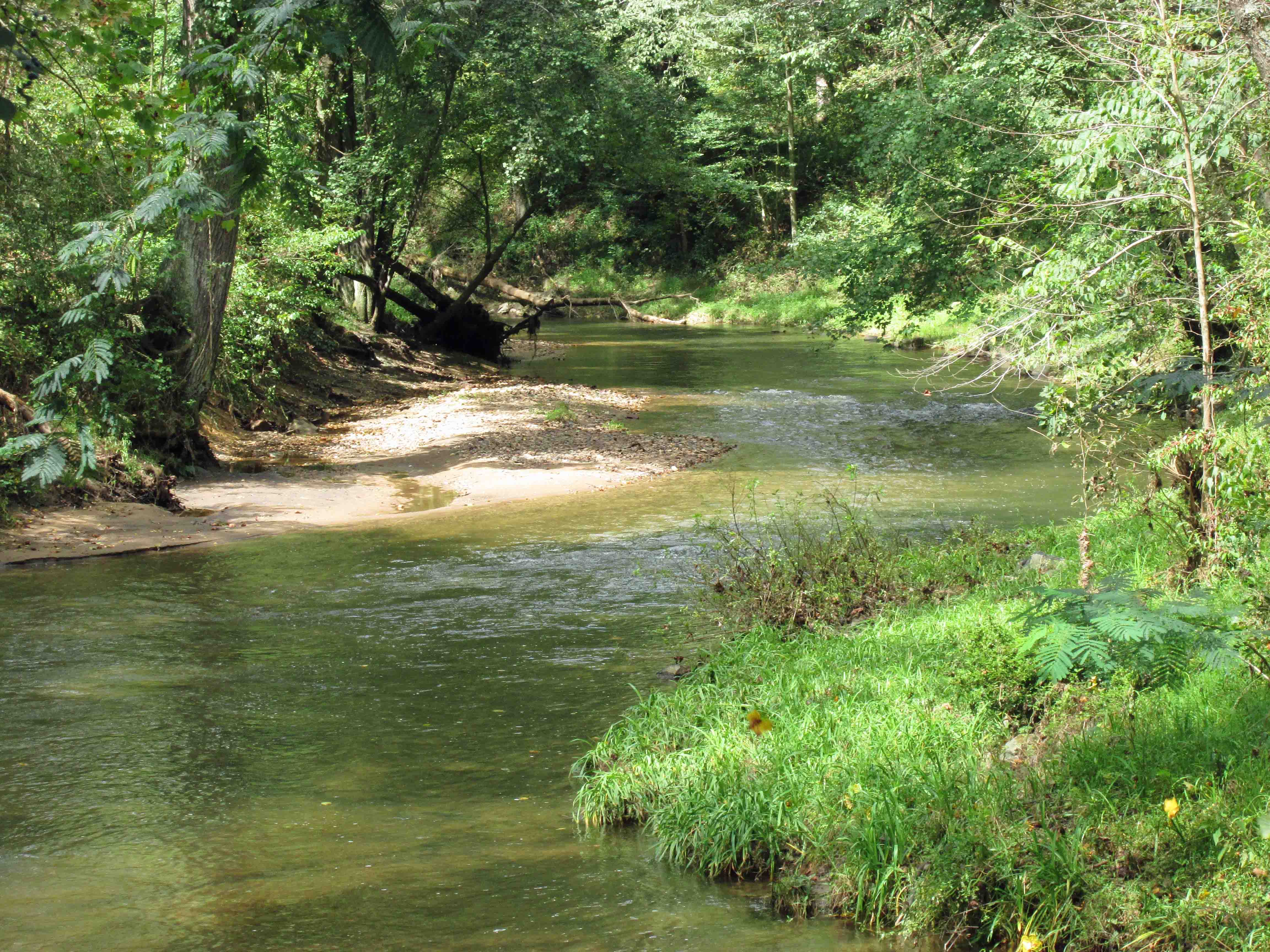
Read that this was designated as a canoe creek. Don’t think so. Maybe at one time.

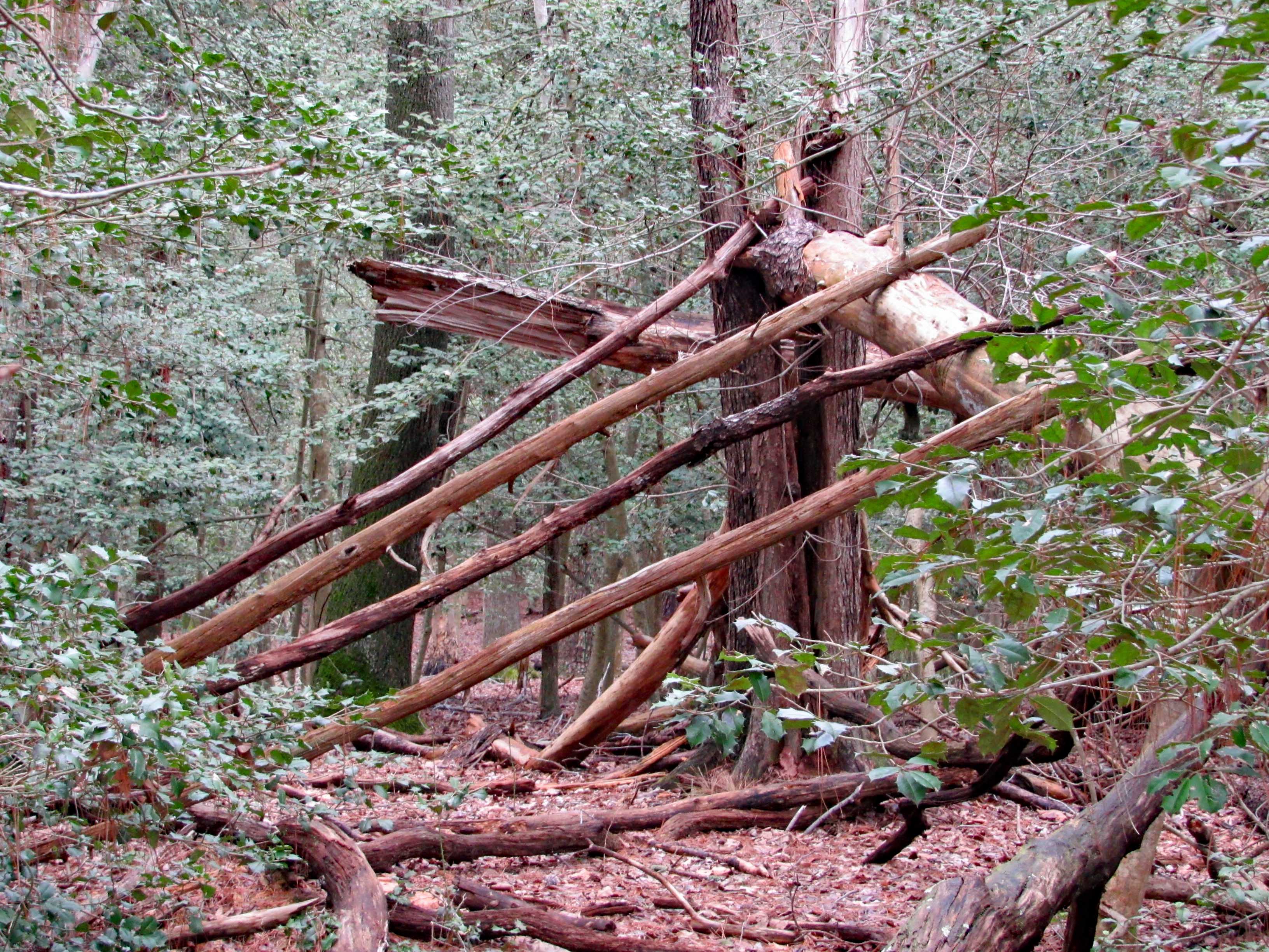
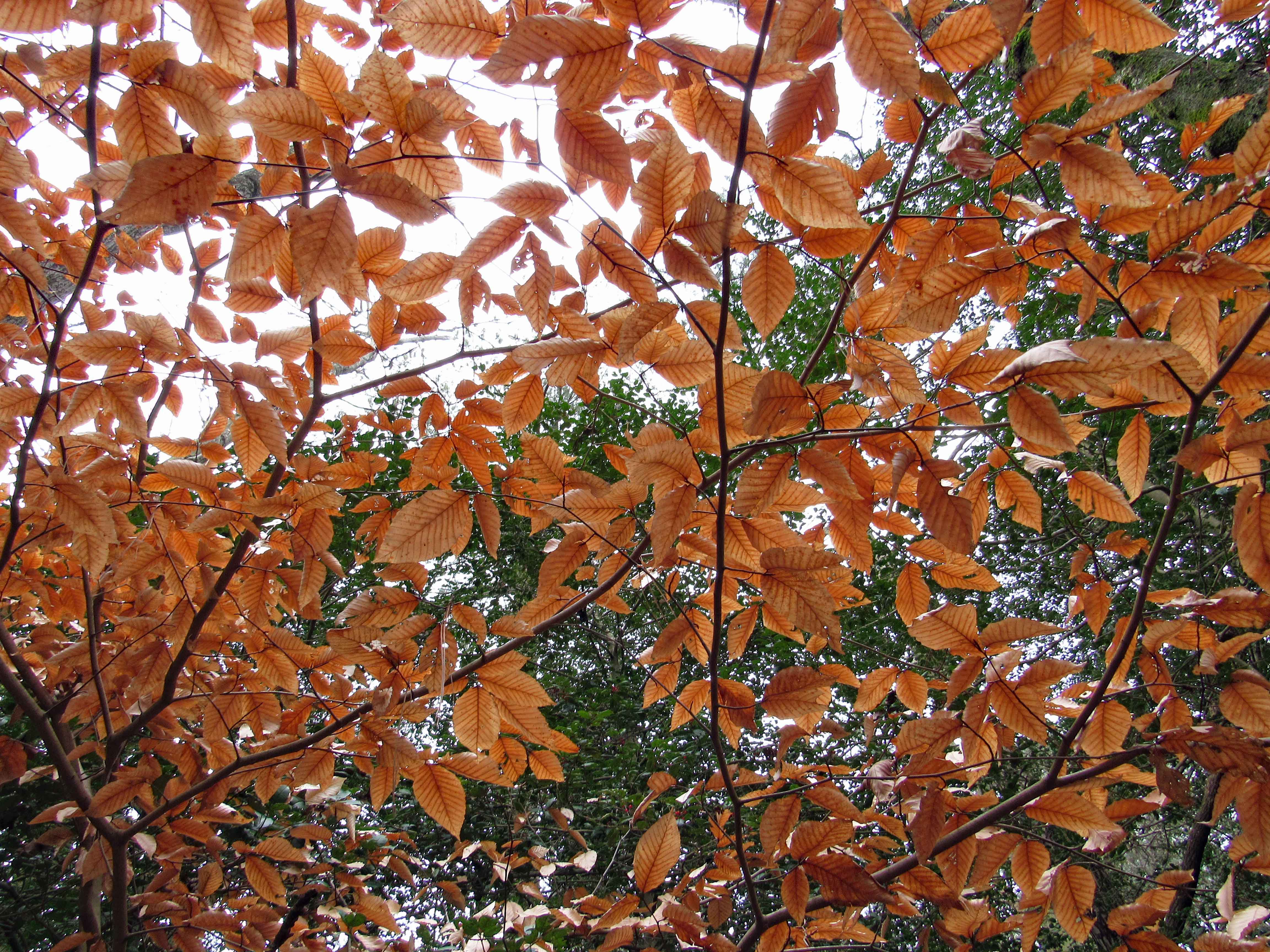
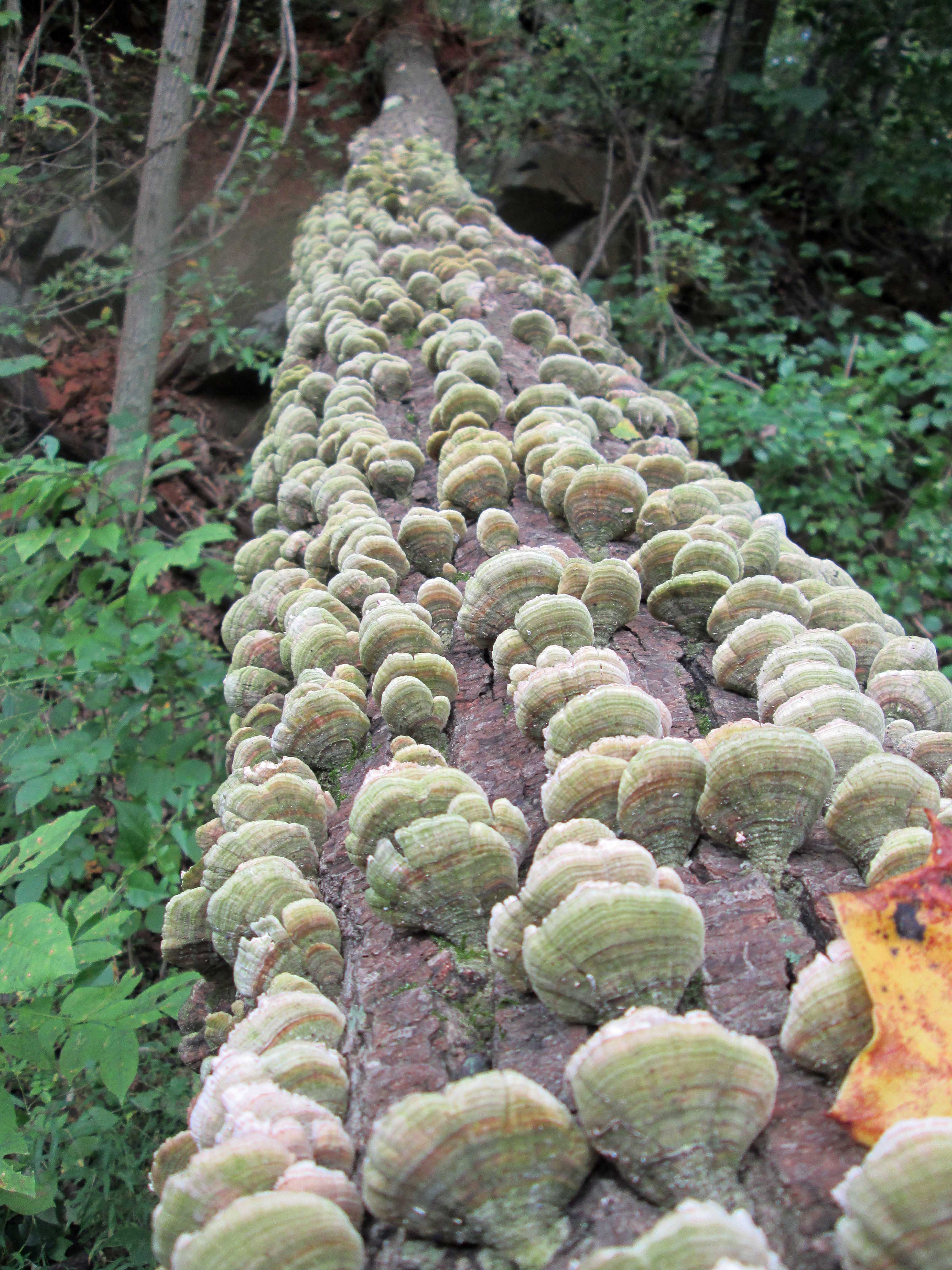
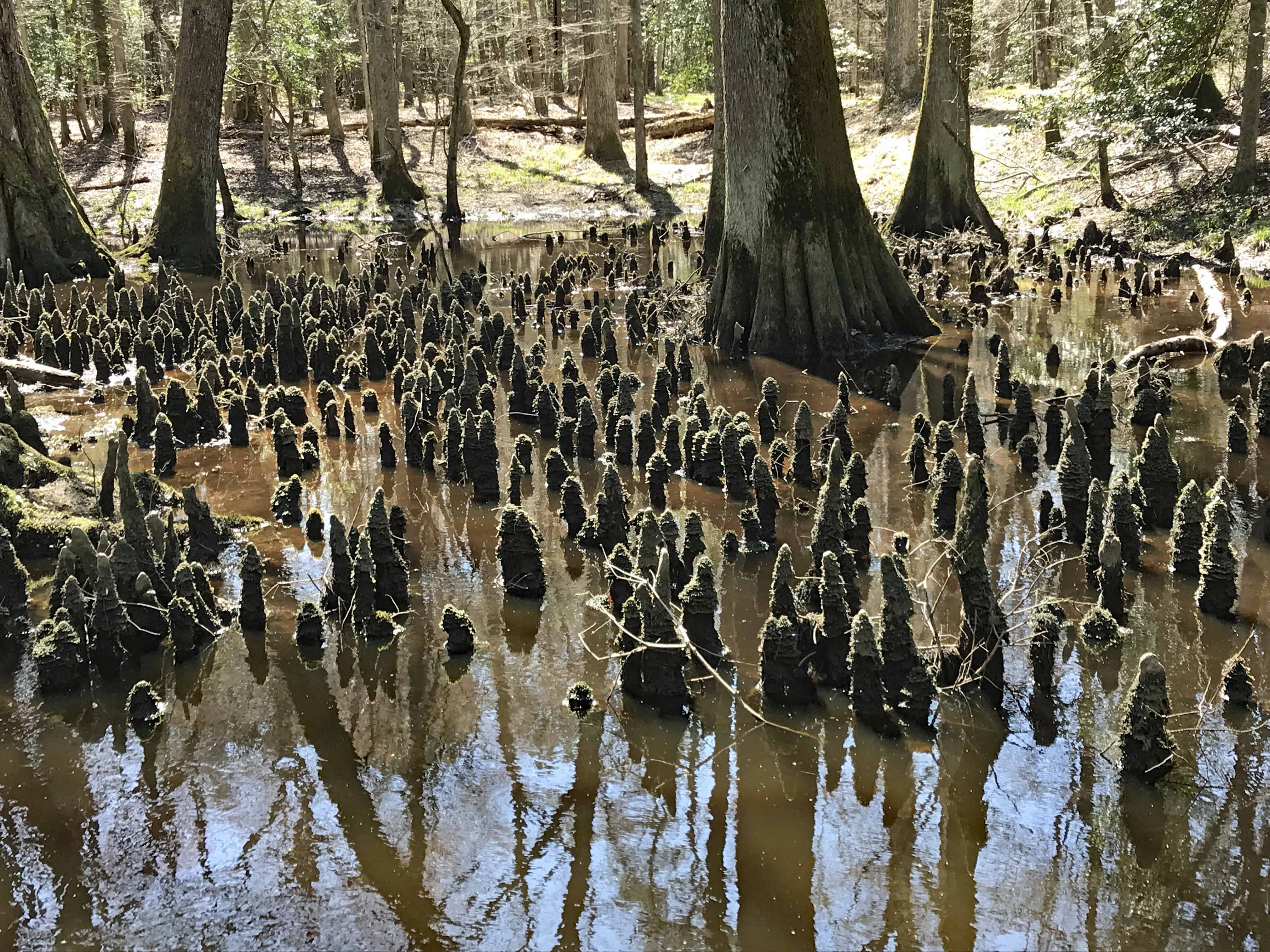
We walk a ways and come across the most Cypress Knees we have ever seen.

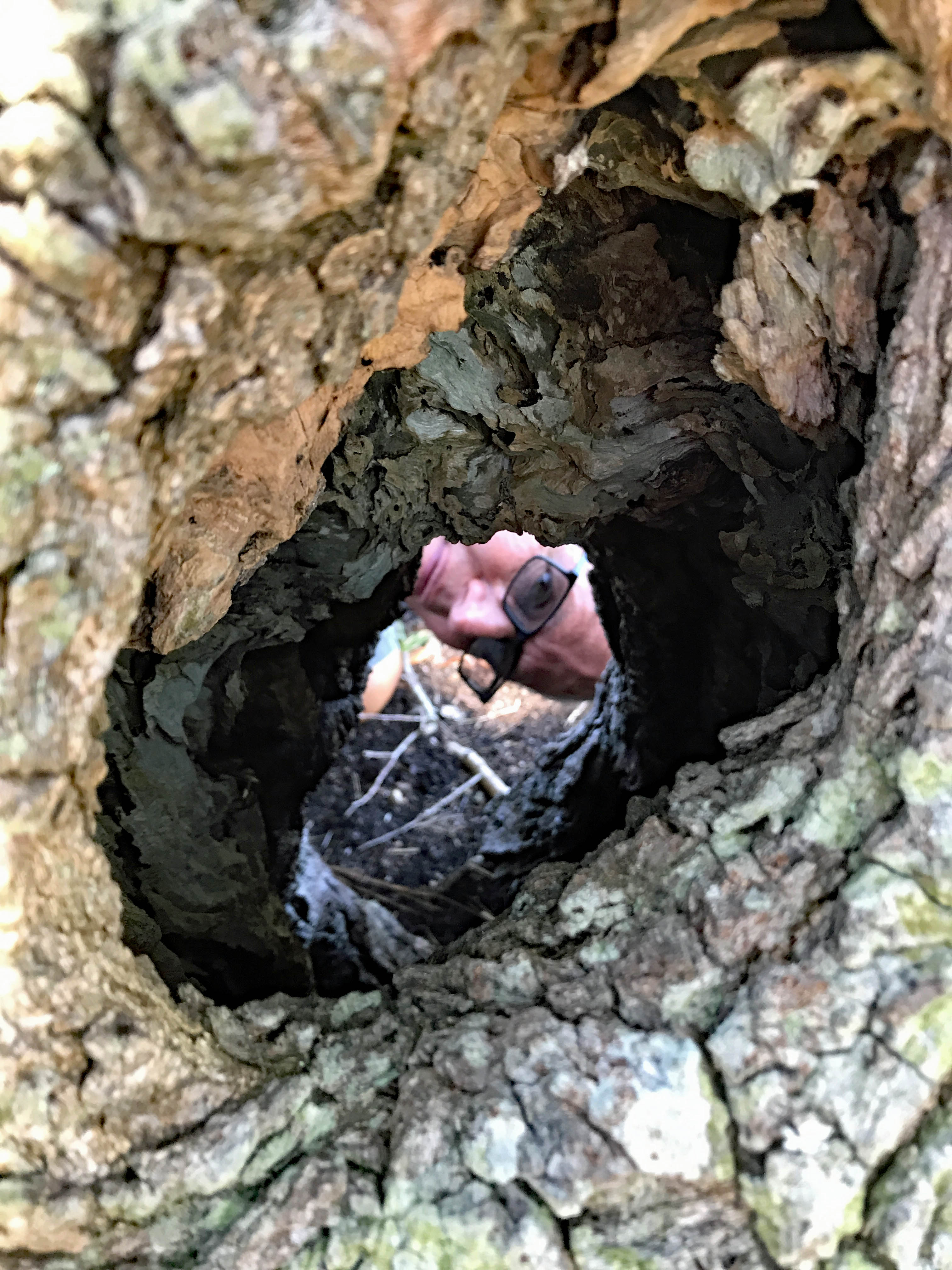
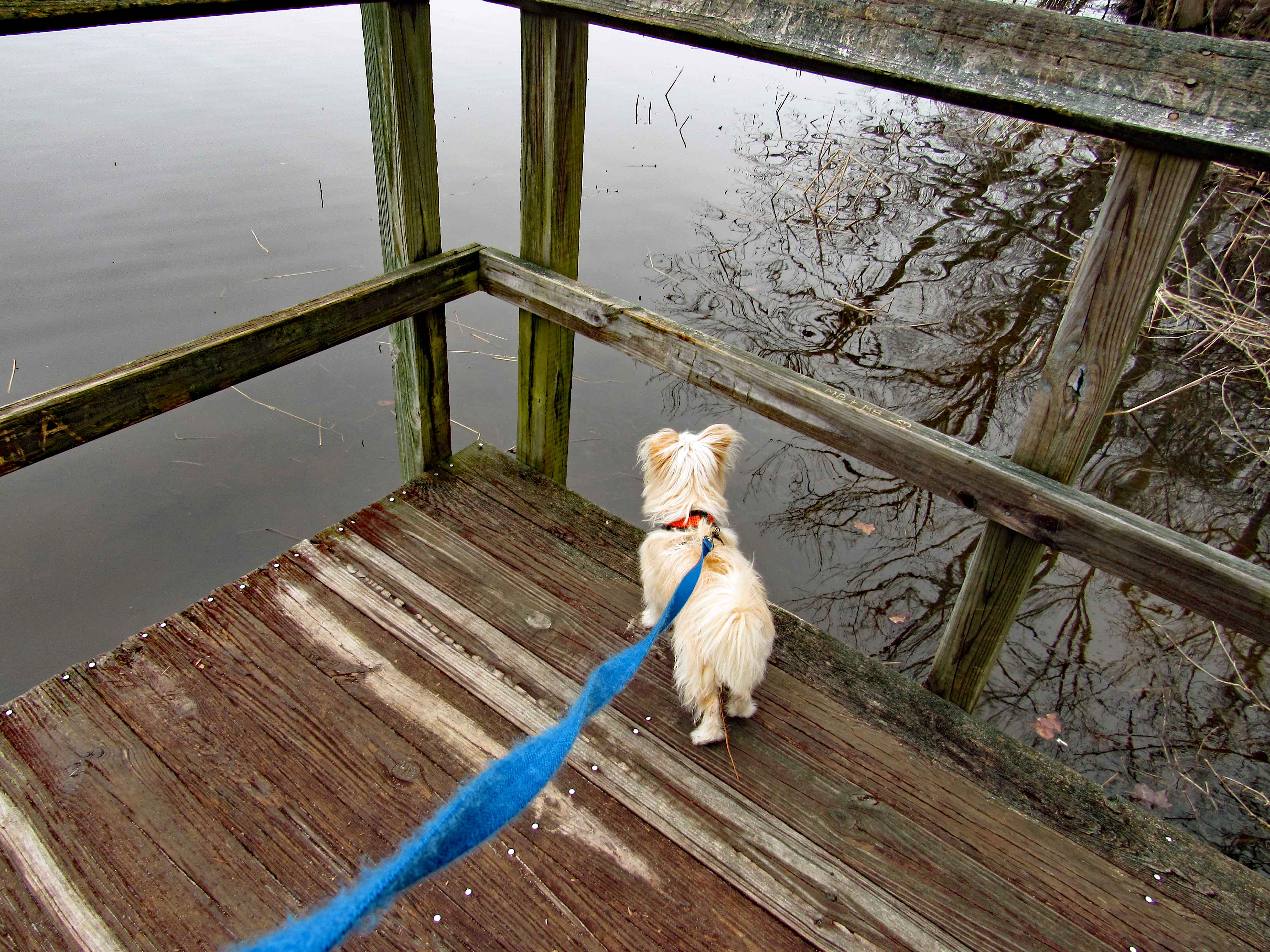
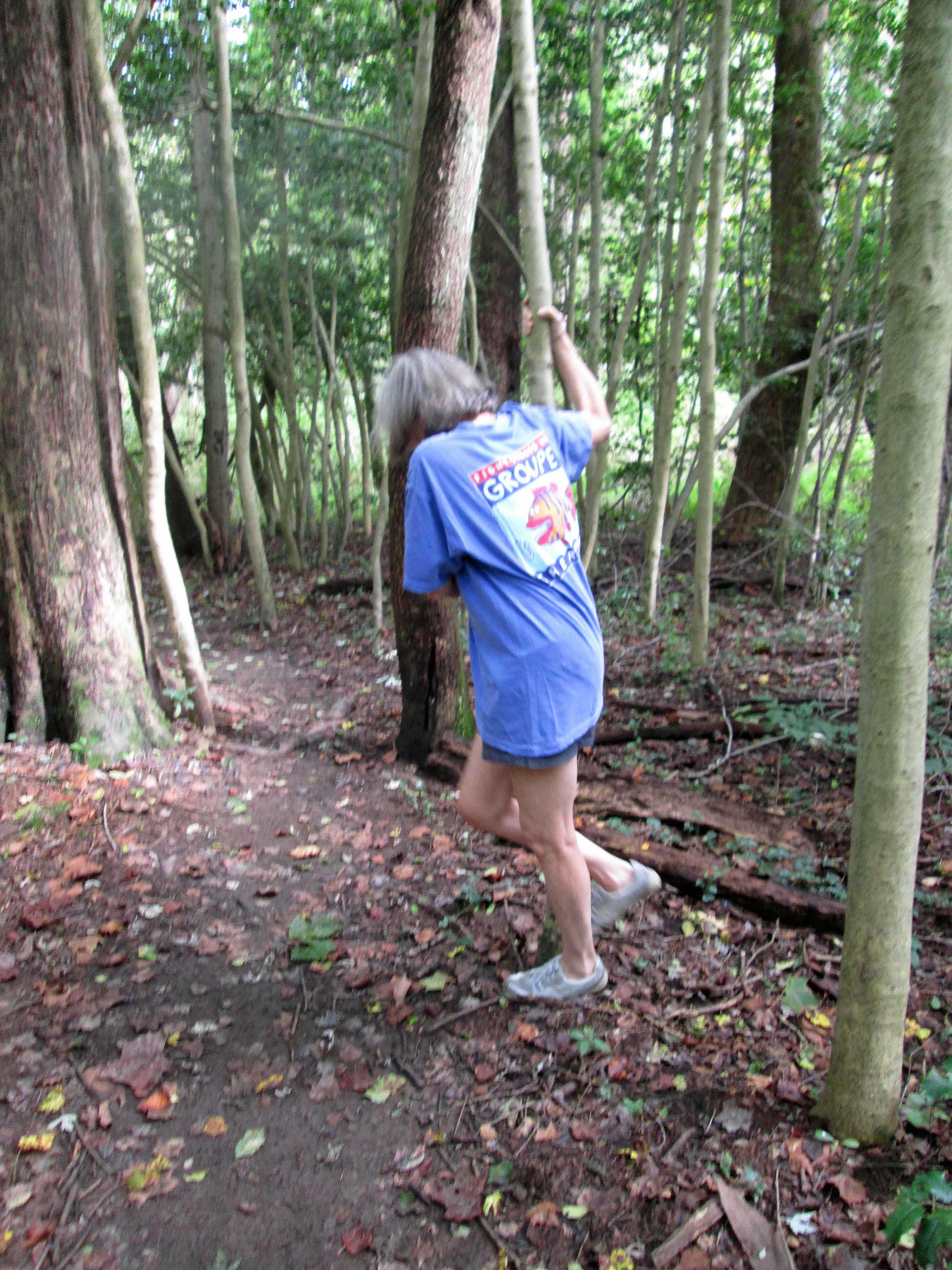
Kathy heads over for a better look…

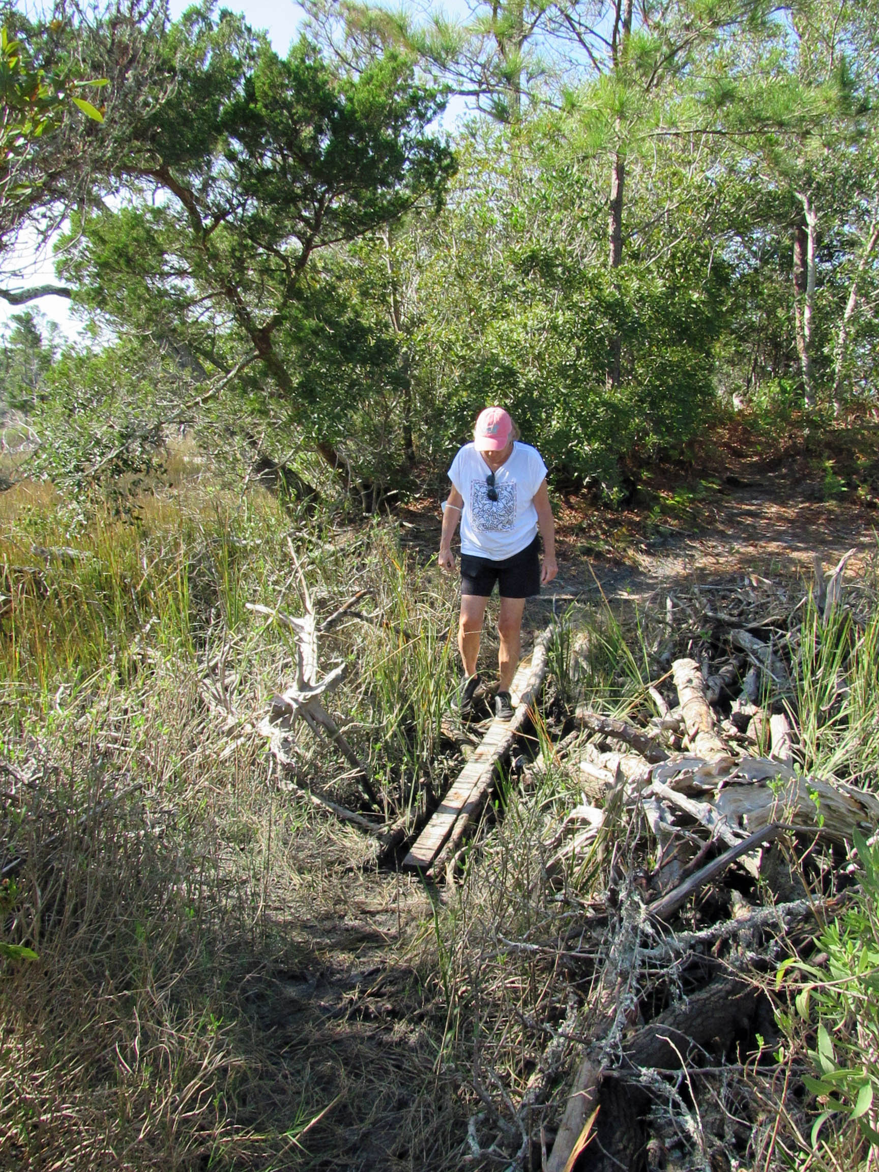
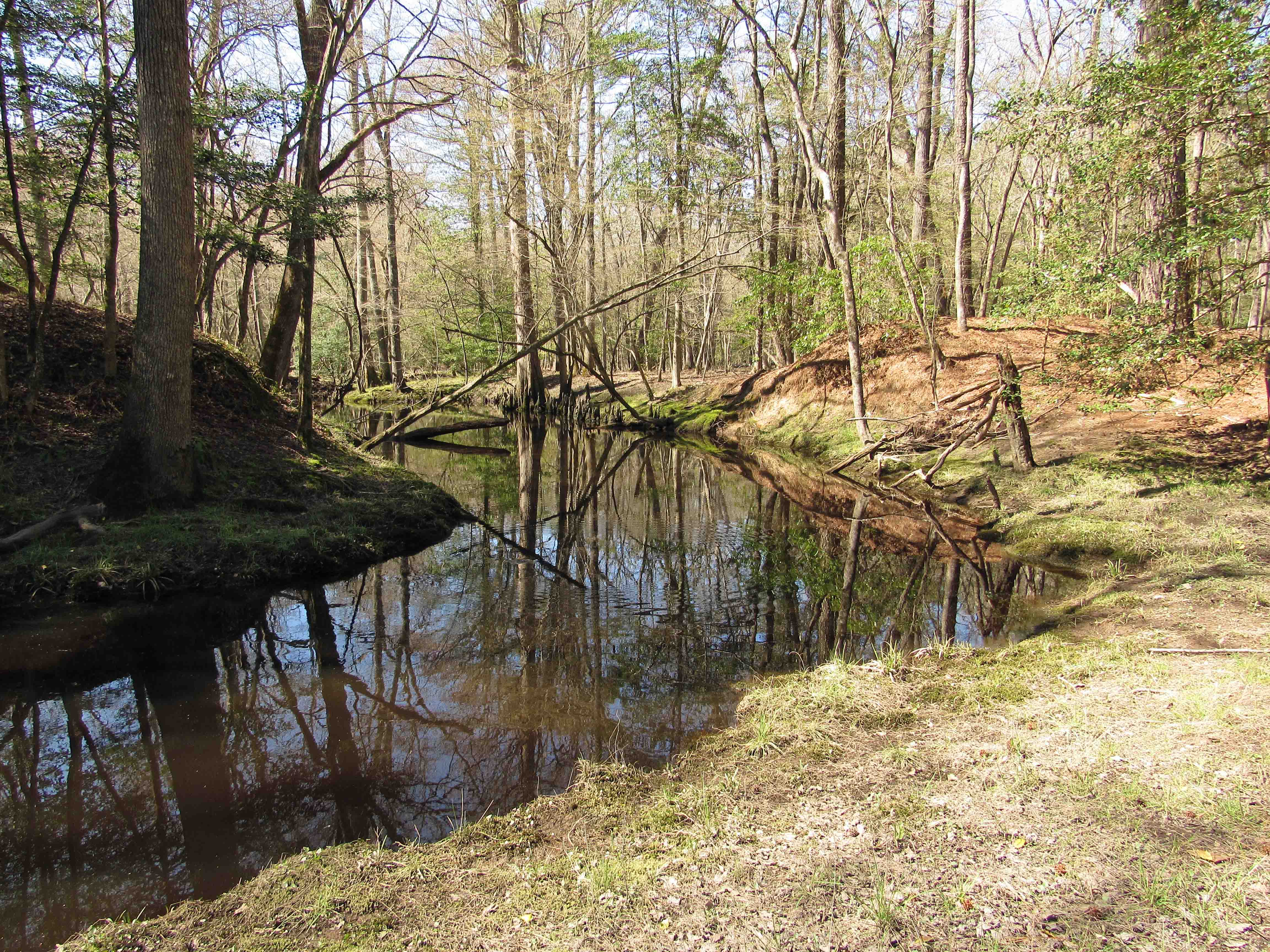
Instead of heading back the way we came, we cut through the woods, but still have to navigate the ditch. I thought Kathy was going to want us to cross the log.

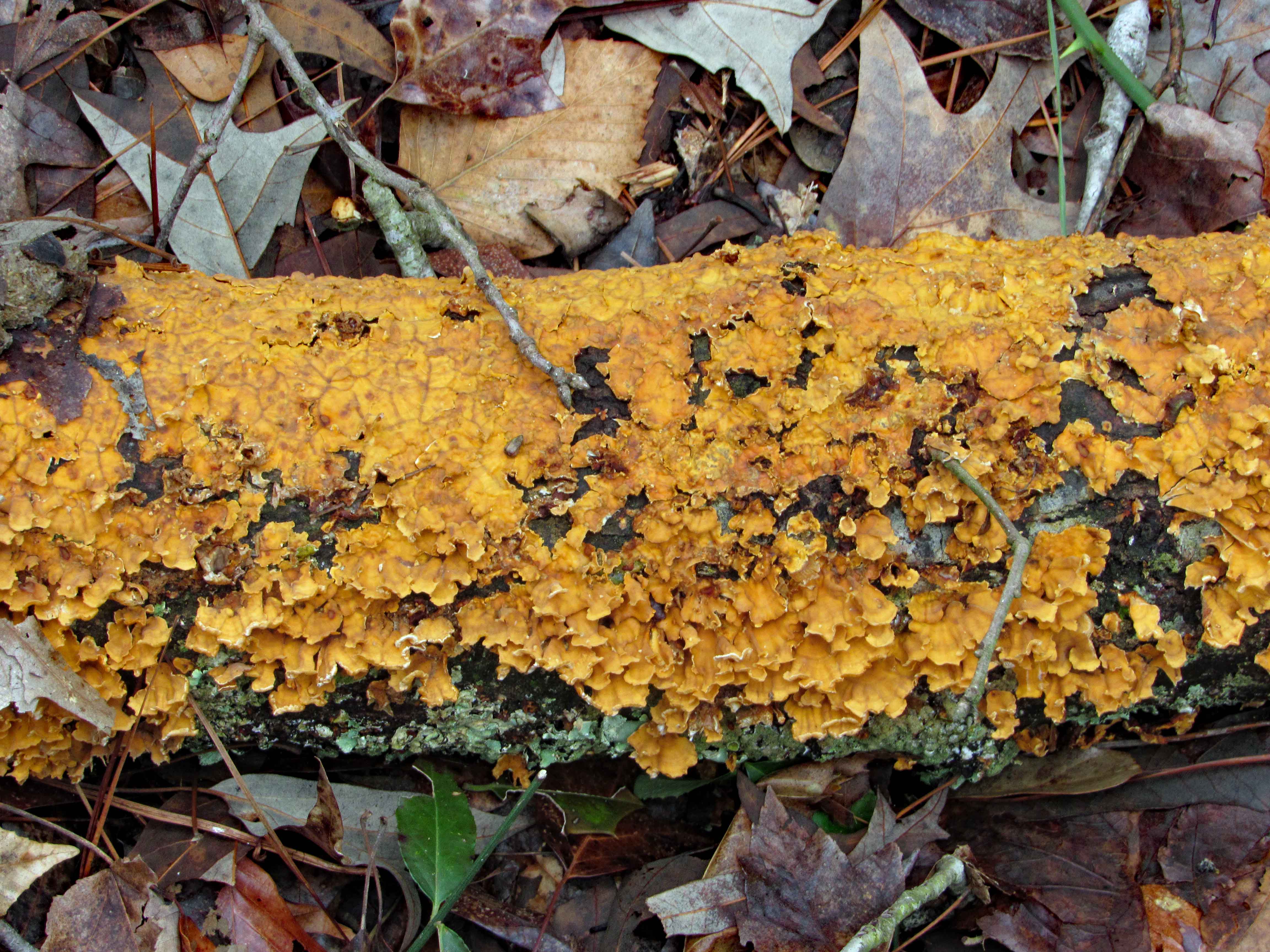
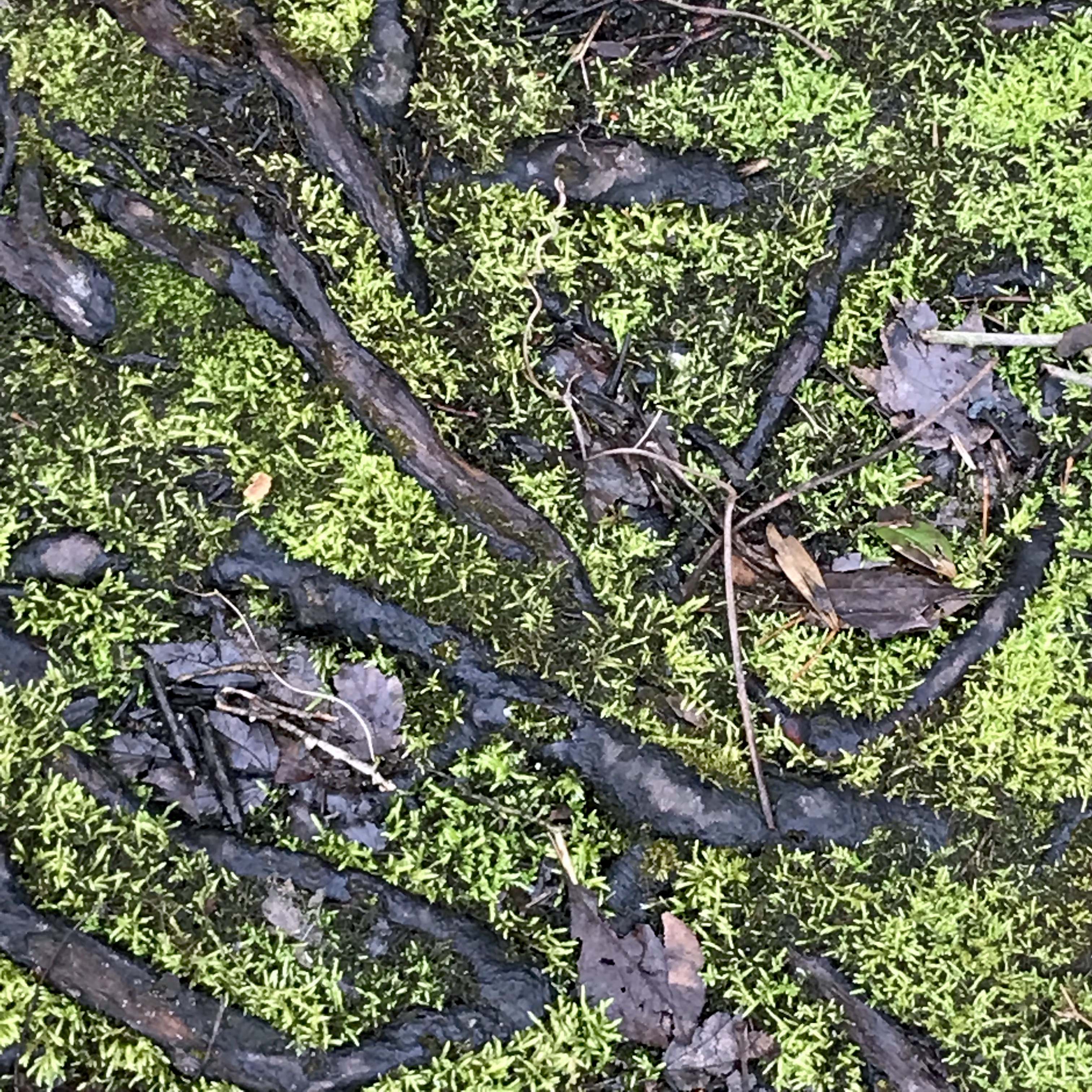
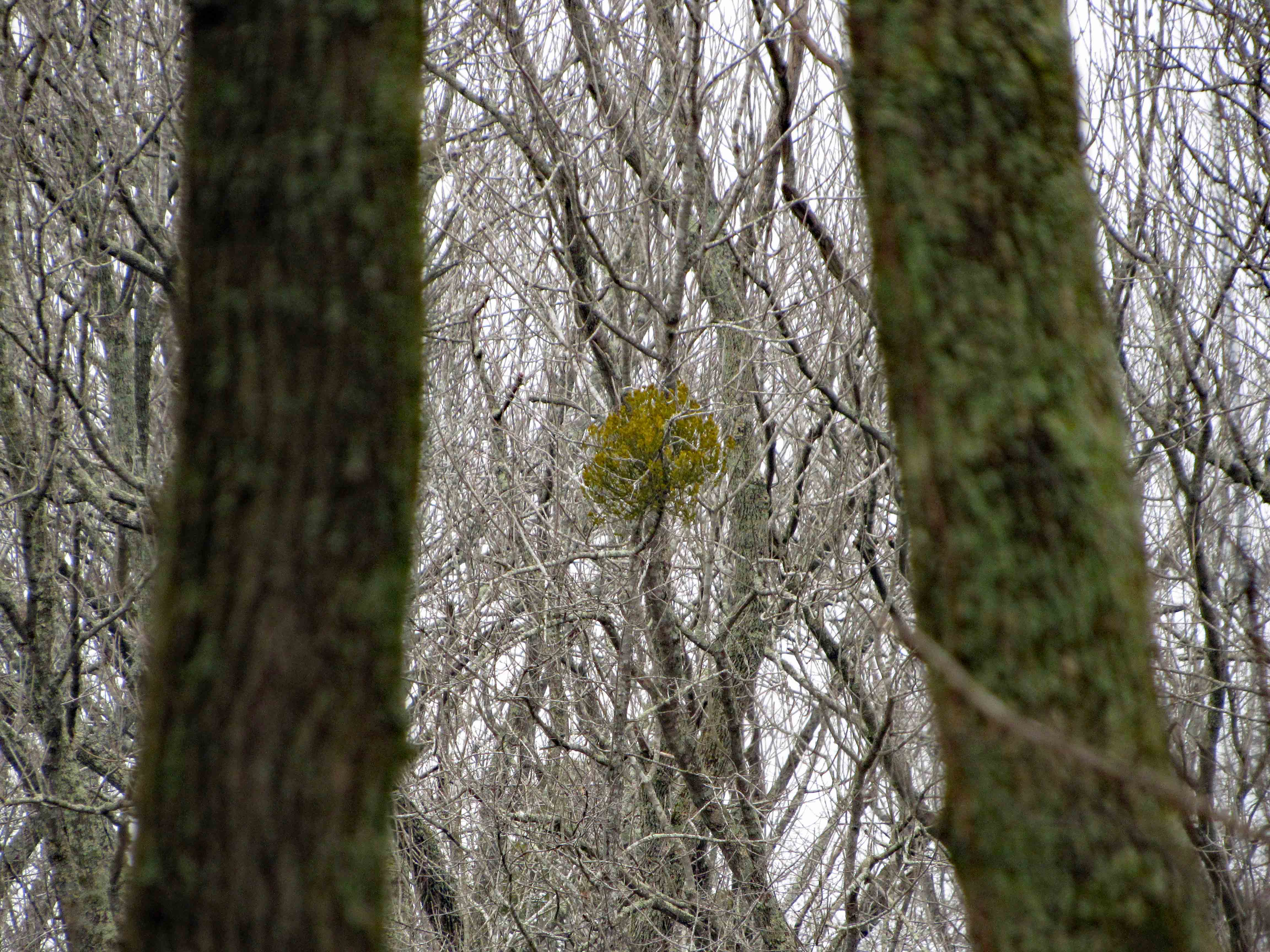
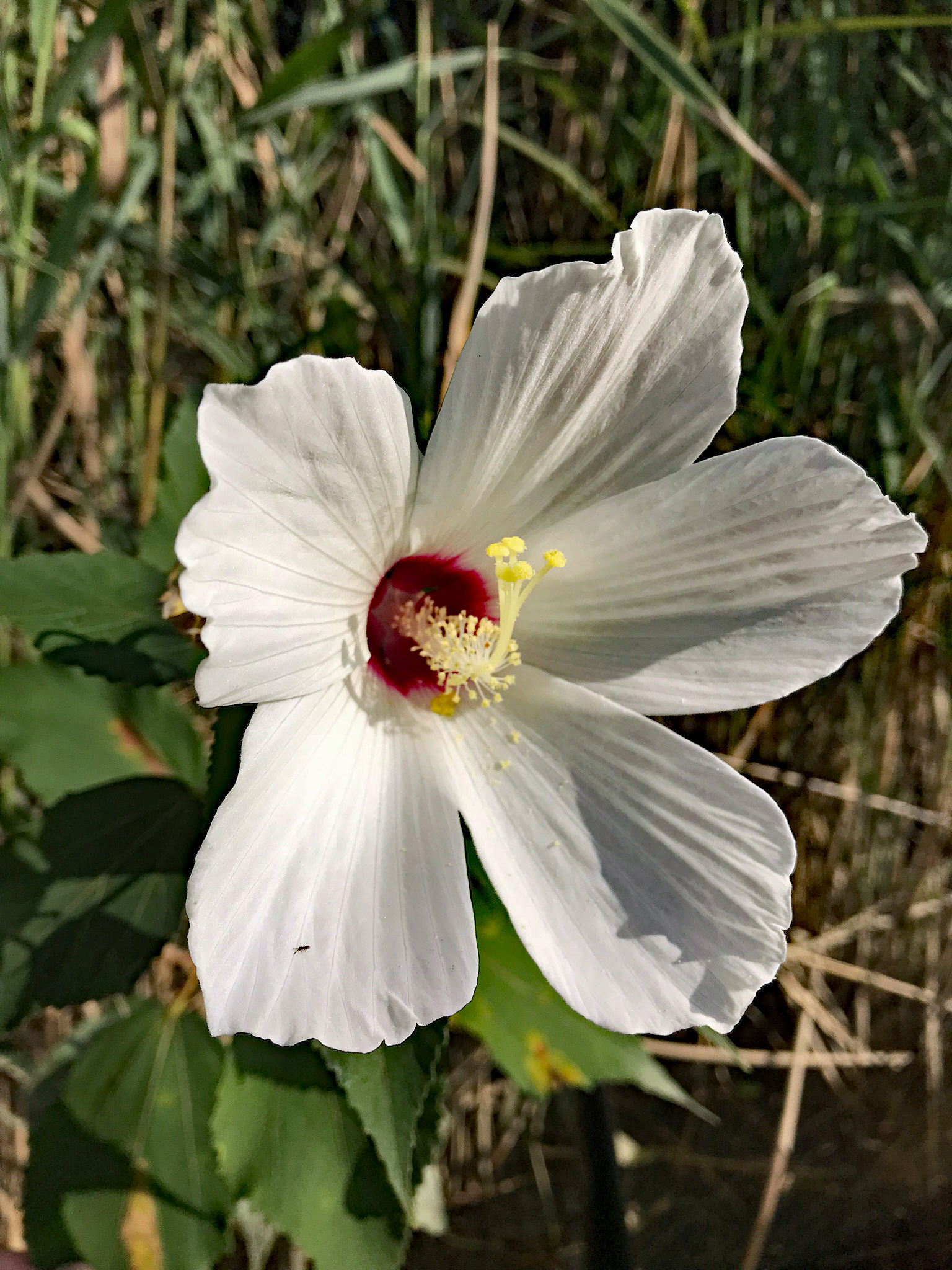
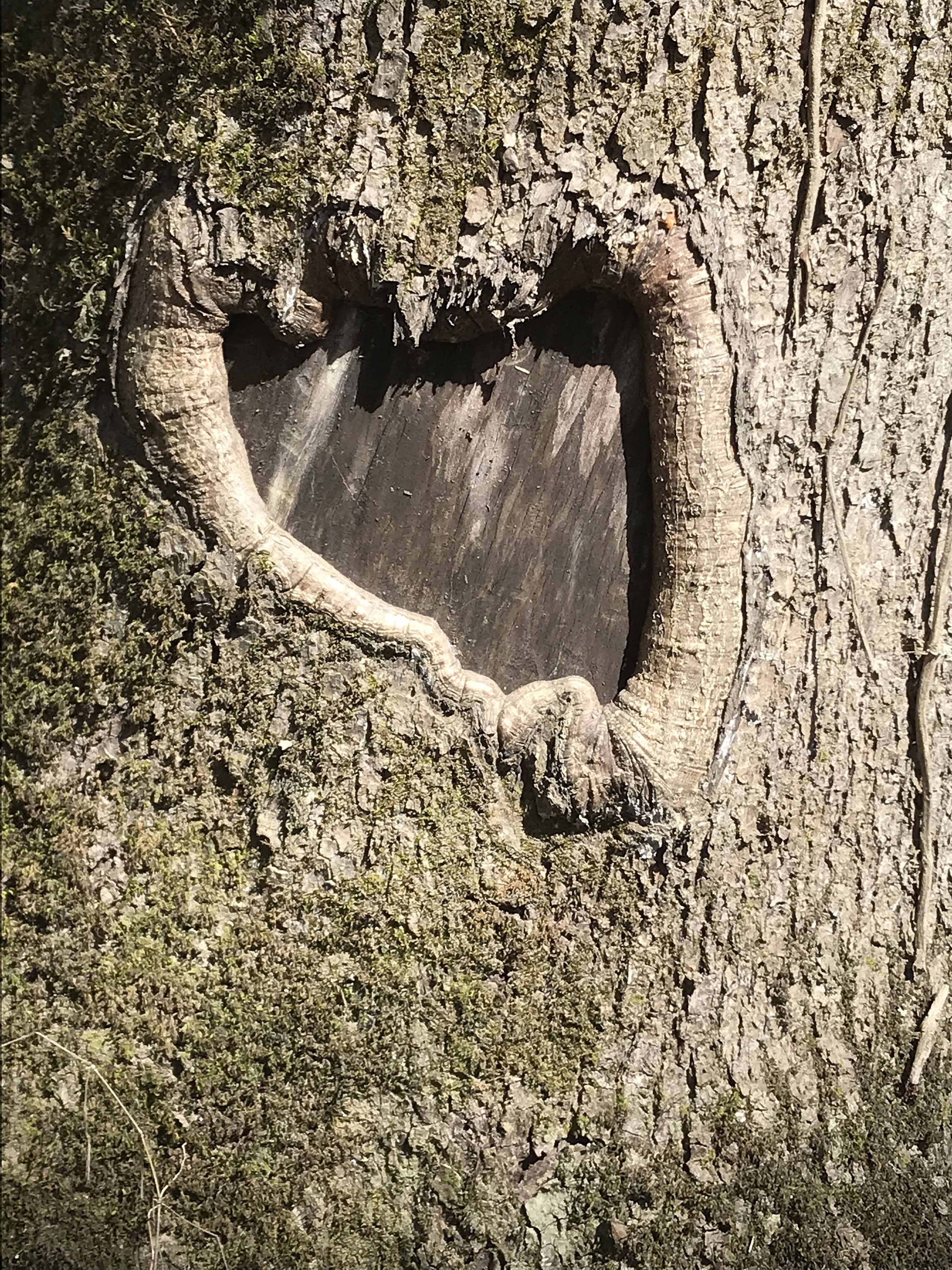
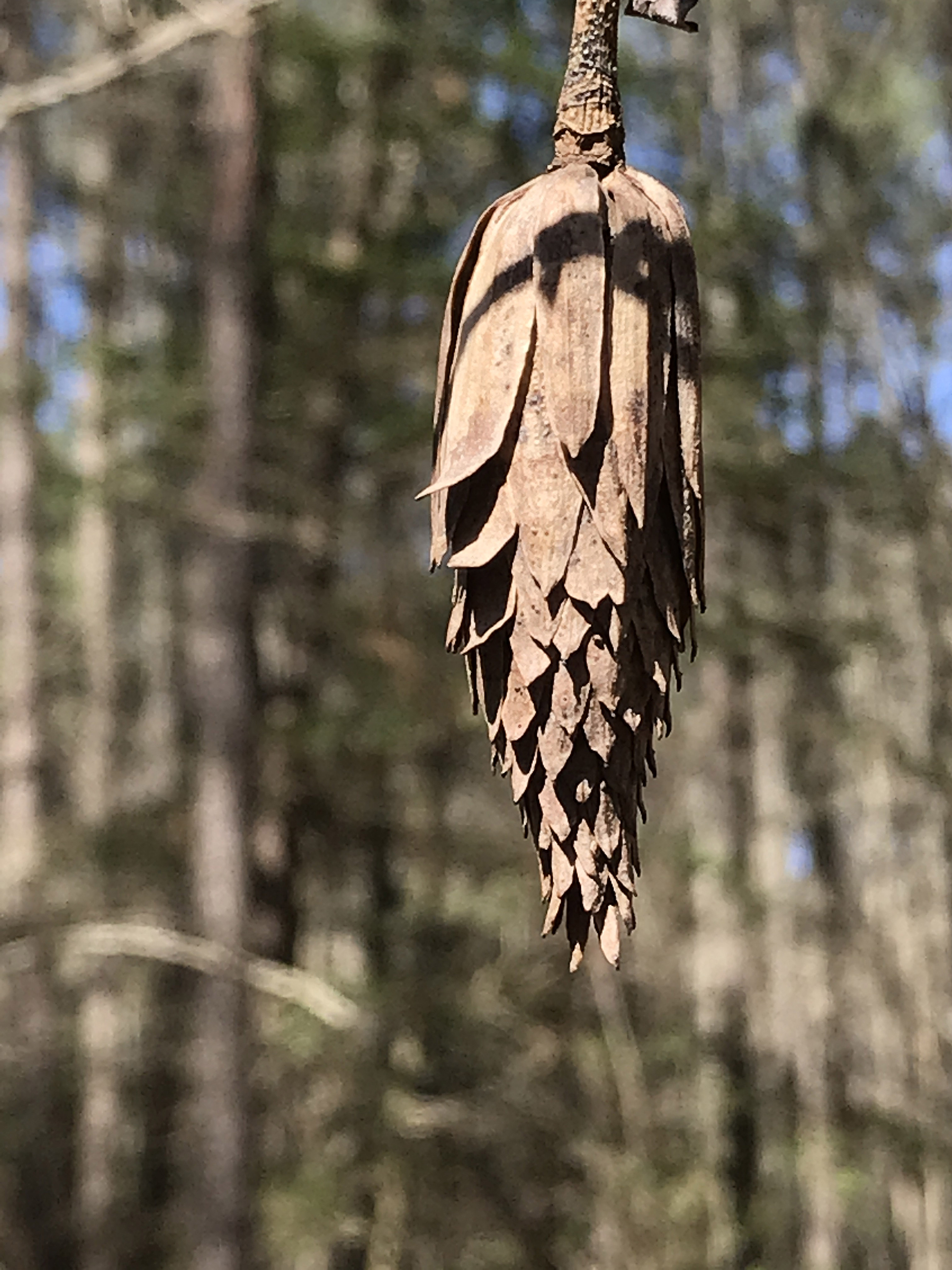
Some really nice close-ups that Kathy took.

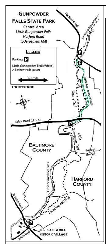
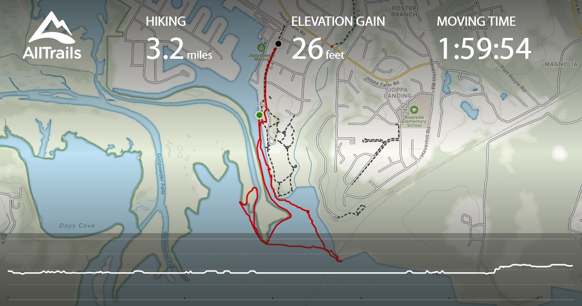
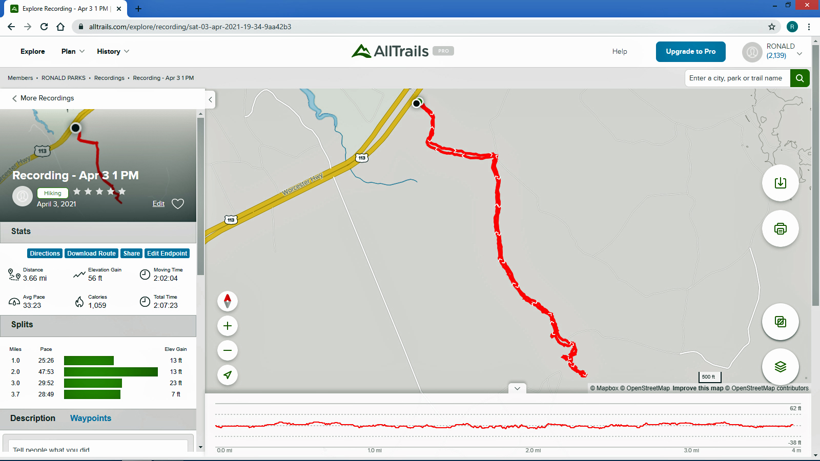
Below is the map that AllTrails has. Path looks pretty straight and narrow – in and out.

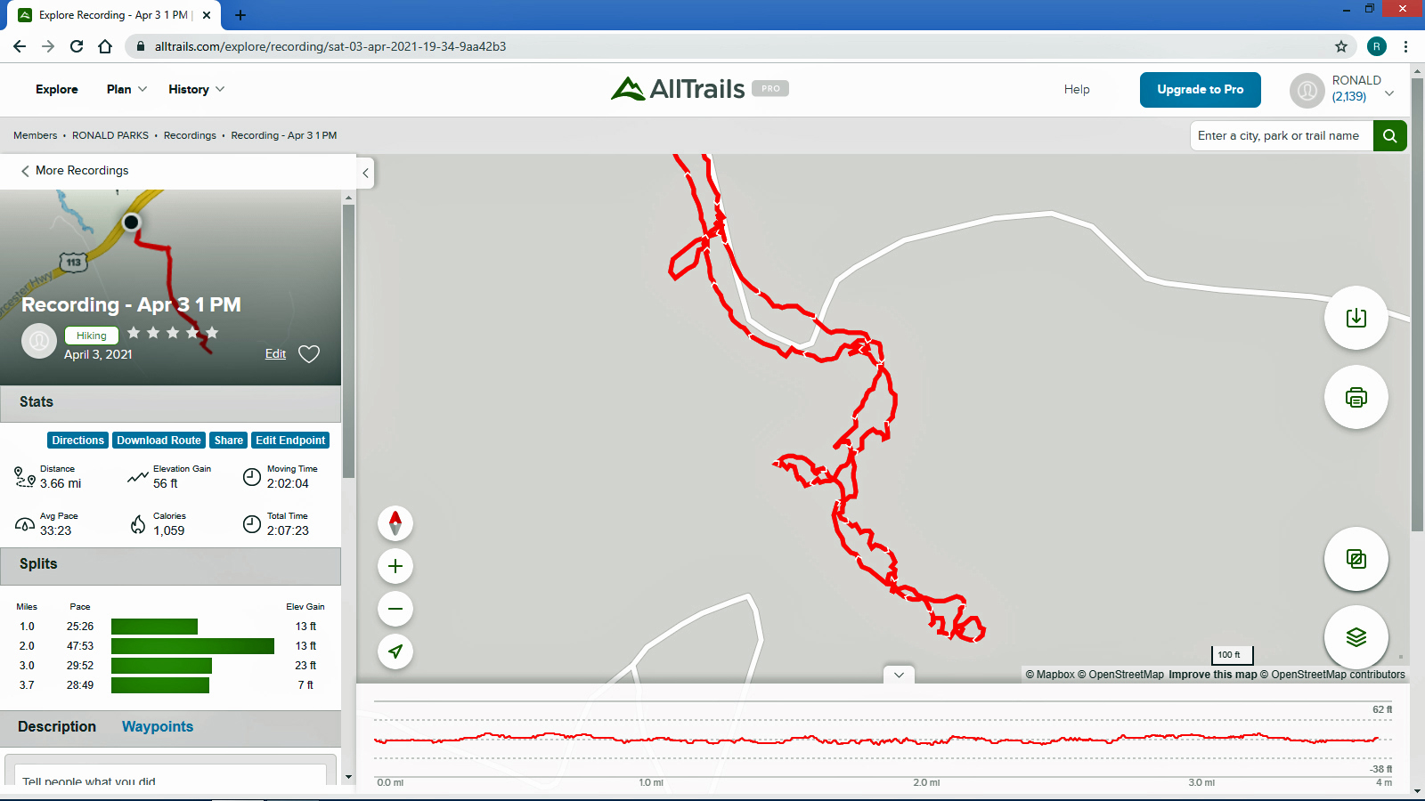
Here is what it looks like enlarged, at the creek. We were all over the place!

Another wonderful adventure! We will probably do the Green Path by bike, next trip.

Fourth Annual Christmas Adventure

11 Friday Dec 2020

Posted by Ronald Parks in Hiking, nature, Photography, Road Trips, Trails

≈ 3 Comments

Tags

Baltimore, bridges, Chesapeake Bay, Christmas, Cromwell Park, engineering, Gunpowder Falls, Hiking, Loch Raven, nature

Wasn’t sure we would make it to Baltimore this year, to decorate our favorite building in our favorite park – Cromwell Valley Park. But we did! Heading across the field towards the Greenhouse Path (Not sure when they started calling it that), up in the distance we see the little house. Many years ago it was a bath house for the family that use to live near here.

Wondering how many more years our little house will weather the storms. I wish there was a way myself or any of the park volunteers could restore it.

And here I am, decorating.

Our finished Christmas gift to the park.

Time to make a Christmas wish…

We walk the trail to the woods and then head through to the old balancing reservoir shaft.

On to the Sycamore Trail

This is new. Built in 2019 by a Scout for his Eagle Scout Badge.

Hike towards Mine Bank Run. Can still tell this run continues to overflow it’s banks. Stopped to check out what I call the Bubbling Pond. They call it Marble Spring. It bubbles up from lime underground mixing with the water. Not much bubbling today.

From Mine Bank to the Lime Kiln Trail. I am still amazed at how these were rebuilt.

View from the top looking towards Long Island Farm.

The sky was spectacular this evening. This is at the park.

This one was taken from the Eastern Shore at the Bay Bridge. We pulled off of Rte. 50 to eat and look at the water and ships.

Kathy took this one from the car, heading towards Vienna.

Beautiful day! Beautiful adventure!

North Carolina October 2020

01 Sunday Nov 2020

Posted by Ronald Parks in boating, Family, Hiking, nature, Photography, Road Trips, Trails, Travel, vacation

≈ 1 Comment

Tags

boating, bridges, Cape Lookout, Dismal Swamp, Fog, LSD50, North Carolina, shells, Shrimp, SpaceX, Sunset, Swansboro, Tern

Another great road trip to North Carolina. Kathy already there for a week before I headed down to pick her up. I was to stay a week also but the weather took a turn for the worse and we came back a couple days early.

It was very foggy when I left Salisbury, Md. to head south. The fog did not dissipate until well after Edenton. I missed the windmill farm, but Kathy got a photo of it.

One of my favorite stops is at the Dismal Swamp. About 1/2 way there.

Arrived at Indian Beach, N.C. and we took a walk. Shrimp boat.

The seagulls here are unlike the ones in Maryland that will hover over you waiting for food.

A Royal Tern

The next day John came down to take us out on their boat. That was very nice of him. With all this Covid stuff going on, we hardly see each other.

Heading under the Atlantic Bridge Causeway.

Easing past Sugarloaf Island, headed towards the N.C. Port. Docked there for the time being is the USS 50 (LSD-50), Carter Hall. Landing Ship Dock.

Here she is a little while later pulling out of port.

Not far from her is this interesting vessel – Go Ms Tree. Formerly named Mr. Steven. GO Ms. Tree – often shortened to Ms. Tree – is a fast, highly maneuverable vessel that was chartered by SpaceX in 2017 to support their fairing recovery program. The ship has been heavily modified by SpaceX so that it now has a large net structure designed to catch fairing halves as they descend. The name ‘Ms. Tree’ is a pun of the word ‘Mystery’. (from SpaceX website)

Pass this area of the port and ran smack dab into a fog bank.

Made it through there and we all, except John, got off onto Shackleford Banks.

Nice driftwood.

My shot of Kathy and Gail, from up on a dune.

Kathy stepped on a couple Hermit Crabs.

Left Shackleford and headed over to Beaufort. You need to swing around Rachel Carson Island. Shrimp boats everywhere.

Sea Tow is like AAA of the water.

The CaryAli. Wow! A steel and aluminum ship. Built by Alloy Yachts in 2013. For just $25m she can be yours.

Looking through the Watercraft Center at a ship painted on a wall…

Went up Taylor Creek for a bit, looking at all the boats and quaint little houses. Turned around and headed to Pivers Island Road.

We made it under the bridge but then the water started getting shallow so we headed back to the Beaufort Channel and then towards Bogue Sound. Passing NOAA on the way. There are a lot of colleges and government research centers down here.

I guess it makes a good kayak launch?

After John and Gail left, to go back home, Kathy and I went over to Swansboro to find a nice place to watch the sunset. Saturday night and the town was packed! So we left and the sun was heading west fast, so I pulled over at Dudley’s Marina on Rte. 24 and Kathy took a photo of me taking a photo of the pelican sunset.

The ‘New Norm’ I hope not for too much longer. The next day we went back to Swansboro to look around

Domestic Muscovy Duck.

Another shrimp boat. Shrimp burgers from the food truck were huge, along with their oyster burgers and soft crab sandwiches.

Love the water – when it isn’t freezing. Or knocking me on my butt!

Our next adventure was to Cape Lookout Lighthouse, via a tour boat, where everyone was practicing social distancing, for the most part.

We cut over to the beach, hoping to find some 1/2 way decent shells. No luck.

Even some of the better shells were being fought over. This guy wasn’t giving up his shell find.

We leave the ocean side of the isle and head over to Wreck Point. Trudging through the dunes and marsh.

Balancing the Light.

Heading back towards the lighthouse.

Checking out under the dock…

Boardwalk to the lighthouse area.

This guy was going close to shore and other boats blasting his horn and making all kinds of noises.

On the way back, on Shackleford Island. Scratching an itch with his food.

Another day, another adventure. Off to the side of the Pine Knoll Shores Aquarium is a nice little hiking trail. About 1.2 miles.

We thought this coloration was the tree itself (Holly)

But it is lichen. Nice info signs along the trail.

One side of the trail is a marsh. The other side is the Bogue Sound.

Sign in front says End of Trail. Sign behind it says Last Marsh Overlook Ahead?

Foot bridge to the end.

And at the end, a nice bench to rest on.

Who Dat? Go ahead Ron, stick your head in there..

To the beach one last time.

Another nice vacation, thanks to John and Gail.

Cape Lookout

18 Friday Oct 2019

Posted by Ronald Parks in Hiking, National Parks, nature, Photography, Road Trips

≈ 1 Comment

Tags

Beach Life, Cape Lookout, ferry, Hiking, Lighthouse, National Parks, nature, North Carolina, photography, sea shells

While at Indian Beach, North Carolina, we decided to visit the Cape Lookout National Park. To get there we needed to catch the ferry from Harkers Island. They have a nice visitors center there. A few blocks away is/was a museum, Core Sound Waterfowl Museum. It is still closed from the storm of a year ago.

Visitor Center, anchor from ship that sank in 1902
Beach artifacts

it was about a 4-1/2 mile ferry ride, making one stop at Shackleford Banks. People like to stop there and look at the 100+ wild horses on the island. Kathy and I visited the western end of this island back in June. Nice trip. Didn’t see any horses though.

Pelicans doing pelican stuff.
One of the shy horses

Arrived at our destination and stopped at the Keepers House first.

We missed being able to climb up to the top by about a month.

Black diamonds face north and south. White, east and west.. So, not only does the light shine 24/7, you can also get your bearings by the diamonds.
Random black and white

Instead of taking the boardwalk to the ocean, we took a service road.

The ocean. Too many people before us so the pickings were slim for seashells.

So, Kathy decides instead of us walking back up the beach, we should cut across to the bay side. “Are you sure?” “Yes” Ok!

Sand first…
…and then all marsh.

Not just a marsh but also a bunch of inlets of rushing water. I didn’t know we were doing this kind of hike or I would have worn my water shoes and not my Tevas!

Spooked this guy
The lighthouse looks far away
Looking back from where we came from. It was actually a nice hike.
Finally to the beach
Unknown structure
Getting closer
And so we rest
Back to the dock
Random camera colorization of image. It does this sometimes.
The ferry coming to drop off people and pick us up.
The map of our trip

Although I was only at the beach for about 4 days, it was so nice to get away! Ha! Get away from what??!! Kathy and I always go to the beach! A wonderful trip. Thanks Gail and John.

Indian Beach Vacation

01 Monday Jul 2019

Posted by Ronald Parks in Photography, State Parks, vacation

≈ 2 Comments

Tags

Beach, Beach Life, boats, Bogue Inlet, dolphins, Fort Macon, North Carolina, tours, turtles

After months of retiring, selling our homes, moving, working on the new house…we finally were able to take a vacation. Kathy’s sister let us stay at her place on the Crystal Coast of North Carolina. Thanks Gail and John for a much needed break.

On the drive down we stopped for a rest at the Dismal Swamp Canal. Place has an interesting history. Google it. We also stopped on our way home.

While there, the hydraulic bridge was being moved for a couple of boats to go through. Boats have the right of way.

Raising the bridge

Molly needed a rest area too!

History

The canal

Whatever happened to this guy?

Onto Indian Beach. Some favorite shots.

Portuguese Man-o-War Jellyfish

Replacing dune grasses
50 cent
Turtle Nest
Wave Dancer
Peace

Night time, sun sets.

One night we went for a bike ride.

Bike ride sunset

Emoticons – Emoceans.

Headed over to Beaufort for a boat ride to Shackleford Island.

A beauty amongst the flowers
Putting a boat on a boat
Tour boat
Plane pulling a para-glider
On their own
Duke University lab
Lots of dolphins
Landing site for our adventure
Heading towards the horse paths
Higher than they look
I fell on this one. Saved my camera!
Skate
Fort Macon
Coast Guard yard
Fool

Bogue Inlet Pier

Thanks Gail and John! what a great vacation!

Early March Hike

03 Sunday Mar 2019

Posted by Ronald Parks in Eastern Shore, Hiking, nature, Photography

≈ 1 Comment

Tags

bridges, Dams, Eagles, Hiking, nature, Pemberton, photography

Retirement has been hard work and it seems like forever since we have been able to find the time to enjoy a really nice hike. It was really cold and windy when we hiked Chincoteague a couple of weeks ago. Today did not seem like a good day to hike with the impending storm on the way, but we said the hell with it. We need to get out!

So off we went. We decided on somewhere local in case the weather took a turn for the worse. Pemberton Historical Park is just southwest of Salisbury and just a few minute drive from home. Here is the historical marker as you enter the park.

Sme more history can be found on their website. Very interesting. The trail map below. We hiked the Bell Island, Osprey and History trails, along with part of the Handy Hall Trail.

Entering the park is a nice fence…

A man-made fence vs. a fence Mother Nature is making…

The trail head consists of various older buildings. Including this restroom.

This looks to be an old bunker/storage building of some sorts.

A nice theater.

And a rounded dam. I can almost picture years ago this being made of wood and then maybe stone. 

A little island picnic area.

Kathy taking a photo of me…

taking one of her.


Dreary yet some nice colors.

Boardwalks 

and bird boxes.

Molly hears it…

I see it.

And kathy sees it.

An eagle on the top of the lone tree dead center

Hard to get a good shot this far away. (I do not carry a bunch of lenses and stuff with me when hiking)

More colors.

This was in the path. nicely strange. Kathy took this one.

When one tree fell, I guess it took the other one with it.

Dead center and this thing was humming.

Lone growth up in the trees.

A beaver house.

As I walk away…

A penny for your thoughts (I’m thinking – Don’t touch it! It looks like a booby-trap!)

A wonderful adventure in our new neck of the woods!!

Thanks God.

https://www.pembertonpark.org/pemberton-park/index.htm

A September Walk on the Little Gunpowder Falls

10 Wednesday Oct 2018

Posted by Ronald Parks in Hiking, nature, Photography

≈ Leave a comment

Tags

Gunpowder Falls, Hiking, nature, photography

A nice little hike we took last month. A little over a mile and a half. The green highlight is our path; from Belair Rd. to Harford Rd. and back. Use caution once you get to Harford Rd. to cross over the bridge. People are flying down that road and approach a curve. It is hard to be seen.

map2

From the parking lot on Belair Rd. we head under the bridge.003

Additional graffiti is added every year. And yes we do – 005

A nice pattern for the walkway under the bridge.006

Looking towards Harford Rd.008

The trail. I have nothing against Mountain Bikers, as long as they are on a trail that I am not on, but quite a few act like they have the right of way on these narrow spots – you don’t! Common courtesy is the rule of the day.014

Across the Falls.018

A sandbar up ahead.019

Time to look for some river glass.023

Not much glass but Kathy found this. Possible arrowhead?028

Lots of debris in the Falls – lots of rain all summer. Molly looking for a way around it.045

A pond off to the side of the Falls, before Harford Rd.052

A foot bridge over the stream that feeds the pond.054

After crossing over the bridge at Harford Rd. we head back. This path is pretty narrow. In all the years I have hiked the Gunpowder Falls, I have never taken this path for some reason? Kathy practicing her dance moves.064

Rot inducing pathogens or fungus, whichever you prefer.074

Looking thru a leaf to see what I can see…081

Heading to Belair Rd. the path swerves north along the road a few hundred yards before you can climb up and over. Belair Rd. is a 4 lane highway at this point. Speed limit, well doesn’t matter, people again are flying by…082


Mariner Point Evening Kayak

28 Tuesday Aug 2018

Posted by Ronald Parks in kayaking, Photography

≈ Leave a comment

Tags

boats, bridges, Eagles, Gunpowder Falls, kayaking, Mariner Point, nature, Osprey, photography

Beautiful weather and time to go for an evening kayaking trip at Mariner Point Park up in Joppatowne. We were hoping to see a lot of birds, but only saw a few. Lots of boats and noise going on in the park. Here is our path. (The green dot to the black dot is me forgetting to turn off AllTrails when leaving!)

Heck of a time parking anywhere. The lots were full with boat trailers and there was a party going on at the pavillion. I wrote the park service and the county executive last year about this problem and was more or less told – oh well. Into the kayaks and headed out. 

Kathy took a bunch of these photos. Only a couple flowers along the shoreline. 

Leaving the boat ramp, heading south then a right turn and back north. We actually went further up than the map shows. It also doesn’t show us cutting thru a waterway to the other side. It has us going across land. Lots of sea grass makes paddling a little more work.

Kathy doing the double paddle reflective stroke!

Me trying to avoid eye contact with that heron watching me.

After some paddling in the little waterways (The Gunpowder Rivers/Falls), we headed to open water. Towards the railroad bridge. Watch out for boats!

I always like going under this thing, and hearing the trains go whizzing by overhead.

Kathy should wear a hardhat under here.

Time for some leisurely paddling back to the ramp, waiting for the sun to go down. Up in the trees we see these guys.

Looking close you can see a dragonfly photobomb this pic! Not sure if we scared the eagles off or the dragonfly, but the one eagle almost knocked the other eagle off its perch.

Back in the boat lane, Kathy took a photo of me using her iphone. Strange green glow coming from somewhere.

And another green glow.

The sunset side of the river was dark, yet on the other side it was still fairly light. Caught a glimpse of him up in the trees. As fat as he is, I thought it was a parrot at first.

Kathy enjoying the peacefulness of the sunset. It is hard to get a good shot with a point and shoot camera, especially when boats are going by, causing wakes. Only one boater slowed down as they approached our location.

One thing about my P&S camera, in auto, it compensates for the low light and pretty much does its own thing. Like this water shot.

And this lone osprey shot.

Time to head back. Too many boats at the launch so we pulled up and out at a smaller launch area in the woods. The party was just winding down near the launch site.

All in all, a very nice kayaking adventure!

Photogravure – Copper Plates

21 Tuesday Aug 2018

Posted by Ronald Parks in Archives, Dams, Photography, water history

≈ 5 Comments

Tags

Baltimore, Dams, engineering, glass plate negatives, Gunpowder Falls, HISTORY, Loch Raven, photography, photogravure, water history

Doing some more packing of my office and here is another pile that needs documenting. I thought these were pretty neat looking when I found them about 10 years ago. I placed them in ziplocks to keep them from getting scratched and then put them away for another day. That day has come.

The three piles on the left are each about 5″ x 7″ x 7/8″ thick. The smaller ones to the right vary.

Here is one removed from its sleeve and placed on shelf to be photographed. 

Same copper plate scanned with color settings at 300dpi. Trying to be careful not to scratch the glass surface of the scanner.

Kind of shabby looking, so I scanned it in Black and White.

Better, but not as good as the original below. This one is an electronic copy from a glass plate negative I scanned back in 2007. In 1913 (I know, it looks like 1915 but it is not) the contractors performed a pressure test on the 10′ conduit from the new dam at Loch Raven to the old dam. 

Tried another one. Color scan first, but at 720 dpi. Pretty bad looking. 

Now in b&W.

Still no good. I had trouble finding a good copy of this. It was not in the glass plate negative groups and not to mention the difficulty of looking for a reverse image. Looked in the lantern slides and there it was.

There is a nice video at this link which shows the Photogravure Process. Glad we have progressed into the digital art stage!

https://photogravure.com/process/

An August Weekend In Baltimore

20 Monday Aug 2018

Posted by Ronald Parks in art, Baltimore, Photography

≈ 3 Comments

Tags

Baltimore, engineering, Farmers Market, food, HISTORY, Monuments, Mt Vernon, Museum, music, photography, Washington Monument

Living in Baltimore most of my life, there are but a few things that I have never done while living here: Visited the Peabody Library, climbed to the top of the Washington Monument and gone to the downtown Farmers Market. So, time to check those off my “To-Do” list.

First stop on Saturday morning was the Peabody. They are only opened a few hours on Saturday. 10a-1p. 

Before going in we took a shot of the Washington Monument. A lot of these photos Kathy took.

Heading towards the library.

What a wonderful sight!

All these books! Old books!

And the architecture is amazing.

Of course, since you are not allowed to roam around the upper shelves, the next best thing to do is to look through the card catalogue. My name is there – but no listing of my books!

Kathy also has a listing.

After a while of gazing in amazement at the library, we decided to roam around other parts of the building. The Peabody Music School is here also.

Looking up from the bottom…

And then down from the top. Helter Skelter.

Kathy took this next photo. One of my favorites.

Up and down the halls. I was surprised at all the areas we could venture to.

A history of one of many violin makers.

Random artwork.

Time to leave the Peabody and head outside. Looking at the Washington Monument I noticed that the gate was open! My heart started beating faster! I have always wanted to go in and climb to the top!

Yes! The steps are open! $6 is a small price to pay, to be able to go to the top! And I am off! (Kathy did not want to go, but she said she would take a photo of me looking out the window)

Holy crap! Am I going to make it??!!

Halfway there! Time to stop and catch my breath!!

I knew aliens built this thing! 

So close!

Wow! What a view. (I did take lots of pics, but seriously, you should try to make this trip yourself)!

Another view. I wonder how much longer this steeple will last?

Where’s Kathy? Oh, there she is!

And her photo of me, waving through the window! I tried to enhance but there was just too much sun glare.

One happy camper!

Another view of the monument.

And still another, as I REFLECT on my trip up the steps and catch my breath!

And Kathy’s reflections.

Worked up quite an appetite, so here is where we went. Great food. Highlandtown on Gough St.

That was all on Saturday. Sunday we headed to the Farmer’s Market.

A preacher preaching under the overpass.

Lots of food and art work.

Murals everywhere. I liked both of these. It looks like it says “Horny, Angry Man”?

Lots of fruits and veggies. 

Shrooms!!

No, I do not!

Nor these!

Time for breakfast. Crepes.

And a piece of art.

It was a great weekend in Baltimore. Thanks God and Kathy!!

← Older posts

Blogroll

  • Flouride Action Network
  • lulu
  • My Book
  • WordPress.com
  • WordPress.org

Recent Posts

  • In Search of The Skipjack Ada Mae
  • Trap Pond Kayak
  • Pusey Trail and Cemeteries
  • Chandler Tract (White Trail) 4 3 21
  • Oyster Fritters, Antiques, a Hike (and a bad sign)

Blog at WordPress.com.

  • Follow Following
    • Water and Me
    • Join 226 other followers
    • Already have a WordPress.com account? Log in now.
    • Water and Me
    • Customize
    • Follow Following
    • Sign up
    • Log in
    • Report this content
    • View site in Reader
    • Manage subscriptions
    • Collapse this bar
 

Loading Comments...