• About
  • History Writings

Water and Me

Water and Me

Tag Archives: Hiking

Grand Turk Island

26 Friday May 2017

Posted by Ronald Parks in nature, Photography, Travel

≈ Leave a comment

Tags

boats, Hiking, nature, photography, Travel, vacation

After two and a half days at sea we finally made port. This was a six and a half hour stop. Because I had gotten some sunburn, which is unusual for me, even though I had a ton of SPF50 on, we decided we would not spend all our shore time laying on the beach. I signed us up for a history tour of the island. Woo Hoo!!

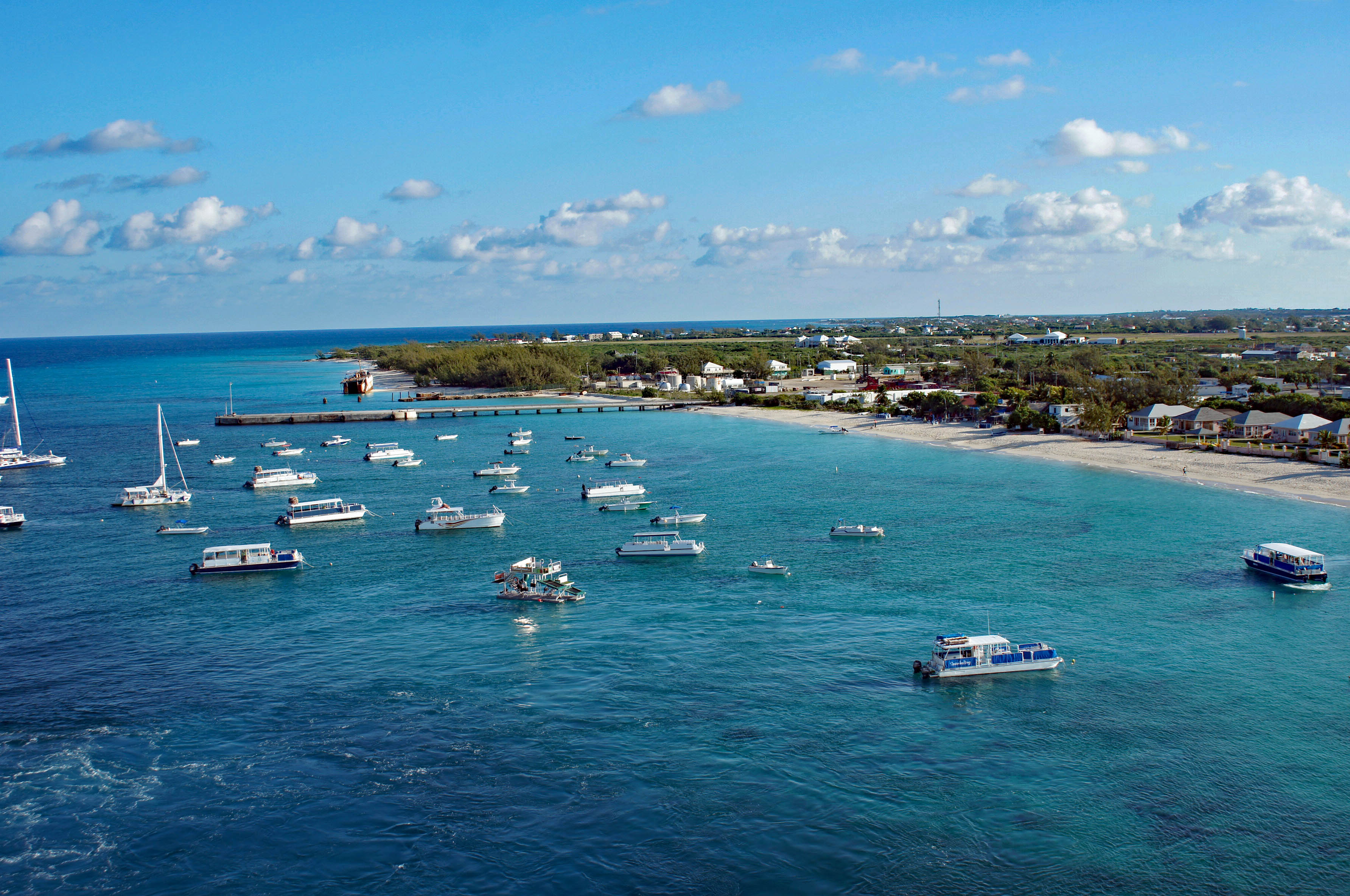
Getting ready to dock about 8am. Look at that water.

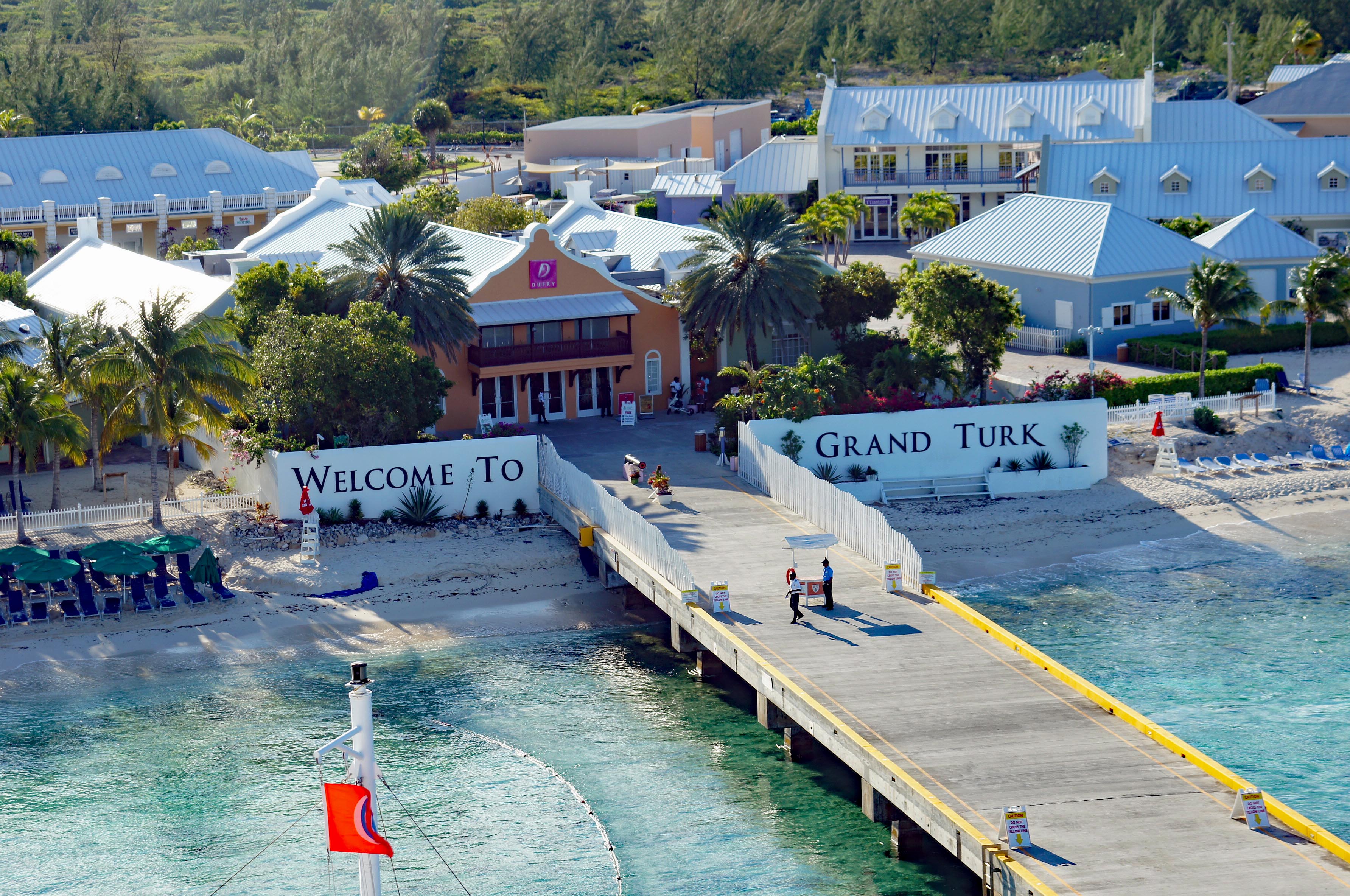
The dock and visitor center. Be sure to take your Boarding Pass and ID. And don’t cross the yellow lines on the pier!

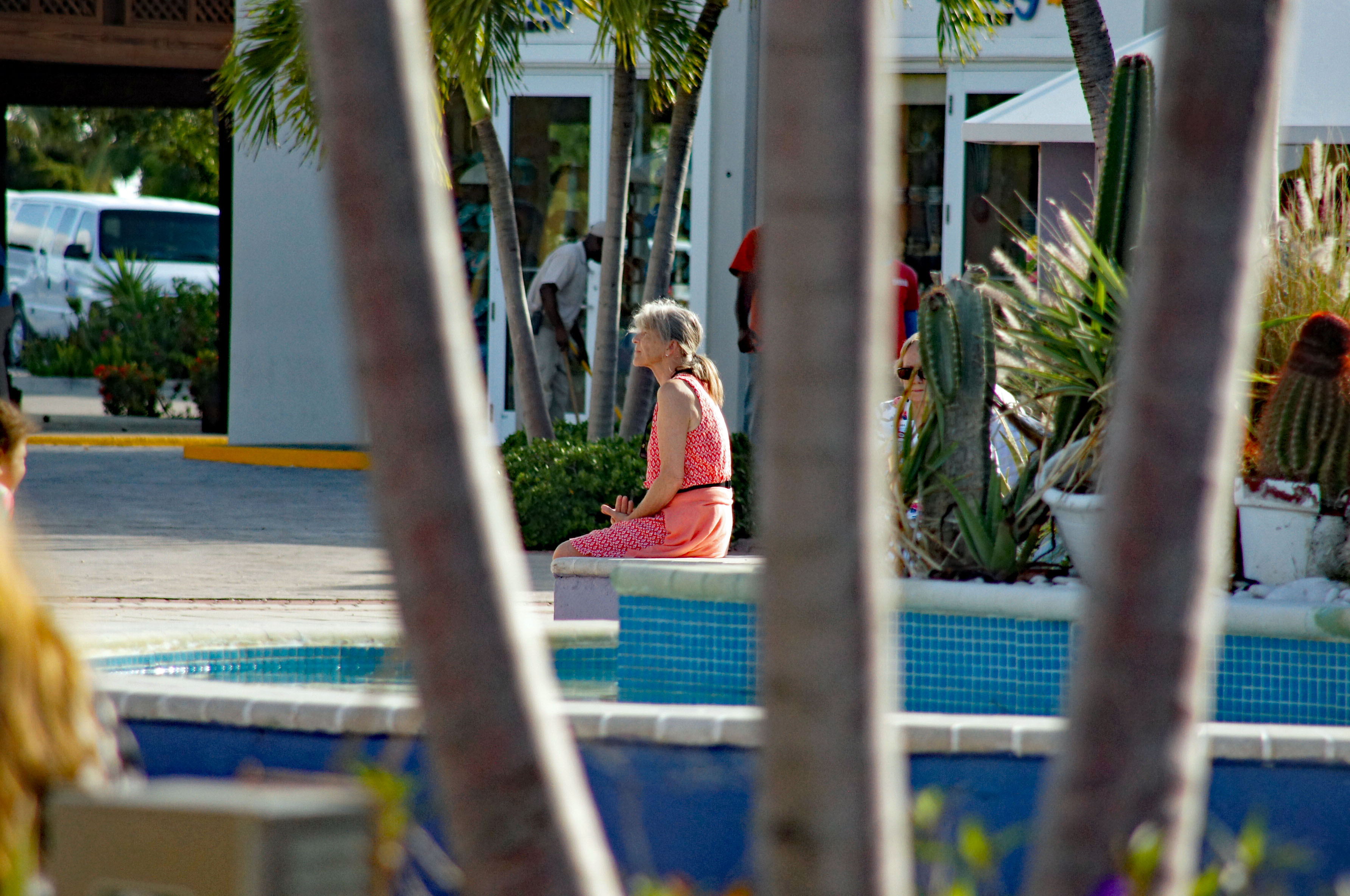
Kathy waiting for the tour bus…or me to to stop taking photos of everything!

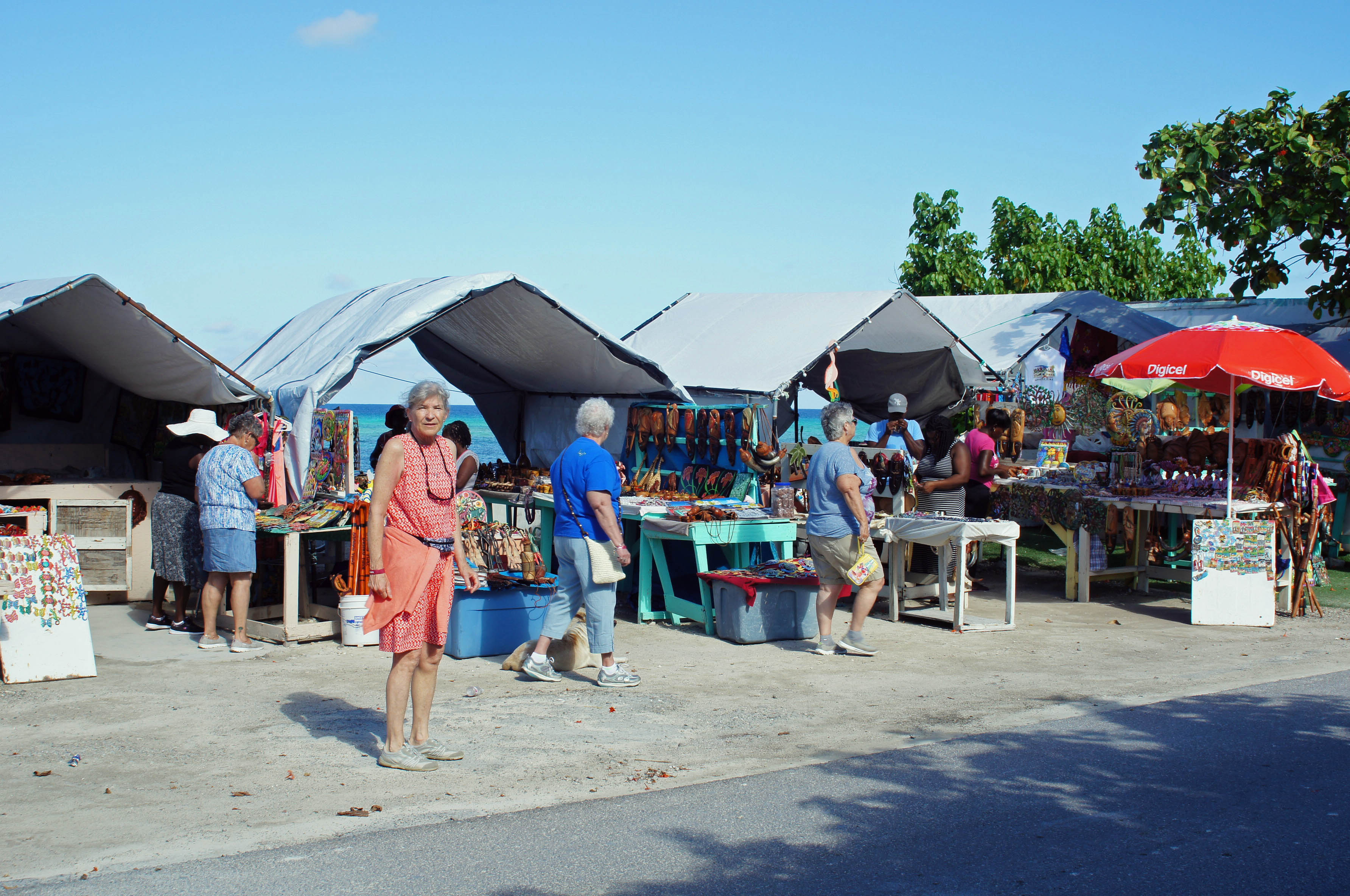
The tour was only supposed to be 1-1/2 hours in an air conditioned bus. it was more like 2 hours. First stop, an area outside of Cockburn Town (our tour guide got a kick out of saying “Cockburn” multiple times??) Above are some local shops.

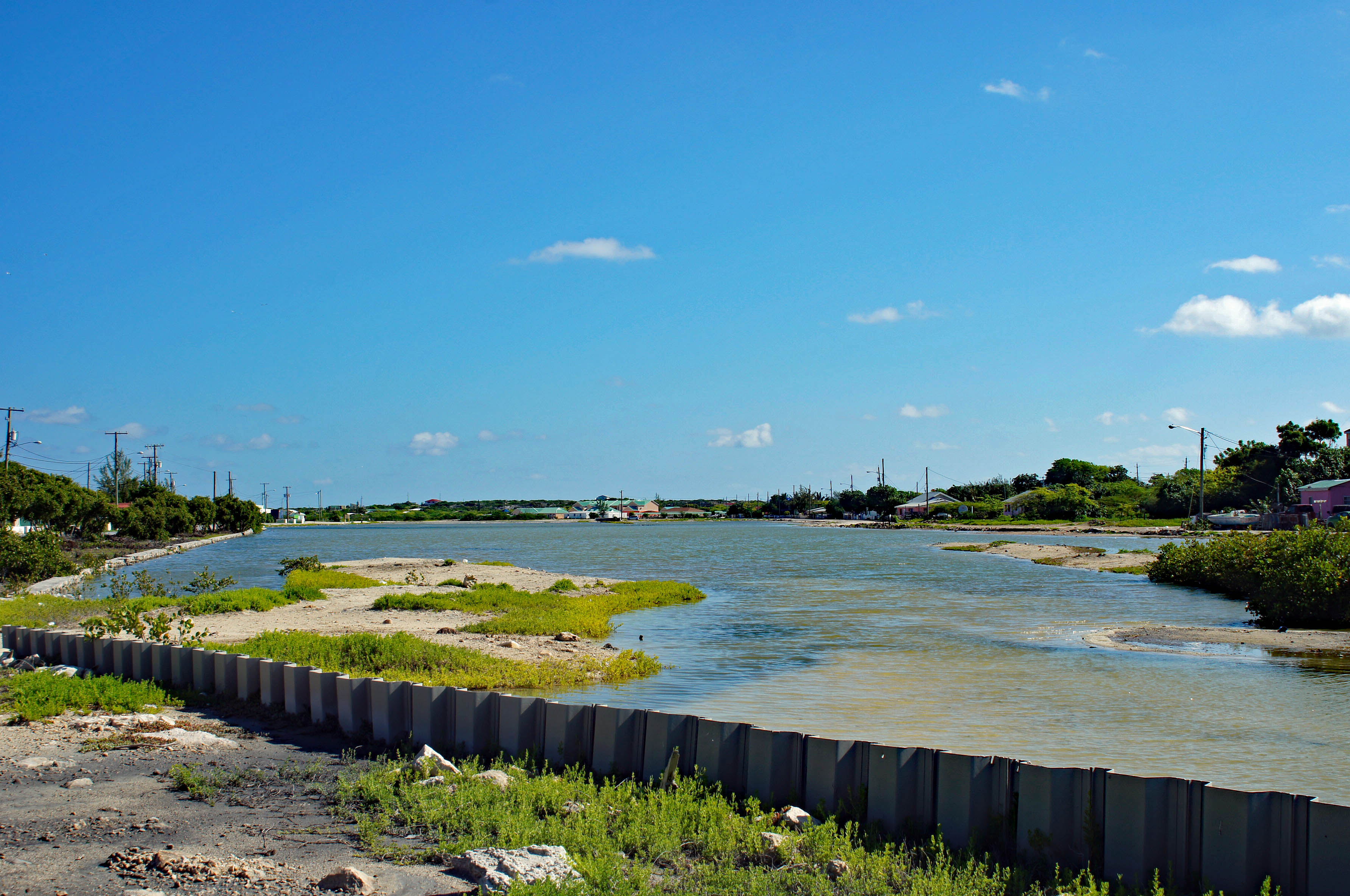
The first stop was 15 minutes long so we left the main strip and headed towards the salt ponds. Grand Turk was a salt producer.

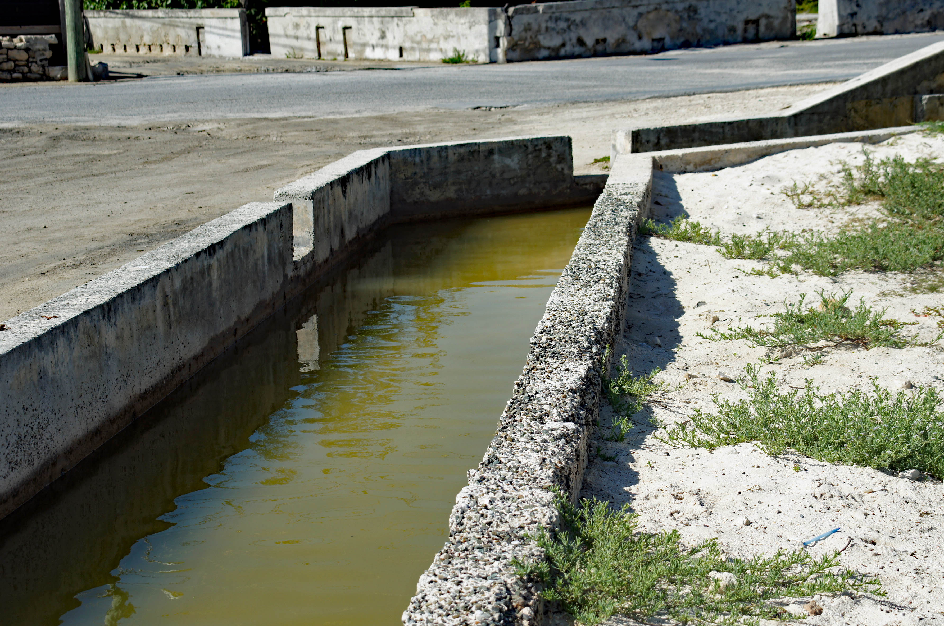
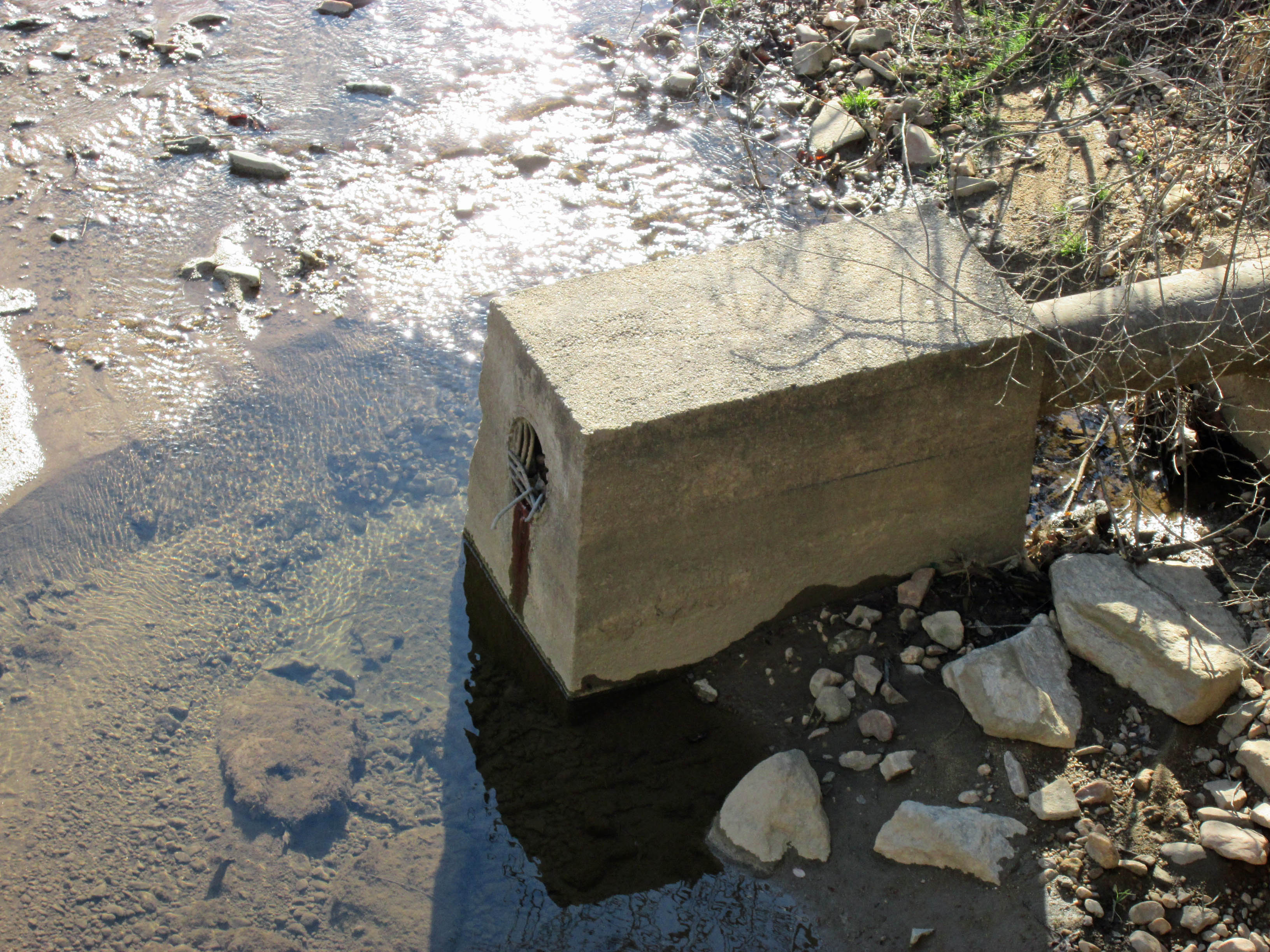
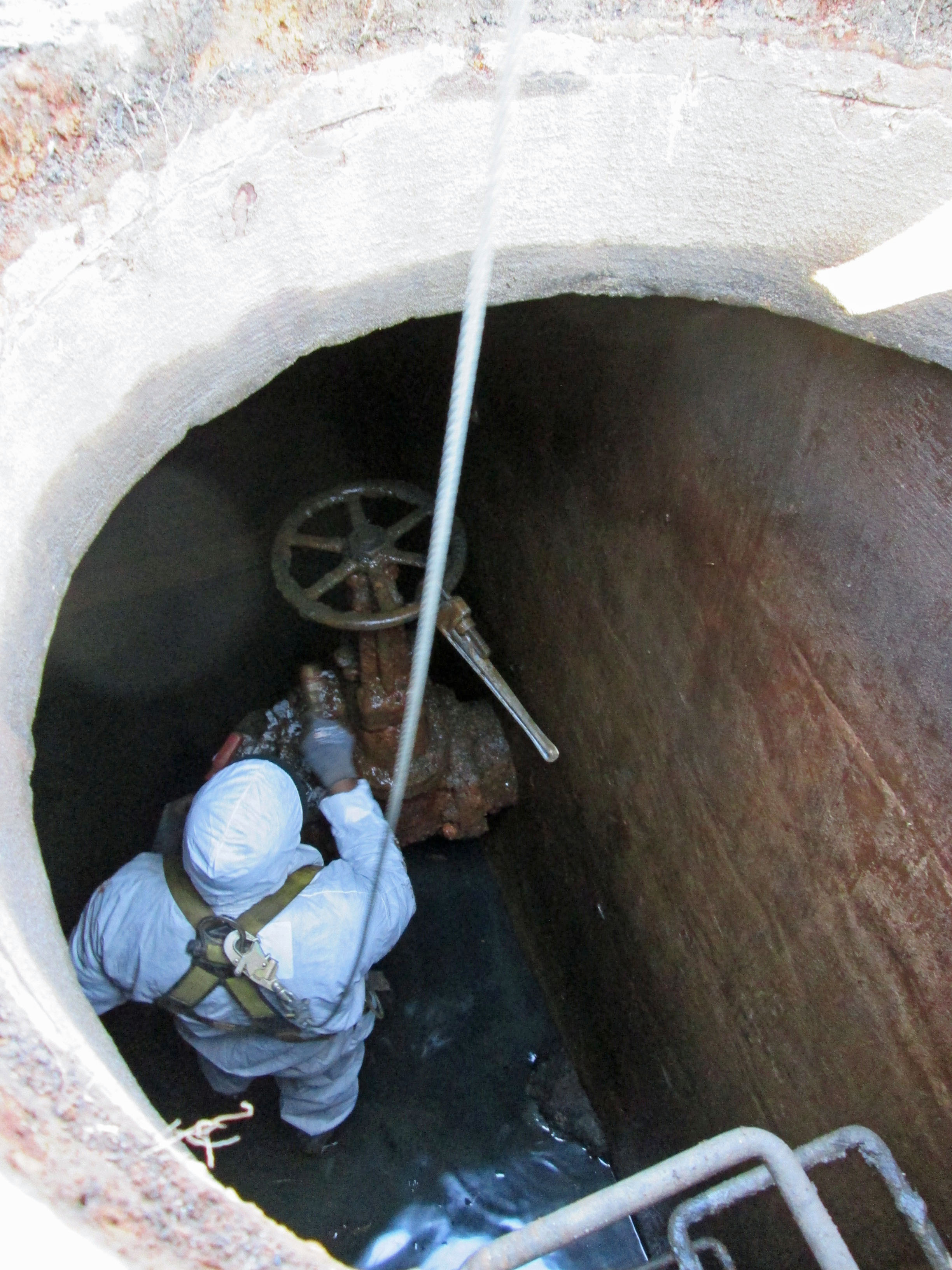
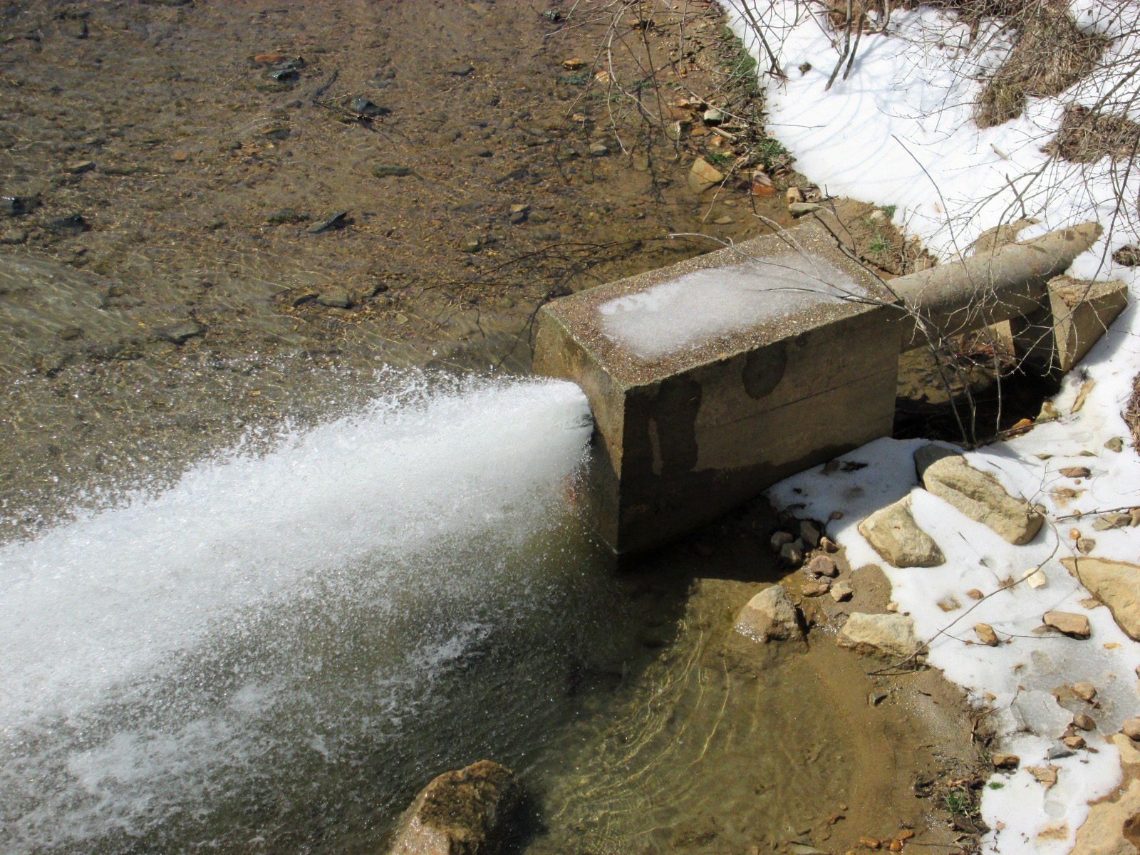
Quite a few of these around. Raise and lower water in the salt ponds but more importantly, they divert flood waters off the island back into the sea.

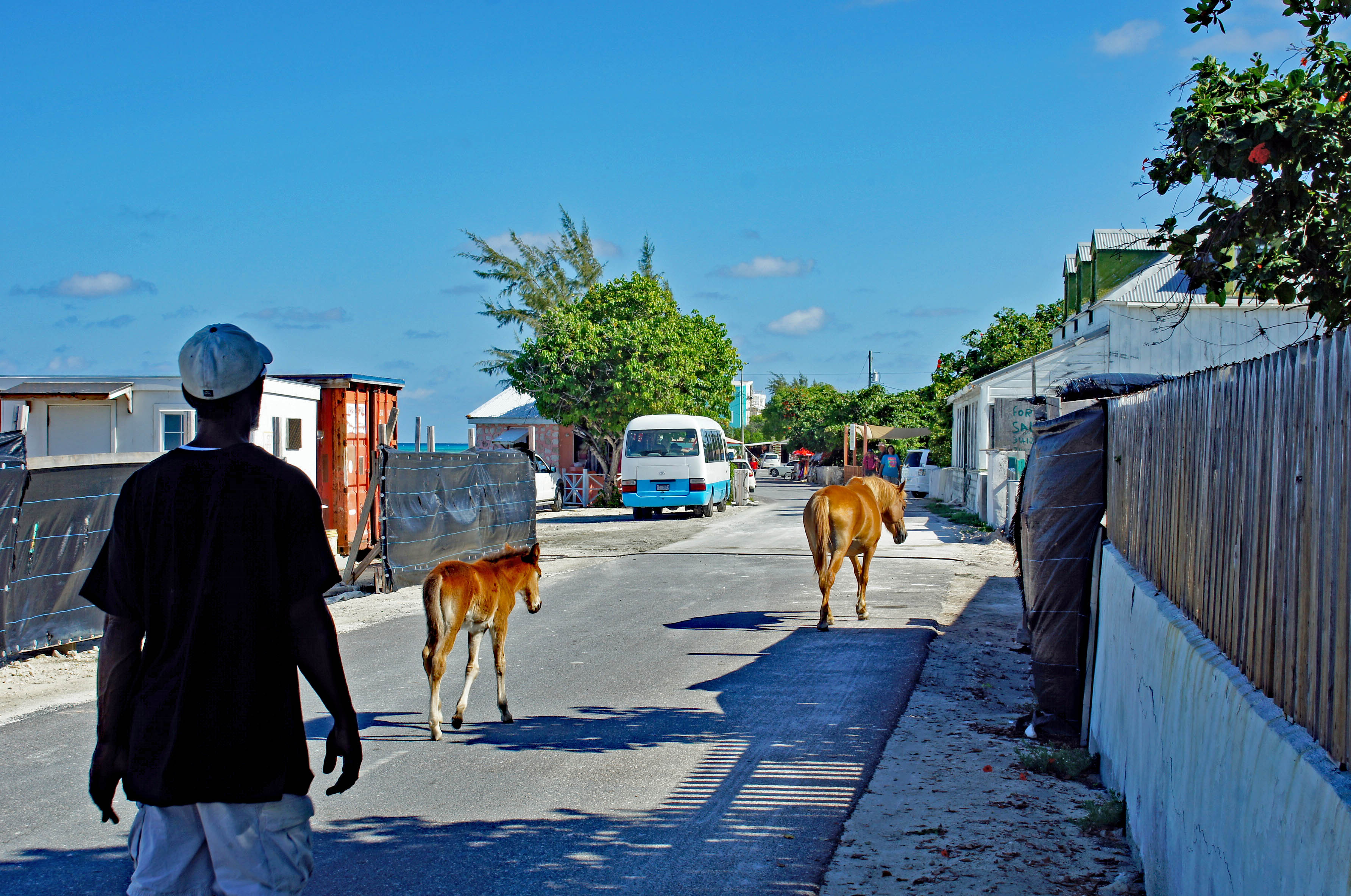
Horses and donkeys roam freely on the island. There is our tour bus.

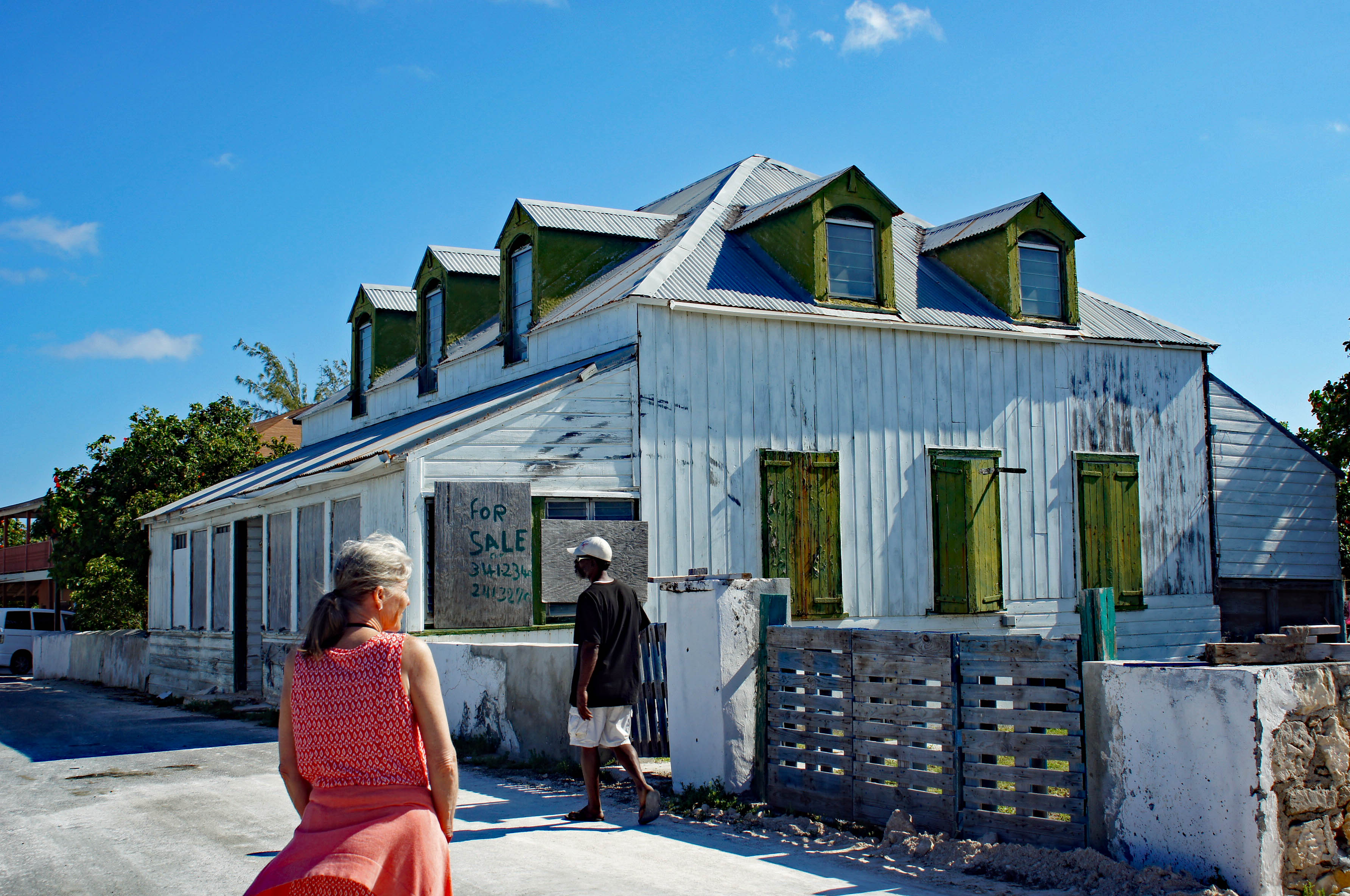
Kathy looking for our winter home. Tour guide said the wooden homes were built from shipwreck wood.

Some of the colorful buildings.
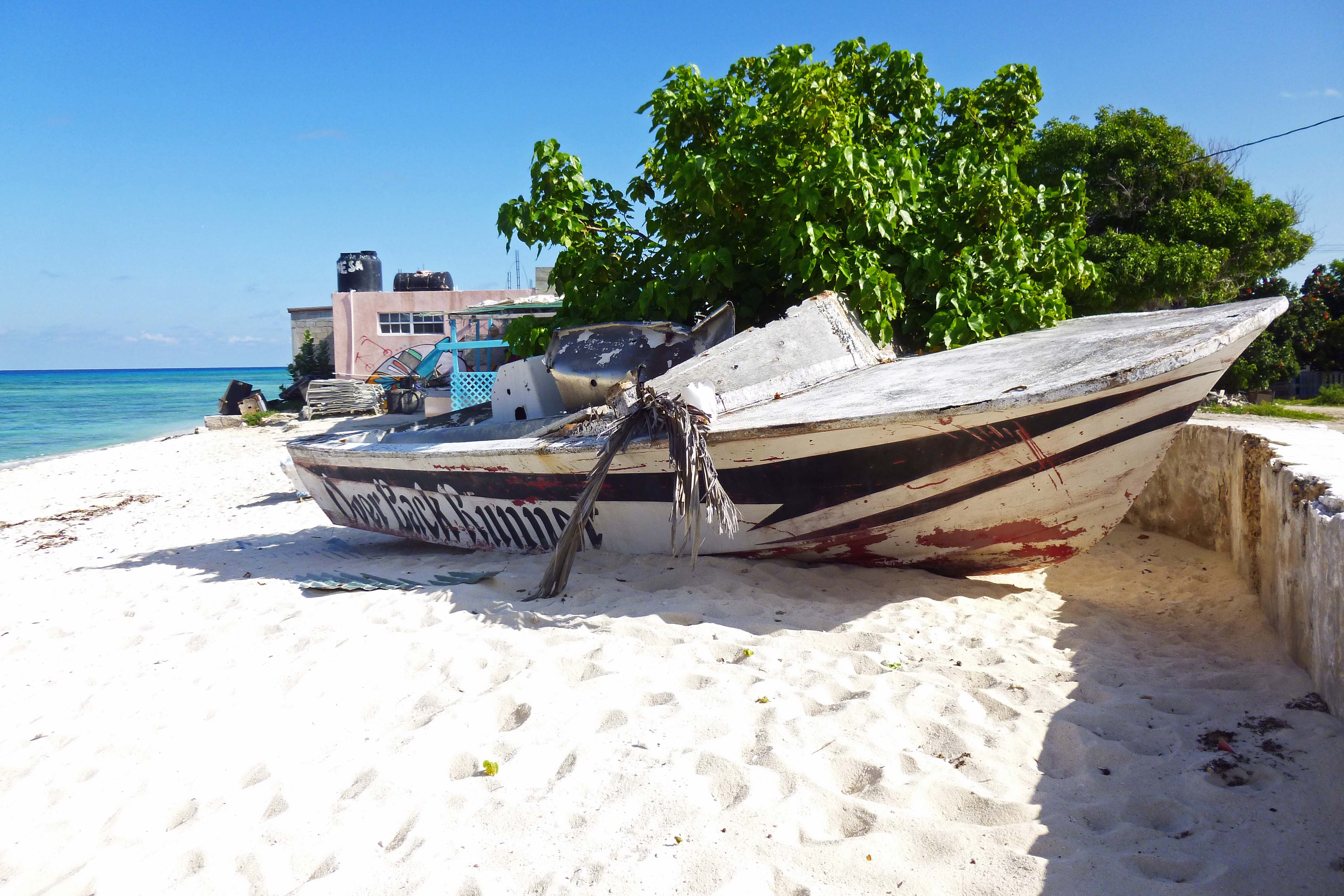
Boat on the beach.

Heading to our next stop we see a replica of John Glenn’s space capsule – don’t blink or you will miss it!

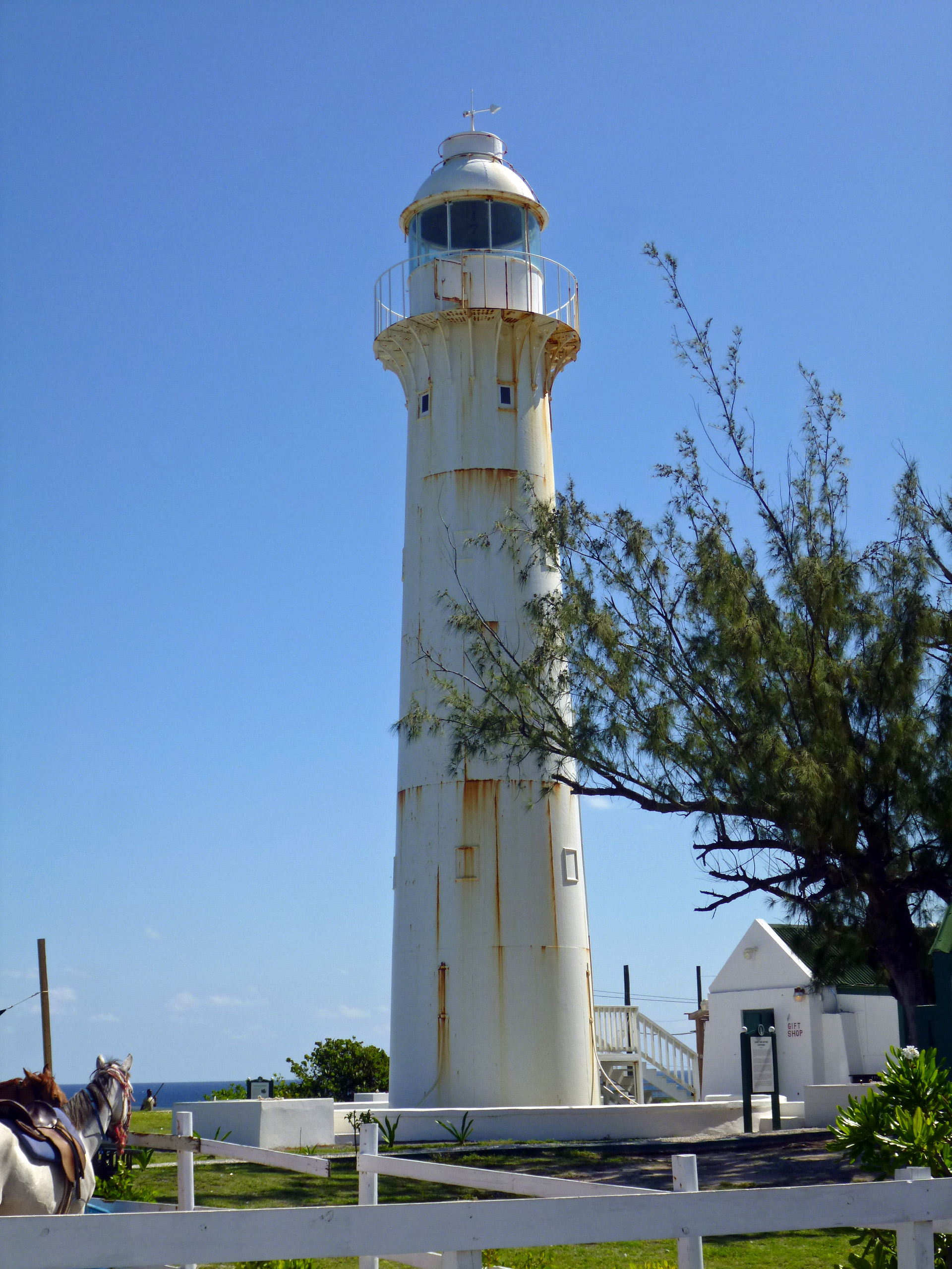
Our second stop was at the far end of the island. The light house. Because of the people who lag behind, that have to use the bathroom after 20 cups of coffee…we didn’t have enough time to go inside.

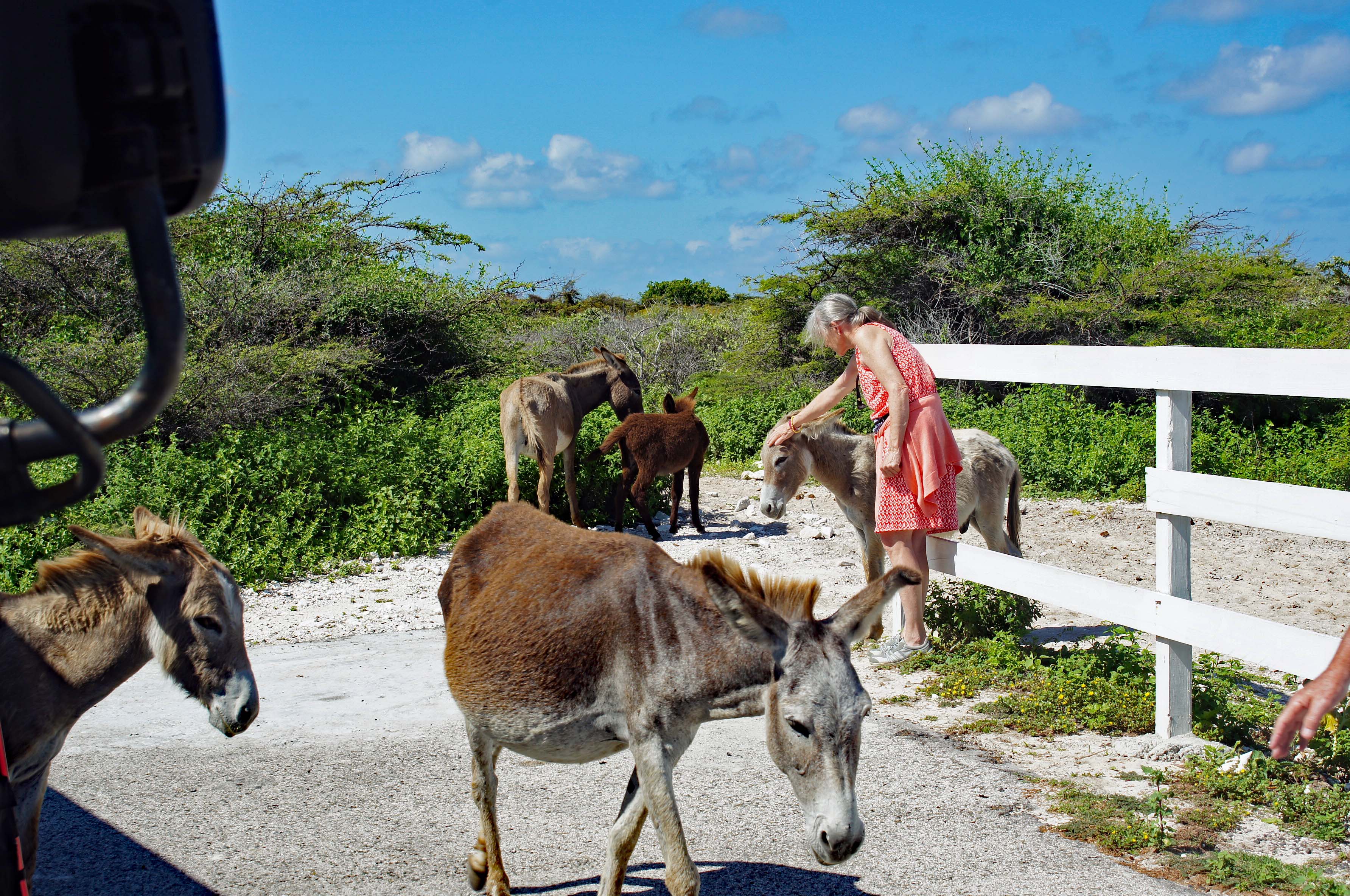
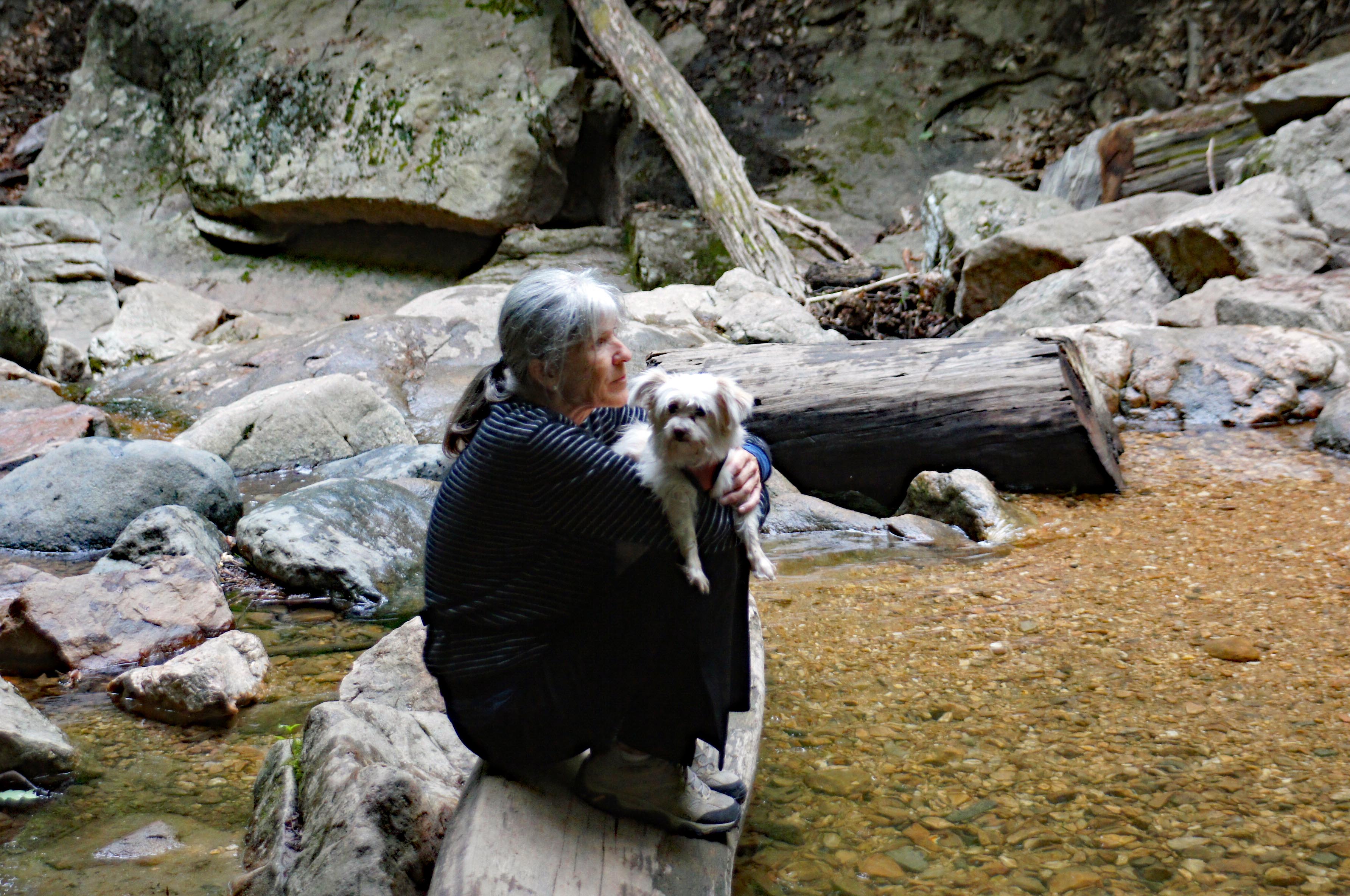
Kathy making some new friends.

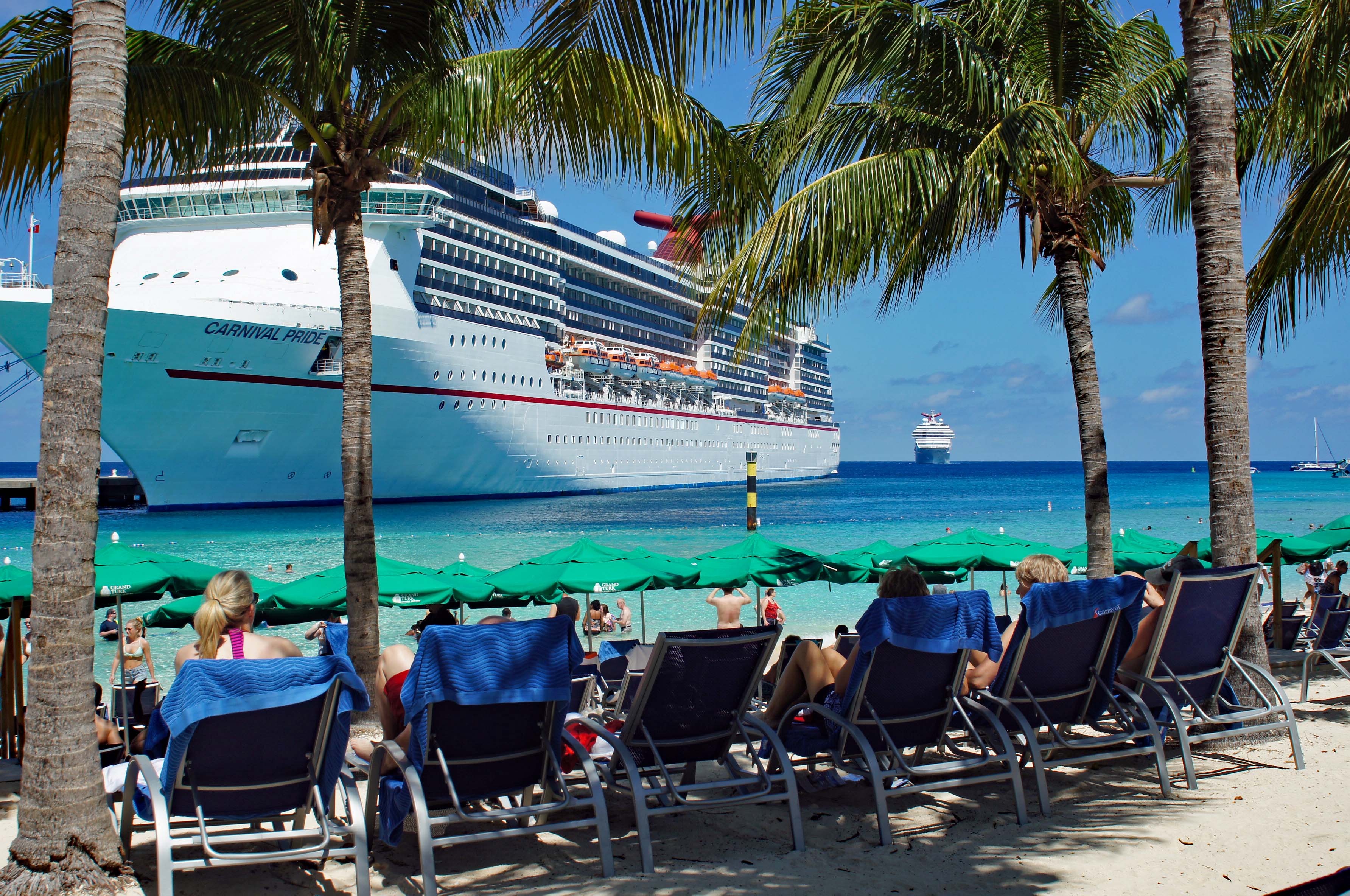
Tour is over and we head back to the ship to change our clothes for the beach. Here comes the Carnival Splendor.

Local took our pic for us. May have been one of the crew members?

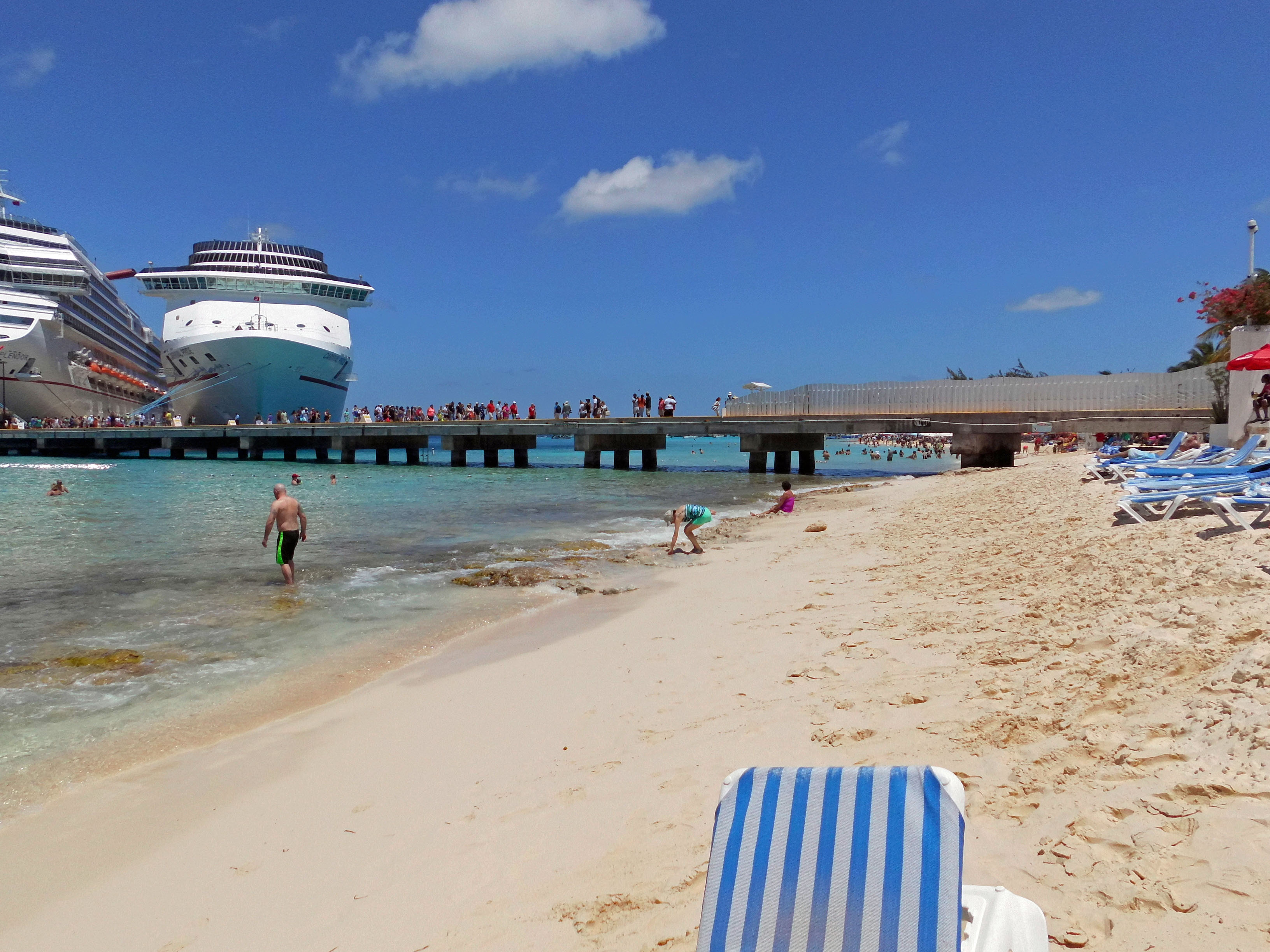
Kathy looking for sea glass. Found some nice pieces. This side of the pier had more rock/coral under the water. Had to go out a ways to avoid it. Water was great!

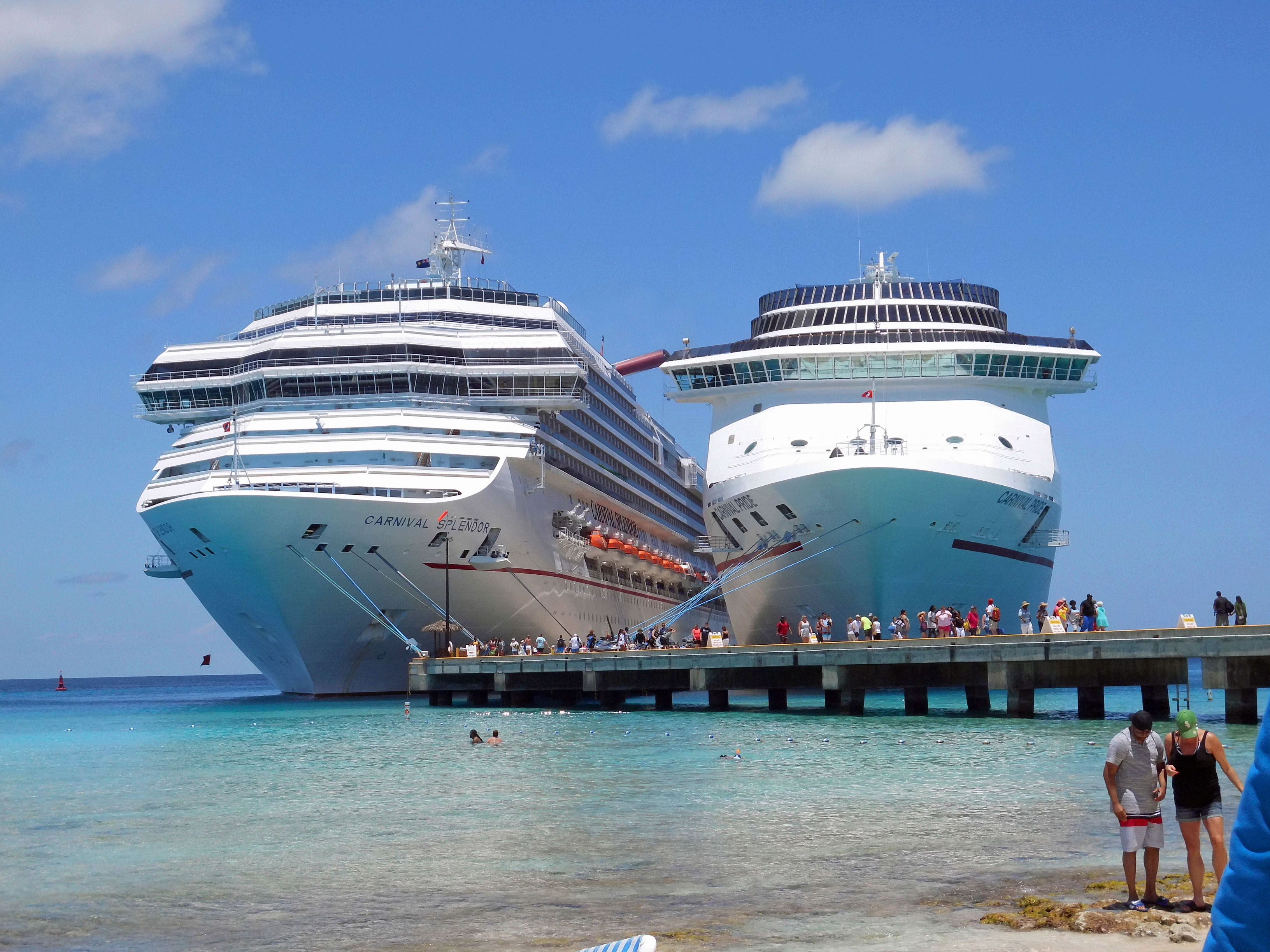
Watching the people on the Splendor disembark. Big ass ship!

Time to set sail and one last memory of our stop on the island…On to Half Moon Cay

Patapsco SP, Avalon

22 Monday May 2017

Posted by Ronald Parks in Baltimore, Hiking, HISTORY, water history

≈ 2 Comments

Tags

Baltimore, bridges, engineering, Hiking, HISTORY, maps, mills, nature, photography, state park, water history

Due to the possibility of rain, we decided to go hiking at Avalon in the Patapsco State Park instead of going kayaking. I have a new phone app called All Trails which is pretty cool. It documents your hike.

Although it says we were moving for 1 hour and 25 minutes, we were actually there for 3 hours. It does not record every time you stop to enjoy the sights, sounds and smells. That is indicated by the thicker line, where we deviated from the trail. Lots of honeysuckle out. The only thing I did not like about this hike was the amount of bikes flying through there. Some had bells, most didn’t.

Entering the park, one of the first things you see is the Thomas Viaduct.

This photo is from the 1930s I believe (DPW Archives). It shows an older train and a newer one from that time.

This photo I took 5 years ago, the last time I visited the park. Soon after this, my Konica Minolta camera would die on me. It was a good camera.

Of course I had to check out the old water works, or what is left of them. Here is some info on that:

On September 30, 1921, the City of Baltimore took over operation of the filters at Avalon. By the purchasing of the Baltimore County Water and Electric Company, the City received a dam and filtration plant on the Patapsco River at Avalon. After this, the filters at Herring Run, near Philadelphia Road, were abandoned and the sand taken to Avalon. Ten years later, the City stops using it.
Of interest is the following:
1923 Correspondence between Edward Rost (Mechanical Engineer), [V].B. Siems (Water Engineer), Edmund Budnitz (Federal Prohibition Director) and A. Bernard Siems (Water Engineer). Concerns sampling water at the Rockburn Branch (Patapsco River), Avalon Pumping Station for pollution caused by illicit liquor still smashed up by Government agents. How the Feds destroyed it and dumped it into the stream, causing the contamination. Excellent description of how the still was built and operated: They built a small dam with a hand pump for water, pumped through a rubber hose and iron pipe to twenty-seven wooden boxes made of pine, made water tight with muslin. They also had a vertical high pressure steam boiler. Scattered around were half gallon mason jars, corn meal and liquid mash. It was suggested by Siems that the mash be hauled away to a local farmer’s manure pit. A follow up letter to the feds by Siems asking that they clean up the corn mash they dumped everywhere, which is still contaminating the stream.

One of the many trails. According to All Trails, there are over 20 miles of trails here.

Tunnels to the other trails.

Another one.

Besides the tunnels to the other side of the train tracks, there were many storm drains. This one had a Tulip Poplar Tree flower. Fell right in place for all to enjoy.

One of our off-trail forages to the river, we came across this guy. There was also an osprey and maybe an adolescent eagle.

Up stream a ways is the swinging bridge. I could swear that when I was young, this bridge was made of rope and wood and it really swung. Now it just kind of bounces.

Five years ago. It was pretty clear under the swinging bridge.

Plein art at the entrance to Cascade Falls.

Well worn trails.

The lower portion of the falls.

Cascade Falls.

Kathy contemplating the sights and sounds of the falls. Molly contemplating how to get off that log and back to land.

Heading back, following the river instead of the trail. Dumpster?

Had trouble finding this guy. An oil tanker that was washed away during Hurricane Agnes, 1972.

This is 5 years ago. So only recently did they (Park people) allow it to get so overgrown. There is a historic marker on the trail – The Forces of Nature.

Walking along the river, found a lot of Sea Glass – actually I guess it is river glass. Also there was an electrical insulator. Found some really nice glass and porcelain. (Kathy found most of it)

A nice day and a wonderful hike. Five years ago I did this hike by myself. It is nice to have someone with me, to enjoy this.

Easter on the Eastern Shore

16 Sunday Apr 2017

Posted by Ronald Parks in Hiking, nature, Photography

≈ 2 Comments

Tags

bridges, Graves, Hiking, nature, photography

Spent Easter with Kathy’s family down on the Eastern Shore. Always a great time. On the drive home we stopped at a couple places.

The first being just outside of Easton. This is one of those historical markers that you go flying by and have a hard time pulling over to read. But we did.

This is a little church (meeting house) and cemetery. Also where the first peaches in Maryland were planted.

Another little cemetery behind the house.

Yes they are.

Then we headed to Terrapin Park on the Chesapeake. This is always a great walk. We started on the outer loop, walked the beach and then took the inner paths back to the lot. There were a lot of cars in the lot but not sure where all the people were? This was on a bench.

Hard to get Sid Vicious to pose.

Alien markings on a piece of driftwood.

Nice little bridge.

Driftwood with drift nail.

Fire wood?

Cement cylinders along the shore.

Looking for other dogs to terrorize.

Adrift? Was hoping it would come our way but it seemed to be anchored down.

Wishing to dandelion seeds, spreading across the park…

Property next to the farm. Potential for a new home to be built…the steps are there!

Salisbury Zoo

30 Thursday Mar 2017

Posted by Ronald Parks in Hiking, nature, Photography

≈ 2 Comments

Tags

Dams, Hiking, HISTORY, nature, photography, Public Works, Salisbury, zoo

Before Salisbury had a zoo, it had a lake – Lake Humphreys, which was created by the building of a dam in 1743. On May 28, 1909 the dam gave way and the lake went dry. Or actually it turned into a mud flat. And it sat like that for a while until the City Park was built, This included building a zoo.

It was a nice day out Saturday and Kathy says “Let’s go to the zoo!” So we did –

Jumped in the car, took a couple back roads and came across these guys. They were kind of far away and I didn’t have my good camera with me. After a while on the side of the road we started heading back to the highway. Me: Where we going? Kathy: To the zoo. Me: I thought that was the zoo?? Duh…

So into Salisbury we go. The City park is really nice. Nice family atmosphere with walking trails, picnic areas, horse shoes, etc. This is what you get for being the Director of Public Works for only 4 years. A bronze propeller.

Nice walking trails around the park.

The zoo. It is free and it wasn’t until we got back to Kathy’s parents house that I was told there is a donation box there. I didn’t see it.

This guy has some sort of attention disorder. He couldn’t stop looking up over the wall to see what was going on.

Not much you can say about this guy other than magnificent.

One thing I’ve never liked is seeing eagles caged up.

Acting up for the camera.

Relaxing.

Where’s John Waters??

These two guys share this spot with a bird, who keeps shitting on them…one day the bird will be in their jaws, wondering, well how did I get here?

Did a complete loop around the park and ended up at this little dam. I imagine the sluice gates are to allow water down stream if the level drops below the top of the dam. Nice walk in the park.

Busted Pipe

17 Friday Mar 2017

Posted by Ronald Parks in 1972, Baltimore, Dams, water history

≈ Leave a comment

Tags

Baltimore, bridges, Cromwell Park, Dams, engineering, Gunpowder Falls, Hiking, HISTORY, Loch Raven, nature, photography, Public Works, water, water history

As I mentioned a few weeks ago, the contractor building a new maintenance facility at Loch Raven, busted a hole in the 10′ water pipe.

The site of the new complex, along the west bank of the Gunpowder River. The caution sign is the area where they broke the pipe. It is now covered with steel plates.

Here is what the conduit looked like when it was installed in 1913. It is a steel pipe, welded and riveted together.

As the conduit was installed, they encased some sections of it in concrete, to give it some strength. Loch Raven Drive is directly above this pipe in some areas.

Looking under the steel plate I ask – how the hell do you NOT know that this pipeline is there?? In the photo can be seen above the wood stake, water pouring out of the pipe. Surrounding the stake is the rebar the contractor had to break thru in the cement to strike the steel pipe. The contractor is lucky that the dam has two independent conduits coming out of it.

There was built a parallel pipeline back in 1972. I’m not sure why or even why it is called the Parallel Pipeline. It kind of zig-zags across the river.

The contractors of 1972 had their fair share of problems – like the worksite getting flooded. The lower, smaller dam is in the background.

In order for the present day contractor to fix the hole he made, the City was asked to drain the pipe.

After searching thru some old drawings, we were able to find the location of the drain pipe. This is a 12″ drain connected to a 10′ pipe.

My favorite valve guys came out to try and open it by hand but were unable to. It has been a very long time since this was open. They ended up having the contractor core drill a hole in the vault roof above the valve. They then used their valve truck to turn it.

This is at 8 turns, 20% open. This will take quite a while to drain. The contractor is impatient.

But. as you can see, opening it up too far will erode the stream bank right under this bridge. Today the contractor was given the ok to place steel plates in the stream to divert the flow away from the bank.

Meanwhile, I roamed around some and took some pics – of other than work related stuff. A stone snowman walking his stone snow duck.

Root system.

View across the reservoir. Days like this, I like my job…


Hiking and History

21 Tuesday Feb 2017

Posted by Ronald Parks in Baltimore, Hiking, HISTORY

≈ 2 Comments

Tags

Baltimore, Dams, engineering, Gunpowder Falls, Hiking, HISTORY, Loch Raven, nature, photography, Public Works, water history

Kathy just loves it when we go on hikes and I fill her head with a bunch of useless information! Went to Loch Raven Saturday since it was so nice out – looking for eagles.

Before the eagles, we saw this guy trying to hide from us.

I guess we saw about 4-5 different eagles. This one was trying to hide too.

Kathy has known that I always wanted to go to the other side of the dams (in all my years hiking, I’ve never been there), so she grabs up Molly and starts heading across the rocks.

Looking for more eagles.

Top of the east side of the old dam. Across the way are the gate house valves.

Next we headed towards the newer dam, which actually underneath is a 100 year old dam.

Look! An Eagle! Damn – too slow on the shutter!

Here is the same dam in the 1970s – it was falling apart really bad. Looking close you can see a circular cap on the lower face.

When they refinished the face of the dam, the round hole became square. It was locked.

Besides the face lift the dam gets, they also built a Zebra Mussel station – tall white building in background. They never used it and now more construction is going on behind it – an admin building of some sort.

How Loch Raven dam looked in 1922. Notice on the lower portion across the water. The land is at the same elevation as this side, but…

Now it is elevated by the placement of this pipe. This pipe is covered in dirt. I’m still not sure why they installed this pipe into the face of the dam??? I have the drawings and project photos, but nothing to say why?

So all this is to say that the original dam, under this one was built in 1914. It was at an elevation of 188′. The newer dam was placed on top of it in 1922 – elevation 240′. Then in the 70s and again in 2005 it received various face lifts and this is why it will never get a historic designation..

Holy Bat Cave Batman

16 Thursday Feb 2017

Posted by Ronald Parks in Baltimore, Dams, engineering, water history

≈ 2 Comments

Tags

Baltimore, batman, bats, Cromwell Park, Dams, engineering, Gunpowder Falls, Hiking, HISTORY, nature, photography, Public Works, Research, water history

The other day I received an email with the following photograph. It asked if I knew what this ‘tunnel’ was for? It was holding up progress on the construction of some new buildings. In the email there was an attached drawing of the building site with the location of the tunnel circled in red. Holy crap! The drawing, to scale, would mean that this tunnel was about 30′ wide! After researching drawings from 1873 onwards, not finding it in any, I went up to look.

untitled-1

What I found was an opening of about 18″ x 24″. Talk about a let down! Below is the contractor’s foot, for size reference.

088

So, since I was there I stuck my camera into the hole to get some pics – glad I didn’t climb in there. Do you see what I see on the left, dangling from a crevice in the rocks??

009

Well so much for finding part of the Underground Railroad or an Indian Burial Ground or a secret cache of moonshine (yes, that was suggested). After about 2 hours of meetings and investigations, I took a walk.

046

Looking across the construction site to the upper dam.

064

The lower, older dam is my favorite. The inspector told me that since it is marble, someone should pressure spray it clean. Ok, I’ll get right on that!

058

First, get someone to remove that log, which has been on there since the storm of 2010!

122

This dam has held up pretty good since 1880

124

The valves which were inside the old gate house.

038

Sorry Batman – the only bat cave I could find…

Time To Retire Yet?

06 Monday Feb 2017

Posted by Ronald Parks in Hiking, kayaking, Recovery

≈ 4 Comments

Tags

GOD, Hiking, kayaking, meditation, nature, Peace, photography, Retirement, spirituality, Work

Every time I go to the Eastern Shore with Kathy, I get this gnawing feeling in my gut, telling me it’s time to retire and move down here. It is just so peaceful.

p1070888

Daydreaming with the moon and the windmill.

p1070889

Little streams every where. Not big enough for a kayak, but a reminder that there are larger ones around…

p1070897

Even just watching the nails back out of the boards they hold up, gives a sense of peacefulness, not found where I am today.

I know that peace comes from the work we do with our spiritual selves. That Peace can come no matter where you are. But for me, I can get too distracted with the busyness of my work and everything around me in the city. It’s bad enough I have never learned through meditation how to quiet my mind and listen to that ‘Still Small Voice’ within. Rock and Roll oldies still play in my head, like them or not! That is why I started to hike years ago and in the last year or so, taken up kayaking; to help quiet my mind. No matter where I go, there I am…but when I’m down the shore, it feels good – physically, mentally and spiritually.

Road Trip, Museum and Hike

30 Monday Jan 2017

Posted by Ronald Parks in art, Photography

≈ Leave a comment

Tags

art, Hiking, mills, Museum, nature, photography

Headed up to the Brandywine River Museum in Chadds Ford, Pa. where part of the Wyeth Collection is displayed. Kathy suggested we go to check out the Wyeth Family art work before we go see Andrew Wyeth’s granddaughter’s work at the Harford Artist Association next month.

p1070817

Art gallery connected to a mill. http://www.brandywine.org/museum

p1070819

A boy and his hawk (and I guess 2 pigeons to feed to his hawk?)

p1070821

View from the second story window, actually thru the window. Meditation pyramid.

p1070828

Not allowed to photograph the artwork, which was fine. Gave me more time to look at and enjoy the work (sometimes I photograph objects and their accompanying plaques, thinking I will read later…) Big Brass Bunny to start off our hike on the Riverwalk.

p1070832

Nice little trail along the Brandywine River.

p1070839

“That’ll do pig, that’ll do.” Farmer Hoggett – Babe.

p1070843

Water connection for my water blog – Stream monitoring station (USGS)

p1070848

View from the train tracks, looking up-stream.

p1070853

One of two inscribed benches along the trail. “Live For The Day”

p1070855

Large sycamore leaning towards the water. Wonder how much longer it will stand?

p1070878

A lone hawk wondering if he will ever get to pose for a bronze statue…

Hiking at CVP

13 Friday Jan 2017

Posted by Ronald Parks in Hiking, Photography

≈ Leave a comment

Tags

Baltimore, Cromwell Park, engineering, Gunpowder Falls, Hiking, Loch Raven, nature, photography

The guys I use to volunteer with up at Cromwell Valley Park asked me to join them for a hike the other day. They wanted to show me something. That something was the house I wrote about a few weeks ago up at Loch Raven. It is now gone. Making way for a new maintenance facility. They also wanted to show me the tree grinder and another surprise…

017

This is the site of the old house and barn. The house was where the yellow excavator is to the left, the barn was the hole in the foreground. Loch Raven is a little frozen between the dams.

007

The tree grinder. What a machine that is! Unlike a regular wood chipper, this thing you drop the trees in the bowl (tub) on top.

021

After watching that for a while, we hiked the old fire road. It was a nice day out and the path was muddy from the warmer weather we were having, but some things take longer to thaw.

030

The surprise…

027

Wow, this took some time to build! Two rooms and an outdoor fire pit!

012

The next day I took Kathy to see it.

033

A nice two afternoons, walking in the park!

← Older posts
Newer posts →

Blogroll

  • Flouride Action Network
  • lulu
  • My Book
  • WordPress.com
  • WordPress.org

Recent Posts

  • Bermuda 2023
  • ICELAND April 2023
  • George Chalmers of Fochabers
  • In Search of The Skipjack Ada Mae
  • Trap Pond Kayak

Blog at WordPress.com.

  • Subscribe Subscribed
    • Water and Me
    • Join 231 other subscribers
    • Already have a WordPress.com account? Log in now.
    • Water and Me
    • Subscribe Subscribed
    • Sign up
    • Log in
    • Report this content
    • View site in Reader
    • Manage subscriptions
    • Collapse this bar
 

Loading Comments...