• About
  • History Writings

Water and Me

Water and Me

Tag Archives: Hiking

Dams

02 Sunday Oct 2016

Posted by Ronald Parks in Baltimore, Photography, Reservoir

≈ Leave a comment

Tags

Baltimore, bridges, Conowingo, engineering, fishing, Gunpowder Falls, Hiking, HISTORY, photography, Reservoir, Star Wars

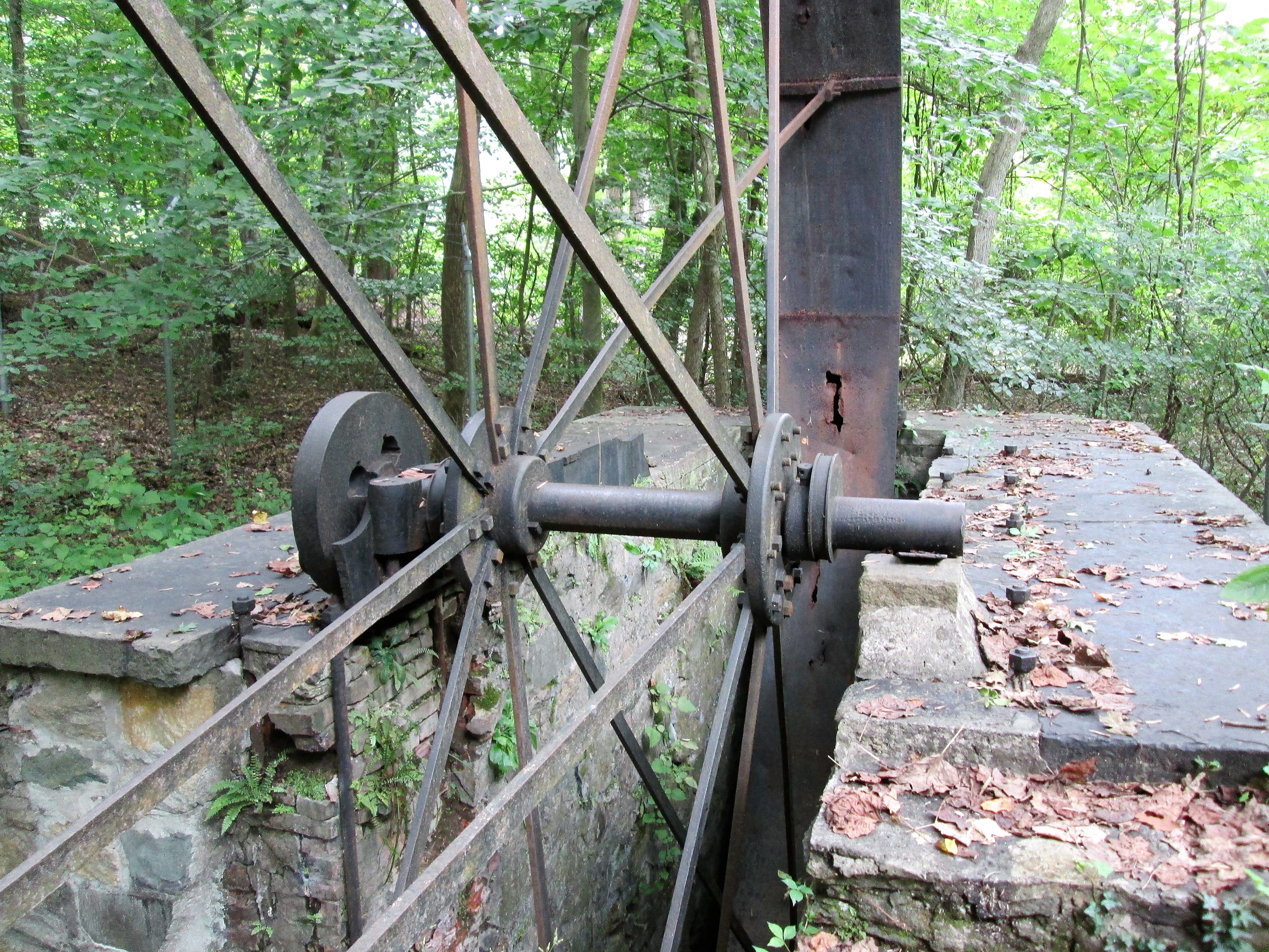
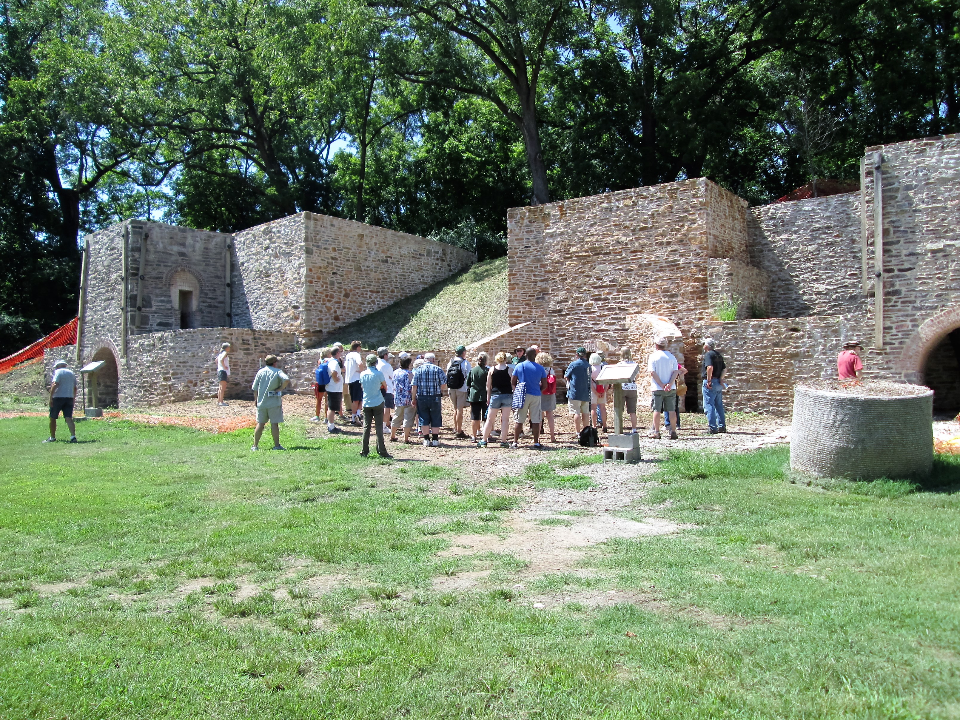
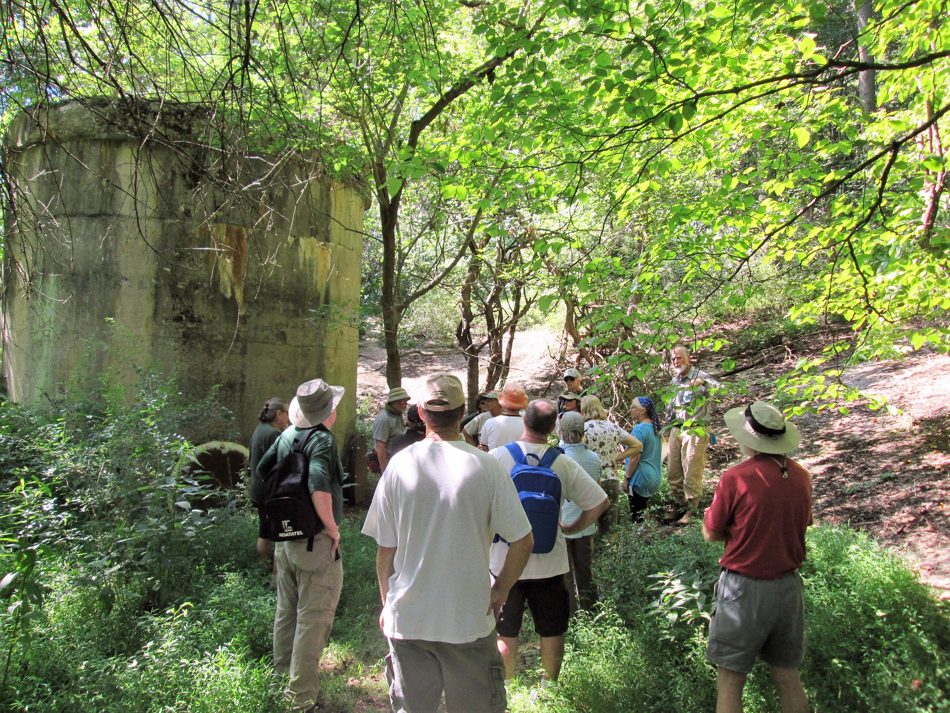
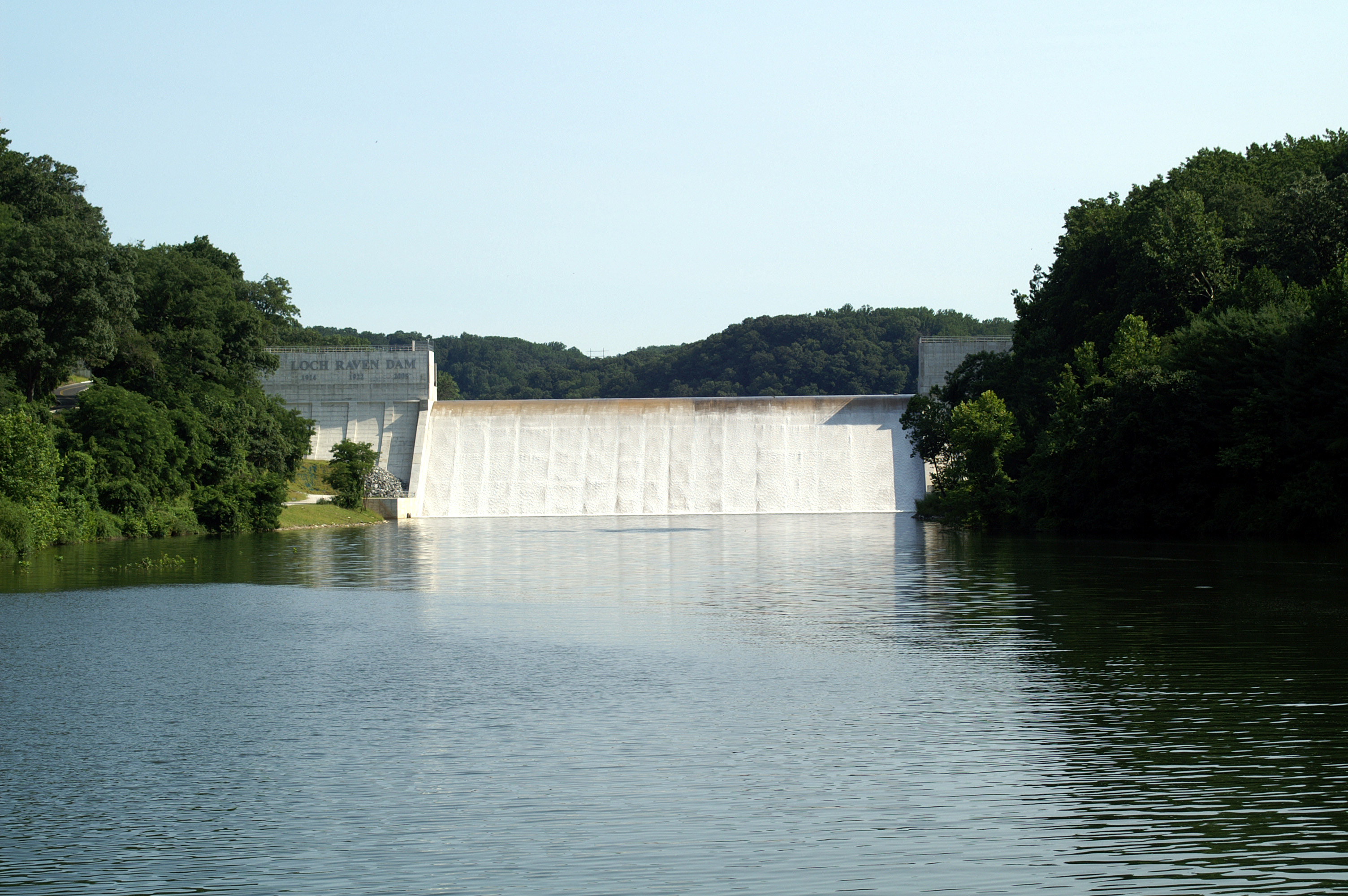
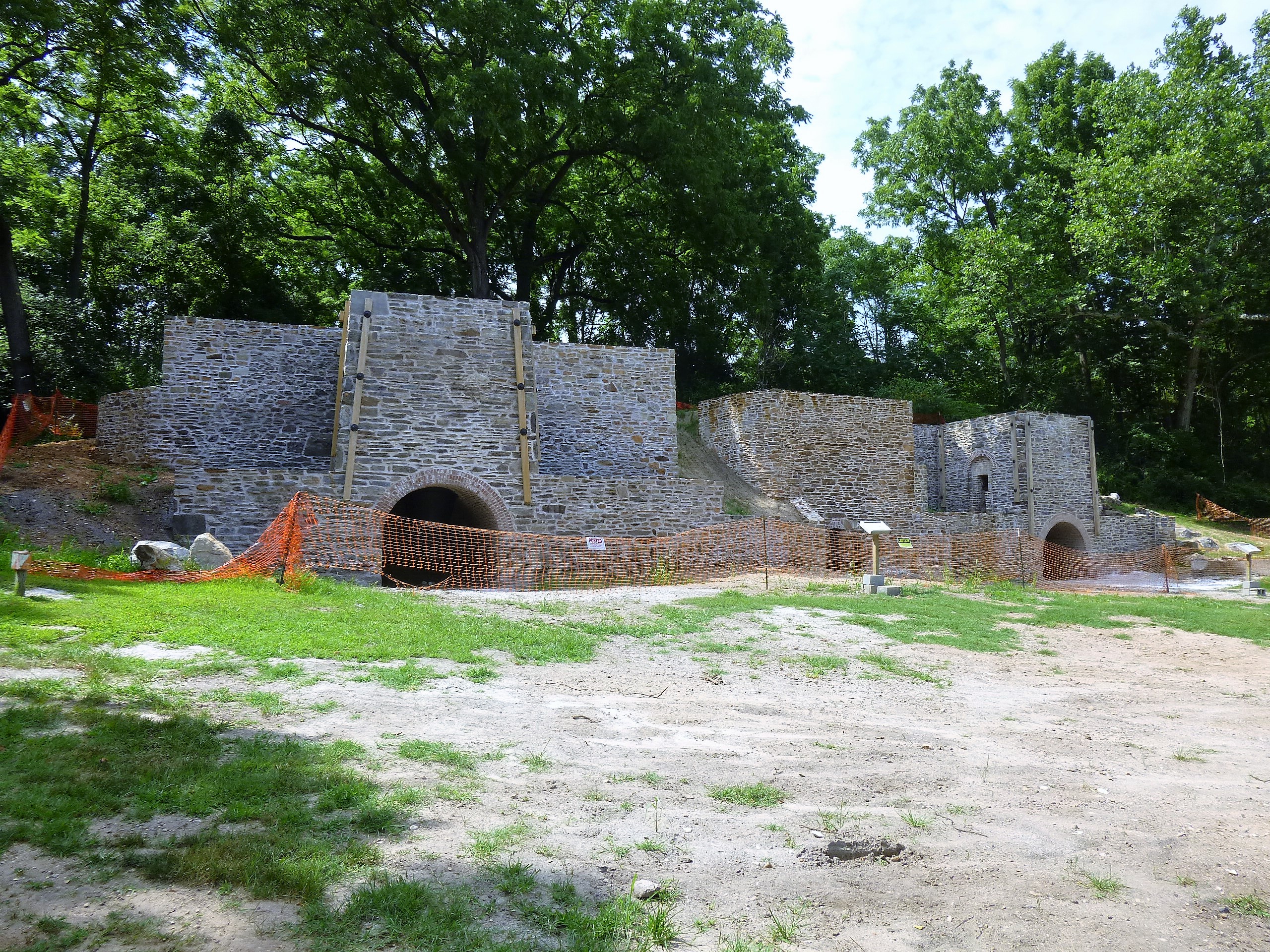
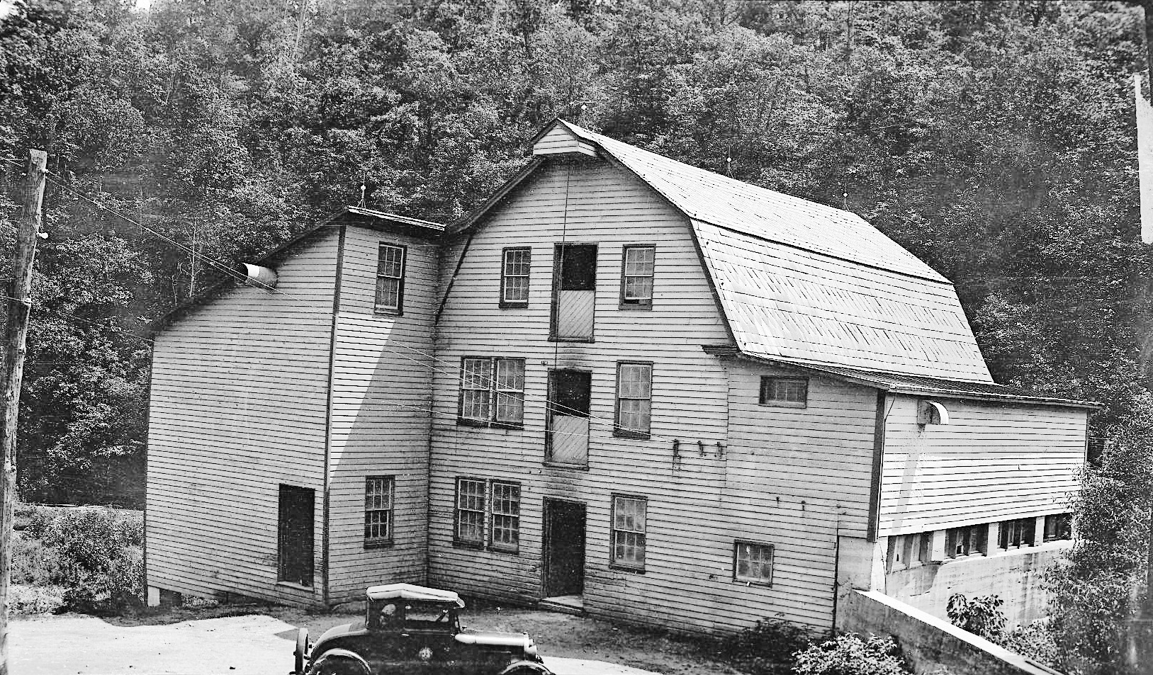
Back in the beginning of September, I posted some photographs of my visit into Liberty Dam. The watershed manager, Clark, took me down to the bottom. It was quite an experience for me. Before leaving I made the comment that the Conowingo Dam will be my next adventure, to go inside. A couple weeks later, Clark sends me an email telling me that a group he belongs to, the Upper Western Shore Tributary Team, are going into Conowingo. That I should contact them and ask if I can go. A couple days later they sent me a yes answer. Very nice. So, here are some of the dams I’ve gone into. Not listed yet is Loch Raven. Not much to go into there but Clark said when they do the next inspection, I can go.

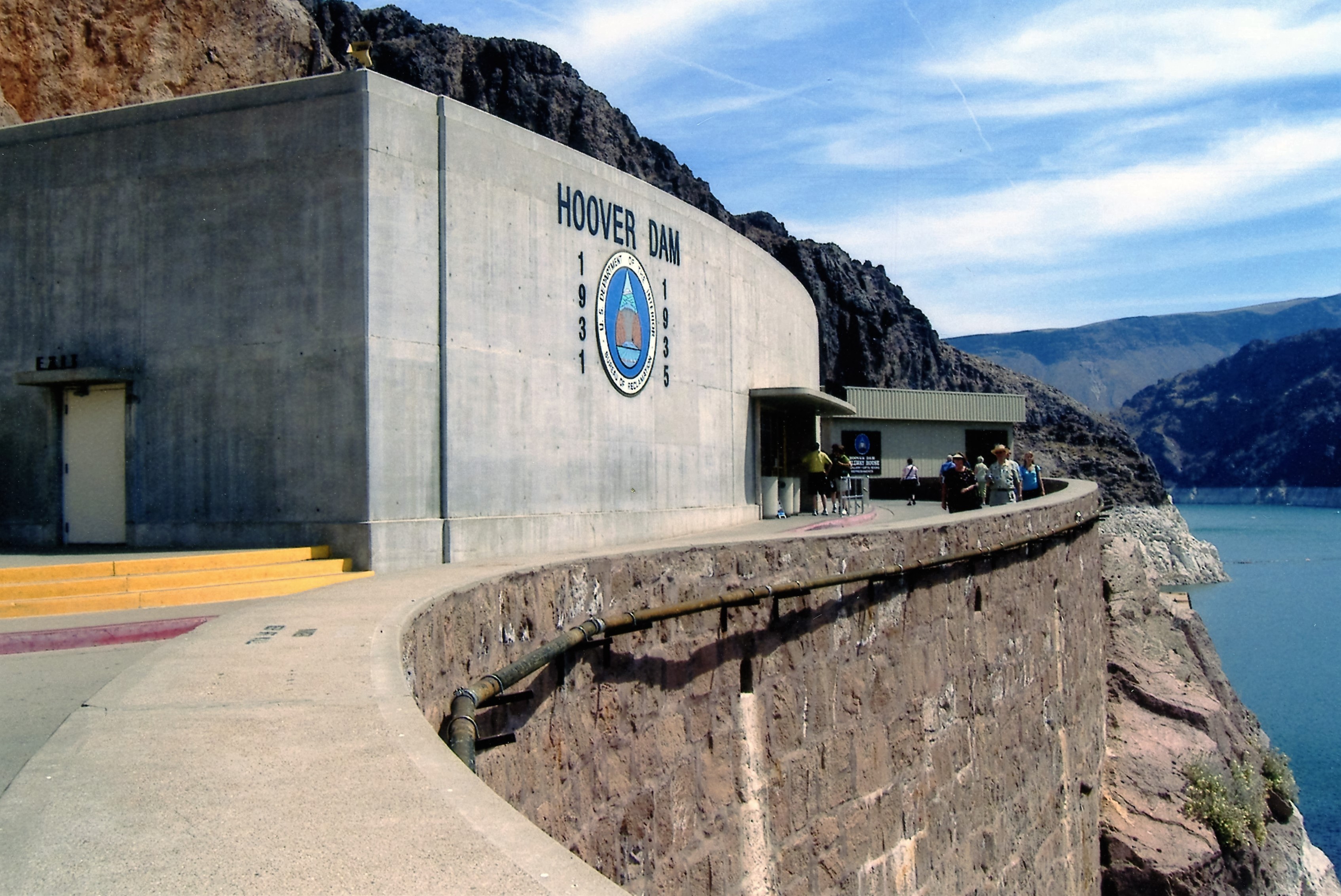
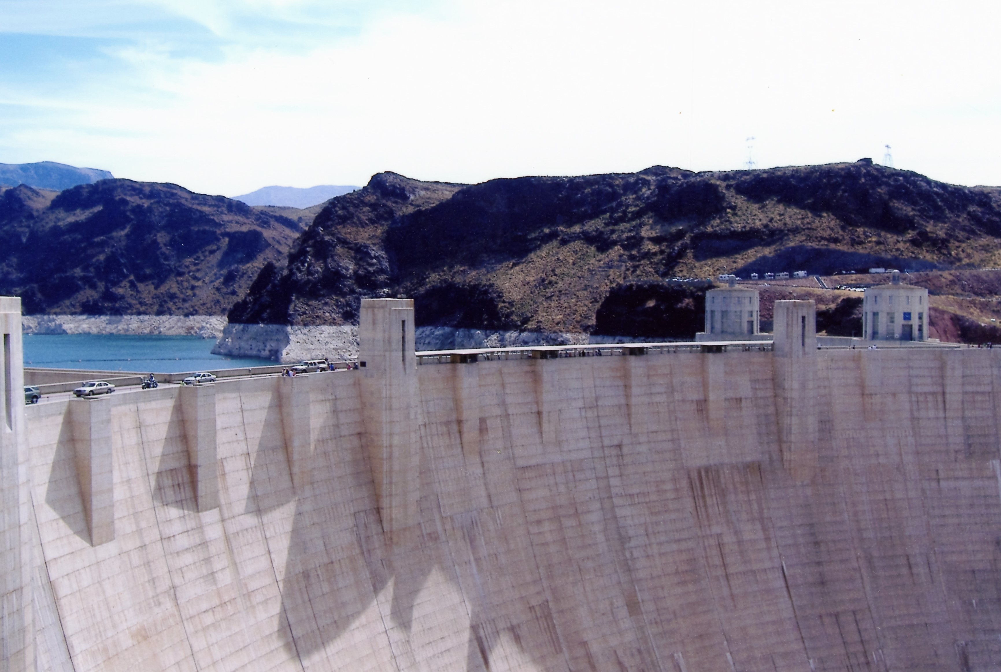
My first interior dam I visited was Hoover Dam in 2005. It was nice but a disappointment in that 3-1/2 years after 9/11, the lower portion was closed off. I only got to see the turbines from an observation deck.

hoover001

This was a quick looksy – “Alright people, back on the elevators.”

hoover004

Up on top.

hoover002

One side of the dam…

hoover006

to the other.

hoover003

Intake structures – actually more impressive than the one at Liberty!

hoover005

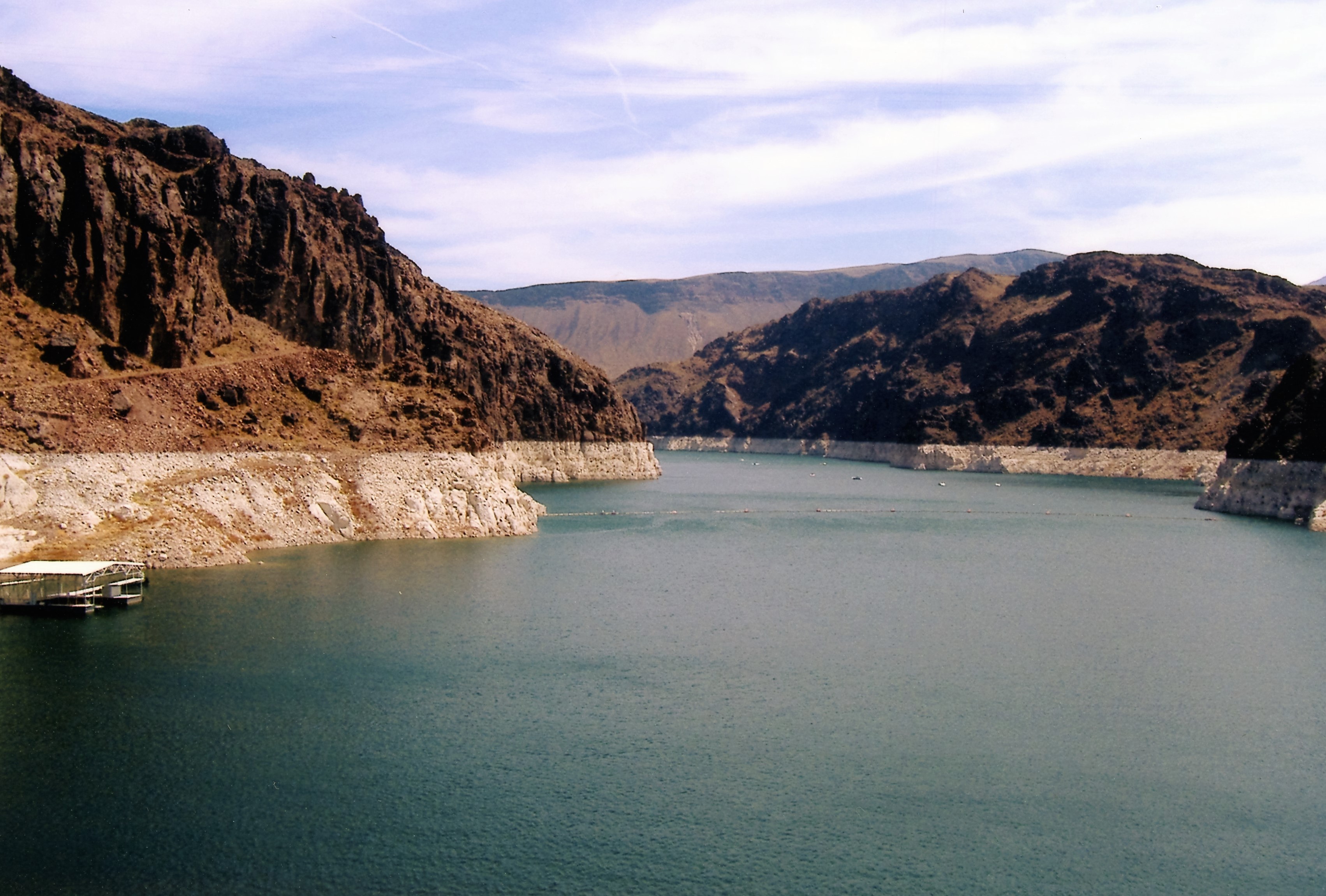
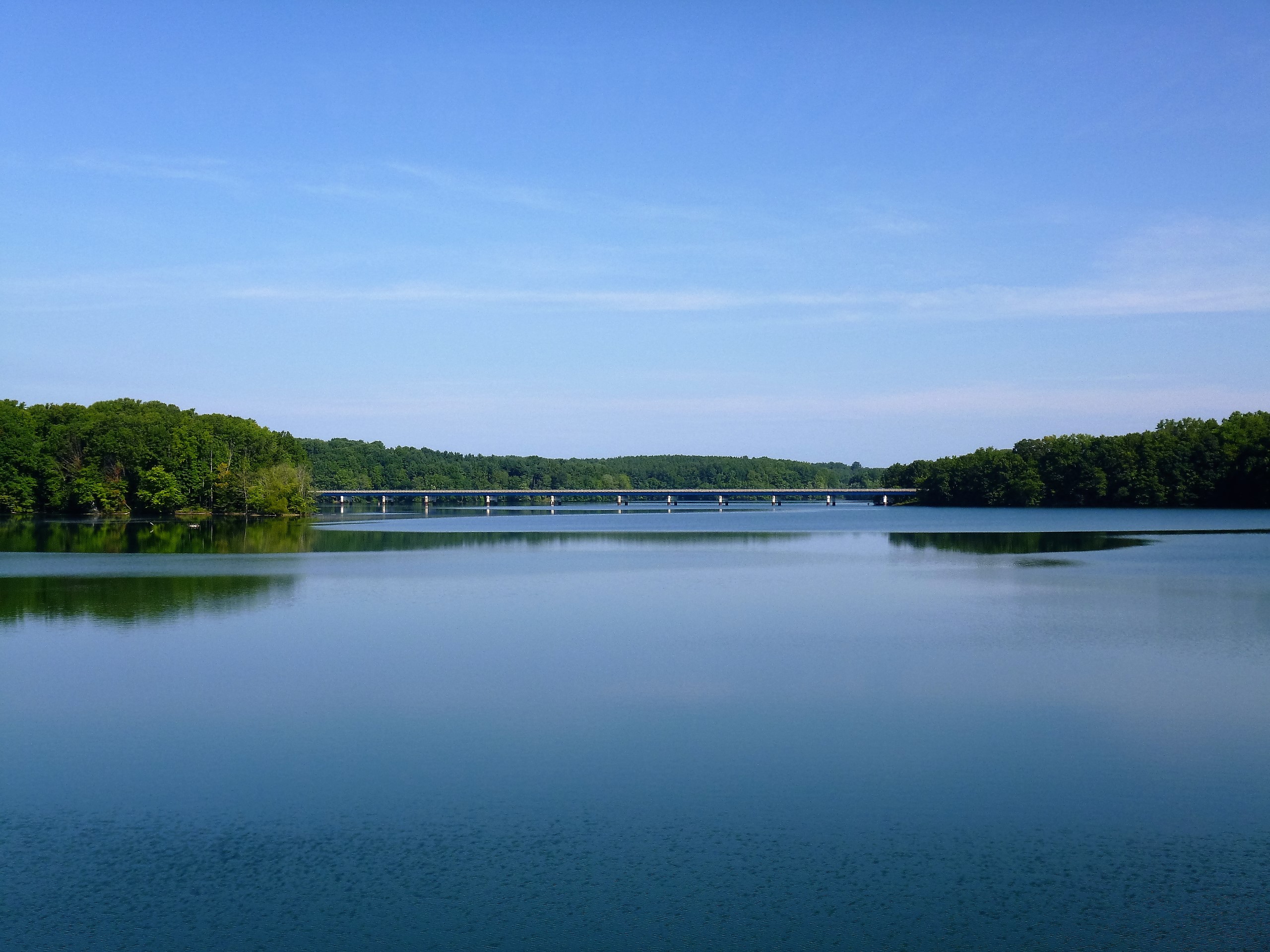
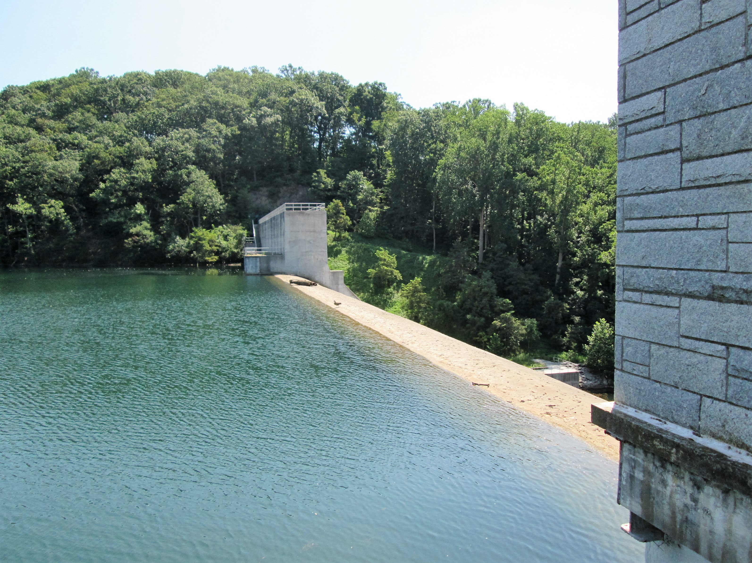
Reservoir getting low…and yet they are still building new homes in the area.

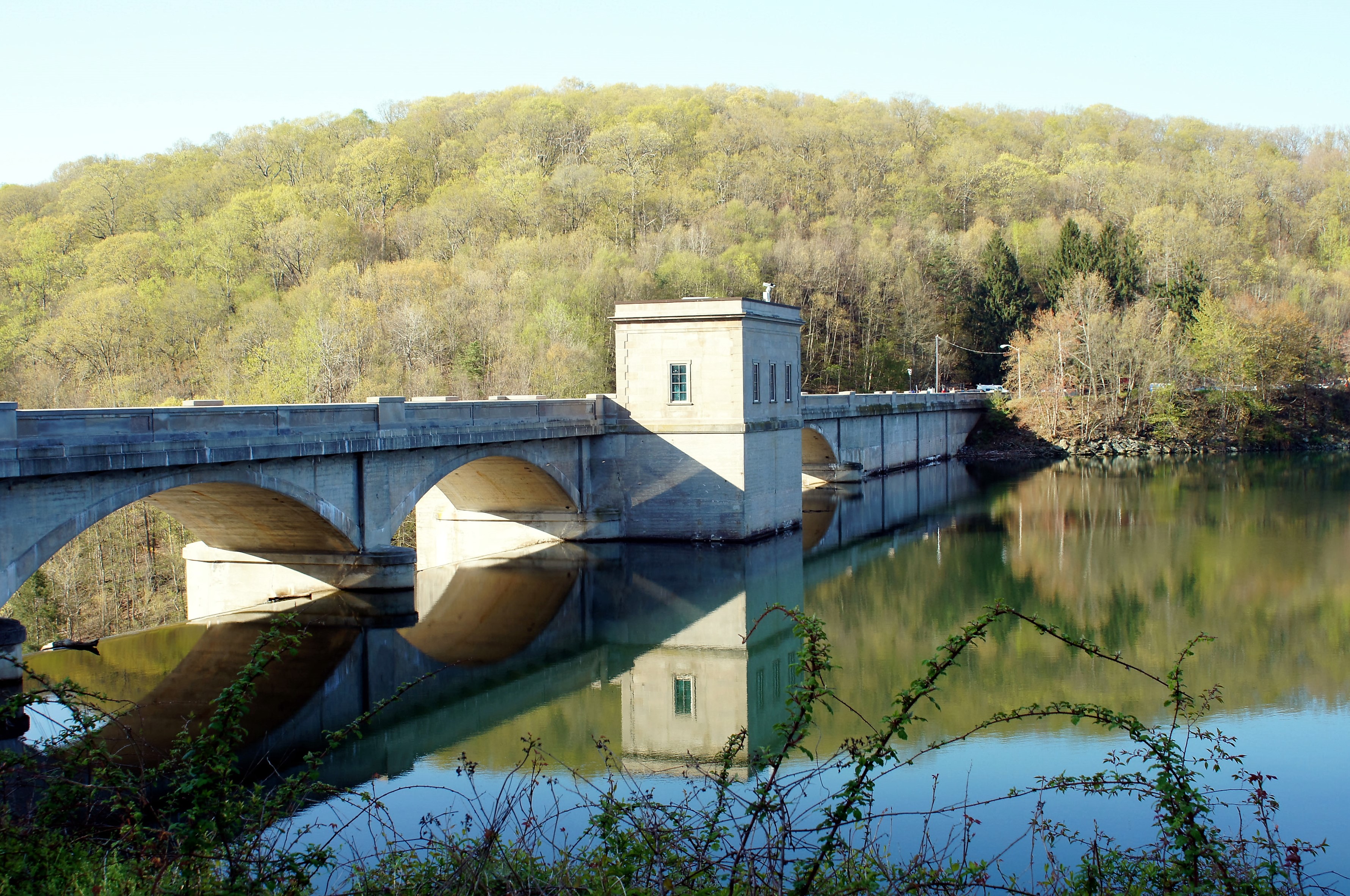
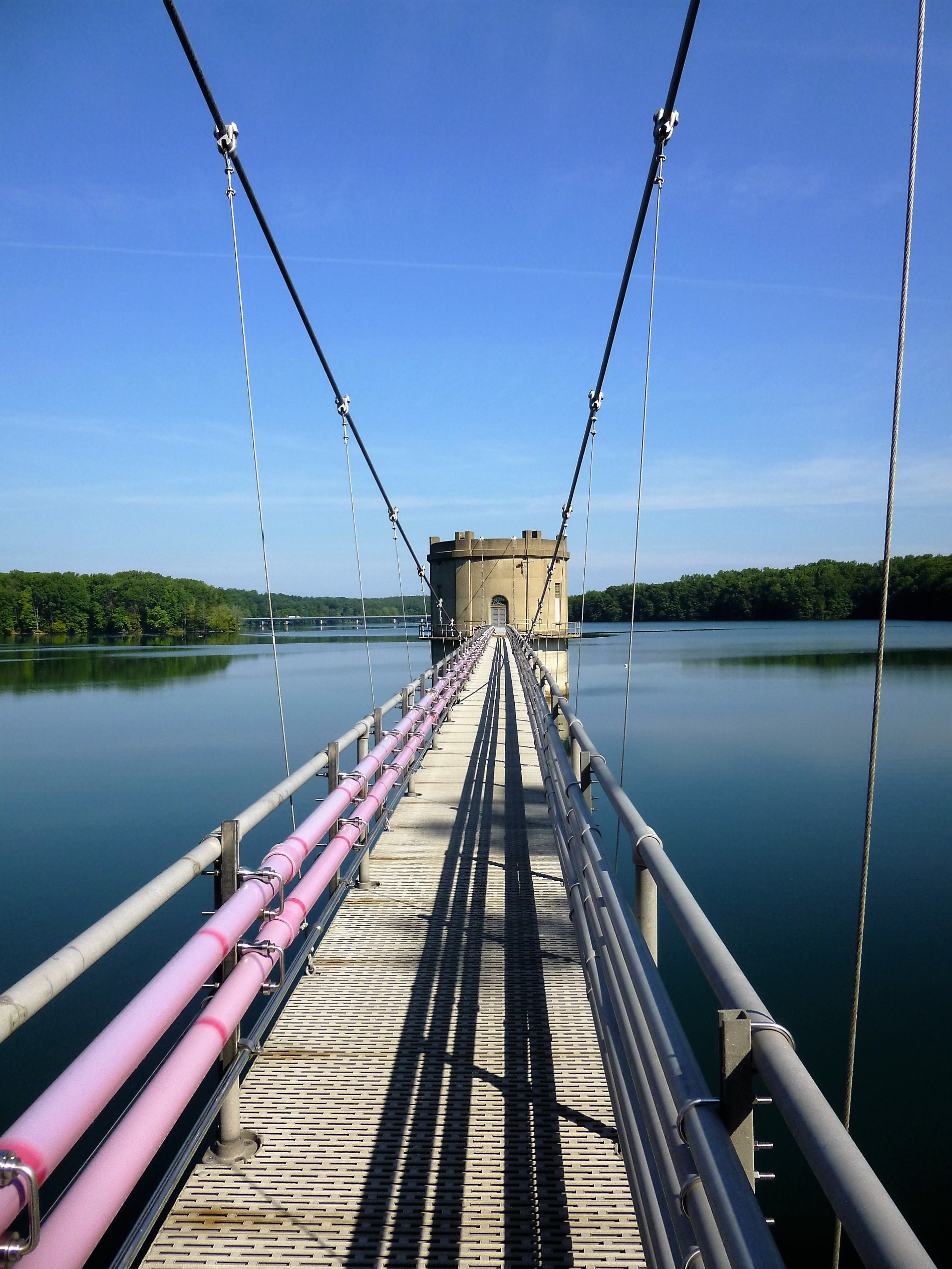
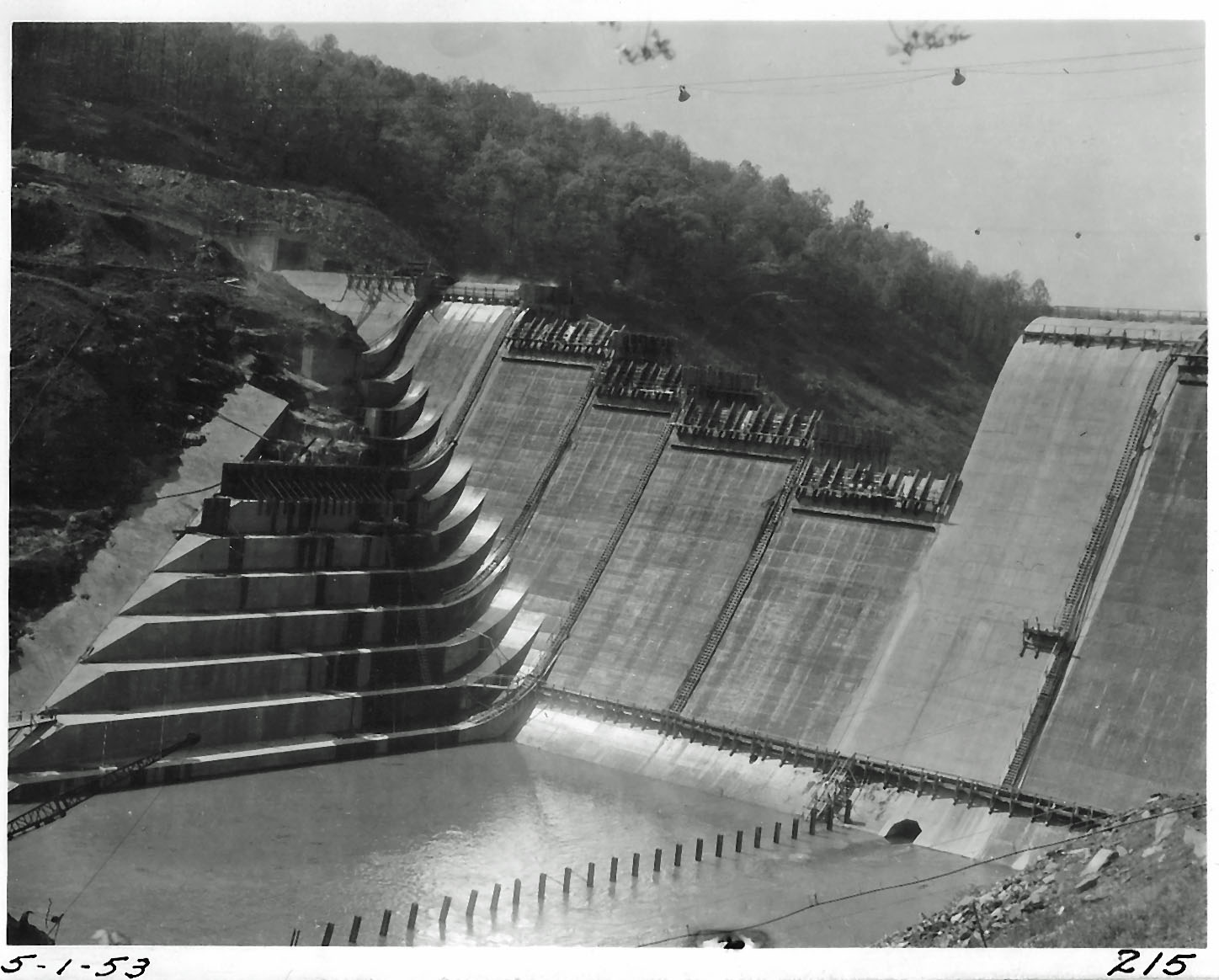
In 2013 I was able to go into Prettyboy Dam.

Looking down from the top.

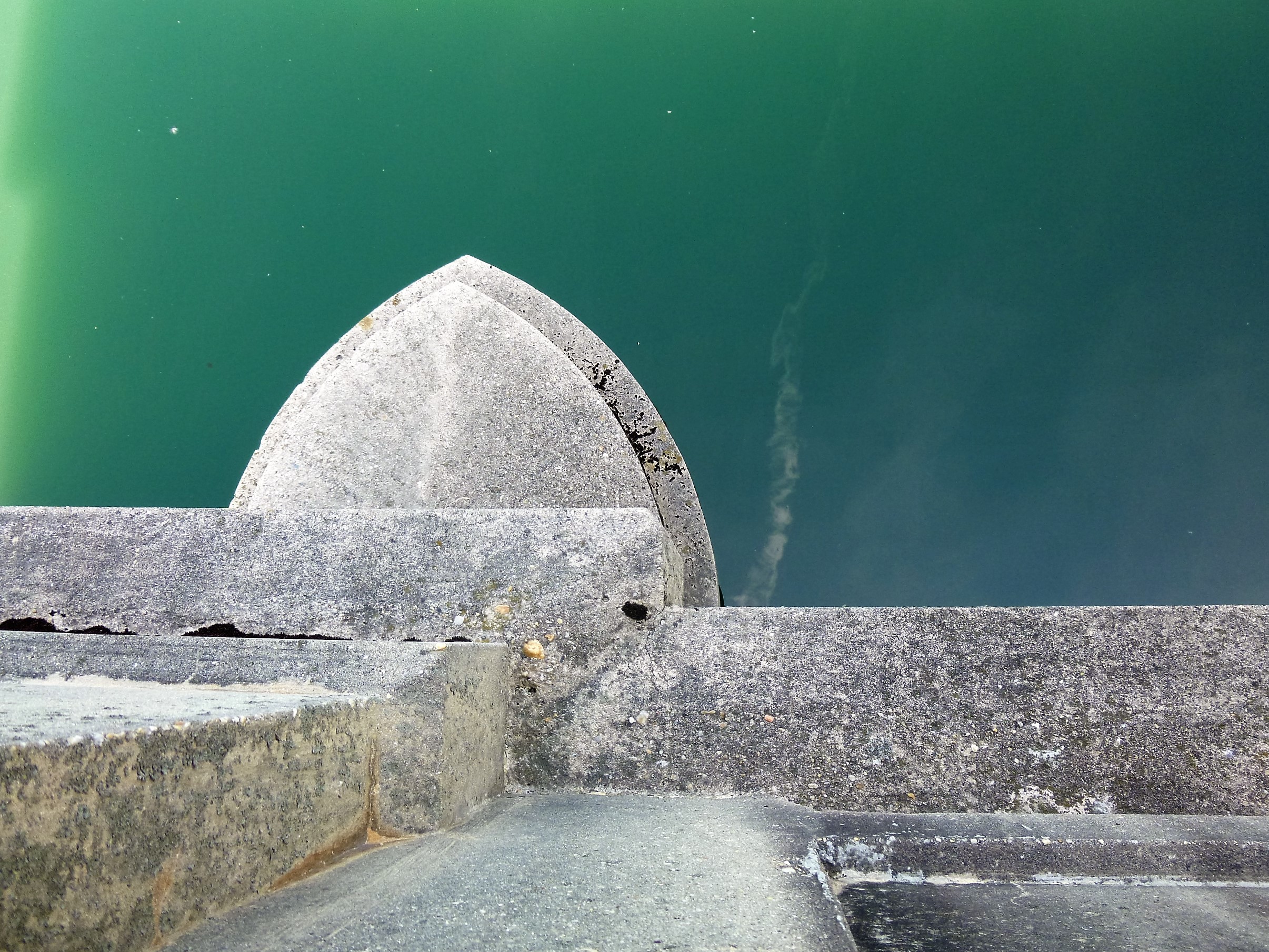
What I like about this view are the memories of my father taking me down to the bottom – concrete slab – to go fishing.

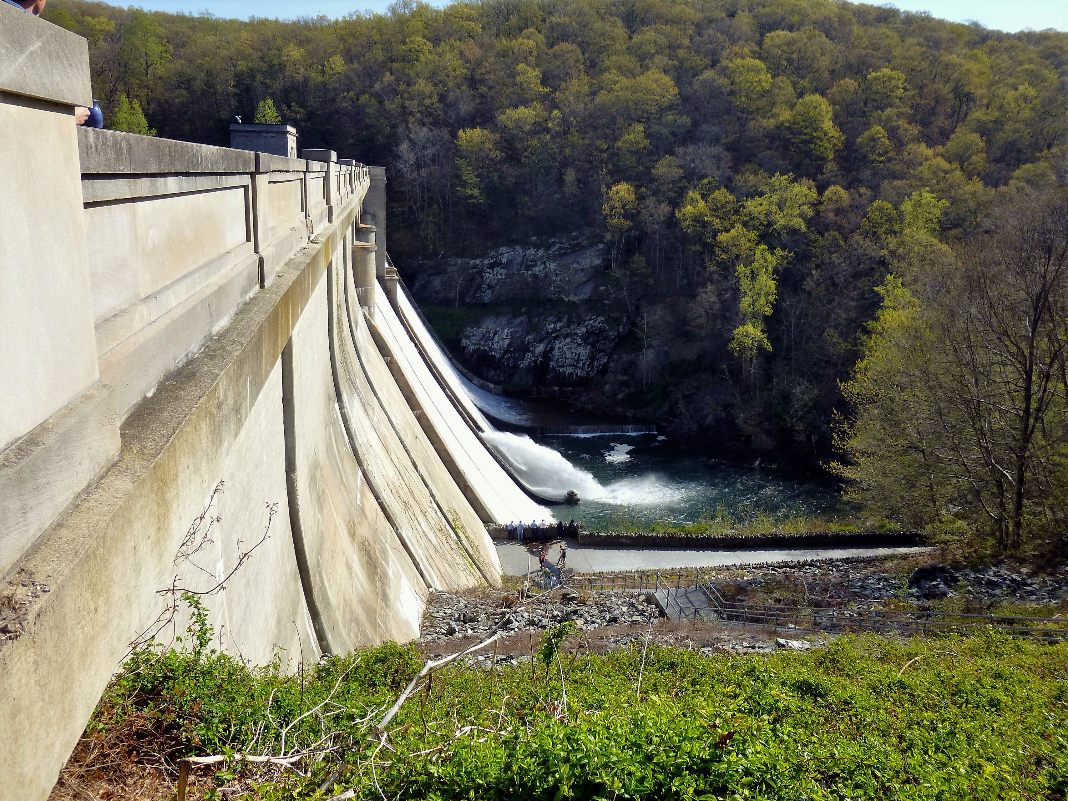
We had to go down the steps, then climb over a fence and trek down the hillside to get to the fishing spot.

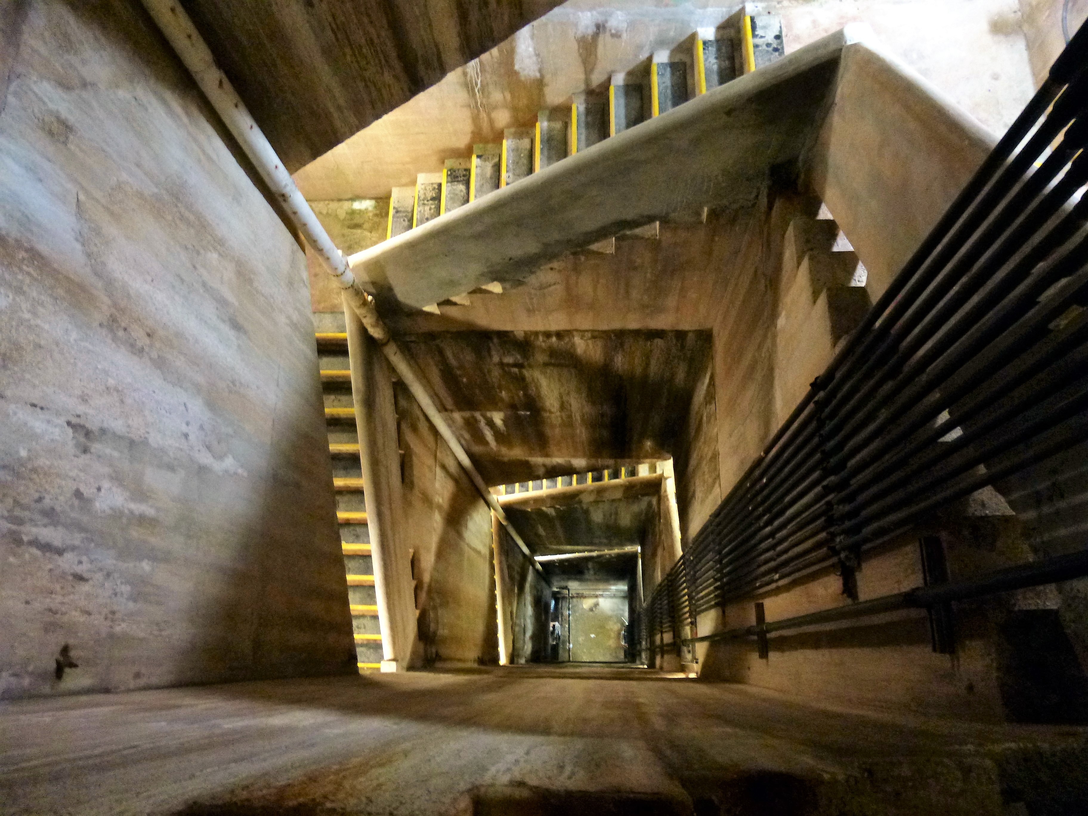
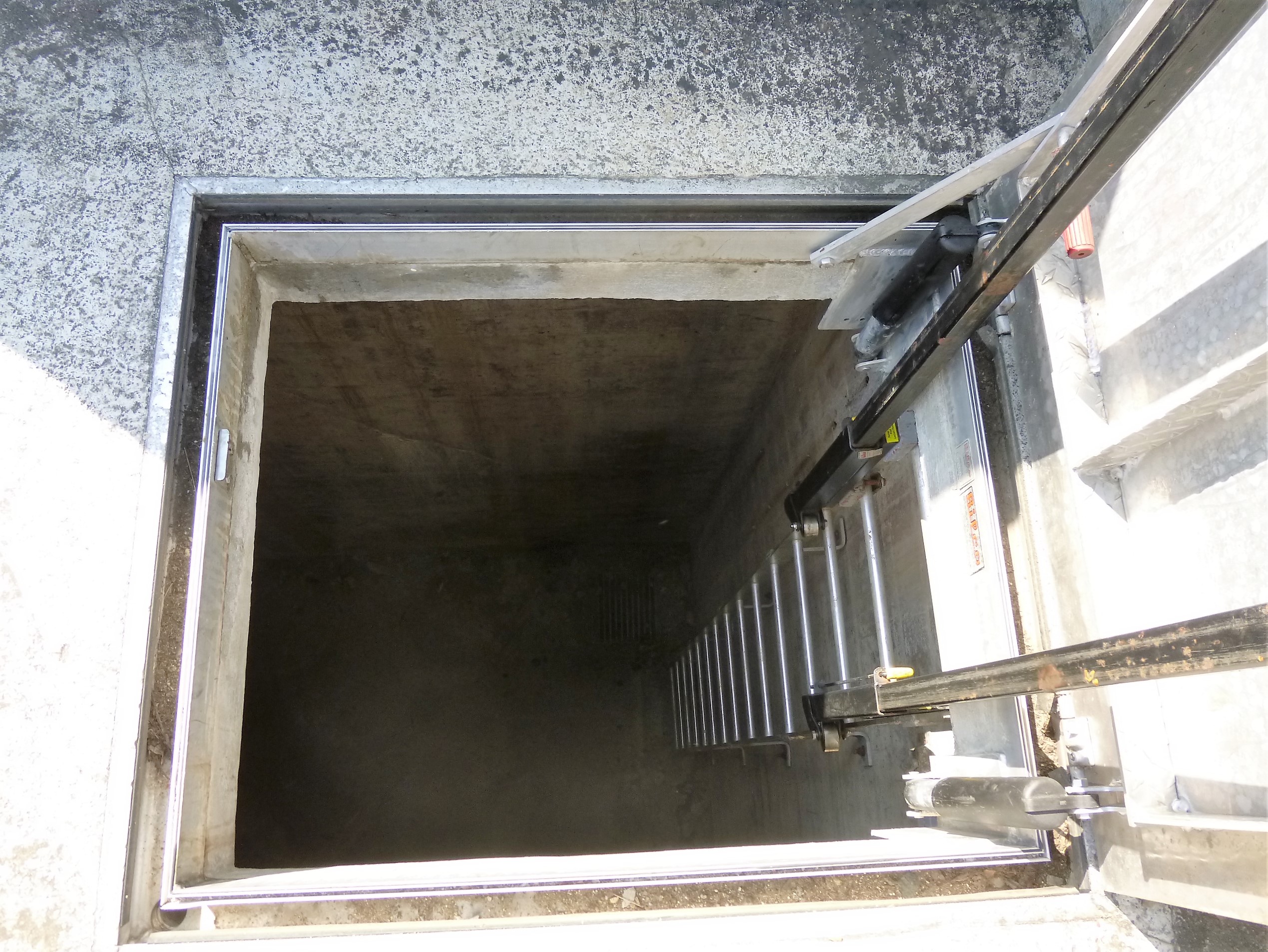
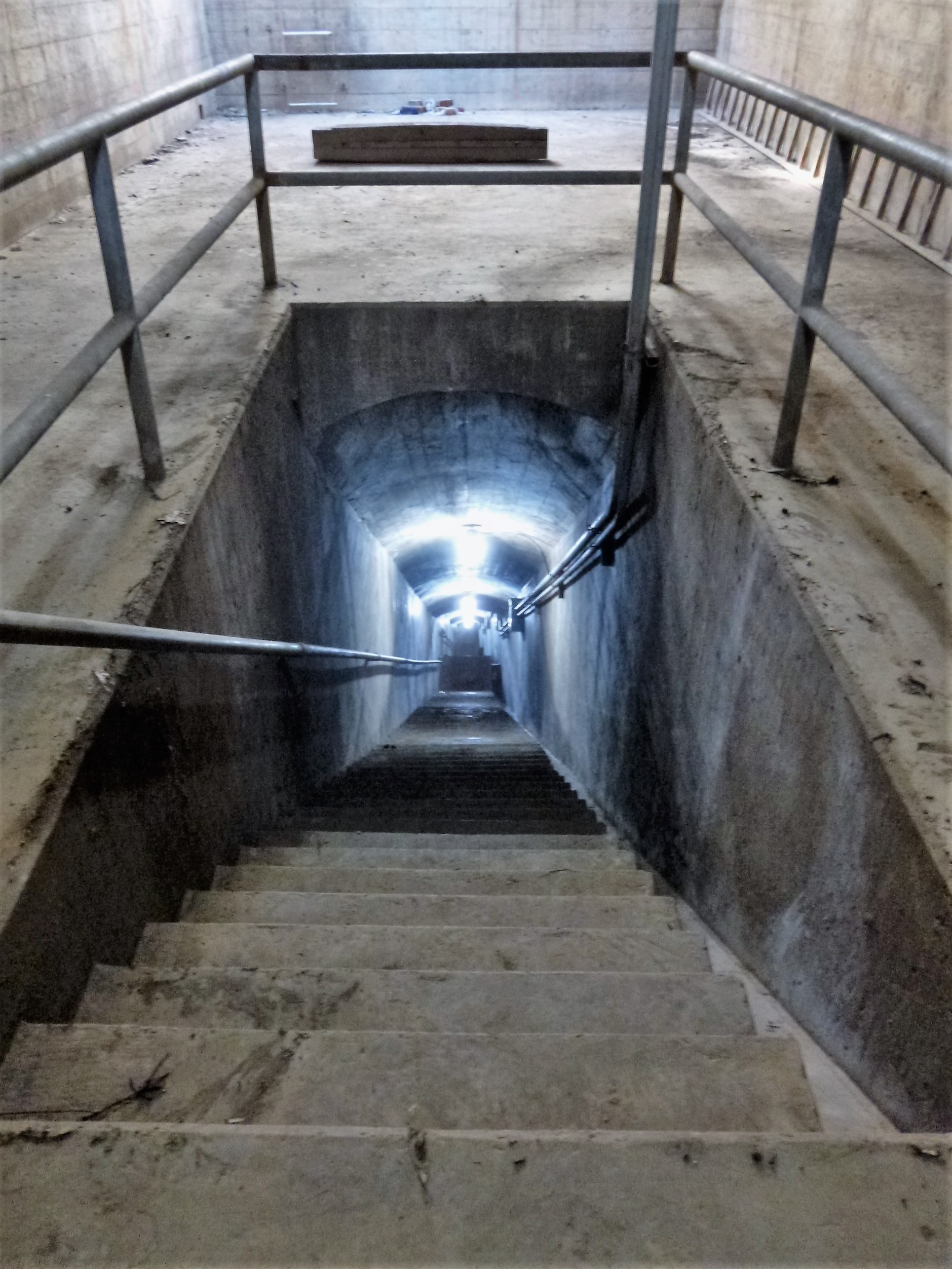
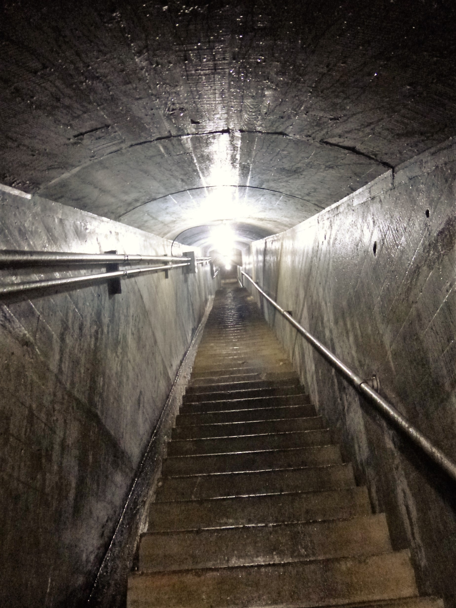
Time to head to the bottom of the dam. More steps.

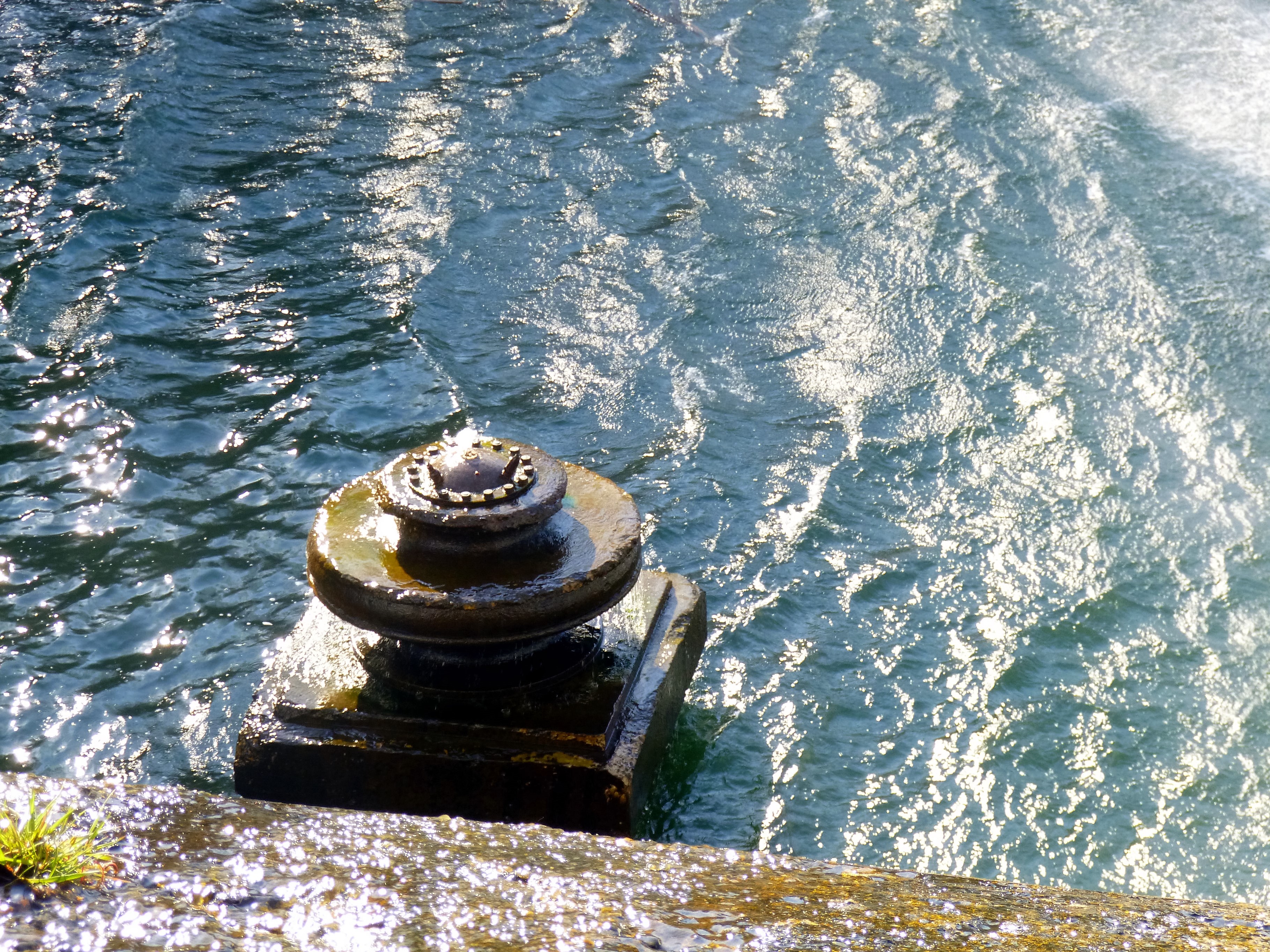
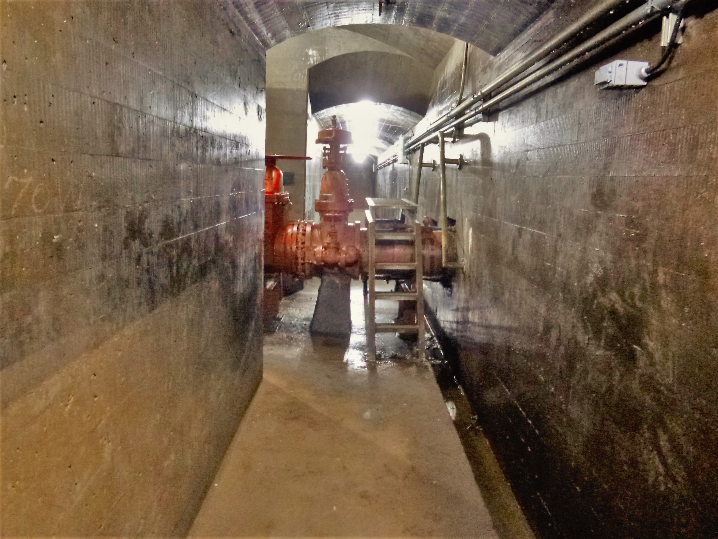
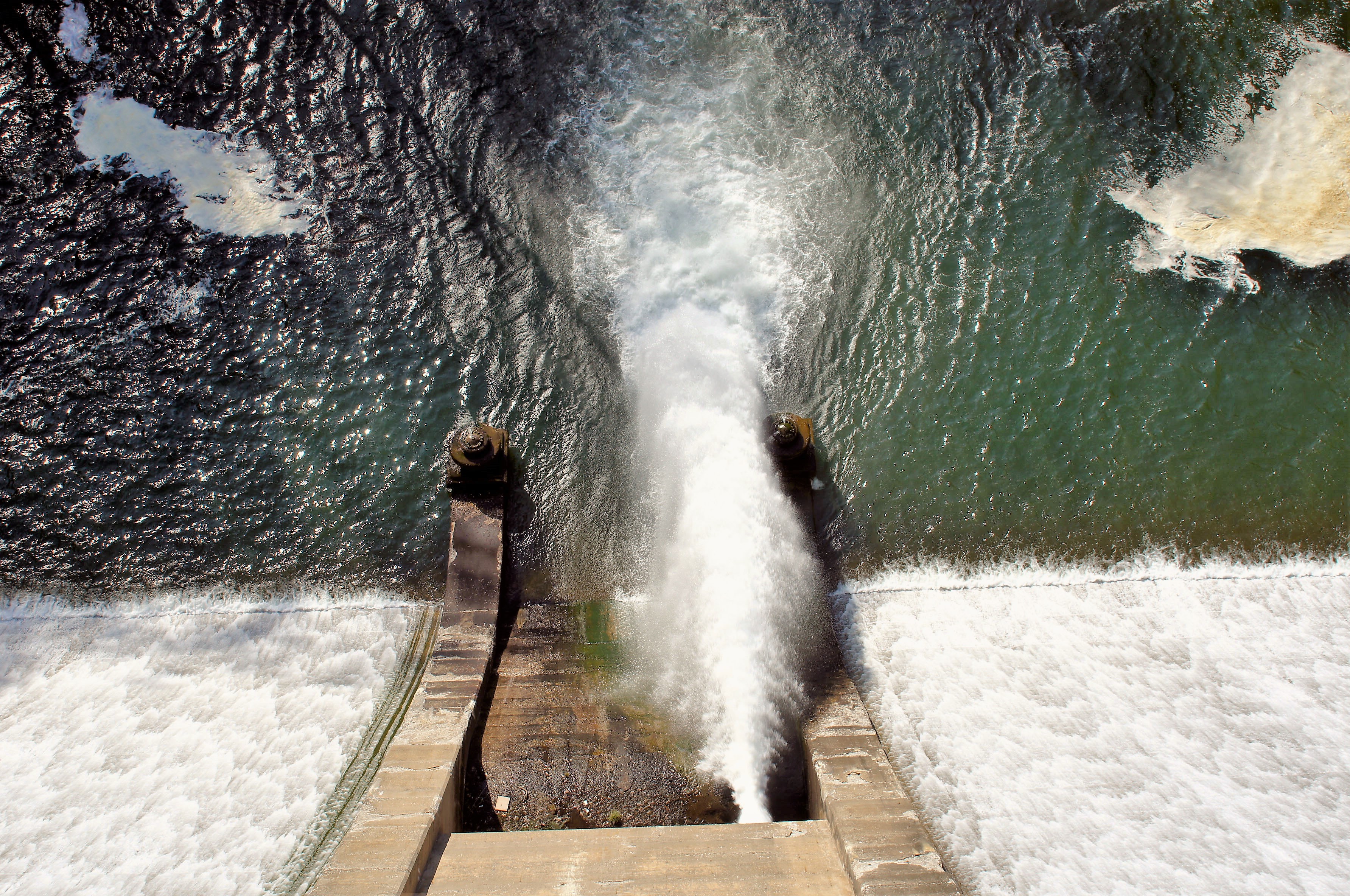
I was able to go out onto the deck, where the valve was spewing forth water to my right. This is one of two fountains that don’t work. Contractor said it would cost over $100k to fix. Director says no.

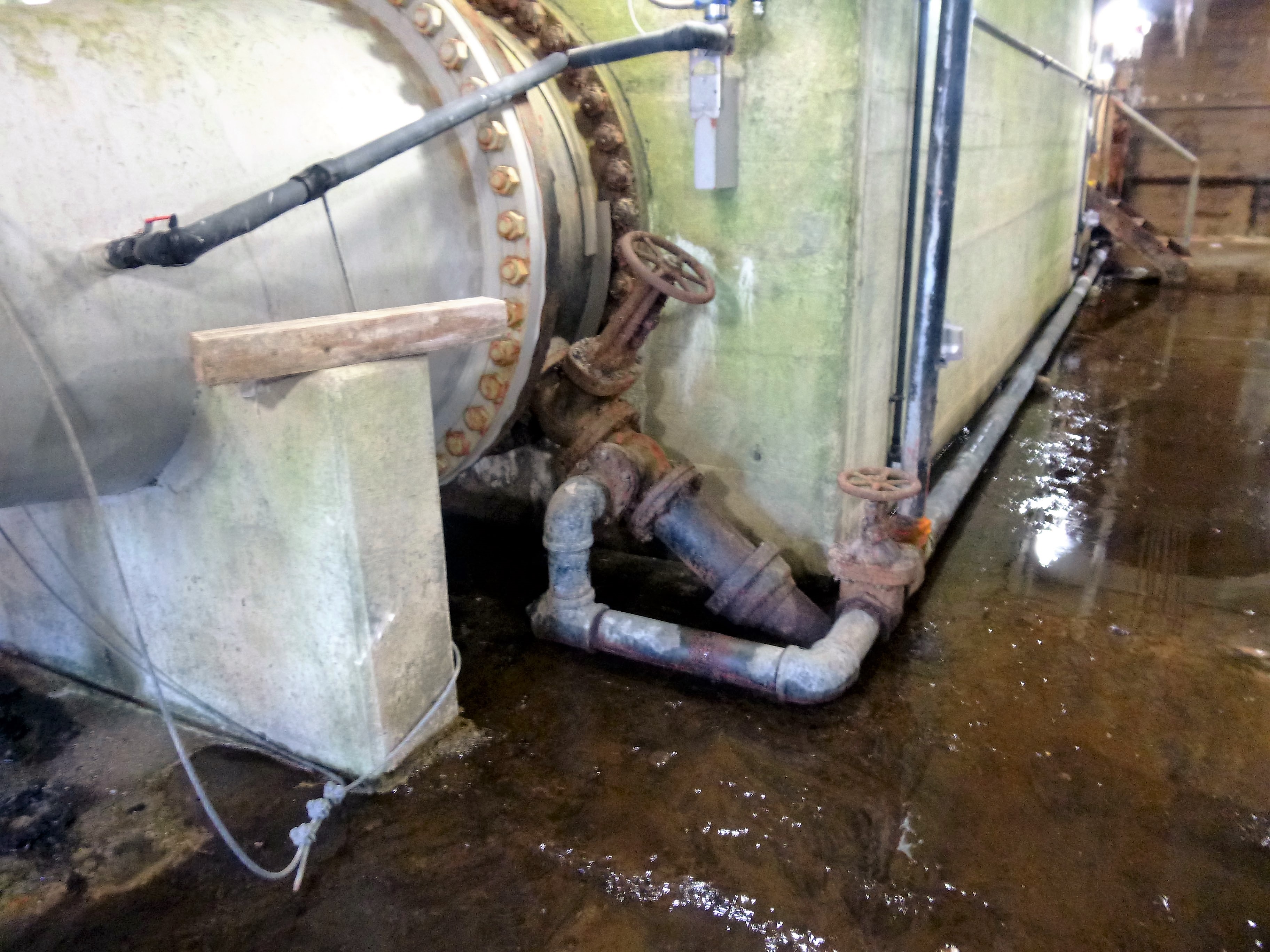
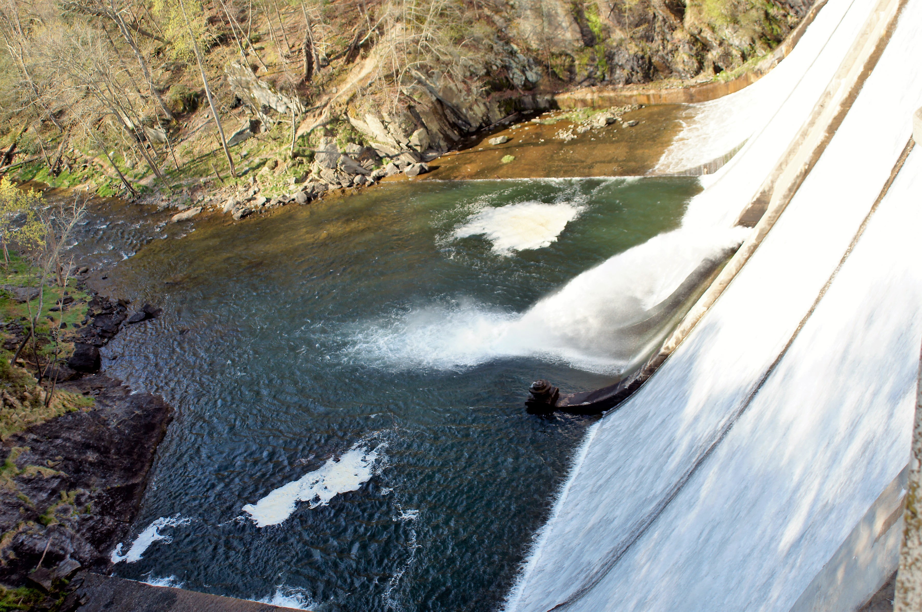
The 45 degree pipe is what feeds the fountains. It goes under this floor into a chamber and then into more concrete. It is collapsed there and this is why it would cost so much to fix.

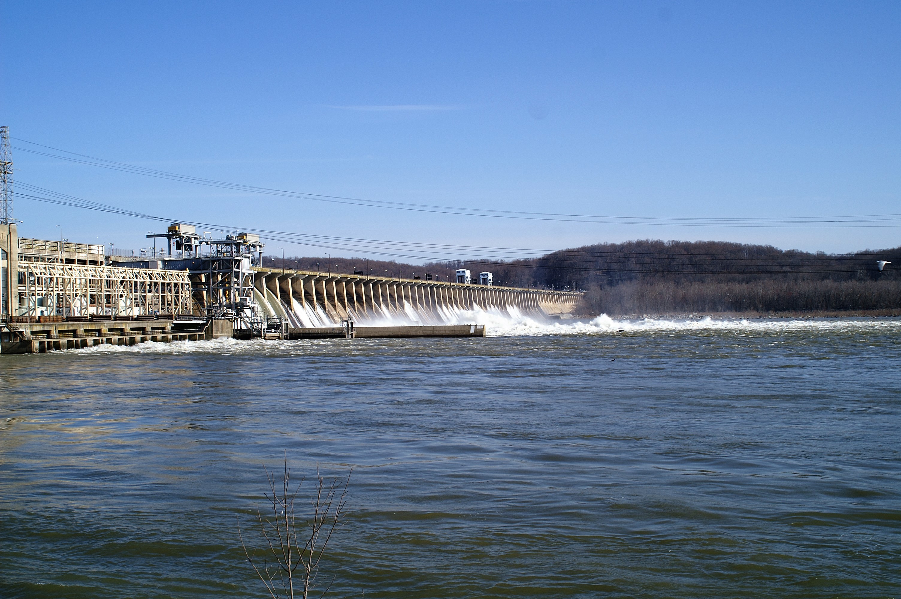
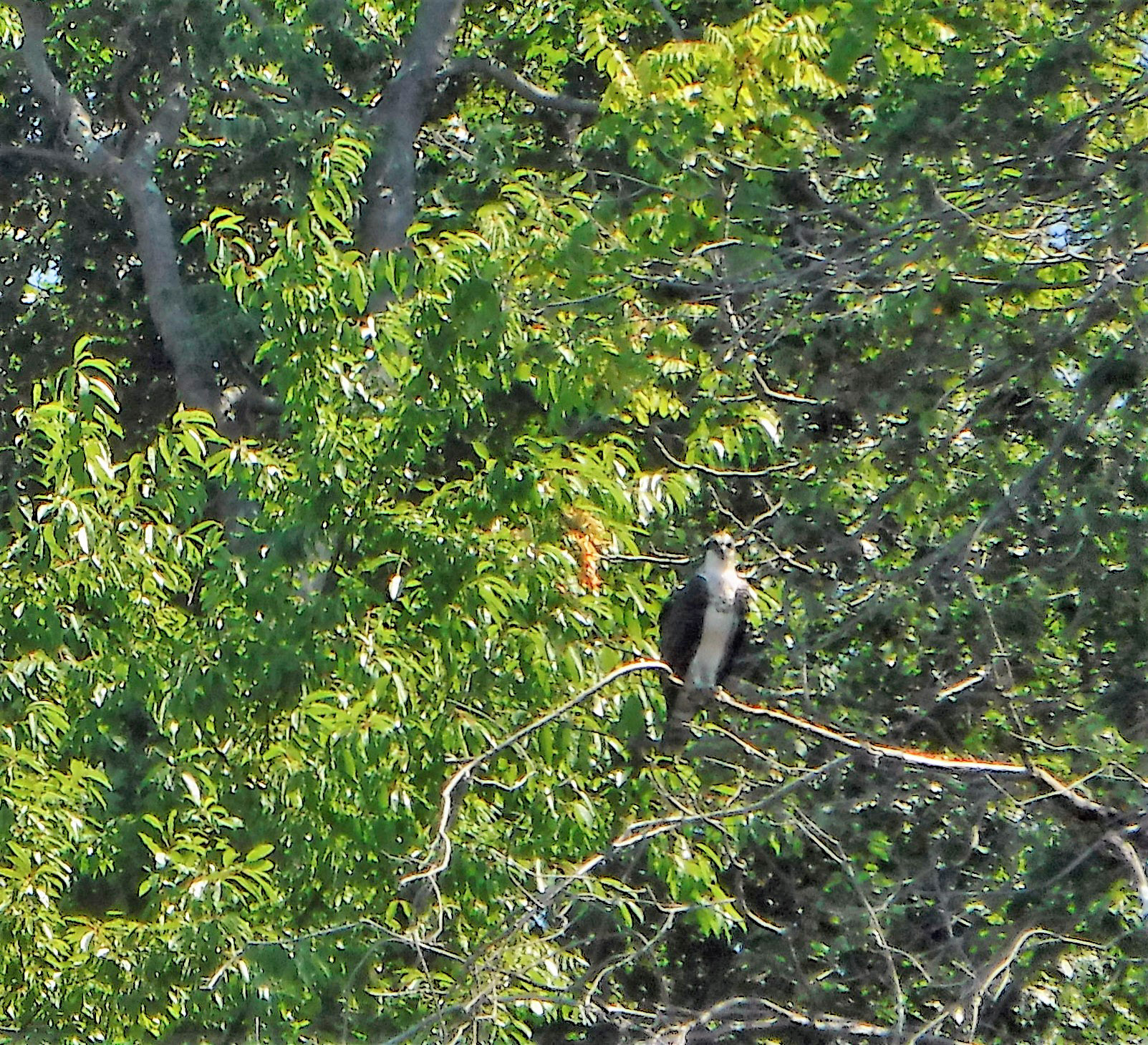
Tomorrow, if the dam Gods permit, I will be going into this dam – Conowingo! This is from 2011 when most of the flood gates were opened. I just bought a new telephoto lense for my camera and wanted to see how it works…

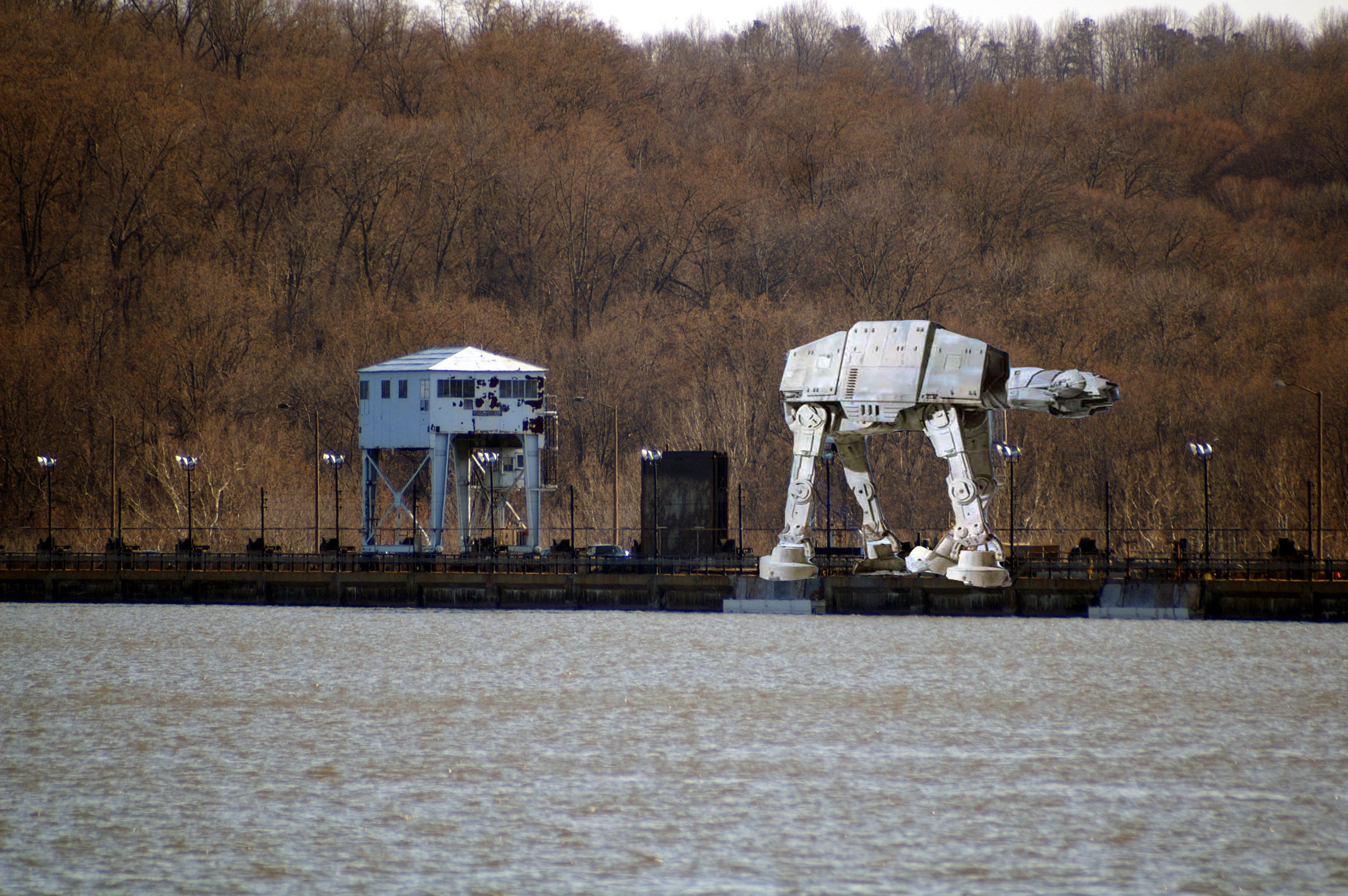
A little too well. I hope this guy shows up again for the tour!

Vac Pics #3

23 Friday Sep 2016

Posted by Ronald Parks in kayaking, Photography, water

≈ Leave a comment

Tags

Hiking, kayaking, photography, vacation

The next day we were off to Assateague Island for more kayaking

p1070559

We entered the water at the beach, end of Ferry Landing Rd. Got there before the crowds did.

p1070554

We headed north and hit a dead end, turned around and went south – lots of little islands and coves.

p1070542

Lots of these guys around.

p1070584

Tree as we headed back north on the other side of the first section.

p1070588

Old duck blind

p1070593

Heading towards the beach.

p1070611

The beach is at the end of the “Life of the Marsh Boardwalk”.

p1070594

Not sure what that guy was. Hard to get good photographs on a kayak. I also don’t care for this new camera of mine. Fuji underwater camera.

p1070597

Make sure you wear your shoes when getting out of the kayak.

p1070601

Kathy and I are the Great Adventurers!

p1070608

Island life.

p1070624

Foamy beach on the other side of the beach we landed on.

p1070649

Fluffy and soft

p1070652

Horses down where the first egret was. Like I said – hard to get a good shot on a kayak with a camera I don’t like.

p1070658

Leaving the park. Another nice adventure!


Vacation

18 Sunday Sep 2016

Posted by Ronald Parks in Hiking, kayaking, vacation, Writing

≈ 4 Comments

Tags

boating, fishing, Health, Hiking, kayaking, photography, writing

Best vacation in a long time!

Ocean City for a couple days: Sun, dolphins, 11th floor balcony door opened – listening to the pounding of the surf on the beach, watching the sunrise and sunset, Thrasher Fries, junk food, good food, 9/11 memorial, biker week …

Snow Hill for kayaking at Goat Island, saw no goats but was a great adventure…

Assateague Island for more kayaking and hiking through water onto beaches…

Fishing off Deal Island (caught a lot of variety including crabs and a skate), boat around other islands…Princess Anne for dinner and historic tour…

Crisfield then to Smith Island…

Home. Great vacation except for two unpleasantries – daughter needs brain surgery and “service engine soon” light came on in truck.

Photos later..


Leakin Park

05 Monday Sep 2016

Posted by Ronald Parks in art, Baltimore, Hiking, HISTORY, Photography, water history

≈ 1 Comment

Tags

art, Baltimore, engineering, Hiking, HISTORY, Parks, photography, Public Works, sewage, Sewage History, water history

Visited this park the other day. Our plans for the Eastern Shore were cancelled by Hermine. It was a nice hike. Below is from the Baltimore Heritage website.

Crimea Estate at Leakin Park
By Johns Hopkins
The Crimea Estate is the former summer home of Thomas DeKay Winans, a chief engineer of the Russian Railway between Moscow and St. Petersburg in the 19th Century. The estate features Winans’ Italianate stone mansion, Orianda, as well as a gothic chapel, a “honeymoon” cottage, and a carriage house. The architectural design is said to have been inspired by Winans’ French-Russian wife, Celeste Louise Revillon.

An early, and now often overlooked, part of the estate is called Winans Meadow in Leakin Park. This current meadow was the site of an early milling operation along the Gwynns Falls River. An iron water wheel still remains that pumped water to the Orianda mansion. Along with the water wheel, a barn, silo, smokehouse, and root cellar also tell the story of early development in West Baltimore. There is even an intriguing battlement near the meadow that is thought to be modeled after the Battle of Balaklava where the Russian stand against the British was immortalized in Alfred Lord Tennyson’s poem “The Charge of the Light Brigade.”

Although Leakin Park has retained its original structures in a picturesque natural setting, it almost wasn’t so. In the 1970s, federal and city officials planned to route Interstate 70 through the park in front of the mansion and directly through the carriage house. Saved by a group of dedicated Baltimoreans, the estate remains a central element in Leakin Park. (Check Google Maps for this road – it ends right at the park. The road to nowhere)

Not mentioned in the above narrative is the fact that since 1940, 71 bodies have been found in the park. Dumping ground for west Baltimore knuckleheads. It is about 1200 acres large. Part of the Blair Witch Project was filmed here.

002

The chapel where annual herb festivals are held.

007

Part of the ‘Art in the Park’ collection. Mr Keebler’s house.

009

Sometimes nature creates her own art.

013Shrooms.

014

Clay art.

024

Big scary squirrel.

028

Spider-woman.

033

Nice little walkway to the next trail down.

044

Fort remnants.

047

Through the doorway, fireplace.

051

Windows to its soul.

054

Looks like a place to keep your black powder.

057

Interior of bunker.

069

The water wheel. It is unbelievable how far up the hill this had to pump water – to the mansion.

073

Water works. (I have to mention something about water since that is what my blog is supposed to be about) (It smelled like sewage here. I read that during the last storm, 850,000? gallons of sewage was dumped into the Gwynn’s Falls – controlled dump?)

083

Trails were marked pretty good.

090

Kathy and I stood and stared at this for a while. No clue. It is on cables and has a trap door with hooks. Torture item? Remnant from filming Blair Witch?

099Man made art…

108

Nature made art.

114

The old carriage house.

117

Pole dancing crab

118

Honeymoon cottage.

125

Art.

126

Mansion.

135

Nice.

Somedays…

02 Friday Sep 2016

Posted by Ronald Parks in Photography, Reservoir, water history, Work

≈ Leave a comment

Tags

Baltimore, bridges, Dams, engineering, FILTRATION, Hiking, HISTORY, kayaking, photography, water history

…I just love my job. I love that I get to see and do the things I do – research! Headed up to Liberty Dam to look for some shaft openings, to do a possible tunnel inspection sometime in the future. While waiting for my tour guides, I roamed around a bit and took some photographs of the property.

P1070328

 This looks like the old hut the engineers used when building the Ashburton plant.

P1070326

Blue highlights on this contraption.

P1070330

Ha! A charm of finches. (Why aren’t seagulls really a flock? They are a colony. And what about turkeys? A rafter??)

P1070336

Getting a little bored here.

P1070344

Yes! First stop, the intake structure!

P1070350

Liberty Road bridge. I asked about kayaking here – need a permit and a 12′ kayak. Mine is 10′.

P1070352 (2)

I like the glass block.

P1070356

The valves. Looking for an opening to enter the conduit to Baltimore, for the inspection.

P1070391

Done at the intake, headed to the dam.

P1070389

Art deco?

P1070369

Damn! I thought there was going to be an escalator or an elevator to get to the bottom!

P1070373

Heading down. Does anyone else have a problem photographing with LED lights?

P1070377

Looking up from the bottom. No matter if I used a flash or not, the LEDs were too bright.

P1070381

Another view. Different light.

P1070384

This is dead center at the bottom. It was a relief opening when they built the dam.

Lib007

As can be seen here during construction – the relief opening.

Susquehanna revisited

28 Sunday Aug 2016

Posted by Ronald Parks in HISTORY, Photography, water history

≈ Leave a comment

Tags

Baltimore, engineering, Hiking, HISTORY, kayaking, light house, photography, Public Works, water history

Back in 2013 I wrote about the Susquehanna River. More specifically on the droughts and the need for Baltimore to withdraw water from the river. This is done through the intake structures above the Conowingo Dam.

During the research for my water history book, I read the various water engineering reports concerning the need for alternate water sources. The Susquehanna came up quite a few times. In one of the reports it was mentioned that there were 13 – 16 various sewage plants along the river. After the drought of 2010 and our using the Susquehanna River as a source of water, I decided to take a field trip to see this river.

I started in 2011 and it took a while to be able to hike and drive along the river. It is 444 miles long (Depending on who you ask), from Cooperstown NY to Havre de Grace Md. No, I did not walk and drive the whole way in one outing. I would drive to a town or just outside it, get out and start hiking for a few miles, up one side and down the other. I would head back to Baltimore then a couple weeks later, ride to the next town until I got far enough north, I just drove all the way to Cooperstown and started hiking/driving south. Climbing under bridges over train tracks and thru some strange parts of towns, hearing a variety of stories about the river. I visited such communities and areas as Goodyear Lake, Binghamton, Wilkes-Barre, Harrisburg, Three Mile Island, Columbia, Turkey Hill, etc.

I was going to do a photo-journal book about my travels but sometimes life gets in the way and I just never had a chance to finish the book. There are two excellent books on the Susquehanna that I wish I read before I started my travels – Susquehanna: River of Dreams and Down the Susquehanna to the Chesapeake.

Today, Kathy and I visited Havre de Grace. Always an adventure!

P1070273

Part of the Susquehanna Locks. While hiking through here years ago, I came across a lot of these, mostly hidden and grown over.

P1070275

Lock House – who has a key to the lock house?

P1070286

Rte 40 Hatem Bridge, old RR bridge and Interstate 95.

P1070288And yes, there is a boat – kayak ramp!

P1070296

Always alone, but never alone…

P1070299

This guys head just bobbed up and down with the ripples of tide

P1070302

Me: Oh look, an 1812 candle holder! Kathy: It’s a corn cob holder for the squirrels. I knew that!

P1070308 (2)

The pier.

P1070313

It a piers that part of the pier is missing.

P1070314

Concord Point lighthouse.

P1070315

Some history

P1070319 (2)

As many photographs that I have taken of this, I just always liked it in black and white

Dam Jam II

23 Tuesday Aug 2016

Posted by Ronald Parks in HISTORY, Reservoir, water history

≈ 8 Comments

Tags

Baltimore, engineering, FILTRATION, Gunpowder Falls, Hiking, HISTORY, Public Works, water history

Nice day for a hike thru Cromwell Valley Park. Always like listening to these guys speak on the history. Learn something new every time. The volunteers here are a great group of people who deserve a lot more credit than they get.

015

View from the observation deck on top of the dam. Water level is dropping again.

056

First stop was the restored lime kilns. Big difference since 2006. Nice turnout for a history talk.

079

The balancing reservoir. See last post for when it was still in use…

Dam Jam 2016

19 Friday Aug 2016

Posted by Ronald Parks in Baltimore, Hiking, water history

≈ 1 Comment

Tags

Baltimore, DPW, engineering, FILTRATION, Gunpowder Falls, Hiking, HISTORY, Montebello, Public Works, water, water history

Happening tomorrow! Loch Raven is nice but I liked the one at Prettyboy Dam a couple years ago, only because I got to go to the bottom-insides of that dam.


You will get to walk out here. This use to be open all the time, now only open to the public on special occasions.

Ask your tour guide who is responsible for closing these gates during the 100 year storm?? Enquiring minds want to know!

Looking upstreams from the old dam to the new.

This is what it looked like after the storm of 2011. Lots of water going over the crest.

This is the 1880 dam during the same storm.

KONICA MINOLTA DIGITAL CAMERA

There will be tours of the lime kilns by Jim Kelly, who will be giving away copies of my book (Might as well give them away – nobody buys them anymore!) (That’s ok, a good cause) This photo was from 2006

Volunteers started clearing the weeds back in 2011.

P1070168

Jim and company have had a lot of work done to the kilns. He will be giving a presentation on the 3 different kilns, talking about their history.

He will also be talking about this house, which has been restored.

PP236.1693A Loch Raven. Balancing reservoir. Throwing shaft over

Thom Grizzard will be giving a tour of this area. Where the old balancing reservoir and shaft are. No sense in bringing your bathing suit – it no longer looks like this. It is grown over. The volunteers have cleared a lot of the trails around here – making exploration of Cromwell Valley Park a lot of fun!

Mariners Point Park

17 Wednesday Aug 2016

Posted by Ronald Parks in kayaking

≈ 2 Comments

Tags

boats, Gunpowder Falls, Hiking, kayaking, photography

Nice Sunday morning kayaking trip. Thanks to EFF30 for the recommendation. What I like about this is that the Little Gunpowder Falls, the Big Gunpowder Falls and the Gunpowder River all converge here.

Entrance into the park

There’s a little black squirrel in the park today…

One of the many fishing piers

Nice boat ramp. I like that it is marked as enter and exit…not that everybody pays attention…

Many heron

Another one

Grounded Buoy.

Ducks

Kathy trying her darndest to make wakes!

And another.

After paddling around the coves we headed to the RR bridge.

I think Amtrak needs a bridge inspector in a kayak

Me.

Besides heron, there were many osprey to be seen.

Eden Mill Kayaking

14 Thursday Jul 2016

Posted by Ronald Parks in HISTORY, Photography, Reservoir, water history

≈ 3 Comments

Tags

eden mill, engineering, Hiking, HISTORY, kayaking, mills, Museum, Public Works, water history

Kathy and I went kayaking on one of the most peaceful creeks I know of – Eden Mill at Deer Creek. Back in July 2013 I posted about History and Photography, that people should appreciate the history of the mills and streams they hike. Since I have just started to kayak, I now have a deeper appreciation of the history of Eden Mill. The perspective is so much different on the water than it is walking the trails.

Additional research has shown that there were a few plans for damming Deer Creek. in July of 2013 I wrote that the crest of the proposed dam at the Rocks would be at an elevation of 540’. Another 1933 study put it at 430’. In either case, if the dam was built, the mill would be under water.

The below topography map shows the creek elevation at 342’. The dam is 16’ tall so that brings us to 358’. The mill is three stories so let’s add roughly another 36’ – that’s 394’. So yes, that is still a good 30 feet underwater! The mill is to the right of the word creek, just past the branch stream.

EM5

To know this and to understand the history makes it such a sweet kayaking adventure. Appreciate history. Go kayaking. Be happy!

EM7

Looking upstream from the base of the mill.

EM6

The Mill as it looked in the 1930s

EM1

The mill and top of dam. View from kayaks.

EM3

One of the branch streams that feeds Deer Creek. These two bridges would be under water.

EM4

View from under the bridge. Back in the 30s, this bridge was probably an old wooden one.

EM2

It doesn’t get any better than this!

← Older posts
Newer posts →

Blogroll

  • Flouride Action Network
  • lulu
  • My Book
  • WordPress.com
  • WordPress.org

Recent Posts

  • Bermuda 2023
  • ICELAND April 2023
  • George Chalmers of Fochabers
  • In Search of The Skipjack Ada Mae
  • Trap Pond Kayak

Blog at WordPress.com.

  • Subscribe Subscribed
    • Water and Me
    • Join 231 other subscribers
    • Already have a WordPress.com account? Log in now.
    • Water and Me
    • Subscribe Subscribed
    • Sign up
    • Log in
    • Report this content
    • View site in Reader
    • Manage subscriptions
    • Collapse this bar
 

Loading Comments...