• About
  • History Writings

Water and Me

Water and Me

Category Archives: Baltimore

Montebello and the Panama-Pacific Exposition 1915

22 Friday Dec 2017

Posted by Ronald Parks in Baltimore, Dams, HISTORY, water history

≈ 2 Comments

Tags

Baltimore, Dams, engineering, FILTRATION, glass plate negatives, Gunpowder Falls, HISTORY, Lake Montebello, Loch Raven, maps, Montebello, Public Works, Research, water history

Finishing up documenting a Water Board Minutes of Meetings Journal, I came across a couple of interesting tidbits concerning the connection between Baltimore and San Francisco. In 2015 we both celebrated a 100 year anniversary. Them celebrating the 1915 World’s Fair and us the building and opening of the Montebello Filtration Plant. The connection being this – February 11, 1915 It was resolved by the Water Board to send the Filtration and Dam models to the Panama-Pacific Exposition. According to the model itself, it was completed in December, 1914.

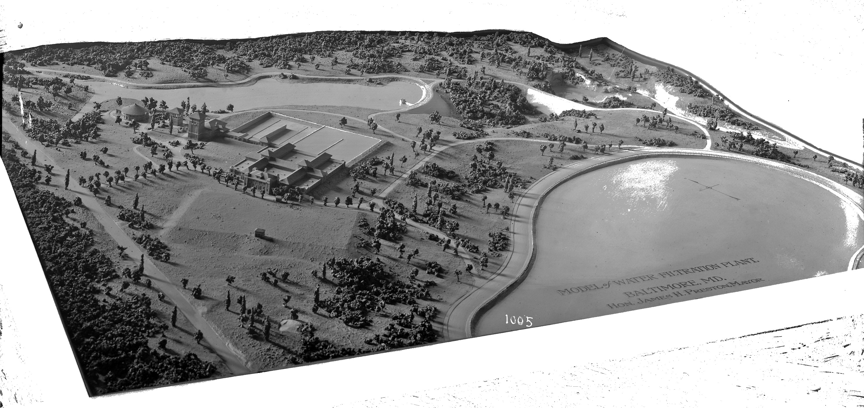
Here is a lantern slide copy of the model. If you visited Montebello during our 100th anniversary and took a tour, you would have saw the actual model.

The lighting in the hallway is terrible with all the reflections. It was too dark with the lights out and too reflective with a flash.

Here is the nameplate data on the model.

Along with this one. I did a search for information on this company but could not find much. And something else I could not find is – where is the model of Loch Raven?

Howell’s did a pretty good job replicating the filtration plant.

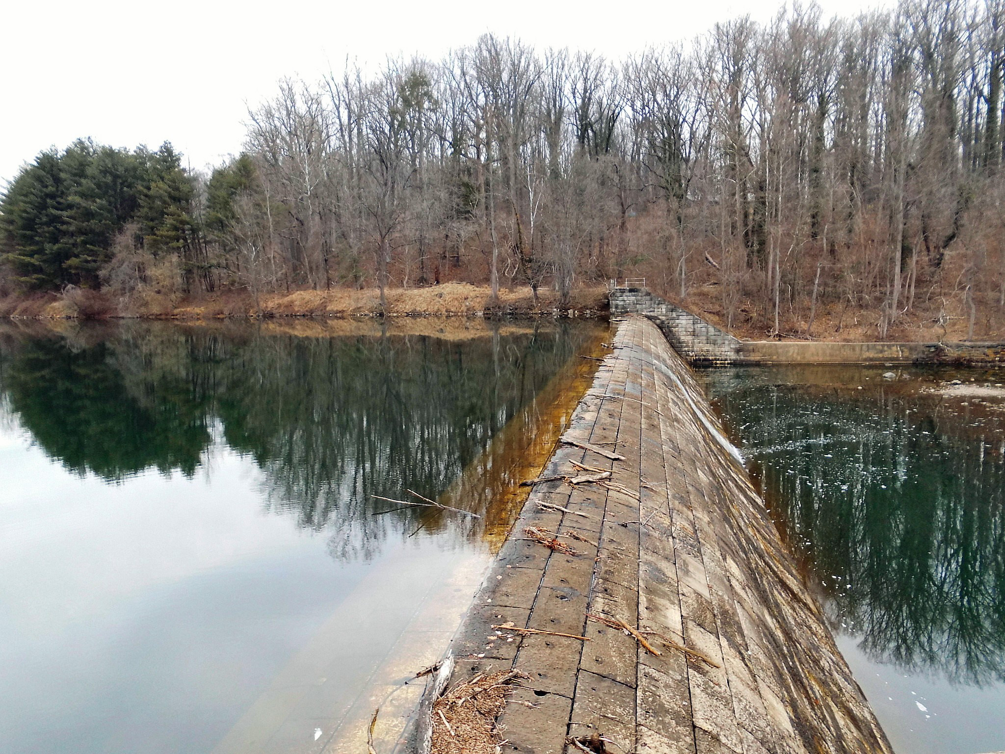
The plant as it looked in the 1920s.

I don’t know about anybody else, but I’d like to put little people in here…and maybe Godzilla!!

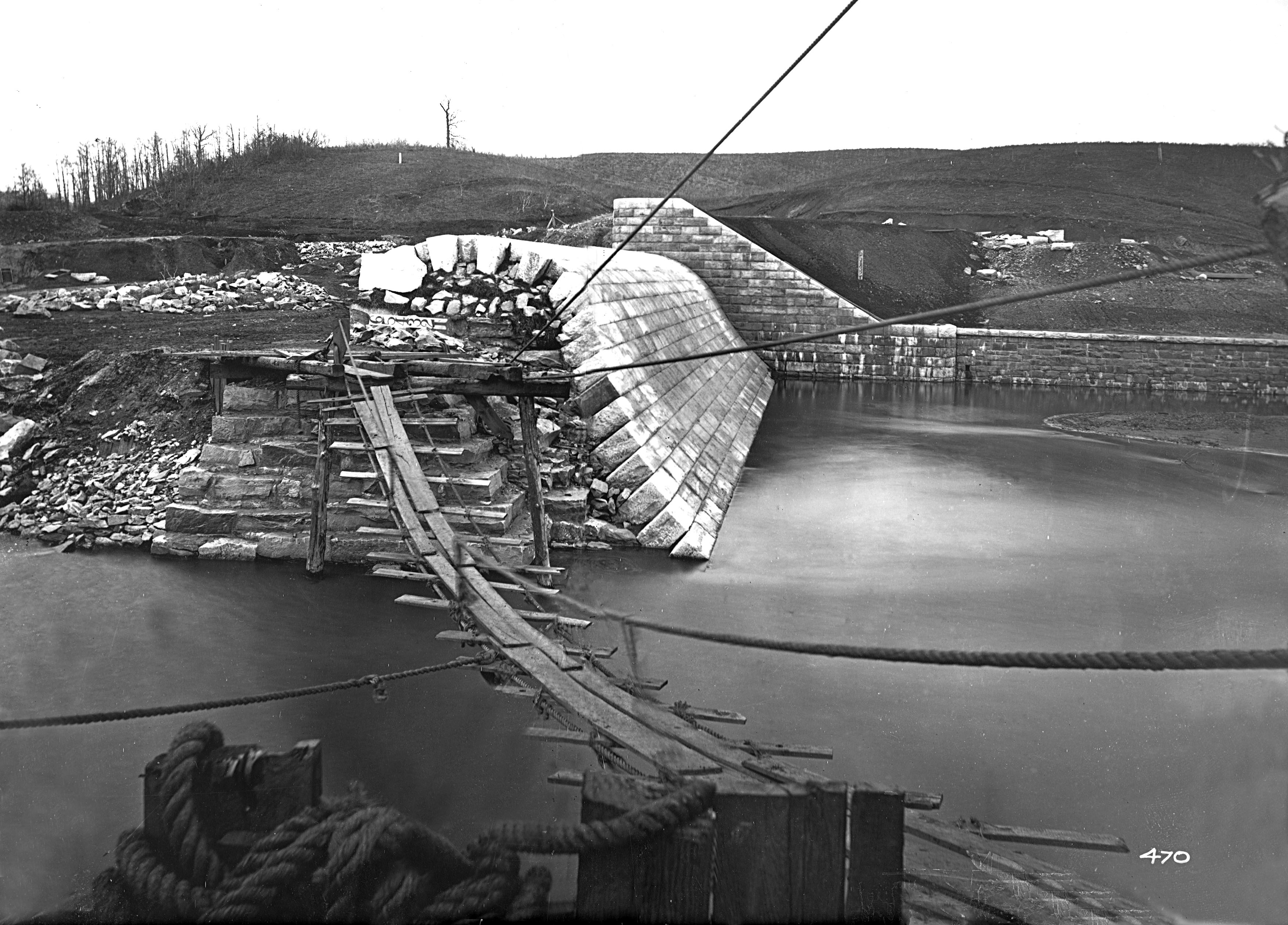
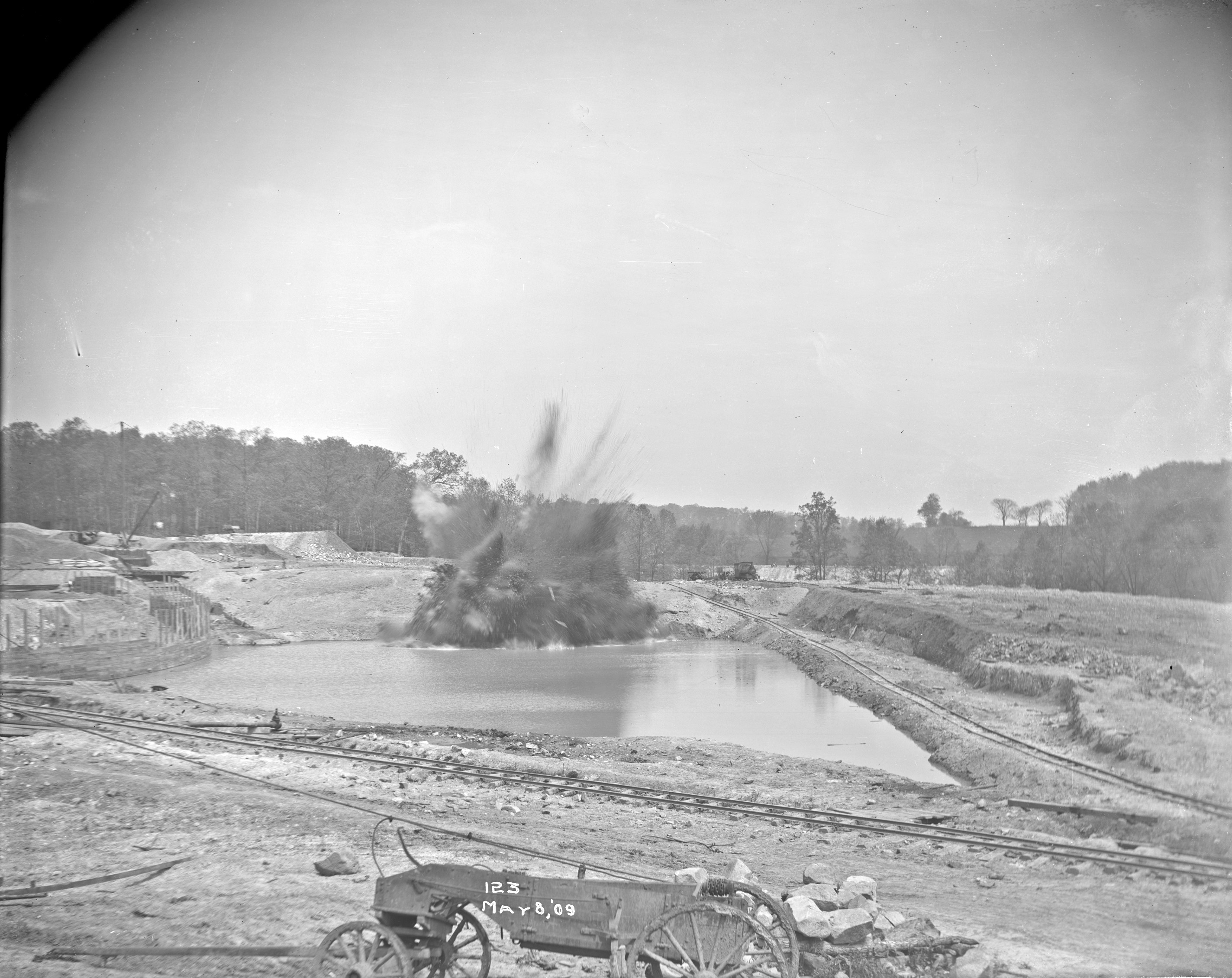
Showing what the waste lake looked like.

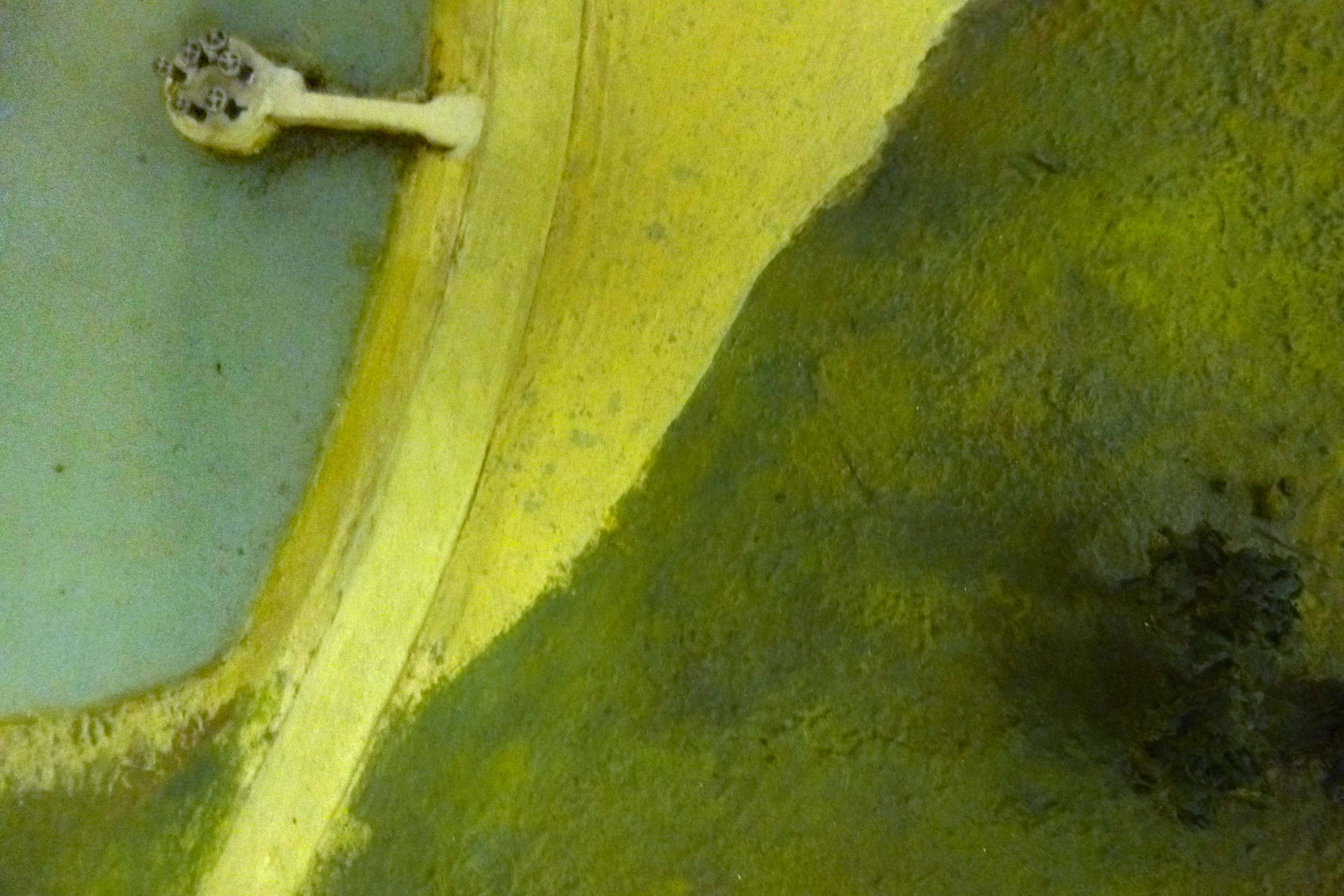
And the detail of the outfall structure.

The waste lake dam and outfall structure being built. Notice the date – October 1914. This means that the model was built conceptually, like an artist’s rendition of something before it is there.

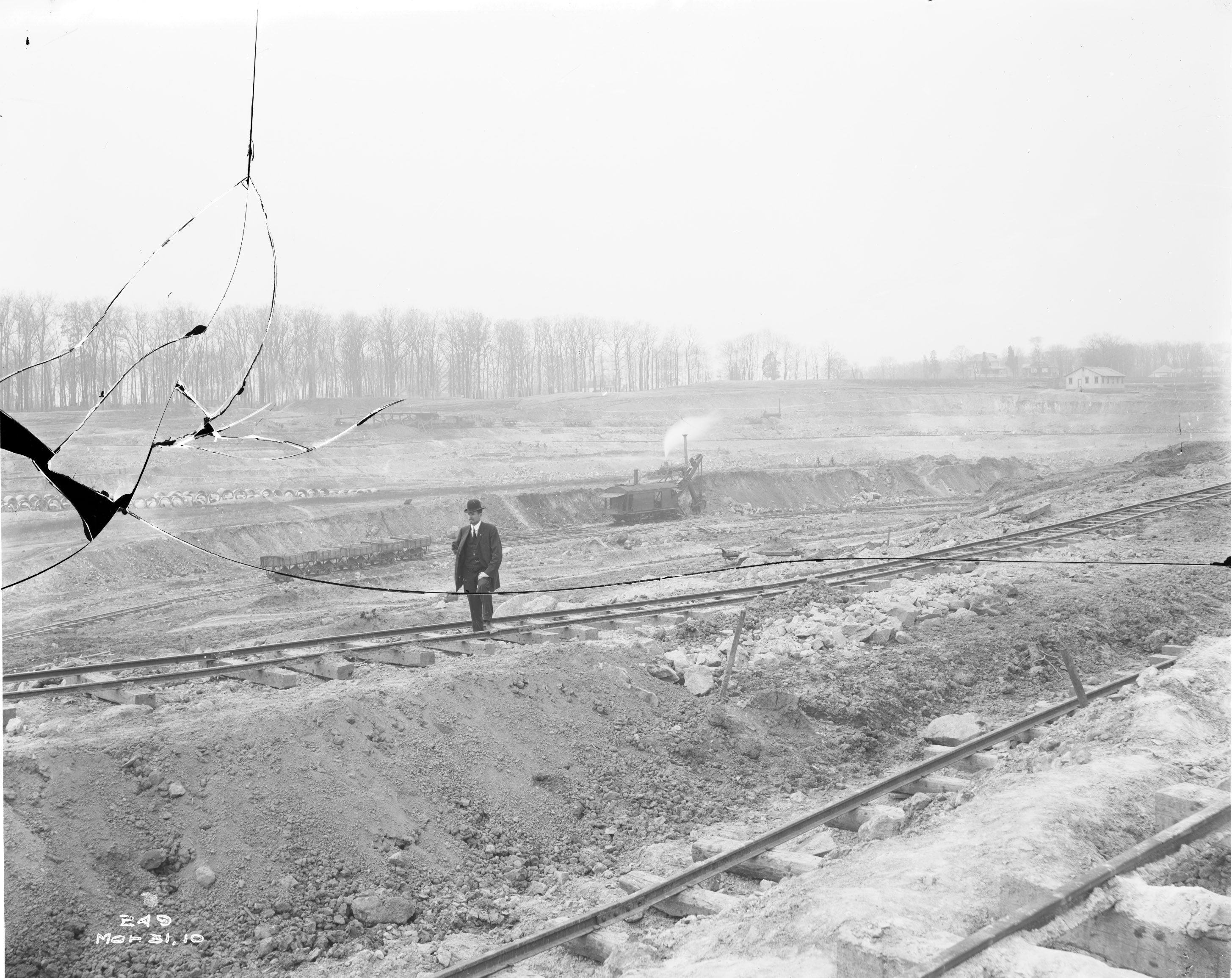
Of course, one research item always leads to more.

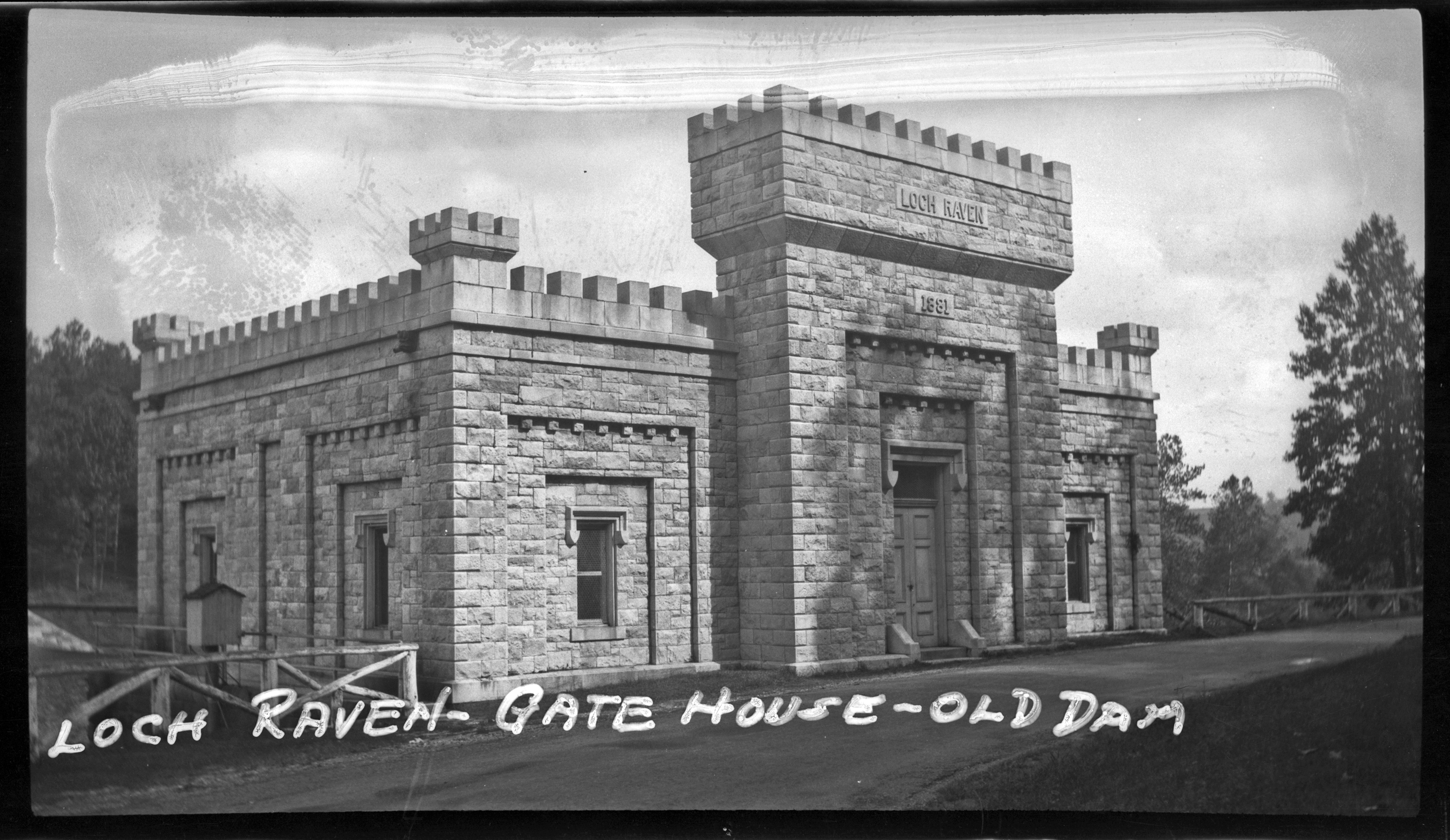
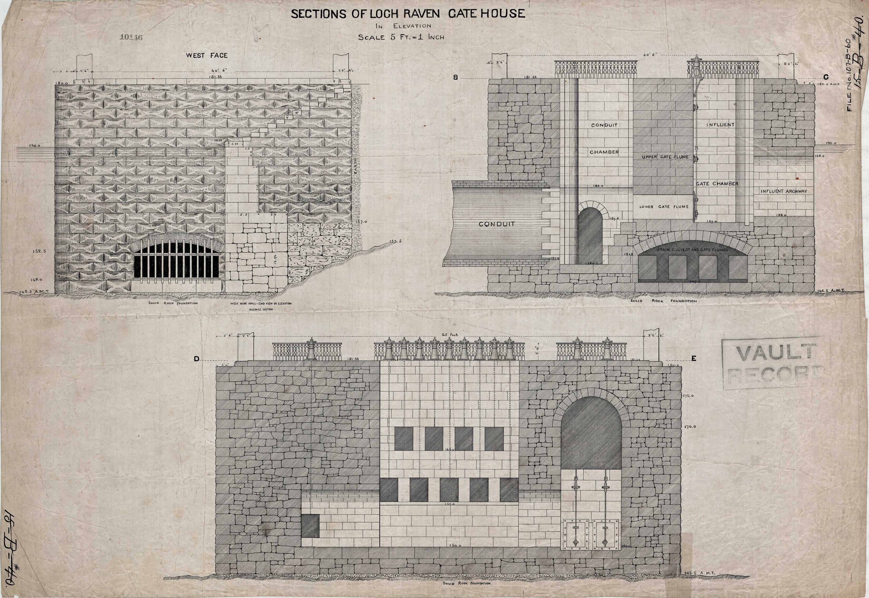
In 1884 models of the substructures were built and placed in each gatehouse, Loch Raven and Lake Montebello, to give visitors a better understanding as to how each works. (What happened to them?)
February 6, 1893 the Water Board resolved to send a display to the Columbian Exposition. This was 21 years before the Howell Microcosms were built. so what did they send?
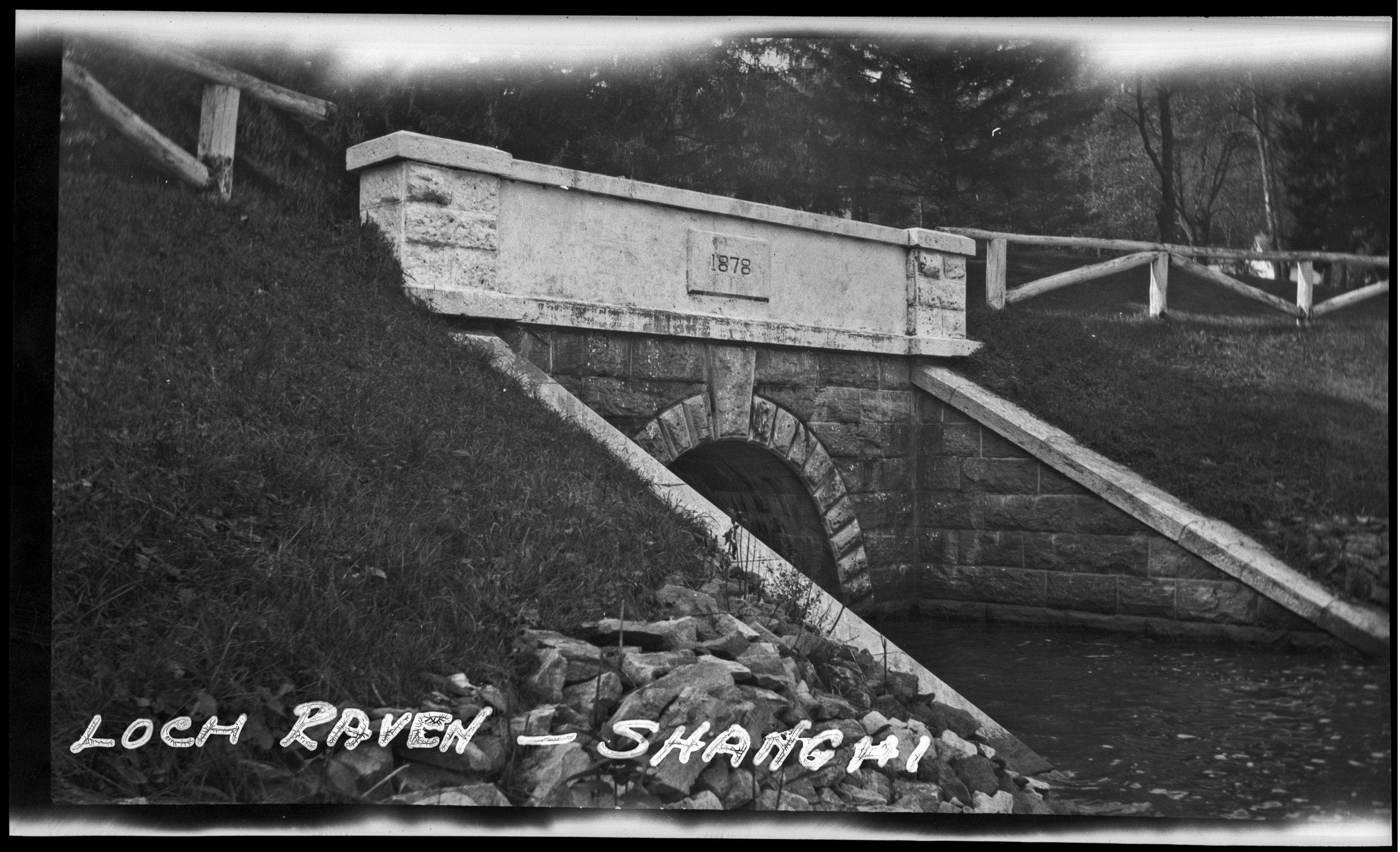
November 18, 1935 letter from M.P. McNulty, he has just completed creating a model of the Loch Raven dams and inquires as to the dates the real dams were built. Small replies that the lower dam was built between 1875 and 1881 by Fenton and Jones, Contractor. The upper dam was constructed by King-Ganey starting in 1912 and finished in 1914 and then raised between 1920 to 1922 by Whiting-Turner. Attached to the letter was a newspaper clipping which shows a picture of the model. (This clipping is at the City Archives)
December 31, 1952 letter from William Eichbaum Scale Models informing Hopkins that they will build a new, Montebello Plant model in the existing case for $1,000.00. This was not done.
And for what appears to be a wonderful book – San Francisco’s Jewel City: The Panama-Pacific International Exposition of 1915 by Laura Ackley


The Permanent Gunpowder Water Supply

05 Tuesday Dec 2017

Posted by Ronald Parks in Archives, Baltimore, water history

≈ Leave a comment

Tags

Baltimore, bridges, Dams, engineering, glass plate negatives, Gunpowder Falls, Loch Raven, Public Works, water history

Started planning back in 1854. Elevation of 160’ would supply seven-eighths of population (according to contour lines). Supplying others outside that elevation would be a matter of mechanical detail (pumping stations). The need to keep Lake Roland and the Gunpowder as two distinct and separate supplies, as Lake Roland becomes muddied during rainy season (this was why Druid Lake was constructed). It was first suggested to tap the river as far up as the Warren Factory but concurred by a host of engineers that the proper volume of water could not be obtained by damming at any point above Raven’s Rock and most agreed to a point further downstream about where Mr. Martin has located it. The dam will be erected on the Gunpowder river, at a point admirably adapted for the purpose, a short distance above Mine Bank Run, and the lake thus formed, will extend up the river as far as Meredith’s Ford Bridge at the Dulaney Valley Turnpike, where the pump house connected with the ‘Temporary Supply’ is now located…will flow by natural gravity through a twelve foot pipe to a lake at Montebello, between Hillen and Harford roads, located in a natural basin formed by one of the tributaries of Herring Run (Tiffany Run). The lake will have a water area of about eighty acres and a storage capacity of 700,000,000 gallons. The twelve foot pipe (conduit) will continue to a point on the Harford road opposite Homestead, whence pipes will be laid to connect with the city pipe system at North Boundary Ave. and Washington St. Lake Clifton.

A drawing of the Loch Raven Gate House a couple years after completion, for the engineer’s files.

The Gate House and how it looked in the 1920s.

An interior, cut away view.

The influent drain chamber to the yet to be built Gate House.

Looking over the construction of the dam, towards the east wall.

A recent view of the discharge conduit, below the dam. As shown in third photo above.

Another drawing of the Gate House structure. Where it says Vault Record would be facing the road.

Recent photo from the road, after Gate House was removed, showning vaults and valves.

This photo has me baffled. It is showing two 12′ conduits, whereas all the drawings only show one. On the left you can see where the laborers are building the brick lined conduit. On the right, nothing going on. Wondering if it was built in error or was it for a bypass as the dam was being built?

Drawing of the east wall.

1880s photo of building dam, looking east.

Recent photo looking east. Looking close you can see where the stone work stops and cement starts. In the 1970s they put a parallel pipeline in and cut right thru the wall.

This is an early, beginning of construction photo. Stone excavation looking west. Interesting on zooming in – under the roadway guardrail is a tunnel opening that looks like…

…the top left of these drawings. 

The drawing for Shanghai Run.

A 1920s photograph.

A recent photo of the opening to Shanghai Run. Looking over the wall towards the woods, there is no opening??

City workers lounging and the job is almost completed.


Guilford Reservoir

22 Wednesday Nov 2017

Posted by Ronald Parks in Baltimore, engineering, water history

≈ Leave a comment

Tags

Baltimore, engineering, FILTRATION, Guilford, HISTORY, POLITICS, Public Works, water history

1888 – Eastern High Service Reservoir at Guilford: On June 5th, 12 acres, 3 roods and 29 perches of land was purchased on Cold Spring Lane, west of York Road, for an Eastern High Service Reservoir at Guilford. The Guilford estate was purchased from the heirs of the late A. S. Abell. A contract was awarded on July 30th to Messrs. Jones & Thorne for the construction of the Guilford Reservoir. The reservoir will have an elevation of 350 feet and a capacity of 40 million gallons of water. The water will be supplied to this reservoir from Lake Clifton via the Eastern Pumping Station. All the area between Huntingdon Avenue and Cold Spring Lane will be supplied with water from this reservoir. The 36-inch pipes temporarily used to supply Gunpowder water to Roland’s Run will be re-laid under York Road, forming a line through which water will be forced from Lake Clifton to Guilford Reservoir. The construction of the Guilford Reservoir commenced on August 1, 1888.

Property purchased by the City.

An earlier drawing without the date on top stone of vault.

A later drawing for construction purposes, showing the date. The connection of this reservoir to the water system is documented in the Early Water History: 1889 – Eastern High Service Pumping Station: A contract was awarded to Henry R. Worthington Company for the erection of the Eastern High Service Pumping Station at the corner of Oliver and Ann streets. The pumping station will have a heavy duty pump with a capacity of 5 million gallons per day for the Guilford Reservoir and ultimately for increasing the water supply in Druid Lake. Supplying Druid Lake is a result of decreasing flows of the tributaries supplying Lake Roland; and of the increase in water demand to the higher elevations. The pipeline installation connecting the Eastern Pumping Station to the Guilford Reservoir was nearly completed during the year. The construction of the Guilford Reservoir was proceeding at a good pace. The excavation was completed, the vault chamber was constructed, the puddle trenches in the embankment surrounding the reservoir were sunk to the requisite depths, and the mains to the reservoir were installed.

Another drawing by years end. Interestingly the date on the vault house is 1889, but a recent search shows the date as 1893:

Hard to see the date on the top stone in this street view. From the history: 1893 – The Guilford Reservoir was completed on June 29, 1893 and placed into service supplying finished water to the public. By 1895, the water consumption from the Guilford Reservoir averaged 400,000 gallons per day.

This drawing is from 1894. I did not know there even was a fountain in here. The two times I went to the reservoir for work was a few years ago for a CL2 leak and just recently to see the work going on there.

In this 1938 aerial view, from the Baltimore Sun, Dark Room series, you can see the fountain in the center of the reservoir and the valve vault on the right hillside.

Here is an overhead shot a couple years ago.

And here is another, showing the construction to cover the reservoir (actually installing new tanks).

High Service Reservoir

08 Wednesday Nov 2017

Posted by Ronald Parks in Baltimore, engineering, water history

≈ Leave a comment

Tags

Baltimore, Druid Lake, HISTORY, maps, Public Works, Research, water history

I know this is not a very good drawing but I appreciate it nonetheless. I love the detail that went into this.

This is the pump house for the High Service Reservoir (HSR) in Druid Park. A lot of times when talking to people, when I mention the HSR, they assume I am talking about Lake Ashburton. Because the City was constantly growing the HSR steadily moved north.

110-A-98

Here is another cut away view.

WesternHighService1b

This early photograph shows the pump room.

WesternHighService1a

Here we have a photo of the exterior of the building. This photo was used by A. Hoen and Company to create the drawing used by the Water Engineer in his Annual Report for 1875. As shown below.

hsr005

This particular report had many Hoen drawings. (Lithographs).

007

Some things don’t change – today the deer were hanging out at the Dewatering Pumping Station at Montebello.

Druid Park

This is a drawing of Druid Hill Park in 1871. The HSR is lower left. In 1861 the Hampden Reservoir supplied the High Service Zones in the City. In 1873 the HSR above, was called the Pimlico Reservoir and it held 26 million gallons. In 1874 the City used water from the HSR to supply the fountain in Druid Lake (They are supposed to fix the fountain under the new contract going on now). In 1891 the Guilford Reservoir supplied the High Service and then in 1909 Lake Ashburton was the HSR.

Water History Drawings

03 Friday Nov 2017

Posted by Ronald Parks in Baltimore, engineering, water history

≈ Leave a comment

Tags

Baltimore, bricks, engineering, Gunpowder Falls, HISTORY, Lake Montebello, Montebello, Public Works, Tunneling, water history

I love it when engineers, from the real world outside of Montebello, send me historic drawings. Not only did he send me some really nice ones, he gave me a link to thousands of others. I’m glad someone else in the Water Department, besides me, is saving our history. Here is one that threw me off at first glance.

I know where the drain tunnel is off of Lake Montebello, but looking close at this drawing and at a recent photo I had taken of the drain where it enters Herring Run, something just didn’t look right.

Here is the photo from my inspection down there. Looks about right, but, the drawing says it is of the West Portal? West? This is east of the lake as shown in the 1894 topography below.

To the right of this kidney bean shaped lake is a small arrow pointing to the drain. Then looking close to the left, near Hillen Road is another portal. This is west. Also, the top elevation of 146′ matches the drawing. The east portal top elevation is about 120′. I wish I had photos of when this structure existed. It is all built over now. Under Hillen Road is a large storm drain – 9-12′ that goes into the gate house (Structure with unknown quarter moon shaped object next to it).

Here is another drawing, unknown location because all the shafts were filled in. (Unknown, even though it gives the station as 22+50. Without the overall view, I’m not sure where the engineer started his stations? 2,250 feet from where?

It shows how they built these tunnels, by hand, through solid rock. Bottom legend shows cost and materials. Thanks Engineering!

Eastern Pumping Station aka Food Hub

25 Wednesday Oct 2017

Posted by Ronald Parks in Baltimore, engineering, water history

≈ 7 Comments

Tags

Baltimore, engineering, FILTRATION, glass plate negatives, HISTORY, Lake Clifton, photography, Public Works, Research, Sewage History, water history

Went to check on the status of the work being done at the old EPS down on Wolf St. (Not to be confused with the Eastern Avenue Pumping Station). The first thing I see is a new roof on the old Gay St. Yard, which later became City S/R 06 then part of the Transit and Traffic storage yard. 

Below is what the building looked like when it was first built.

This was about 1902. 

Sign on the gate showing what is going on. The gate was opened so I invited myself in. Something I’m not sure of, because I thought the Pumping Station was a Historic Place, why does this banner show it as a flat roof (green)?

The building to the right is what it originally looked like. 

This building was just recently put up. It is called the Food Incubator (Best to go to the Foodhub website for more info on this) I went inside here to find the general contractor to ask permission to roam around. Granted. He told me the City no longer owns these 3-1/2 acres. They were bought. And soon to be rented out. The new roof, as shown in the first photo is only to help protect the property. It will be up to others to fix the buildings.

The pumping station ready to be rented out. Someone actually went thru and cleaned the inside of these buildings. I was here in 2014 and it was a mess.

Hallway up to the 2nd floor.

A room with a view.

Heading towards the next building…

Last time I was here, I was able to go up and down this spiral staircase.

Last night’s rain splattering on the floor.

These shots are all of the old maintenance shop. They made valves and hydrants here.

The maintenance shop, in middle, and the storage yard. P.S. to left. 

I think this sign should have been at the front gate?!

I believe this was the workmen’s bath house. It is completely gutted now.

This is the rear of the first building with the new roof. Steps inside are shot, so I took the scaffold up.

Nice new roof. 

Headed across the yard to one of the shops/carriage houses. The blacksmith shop had burnt down a few times.

Here is what the above building use to look like.

Hard hat area.

Looking from stables back towards main buildings.

Random engineering craziness!

This was from the Food Hub’s brochure. When I was in front of the building, this was all grown over. Although the date says 1890 my notes tell me that this Pumping Station was completed in 1891.

If you send me your email, I will send you a brief word document covering the history of these buildings.

Lake Ashburton 1908-1910

04 Wednesday Oct 2017

Posted by Ronald Parks in Baltimore, engineering, Photography, water history

≈ 4 Comments

Tags

Baltimore, Dams, engineering, FILTRATION, glass plate negatives, HISTORY, photography, Public Works, water history

More files, more documenting. More work. As stated before, I am trying to get my archive files in some sort of order so that at a later date, it will be easier for people to find things. (Not that I really think anyone will go through this stuff once I’m gone, but I can retire with a clear conscience that yes, I did my job).

What has made this job difficult, yet interesting, is that various people have had numerous boxes of archives scattered throughout the City. A lot were mislabelled. These photos came from a box of glass plate negatives marked as ‘Loch Raven’ Bringing it all together in some sort of order is challenging. Chaos:

It is hard to believe that out of this construction chaos there will be built a reservoir so that the citizens of Baltimore will be able to enjoy drinking water. These are the pipes from the lake to the gate house (foundation in background).

Many years ago when I started this project, I had no clue about glass plate negatives, positive photos, restoration, etc. When I held the above GPN up to the light I thought it was a bad one – the white shown coming from the pneumatic jack hammers is black on the negative. I thought it was ruined until I processed it. Duh.

This one I have yet had a chance to restore. What I found interesting here is the suitcase in the upper right corner. Not only is this GPN broken, some of the image has peeled off.

Another interesting one from 1908 shows a church in the background. The writing on the sleeve said: Epiphany College in background.

Before building the lake the engineers had to move and raise the sewer/storm water manholes.

The photographer did a good job catching this dynamite blast at the right time.

This broken jigsaw puzzle plate I did restore.


Chalk Art

11 Monday Sep 2017

Posted by Ronald Parks in art, Baltimore

≈ 3 Comments

Tags

art, Baltimore, Chalk Art, Little Italy, photography

Little Italy in Baltimore. I did not see a lot of advertisement for this event, which was a shame since there was such good art work here. And food. We ate at Sabatino’s afterwards, followed by Vaccaro’s pastry shop.

High Street was blocked off for this event.

Betsy Ross.

Lots of work and patience to do these.

This will probably be a great 3-D effect when done.

I think this guy didn’t get the memo about it being Chalk. Smelled like spray paint to me!

We looked at her portfolio. She has done a lot of great pieces over the years.

I really couldn’t see the 3-D effect on a lot of theses…

…even while standing where I was told to.

Nice color on this one. Amazing some of these came out so good considering the texture of the asphalt.

Nice. I saw this one upside down at first and wasn’t sure what is was.

Left over from the City Lights Festival.

The party is over, until next time.

Drawing Loch Raven Dam

17 Thursday Aug 2017

Posted by Ronald Parks in Baltimore, HISTORY, water history

≈ 1 Comment

Tags

Baltimore, Dams, engineering, FILTRATION, glass plate negatives, Gunpowder Falls, HISTORY, Loch Raven, Public Works, water history

It seems that everytime someone asks me to find something for them, I find a lot more undocumented stuff. While researching information concerning the properties at Ashland, which is Northwest of the Loch Raven Dam, Baltimore, Md., I came upon a full scale drawing of the dam. I had posted a few years ago, one of my favorite photographs:

This is the photographer’s studio showing the artist’s rendition of what the dam would look like when construction is completed in 1922. All the supplies for developing the film/glass plates are on the shelves.

Later I would find a lantern slide of just the drawing.

Yesterday I found a colorized drawing. It is fairly beat up. So glad I was able to scan it.

Water and the United Nations

11 Friday Aug 2017

Posted by Ronald Parks in Baltimore, POLITICS, water

≈ 1 Comment

Tags

Baltimore, food&water, POLITICS, Public Works, Research, United Nations, water

August 9th I attended a meeting at Red Emma’s Bookstore in Baltimore. For some reason I thought they were going to try and start another “Free Water Movement”, which has happened in Baltimore before. But this was not the case. They talked about water being a human right and that the U.N. says so:

As can be seen in this flyer, the UN notes that water and sanitation services should not exceed 3% of a families income.

Here is the panel that spoke and the accompanying info from their FB page: Last night more than 160 Baltimoreans came to the Water for All: A Panel on Baltimore’s Water Affordability Crisis. Thank you to everyone who came, to our coalition partners and panelists who made this event so powerful and to Red Emma’s Bookstore Coffeehouse for hosting!
We look forward to working with everyone to ensure that everyone in our city has access to safe, affordable water!
Panelists will include:
-Delegate Mary Washington, 43rd District
-Eddie Conway, Producer, The Real News Network
-Komal Vaidya, Clinical Teaching Fellow with the Community Development Clinic, University of Baltimore
-Yvonne Wenger, Baltimore City and Social Services Reporter, The Baltimore Sun
-Zafar Shah, Attorney, Public Justice Center

And below is me in the crowd

Because I did not know a lot of the information presented, I went to the UN website and looked it up. It is a lot to read and decipher:  “The United Nations General Assembly passed and adopted the resolution on the human rights to water and sanitation on 17th December 2015.
• Everyone is entitled “to have access to sufficient, safe, acceptable, physically accessible and affordable water for personal and domestic use”
• Everyone is entitled “to have physical and affordable access to sanitation, in all spheres of life, that is safe, hygienic, secure, and socially and culturally acceptable and that provides privacy and ensures dignity.” I also found other resolutions from 2002 and 2012.

The panelist talked about how people are losing their homes because they cannot afford their water bills (tax liens/sales) Rent, food and medication comes first. In Baltimore 2015 there were 5,301 water shut-offs. in 2016 there were 1,149. They did not explain the decrease in those numbers. One panelist brought up race and the affect this has on the Black Community. This affects everyone, not just blacks. These disproportionate numbers may come from their being more blacks in Baltimore? Population of Baltimore is 620,961 with 63% being black/African Americans. Which to me, brings up another point I was hoping to address but we ran out of time: If Baltimore’s Water Dept supplies water to 1.8 million people and only 600 thousand plus people live here – why aren’t the other peoples/counties carrying the brunt of these water bills? And the big corporations here should be paying more without those big tax write-offs!

So as not to only express problems, they offered a couple solutions. The one I wasn’t sure what they meant so I won’t bring it up, the other is a fairly good idea: Baltimore should create an income-based billing program. And along with that, no one should lose there home over their inability to pay a water bill.

The UN’s Universal Declaration of Human rights with Preamble and 30 Articles is a good read also.

← Older posts
Newer posts →

Blogroll

  • Flouride Action Network
  • lulu
  • My Book
  • WordPress.com
  • WordPress.org

Recent Posts

  • Bermuda 2023
  • ICELAND April 2023
  • George Chalmers of Fochabers
  • In Search of The Skipjack Ada Mae
  • Trap Pond Kayak

Blog at WordPress.com.

  • Subscribe Subscribed
    • Water and Me
    • Join 231 other subscribers
    • Already have a WordPress.com account? Log in now.
    • Water and Me
    • Subscribe Subscribed
    • Sign up
    • Log in
    • Report this content
    • View site in Reader
    • Manage subscriptions
    • Collapse this bar
 

Loading Comments...