• About
  • History Writings

Water and Me

Water and Me

Category Archives: Baltimore

Highlights in Public Works History part 1

05 Tuesday Jun 2018

Posted by Ronald Parks in Archives, Baltimore, engineering, HISTORY

≈ Leave a comment

Tags

Baltimore, bridges, engineering, FILTRATION, HISTORY, Museum, POLITICS, Public Works, Research, water history

Continuing with documenting and archiving, I found a collection of small posters concerning Public Works. I believe these were given out at the DPW Museum in Baltimore back in the 1980s during the time it was open. There are some missing and I hope to be able to find them, to complete the collection. Here are issues #1,3,4,6 and 7.  #1 has some misinformation. The Roland Tower was completed in 1905 according to Annual Reports. Not sure what the word exhaneous, which is handwritten on the poster, means?

#3 comes from Abel Wolman’s booklet, “The Livable City”.

#4 from the exhibit: Baltimore’s Bridges and Their Builders.

#6 from 1985’s Women’s Week.

#7 is about our infrastructure.

Over the years there have been many attempts at posters, exhibits, newsletters etc. I wish they would start doing more of the history in a poster like the above or a new newsletter… The City attempted to try a new format of the Annual Report, but it is inconsistent and sporadic at best.

North Patapsco Bridges

25 Wednesday Apr 2018

Posted by Ronald Parks in Baltimore, Dams, engineering, water history

≈ 4 Comments

Tags

Baltimore, bridges, Dams, engineering, HISTORY, Liberty Dam, mills, Public Works, water history

More from the Loose Ends Never Ends files. I have about 500 more negatives to scan in this one collection. Just finished up more of the Liberty Dam and adjacent bridges. I must confess, I have never really done a lot of research concerning these bridges. Over the years I have found hundreds of photographs/negatives, and only found a few of them interesting; like Liberty Lumber, the Indian grave marker and the dam itself. Although I really like climbing on and under bridges, I never gave these photos much thought. Looking at Google Maps, it is hard to place the original/present location of these bridges. I’m just not familiar with the area’s history. Most are from the early 1950s.

Ivy Mill Bridge is first. I like this one because it shows the old structure in the background. This photo is one of the few with a description attached.

Beginning construction, temporary bridges were built.

Foundation and columns poured.

As can be seen, these photos are missing the contractor’s descriptions of work – black rectangular areas on photos.

Moving right along with progress.

Reaching the final height and then comes the decking.

The finished bridge.

Next collection of negatives were marked as North Branch Over Patapsco, including Morgan Run. General view of the area.

Setting forms for foundations.

Columns.

Ready to place decking.

Putting on final touches.

Finished bridge from old bridge. (I wonder if this old one is underwater?)

The next group I found were of the Snowden Creek Bridge. Not many photos in this collection. It must be way up there because it looks pretty shallow. Forms poured and ready for decking.

Near completion. 

The next 500+ negatives to document are of building the Susquehanna Tunnel.

Here is the photo of the grave marker, taken from an engineer’s scrapbook. 


Light City Baltimore 2018

22 Sunday Apr 2018

Posted by Ronald Parks in Baltimore, Harbor

≈ Leave a comment

Tags

Baltimore, bridges, City Lights, Inner Harbor, Jones Falls, Light City, photography

Nice night to go to the Inner Harbor for the City Lights. Thinking that it would be really crowded, we parked on the other side of Little Italy and walked. Just over 4 miles round trip. It was still light out when we got there but figured by the time we walked all the way around the harbor, it would be dark on our return trip, and it was.

First up, catching the sun going down…

Then Mr. Trash Wheel. The harbor looked pretty clean.

Octopus at various light. Sun…

Then at night…

Kathy’s photo…

Then our own Tall Ship, my photo of the cannons.

And then Kathy’s, which I like better, because of the black/white contrasting line thru the ship and the Ferris wheel in the background.

A side shot.

This next one looked neat at night, I just couldn’t capture a good image.

Willie D (William Donald Schaefer, ex-mayor, ex-governor)

The Ferris wheel – they really relocated this off a ways.

Electronic mountain.

And soon, it will be dark and the flowers are lit up. (Another one from Kathy)

Shine on you crazy diamond.

Kathy in a display.

Something in the water.

A bunch of ducks.


Liberty Dam Continued

10 Tuesday Apr 2018

Posted by Ronald Parks in Baltimore, engineering, water history

≈ 6 Comments

Tags

Baltimore, Dams, engineering, HISTORY, Liberty Dam, nature, Public Works, water, water history

There were another 120 negatives in the Liberty Dam collection. I scanned all of those. The file drawer also contained about 250 negatives, building the Ashburton Filtration Plant. Fortunately I had previously scanned these from photo albums – all but 22 that were missing from those albums. I hope when and if they get someone to take my place doing this archiving, they will be able to put all like albums/negatives/photos together in proper groups. I am not sure I will have the time. As it has been, I just scanned and documented them as I pulled them from shelves, dusted them off, documented and then packed them back up for storage.

Here are some more from Liberty Dam 9/1/1952 – 10/6/1953 (The next drawer has a bunch of negatives from building the bridges across the reservoir).

Another accident. A truck went off the bridge and is being hoisted out by crane.

Man, I wish I was there with my kayak! This is the relief opening so the contractor can start building on the opposite side of the river.

Images 125 through about 180, the negatives all have this overexposed spot on the left hand side. Some I trimmed but others I was not able to.

And then the floods came.

This one was strong enough to wipe out the coffer dam, but the men are steadily working on the right, placing forms for this portion of the dam.

While one crew is placing the foundation to the west, the east gang continues to raise the elevation of the dam.

Still working against the floods and snow.

Meanwhile, upstream a ways, the intake structure is almost done. A couple things about this photo – how tall the structure is and how deep the water will be at this point of the reservoir. Also, I’m not sure why they didn’t grub, remove the plant growth that will eventually be underwater?

After a few months, the base areas of the dam are completed. Not seen here, underwater, is a relief opening (Kayak hole). Another flood has happened and the water has risen.

Wow – kind of looks like Conowingo Dam on a small scale. I wonder how much sediment is in this reservoir, against the face of this dam?? Since 1956??

The water just rages through. eventually the relief opening will be closed and water will either go over the top of the dam or through the intake structure and head to the Ashburton Filters.

Putting the finishing touches on the intake structure.

Almost done. I have posted on another blog (or Facebook) the finished dam and that engineers were wagering on when the reservoir would fill and the dam would crest? The Liberty Reservoir reached the crest point of four hundred and twenty feet on February 6, 1956, approximately nineteen months after the filling of the reservoir began on July 22, 1954

Baltimore 1918 – What Happened Baltimore?

20 Tuesday Mar 2018

Posted by Ronald Parks in Baltimore, HISTORY

≈ Leave a comment

Tags

Baltimore, HISTORY, POLITICS, Public Works

1918 – From the City Officers’ Reports, including Mayor’s Message:

The people of Baltimore are proud of their city and sanguine of her future. With an awakening sense of her advantages; with confidence that Baltimore will have honest and economical and at the same time constructive and progressive City Government, private enterprise is going forward by leaps and bounds, co-operating with the public, through their City Government, in giving Baltimore a secure place in the front rank of cities famed for progress, for enterprise and business, for happy homes of a healthy, contented people, and for good government. Very respectfully, [signature] James H Preston, Mayor.

Swann Lake – Not the Ballet

23 Friday Feb 2018

Posted by Ronald Parks in Baltimore, engineering, HISTORY, water history

≈ Leave a comment

Tags

Baltimore, Dams, engineering, HISTORY, Jones Falls, Lake Roland, maps, Monuments, POLITICS, Public Works, Research, water history

When I first started researching the water history of Baltimore, and I came across a map of Swann Lake, I just assumed that it was called Swann Lake because the Mayor at that time was Thomas Swann, who later went on to be the Governor of Maryland. 

Here is the man himself. In the journal I am presently transcribing, I came across this entry:

October 4, 1869: The Committee on Swann Lake submitted the following report: Having examined the minutes of the Board and the records of the office, with the view of ascertaining in what way and by what authority the Lake, so long called Lake Roland received the name of Swann Lake, would respectfully call the attention to the Board the following – That Mr. Charles Manning, Chief Engineer was asked to name the principal stream that supplies the Lake, by which with great propriety the Lake could be known. Under his direction the name of Lake Roland was placed over the door of the stop house and a map of Lake Roland was presented to the Water Board with the general and final report of the Chief Engineer on the completion of the Works. In this manner the lake became known to all our citizens, by a familiar and more appropriate local name. The Board of Water Commissioners, by resolution, posed at a regular meeting on December 26, 1861, approved and adopted what had been done in the premises…to be called Lake Roland. At some subsequent period the name on the door (Roland) was erased and Swann Lake inserted and a patch was made and placed on the map stating the same. In the opinion of the Committee, these changes and defacement were entirely unauthorized and would have been improper even if ordered by the Water Board. The Board has heretofore declared its opinion as to the impropriety of designating any of the public works by the name of an individual citizen, because of his connection with the City Government and your committee sees no reason why this Lake should be made an exception of. These views have long been entertained but have thought it best to defer presenting them until the present time, when by no possibility can it be supposed that you are in any way influenced by personal or political feeling. Ask that the Lake be referenced from this point forward as Lake Roland. Unanimously resolved.

So, one has to wonder – did a political adversary go and change the name from Roland to Swann over the door? And why would the Water Engineers continuously refer to the lake as Swann Lake? Every entry that I have summarized from the 1862-1869 journal notes “The work at Swann Lake…” or as such. Here is what the work at Swann Lake looked like. Even A. Hoen and Co. called it Swann.

Wikipedia has this to say about Thomas Swann – not too good a commentary!

Many believed once slavery was abolished in Maryland, African Americans would begin a mass emigration to a new state. As white soldiers returned from southern battlefields they came home to find that not only were their slaves gone but soil exhaustion was causing tobacco crops in southern Maryland to fail. With a growing number of disaffected white men, Thomas Swann embarked on a campaign of “Redemption” and “restoring to Maryland a white man’s government”. His strategy was built on the platform of entrenching white power and displacing independent African Americans. During this same time an oyster crisis in New England caused the oyster industry in Maryland’s Chesapeake Bay to surge. Swann’s problem was that the Bay oyster trade was heavily African American. His solution; use government policy to push African Americans in the bay and replace them with, “White Labor, at reasonable rates wherever needed.” Even more egregious he enacted a law that encouraged white fisherman to harass black fisherman when he signed into law the states first ever “Oyster Code.” “And be it acted, that all owners and masters of canoes, boats, or vessels licensed under this article, being White Men, are hereby constituted officers of this state for the purpose of arresting and taking before any judge or Justice of the Peace, any persons who may be engaged in violating any provisions of this article. Furthermore, all such owners and masters are hereby vested with the power to summon pose comitatus to aid in such arrest.” Even more egregious, any property seized during an “Oyster Code” violation was auctioned off, with one quarter of the proceeds going to the white man who initiated the arrest.

Wow and as Confederate Monuments have been removed in Baltimore, I guess no one thought to remove the entrance of Druid Lake at Swan Drive that has his name emblazoned across the top of the arch!

Trash and Civic Pride

30 Tuesday Jan 2018

Posted by Ronald Parks in Baltimore, HISTORY

≈ Leave a comment

Tags

Baltimore, HISTORY, POLITICS, Public Works, Trash

Here we have Mayor Thomas D’Alesandro, Jr. with a kid in a trash can. School #98 Samuel Morse. Civic pride.

A parade was even held that year – 1951

Jump forward to 1987 and the mayor back then came up with a plan to give everyone new trash cans. Thirty years later, the new mayor did the same thing, at a cost of $10,000,000.00! I wonder what happened to the ones of 1987??

And finally, Ethel Ennis showing her pride by playing TrashBall!


History Hike Part 2

23 Tuesday Jan 2018

Posted by Ronald Parks in Baltimore, Dams, water history

≈ 4 Comments

Tags

Baltimore, Dams, engineering, Gunpowder Falls, Hiking, HISTORY, mills, nature, POLITICS, Public Works, Research, water history

Now the good stuff! In yesterday’s post I shared about our hike along the Little Gunpowder Falls, from Jerusalem Mill to the old iron bridge at Franklinville. On the way we stopped and explored an abandoned mill race and structure that appeared to be for valving or damming up the water flow. Back at my office on Monday I found a report from 1933 concerning the mill and property.

Here is a photograph of the mill that use to be there:

The 1933 report gives this description of the mill – Wm. Barton Mill in Franklinville, Little Gunpowder Falls. Several mill buildings used for the manufacturing of cotton duck. Mill race and dam have been broken thru since about 1926. Mill was built in 1883. All manufacturing equipment has been removed except for turbine. Barton purchased property from Mt. Vernon-Woodberry Mills on August 5, 1930. Information is sketchy on ownership. 1899 sold to Mt. Vernon-Woodberry Mills, yet they sold it twice. Once to Oak Tire and Rubber in 1925 and to Barton, but notes ownership to Marvin Merryman in 1929. No info on size of mill pond since dam was broken through. Supplementary water reservoir of 20,000 gallons in center of square in tenement section to furnish water for automatic sprinkler system in mills. Dam, made of timber, was about 800’ from mill. There was a water wheel at one time, with 140hp capacity.
Buildings at mill included: the main mill, waste house, store house, boiler house, and wheel house. There were also 3, two family two story houses on property. And more, according to tax records at Baltimore county. Records mention a mill adjacent to this one, to the north, known as Jericho mill. no traces of mill could be found.
Along with the report is this plat which shows the layout of the buildings:


And this plat:


As stated before, we climbed down into the mill race where we saw holes in the structure. I told Kathy I believed them to be supports to hold valves or gates.

In the report was this photo. The center part of this structure on the left is missing, along with the dam itself on the right.

Below is a photograph of the area today, where the mill use to be. A sign on the fence says it is managed by Carnegie Express Construction Managers, Builders and Developers:

What does this have to do with Baltimore’s Water Supply History?

Typhoid cases, which had decreased by the mid-1920s, would re-emerge by the early 1930s along with a long period of drought. In 1932, the City Government hires consultants to review the status of its water supply. These consultants would form a board of engineers known as The Advisory Engineers on Water Supply. The engineers were Messrs. John H. Gregory, Gustav J. Requardt and Abel Wolman9. On December 19, 1934, the Advisory Engineers released their report:
1) Immediate construction of a new Gunpowder Falls Montebello Tunnel.
2) Immediately following the completion of the new Gunpowder Falls – Montebello Tunnel, the existing Loch Raven – Montebello Tunnel should be strengthened.
3) Conduct surveys, land purchases, sub-surface explorations and preparation of plans and specifications for the development of an additional water supply should be undertaken at once. (Areas of development looked at by the Board were the Patapsco River; the Little Gunpowder Falls, Winters Run and Deer Creek, and the Susquehanna River).

They were going to dam up the Little Gunpowder Falls and all the mills and property along the Falls would need to be bought (or taken). It was decided to go with Item #1 above.


One Thing Leads to Another

12 Friday Jan 2018

Posted by Ronald Parks in Baltimore, HISTORY, Sewage History

≈ 4 Comments

Tags

Baltimore, engineering, glass plate negatives, HISTORY, Jones Falls, Public Works, Research, Sewage History

Sometimes the requests I receive for historical information have nothing to do with Water and Sewage. A friend from the Pratt Library and then one from the Baltimore City Archives both sent me request for information on a 1990 article in the Maryland Historical Society Magazine. The article concerned rye whiskey made in Maryland. Accompanying the article was this photograph.

The caption underneath states:  “At Wolfe and Aliceanna streets, about 1910 (Actual 1907), a Phillip Lobe Co. vehicle speeds barrels of Ram’s Horn whiskey to saloons. Photograph courtesy Baltimore Public Works Museum.” The person seeking the information wrote me this: I am a relative of Phillip Lobe and am writing an article about his business for a national bottle collector’s magazine. I would love to use this photo in my article as well as getting a nice, clean version of the photo if possible.
Could you help me with that pursuit?
Sincerely,
Susan Adler Davis
Since the photo came from the DPW Museum, of which I have been documenting, I was able to find a much clearer photograph. On the side of the wagon to the right, Rams Horn, it has written; Lobe and Son W. Pratt Street. The caption in my notes states: SWC 2. Wolf and Aliceanna Sts. showing gutter plates and openings.

While searching for the above, I came across some other photographs that I forgot about. And this is how my mind wanders, from one thing to another!

From the same time period, you can see the obstacles that the water department faced in the installation of mains and drains. Caption in notes for the above: SWC 3. Charles and Saratoga Sts. Obstructions in trench. (Storm Water Contract #3)

Another concern while installing mains was trolleys zipping by: SWC 1. Showing excavation at North and Madison Aves. 

Of course there was always a crowd watching: SWC 3. Saratoga St above Gay showing obstructing pipes and conduit.

More pipes: SWC 2. South St at Pratt showing nest of pipes encountered in SW trench.

There was always the possibility of adjacent homes crashing down on the workers: SW87. Belair Rd extension, N of Hamilton, showing rock condition.

And you also had the placing of wood pipe connections to concrete ones: SWC 2. 62” wooden stave pipe at outlet of Light St drain. (Other marking: Showing barrel construction of outlet).

But one of the bigger problems was when you had to go through someone’s house or business: Reinforced concrete sewers through D.E. Foote Canning Factory, Woolford’s Dock, foot of Castle St.

More pipes to work around: SWC 3. Double 50”x69” storm water drain in Market Place at Baltimore, looking towards outlet.

So my mind wanders more times than not, but it is always fun and a pleasure to research these sort of things! I look forward to reading Ms Davis’ article.

Let’s Get The Lead Out

03 Wednesday Jan 2018

Posted by Ronald Parks in Baltimore, filtration, Health, water history

≈ 3 Comments

Tags

Baltimore, engineering, FILTRATION, Health, HISTORY, Lead, Montebello, Public Works, water history

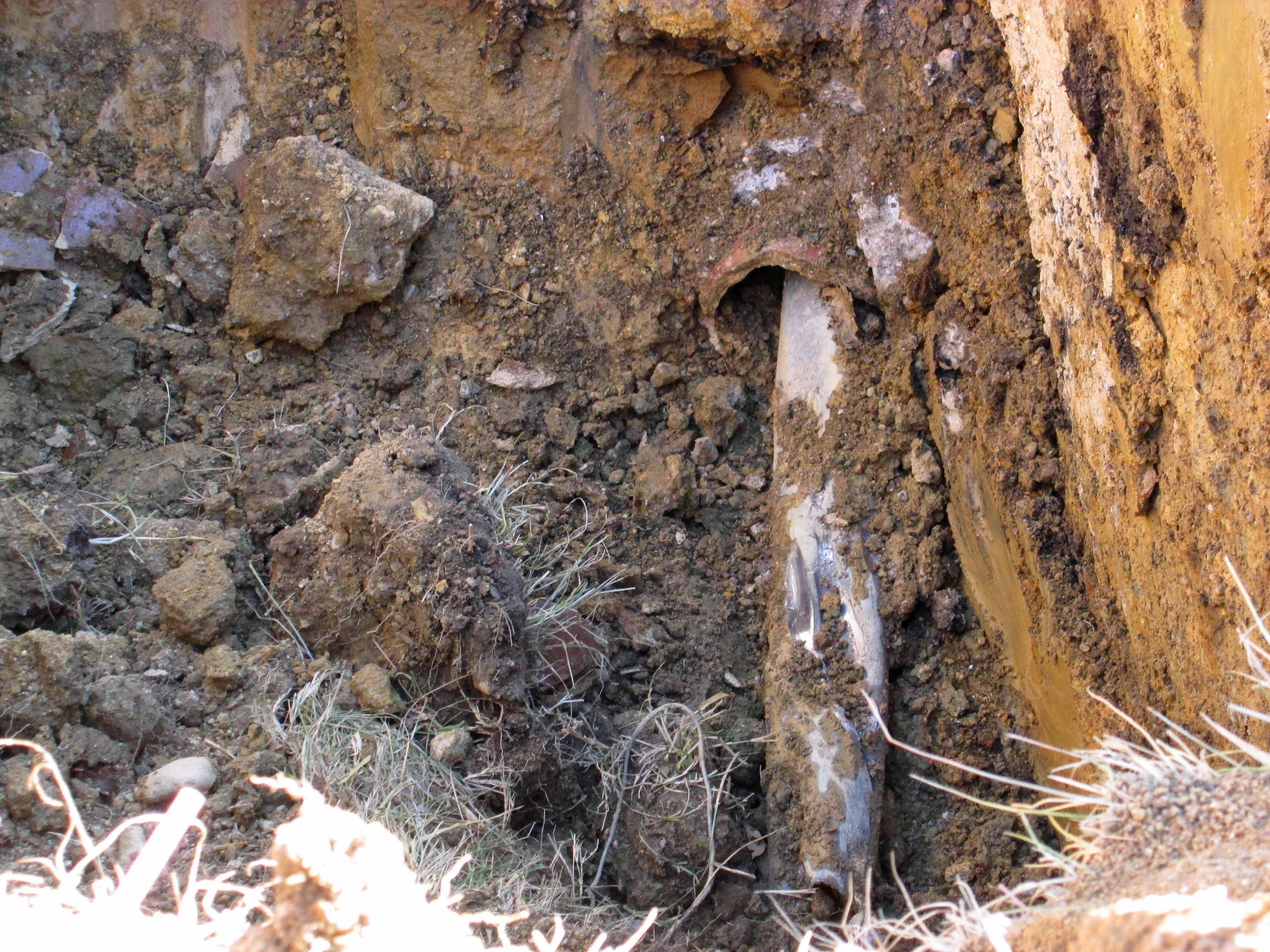
I was recently called over to the contractor’s worksite because they hit another pipe underground. Another one not on their drawings but included in other drawings (Why the engineers don’t look at other record drawings is beyond me). This is a special pipe that I was looking forward to them hitting. I knew it was just a matter of time.

Here it is – a 4″ lead pipe inside an 8″ Terra Cotta pipe. Why is it special? Because I always wanted to see how the alum, manufactured at Plant II was piped across the street to Plant I.

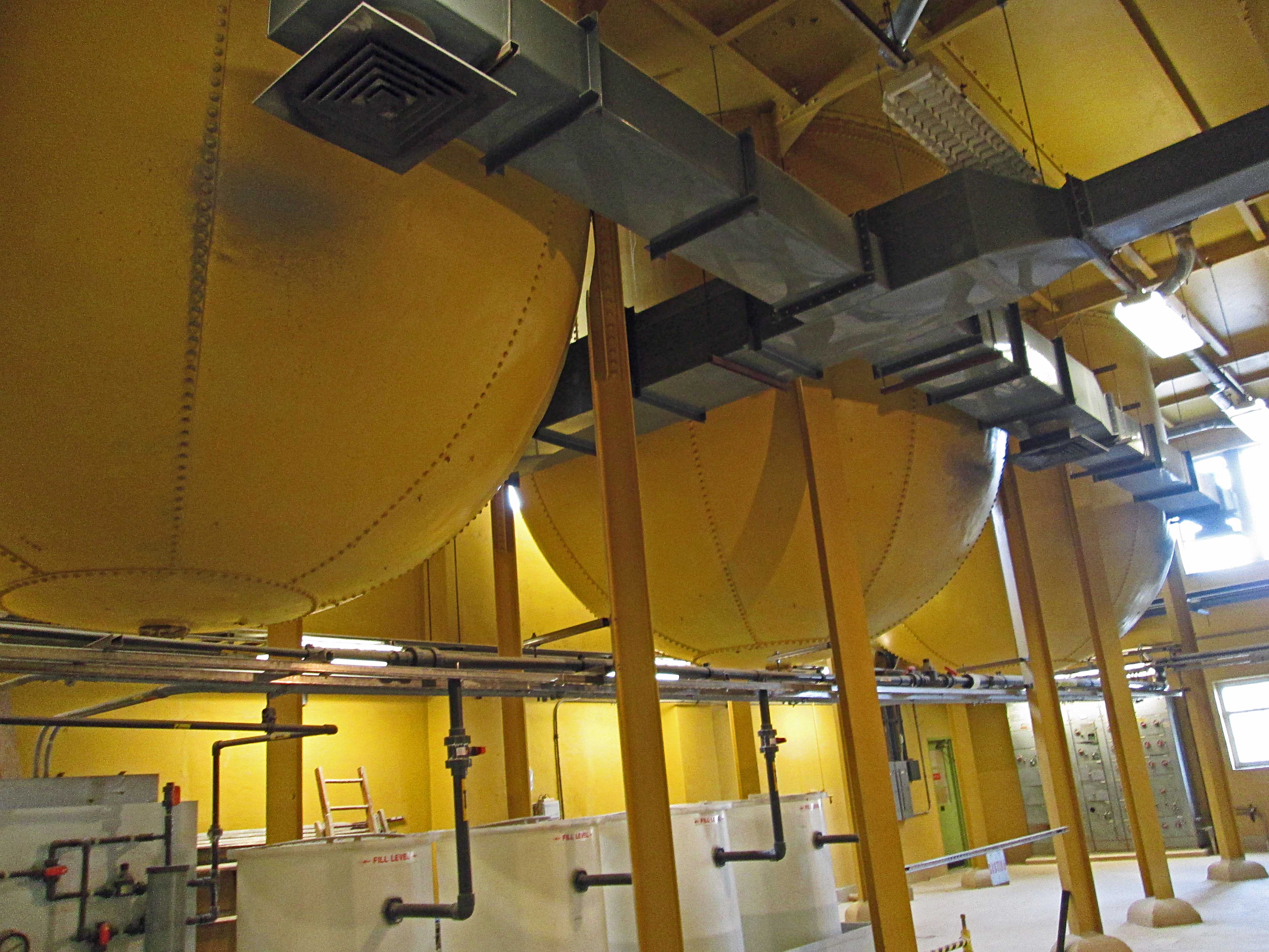
When I first started working at Montebello, these bins were just hanging from the ceiling.

When I asked about them, I was told that alum use to be made here.  When you go upstairs, this is what it looks like.

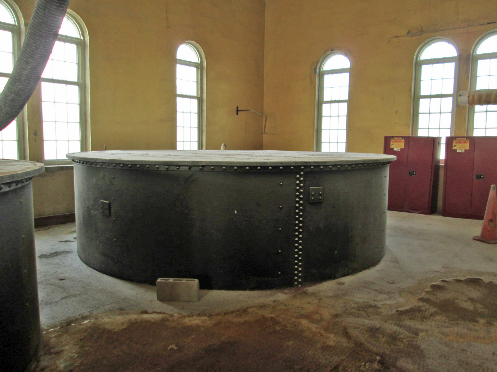
And years ago, this was the alum plant.

The water engineers boiled up their own alum in lead lined vats and it was then pumped across the street through the lead pipes. Below is one of the vats right after the lead was replaced. Over the years there were many contracts to recoat the insides of the vats. When the vats were no longer used, city workers climbed down into them to remove the lead sheeting. 

Below is a photograph from an old water works magazine showing lead and terra cotta pipe.

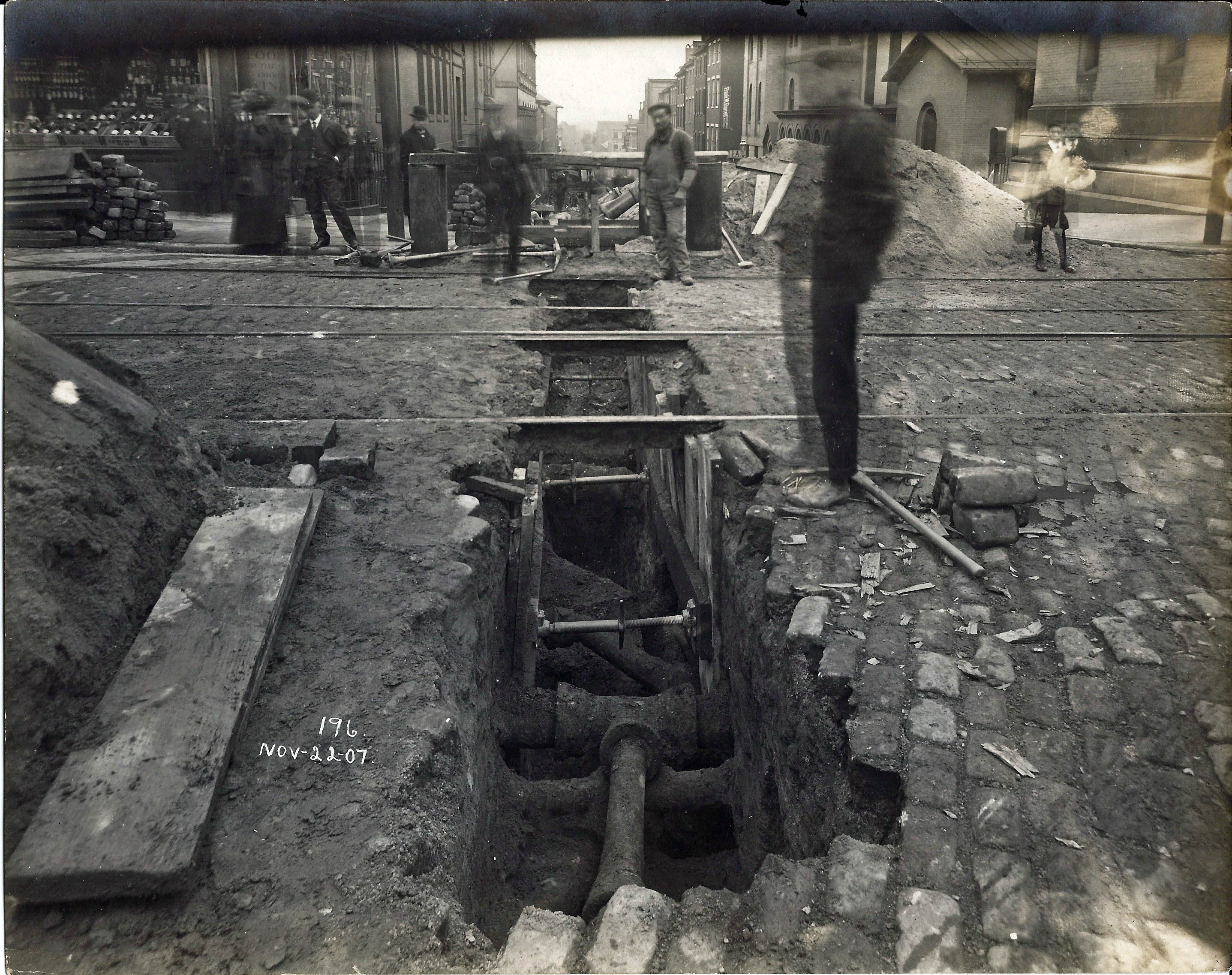
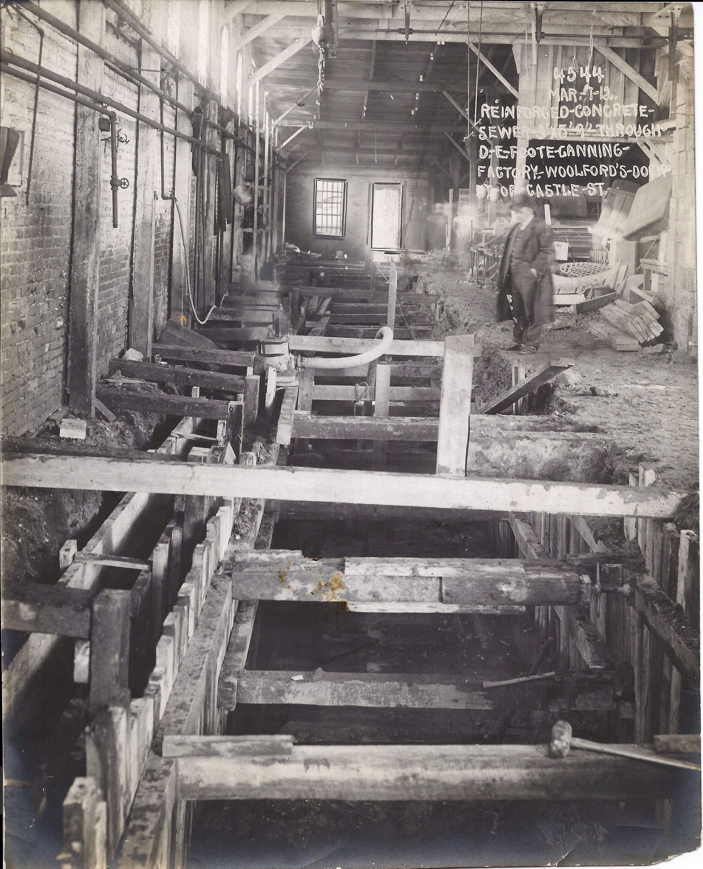
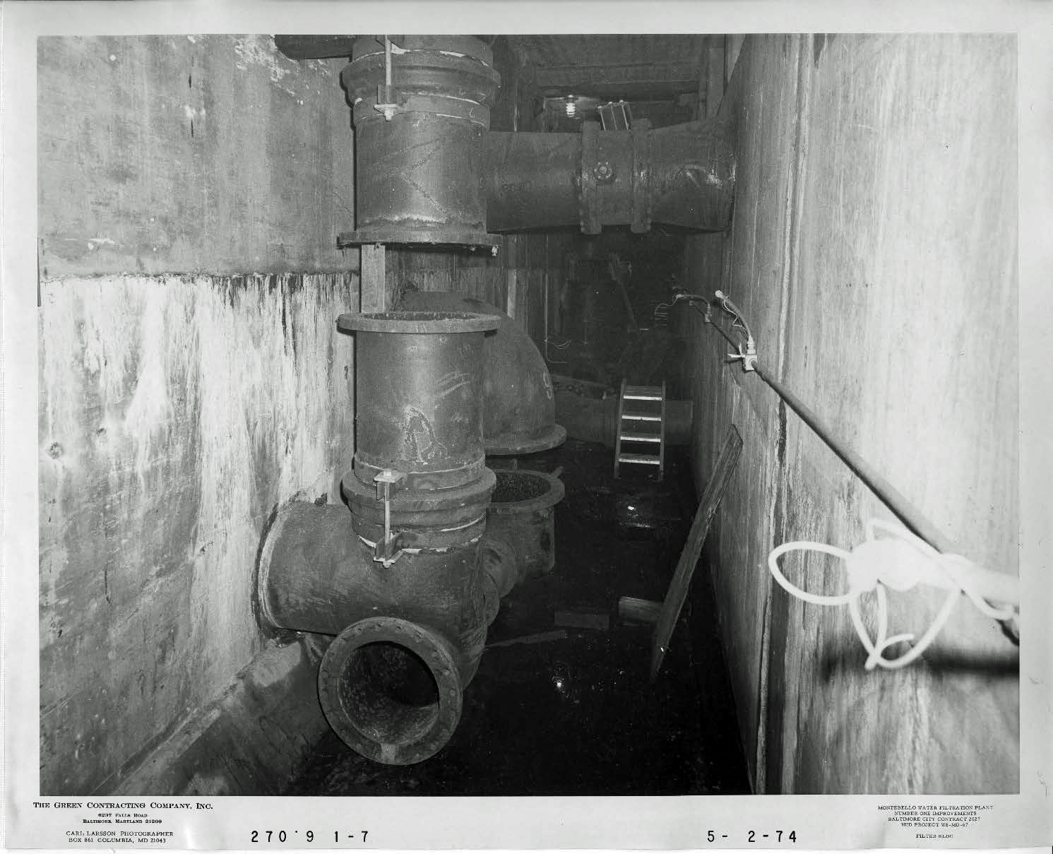
Lead pipes have been in use since the early Roman days. It was also used as a seal on pipes as shown below. In 1974 a lot of the old gate valves were replaced with butterfly valves. They did not replace the pipe. You can see where brackets hold the pipe together where lead is in the joints. These joints being made 1912-1915.

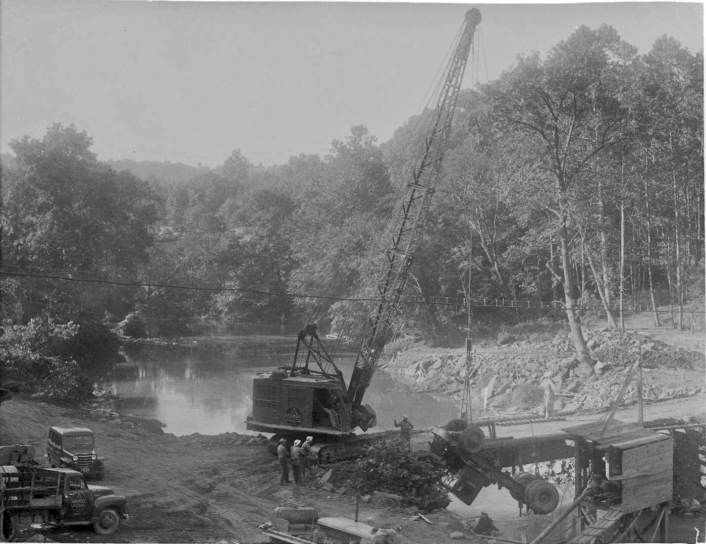
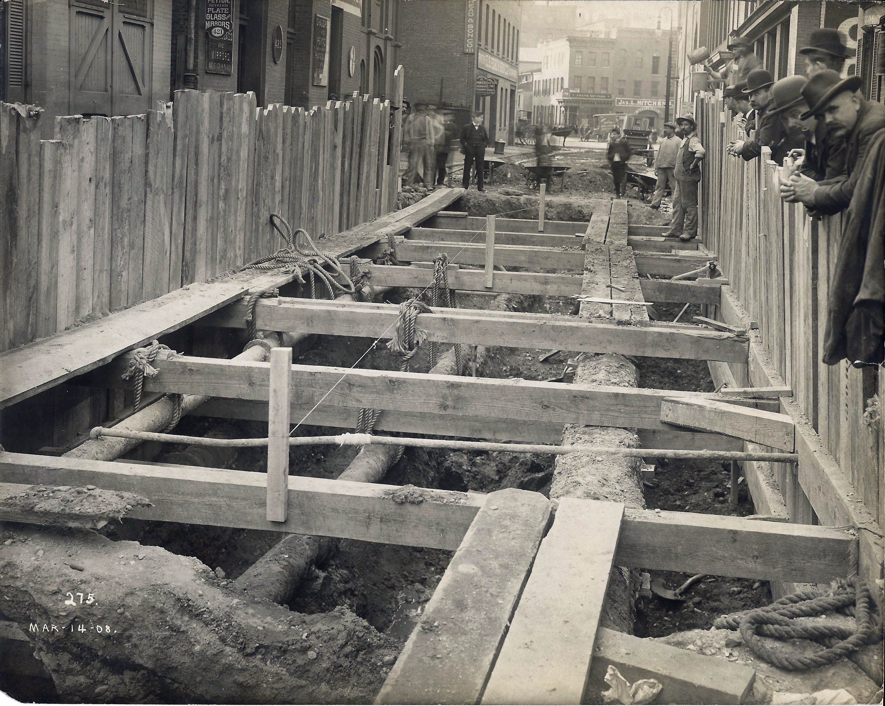
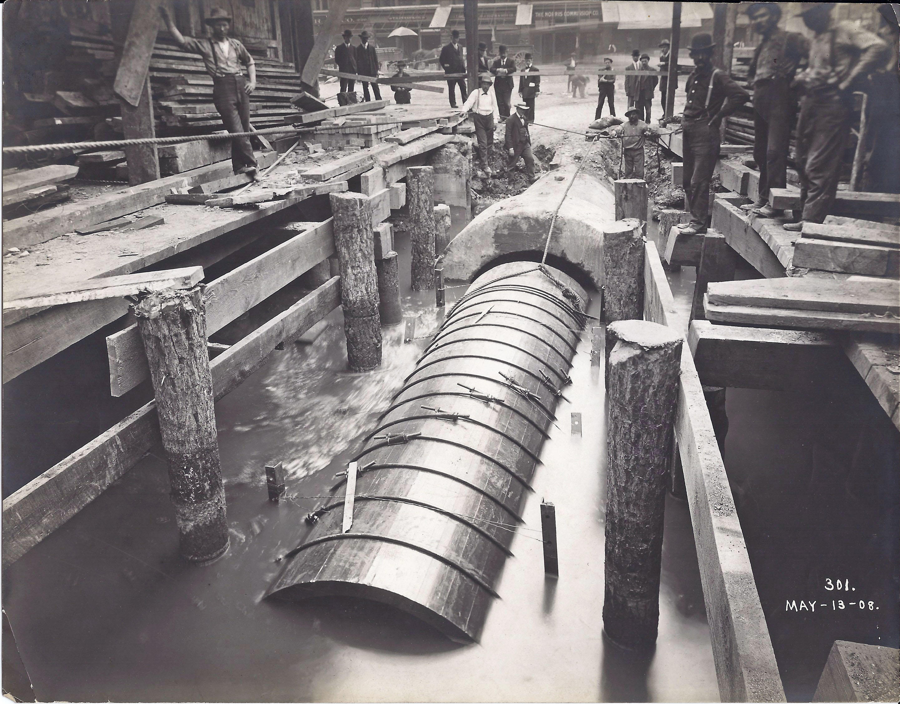
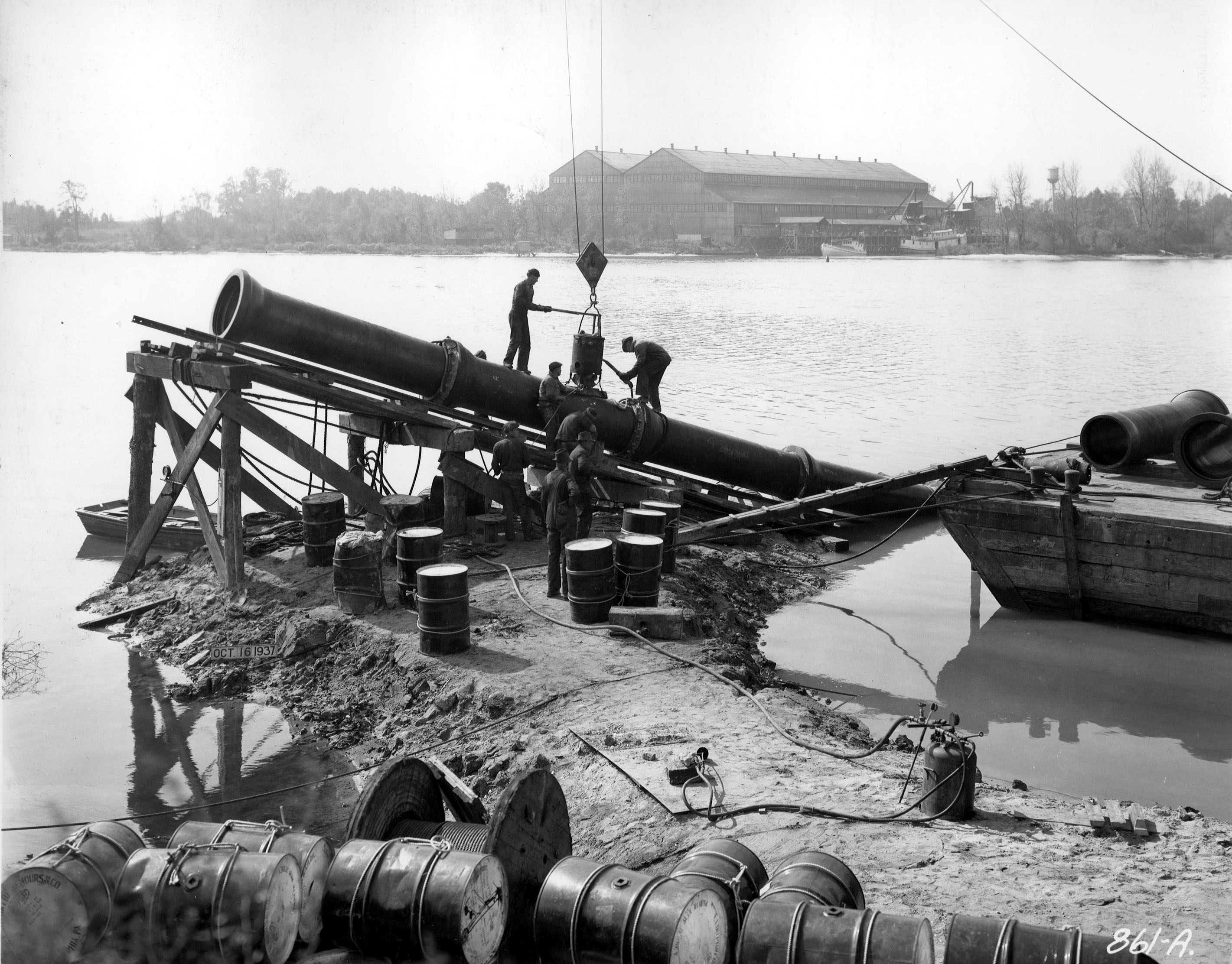
Another photo of a lead jointed pipe. I believe this is the water main under Curtis Creek. Looking close you can see the workmen pouring the lead into the joint. 

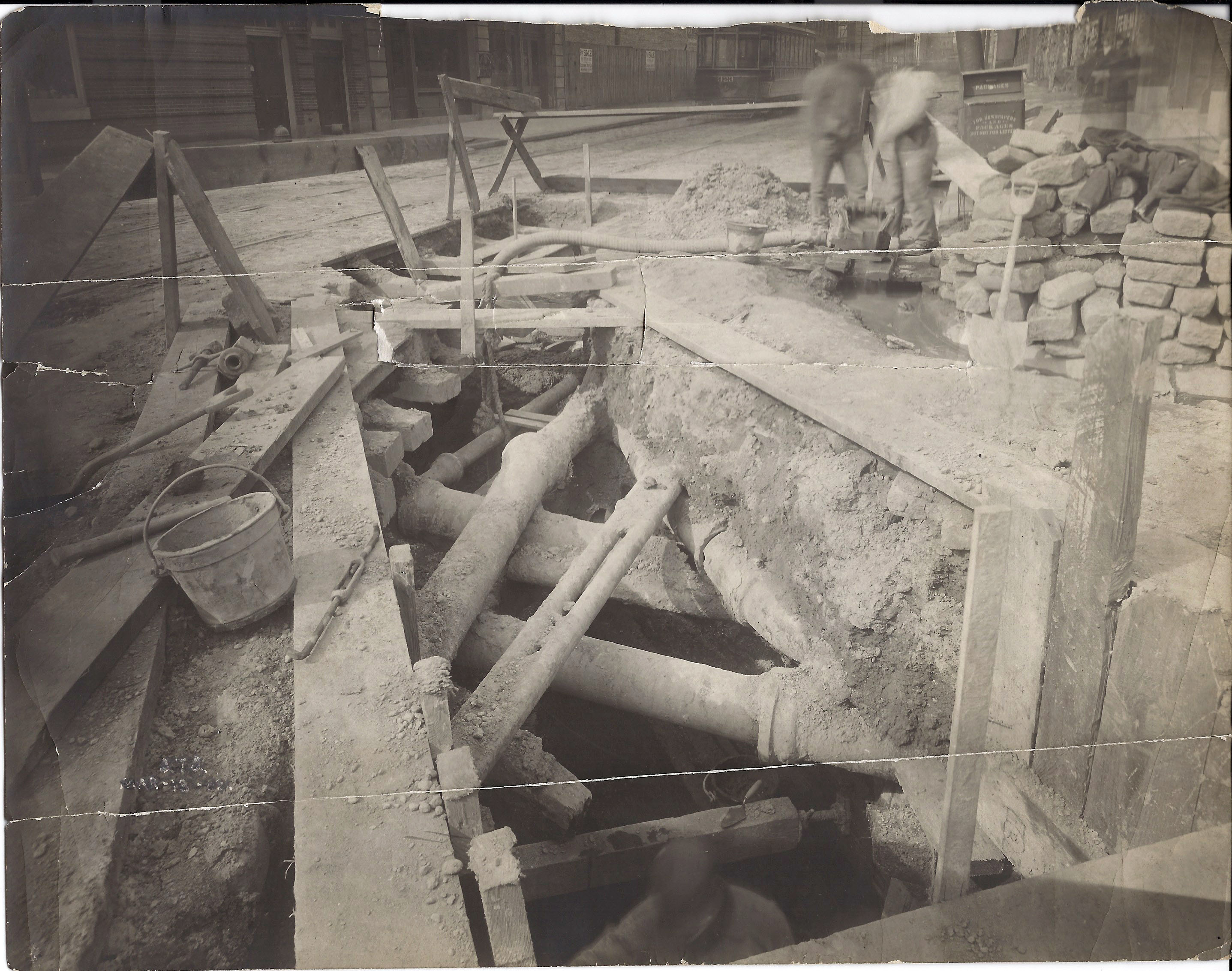
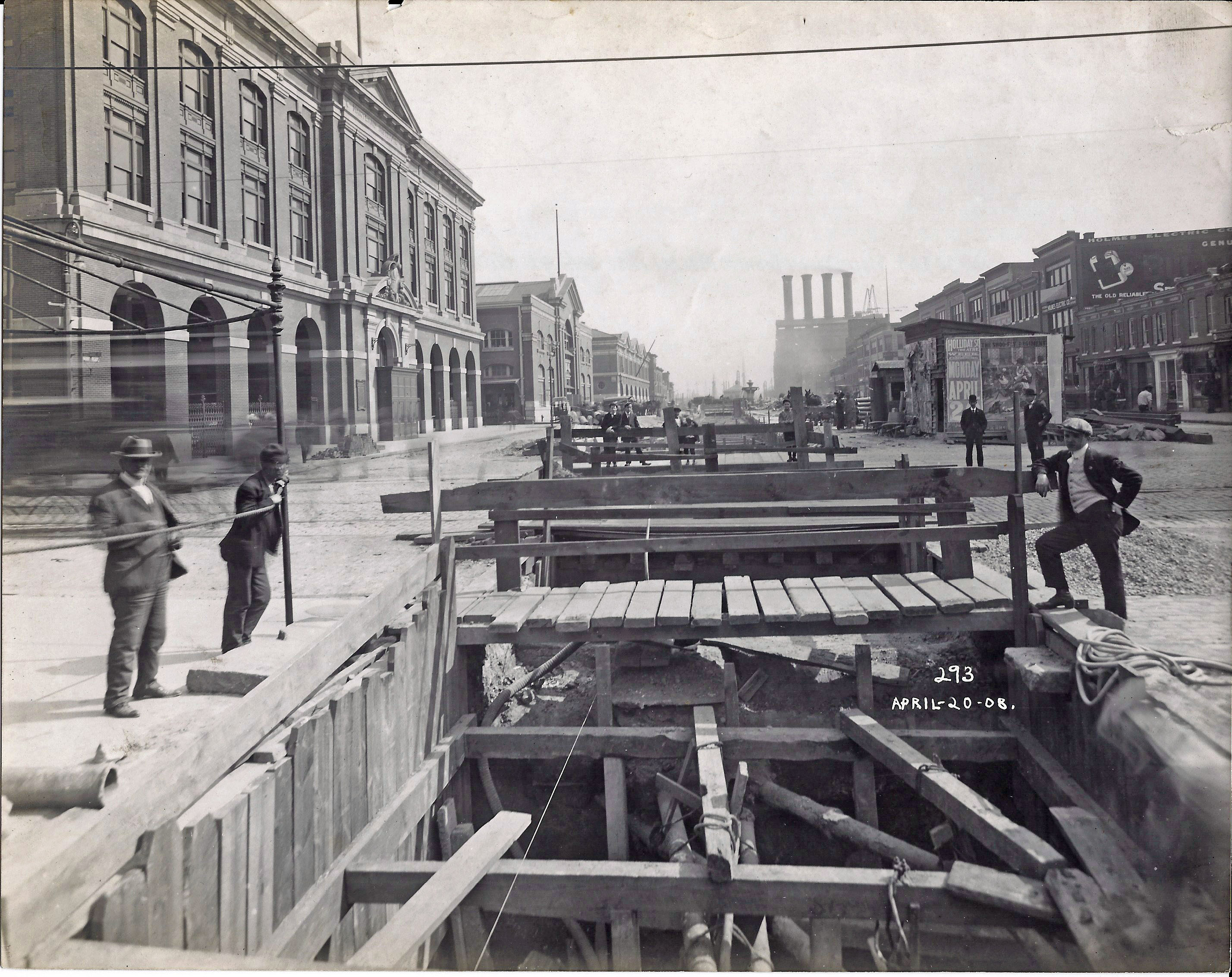
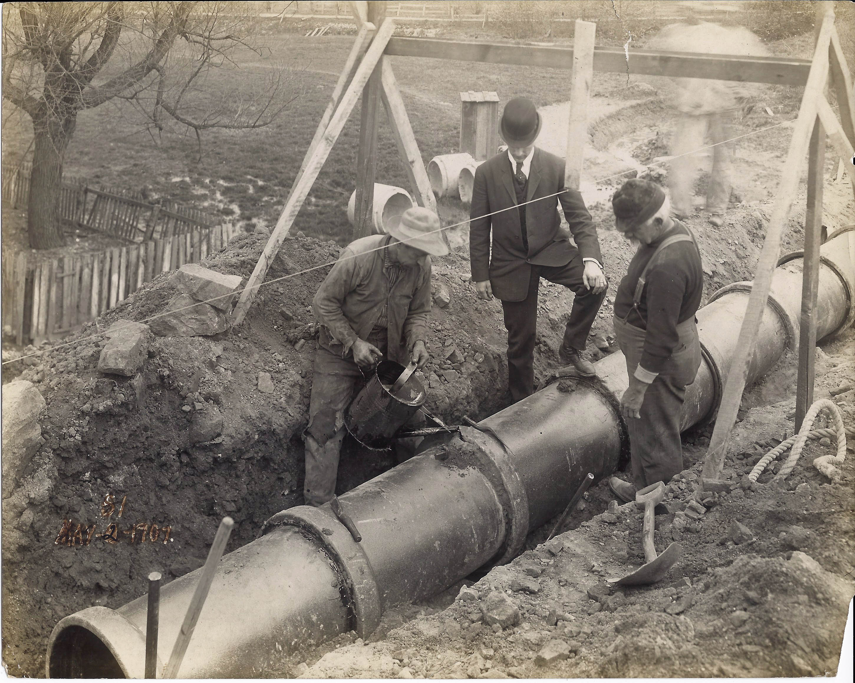
The City being the City and always trying to save money started using a lead substitute called Leadite. They also used a sealant over the lead called Hyrolene-B as seen in this 1907 photo.

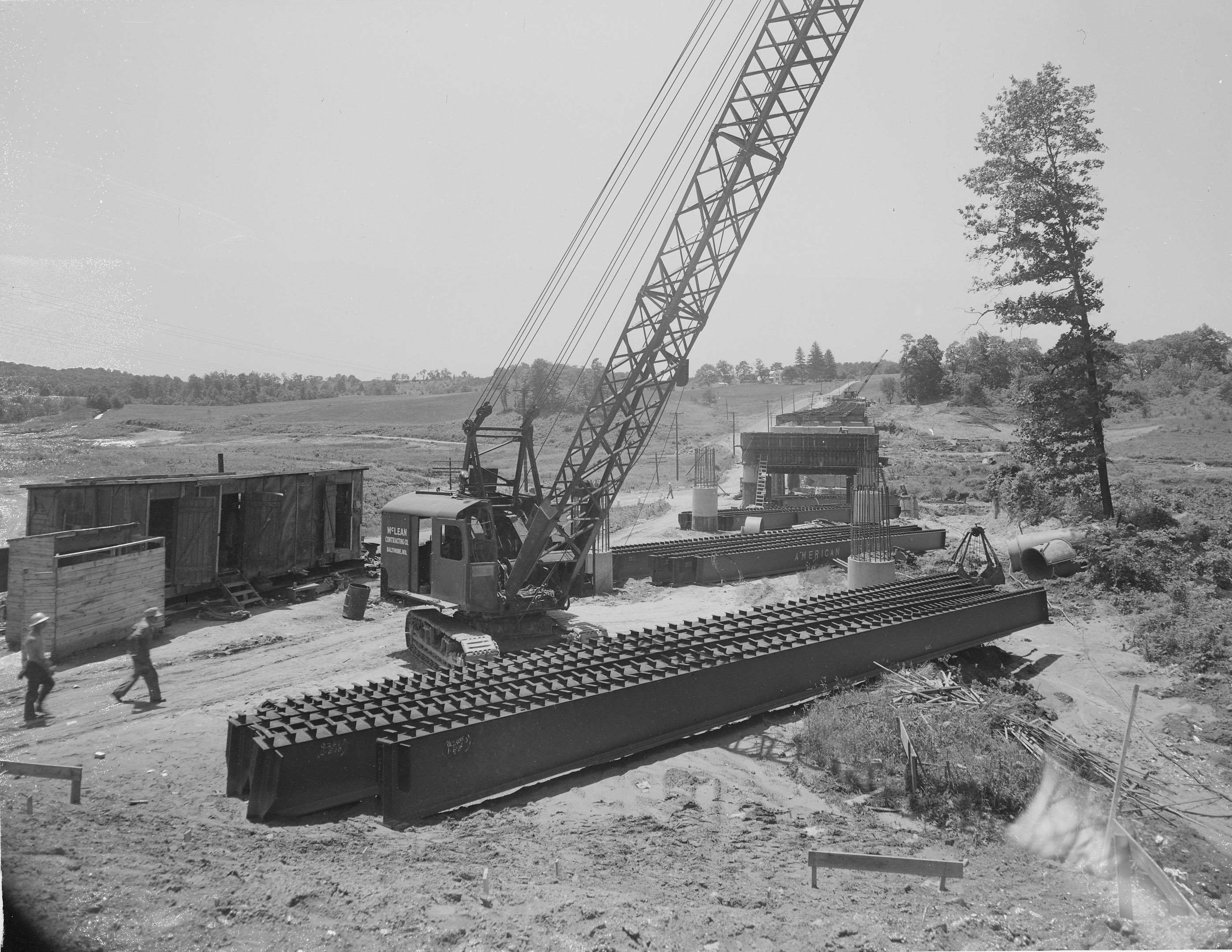
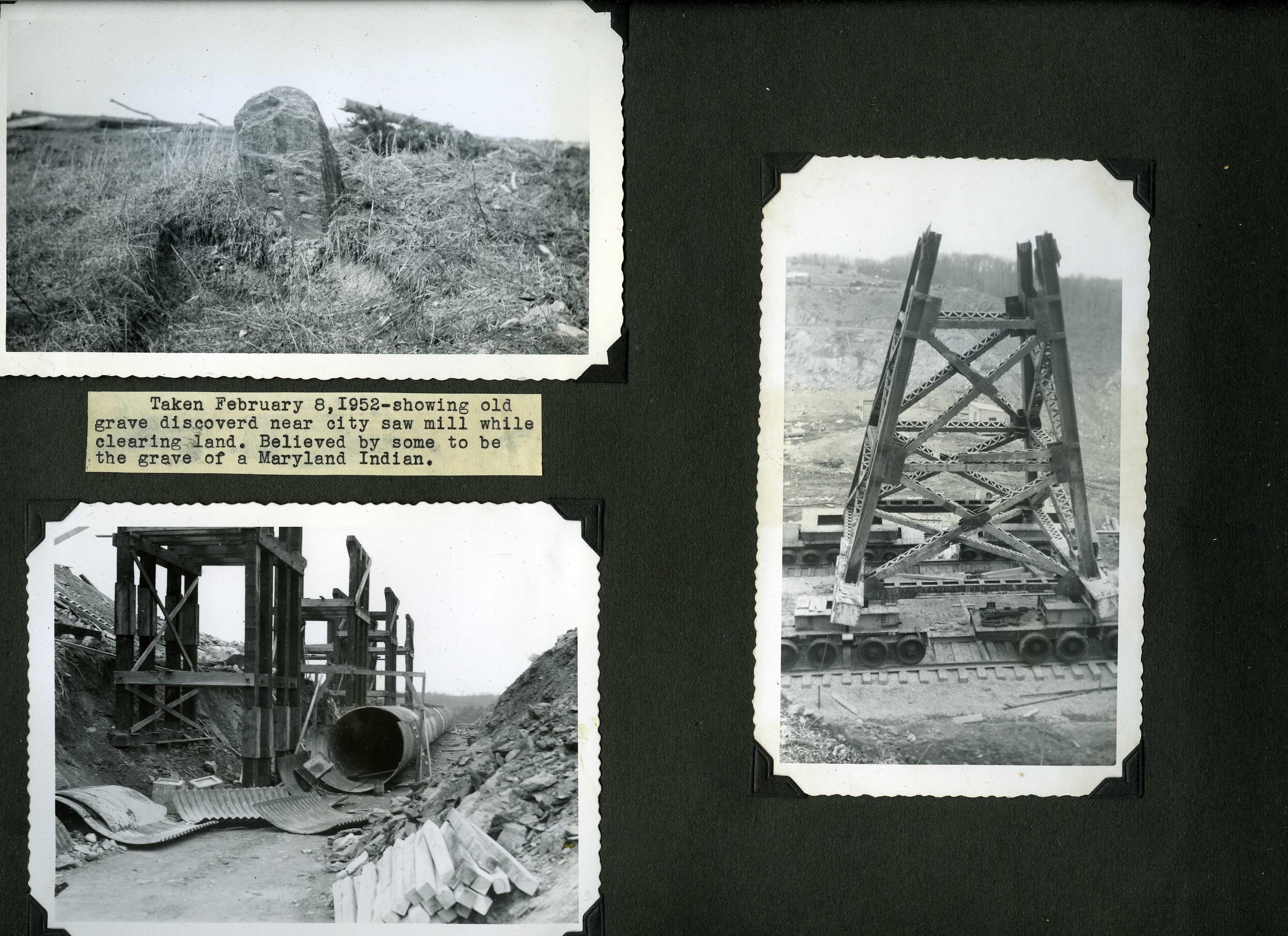
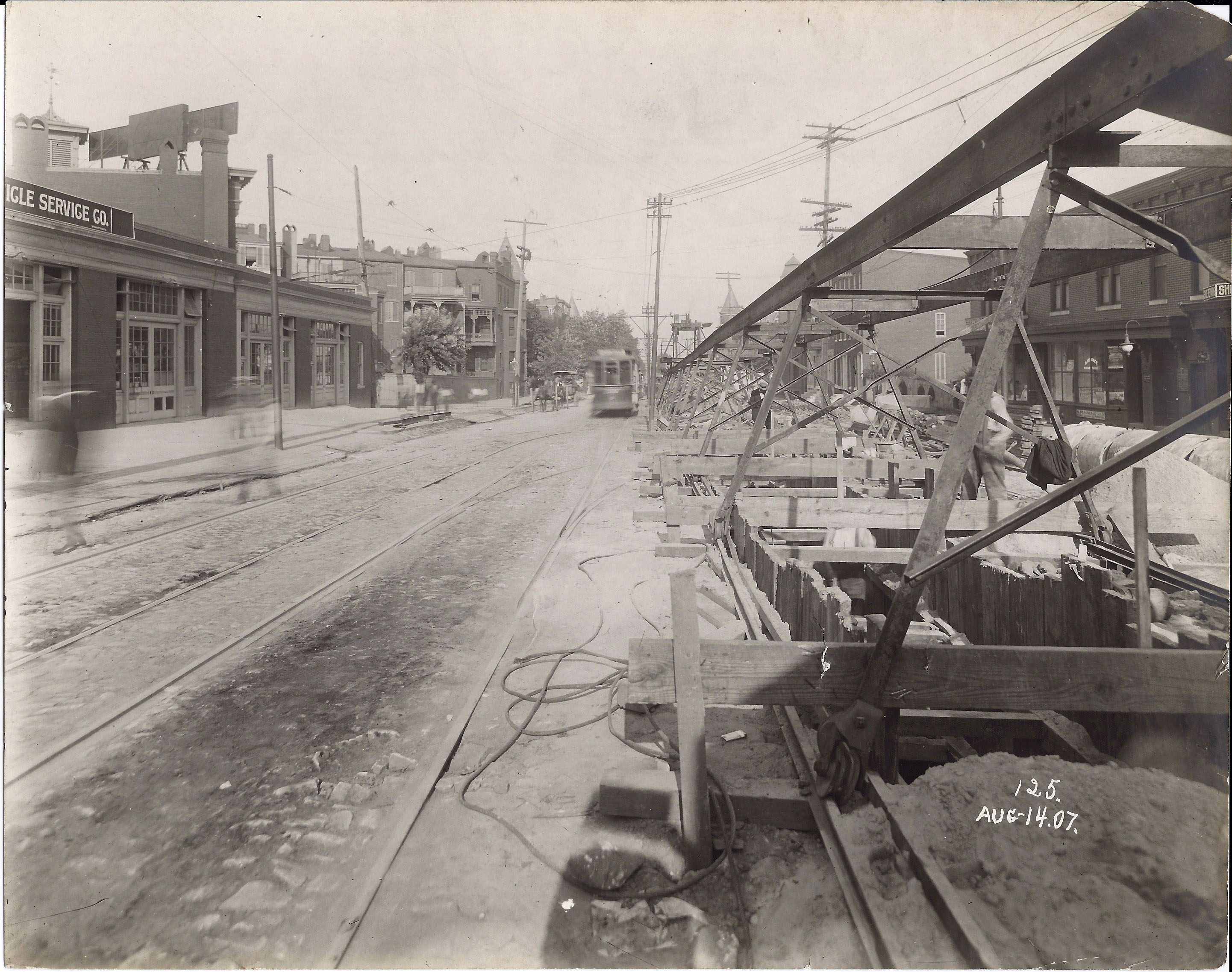
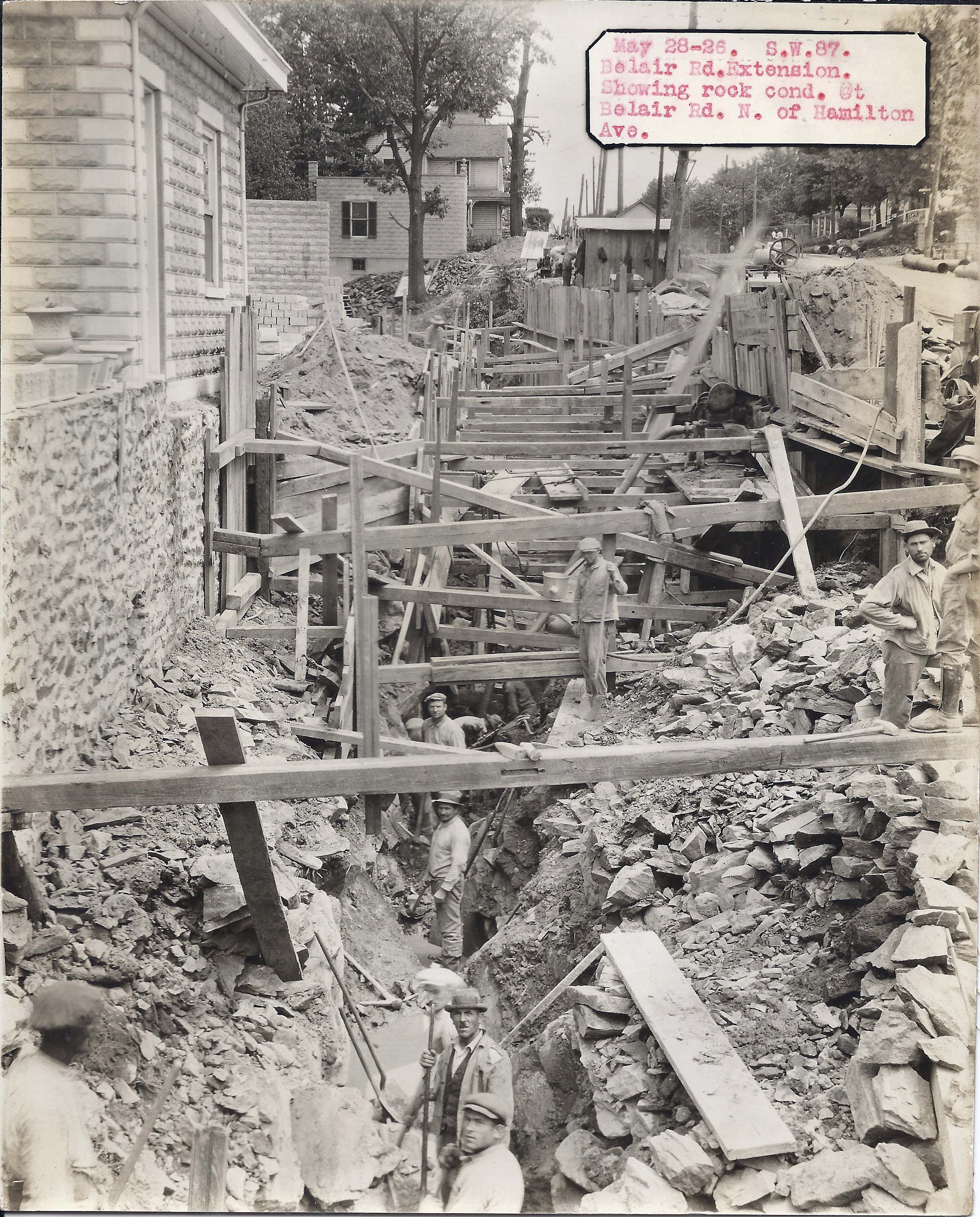
You have to feel kind of sorry for the contractors (and the city) for all the antiquated piping underground. Here is a site on Montebello property showing the obstacles of past contractors. Unfortunately, these abandoned lines were and are never removed. This photo shows a 5” conduit, 8” raw water, 10” water supply, 4” alum, 4” lead alum and 6” sanitary all in one pit. Under the very top conduit is the 13,000 volt, cement encased, electrical duct bank.

For your further historical pleasures – here is a history of lead in Baltimore:

1923 – Leadite Use: Bureau adopts leadite as a jointing compound and as a substitute for lead on water main installations. Leadite eliminates the use of caulking and can withstand the enormous pressure that the water mains are subjected.
Contract No. 84: Lead Lining Tanks: The Specification was dated July 21, 1926. Contract was awarded to the Joseph G. Graydon & Sons of Baltimore on July 21, 1926.
1930 – The Hampden Reservoir was drained. The outlet gates were closed permanently where possible by welding and then sealed with lead.
1931 – The liquid alum being made at Montebello is more acidic and corrosive than the lump alum. The cast iron pipes and valves can not stand up to this type of corrosion. They were replaced by pure chemical lead for the pipes and hard lead for the valves. Maintenance also had problems with the lead lining in the alum boiling tanks cracking.
A 1934 article appeared in several technical journals, which had given a general survey of the mineral contents, as determined by means of a spectrograph of the water used by 50 cities throughout the country. Baltimore was 1 of the 50 cities used in the survey, and the article indicated that the drinking water as delivered to its citizens contained lead as high as 0.3 parts per million, which was an amount generally accepted as detrimental to the health of people continuously drinking such water. The Water Department being stunned by this article, since this value was higher than any that had ever been noted, decided to ascertain the exact truth of the matter. The Montebello laboratory carried on a series of careful determinations extending through the year 1935. The City Health Department laboratory, not knowing the tests being conducted by the Montebello laboratory, conducted their own investigation for the lead count in the water. The City Health Department tests confirmed the test values conducted at Montebello. The results indicated that the lead content in the raw water never exceeded 0.2 parts per million and after treatment and filtration at Montebello, the content of lead did not exceed 0.02 parts per million. The normal lead count of the water was 0.01 parts per million. The tests proved conclusively that there was no danger whatsoever from lead poisoning due to the drinking of filtered Gunpowder River water.
1936 –  December 7, 1936 letter from Engineer Small to the Chief of Police concerning the theft of pig lead.
1939 – Minute cracks started to appear in the lead lining of the tanks used in the manufacturing of alum. Tanks lasted ten years and produced 20,000 tons of alum.
1941 – The alum steel tanks were relined with lead. Tank #9 was relined with 20# tellurium lead and placed back into service on June 16. Tanks #5 and #7 are planned to be relined using St. Joe lead. Tank #7 is expected to be placed back into service by January 30, 1942; and Tank #5 is expected in service by March 15, 1942.
1942 – Because of the decision by the War Production Board regarding critical materials, the use of copper tubing for new installations was prohibited starting in August. Copper tubing installation was replaced by Type K lead alloy tubing. The replacement of the lead lining of the alum steel tanks was completed on February 7, 1942.
1949 – Pig lead test (checking for radioactivity). Leadite joints on water pipes are failing due to a high content of Sulphur and carbon in the surrounding soil.
1951 – A contract was awarded on December 26 to lead line the three steel alum storage tanks at Montebello Plant No. 2.
1952 – The lead pipe alum line between Montebello Plant No. 1 and Plant No. 2 had several leaks and was replaced.
1953 – Replaced Sulphuric acid pumps for Alum manufacturing. Also renewed was the lead line transporting the acid from the basement storage tanks to the manufacturing room.
1957 – 4 page Sunday Sun article on Weights and Measures. George Leithauser. Mentions chicken sellers using lead weights in birds.

In the late 1920’s a plasticized sulfur cement compound was developed as an alternate to lead for sealing the pipe joints in the field. This compound is referred to as “leadite”. Leadite was commercially produced up until the early 1970’s, and was used extensively from 1941 to 1945 when lead was scarce as a result of raw material needs associated with World War II. Ultimately, leadite was found to be an inferior product to lead for two reasons. First, leadite has a different coefficient of thermal expansion than cast iron and results in additional internal stresses that can ultimately lead to longitudinal splits in the pipe bell. Secondly, the sulfur in the leadite can facilitate pitting corrosion resulting in circumferential breaks on the spigot end of the pipe near the leadite joint. The failure rate in the industry for leadite joint pipe is significantly higher than for lead joint pipe even though the pipe may not be as old.

← Older posts
Newer posts →

Blogroll

  • Flouride Action Network
  • lulu
  • My Book
  • WordPress.com
  • WordPress.org

Recent Posts

  • In Search of The Skipjack Ada Mae
  • Trap Pond Kayak
  • Pusey Trail and Cemeteries
  • Chandler Tract (White Trail) 4 3 21
  • Oyster Fritters, Antiques, a Hike (and a bad sign)

Blog at WordPress.com.

  • Follow Following
    • Water and Me
    • Join 228 other followers
    • Already have a WordPress.com account? Log in now.
    • Water and Me
    • Customize
    • Follow Following
    • Sign up
    • Log in
    • Report this content
    • View site in Reader
    • Manage subscriptions
    • Collapse this bar
 

Loading Comments...