• About
  • History Writings

Water and Me

Water and Me

Tag Archives: bridges

History Hike Part 1

22 Monday Jan 2018

Posted by Ronald Parks in Hiking, nature

≈ 2 Comments

Tags

bridges, Dams, Gunpowder Falls, Hiking, mills, nature, photography

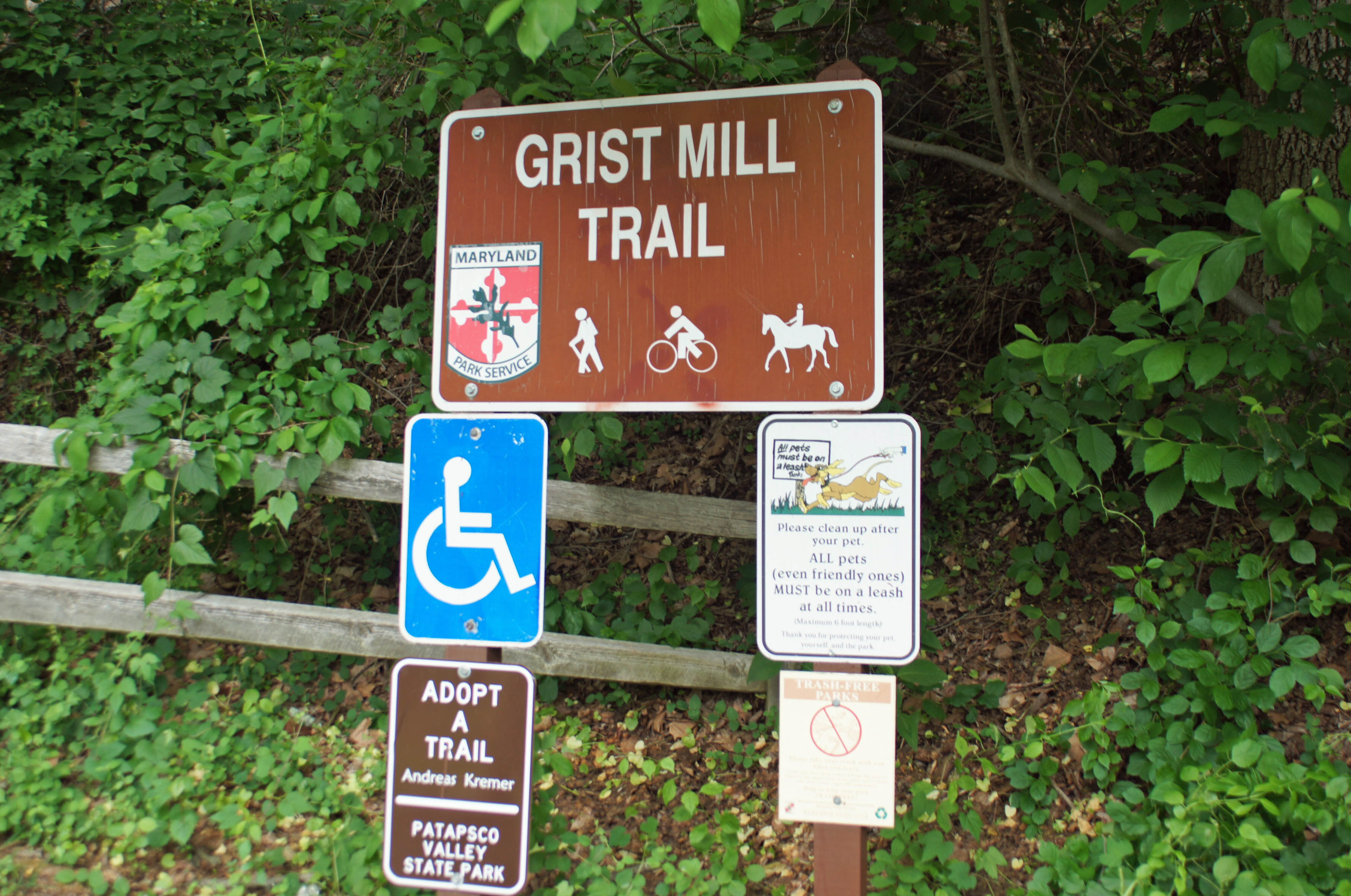
Between the work on our houses and going to Salisbury, yesterday was our first opportunity to take a hike. A little over-cast but a very nice day. The map shows we walked about 3-1/2 miles on the Little Gunpowder Trail, starting at Jerusalem Mill.

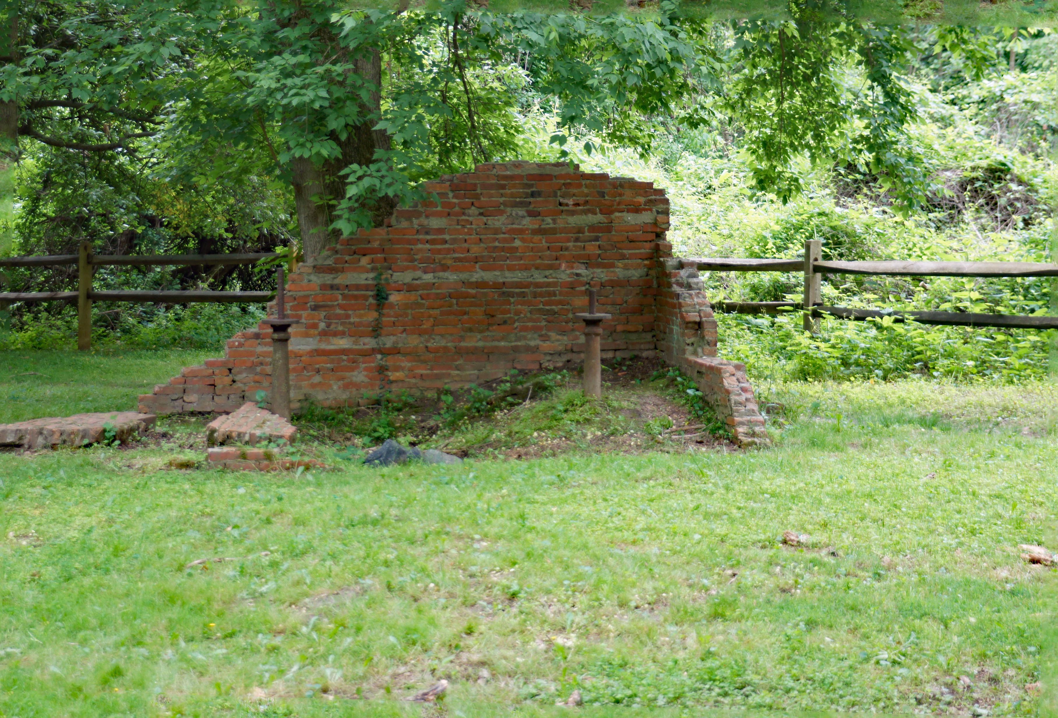
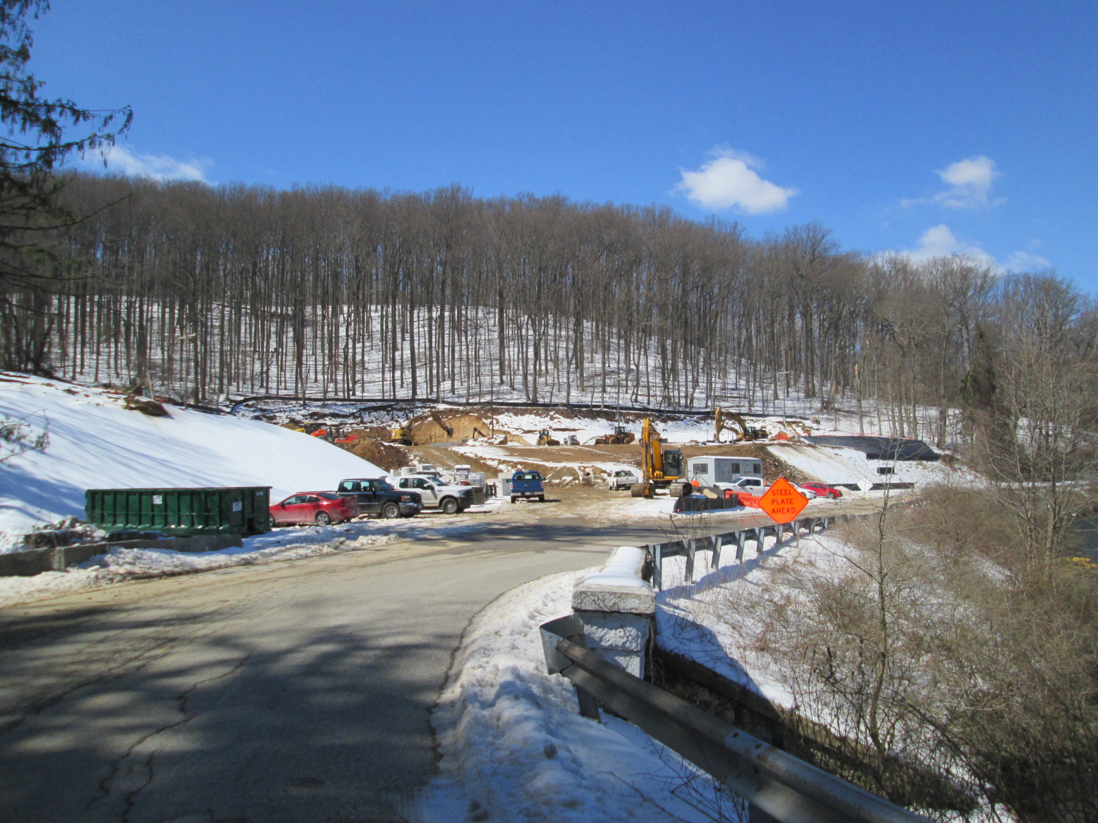
We headed thru the field to first look at the progress of the old stone structure. Not much done.

From there onto the Jericho Covered Bridge.
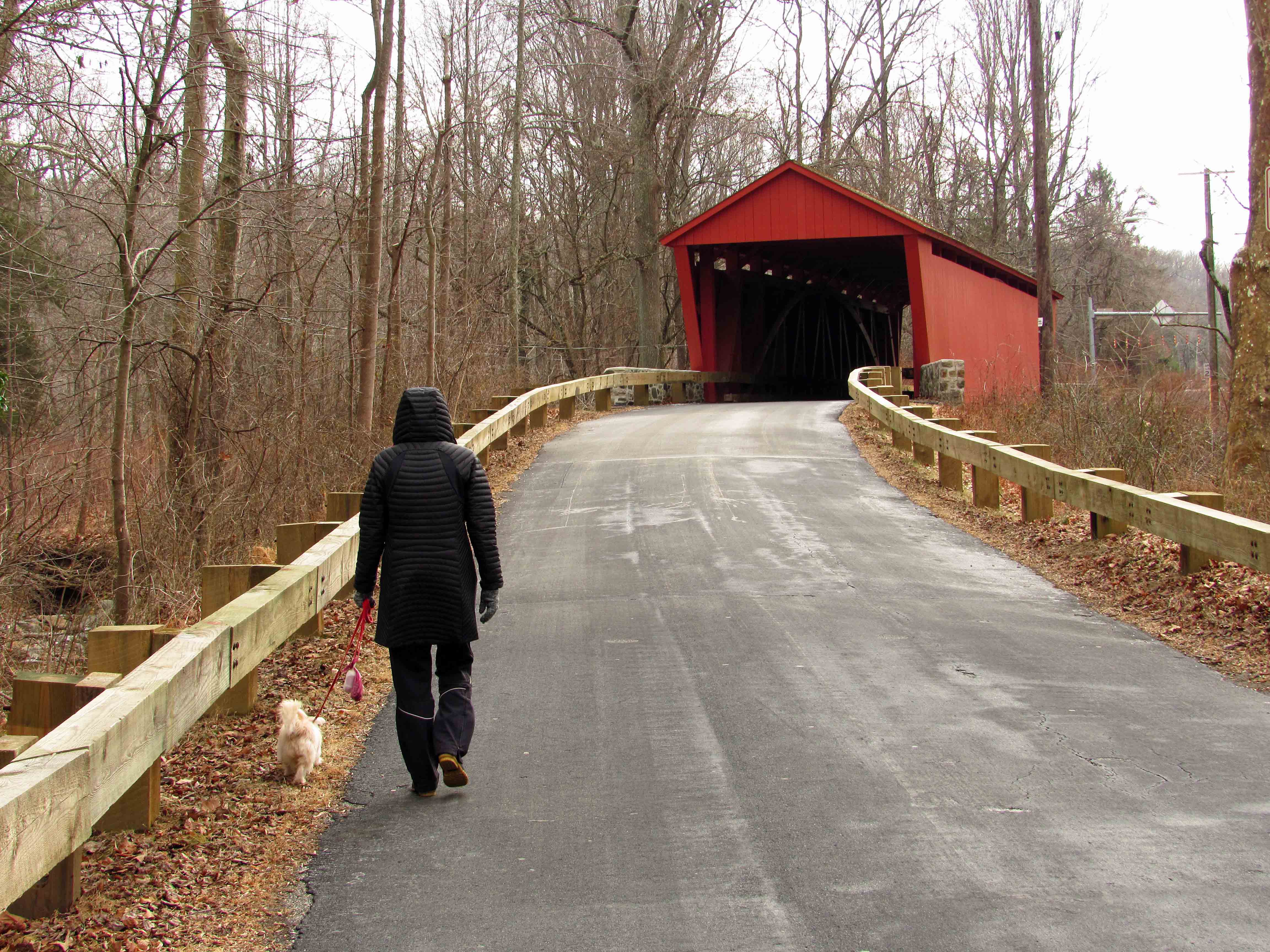
Interior of bridge.

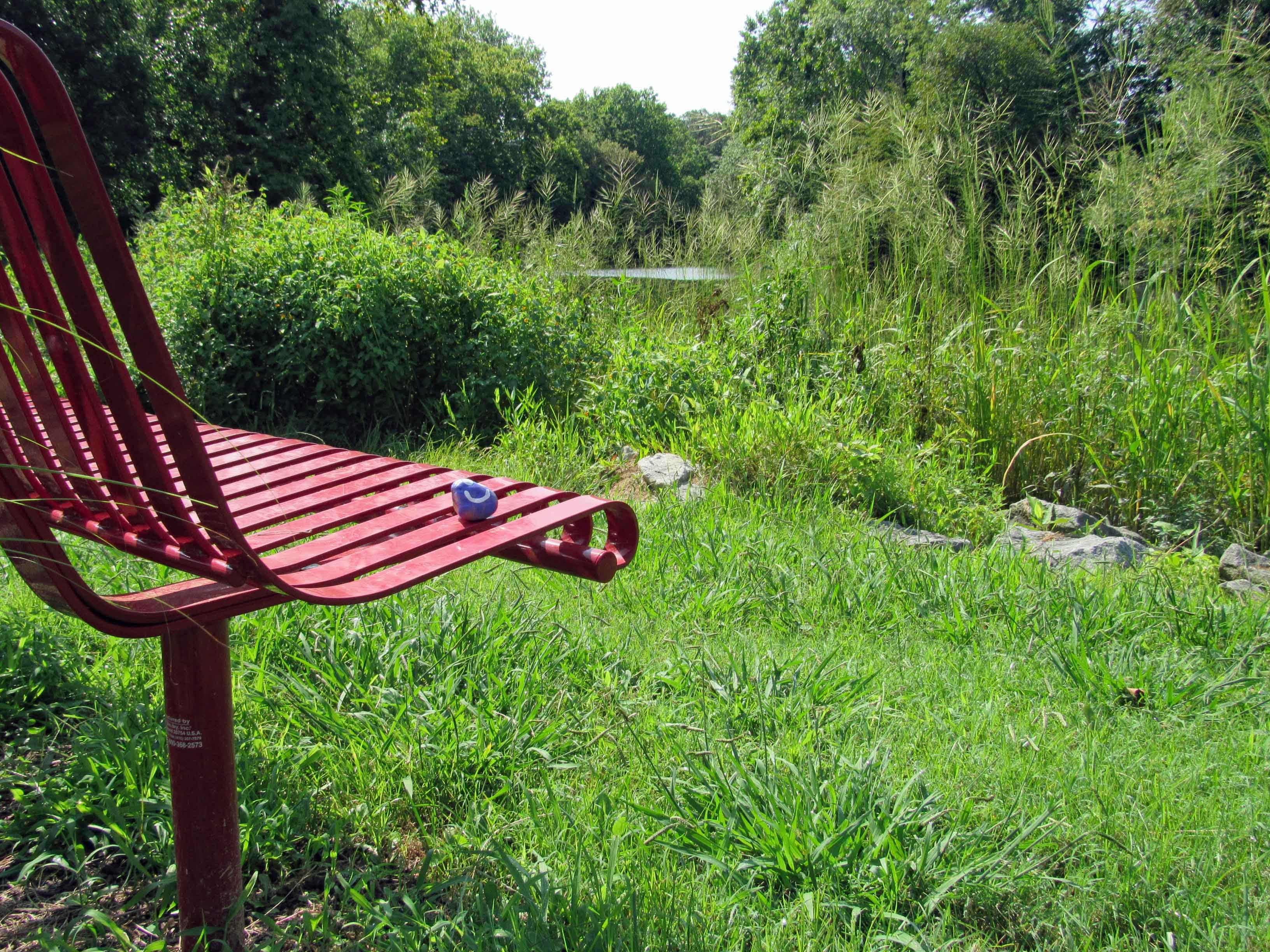
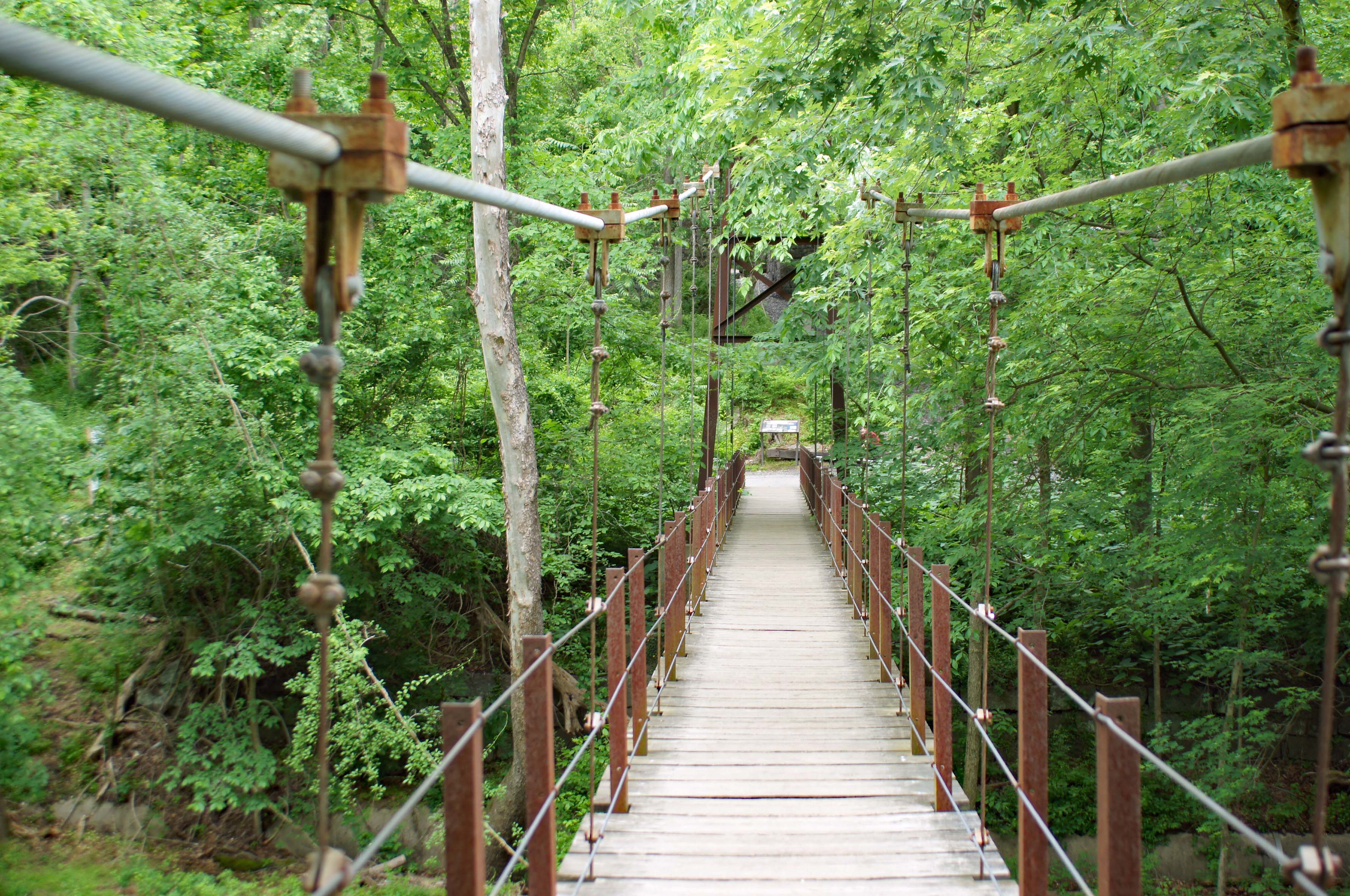
Since this was a short walk, we decided to follow the road for a bit instead of taking the other trail back. Here is a roadside attraction.

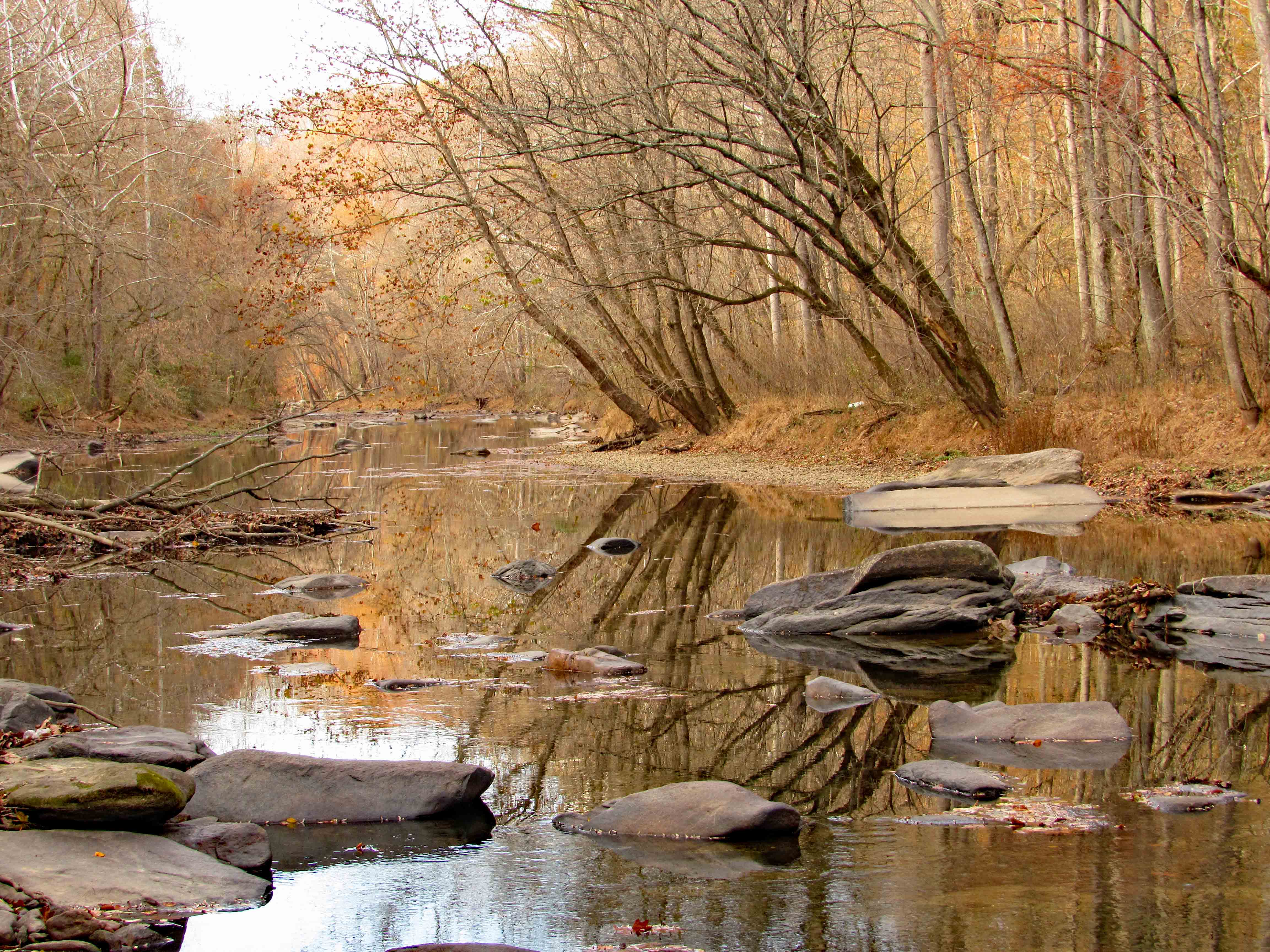
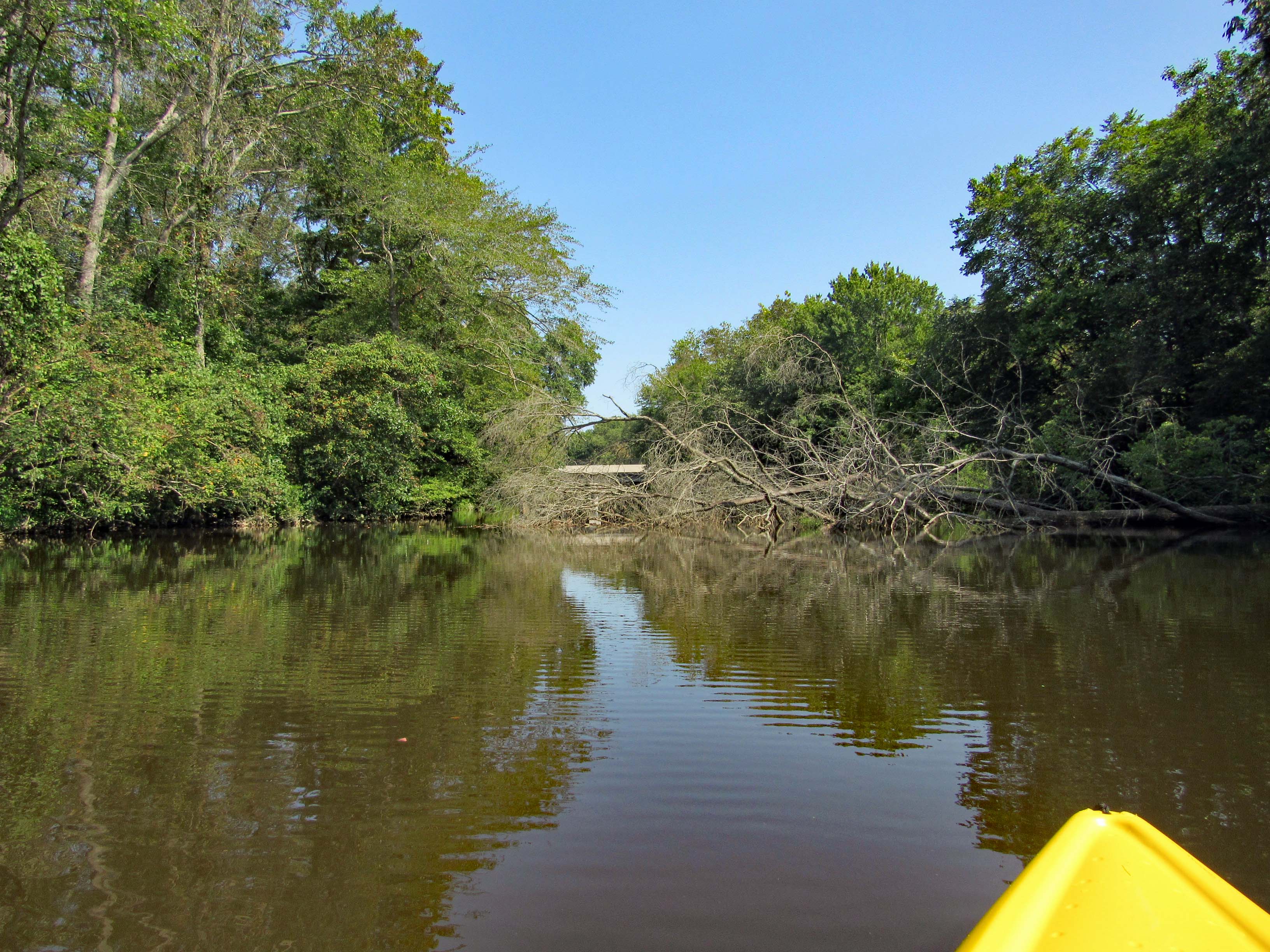
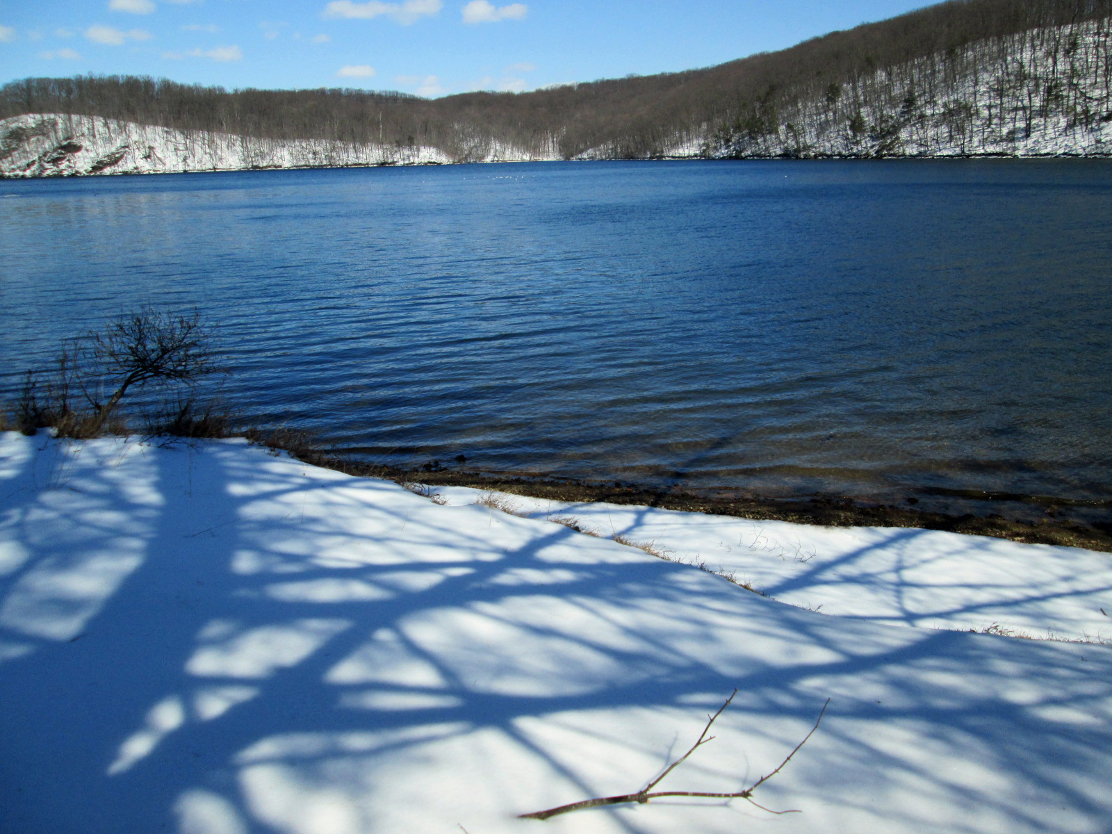
Overlooking the stream. 

A nice ice floe with some blue ice.

Beavers getting their fill. First time I have seen a double gnawing on a tree?

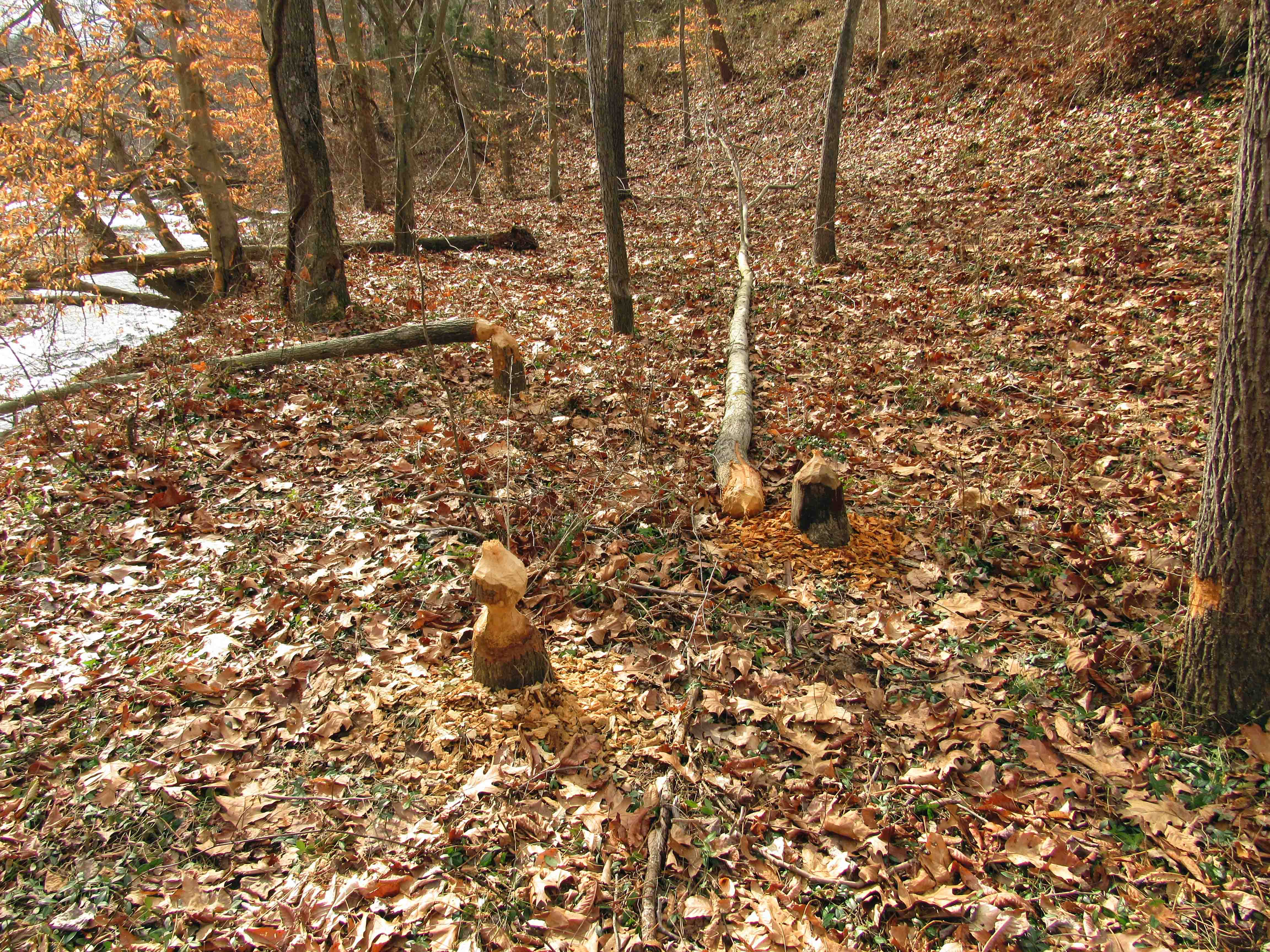
Another view of the ice floe.

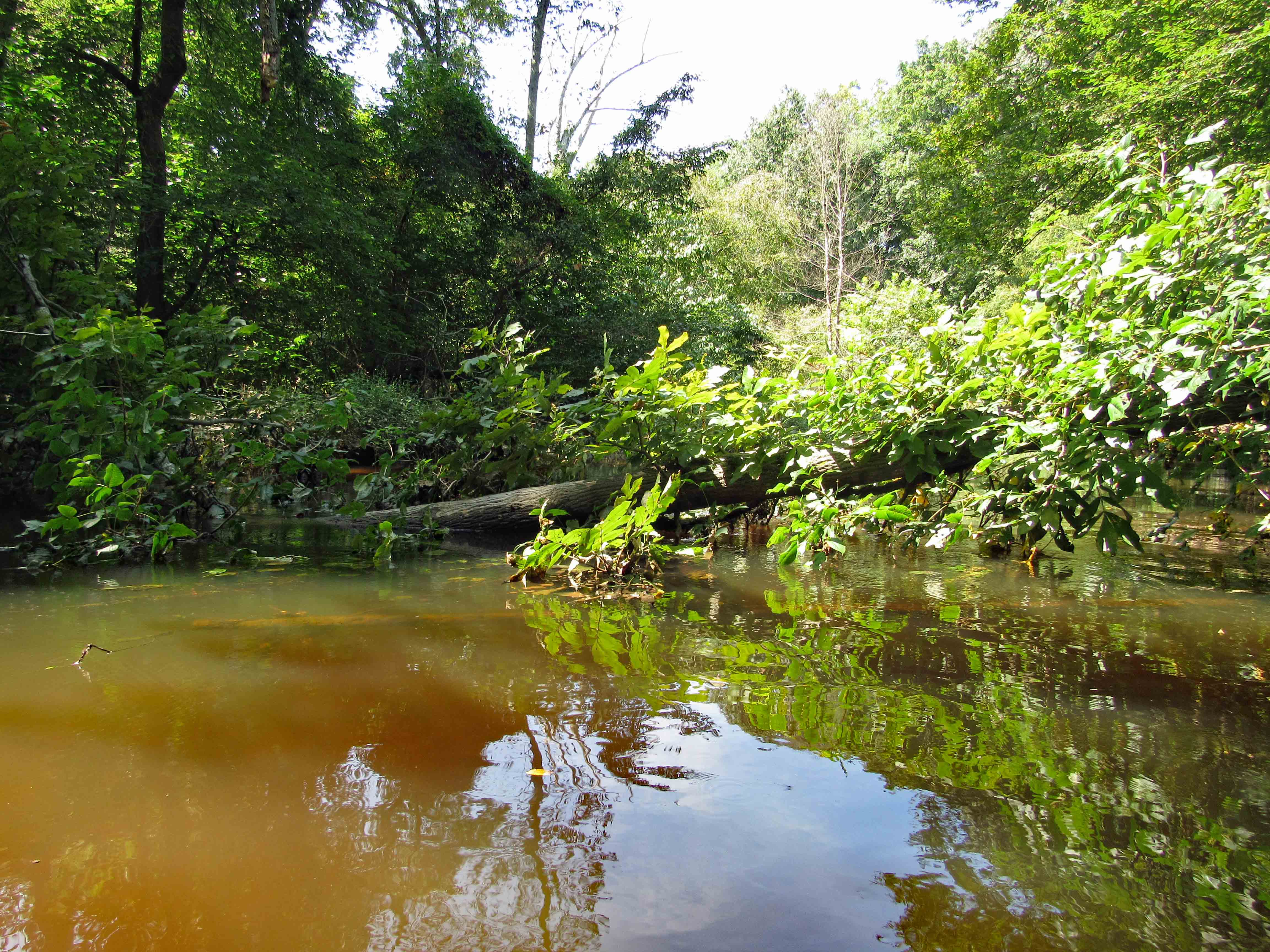
A small stream feeding into the Falls.

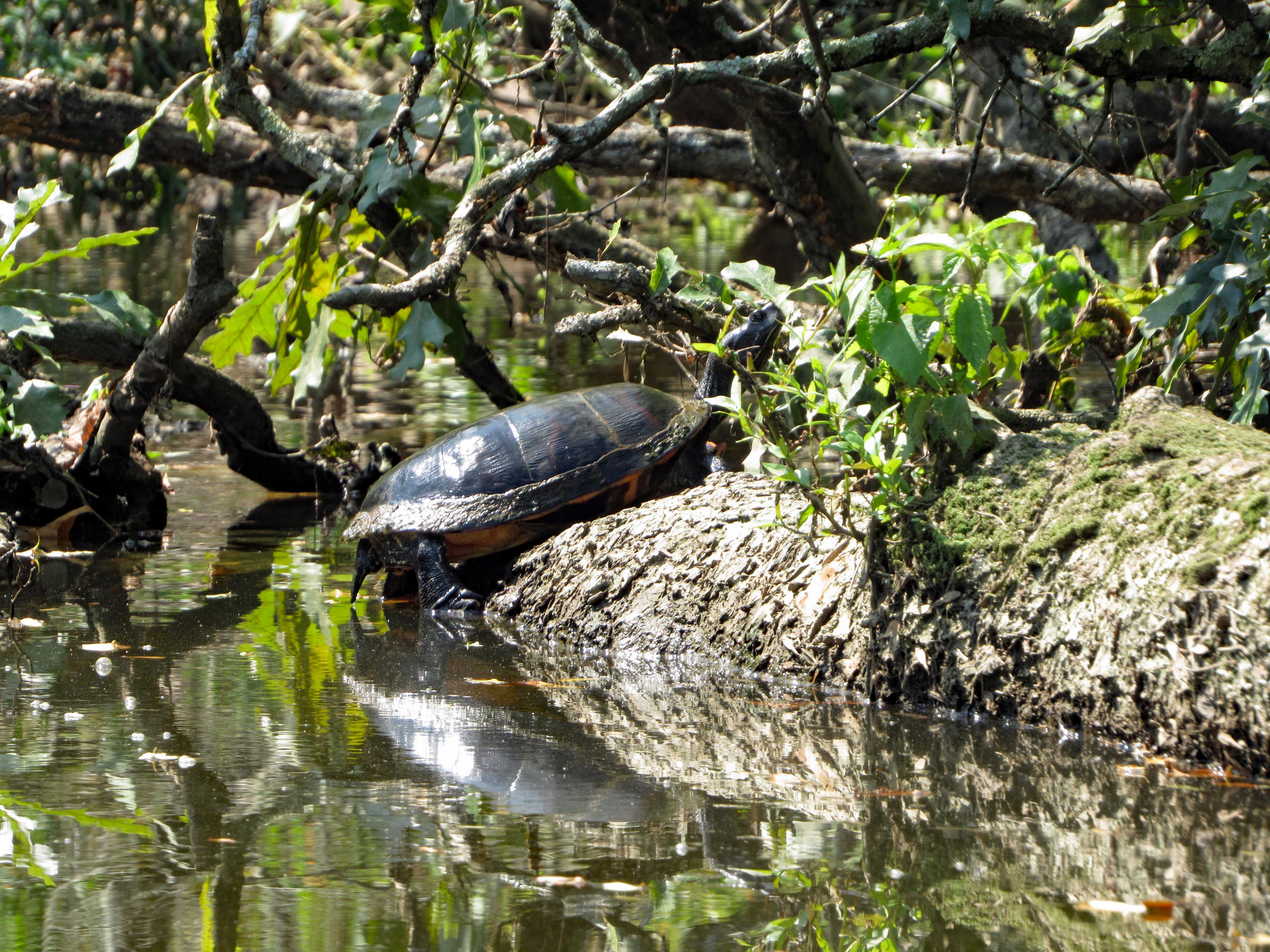
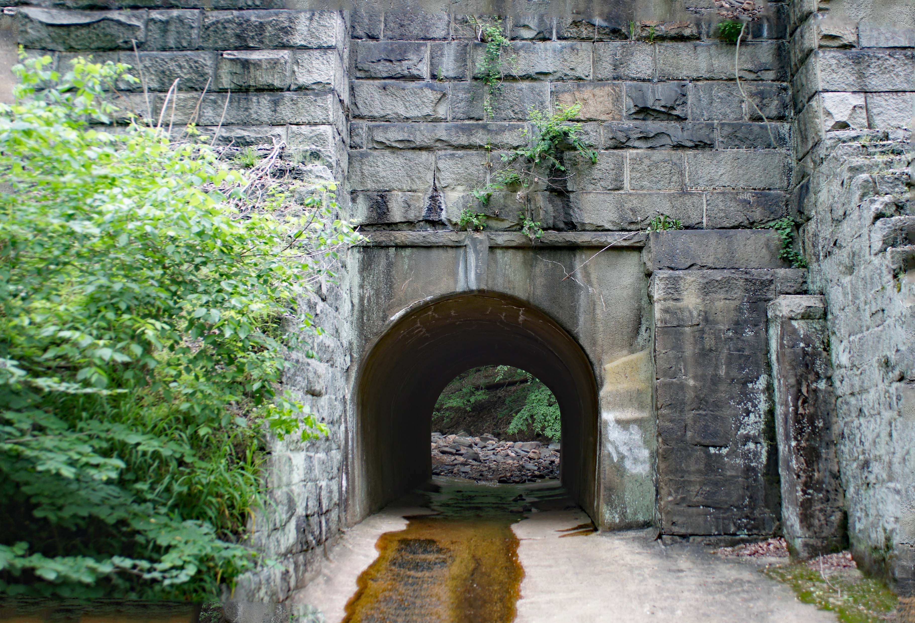
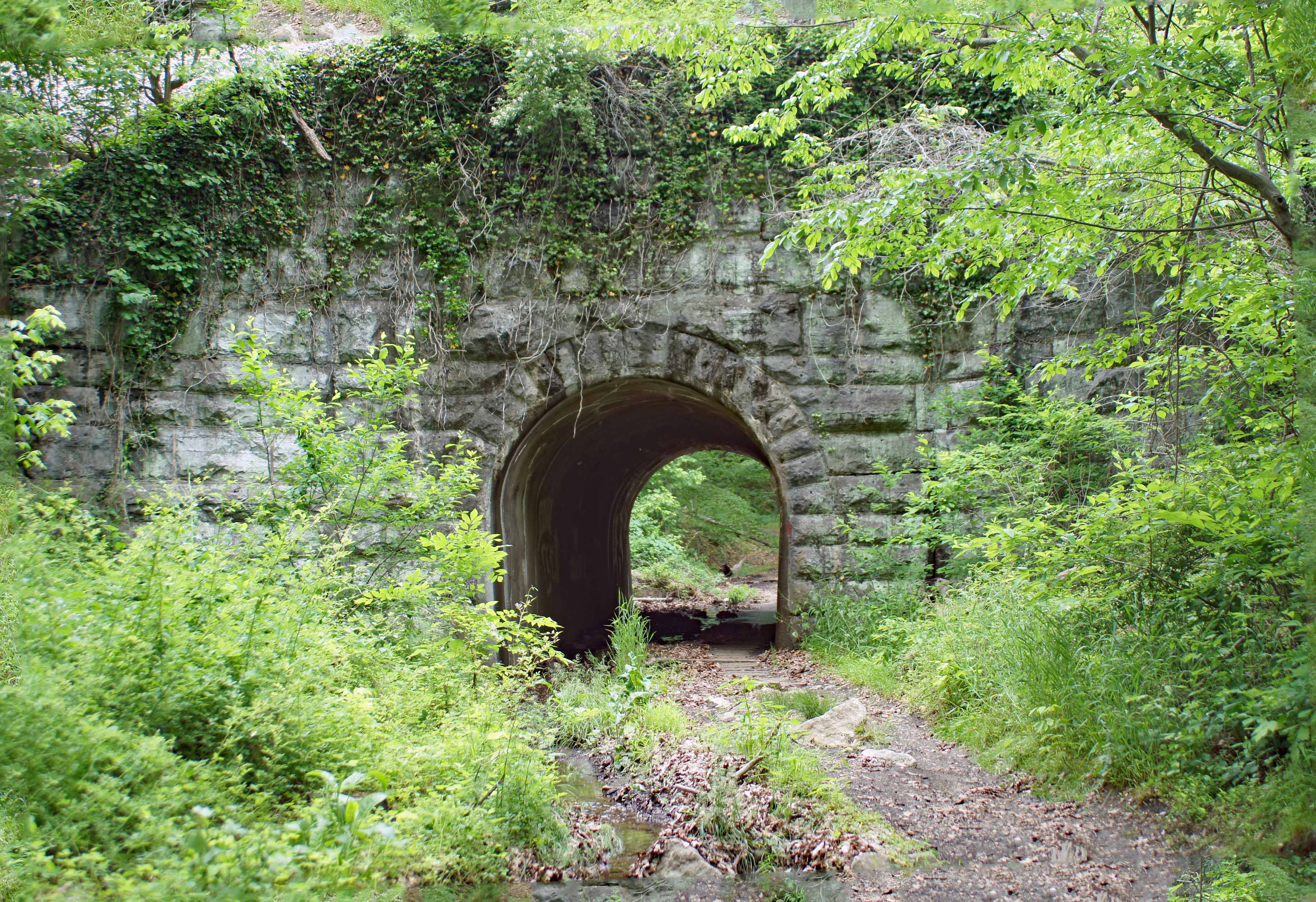
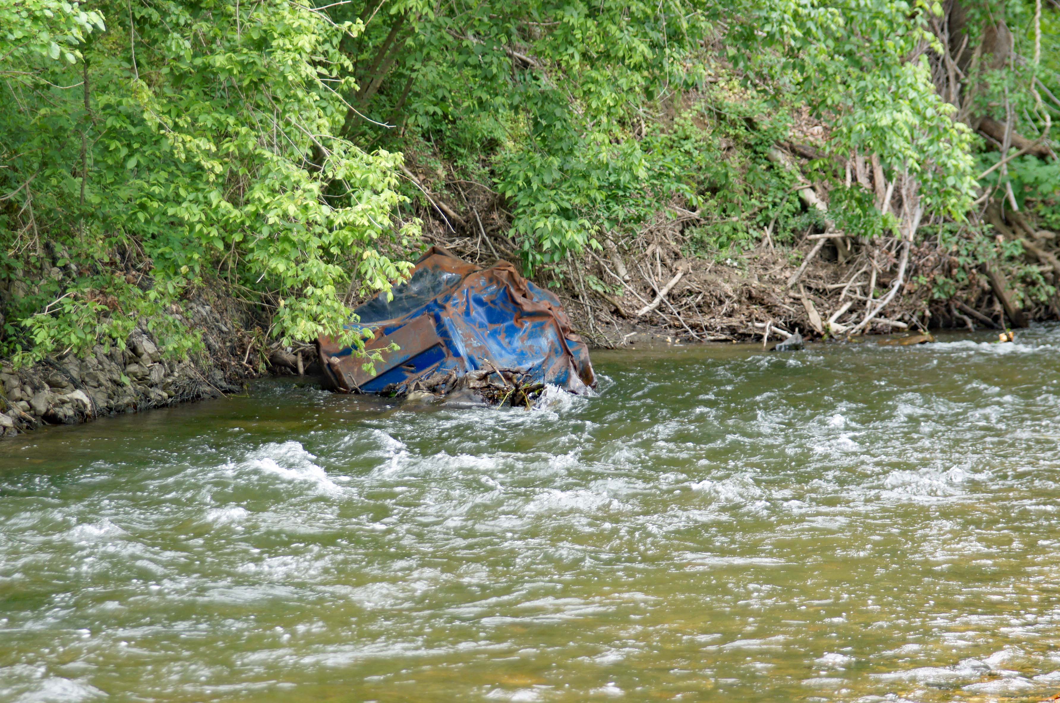
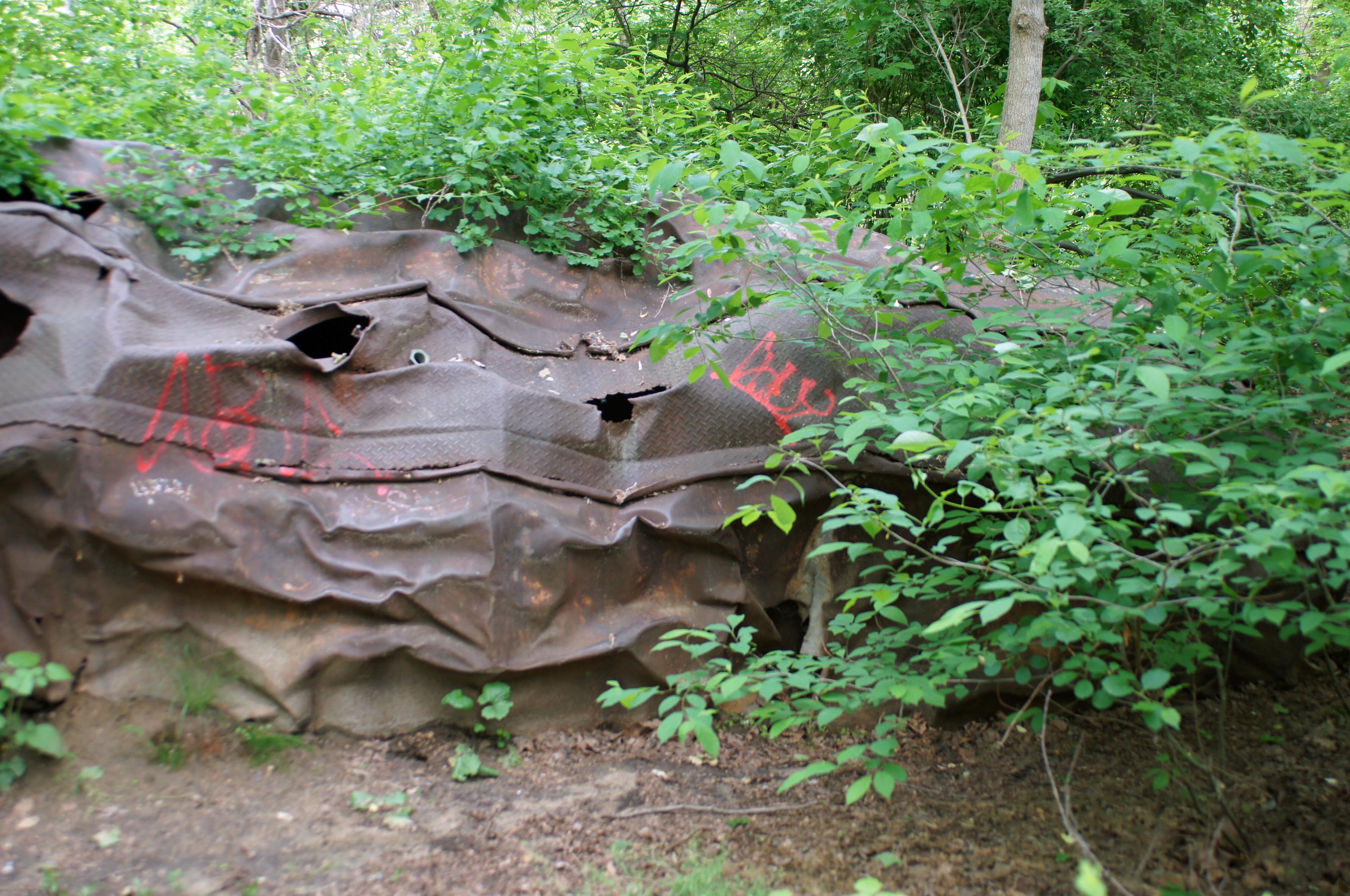
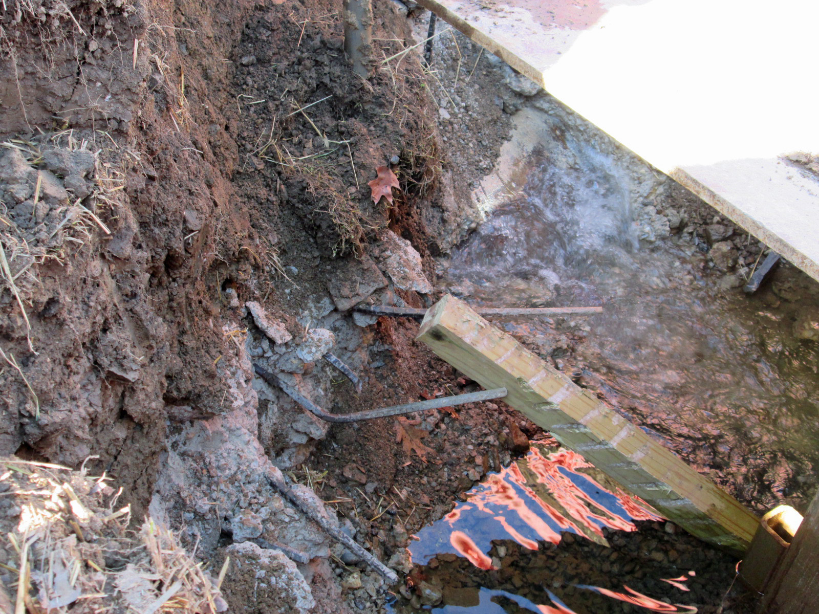
And what do we have here?

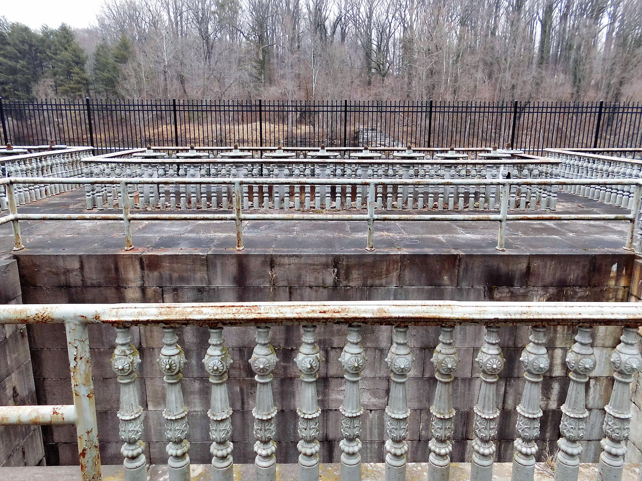
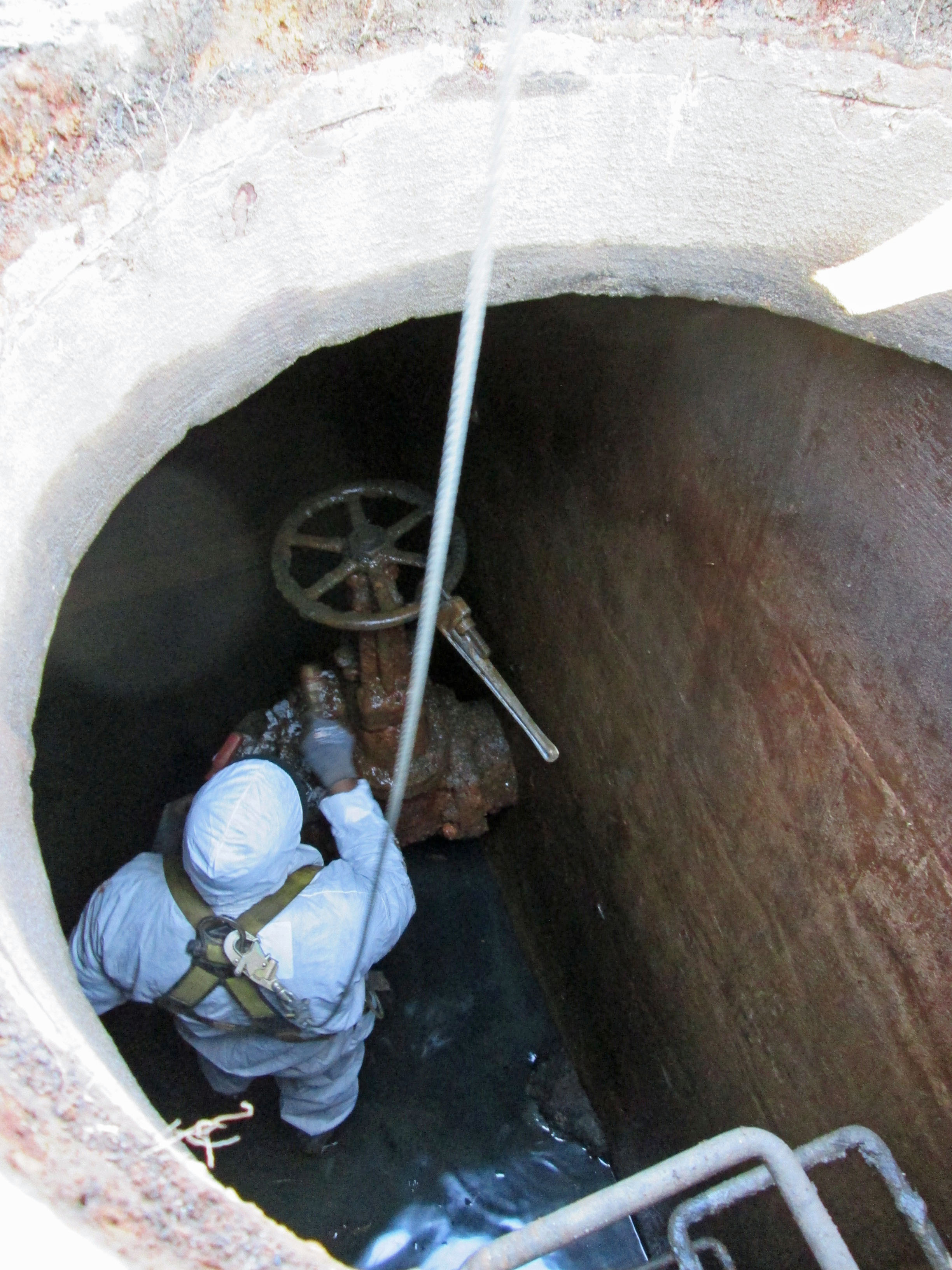
An old mill race. Kathy could see that I was excited to see this, so she prodded me on for us to go down there and take a look. 

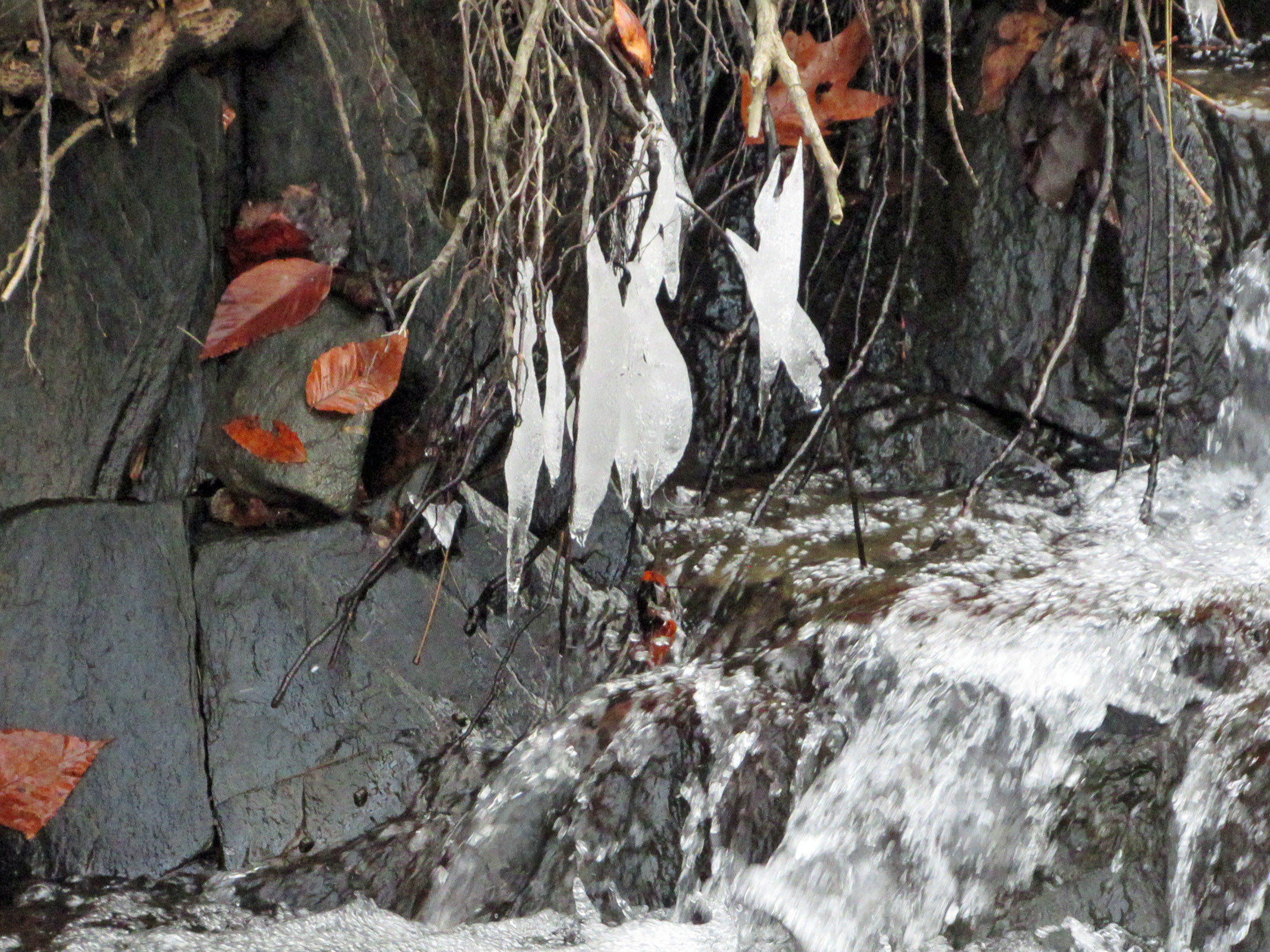
So we did. Molly wasn’t too enthused about this. Ice hanging off the rocks.

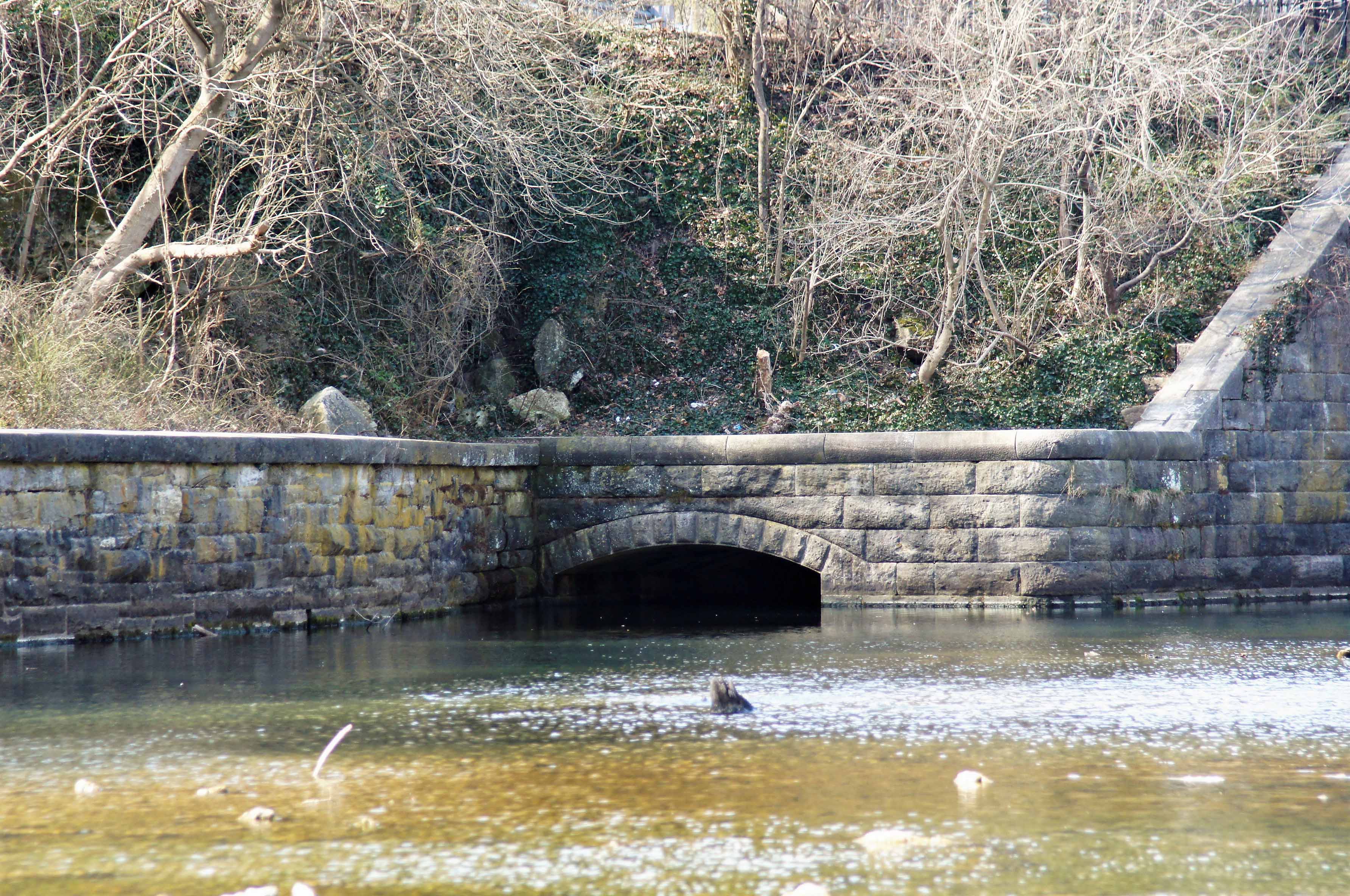
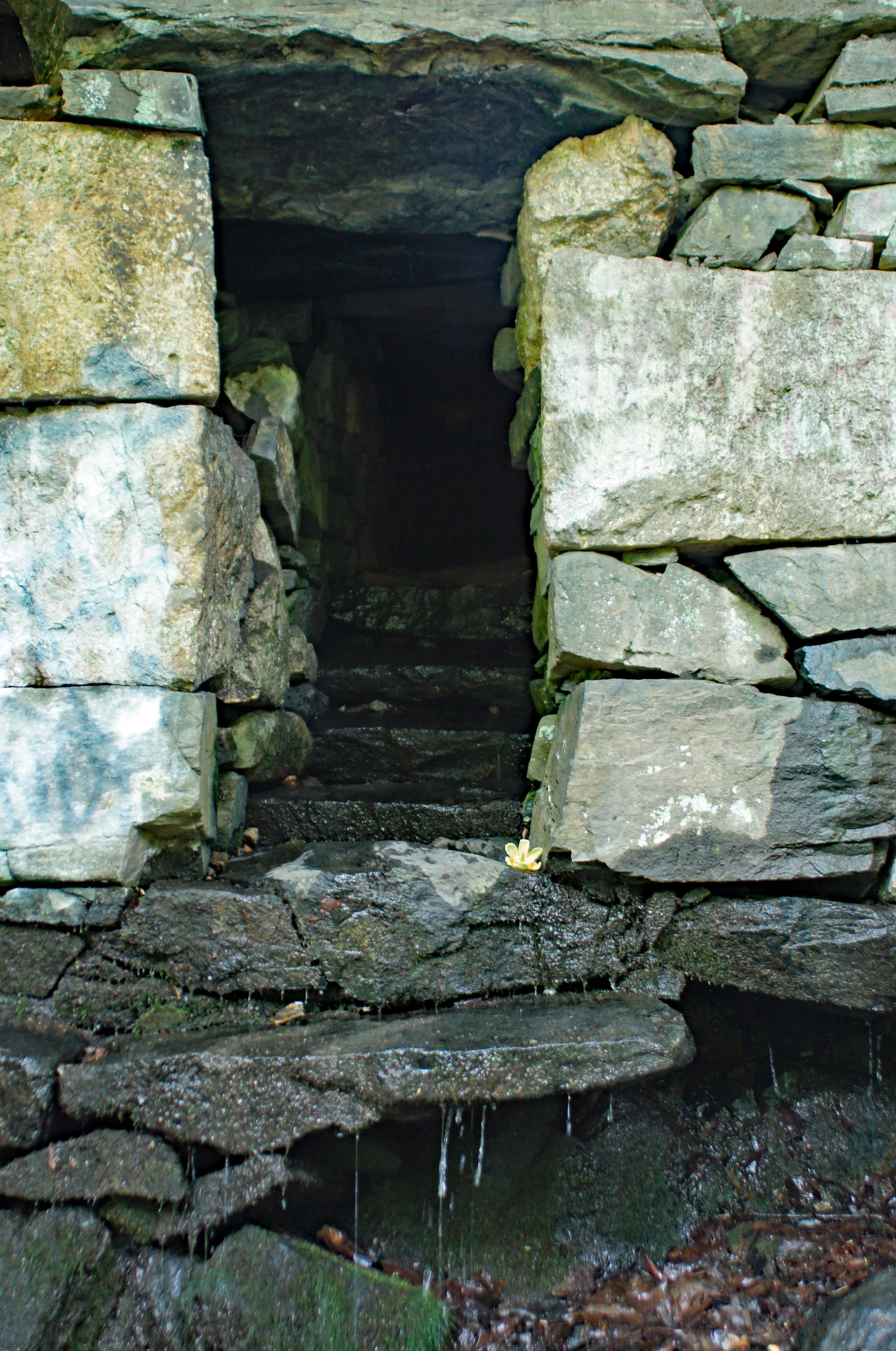
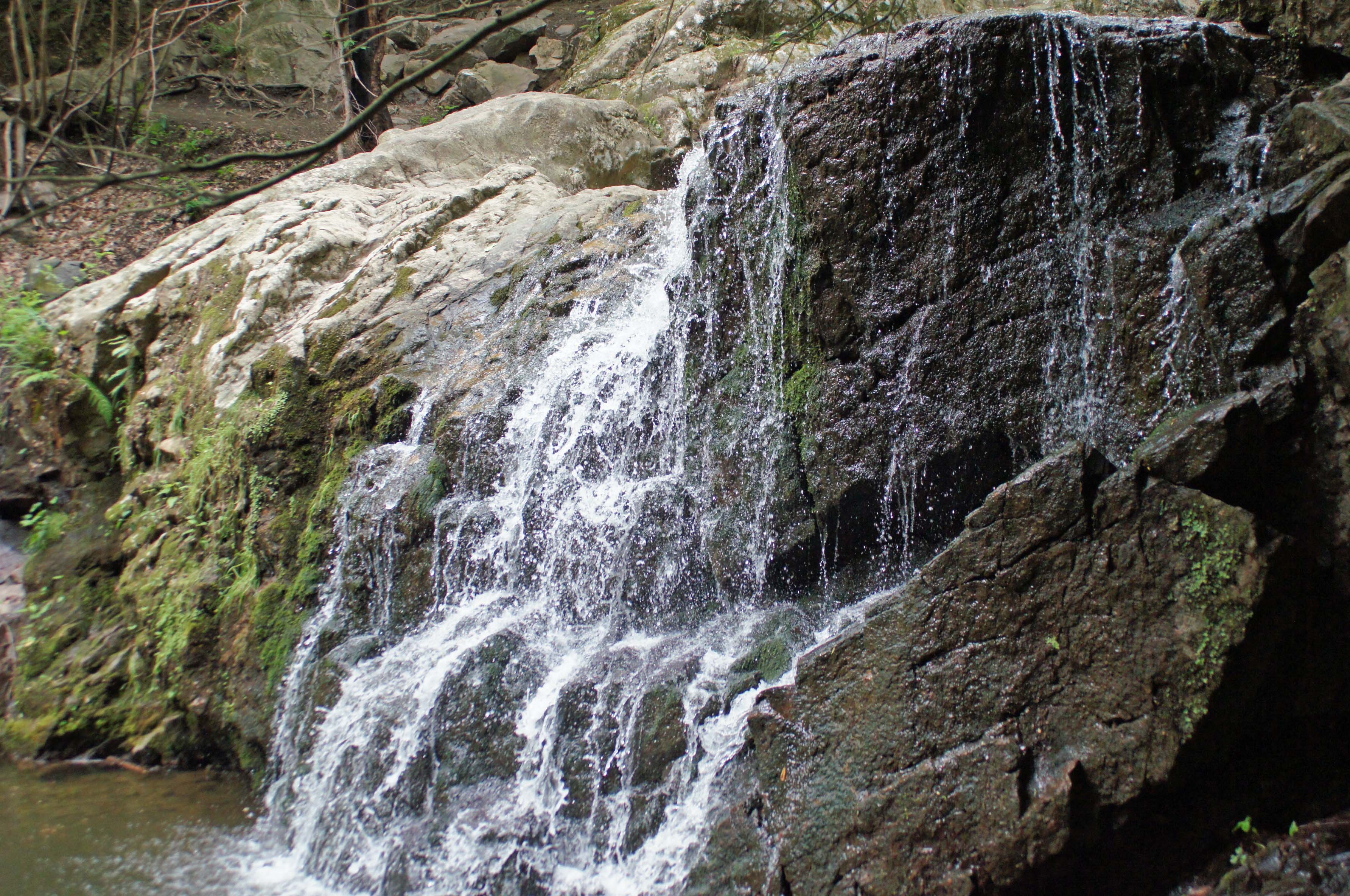
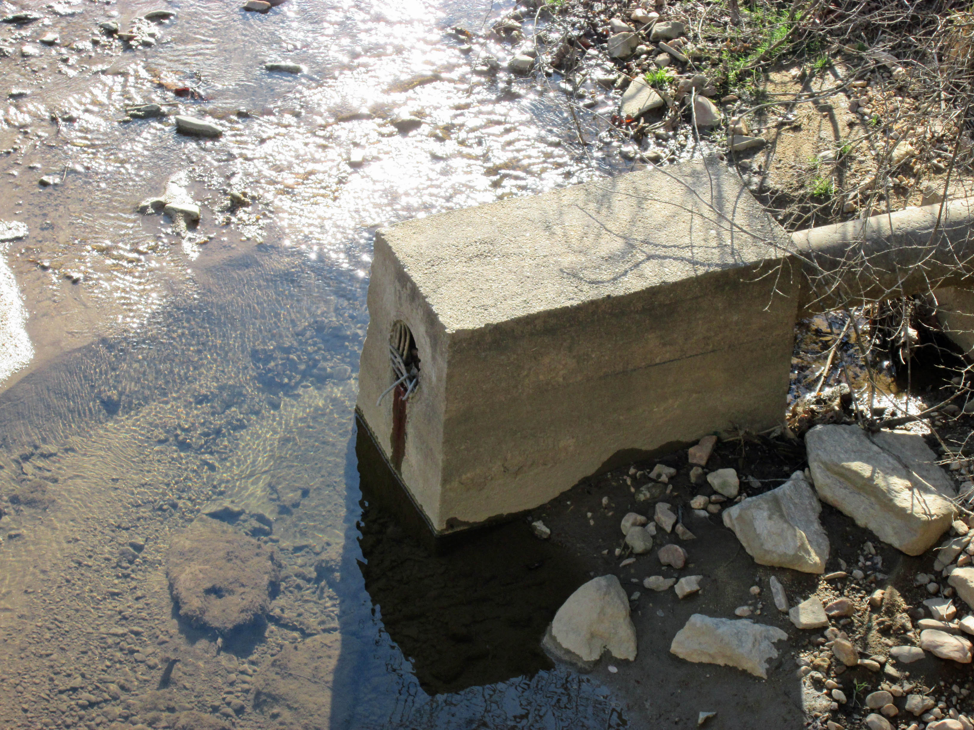
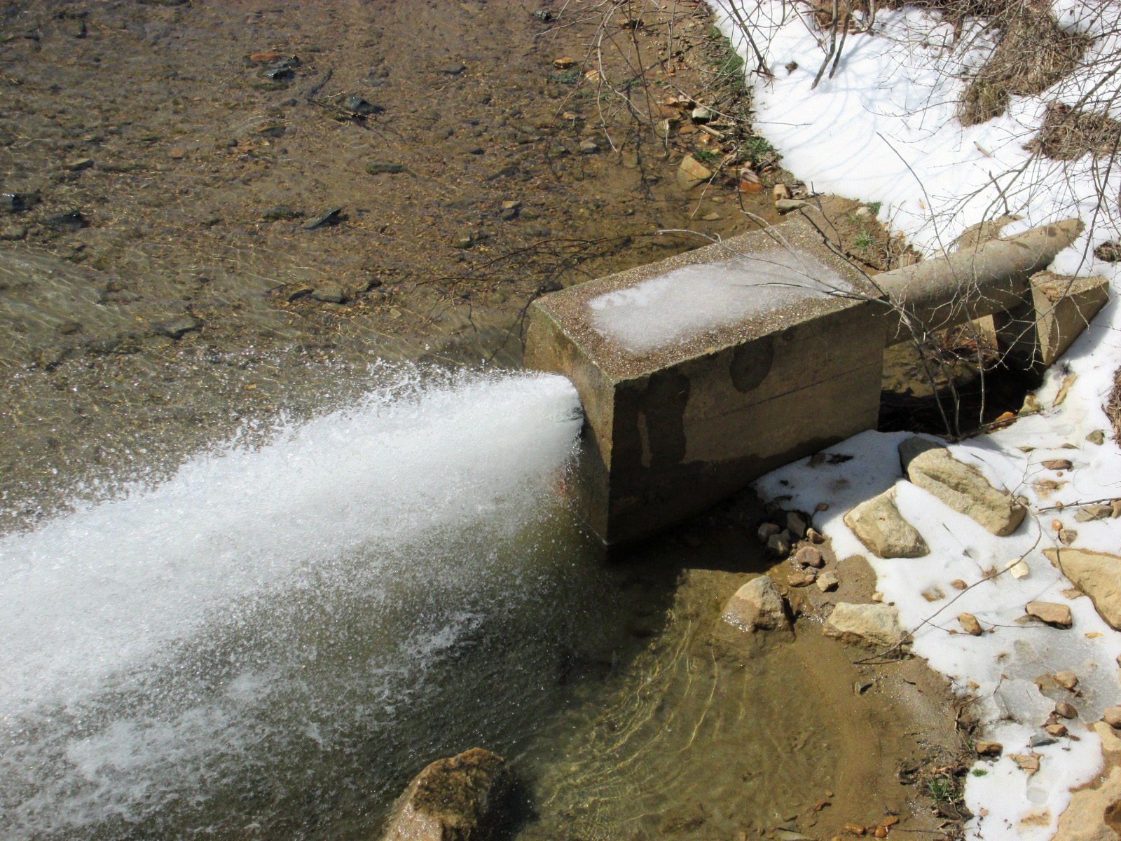
The mill race valve structure (More later on the mill)

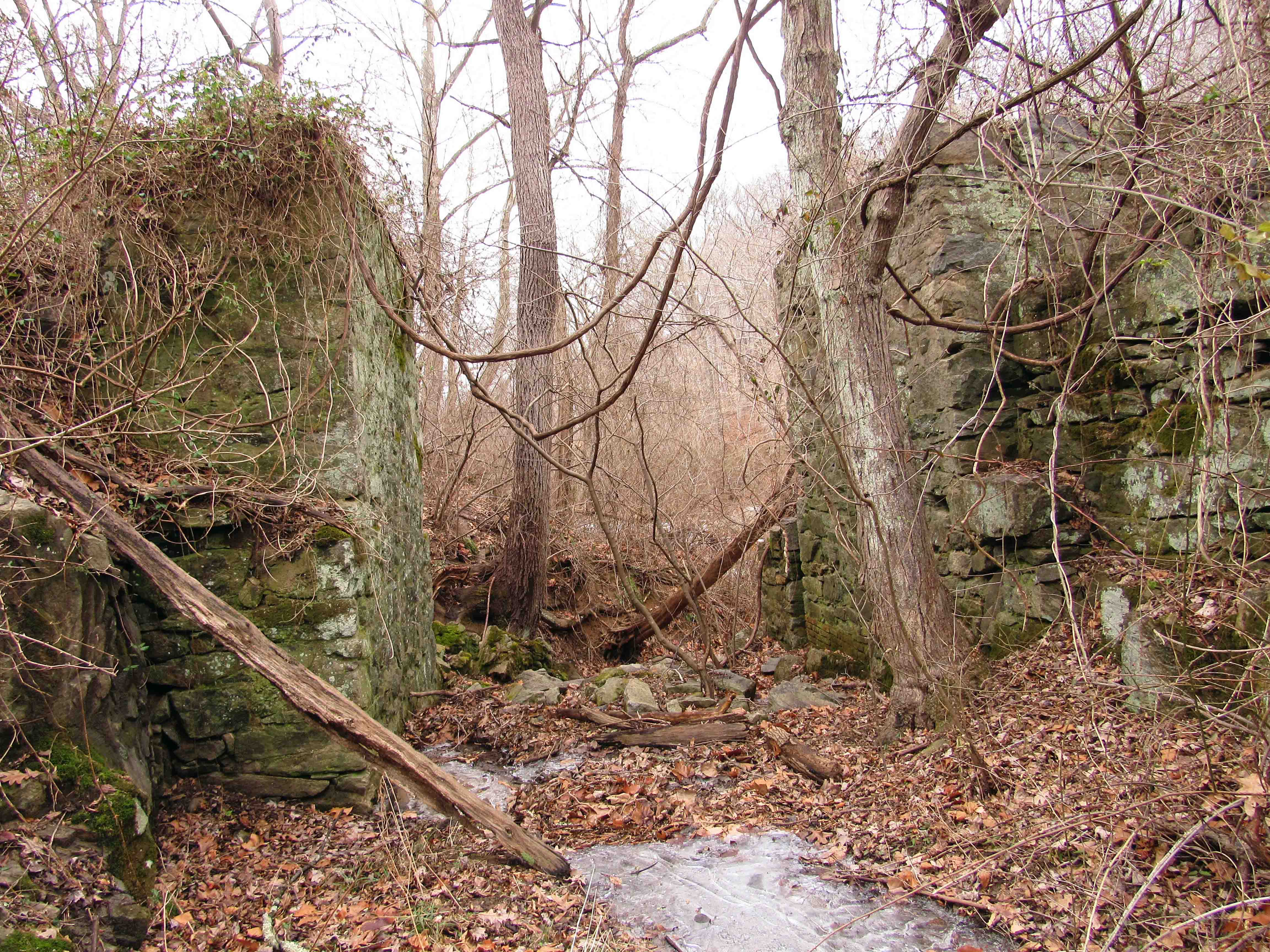
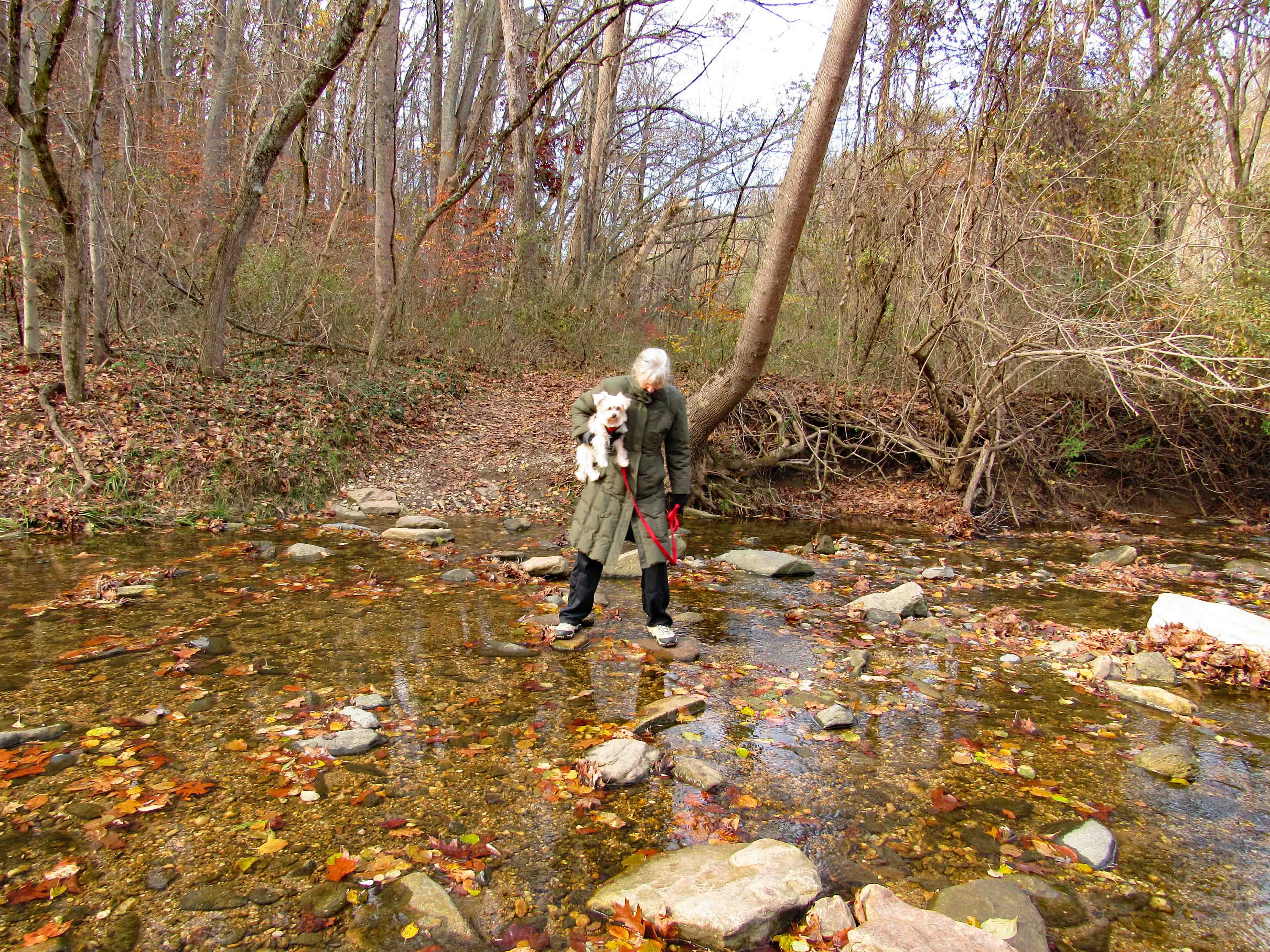
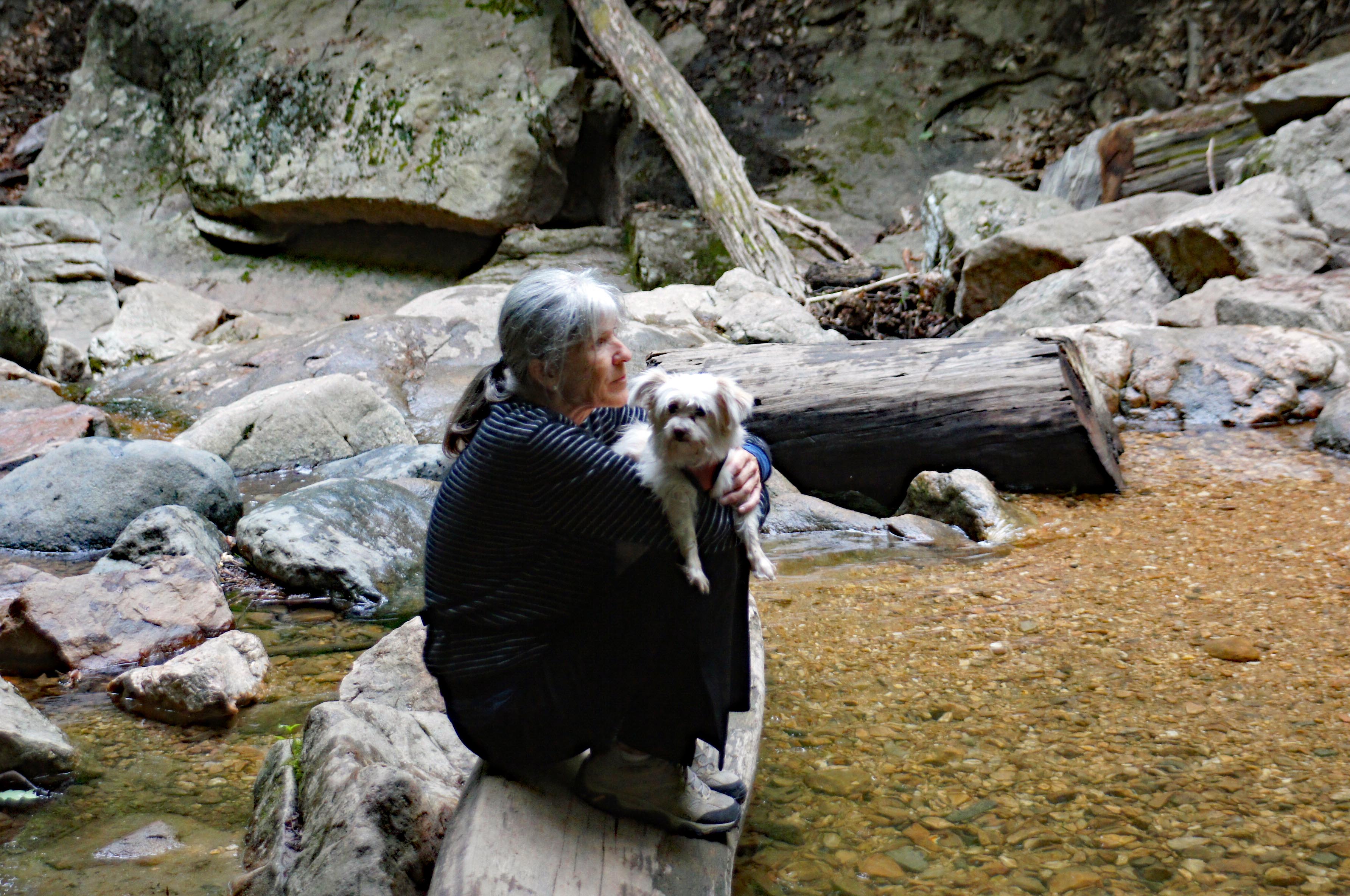
Molly was pretty much done with walking on the ice, so I picked her up and still managed to get some photos while Kathy was taking my pic.

Out of the mill and headed farther south. Sign about the town of Franklinville.
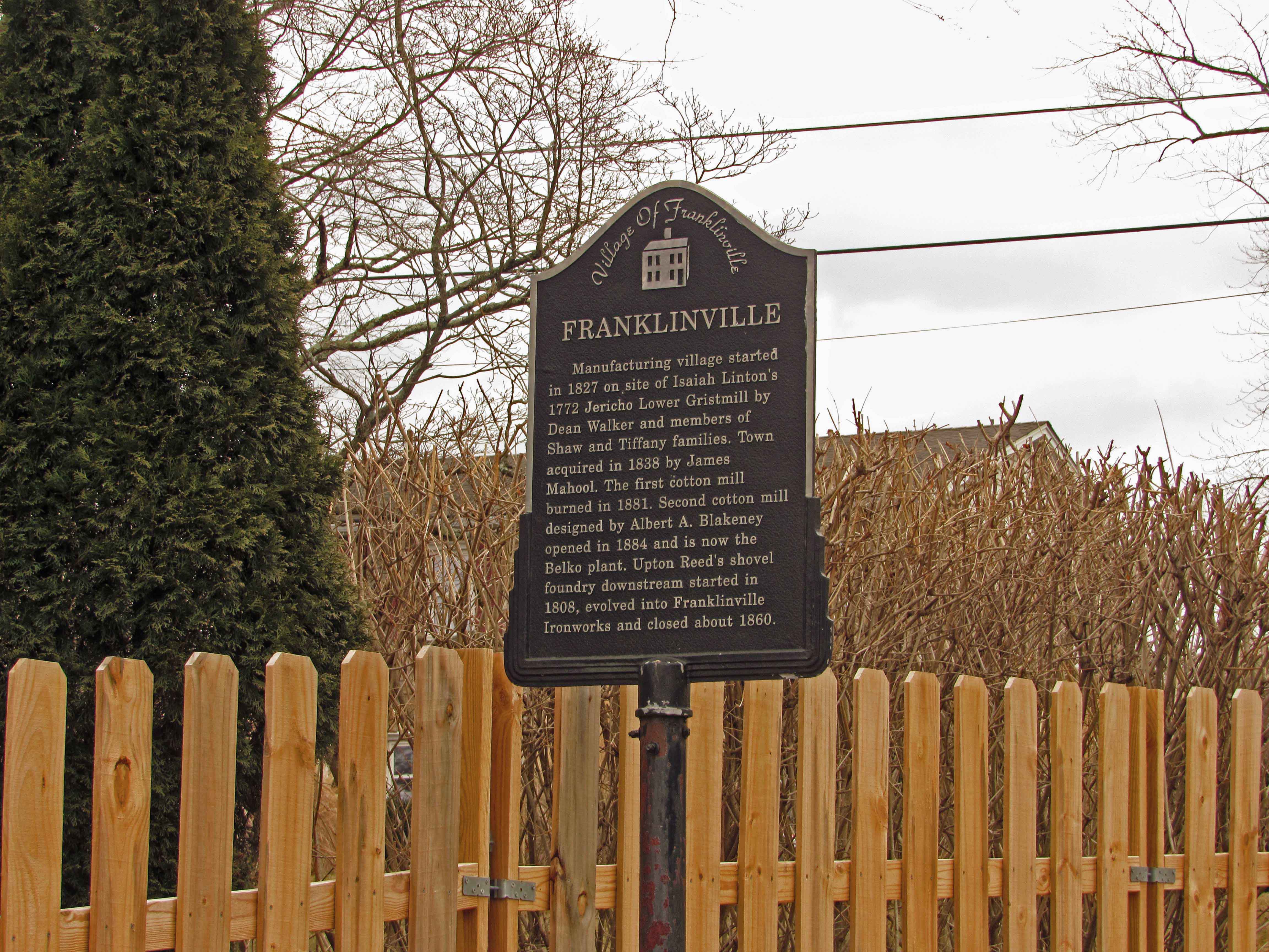
Nice place to be.

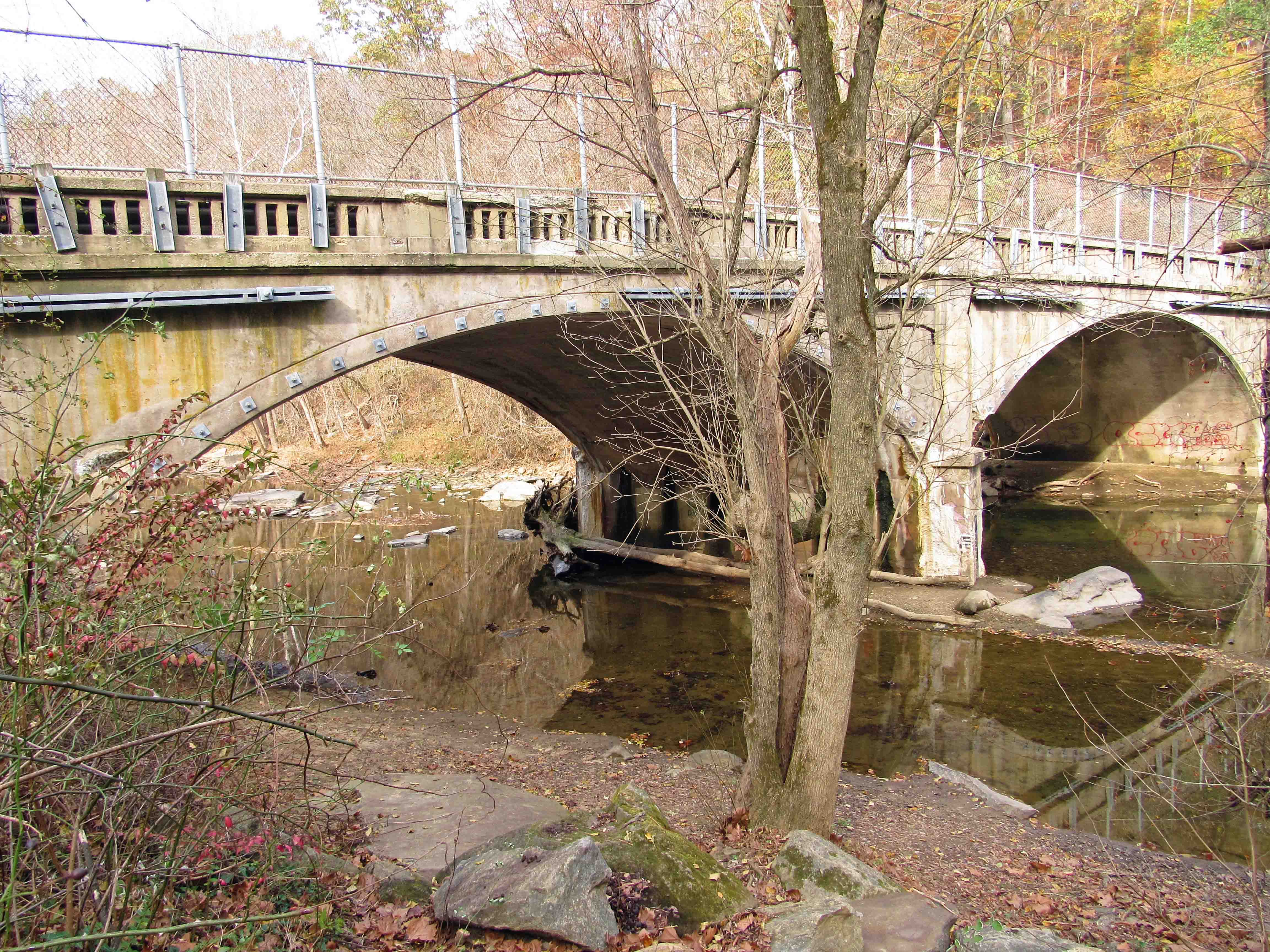
Passing thru Franklinville and onto the old iron bridge.

From the bridge. Looking north.

Then looking south. Kathy took a great photo of this. Hoping she shares soon!

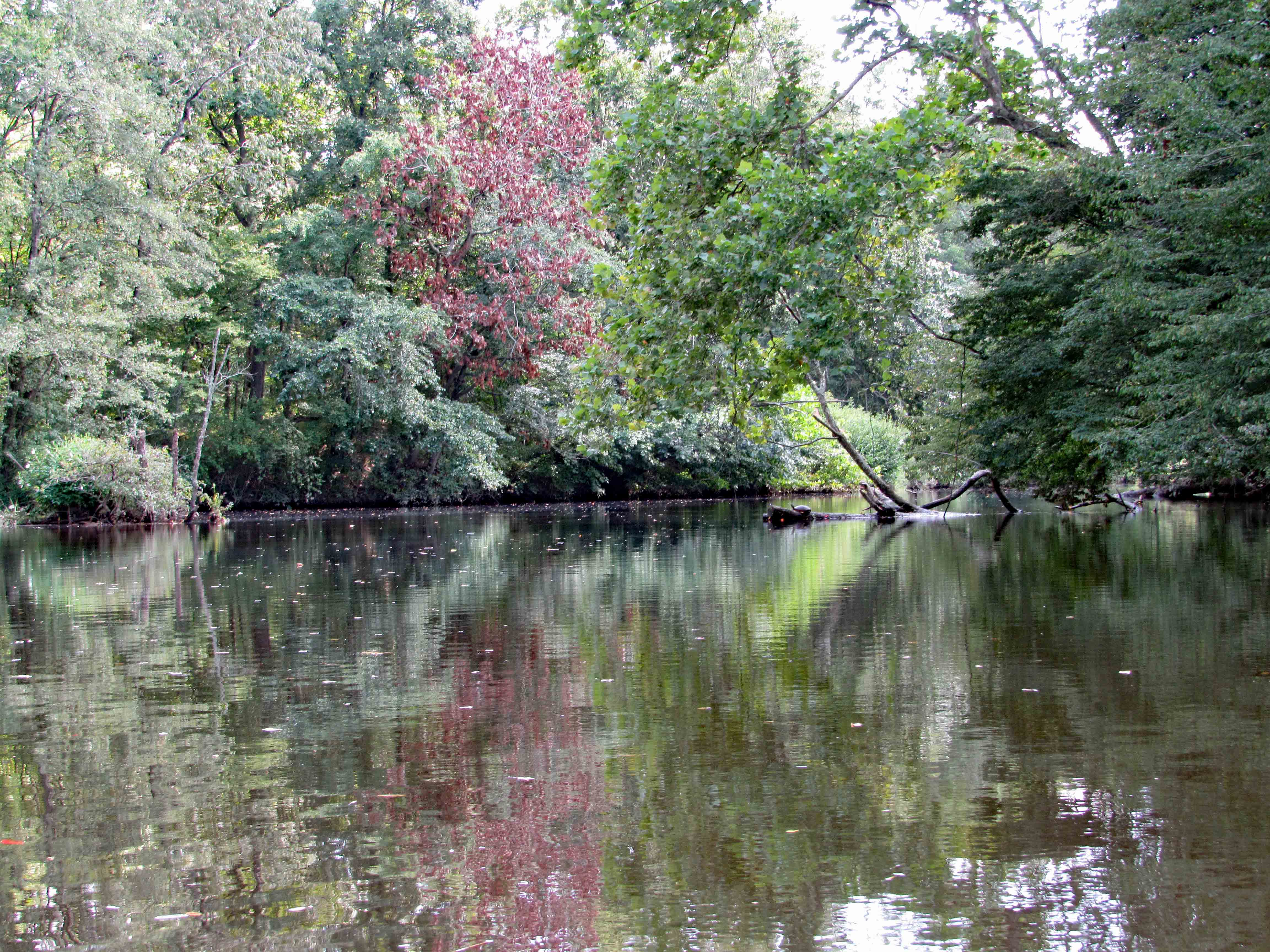
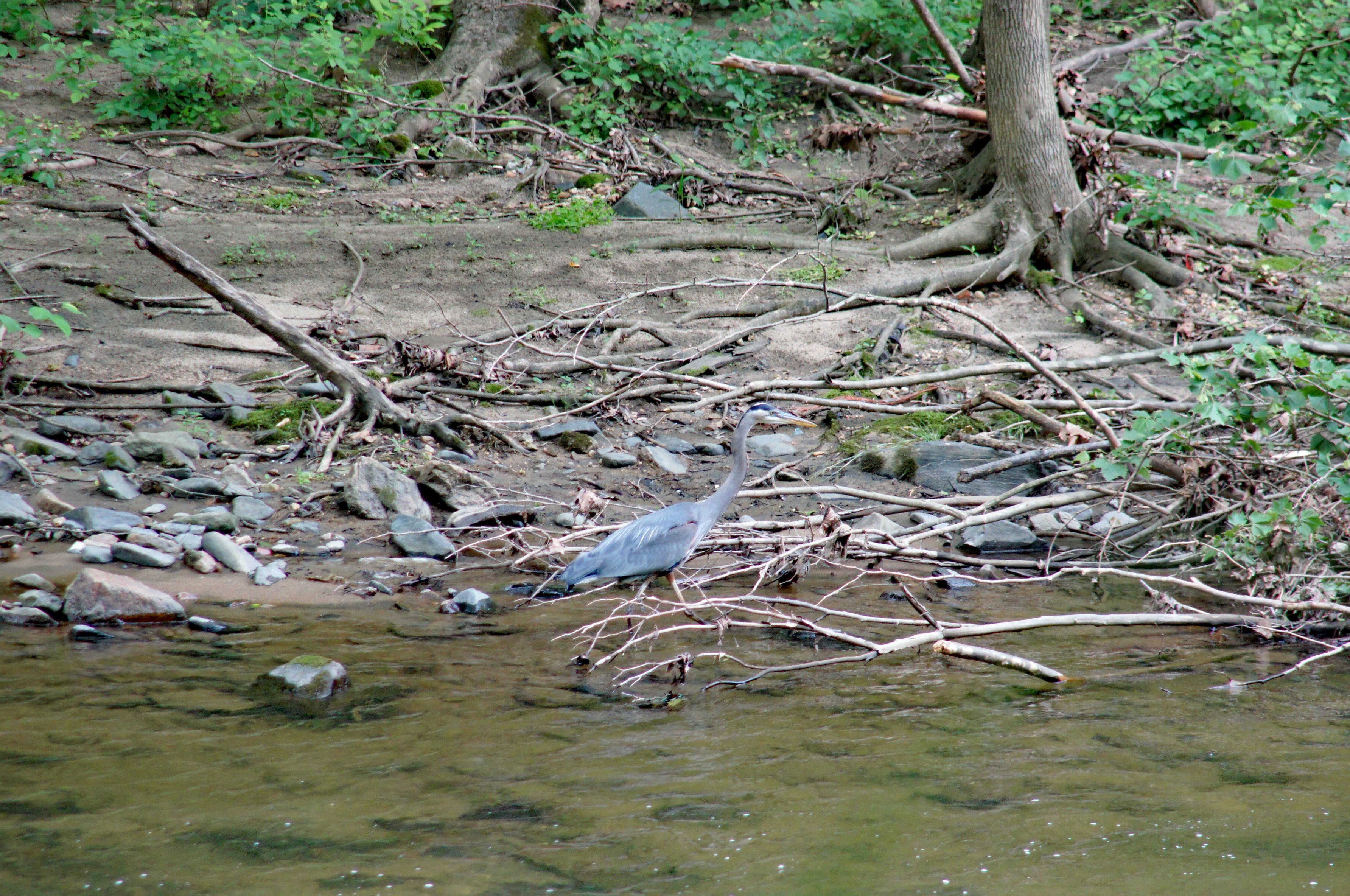
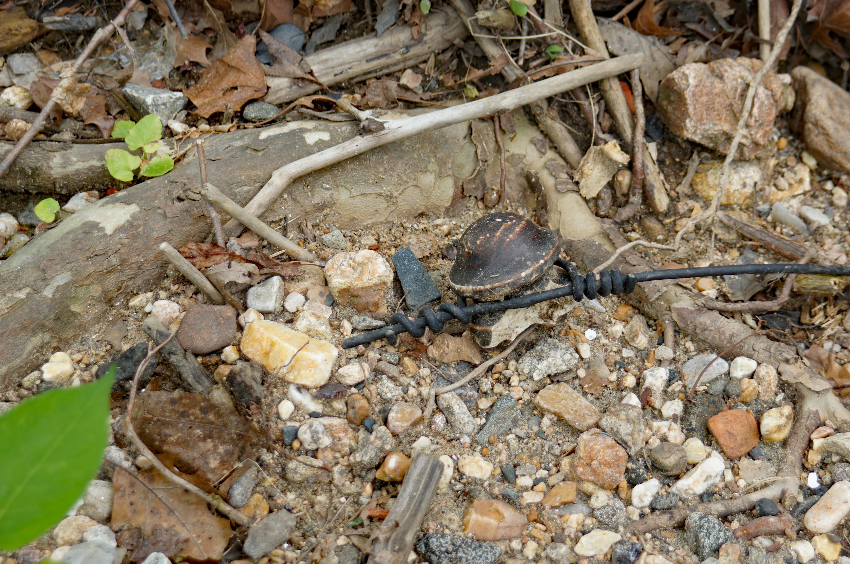
Time to head back. Saw this guy on the way.

A leaf left its mark in the asphalt, with the help of a lot of salt.

This is a long narrow road. Most drivers were very cautious approaching us. Nice fence.

The covered bridge from the west side.

Molly back on the ice, floating around.

If you are still long enough, you can hear the ice crack.

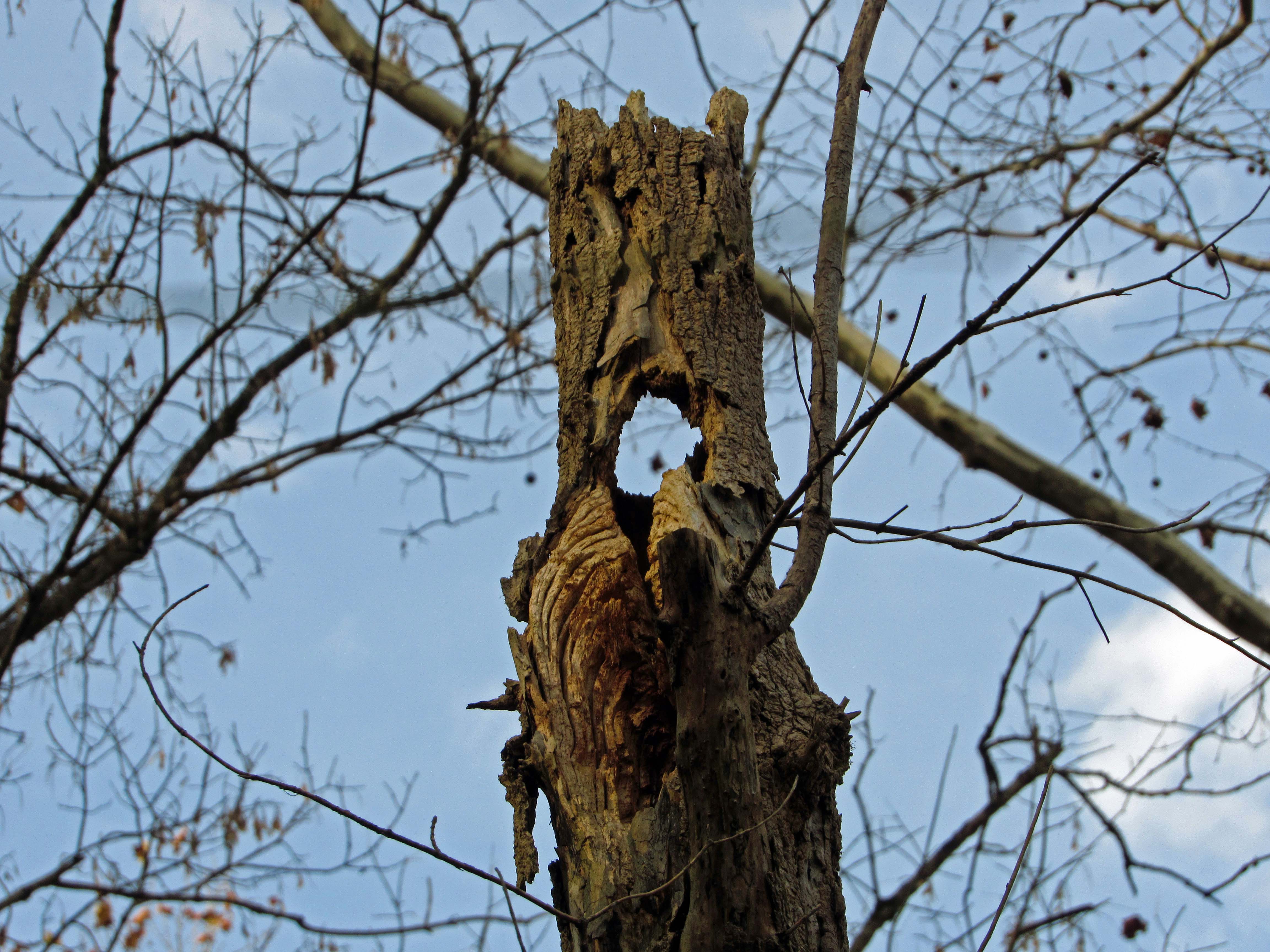
How much longer can this tree hold on?

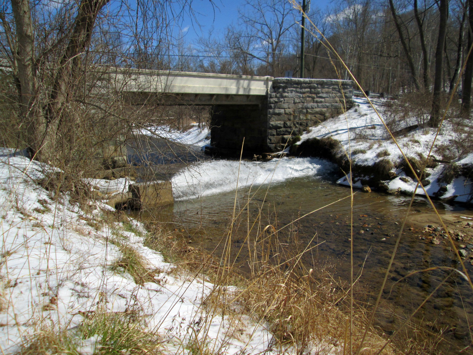
Jerusalem Mill road. Bridge over stream.

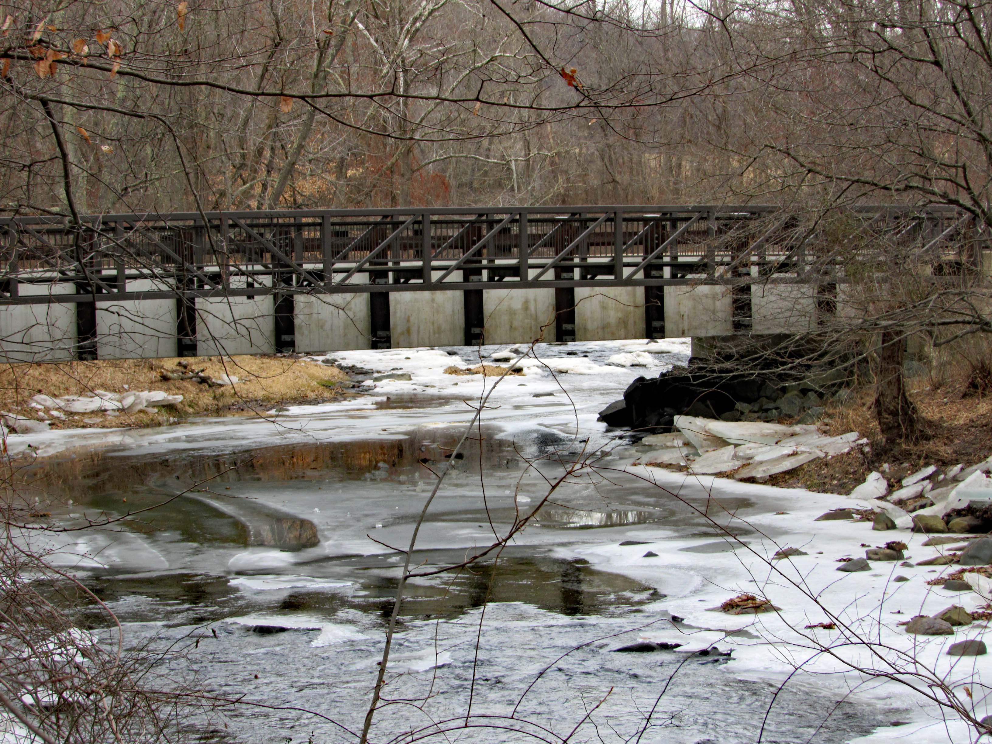
Later I will write about the history portion of our hike. Some interesting stuff!!


The Permanent Gunpowder Water Supply

05 Tuesday Dec 2017

Posted by Ronald Parks in Archives, Baltimore, water history

≈ Leave a comment

Tags

Baltimore, bridges, Dams, engineering, glass plate negatives, Gunpowder Falls, Loch Raven, Public Works, water history

Started planning back in 1854. Elevation of 160’ would supply seven-eighths of population (according to contour lines). Supplying others outside that elevation would be a matter of mechanical detail (pumping stations). The need to keep Lake Roland and the Gunpowder as two distinct and separate supplies, as Lake Roland becomes muddied during rainy season (this was why Druid Lake was constructed). It was first suggested to tap the river as far up as the Warren Factory but concurred by a host of engineers that the proper volume of water could not be obtained by damming at any point above Raven’s Rock and most agreed to a point further downstream about where Mr. Martin has located it. The dam will be erected on the Gunpowder river, at a point admirably adapted for the purpose, a short distance above Mine Bank Run, and the lake thus formed, will extend up the river as far as Meredith’s Ford Bridge at the Dulaney Valley Turnpike, where the pump house connected with the ‘Temporary Supply’ is now located…will flow by natural gravity through a twelve foot pipe to a lake at Montebello, between Hillen and Harford roads, located in a natural basin formed by one of the tributaries of Herring Run (Tiffany Run). The lake will have a water area of about eighty acres and a storage capacity of 700,000,000 gallons. The twelve foot pipe (conduit) will continue to a point on the Harford road opposite Homestead, whence pipes will be laid to connect with the city pipe system at North Boundary Ave. and Washington St. Lake Clifton.

A drawing of the Loch Raven Gate House a couple years after completion, for the engineer’s files.

The Gate House and how it looked in the 1920s.

An interior, cut away view.

The influent drain chamber to the yet to be built Gate House.

Looking over the construction of the dam, towards the east wall.

A recent view of the discharge conduit, below the dam. As shown in third photo above.

Another drawing of the Gate House structure. Where it says Vault Record would be facing the road.

Recent photo from the road, after Gate House was removed, showning vaults and valves.

This photo has me baffled. It is showing two 12′ conduits, whereas all the drawings only show one. On the left you can see where the laborers are building the brick lined conduit. On the right, nothing going on. Wondering if it was built in error or was it for a bypass as the dam was being built?

Drawing of the east wall.

1880s photo of building dam, looking east.

Recent photo looking east. Looking close you can see where the stone work stops and cement starts. In the 1970s they put a parallel pipeline in and cut right thru the wall.

This is an early, beginning of construction photo. Stone excavation looking west. Interesting on zooming in – under the roadway guardrail is a tunnel opening that looks like…

…the top left of these drawings. 

The drawing for Shanghai Run.

A 1920s photograph.

A recent photo of the opening to Shanghai Run. Looking over the wall towards the woods, there is no opening??

City workers lounging and the job is almost completed.


Thanksgiving Fog

26 Sunday Nov 2017

Posted by Ronald Parks in Hiking, nature, Photography

≈ Leave a comment

Tags

Barn, bridges, dogs, GOD, Hiking, nature, photography

Wonderful weekend with Kathy’s family down the Eastern Shore.

Sunset on the farm.

Gail and John 4-wheeling.

Back again looking for fish.

Time for a hike before deer season starts. Molly trying to flush out some birds.

A hawk surrounded by crows.

Grey barn roof on blue sky.

Reflections on the pond.

Kathy’s reflection.

Reflecting, contemplating…

Winter Robins.

And then the fog rolled in.

Like a loose blanket.

The barn. Soft coating of ice on everything.

The lone tree fighting off the shroud.

Dirt road to the heart of the fog.

It started to retreat from the pines.

Sniper house. New addition to the farm.

Walking through here, the trees’ upper branches, bathed in sunlight, let go a rain storm of melted frost.

Under the tree, a real bird dog.

Fog and steam mixing together.

Thanks given to God for all this.

A Walk In The Woods

14 Tuesday Nov 2017

Posted by Ronald Parks in Hiking, Photography

≈ 4 Comments

Tags

bridges, engineering, Gunpowder Falls, Hiking, meditation, nature, photography

That was actually a pretty good movie, with Robert Redford and Nick Nolte. But for us, it wasn’t the misadventures while walking the Appalachian Trail. It was just a peaceful, late afternoon stroll along the Big Gunpowder Falls. 

I always like checking out the bridges. Quite a few bandaids on it and should be rebuilt. This is where Harford Rd. crosses the Falls.

Here we have Molly not wanting to get her feet wet. This is crossing over Jenifer’s Branch. We did that hike once before so we stuck with the Gunpowder on this trip. 

Can’t blame Molly for not wanting to get wet – the water was cold.

Ice in early November.

Even though it was cold, this little guy was reaching for the sun, trying to stay alive.

I don’t think this stuff ever dies.

Daily black and white. Some b/w make the day dreary looking. Our days hiking are always fun. We stay positive. And Kathy has shown me how to be aware of the goodness of the hike (as opposed to my just trudging through, seeing how many cool photos I can take, to post on FaceBook!!)

I now take the time to reflect on what I am seeing – to look across and up in the trees.

Sitting pretty.

Just need to focus on what is around me, on that which is in front of me, on what is important. To be in the moment. Mindful Walking.

Kathy’s gift to the tree. Art in the park.

Our map of the trip. The one thing about AllTrails is, it shows how long you are out there while recording (over 2 hours) but when you save it, it only shows how long you were actually moving. Guess I better check the settings or will probably have to upgrade.

Tuckahoe

28 Monday Aug 2017

Posted by Ronald Parks in kayaking, Photography

≈ 4 Comments

Tags

bridges, Hiking, kayaking, nature, photography

I’d like to thank https://kayakingdelmarva.com/ and Bill Gross from Facebook for telling me about this place. It was really, really nice. Kathy says it is second only to Assateague Island kayaking. I believe she is right! The map below shows our route. I would say it was more like 5 miles total (we did zigzag around a bit on the way up but took a straight shot back) We were there for about four hours.

According to Google Maps, we were in 3 different counties. The ramp is in Caroline. Once we crossed to the other side of the creek we were in Talbot. Then heading north, zig-zagging back and forth in Queen Anne’s. Not sure exactly how far we went because Kathy’s phone lost the location signal. I do know that a plane doing somersaults over our heads was somewhere heading towards Ridgely Airfield. I know we weren’t that far up.

The boat ramp. Nice little secluded area. A man and his son were fishing there and two girls were swimming.

I found this painted rock in Baltimore and brought him for the ride. Left him on the bench to be found and enjoyed by another. When we came back 4 hours later he was gone – tossed in the water! I rescued him! And found 2 others that I just left on the ramp.

Heading under Main St. Don’t forget to duck.

I see you. A lot of times Kathy and I will drift off in different directions. I went into this little cove to check things out.

Next is the first railroad bridge.

Those are some old trees.

There were a lot of trees down in this creek. It was a giant obstacle course. Lots of underwater limbs you have to look out for. But it was fun!

Route 404. It sure is taking the state a long time to finish this road.

The next RR Bridge.

Baxter.

Tarzan swing.

Underneath the power lines is this diesel tank and pump?

The changing of the leaves. Fall is coming early to Tuckahoe Creek. It will be so nice to come back here in the fall!

Kathy getting a close up of a flower. Her phone takes better pics than my camera.

Inside the flower.

This thing jumped up on her kayak and she started beating it with her paddle! Actually, she retrieved it out of the water and wanted to keep it. I broke it when I dropped it in the grass – sorry…

This was a point where Kathy went to one side of the island and I stayed the course. Was able to duck under this.

It was unbelievable the number of turtles we saw.

Upstream a little farther, another tree in the way. Kathy doing the limbo.

Little hands on shore. We did get out to look around some. It is very muddy. Took a while to scrub the kayaks later on.

This became the end of our journey north. Probably could have went under it, but we were already at 2-1/2 hours.

Blockage on the other side of the creek.

A friend of Donald Sutherland?

Heading back with a different perspective.

Come on Fall!!

Wonder if Baxter wrote this and if Kaci said yes?

Not a lot of visible wildlife. A couple hawks showed up and this guy and the turtles and little fishies in the water.

Almost there. I really enjoyed this adventure. All the colors and reflections.

I am soooo glad I didn’t see this before going in the water. I wouldn’t have enjoyed myself thinking I was going to be towed or fined!

Patapsco SP, Avalon

22 Monday May 2017

Posted by Ronald Parks in Baltimore, Hiking, HISTORY, water history

≈ 2 Comments

Tags

Baltimore, bridges, engineering, Hiking, HISTORY, maps, mills, nature, photography, state park, water history

Due to the possibility of rain, we decided to go hiking at Avalon in the Patapsco State Park instead of going kayaking. I have a new phone app called All Trails which is pretty cool. It documents your hike.

Although it says we were moving for 1 hour and 25 minutes, we were actually there for 3 hours. It does not record every time you stop to enjoy the sights, sounds and smells. That is indicated by the thicker line, where we deviated from the trail. Lots of honeysuckle out. The only thing I did not like about this hike was the amount of bikes flying through there. Some had bells, most didn’t.

Entering the park, one of the first things you see is the Thomas Viaduct.

This photo is from the 1930s I believe (DPW Archives). It shows an older train and a newer one from that time.

This photo I took 5 years ago, the last time I visited the park. Soon after this, my Konica Minolta camera would die on me. It was a good camera.

Of course I had to check out the old water works, or what is left of them. Here is some info on that:

On September 30, 1921, the City of Baltimore took over operation of the filters at Avalon. By the purchasing of the Baltimore County Water and Electric Company, the City received a dam and filtration plant on the Patapsco River at Avalon. After this, the filters at Herring Run, near Philadelphia Road, were abandoned and the sand taken to Avalon. Ten years later, the City stops using it.
Of interest is the following:
1923 Correspondence between Edward Rost (Mechanical Engineer), [V].B. Siems (Water Engineer), Edmund Budnitz (Federal Prohibition Director) and A. Bernard Siems (Water Engineer). Concerns sampling water at the Rockburn Branch (Patapsco River), Avalon Pumping Station for pollution caused by illicit liquor still smashed up by Government agents. How the Feds destroyed it and dumped it into the stream, causing the contamination. Excellent description of how the still was built and operated: They built a small dam with a hand pump for water, pumped through a rubber hose and iron pipe to twenty-seven wooden boxes made of pine, made water tight with muslin. They also had a vertical high pressure steam boiler. Scattered around were half gallon mason jars, corn meal and liquid mash. It was suggested by Siems that the mash be hauled away to a local farmer’s manure pit. A follow up letter to the feds by Siems asking that they clean up the corn mash they dumped everywhere, which is still contaminating the stream.

One of the many trails. According to All Trails, there are over 20 miles of trails here.

Tunnels to the other trails.

Another one.

Besides the tunnels to the other side of the train tracks, there were many storm drains. This one had a Tulip Poplar Tree flower. Fell right in place for all to enjoy.

One of our off-trail forages to the river, we came across this guy. There was also an osprey and maybe an adolescent eagle.

Up stream a ways is the swinging bridge. I could swear that when I was young, this bridge was made of rope and wood and it really swung. Now it just kind of bounces.

Five years ago. It was pretty clear under the swinging bridge.

Plein art at the entrance to Cascade Falls.

Well worn trails.

The lower portion of the falls.

Cascade Falls.

Kathy contemplating the sights and sounds of the falls. Molly contemplating how to get off that log and back to land.

Heading back, following the river instead of the trail. Dumpster?

Had trouble finding this guy. An oil tanker that was washed away during Hurricane Agnes, 1972.

This is 5 years ago. So only recently did they (Park people) allow it to get so overgrown. There is a historic marker on the trail – The Forces of Nature.

Walking along the river, found a lot of Sea Glass – actually I guess it is river glass. Also there was an electrical insulator. Found some really nice glass and porcelain. (Kathy found most of it)

A nice day and a wonderful hike. Five years ago I did this hike by myself. It is nice to have someone with me, to enjoy this.

Baltimore 1910-1965

24 Monday Apr 2017

Posted by Ronald Parks in Baltimore, HISTORY, Inner Harbor

≈ 2 Comments

Tags

Baltimore, boats, bridges, engineering, Inner Harbor, Jones Falls, photography, Public Works

Scanning and documenting some more photos from the DPW Museum collection. A while back I had posted some photos taken from the smoke stack of the Eastern Avenue Pumping Station – they were in bad shape and a lot of smog in the pics. These look more like originals. Found in an unmarked folder. Some writing on reverse of photos.

On reverse of this photo is stated: Property of C.C. Wisner showing side wheeler Louise. 1910

Also marked as Wisner and being taken by A. Waldek (His name is spelled two different ways on 2 photos). Undated. Looking north. Shot Tower in upper left.

Another undated one. Assuming between 1910 and 1934 . Marked with Wisner and Waldeck. View of Pratt Street up Jones Falls.

Notation on back: Baltimore City, Old Light Street waterfront piers and docks since removed. 1949.

And after the removal. About 1954.

1965 improvements prior to the Inner Harbor becoming Harbor Place.

Easter on the Eastern Shore

16 Sunday Apr 2017

Posted by Ronald Parks in Hiking, nature, Photography

≈ 2 Comments

Tags

bridges, Graves, Hiking, nature, photography

Spent Easter with Kathy’s family down on the Eastern Shore. Always a great time. On the drive home we stopped at a couple places.

The first being just outside of Easton. This is one of those historical markers that you go flying by and have a hard time pulling over to read. But we did.

This is a little church (meeting house) and cemetery. Also where the first peaches in Maryland were planted.

Another little cemetery behind the house.

Yes they are.

Then we headed to Terrapin Park on the Chesapeake. This is always a great walk. We started on the outer loop, walked the beach and then took the inner paths back to the lot. There were a lot of cars in the lot but not sure where all the people were? This was on a bench.

Hard to get Sid Vicious to pose.

Alien markings on a piece of driftwood.

Nice little bridge.

Driftwood with drift nail.

Fire wood?

Cement cylinders along the shore.

Looking for other dogs to terrorize.

Adrift? Was hoping it would come our way but it seemed to be anchored down.

Wishing to dandelion seeds, spreading across the park…

Property next to the farm. Potential for a new home to be built…the steps are there!

Busted Pipe

17 Friday Mar 2017

Posted by Ronald Parks in 1972, Baltimore, Dams, water history

≈ Leave a comment

Tags

Baltimore, bridges, Cromwell Park, Dams, engineering, Gunpowder Falls, Hiking, HISTORY, Loch Raven, nature, photography, Public Works, water, water history

As I mentioned a few weeks ago, the contractor building a new maintenance facility at Loch Raven, busted a hole in the 10′ water pipe.

The site of the new complex, along the west bank of the Gunpowder River. The caution sign is the area where they broke the pipe. It is now covered with steel plates.

Here is what the conduit looked like when it was installed in 1913. It is a steel pipe, welded and riveted together.

As the conduit was installed, they encased some sections of it in concrete, to give it some strength. Loch Raven Drive is directly above this pipe in some areas.

Looking under the steel plate I ask – how the hell do you NOT know that this pipeline is there?? In the photo can be seen above the wood stake, water pouring out of the pipe. Surrounding the stake is the rebar the contractor had to break thru in the cement to strike the steel pipe. The contractor is lucky that the dam has two independent conduits coming out of it.

There was built a parallel pipeline back in 1972. I’m not sure why or even why it is called the Parallel Pipeline. It kind of zig-zags across the river.

The contractors of 1972 had their fair share of problems – like the worksite getting flooded. The lower, smaller dam is in the background.

In order for the present day contractor to fix the hole he made, the City was asked to drain the pipe.

After searching thru some old drawings, we were able to find the location of the drain pipe. This is a 12″ drain connected to a 10′ pipe.

My favorite valve guys came out to try and open it by hand but were unable to. It has been a very long time since this was open. They ended up having the contractor core drill a hole in the vault roof above the valve. They then used their valve truck to turn it.

This is at 8 turns, 20% open. This will take quite a while to drain. The contractor is impatient.

But. as you can see, opening it up too far will erode the stream bank right under this bridge. Today the contractor was given the ok to place steel plates in the stream to divert the flow away from the bank.

Meanwhile, I roamed around some and took some pics – of other than work related stuff. A stone snowman walking his stone snow duck.

Root system.

View across the reservoir. Days like this, I like my job…


Love – Hate Relationships

14 Tuesday Feb 2017

Posted by Ronald Parks in engineering, HISTORY

≈ 2 Comments

Tags

Baltimore, bridges, Dams, engineering, FILTRATION, glass plate negatives, Gunpowder Falls, HISTORY, Public Works, water history

Sorry, this is not a Valentines Blog! This is in regards to my job. Co-workers know I do the archiving, so when they think it’s time to clear out some filing cabinets, they bring all their junk drawers to me. I hate it! So I sort and document and throw out a bunch of stuff…but then, hidden between the pages of some obscure files, I find a folder of photographs! I love it! This particular group of photos are from the 1913-1915 building of the Loch Raven dam. They are the actual prints from the glass plate negatives. Some of which I’ve never seen or ones that I have, scanned from plates that were cracked or silvering. Poor quality. These are near perfect prints.

ic-006

 I have a very poor quality of this one with no real description. On the back it says – “Crushing Plant at Department Quarry near Bridge #1”

ic-001

Building Bridge #1 which is the first bridge up Loch Raven Drive from the dam. One thing I don’t understand about engineering is…

ic-002

…how do they take the upside down bridge and turn it right side up??

ic-003

I’m not sure what this one is, which is ok. I will look thru the old records and see if I can match it up some how. I thought it was of the construction of bridge #1 but the date wouldn’t be right.

ic-004

No description on this one either, but I like the guy in the back with a hatchet, wearing Frye Boots!

ic-005

This one is of the building of the bridge. Look close and you can see a typical City worker, sitting down on the job to the right!

← Older posts
Newer posts →

Blogroll

  • Flouride Action Network
  • lulu
  • My Book
  • WordPress.com
  • WordPress.org

Recent Posts

  • ICELAND April 2023
  • George Chalmers of Fochabers
  • In Search of The Skipjack Ada Mae
  • Trap Pond Kayak
  • Pusey Trail and Cemeteries

Blog at WordPress.com.

  • Follow Following
    • Water and Me
    • Join 226 other followers
    • Already have a WordPress.com account? Log in now.
    • Water and Me
    • Customize
    • Follow Following
    • Sign up
    • Log in
    • Report this content
    • View site in Reader
    • Manage subscriptions
    • Collapse this bar
 

Loading Comments...