Tags
art, Baltimore, Crafts, fishing, Gunpowder Falls, Hiking, Holidays, Montebello, Peace, photography, Public Works, water
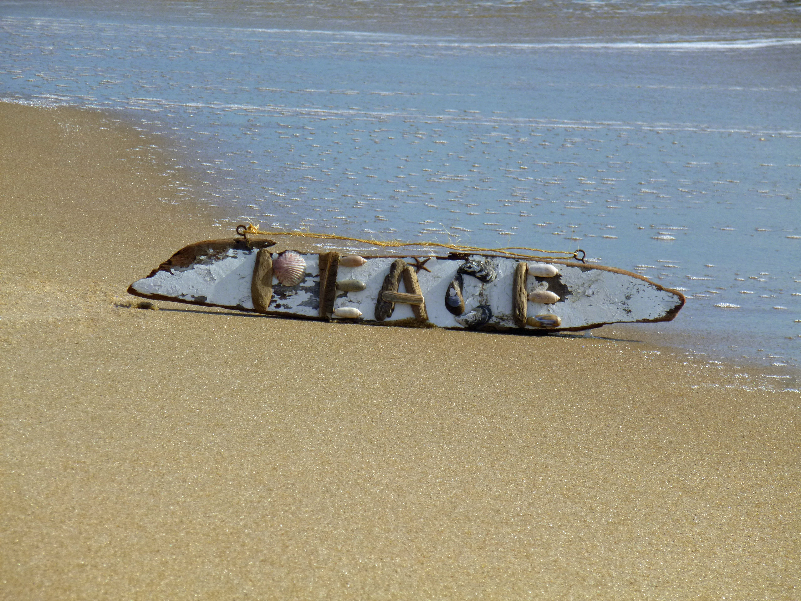
From Kathy, Molly the mutt and myself….

23 Friday Dec 2016
Posted in Baltimore, nature, Photography
Tags
art, Baltimore, Crafts, fishing, Gunpowder Falls, Hiking, Holidays, Montebello, Peace, photography, Public Works, water
From Kathy, Molly the mutt and myself….
21 Wednesday Dec 2016
Posted in Baltimore, water history
Tags
Baltimore, engineering, glass plate negatives, Gunpowder Falls, HISTORY, Lake Clifton, Lake Montebello, Montebello, Monuments, POLITICS, Public Works, Statues, water history
When the permanent water supply from the Gunpowder Falls was built, it included a dam at Loch Raven, a 12′ tunnel approximately 7 miles long, an impounding reservoir at Montebello, another conduit from there to Lake Clifton and then it was distributed to the public as unfiltered, yet wholesome drinking water.

Photo from the 1920s showing the original 1881 gate house at Loch Raven

How the gate house area looked in 2011.

When they eventually removed the gate house, they kept some of the original stone and built this somewhat mini-monument to the Permanent Supply, across the street.

The supply is finished and the valves are opened. This is downtown Baltimore at the Battle Monument. Caption reads: Fountain and Cataract – Monument Square – The Introduction of the Gunpowder Water Supply – Oct. 10th 1881
10 Saturday Dec 2016
Tags
abandoned house, Baltimore, bricks, Eagles, engineering, FILTRATION, fishing, glass plate negatives, Gunpowder Falls, Hiking, HISTORY, Montebello, nature, photography, Public Works, water history
The day before taking off work for my daughter’s operation, I was contacted by CHAP – Commission for Historical and Architectural Preservation. They wanted to know if I knew anything about a fireplace mantle from Glenn Ellen Castle that was stored in a maintenance building downstream from the second dam? No. They were getting ready to tear down the buildings and were told by the contractors about the mantle.
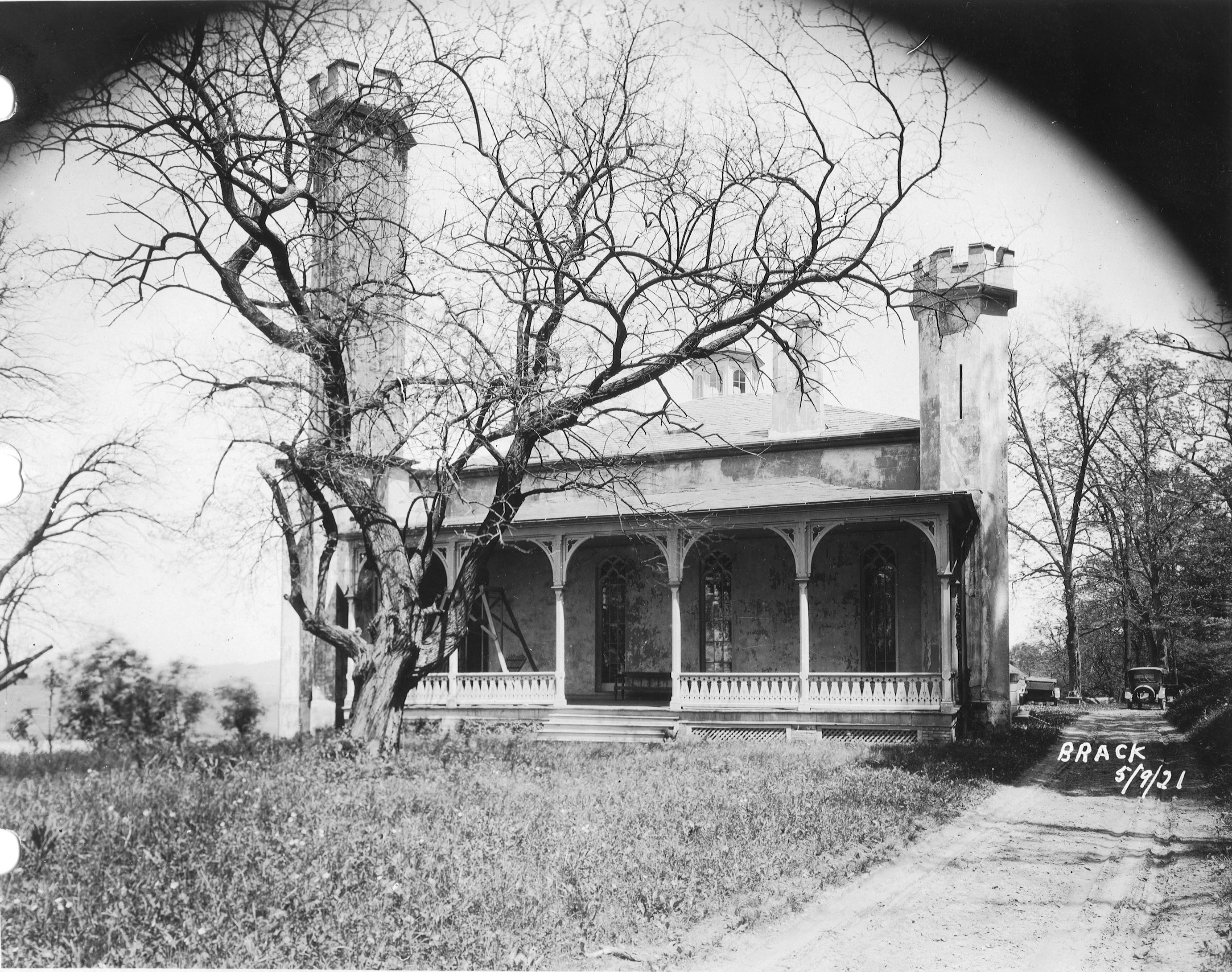
This was Glenn Ellen prior to raising the dam from elevation 188′ to 240′. The reservoir did not reach this height but it was still on watershed property and taken by the City. I think only the foundation exists now.

Earlier this week a friend of mine, Thom, contacted me and told me about some signs he saw on the property as he was hiking behind the construction site. At first glance I thought they were bronze plaques so I met him and Wayne to go exploring.

The hiking trail is on the hill behind the silt fence. This is where the signs were. Turned out to be steel and not bronze, but still worth keeping a couple for history’s sake!

Saw some interesting items so took a closer look. I thought it was odd that the contractor cut the beams instead of just knocking this building down. Come to find out a company called Bricks And Boards came up a removed the wood to re-purpose. The boxes contain core bore samples. Not sure why the City didn’t want to keep these? They do me no good without the engineer’s records saying where the samples came from.

After rooting around in the barn we decided to head into the house. This is being knocked down also. A few years ago I was told there were lantern slides stored in here along with some old drawings. Back then, I wasn’t allowed in to look.
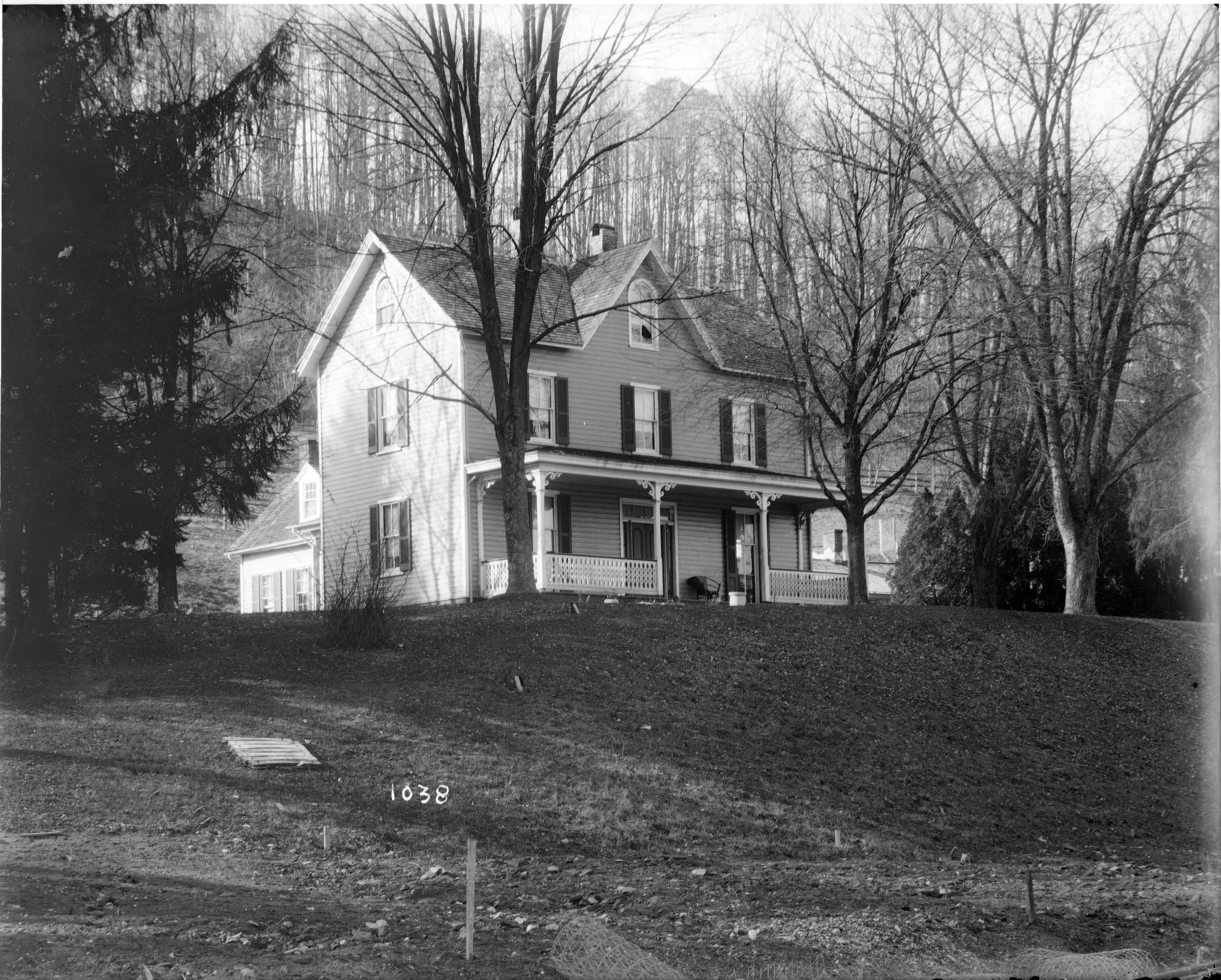
The house as it looked about the 1920-30s. I tried to find who was the original owner but had no luck. From a map of 1882 it has it listed as City Property. Adjacent to the Wisner, Shanklin properties. Further investigation is needed.

Wayne asked the date the house was built. Not sure but it shows up in a 1881 photo. Far right side just up from the Gunpowder River. This photo shows the dam near completion, ready to lay the last stone.

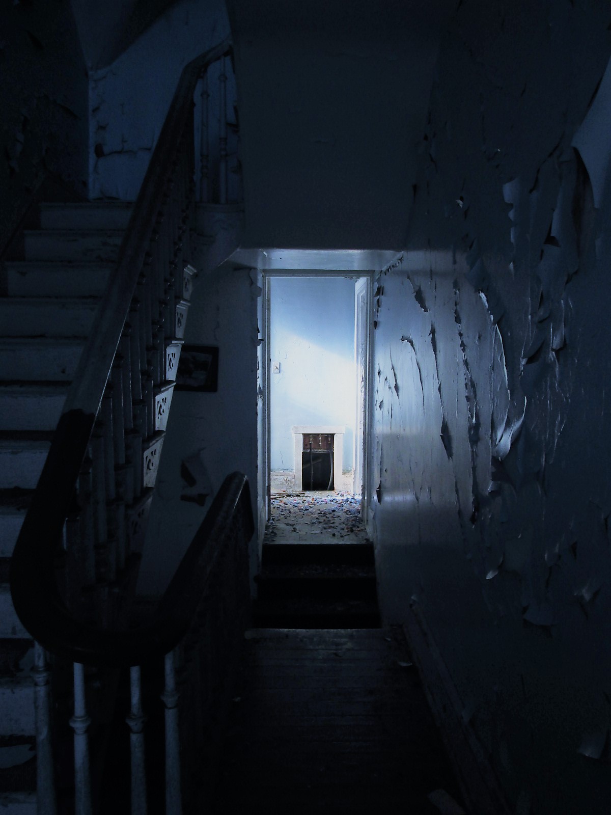
Back into the house. Entrance hall.

There are 3 fireplaces. One plastered over and two, like this one, with the mantles missing.
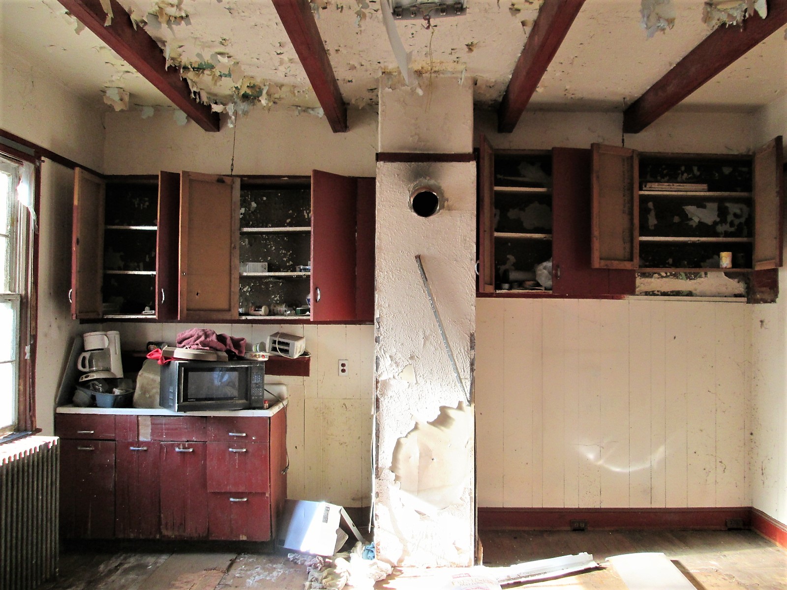
Kitchen.
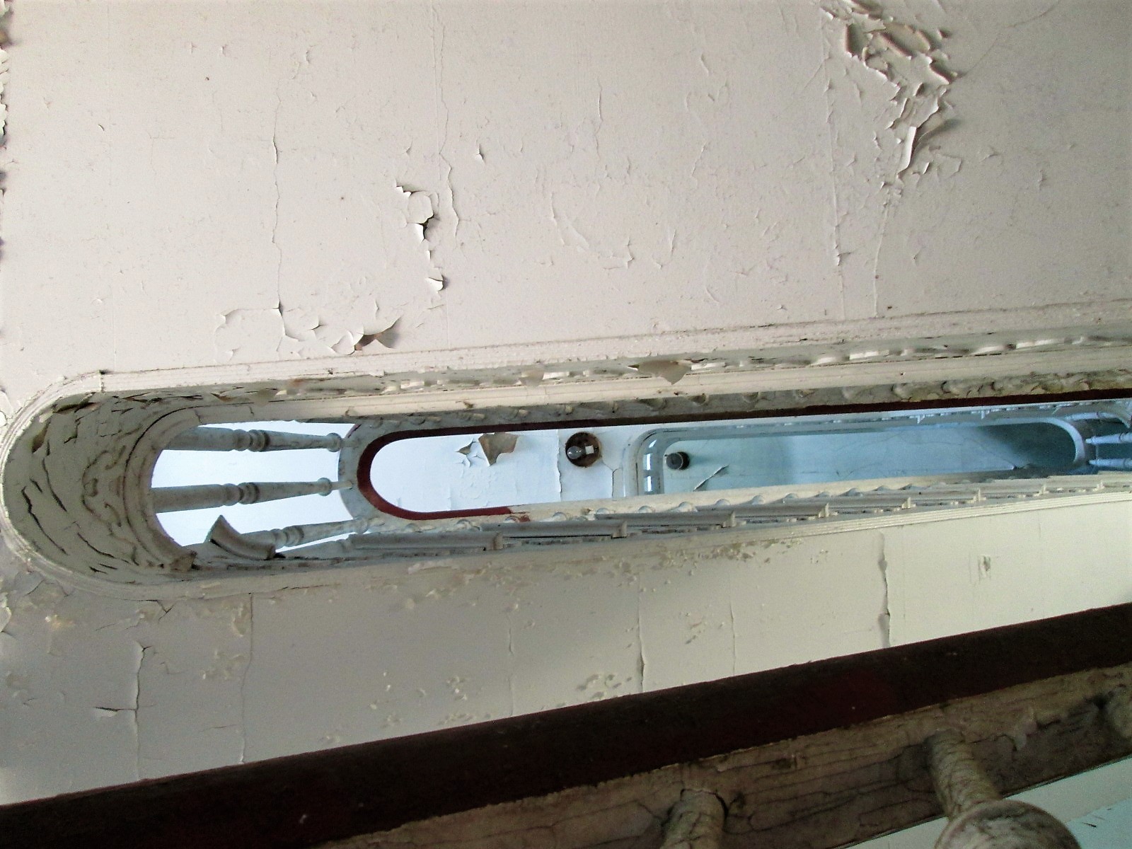
Looking up the stairwell. Three floors.
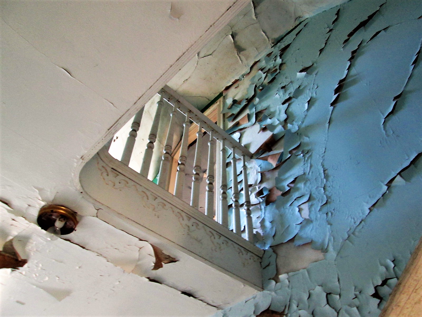
Second floor to third floor
This was a nice design – up the stairs to a landing that will take you in both directions. This is a huge house.
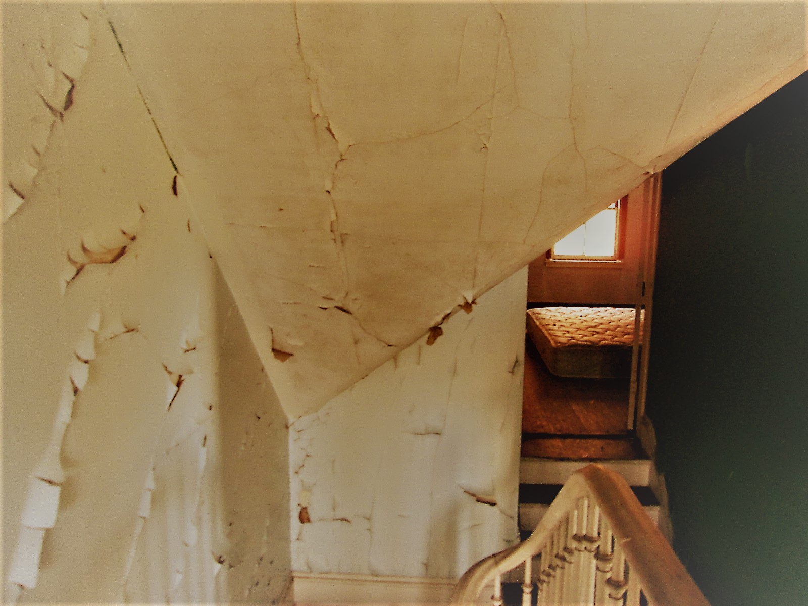
Lots of rooms – curves and angles.
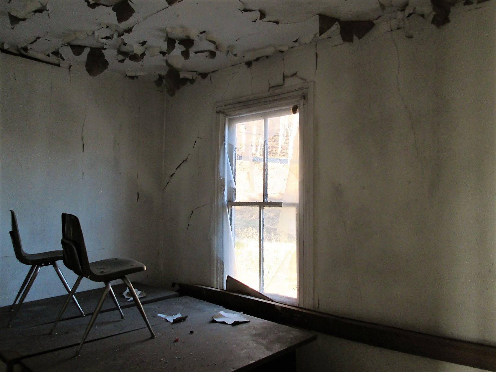
Chairs on a desk – watching…

One of the many views. Someone nailed a metal sign to the window? I would have loved to live here with this view. Two eagles were playing most of the morning over the lower reservoir. Nice!
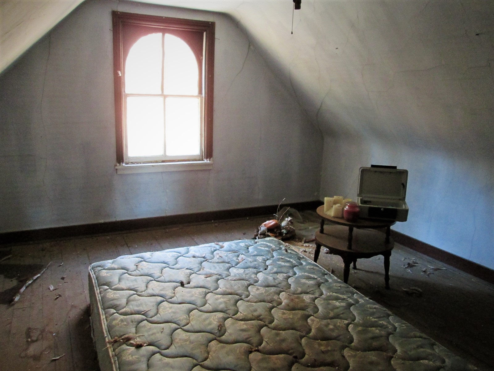
Another room. Candles, a bed, money box and stuffed ducks that look like the turkey buzzards tore open – must of thought they were real!
Prologue: I asked the contractor to hold two of the signs for me until I can come back up. He said ok…but, between my visit and when I sent off the email, Brick and Boards came up and took them. Talked to Max from there and he said they are in his warehouse and I can come pick them up!
Their site: https://baltimorebrickbybrick.com/2016/08/04/brick-board-is-here/
08 Thursday Dec 2016
Posted in Baltimore, engineering, water history
Tags
Baltimore, conduit, engineering, FILTRATION, Lake Montebello, Montebello, pipe, Public Works, water history
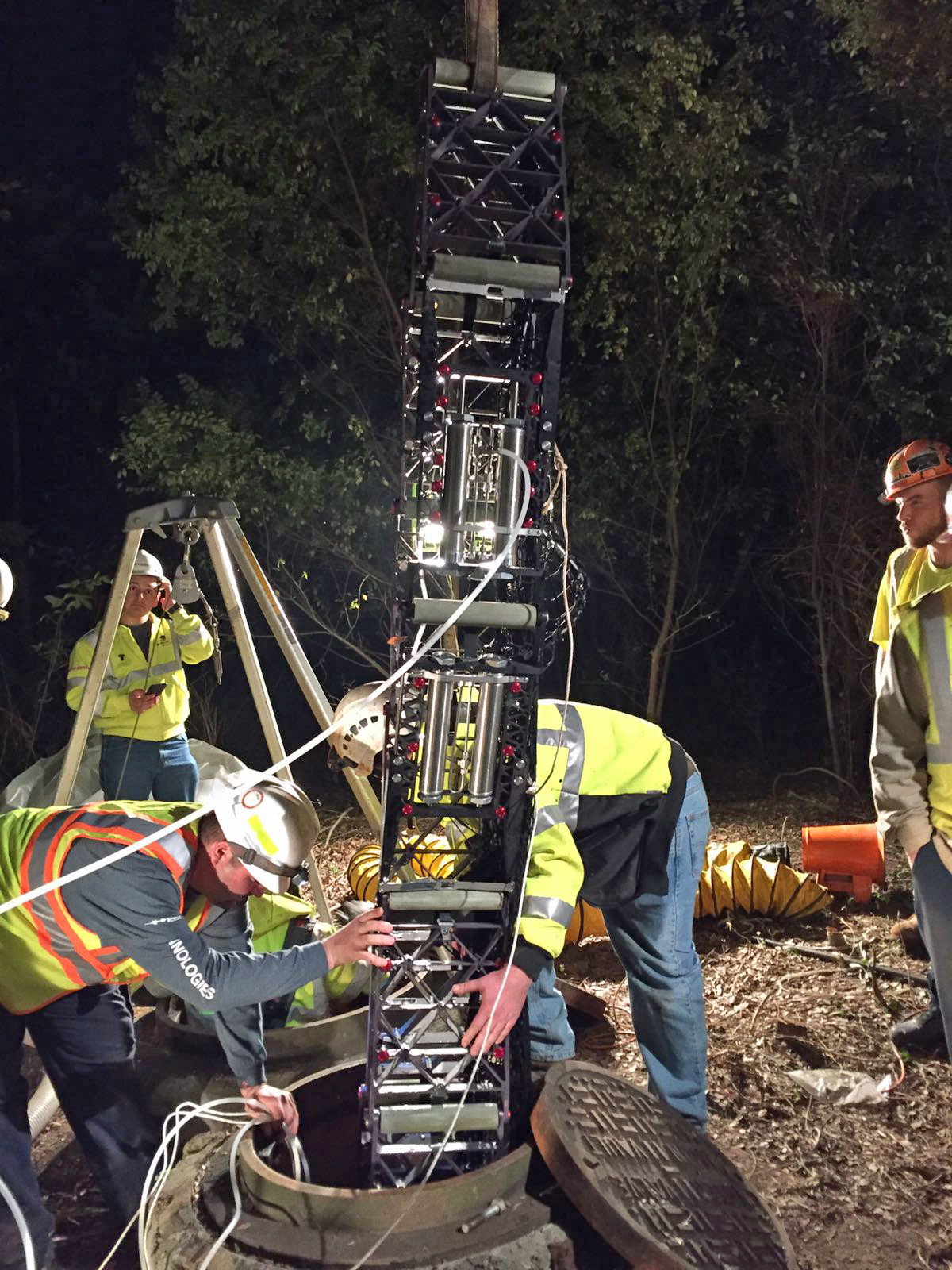
Back in 1956 – 1957 a new 84″ pipeline was laid to connect the Montebello Filters with South East Baltimore, doing away with a pumping station. It was inspected this week using what is called a Pipe Diver. A mini-sub looking thing with a bunch of probes. No camera unfortunately.

Here is the pipe prior to connection to the filtered water reservoir in 1957. The reservoir (20 million gallons) is behind that house on the left, underground.

Connection to the clear-well chamber. Years later another connection would be made on the opposite side of the reservoir. The two conduits are connected about 100 yards from the above point.

Back in June, while making my rounds thru the property, I saw a contractor digging a hole. Asked what he was doing and he said he needed to rebuild this manhole and put a new valve on the pipe. That they were getting ready to inspect the 84″ pipe. I asked if he knew that this pipe was full of water. He said he knew and it would be alright. Here is another case in the City when agencies do not communicate. We had no idea they were doing a pipe inspection.

A month later, a contractor comes on site to look at a possible entry point for their pipe diver. I showed them and in November they came back.

They could not relieve the pressure in the pipe enough to insert their tool. So they had to postpone and rethink their strategy.
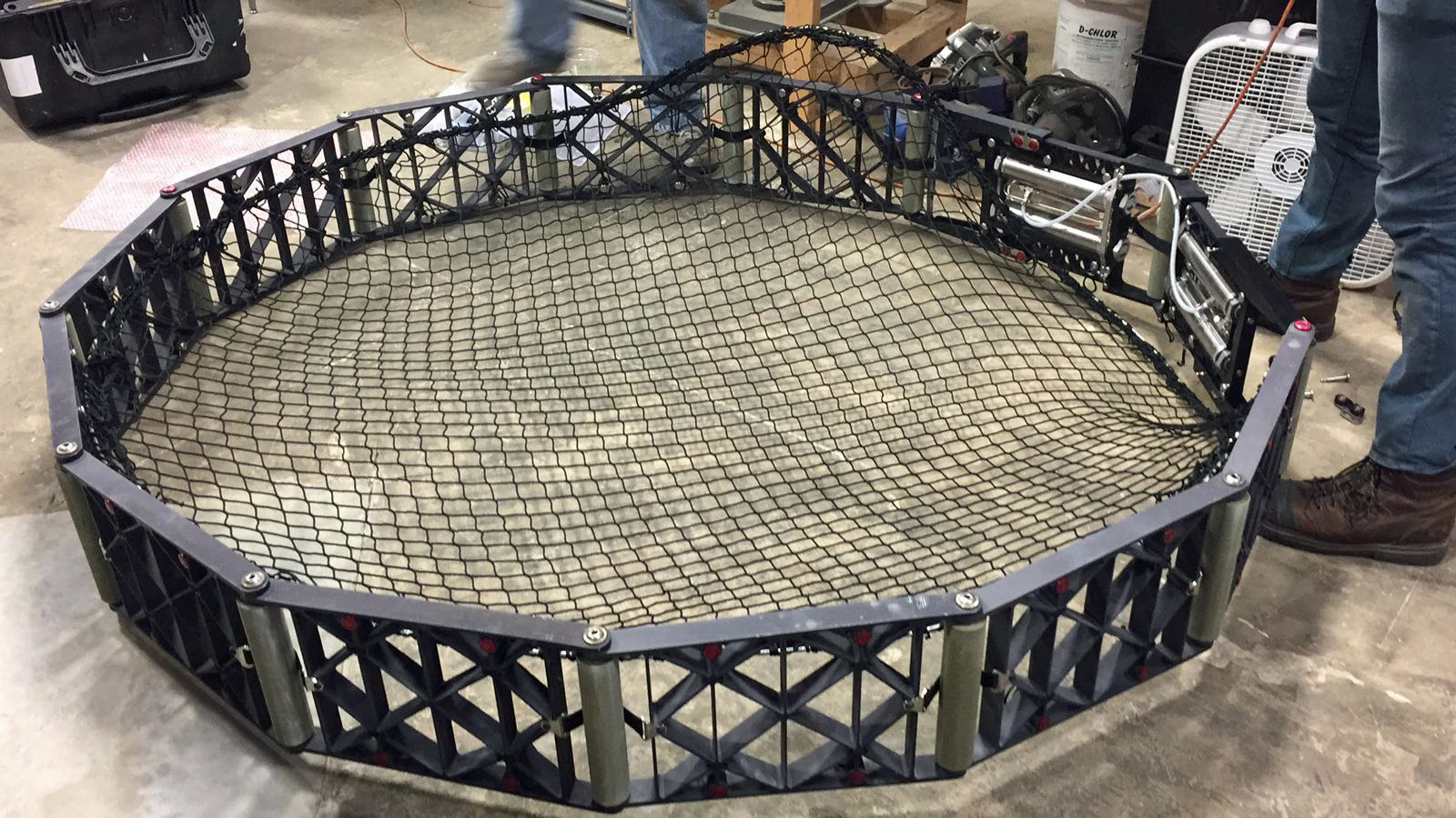
This week they came back. It took a lot longer to relieve the pressure than what they thought. This is the net that was inserted downstream, about 3 miles. It was there to catch the pipe diver.
Installing the net.

This is the equipment that was used to track their diver. It only took about 3-1/2 hours for the machine to flow by water pressure to the net.

Removing the pipe diver tool. hopefully the information obtained is all good info – that the pipe doesn’t need repairs or in worse case, replacing.

One disturbing photo sent to me is this one, showing where ground cover has washed away, exposing the water pipe. I’ve lived around this stream for many years and I know the force of nature, during storms. Just a matter of time…
05 Monday Dec 2016
Posted in Baltimore, filtration, water history
Tags
Baltimore, engineering, FILTRATION, Lake Montebello, Montebello, photography, Public Works, water history
The contract has been completed. Here are the before and after photos.

23 Wednesday Nov 2016
Posted in Baltimore, water history, Writing
Tags
Baltimore, engineering, FILTRATION, fluoride, Gunpowder Falls, Health, HISTORY, Lake Montebello, Montebello, POLITICS, Public Works, Research, water, water history, writing
Ok, time to order now for Christmas! Nothing like a little self promoting during the Holiday Season. (Thanks to the person(s) that bought 3 copies this month! My sales report does not list the buyers so I have no way to know who to thank)
These books are cheaper on Amazon than they are on the publisher’s pages. ALL proceeds from the sale of these books goes to Water For People.
This first book is a crazy story about Chuck and Gary and the misadventures that happen because of the fluoride in their toothpaste! I think this may have been an LSD induced novel. But more likely comes from all the research I did concerning the subject that I didn’t know what else to do with!
This next one is about, well, it’s about what the title says it’s about. Taken from the journals of the building inspectors. Ten miners killed in an explosion – called an accident, but I don’t think so…

And this last one is also about what the title implies. Over 400 pages of more information you will probably ever need concerning water history. Plus a bunch of tidbits thrown in.
21 Monday Nov 2016
Tags
Baltimore, bridges, engineering, Floods, HISTORY, Lake Montebello, Montebello, Public Works, water history
I was not the only one asked for information concerning Herring Run. All this info is for a walking tour on Black Friday. This instead of Mall Madness. Another submission of info:
The design for the Pedestrian Bridge at Sinclair Lane began in 2010 with final greenway plans dated on January 31, 2014. The bridge was designed by Wheeler in Bloomington, Minnesota and fabricated by Big R Bridge in Gresley, Colorado. A new pedestrian bridge was built in close proximity to Sinclair Road since the new ten foot wide greenway trail could not be accommodated using the existing Sinclair Road bridge. Also, the new pedestrian bridge location was selected to span the narrowest portion of the Herring Run Stream and the bridge length was determined to not encroach the Herring Run Stream’s 100 year flood elevation and cross over the existing DPW utility sanitary and 84” water pipes.
This info got me thinking about various reports I had read recently. Not concerning a 100 year flood, but about what would happen if the dam gave way at Montebello Lake??
August 2000 – Danger Reach Study for Lake Montebello MD Dam #107. Prepared for DPW, Bureau of Water and Wastewater. Has a lot of graphs, charts and data. ‘What if’ scenario of a dam failure at Lake Montebello, between Harford Rd and the Park. The consultants do not believe the water would go over the Harford Rd bridge, but under. They do believe it would overflow four feet above the Belair Rd bridge at Herring Run. It would overflow Manasota by two feet and Brehms lane by four feet. Sinclair Lane would be two feet under water. It would follow a path all the way to Moore’s Run. The dam is 600 feet long, 60 feet wide at top and 31 feet tall.
From the Emergency Action Plan 2016: Lake Montebello is an earthen dam built in 1880 as a water supply reservoir for the city of Baltimore. It contains approximately 410 million gallons of water, with a maximum storage of 606 million gallons. If the dam fails, this is what will be read by Emergency Management:
“Lake Montebello Dam, MD Dam No. 107, located northeast Baltimore City is failing. Repeat. Lake Montebello Dam, Dam No. 107, located northeast Baltimore City is failing. If you are in or near this area, proceed immediately to high ground away from Herring Run Park. Do not travel on the following roadways: Parkside Dr., Shannon Dr., Pulaski Hwy, North Point Rd, Bowleys Ln, Harford Rd, Mannasota Ave, Belair Rd and Sinclair Ln, in the vicinity of Herring Run Park. Avoid all residential roadways near the Park located in northeastern Baltimore City. Travel away from Herring Run Park. Avoid all residential roadways near the park. Do not return to your home to recover your possessions. You cannot outrun or drive away from the flood wave. Proceed immediately to high ground away from the area.”

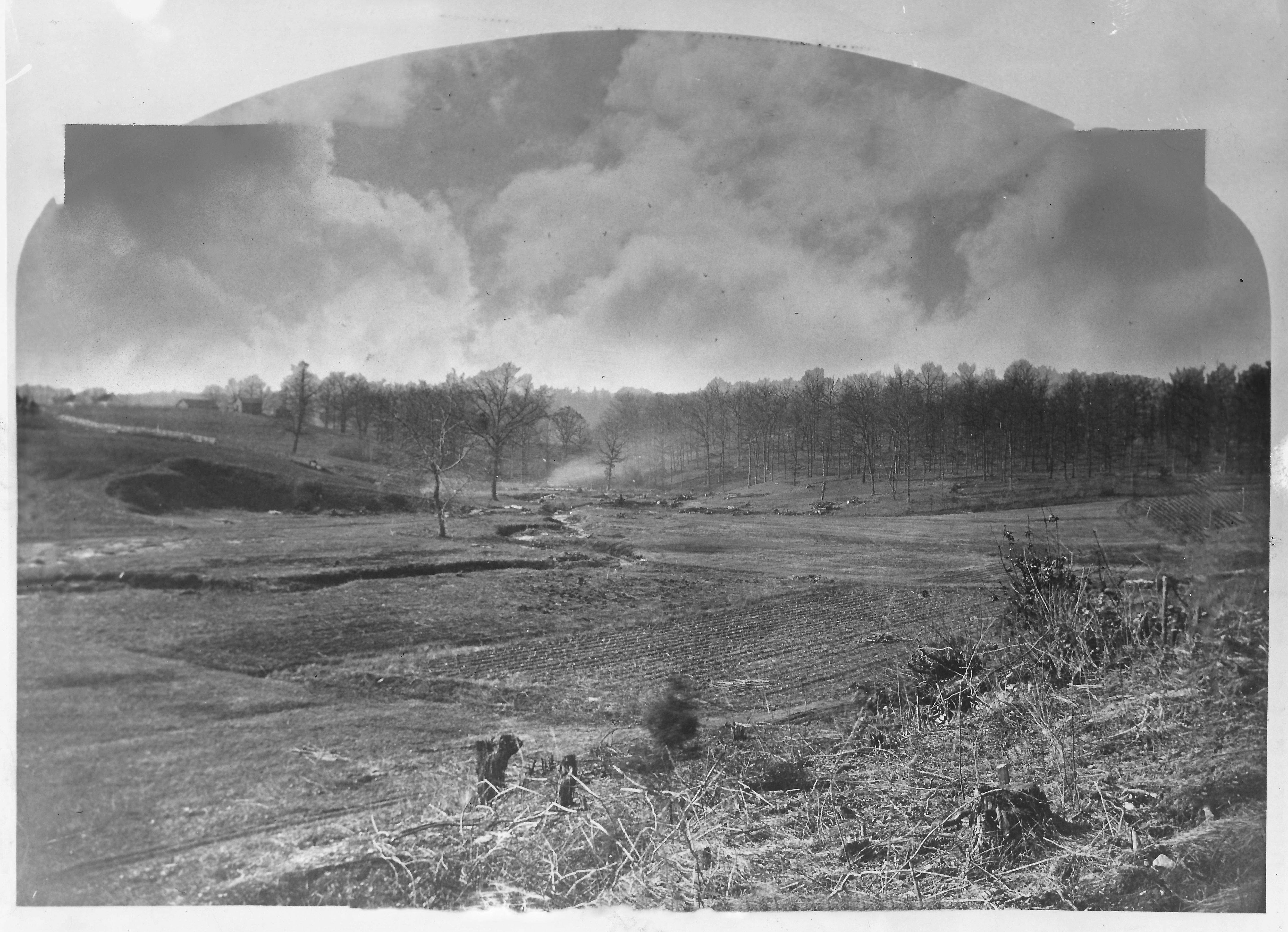
The dam in question is to the right of the lake. Shows the Harford Road bridge to the far right.
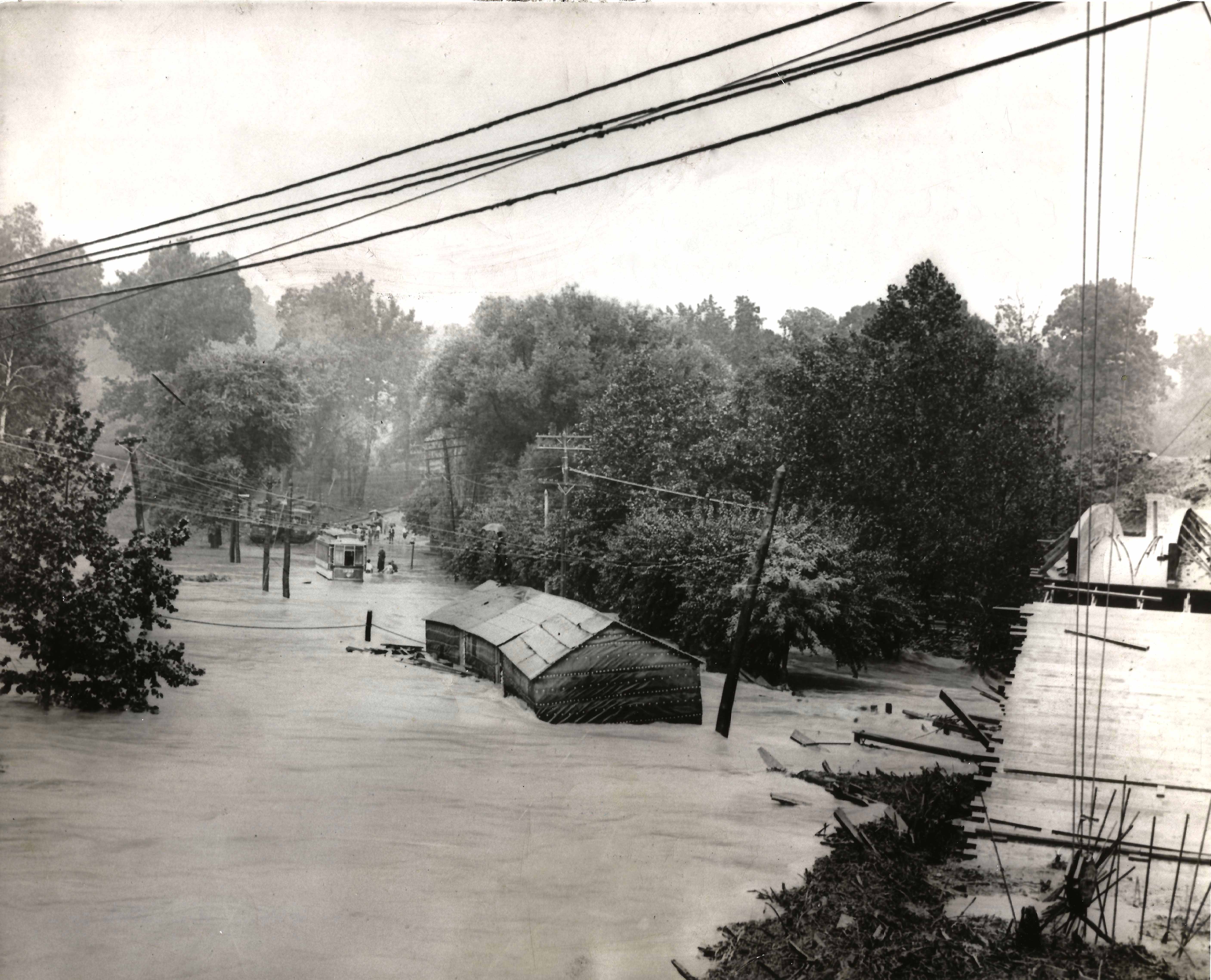
This is how a rain induced flood looked many years ago, Harford rd. bridge to the right.

Belair road bridge would be flooded 4′ above roadway.

Brehms Lane bridge – would also be 4′ under. (Note: Bridge no longer looks like this and there are no longer any horse rides in the park)
17 Thursday Nov 2016
Posted in Baltimore, HISTORY, water history
Tags
Baltimore, engineering, glass plate negatives, Gunpowder Falls, HISTORY, Lake Montebello, Montebello, Public Works, Research, water history, writing
I was recently asked to do a brief history for the Friends of Herring Run Park, concerning the history of DPW activity in the park. More specifically – What is up with those concrete structures in the park that have pipes sticking out of them? They are air relief vaults for the Susquehanna pipeline. So, instead of a brief, one line answer, I decided to give them a Readers Digest version for the building of the Susquehanna pipeline.
As in most cases, when doing basic research, I always get distracted with other history facts I find. The story of my life (Well, the story of my life is another book I wrote, which is out of print. Too many people disagree with what I wrote about MY life and MY memories. I did however see a copy on Amazon for $354.00! Ha!)(See what I mean about getting distracted!!)
Anyway, I came across the below 1854 report that mentions Herring Run as a possible source of water for the City of Baltimore. If not a source, then possibly build a reservoir there. The author of the report, Alfred Duvall, who signs the report as a ‘Practical Engineer’ also suggests a reservoir on Tiffany Run, which is a stone’s throw away from Herring Run. By 1875 they decided on Tiffany Run for the new reservoir, that would be filled via tunnel from Loch Raven.

Duvall’s 1854 report. Interesting read.
Tiffany Run, prior to the 1875-1881 construction of Lake Montebello

Lake Montebello soon after construction. Gatehouse to the left received water from Loch Raven, where a dam was built during the same years.
31 Monday Oct 2016
Posted in Baltimore, Hiking, water history
Tags
Baltimore, boats, engineering, FILTRATION, Hiking, HISTORY, Lake Montebello, Montebello, Public Works, water history
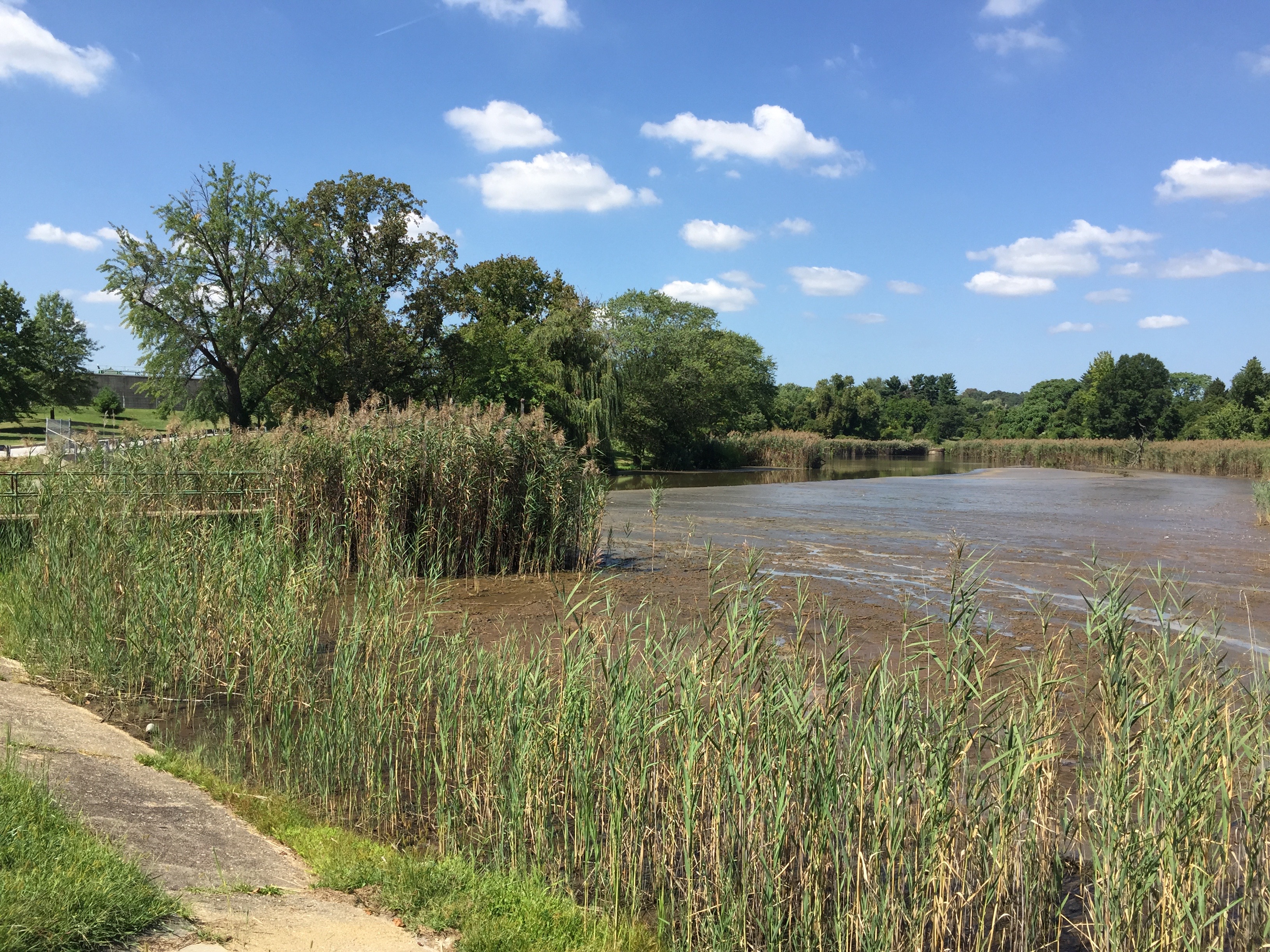
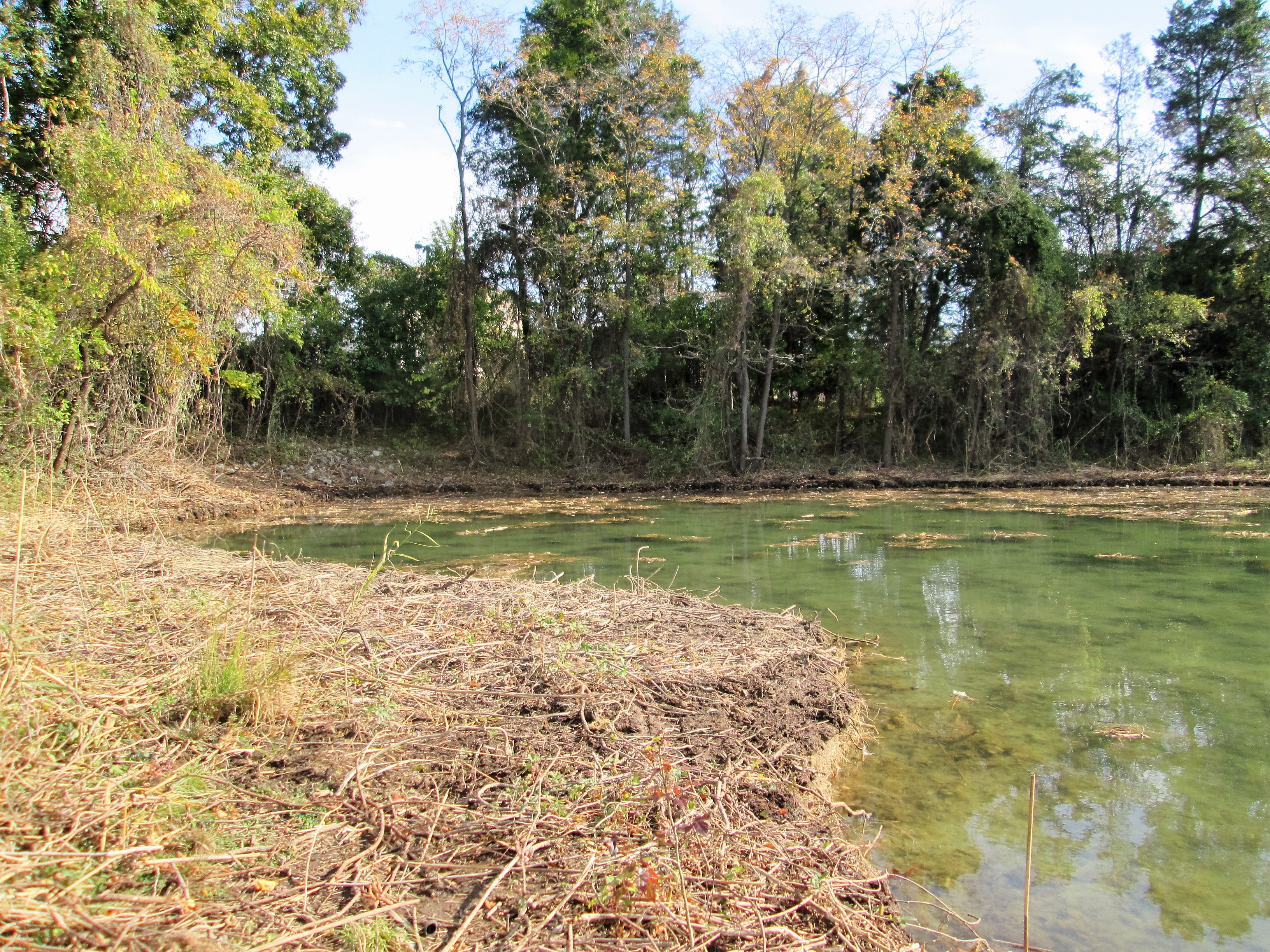
Checking on the contractors the other day, I saw that they had pretty much cleared most of the shoreline…nice day for a hike around the lake.

Started on the SW side looking towards Morgan State University.

Headed up to the far end, closest to Hillen Road. The old surge shaft from Loch Raven is to the right. The dredge and barges could not get this far up.

Looking down from on top – the sludge. This is a by-product of what goes on in the filtration plant. Lots of sand at this point. The sand is used to filter the drinking water and when the filter becomes clogged, we backwash it. Unfortunately the pressure from backwashing pushes sand into the drain and ends up here.

More sand and sludge.
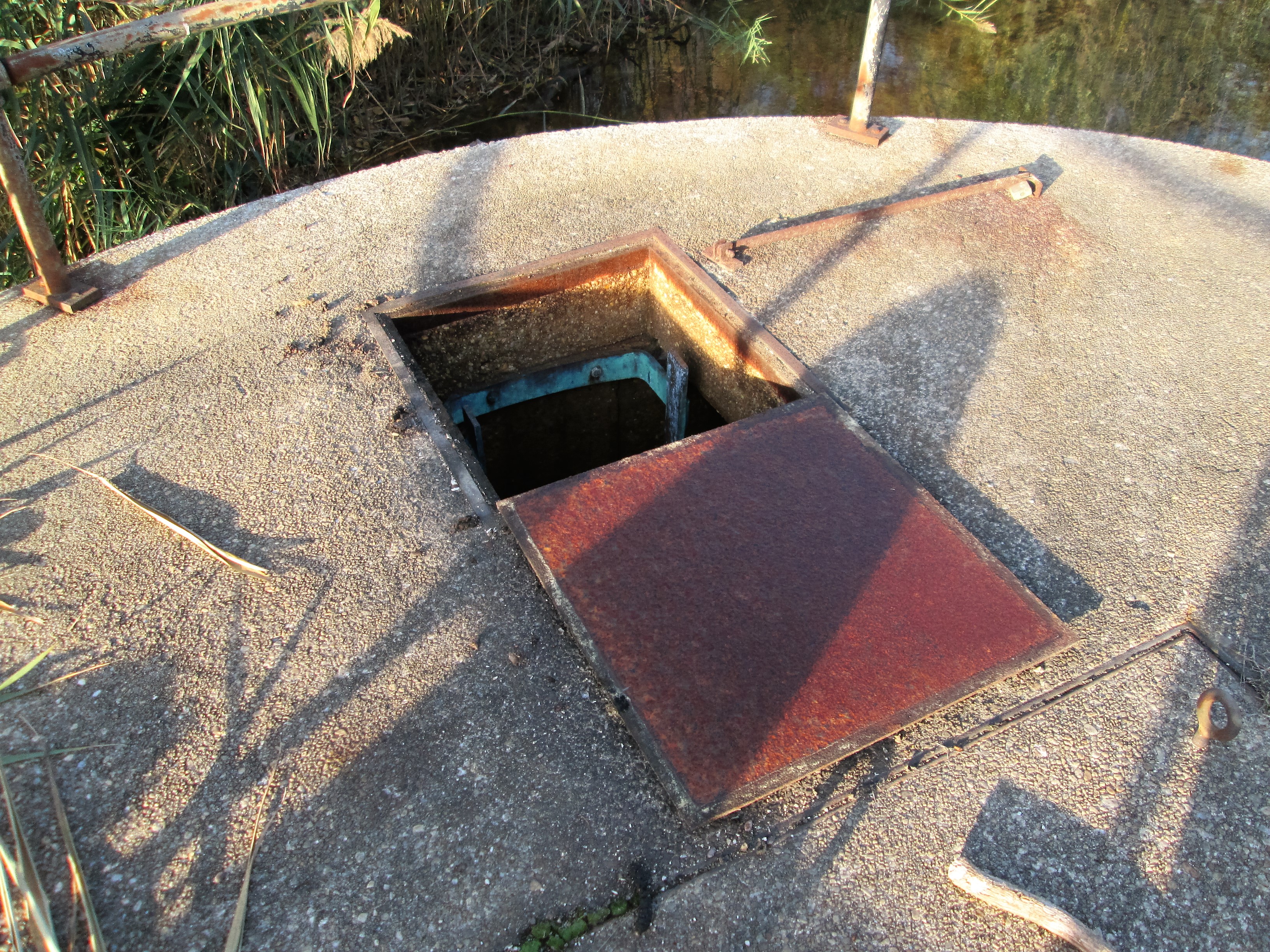
Since I was up here, I figured I would look down the hatch. The contractor had some concerns about getting too close to this structure. He said they could see a pipe that I told them to stay away from.

The pipe coming thru the wall at the top, is laid in the waste lake bed. It is about 10′ under the water surface. Although capped off, it would still cause problems if broken. I was supposed to climb out of this shaft a while ago…after an inspection of the old 1880 Loch Raven tunnel. (5-1/2 mile hike). Cancelled due to safety concerns.

Heading down the NE side. Watching the small barge and excavator get as close as he can.

The large excavator and barges. These barges are only about 5 feet tall. They displace only 2 feet of water. That just amazes me.

Soon, we will be testing pumps up on Deer Creek. This will be water from the Susquehanna River. It is very dirty water so we will just dump it instead of letting it go into the plant. See that tower in the background? That is the Susquehanna Surge shaft. When the DC pumps come on and the water flows 36 miles to this point, closing the valves to not let it in, well, the water has to go somewhere. It goes up that shaft and then out thru the drain you see to the left of the boat. 50-60mgd. The dredging should be done by then and their equipment removed. If not, they better tie that stuff down!

Continuing my hike down the shoreline.

Some spots were a little rough to navigate across.
Here is that cove I mentioned in an earlier post. Deer tracks everywhere.

The 4 million dollar problem – already rearing its head in the warm sun!
24 Monday Oct 2016
Posted in Baltimore, engineering, HISTORY, water history
Tags
Baltimore, engineering, FILTRATION, HISTORY, Lake Roland, Montebello, POLITICS, Public Works, water, water history
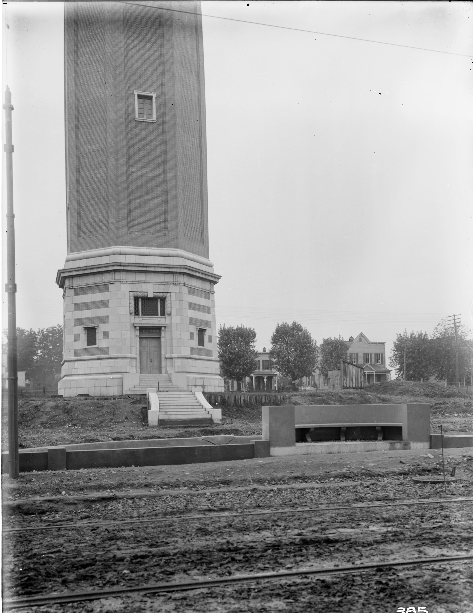
Received an email – you know the kind – a city resident has a complaint, goes to their City Council Person, goes to the Director of Public Works, goes to my boss – who sends it to me to investigate: The area around the Roland Water Tower is the site of 24/7 drug dealing activity. Shouldn’t this complaint have gone to the police? Being the good employee that I am, I went to investigate. For a 24/7 drug spot, the grounds looked clean and I saw only 2 people, walking their dogs. My mission was to see if there was any available electricity for new lighting? There are already 5 street lights surrounding the property. I could not get inside the tower itself to see if there was electric. I doubt it.
Time for a history lesson: The Tower was built, according to the bronze tablets, between 1904 and 1905. According to my records the contract was awarded to two contractors – one for the steel tower and one for the brick enclosure. Then later, another contractor for the concrete pool and steps.

The steel stand pipe being built by Tippett and Wood.
The brick enclosure by John Stack. The steps and pool by the Andrew Co.
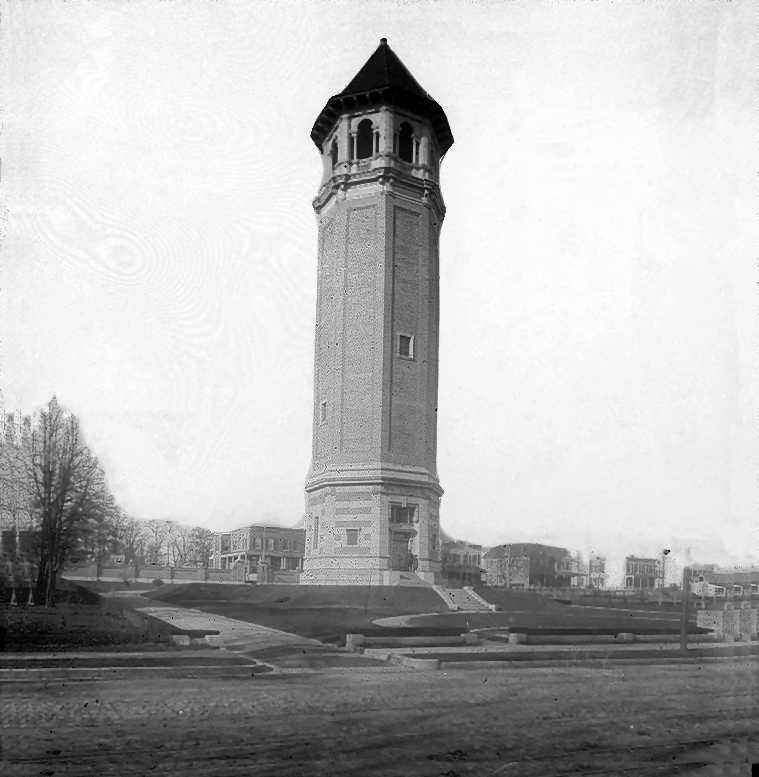
The finished tower.
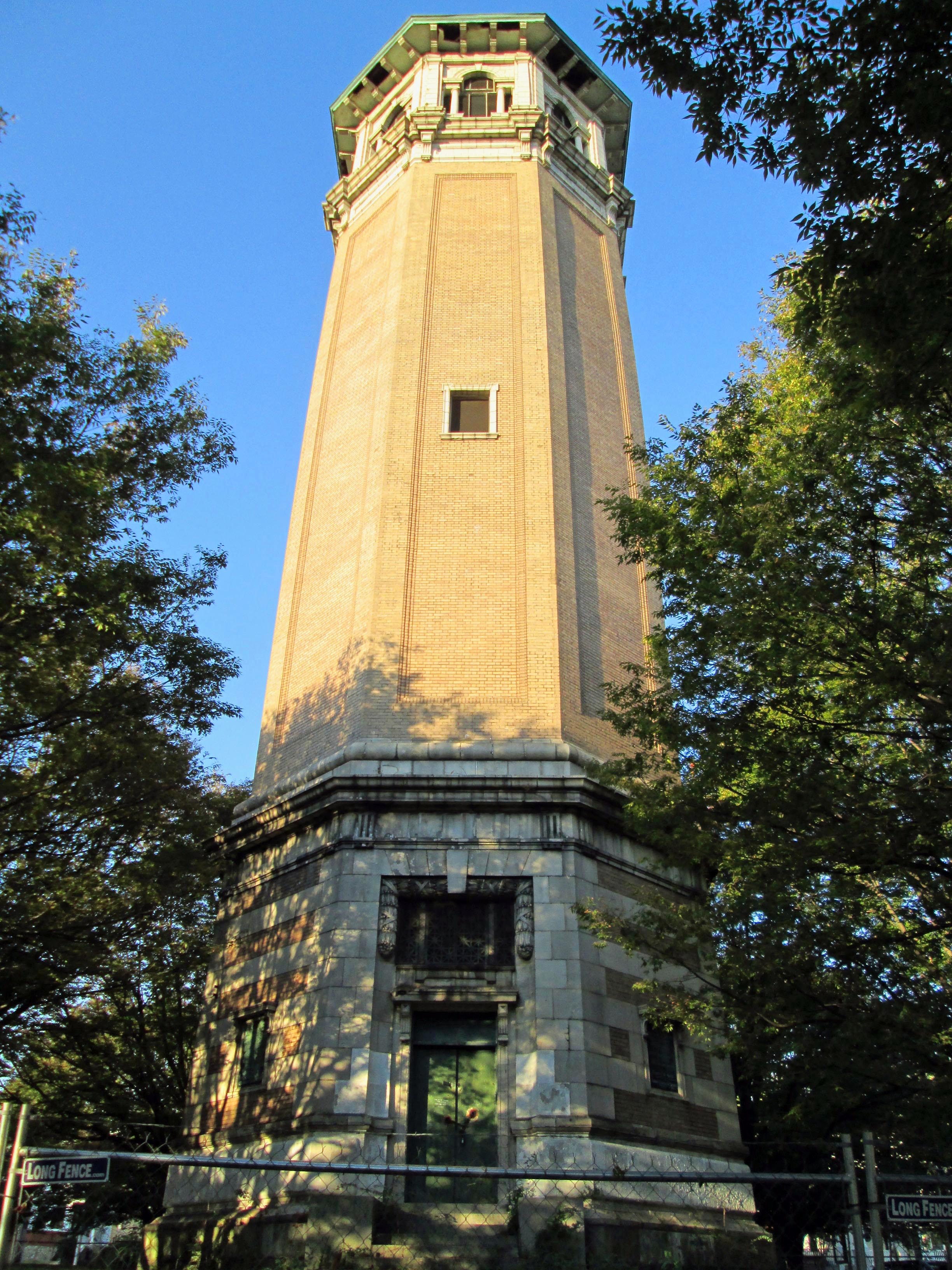
As it looked this morning. There is a fence around it, which I was able to go through.

Pieces of the tower are falling down. This is the purpose of the fence – to keep people out and to keep people away from the falling pieces.
The tower held about 213,000 gallons of water that it received from Druid Lake. The design was by William Fizone, who also designed the Montebello Filters. The pool has been filled in. In 1939 the Water Board turned the property over to the City Comptroller. In 2009 and again in 2011 consultants were hired to figure out what to do with this abandoned tower. It had a couple times been turned over to the Roland Park Community Association, who tried to raise funds to restore it. And it still sits – a magnet for the druggies and dog walkers.
