• About
  • History Writings

Water and Me

Water and Me

Tag Archives: engineering

Eden Mill Kayaking

14 Thursday Jul 2016

Posted by Ronald Parks in HISTORY, Photography, Reservoir, water history

≈ 3 Comments

Tags

eden mill, engineering, Hiking, HISTORY, kayaking, mills, Museum, Public Works, water history

Kathy and I went kayaking on one of the most peaceful creeks I know of – Eden Mill at Deer Creek. Back in July 2013 I posted about History and Photography, that people should appreciate the history of the mills and streams they hike. Since I have just started to kayak, I now have a deeper appreciation of the history of Eden Mill. The perspective is so much different on the water than it is walking the trails.

Additional research has shown that there were a few plans for damming Deer Creek. in July of 2013 I wrote that the crest of the proposed dam at the Rocks would be at an elevation of 540’. Another 1933 study put it at 430’. In either case, if the dam was built, the mill would be under water.

The below topography map shows the creek elevation at 342’. The dam is 16’ tall so that brings us to 358’. The mill is three stories so let’s add roughly another 36’ – that’s 394’. So yes, that is still a good 30 feet underwater! The mill is to the right of the word creek, just past the branch stream.

EM5

To know this and to understand the history makes it such a sweet kayaking adventure. Appreciate history. Go kayaking. Be happy!

EM7

Looking upstream from the base of the mill.

EM6

The Mill as it looked in the 1930s

EM1

The mill and top of dam. View from kayaks.

EM3

One of the branch streams that feeds Deer Creek. These two bridges would be under water.

EM4

View from under the bridge. Back in the 30s, this bridge was probably an old wooden one.

EM2

It doesn’t get any better than this!

Montebello Waste Lakes

05 Tuesday Jul 2016

Posted by Ronald Parks in Baltimore, water history

≈ Leave a comment

Tags

aerial, Baltimore, drone, engineering, FILTRATION, Health, HISTORY, Lake Montebello, maps, Montebello, POLITICS, Public Works, water, water history

Yes, there are two waste lakes at Montebello. The large one that people use every day as a park and a smaller one, hidden from view, on the filtration plant property. The large one was at one time (1881-1915) used as drinking water. The small one (1915) has always been used to settle out the waste by-products of the filtration process.

To the dismay of the Filter Engineer, he was forced to allow the Model Yacht Club to use the small lake for their club activities in the late 1930s. Sometimes when he was pissed off, he would drain the lake down. At the start of WWII, for security reasons, the club could no longer use the lake.

wl1939

wl1939b

Because of the amount of water processed and the waste created by this process, the lakes would need dredging. It was a lot easier to dredge the smaller one than to do the big one. Unfortunately, the dredged material would be pumped into the big lake. That one was to be dredged every 30 years. An optimal plan would be to dredge the small lake every five years.

wl1978

In 1978 thru 1984, the small lake was dredged.

wl1984

What was called a “sonic survey” took place in 1984, this was to show the nearby residents what needed to be done to the lakes. Both lakes were partially drained to show the amount of sludge build-up.

wl2003

This is a google map aerial of the lake in 2003. The brown sludge build-up is the overflow from the small lake. (Note that Google Map dates are not always correct)

wl2007

2005-2007 a portion of the small lake was dredged and a little over 1/3 of the big lake. Why? Money constraints. They should have completely dredged both lakes, but consulting engineers and politics dictates what goes on.

wl2010

By 2010 the small waste lake is practically filled, again (to the lower right of the 4 square basins) and it is now flowing into the large lake (Hard to see but it is in the lower right corner)

wl2015

By 2013 the big lake starts filling up rather quickly. The small lake is full

wl2016b

In 2016 it was decided to start dredging the small lake, only partially??

wl2016

The present day dredge cutting a path thru the sludge. The waste lake is about 30 feet deep here. they have only reached 17 feet (Photo courtesy Merrill Bros. drone)

What Baltimore Could Have Looked Like 1916

30 Thursday Jun 2016

Posted by Ronald Parks in Baltimore, HISTORY, water history

≈ Leave a comment

Tags

Baltimore, engineering, Geology, HISTORY, Jones Falls, maps, POLITICS, Public Works, water history

Here is a 1916 map of the Geological Survey showing the proposals of Senators Ogden and Campbell. They each had their own ideas on how Baltimore should look back then.

BaltiEnlarg1916r

I like how this map shows the reservoirs and the water supply conduits. Of interest to me is the reservoir at Philadelphia Rd. and the Mt Royal Reservoir. There was another Mt Royal one built in 1845. This new one received a name change for some reason.

1845 Original Mount Royal Reservoir:  Started construction of a new reservoir on the east side of Jones Falls above the Belvedere Bridge.

1846 Original Mount Royal Reservoir: The new reservoir replaced the old reservoir located on Calvert Street, and in addition, supplied water to the section of the City east of Jones Falls.  The new reservoir was 18 feet deep, with seven acres of water surface, and a capacity of 15 million gallons.  According to the Maryland Historical Trust Maryland Inventory of Historic Properties Form for the City of Baltimore, Loch Raven Dam, submitted to MHT 1-17-96, this 15 million gallon reservoir was also known as Mount Royal Reservoir.  This Mount Royal Reservoir was built near the location known in the year 1996 as Pennsylvania Station. By 1862, this Mount Royal Reservoir would be abandoned; and, the name of the Mount Royal Reservoir would be transferred to a new reservoir at a different location. (From early water history notes, R. Vann)

Research and Sources

23 Thursday Jun 2016

Posted by Ronald Parks in Baltimore, HISTORY

≈ Leave a comment

Tags

Baltimore, engineering, HISTORY, Monuments, Public Works, Research, Statues, writing

Tuesday evening I attended a class “Explore Baltimore Heritage 101” and during the class it was talked about ‘sources’ used for writing about historic people, places and things. My main interest in this (other than the history of sewers) are the displaced and missing monuments. My most recent research of just one, the Monument to Columbus, shows how various people looked at things and more importantly, are their perceptions true historical facts?
From the Monument City Blog:
History
To commemorate the three-hundred year anniversary of Columbus discovering America, a forty-four foot obelisk was erected in Charm City. Made of brick with a stucco finish, the monument to Columbus is the oldest in the country, and world, that is still standing. Originally it was placed on the estate of French Consul to Baltimore, Charles Francois Adrian De Paulmier, Chevalier d’Anmour, and was moved to its current location in 1964. Rumor has it that one evening De Paulmier was entertaining guests, which he did frequently, and they started discussing the great men of the western world. It was mentioned that there was not a single monument to Christopher Columbus in America. De Paulmier promised to change this fact, placing the monolith on his property shortly thereafter.
Another Monument City Blog:
History
The first monument dedicated to Christopher Columbus in the United States is the 44 foot tall obelisk on Hartford [Harford] Road, just east of Lake Montebello. The structure was erected, in 1792, to commemorate the three-hundred year anniversary of the explorer’s discovery of America. During the 19th century a local legend developed stating that the obelisk was actually a monument to a horse of the same name, not the explorer.
The Italian community refused to recognize the obelisk, eventually collecting funds and erecting their own statue on the shore of Druid Lake. On Columbus Day in 1892 the monument was unveiled. The sculpture, carved by Albert Weinert, is a reproduction of artist Achille Canessa’s original. In 1950, Mayor Thomas D’Alesandro, Jr. placed a wreath on the neglected Hartford Road monument, finally putting an end to misconception, and giving equal worth to both memorials.
A third monument to Chris Columbus stands in the Inner Harbor near the Katyn Memorial and the Public Works Museum. Professor Wayne Schaumburg of Johns Hopkins University states that Mayor William Schaefer planned to move the Weinert Columbus to the Harbor East location but the Druid Hill neighborhood committees protested strongly. Instead, a new statue was created and dedicated, in 1984, with President Reagan attending the ceremony.
1992 Sunpaper: http://articles.baltimoresun.com/1992-05-21/news/1992142117_1_columbus-monuments-baltimore-county-columbus-day
Because the monument was on private property, it remained unknown to the public for decades. As the estate passed through several hands and lapsed into ruin, the obelisk eventually was forgotten. North Avenue became a public thoroughfare in 1876. Sometime later, a group of Johns Hopkins students exploring the woods stumbled across the obelisk. Its last previous known sighting had occurred in 1863 when Union soldiers at Belmont found it while cutting trees for firewood and fortifications. Woods reclaimed the area after the Civil War. In 1887, Belmont became the Samuel B. Ready School. It moved to West Baltimore in 1938 to make way for Sears Roebuck’s huge store, which is now the Eastside District Court. The obelisk, considered too fragile to be moved, was left behind on what became a Sears parking lot. In 1963, however, the city moved it to its present location in a grove of maples, pines and arbor vitae on Harford Road at Parkside Drive. It was the focus of traditional Columbus Day ceremonies until 1977, when the festivities were moved to East Baltimore and then to the Inner Harbor. The old monument drifted farther from public consciousness after October 1984, when President Ronald Reagan dedicated a new statue of the Great Explorer in a plaza at the edge of Little Italy. But the obelisk has refused to be ignored throughout its history. Now, it has bobbed up again during the 500th anniversary of Columbus’ achievements, say Mr. D’Alesandro and Mr. Culotta. And very appropriately, they add. After all, they say, the monument was North America’s first recognition of Columbus’ voyage, and another two centuries have elapsed since then.

Columbus001

The monument behind Sears.

Columbus009

Making way for a new parking lot.

Columbus018

After a short move, placing at its new location.

Columbus019

Right down the street from my house.

Columbus020

The Little Italy version.

Entrance to the Jones Falls

20 Monday Jun 2016

Posted by Ronald Parks in Baltimore, HISTORY, Sewage History

≈ 1 Comment

Tags

Baltimore, bricks, engineering, HISTORY, Jones Falls, photography, POLITICS, Public Works, sewage, Sewage History

On sunday I went looking for the entry point of the Jones Falls conduit. Here is the 1912 description of where it should be:

The extent of this improvement (Jones Falls conduit) will be from Baltimore street bridge to the westerly side of Maryland avenue, a distance of approximately 8,850 linear feet. The structure planned is of reinforced concrete with a flat roof, designed to carry the heaviest city traffic, and curved inverts, lined with vitrified brick. This design was selected after considerable effort to find an arched structure which would fill the requirements and keep the expense within a reasonable figure. The lack of head room over a considerable part of the distance to be covered made the problem very difficult. The structure proposed can be erected without disturbing the present retaining walls, the invert of the east conduit being first erected to carry the ordinary flow of water while the other conduits are under construction. As the retaining walls are not to be taken down they can be reckoned upon to give side support to the structure which, in consequence, has not been designed to carry all of the lateral pressure which the side banks would impart to it if not already safely supported.

A quick view of Google maps is deceiving because of all the growth under and around the JFX. The plain map view shows the Falls ending right about under Howard St. So there I went. This portion appears to have been built later – for the light rail and Amtrak? Looking thru the tunnels you can see daylight and I believe this is where the actual entrance starts. Didn’t have my water shoes on so I didn’t venture thru the first set of tunnels And it actually smelt pretty bad there – sewage! (Sewage does not belong in the Jones Falls!)

Here is a link to some guys who actually went into the tunnels – amazing and I thank them for the trip!

http://ronniekirchner.com/jones-falls-conduit/077

Howard Street bridge up above

086


094


103


070 (2)

I just added this last one because I like the brick-work.

Bridges Along the Jones Falls

17 Friday Jun 2016

Posted by Ronald Parks in Baltimore, HISTORY, Sewage History

≈ 3 Comments

Tags

Baltimore, boats, bridges, engineering, glass plate negatives, Health, HISTORY, Jones Falls, POLITICS, Public Works, sewage, Sewage History, water history

Here are some photos from the DPW collection of various bridges along the Jones Falls. These negatives were all in an unmarked box. I posted them on Facebook a while ago and people told me the names as best they could guess. I am no longer on FB and unfortunately I did not write down the names they told me. Some are marked. Some are duplicates from other views – north to south or south to north.

If you can correctly name these bridges I will send you a copy of my book – Baltimore’s Water Supply History. Thanks.

img075

br045

img517

img515

img511

img510img509

img507

img506

img504

img501

img395c

img395b

img003b

img001e

img001d

img001a

81_6_1338

The Walls of Jones Falls

14 Tuesday Jun 2016

Posted by Ronald Parks in Baltimore, HISTORY, Sewage History

≈ Leave a comment

Tags

Baltimore, engineering, HISTORY, Jones Falls, POLITICS, Public Works, sewage, Sewage History

February 12, 1816: Edward Johnson notes his retiring as mayor after eight years. Jones Falls – A Law has been passed by the General Assembly of Maryland at their late session, authorizing a Lottery to raise a sum of money, not exceeding fifty thousand dollars, clear of all expenses. One half of the net proceeds of which is to be appropriated under the direction of the managers named in the law, to the deepening of Jones’ Falls and walling the public streets binding thereon; the other half in conveying a stream of water that passes down Harford Street in a culvert or tunnel, below the surface of the street into the cove.

January 5, 1829: Jones Falls – The hand rail on Jones’ Falls and Harford Run has been completed, as directed by the resolution No. 15, of February, 1828, and affords security to our citizens. The walling of Harford Run has been continued southerly, as directed by Ordinance. The walling of a part of Jones’ Falls, as directed by the Resolution of April, 1828, has been executed; but the efforts of the City Commissioners in enforcing the provisions of the Ordinance of February, 1826, requiring the owners of property on Jones’ Falls to erect walls, etc., have continued to prove unavailing. It is submitted whether the City Commissioners should not be authorized to have the work done, thereby to avoid future injury to the navigation; and require the owners of property to pay the expenses thereof.

Walls will be built. Walls will be knocked down or tunneled through, all to try and change the course of the Jones Falls, flowing through the city.

wall1

Walls upon walls.

wall2

Tunneling through the walls (I would liked to have seen the park up above)

wall3

Close up of one of the walls (Is that graffiti to the right? HW)

Possible Treasure Trove

10 Friday Jun 2016

Posted by Ronald Parks in Baltimore, HISTORY, Sewage History

≈ Leave a comment

Tags

Baltimore, engineering, FILTRATION, HISTORY, Jones Falls, Museum, photography, Public Works, sewage, Sewage History, water history

A few years ago, before I was asked to relocate the DPW Museum Archives, I was researching Baltimore’s Water History. I knew there were files kept down at Back River, in the museum storage area and after repeatedly pestering people to let me have access to the building, I was told ok – the only problem being, they sent me to the wrong ‘archives’ area. This building was old, dark, damp and a disaster. I was unable to find anything I could use. (It was so dark, I had to use my camera’s flash to get around!) I told the admin down there that if they were to put in some lights, I would volunteer to clean, organize and document the files. No response. A while later I was given access to the museum files, the ones I originally wanted to see.

For my Sewerage History, I again asked for access to the old building. The museum files have since been moved to my work location, but I knew there were others down at Back River, in that original building I was sent to. The place is still a mess but at least I could see inside. The boards on the windows have rotted and fallen down. Sunlight filtered in. There are a lot of old records in there that need preserving. Maybe someone will give me permission this time to do what needs to be done.

019

Early contracts, specification books and drawings.

011 (2)

Three floors of Early Sewerage History!

003

There are even photographs from water filtration. These are of the renovations at Ashburton. Why they are at Back River is beyond me!

The Conduit from Loch Raven (aka my favorite workers GPN)

08 Wednesday Jun 2016

Posted by Ronald Parks in Baltimore, water history

≈ Leave a comment

Tags

Baltimore, engineering, glass plate negatives, Gunpowder Falls, HISTORY, Lake Montebello, photography, Public Works, water history

Since I started scanning and documenting the huge collection of Glass Plate Negatives (GPN) at work, there has always been a few that really caught my eye and became my favorites. Such being the one below. I would take the 8″ x 10″ GPN out of its falling apart sleeve, hold it up to the light and see what it was and in which collection it belonged. Most of these negatives were in the original boxes. Some not, just thrown into other boxes. I had to take a second look at this one. Is that a foot I see? I scanned it and blew it up and it sure does look like a foot! And a couple of workers taking a smoke break.

The original 1881 tunnel from the first dam to Lake Montebello was dug through rock. The new dam of 1915, just upstream from the old dam, was connected to the old tunnel by a steel conduit. The second picture below shows the steel conduit dropping down to meet the old one.

LochRaven 5-15 686a copy

I enlarged the center section and superimposed onto the corner.

LochRaven 5-15 683

Workers posing, which makes me wonder how much work would slow down if the cell phone/selfie was around back then?

Sewage at Back River

03 Friday Jun 2016

Posted by Ronald Parks in Baltimore, HISTORY, Sewage History

≈ 3 Comments

Tags

Baltimore, engineering, HISTORY, POLITICS, Public Works, sewage, Sewage History

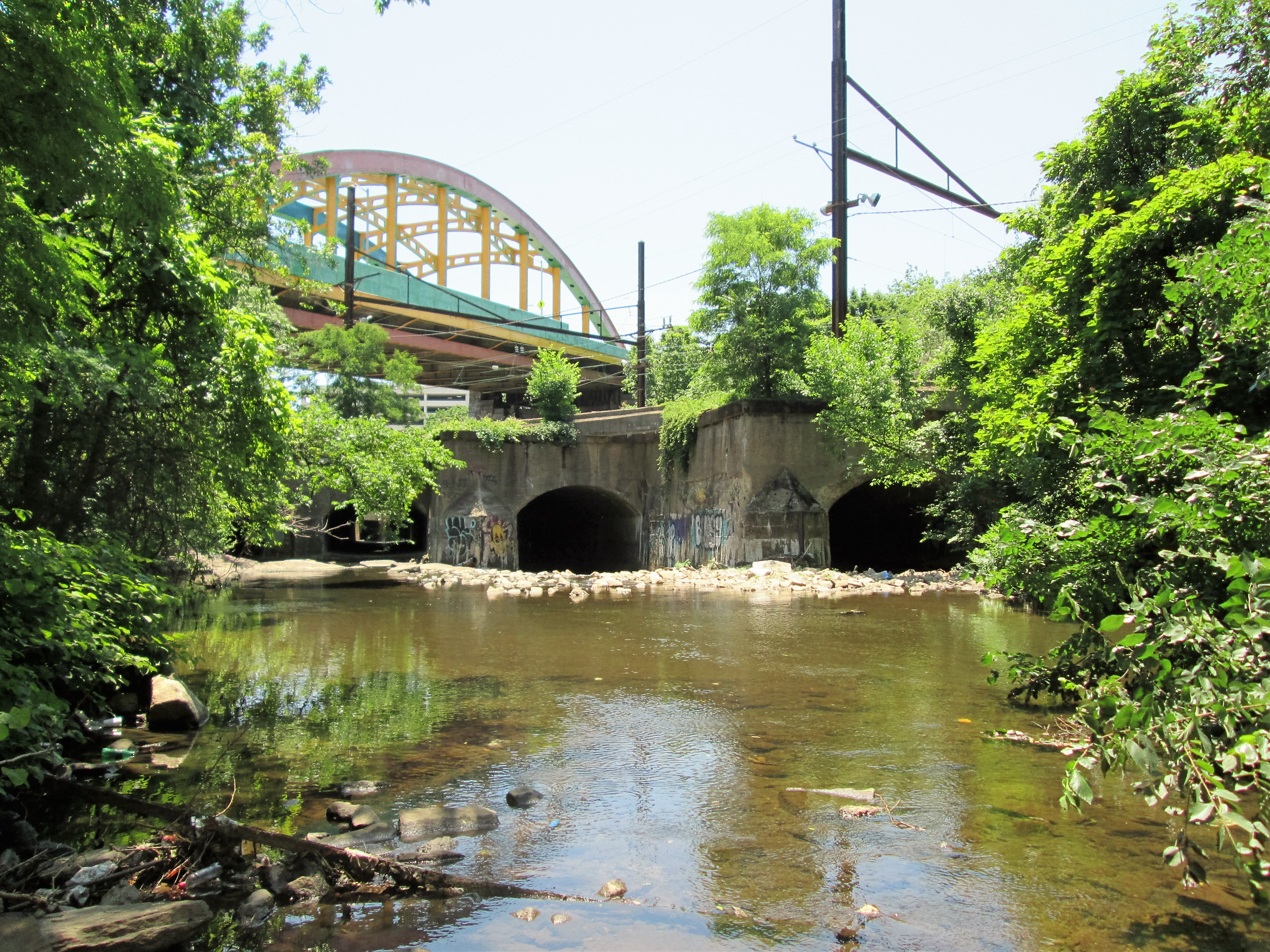
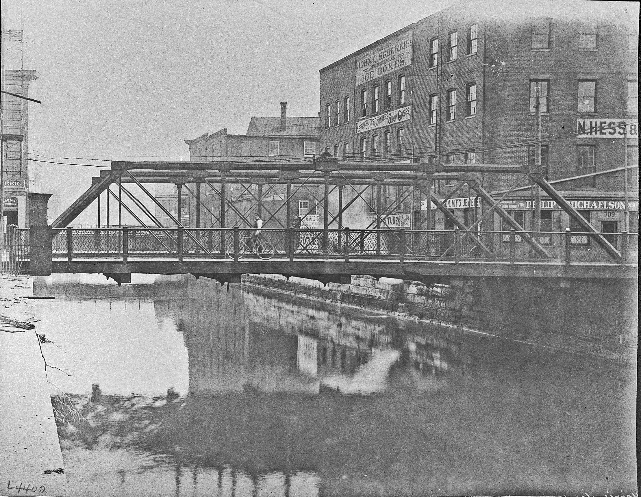
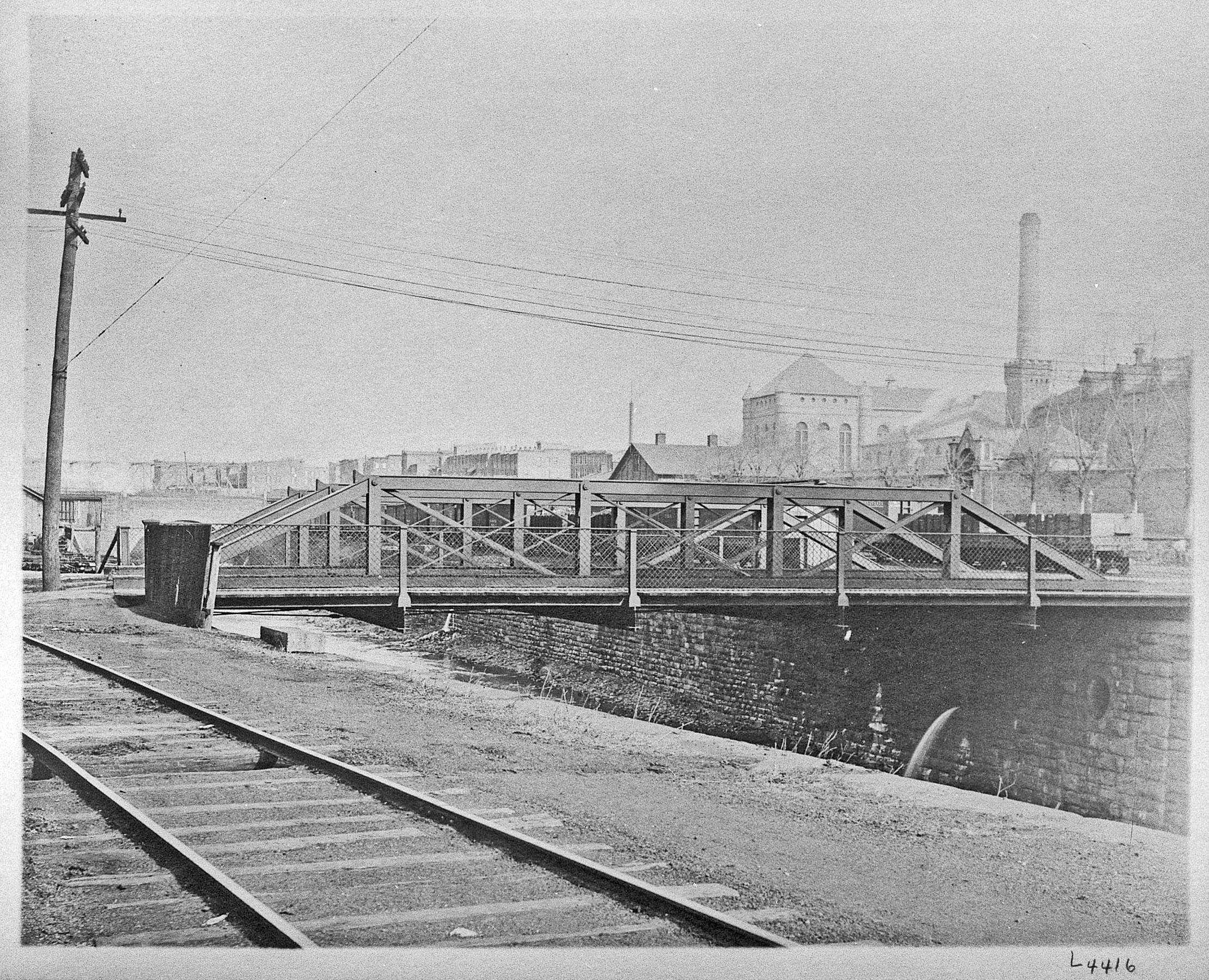
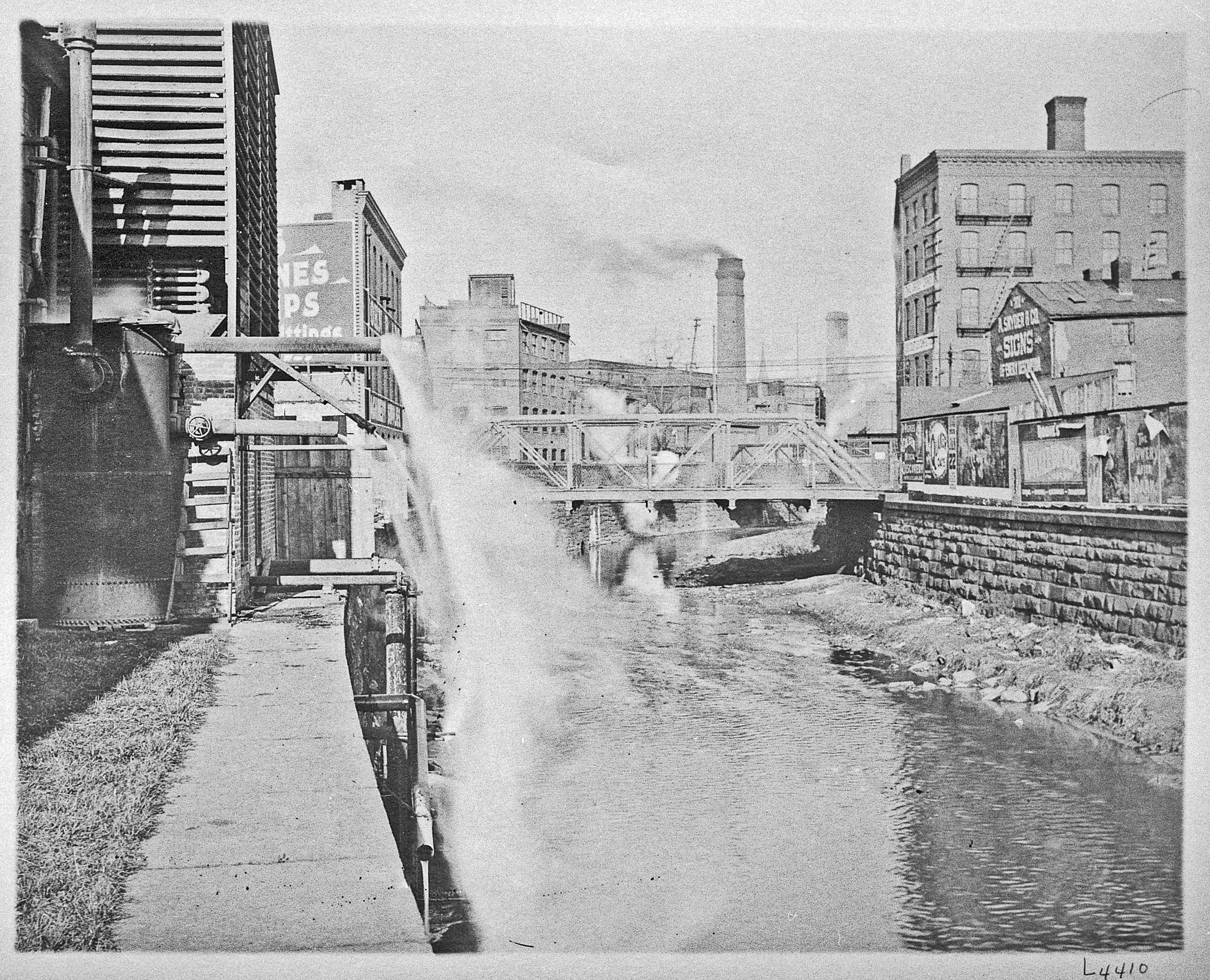
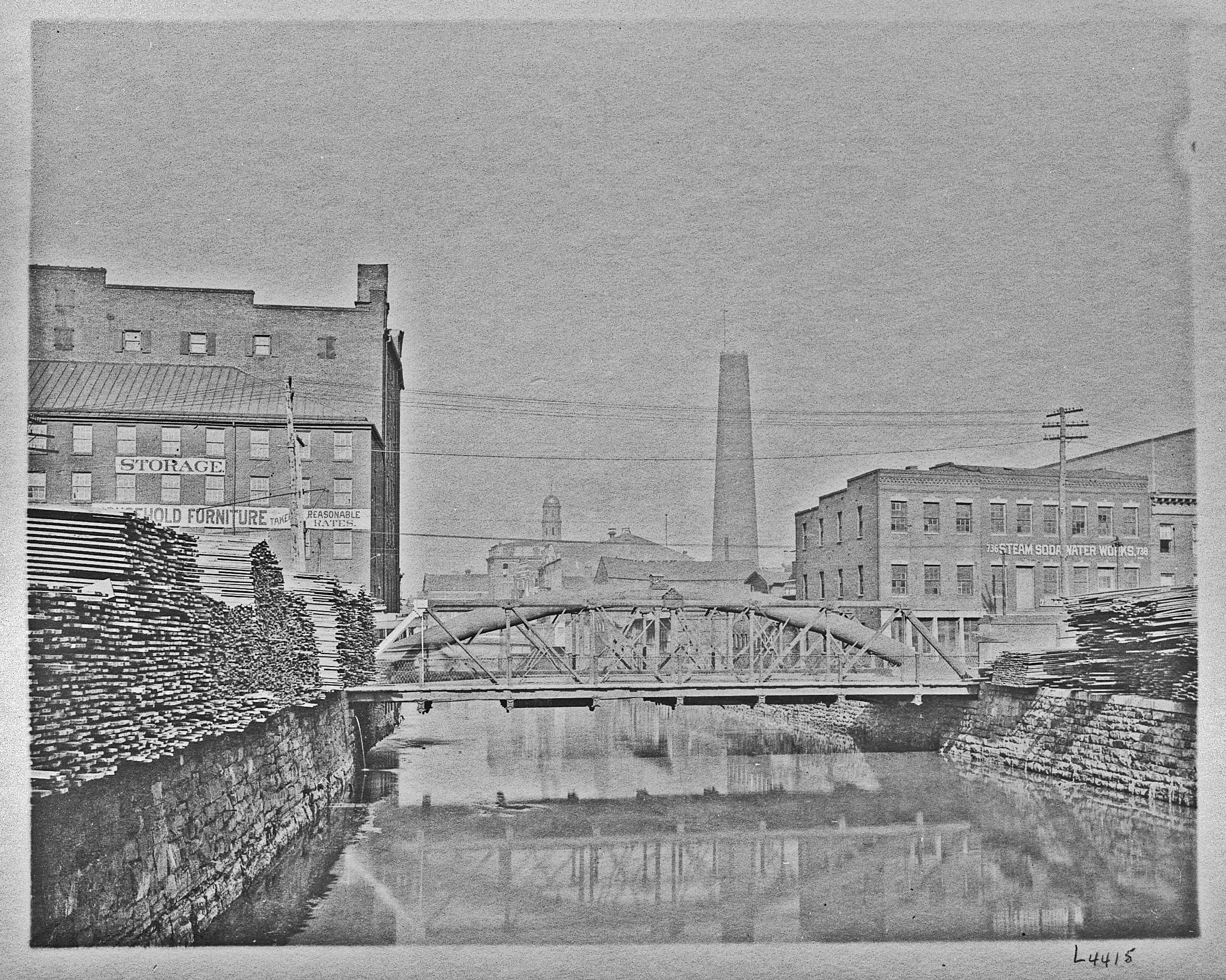
I read with some interest a blog on Baltimore’s disposal plant at Back River, where it was stated that the Outfall Sewer, which connects to the plant, has sunk about four feet and that millions of dollars will be spent to correct this problem. (For 35 years working in the water department, it always amazed me that there was work going on non-stop at Back River. Billions of dollars’ worth. Nothing for the drinking water side though!) It was also mentioned that this ‘sinking’ was possibly caused by poor construction and engineering. I guess it is easier to blame people who are no longer around that can defend their work! The system is over 100 years old. Below is some info on construction.

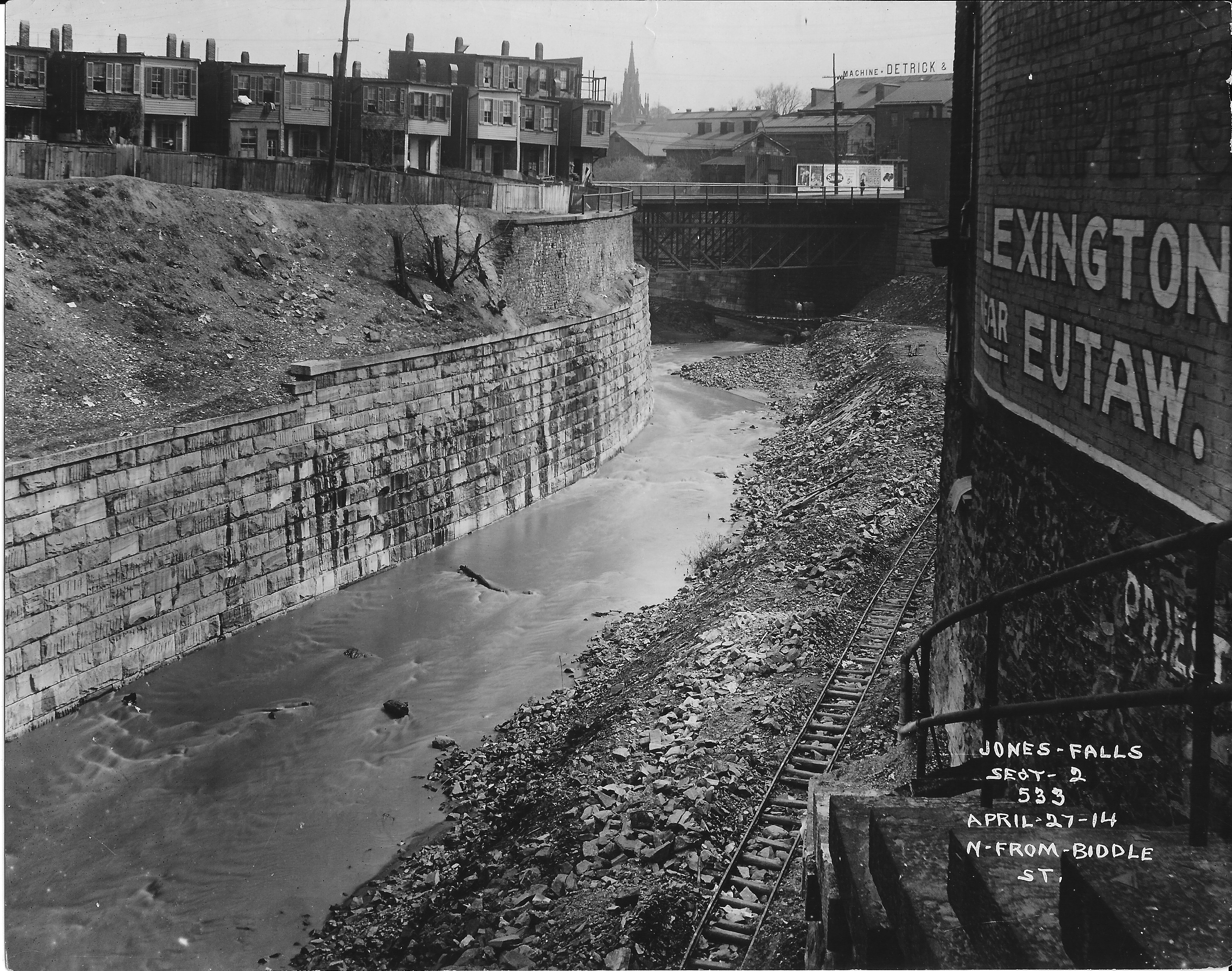
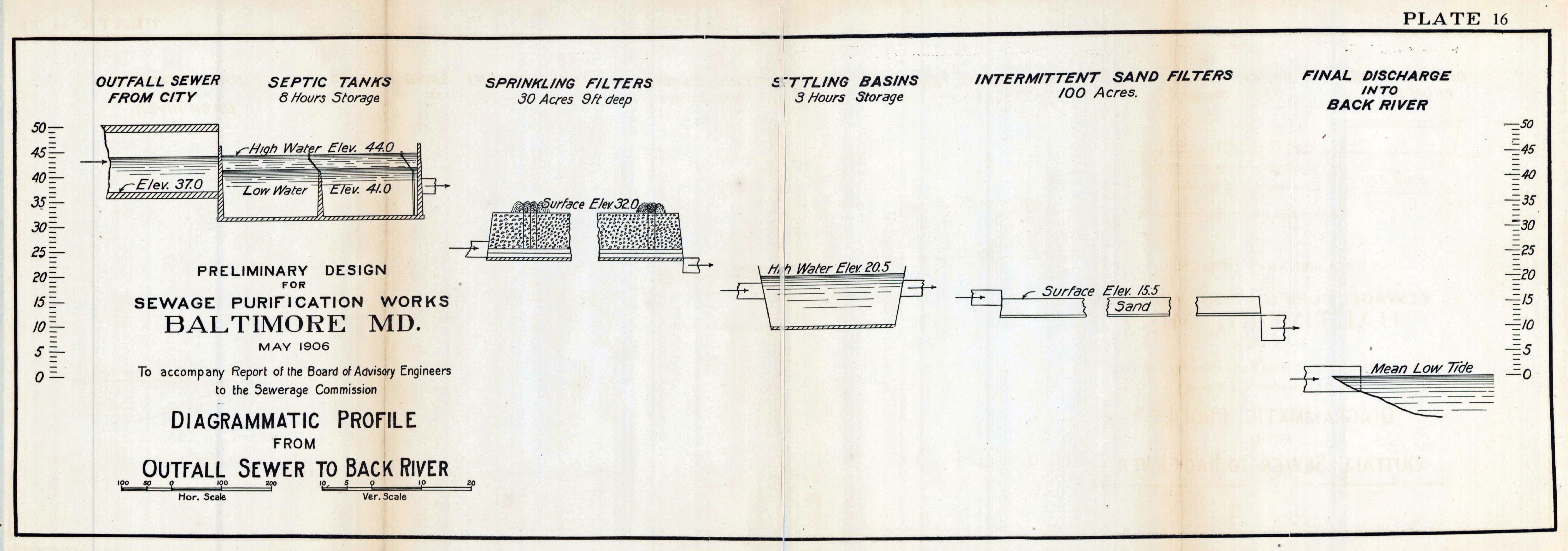
1906 – The Board of Police Commissioners caused a census of the city to be taken by the Police Force, which was completed about April 10, 1906, and showed that by the police computation the population of the city at that time was 543,034. A later estimate made in September, 1906, gives the city a population of 555,000. The capacity of the system in whole, will be for a projected one million persons. The Outfall Sewer extends from Chase and Durham streets to Monument street and Loney’s Lane inside the city limits, a distance of 7,016 feet, or 1.33 miles. This portion is under contract and construction was begun on December 24th. From Chase and Durham streets to Madison and Luzerne streets the sewer will be 10 feet 9 inches high and 12 feet wide; thence to the Disposal Plant it will be 11 feet high and 12 feet 3 inches wide. It will be built of concrete, the lower half being lined with brick. From the city limits the line continues east in Monument street to the Union Railway, thence on the south side of the Union Railway, and with a general easterly and southeasterly direction in Fayette street extended and across private property to the Disposal Area on the west shore of Back River south of Eastern avenue, a distance of 23,354 feet, or 4.42 miles, in Baltimore County, making the total length of the Outfall Sewer 30,369 feet, or 5.75 miles.

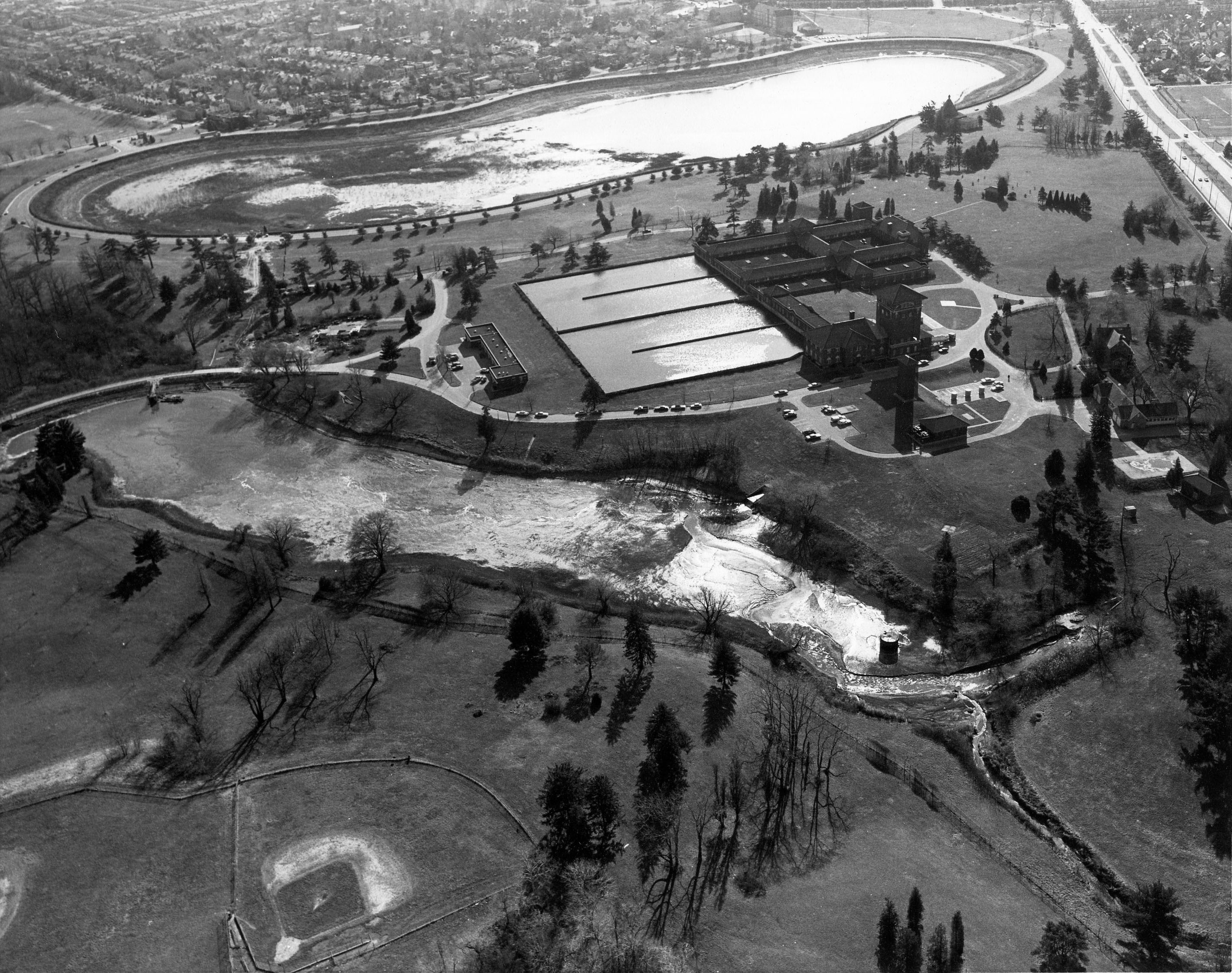
1908 – Disposal Works – The fact of being able to intercept two-thirds of the City’s sewage and carry it by gravity to the disposal works, where the sewage of the entire City is to be treated, is an item that future generations will appreciate, as it means an enormous saving for all future time in the cost of operation of the sewerage system.

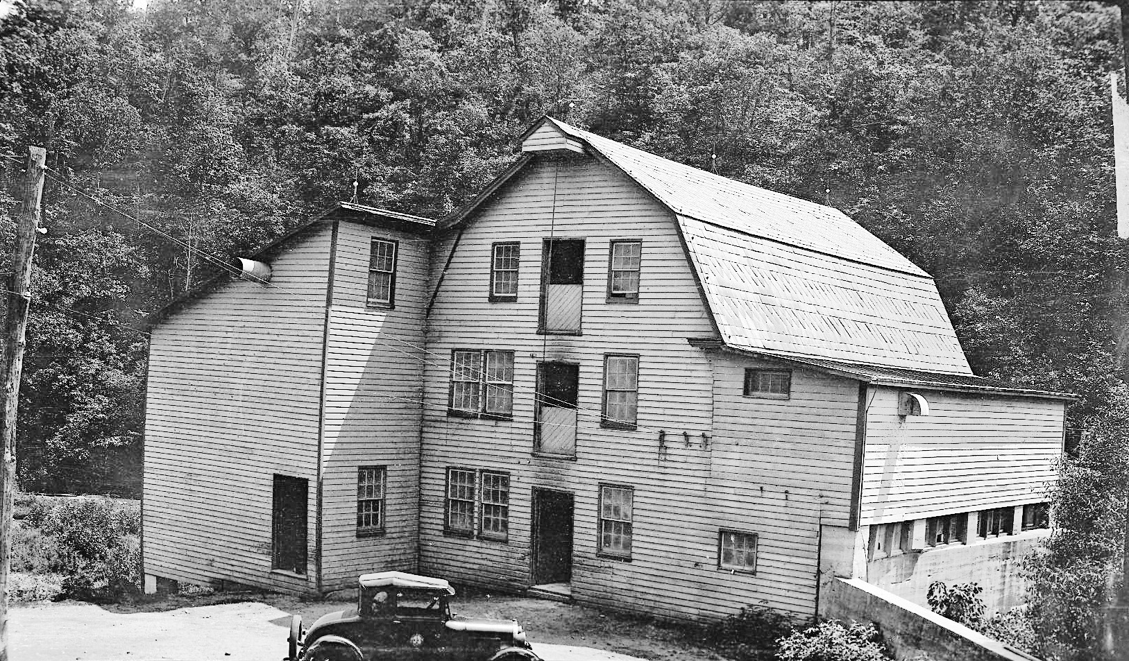
1908 Engineer Hendrick’s report – “It has been our endeavor to treat the work, both as to letting contracts and the employment and promotion of the men, entirely on a business and merit basis, resulting in an excellent class of work and men, including both contractors and engineers. I wish to express thanks to Mr. W.W. Crosby, Chief Engineer of the Maryland Geological Survey and State Roads Commission, for making various rattler tests on brick; to Dr. E. B. Mathews, Professor of Mineralogy and Petrography, for making examinations of various stones, and to Prof. Earle B. Phelps, of Boston, for his assistance in our chlorine experiments at Walbrook. Considering the many difficulties arising daily in constructing two separate systems of sewers (sanitary and storm water) among the vast number of underground obstructions, in streets crowded with traffic and the rapidity and satisfactory manner in which the work has moved forward, which could not have been accomplished if it had not been for the faithfulness and devotion of everyone connected with the work, regardless of overtime and weather, I take this opportunity of expressing my high appreciation of the faithfulness of my staff, consisting of Mr. Albert M. Brosius, First Assistant Engineer; Mr. Herbert M. Knight, Storm-water and Low Level Divisions; Mr. Oliver W. Connet, High Level Division; Mr. Ezra B. Whitman, Disposal Division; Mr. Thomas D. Pitts, Office Division; also, including the engineers, rodmen and inspectors. As stated in a recent address I made to the Society of Civil Engineers in Washington, D. C., the sewage problem as a world factor is forcing itself to the front very rapidly, and our country is approaching a point where it will have to deal with the sewage question on a broad scale. As rivers run from one State to another, the States cannot deal with the problem without clashing, and it will soon have to be dealt with by a National Sewage Board, similar to those abroad. We have heretofore, on account of the vastness of our country and the size of our rivers, simply disposed of the sewage in the most economical manner at the time, regardless of results, such as dumping it directly into lakes and rivers. This has been a short sighted policy from the fact that large expenditures have been entered into in the way of sewers, which will necessarily have to be readjusted in order to conform to sanitary laws now being passed requiring the treatment of sewage before discharging it into rivers or lakes. The City of Baltimore is showing the same progressive spirit in handling this great sanitary problem that she has shown in many other enterprises of world-wide interest, causing cities all over the world to send committees and engineers to study the plans and methods of prosecuting our work.”200- 2

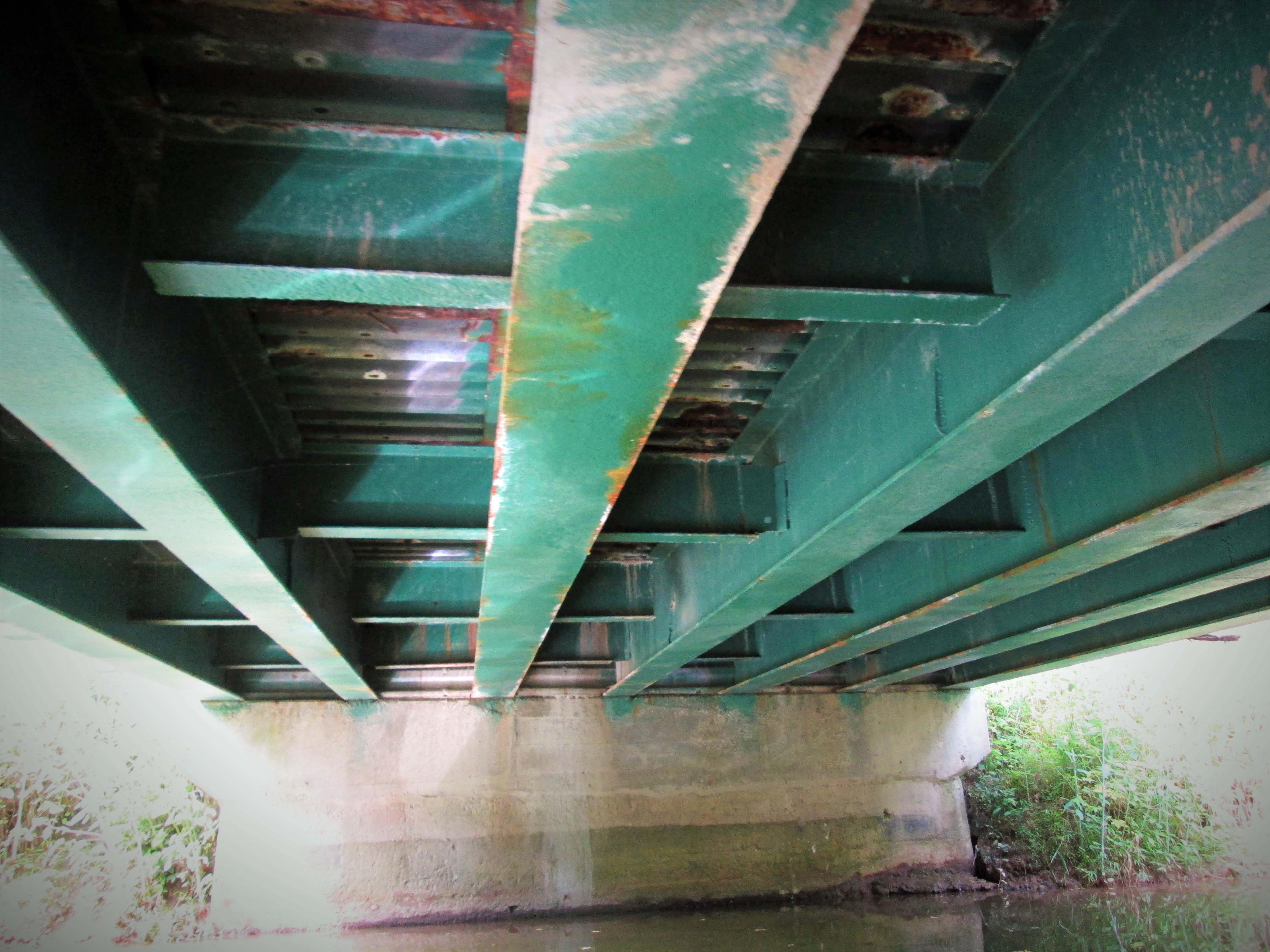
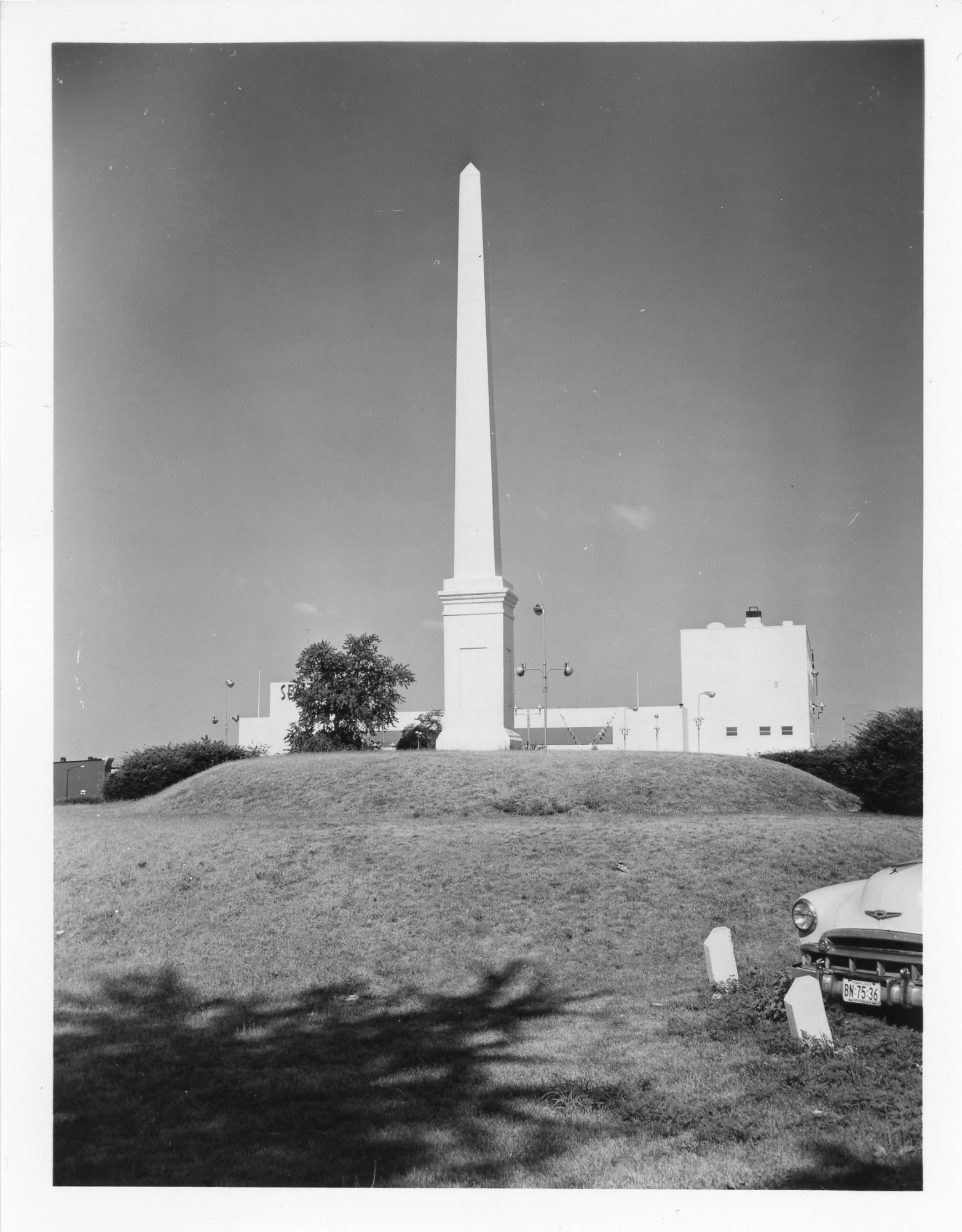
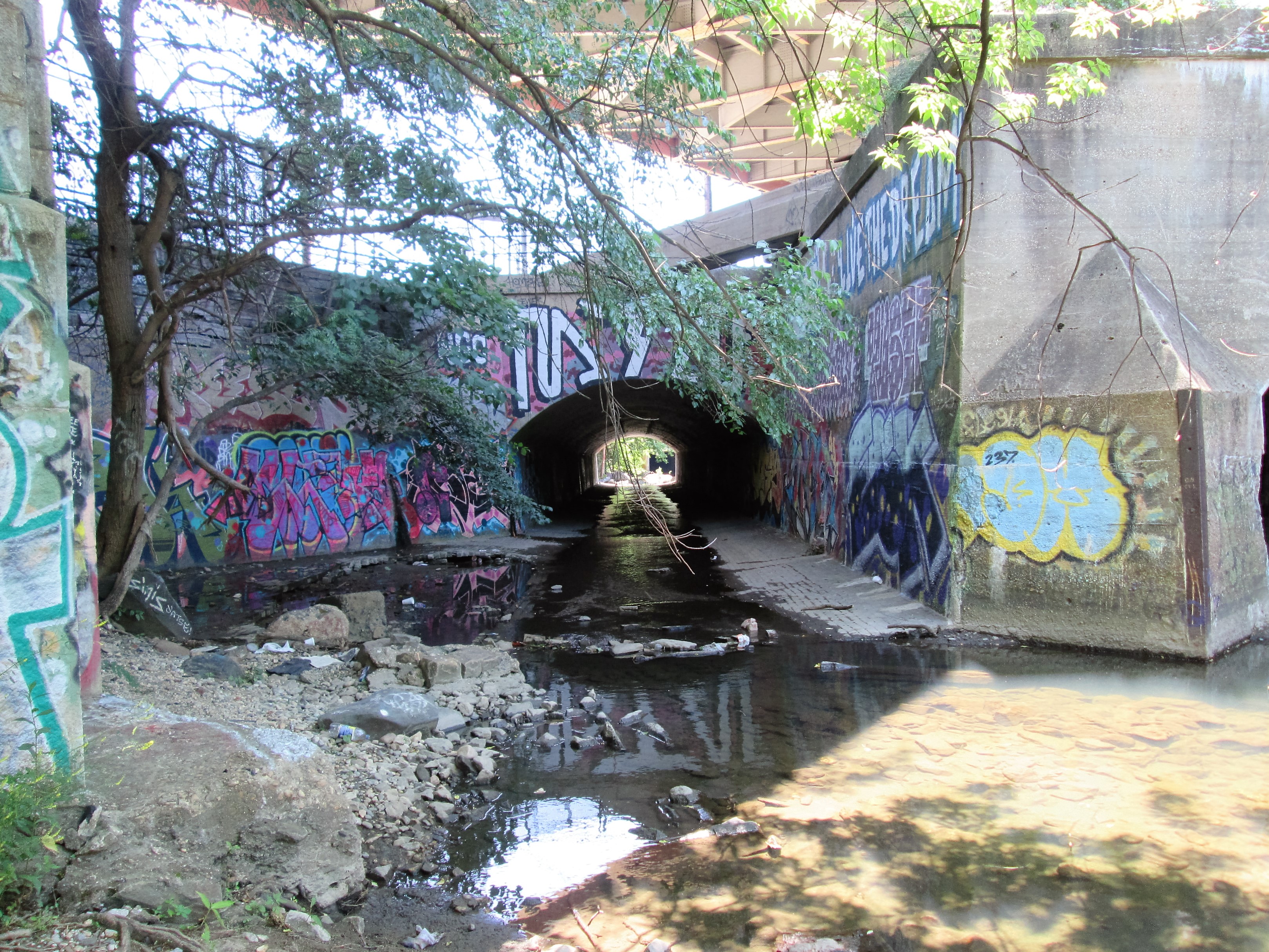
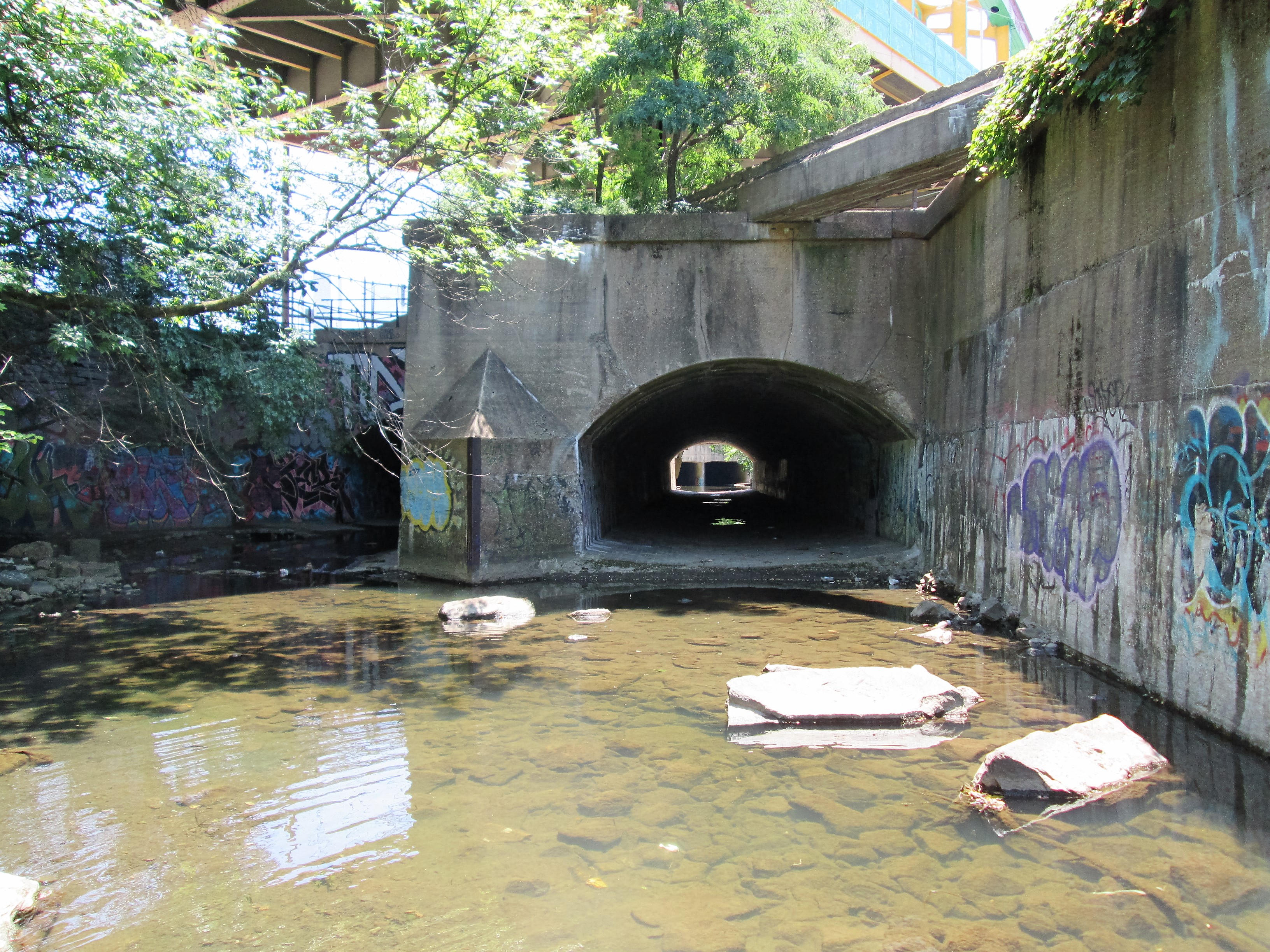
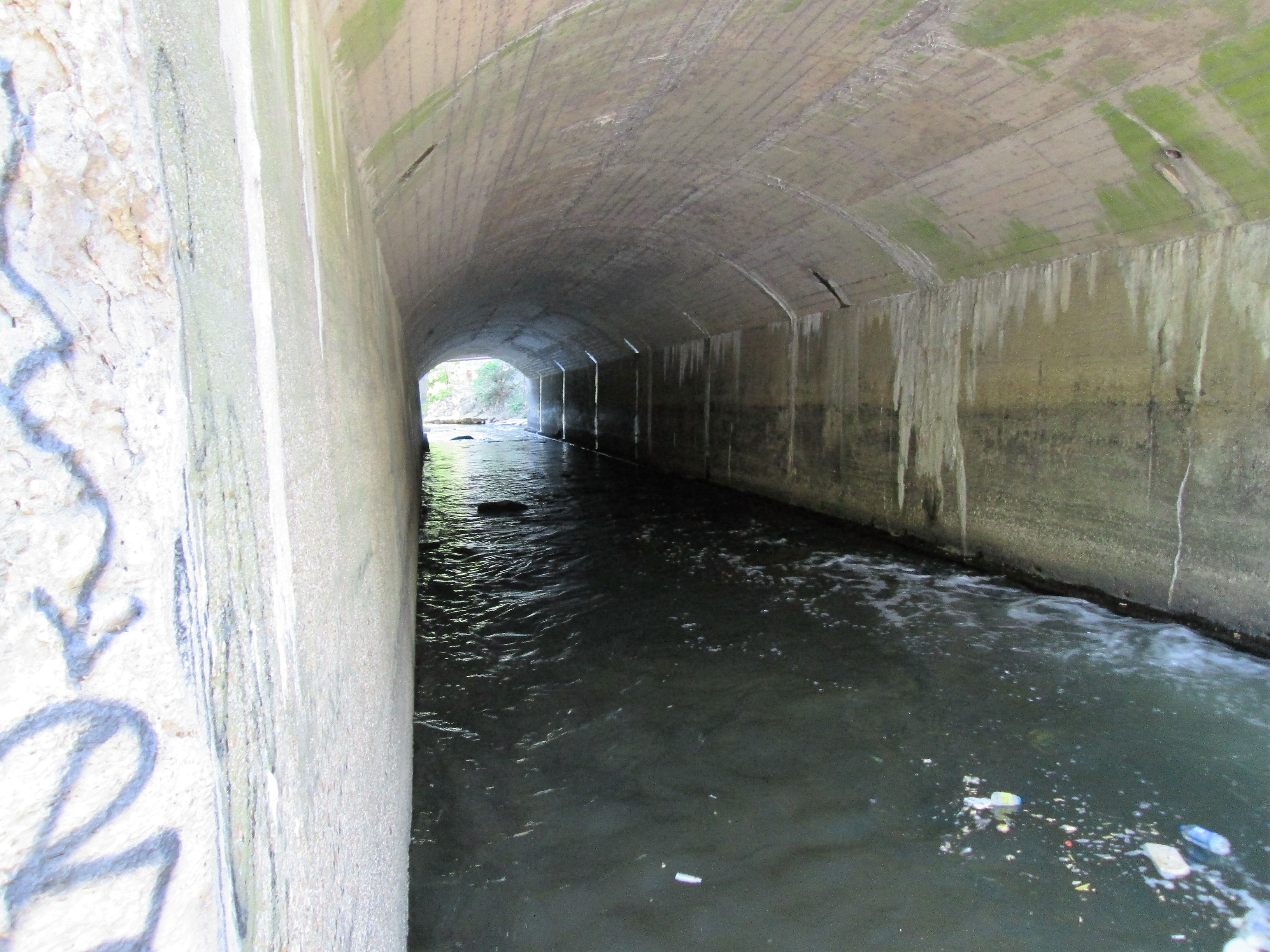
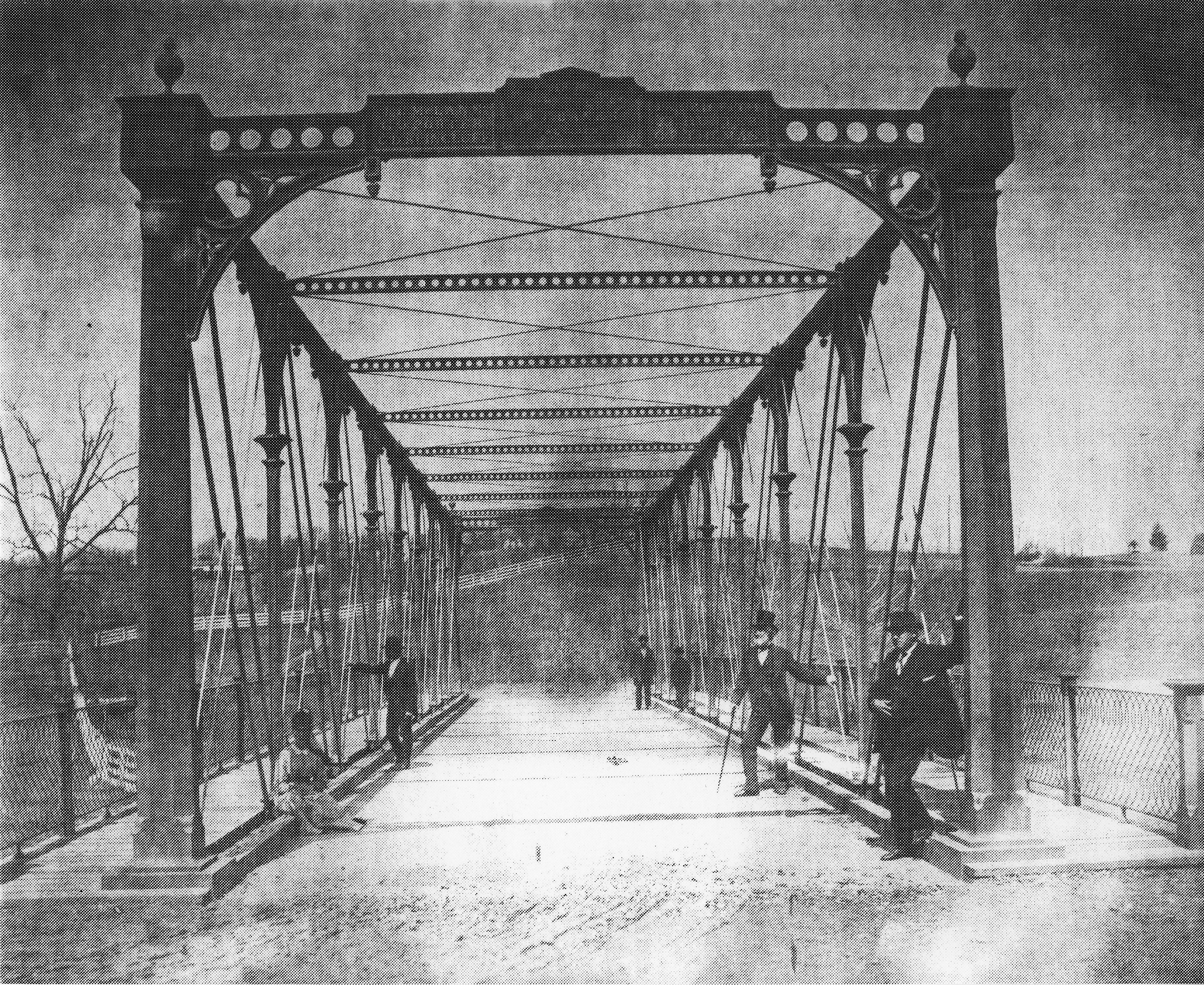
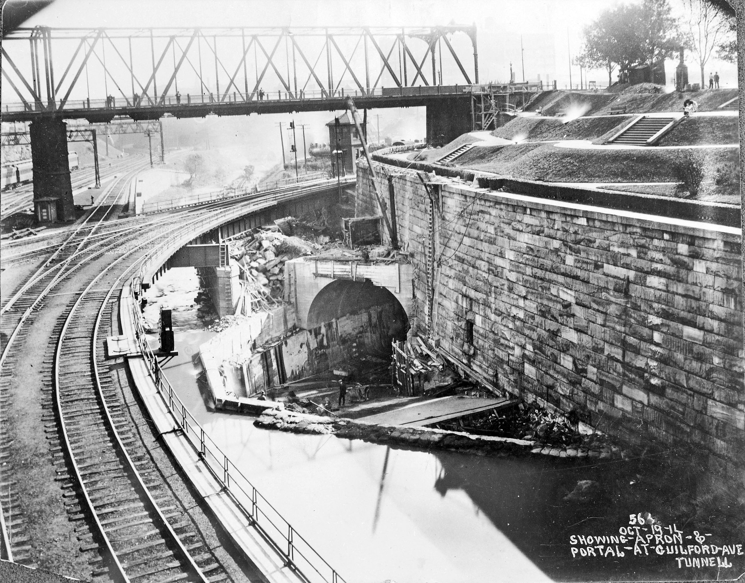
Here is a drawing showing to the left the supposed sunken outfall connection to the plant. img001b

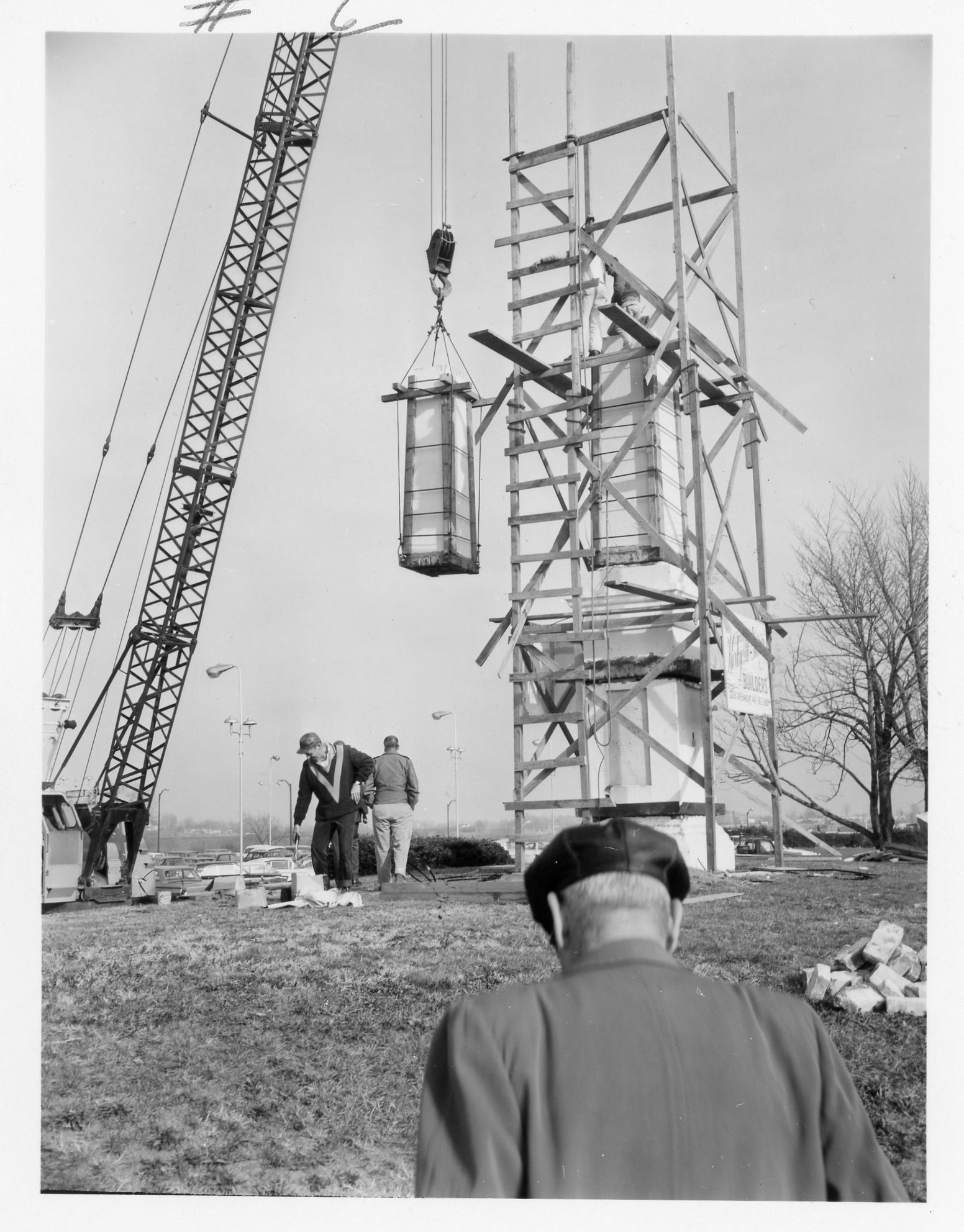
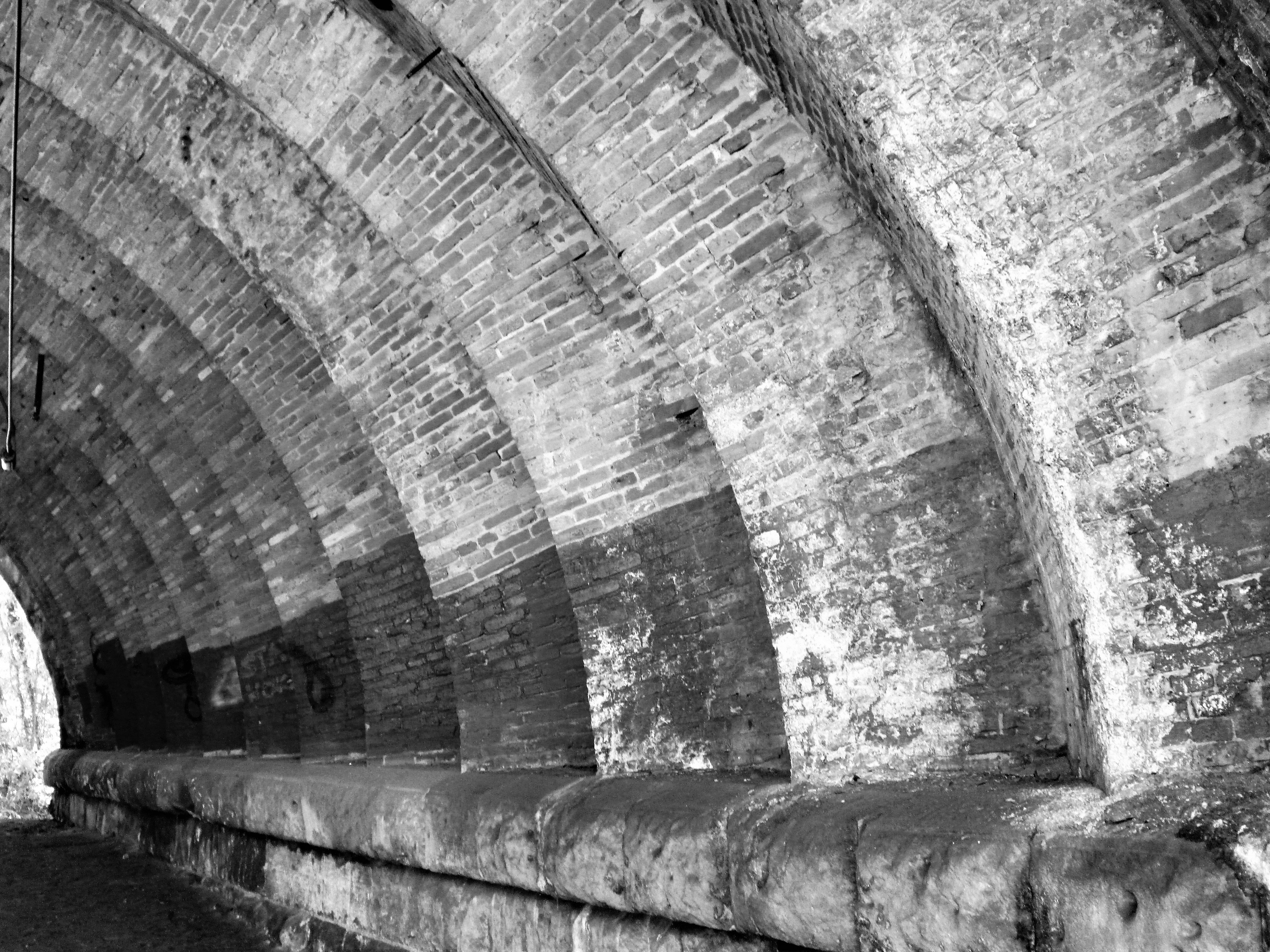
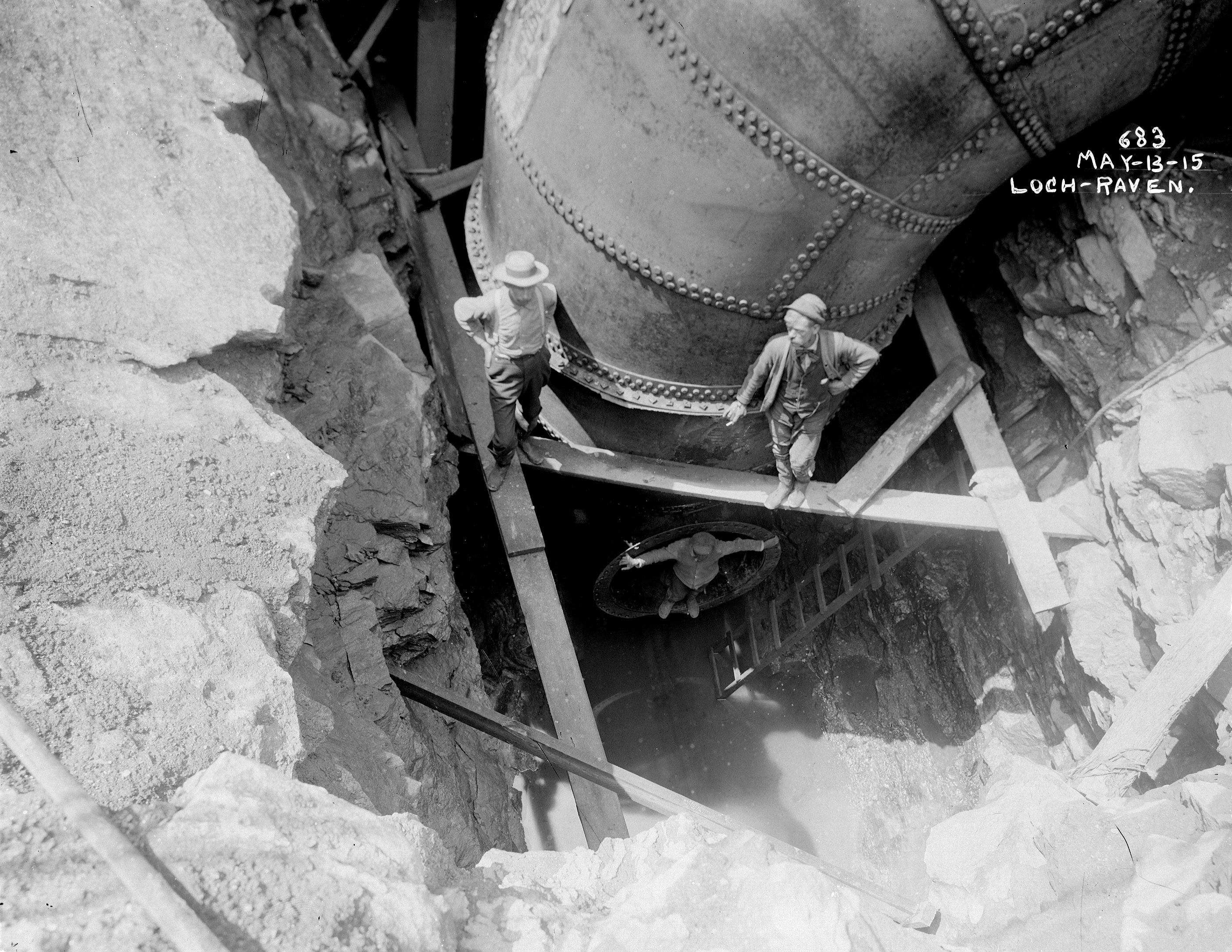
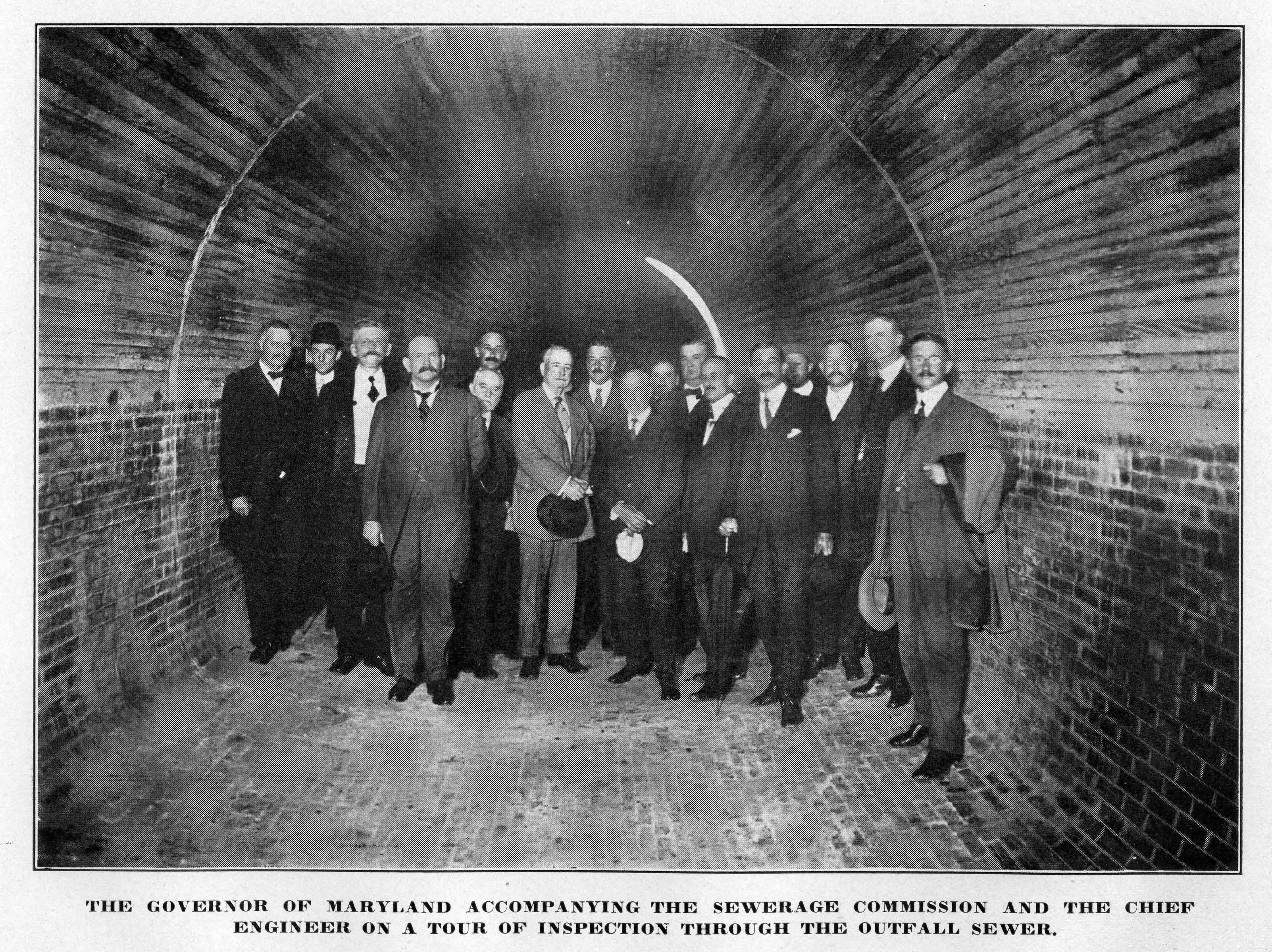
Here are the engineers that built this structure. It appears to me that if this brick-lined conduit did sink 4′ that there would be a mass amount of broken brick and concrete?

← Older posts
Newer posts →

Blogroll

  • Flouride Action Network
  • lulu
  • My Book
  • WordPress.com
  • WordPress.org

Recent Posts

  • Bermuda 2023
  • ICELAND April 2023
  • George Chalmers of Fochabers
  • In Search of The Skipjack Ada Mae
  • Trap Pond Kayak

Blog at WordPress.com.

  • Subscribe Subscribed
    • Water and Me
    • Join 231 other subscribers
    • Already have a WordPress.com account? Log in now.
    • Water and Me
    • Subscribe Subscribed
    • Sign up
    • Log in
    • Report this content
    • View site in Reader
    • Manage subscriptions
    • Collapse this bar
 

Loading Comments...