Tags
art, Baltimore, Crafts, fishing, Gunpowder Falls, Hiking, Holidays, Montebello, Peace, photography, Public Works, water
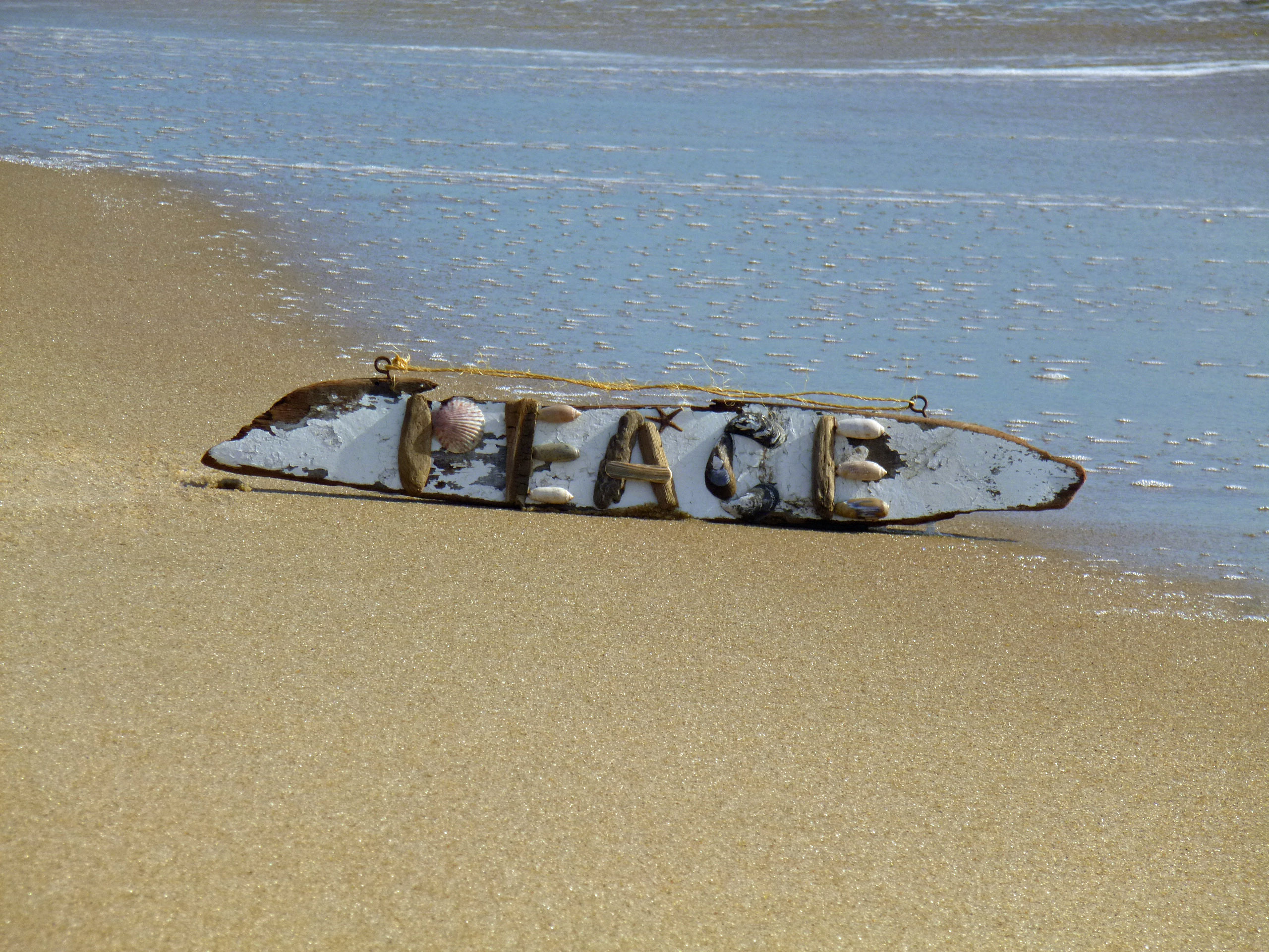
From Kathy, Molly the mutt and myself….

23 Friday Dec 2016
Posted in Baltimore, nature, Photography
Tags
art, Baltimore, Crafts, fishing, Gunpowder Falls, Hiking, Holidays, Montebello, Peace, photography, Public Works, water
From Kathy, Molly the mutt and myself….
21 Wednesday Dec 2016
Posted in Baltimore, water history
Tags
Baltimore, engineering, glass plate negatives, Gunpowder Falls, HISTORY, Lake Clifton, Lake Montebello, Montebello, Monuments, POLITICS, Public Works, Statues, water history
When the permanent water supply from the Gunpowder Falls was built, it included a dam at Loch Raven, a 12′ tunnel approximately 7 miles long, an impounding reservoir at Montebello, another conduit from there to Lake Clifton and then it was distributed to the public as unfiltered, yet wholesome drinking water.

Photo from the 1920s showing the original 1881 gate house at Loch Raven

How the gate house area looked in 2011.

When they eventually removed the gate house, they kept some of the original stone and built this somewhat mini-monument to the Permanent Supply, across the street.

The supply is finished and the valves are opened. This is downtown Baltimore at the Battle Monument. Caption reads: Fountain and Cataract – Monument Square – The Introduction of the Gunpowder Water Supply – Oct. 10th 1881
19 Monday Dec 2016
Posted in Baltimore, water history
Tags
Baltimore, Dams, engineering, HISTORY, Public Works, water history

From the City Council Records: It says –
Resolved by the first and second branches of the City Council of Baltimore, that the Mayor be, and he is hereby authorized and requested, to give public notice, that proposals will be received at his office, until the first day of June next, for introducing a copious and permanent supply of wholesome water, into the City of Baltimore, or into any part thereof, by any individual or Company; and that whenever such proposals have been received, as in the opinion of the Mayor are worthy of consideration, he convene the City Council to deliberate thereupon.
Baltimore Feb. 23, 1804 In 1st Branch read and agreed upon.
The concurrence of the Second Branch is requested
Feb 23, 1804 In the 2nd Branch read and agreed to.
Noted from Early Water History, Annual Reports:
1804 Baltimore Water Company: On April 30, Samuel Smith, W. Cooke, E. Ellicott, Robert G. Harper, Thomas McElderry, Alex Mckim, and John E. Howard agreed to form The Baltimore Water Company. The Baltimore Water Company, a private company, furnishes water to a portion of Baltimore City. Company purchased parcels of land above and below the Belvedere Bridge, which crossed the Jones’ Falls, and built a dam and bought a lot at the southeast corner of Center Street and Calvert Street for the purpose of constructing a reservoir at that site. Water to this reservoir was supplied from the water at the dam by means of an open channel. The open channel ran between Calvert Street and the street known today as Guilford Avenue.
1805 Baltimore Water Company: The Baltimore Water Company receives an act of Incorporation.
15 Thursday Dec 2016
Posted in Baltimore, engineering, Reservoir, water history
Tags
Ashburton, Baltimore, engineering, FILTRATION, glass plate negatives, HISTORY, Public Works, Snow, water history, weather
First thing that popped up on my news feed said – Double Polar Vortex to Slam U.S. Did they talk like that in 1908? Or did they just say, “Folks we had us some snow last night, so bundle up!”
Building the High Service Reservoir, also known as Lake Ashburton.

The little train that couldn’t.

Steam engines used to pull cables on derricks, to lift construction materials.
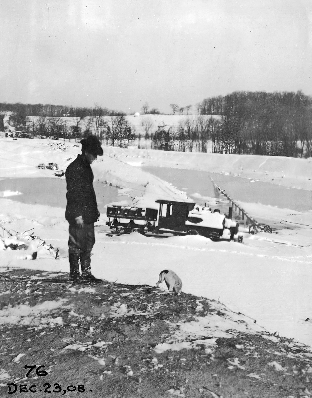
A boy and his dog. Look close, center on horizon. Does that look like a giant snow ball someone is about to roll down the hill?
10 Saturday Dec 2016
Tags
abandoned house, Baltimore, bricks, Eagles, engineering, FILTRATION, fishing, glass plate negatives, Gunpowder Falls, Hiking, HISTORY, Montebello, nature, photography, Public Works, water history
The day before taking off work for my daughter’s operation, I was contacted by CHAP – Commission for Historical and Architectural Preservation. They wanted to know if I knew anything about a fireplace mantle from Glenn Ellen Castle that was stored in a maintenance building downstream from the second dam? No. They were getting ready to tear down the buildings and were told by the contractors about the mantle.
This was Glenn Ellen prior to raising the dam from elevation 188′ to 240′. The reservoir did not reach this height but it was still on watershed property and taken by the City. I think only the foundation exists now.

Earlier this week a friend of mine, Thom, contacted me and told me about some signs he saw on the property as he was hiking behind the construction site. At first glance I thought they were bronze plaques so I met him and Wayne to go exploring.

The hiking trail is on the hill behind the silt fence. This is where the signs were. Turned out to be steel and not bronze, but still worth keeping a couple for history’s sake!

Saw some interesting items so took a closer look. I thought it was odd that the contractor cut the beams instead of just knocking this building down. Come to find out a company called Bricks And Boards came up a removed the wood to re-purpose. The boxes contain core bore samples. Not sure why the City didn’t want to keep these? They do me no good without the engineer’s records saying where the samples came from.

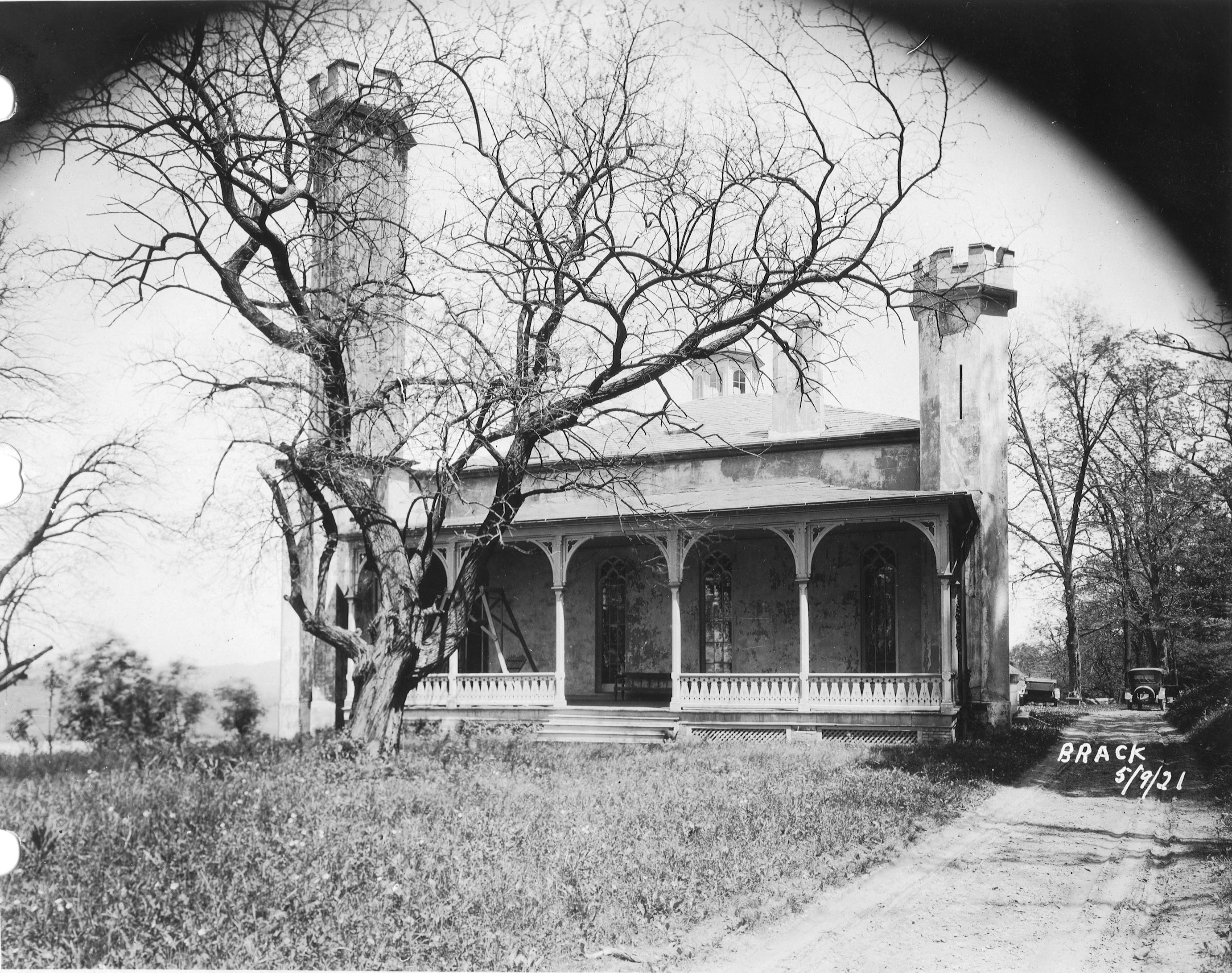
After rooting around in the barn we decided to head into the house. This is being knocked down also. A few years ago I was told there were lantern slides stored in here along with some old drawings. Back then, I wasn’t allowed in to look.
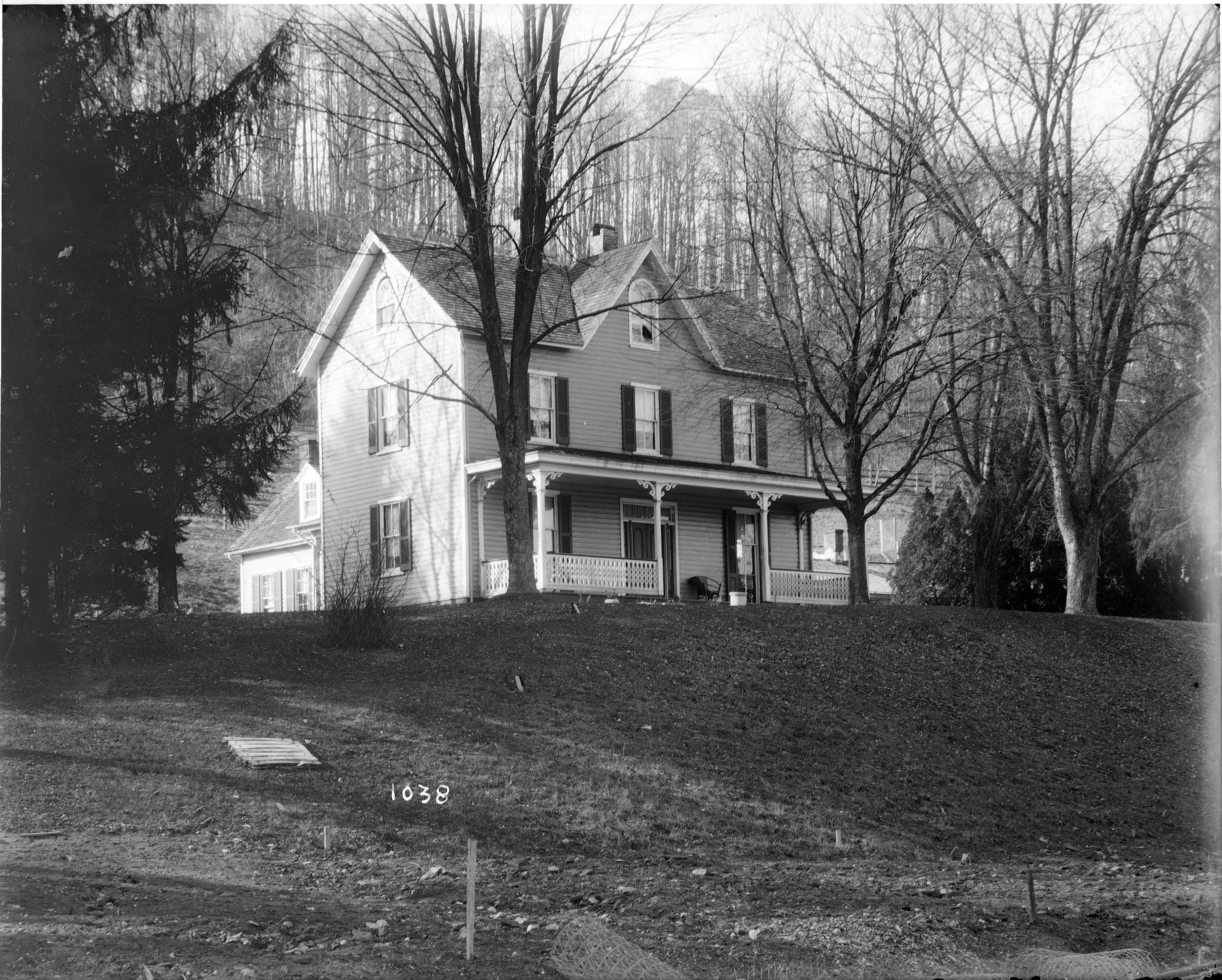
The house as it looked about the 1920-30s. I tried to find who was the original owner but had no luck. From a map of 1882 it has it listed as City Property. Adjacent to the Wisner, Shanklin properties. Further investigation is needed.

Wayne asked the date the house was built. Not sure but it shows up in a 1881 photo. Far right side just up from the Gunpowder River. This photo shows the dam near completion, ready to lay the last stone.

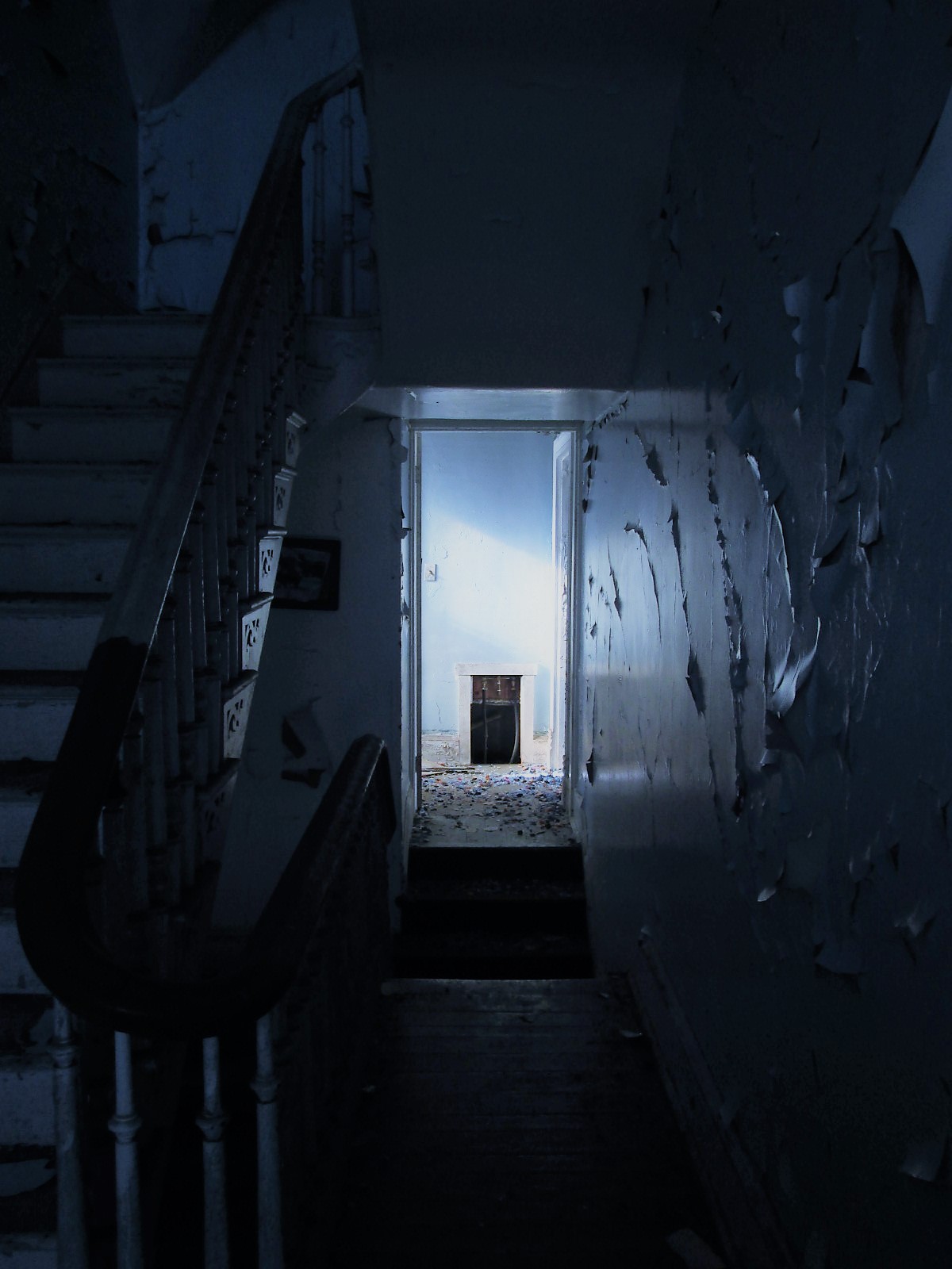
Back into the house. Entrance hall.

There are 3 fireplaces. One plastered over and two, like this one, with the mantles missing.
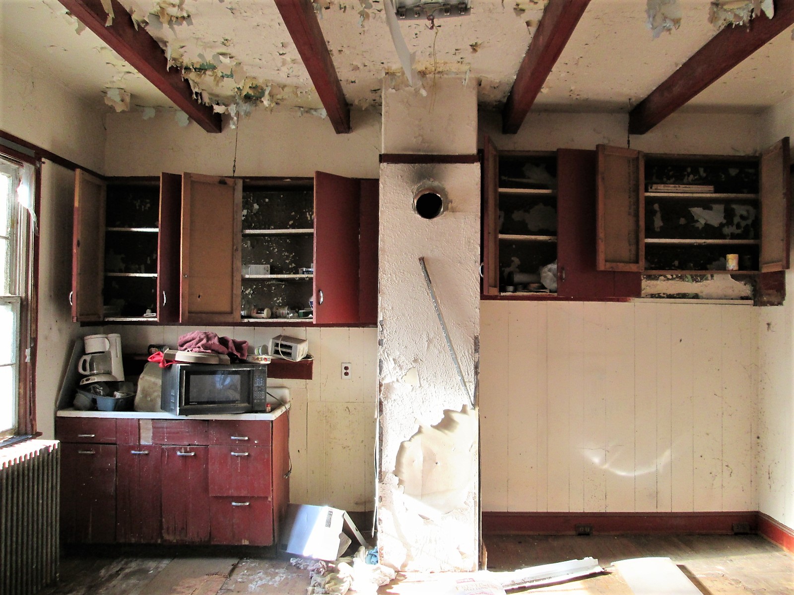
Kitchen.
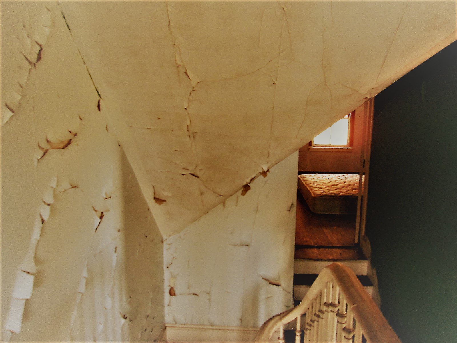
Looking up the stairwell. Three floors.
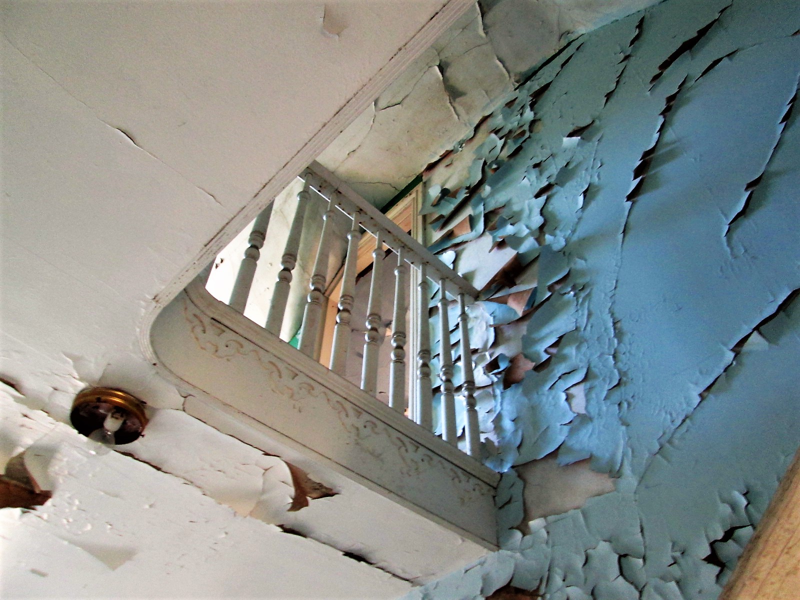
Second floor to third floor
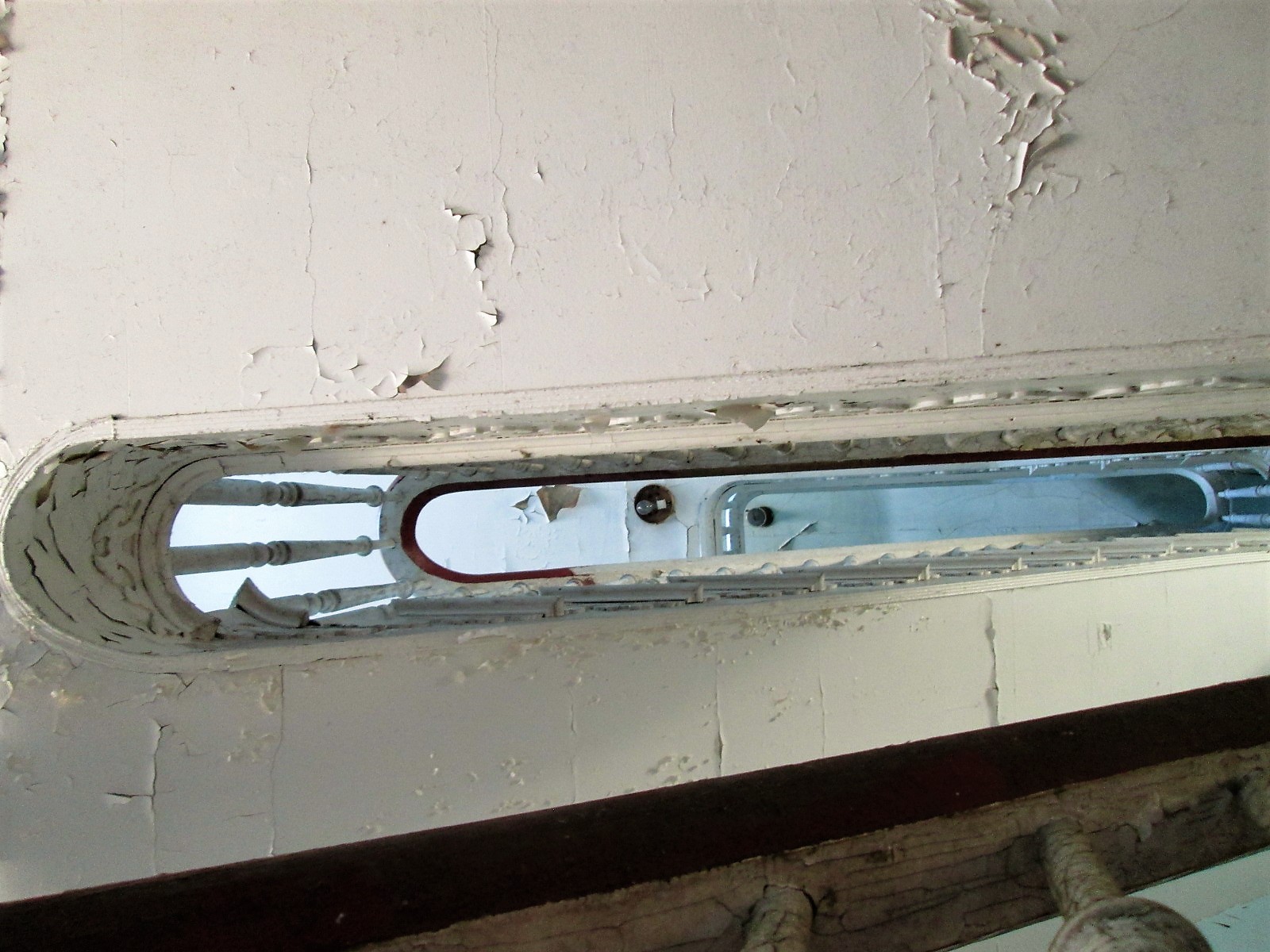
This was a nice design – up the stairs to a landing that will take you in both directions. This is a huge house.
Lots of rooms – curves and angles.
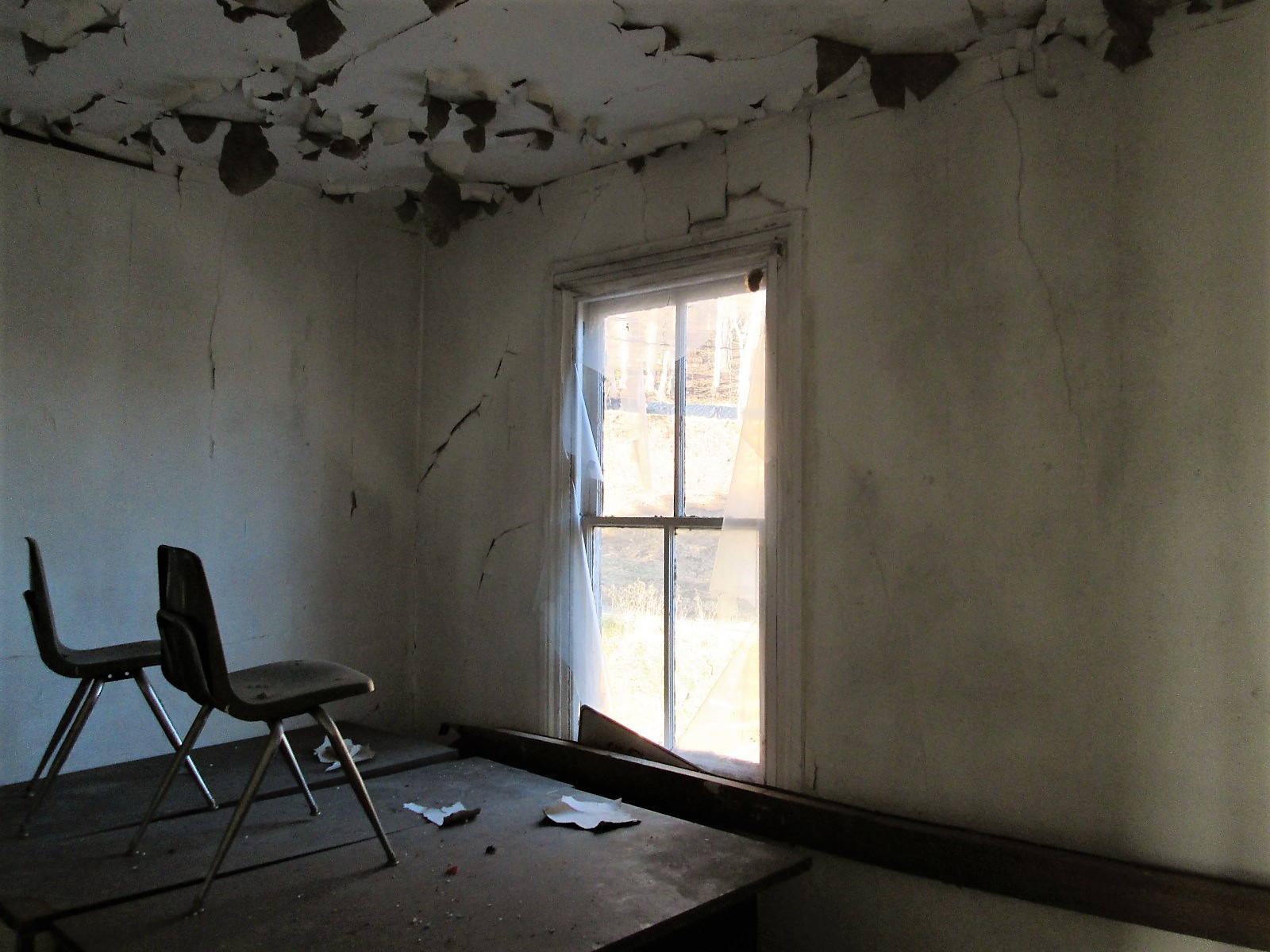
Chairs on a desk – watching…

One of the many views. Someone nailed a metal sign to the window? I would have loved to live here with this view. Two eagles were playing most of the morning over the lower reservoir. Nice!
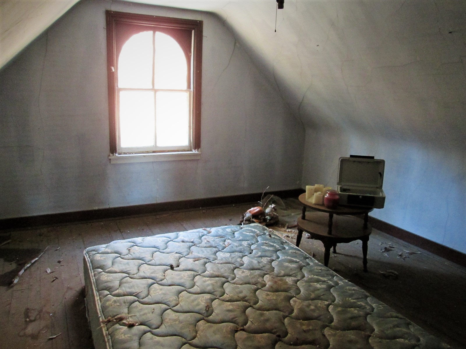
Another room. Candles, a bed, money box and stuffed ducks that look like the turkey buzzards tore open – must of thought they were real!
Prologue: I asked the contractor to hold two of the signs for me until I can come back up. He said ok…but, between my visit and when I sent off the email, Brick and Boards came up and took them. Talked to Max from there and he said they are in his warehouse and I can come pick them up!
Their site: https://baltimorebrickbybrick.com/2016/08/04/brick-board-is-here/
08 Thursday Dec 2016
Posted in Baltimore, engineering, water history
Tags
Baltimore, conduit, engineering, FILTRATION, Lake Montebello, Montebello, pipe, Public Works, water history
Back in 1956 – 1957 a new 84″ pipeline was laid to connect the Montebello Filters with South East Baltimore, doing away with a pumping station. It was inspected this week using what is called a Pipe Diver. A mini-sub looking thing with a bunch of probes. No camera unfortunately.

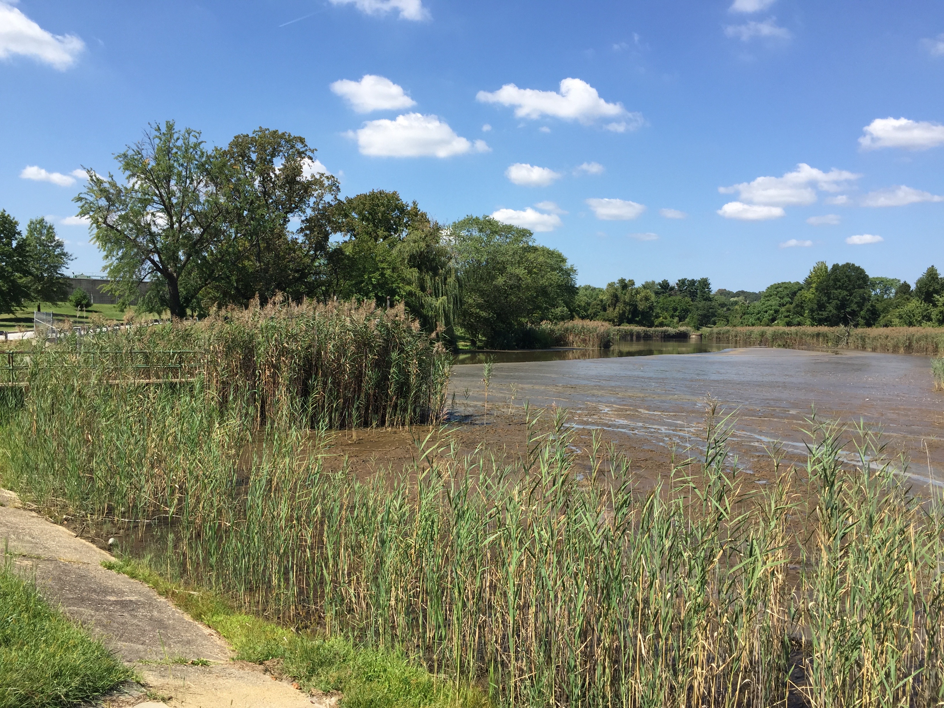
Here is the pipe prior to connection to the filtered water reservoir in 1957. The reservoir (20 million gallons) is behind that house on the left, underground.

Connection to the clear-well chamber. Years later another connection would be made on the opposite side of the reservoir. The two conduits are connected about 100 yards from the above point.

Back in June, while making my rounds thru the property, I saw a contractor digging a hole. Asked what he was doing and he said he needed to rebuild this manhole and put a new valve on the pipe. That they were getting ready to inspect the 84″ pipe. I asked if he knew that this pipe was full of water. He said he knew and it would be alright. Here is another case in the City when agencies do not communicate. We had no idea they were doing a pipe inspection.

A month later, a contractor comes on site to look at a possible entry point for their pipe diver. I showed them and in November they came back.

They could not relieve the pressure in the pipe enough to insert their tool. So they had to postpone and rethink their strategy.
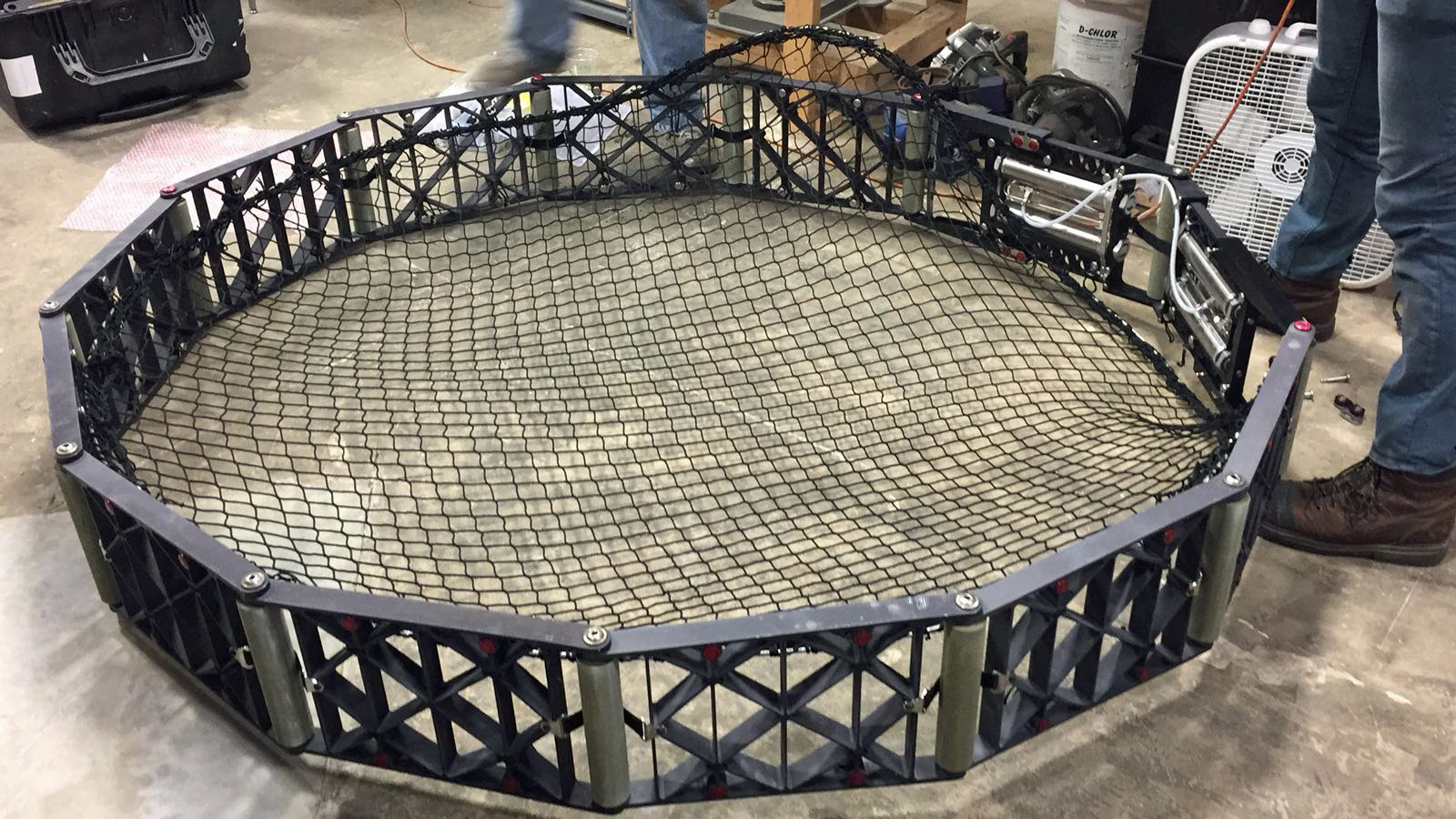
This week they came back. It took a lot longer to relieve the pressure than what they thought. This is the net that was inserted downstream, about 3 miles. It was there to catch the pipe diver.
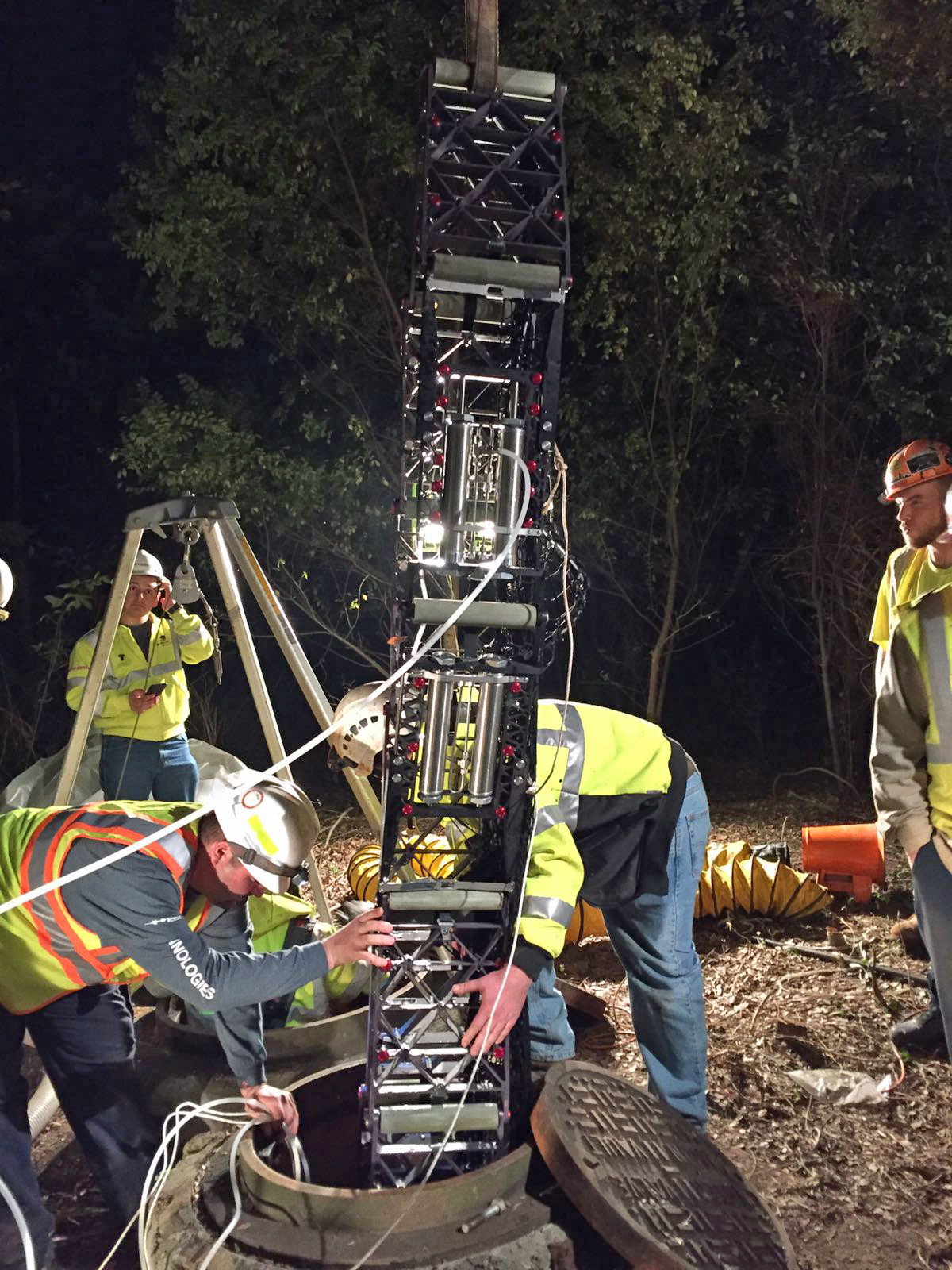
Installing the net.

This is the equipment that was used to track their diver. It only took about 3-1/2 hours for the machine to flow by water pressure to the net.

Removing the pipe diver tool. hopefully the information obtained is all good info – that the pipe doesn’t need repairs or in worse case, replacing.

One disturbing photo sent to me is this one, showing where ground cover has washed away, exposing the water pipe. I’ve lived around this stream for many years and I know the force of nature, during storms. Just a matter of time…
05 Monday Dec 2016
Posted in Baltimore, filtration, water history
Tags
Baltimore, engineering, FILTRATION, Lake Montebello, Montebello, photography, Public Works, water history
The contract has been completed. Here are the before and after photos.

02 Friday Dec 2016
Posted in art, Baltimore, Photography, Sewage History
When not doing my regular job, I document archives and museum objects. Recently thinking of my retirement in a few years, I started to wonder what will happen to most of the stuff I have stored in a large garage at work. Most of the water archives were almost thrown out many years ago, but I stashed them away for a couple decades. So, with my leaving, what will happen to it? No one really knows or knows what to tell me. Some of the artwork doesn’t even belong to the City, so I decided to get in touch with the artist to see what they wanted me to do with it.
First up is Bobbi Mastrangelo who has a collection of manhole cover art. Both sculptures and art prints. I found her thru a Google search and we have been in contact for the past couple weeks. She will see first how to relocate the work and if she has no luck, I will ask around to see who may want to display or purchase the works. Below is a sampling of her work.
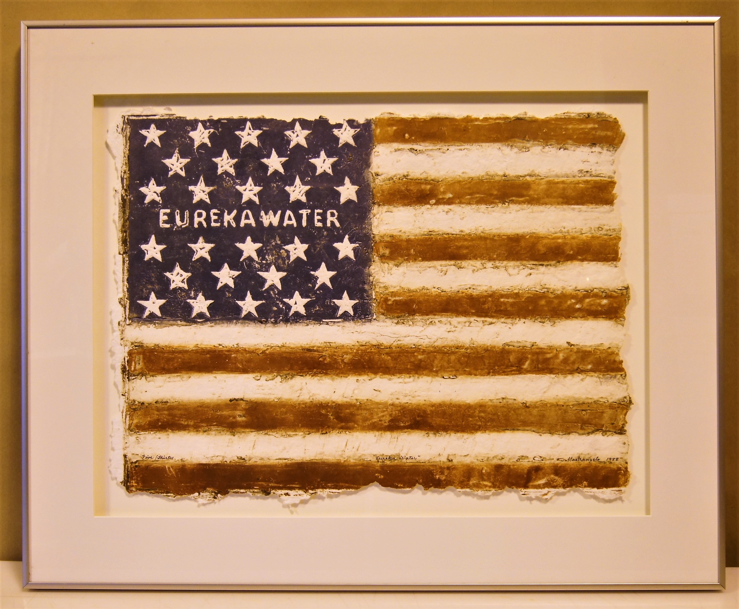
One of my favorites. Eureka Water American Flag.
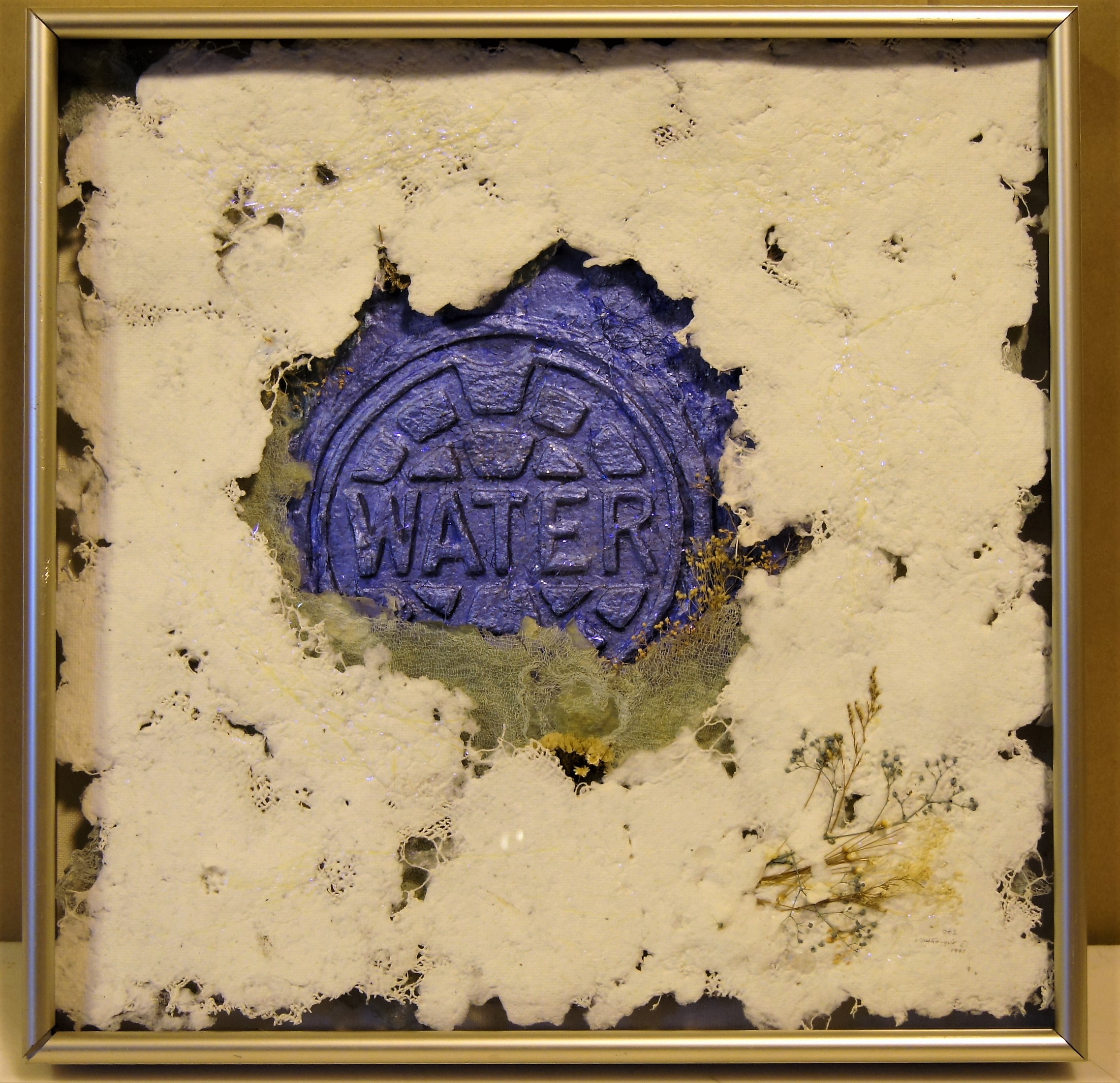
Another favorite. I think this one is called – Sparkling Blue Waters. (Mixed Media Relief) Some of the names I am unsure of. They have been stored at Back River WWTP for about 20 years. The transfer of loan paperwork is a mess.

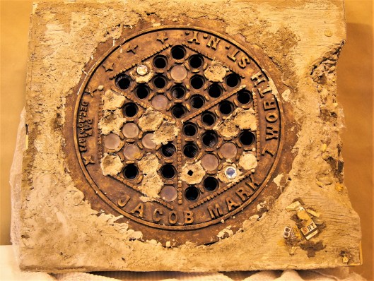
The Great Wall Medallion.
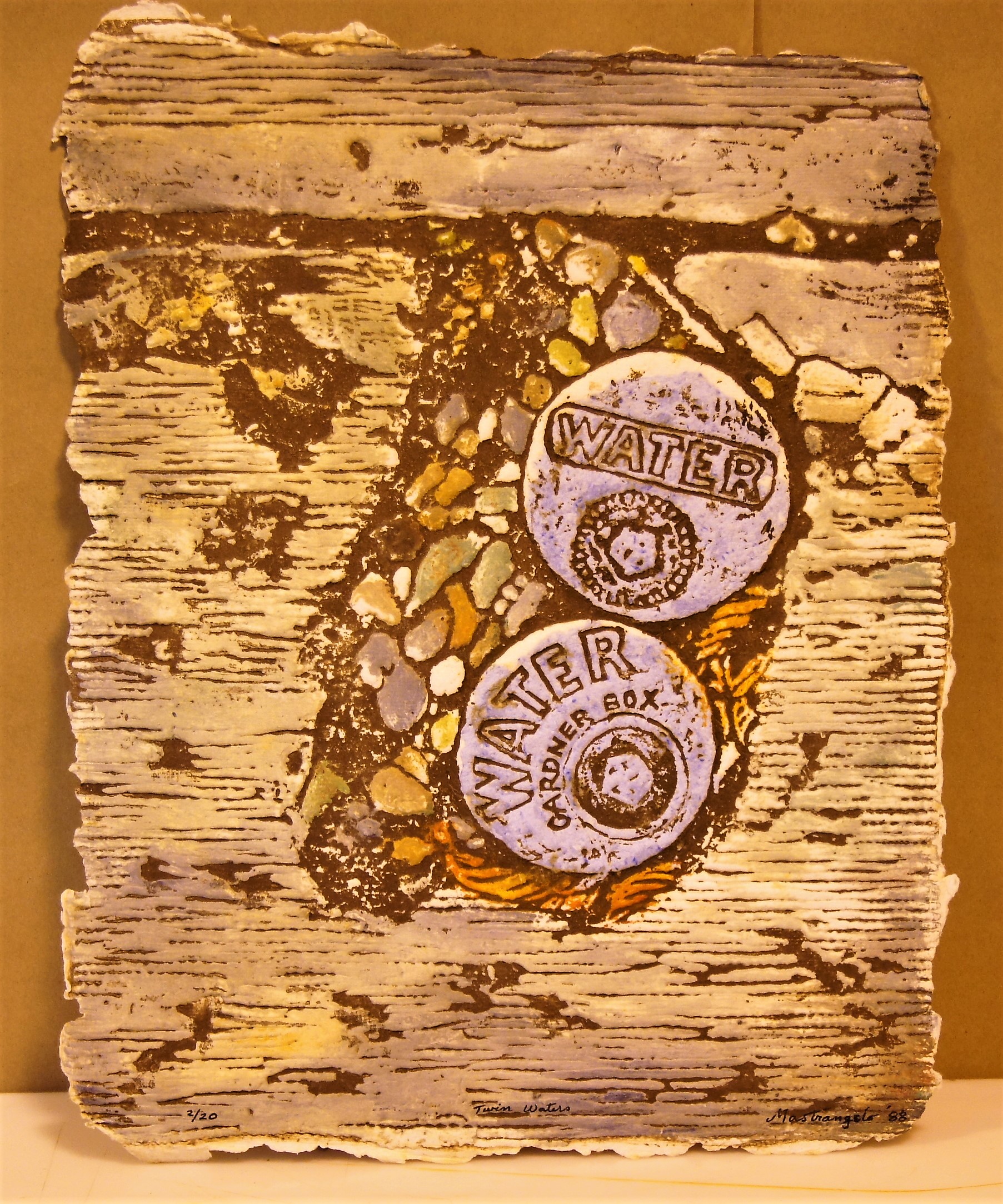
Twin Waters.
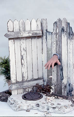
Another sculpture. People Start-Stop Pollution.
A few of these I had trouble photographing. The lights in the building are a mixture of incandescent, sodium vapor and fluorescent. I snapped off 20 before looking at them on the computer and realized they were all really yellow. I brought into work my good camera and messed with the white balance but still had trouble getting it right?? Any tips on this kind of lighting?
Here is Bobbi’s website if you are interested in her work: http://www.grateworks.com/
30 Wednesday Nov 2016
Posted in Hiking, HISTORY, kayaking, Photography
NASSAWANGO IRON FURNACE:From 1828-1850 the Nassawango Iron Furnace was in its heyday. Many workers – miners, sawyers, colliers, molders, draymen, and bargemen – labored to make iron. They gathered bog ore from Nassawango swamp, brought clam and oyster shells up the canal via the Pocomoke River from the Chesapeake Bay, and made charcoal in the Pocomoke Forest. These raw materials were loaded into the Iron Furnace from the top, heated to 3,000 degrees, and the two resulting liquids were drawn off at the bottom of the furnace. Slag was cooled and tossed into the swamp. Iron was poured into molds and loaded onto barges which were towed down the canal by mule to waiting ships for transport to Baltimore, Philadelphia, and New York.

It was closed! Closed on October 31st.
Left there and went to Milburn Landing on the Pocomoke. Glad I don’t have to rake all those leaves!
The landing. A couple reviews I read said it doesn’t get crowded. Kayak time!

After that we found an abandoned golf course – Nassawango. The club house.
Leader board?

I prefer Putt-Putt

But I don’t remember seeing one of these at Putt-Putt? Ball warmer?

Then heading back to the farm we spotted a couple eagles – and this is why I’m not an animals in nature photographer!

Inside the barn. Nice visit with Kathy’s family.
27 Sunday Nov 2016
Posted in nature, Photography
Tags
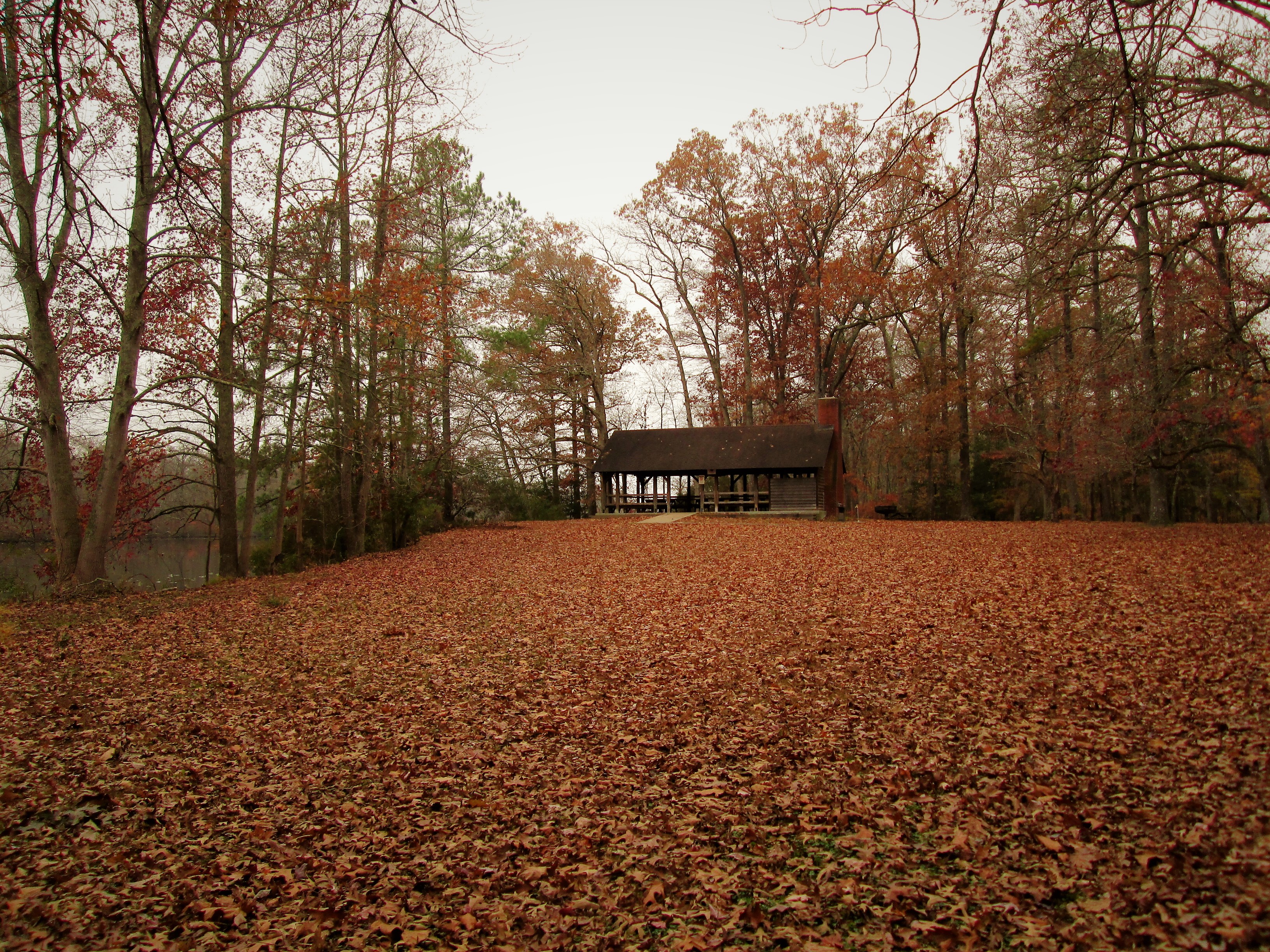
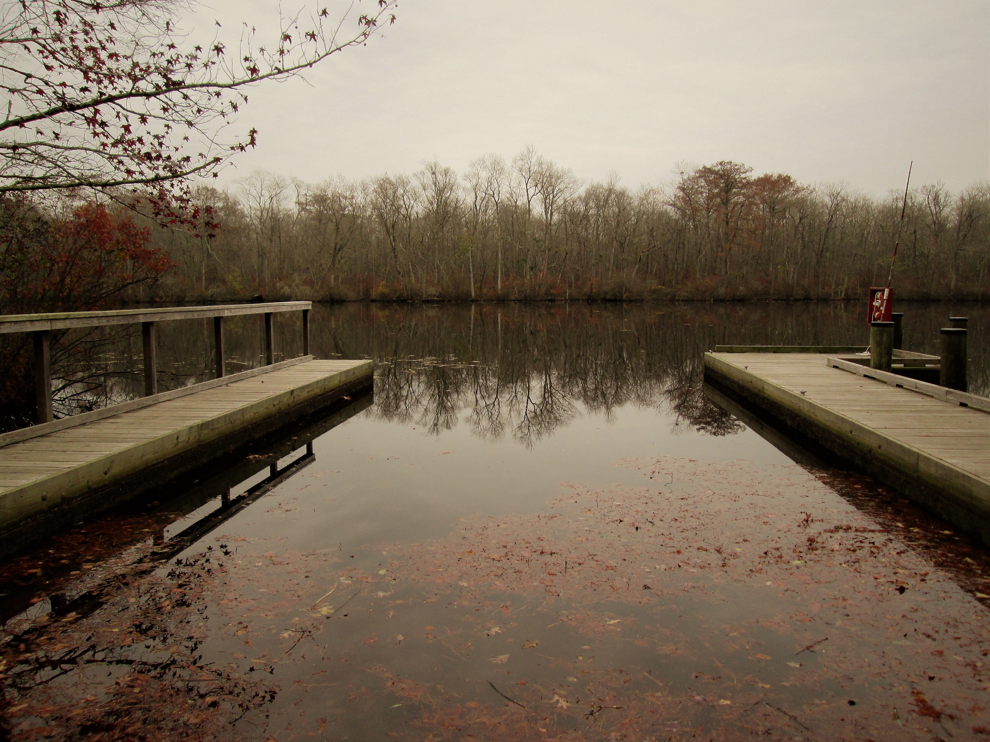
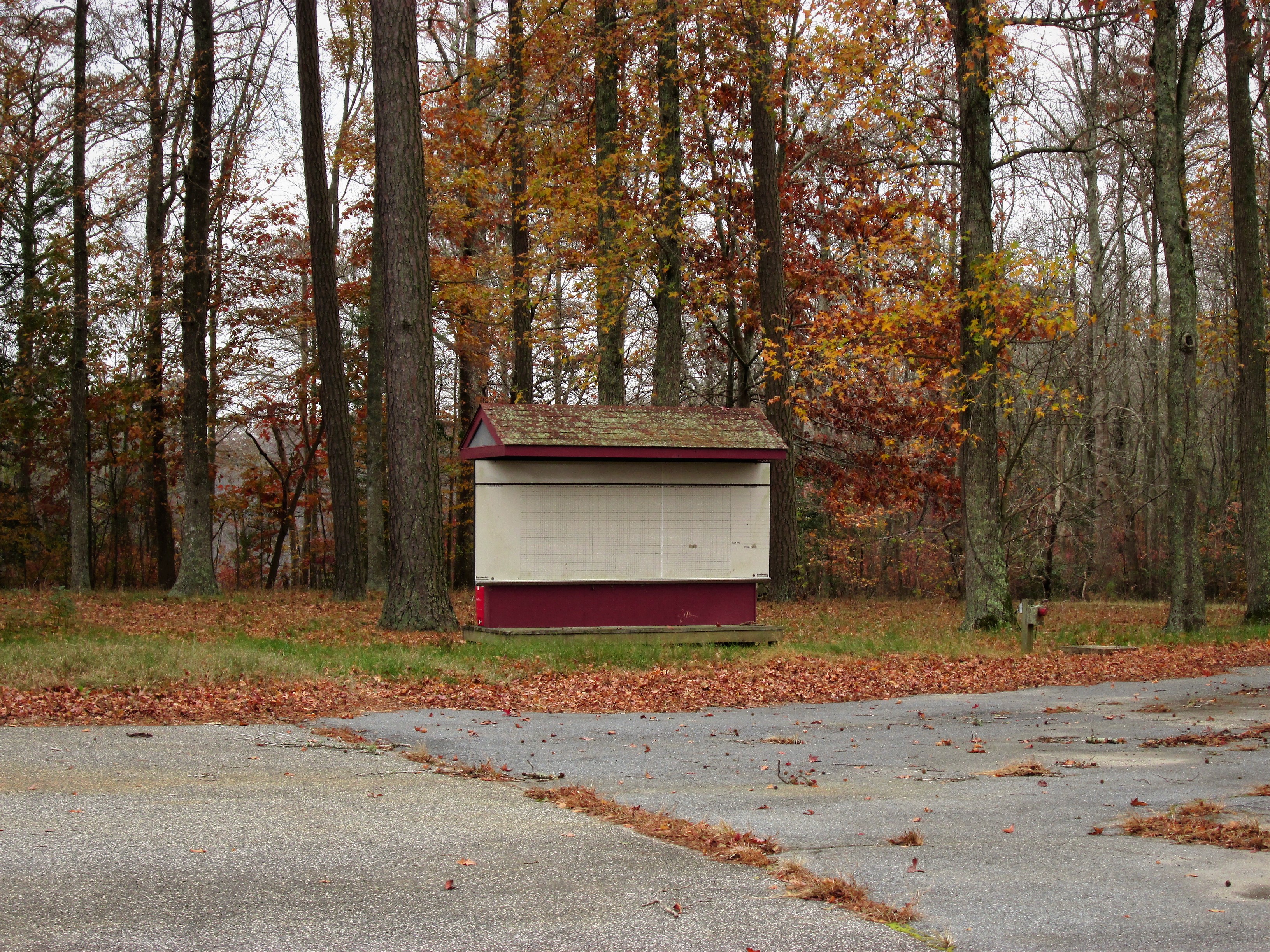
Our last walk in the woods prior to all the hunters showing up.

Deer stand or condo?
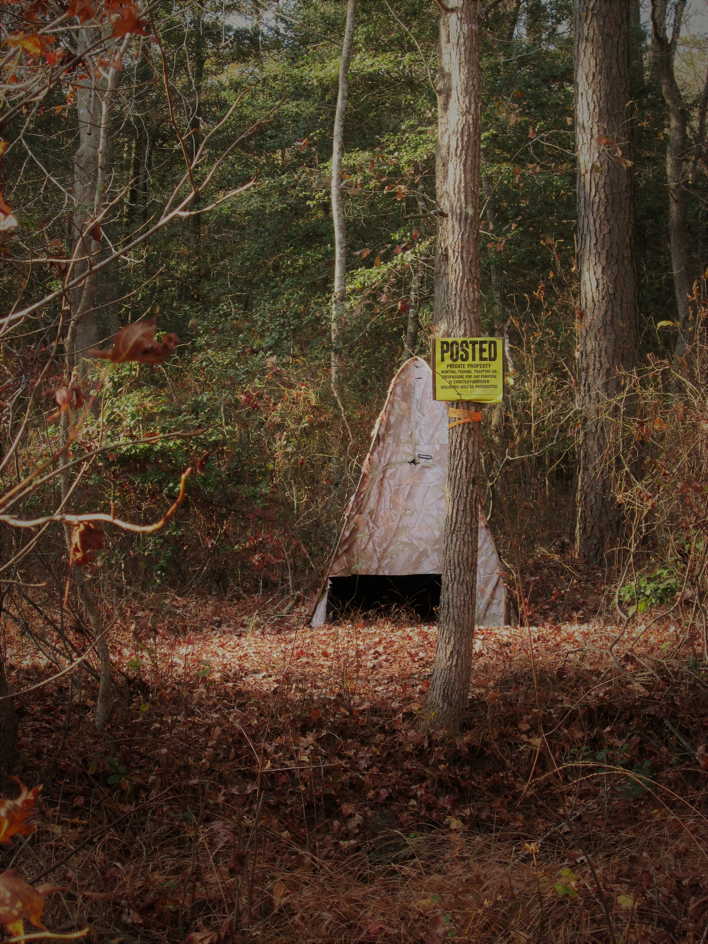
Tee-pee hunting lodge? It is in direct sight of the one above. Wonder if they ever shoot at each other?

Deer trap ahead – corn laying on the ground.
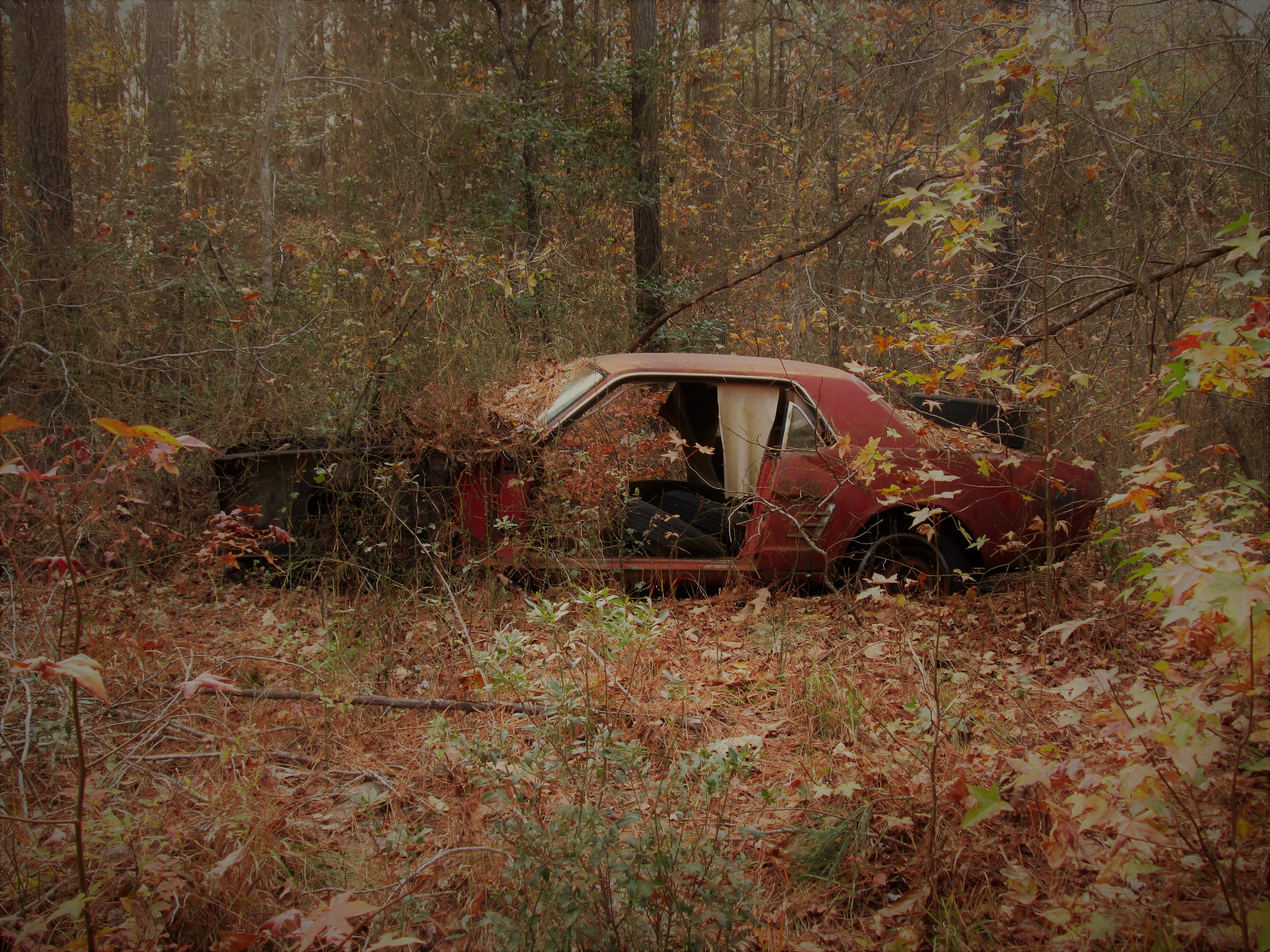
Someone shot a Mustang by mistake and left it there

Path next to the farm property. I personally do not hunt but I do understand why the land owners allow hunters on their property. The deer will totally destroy the crops and everything else that is edible.

The old barn.
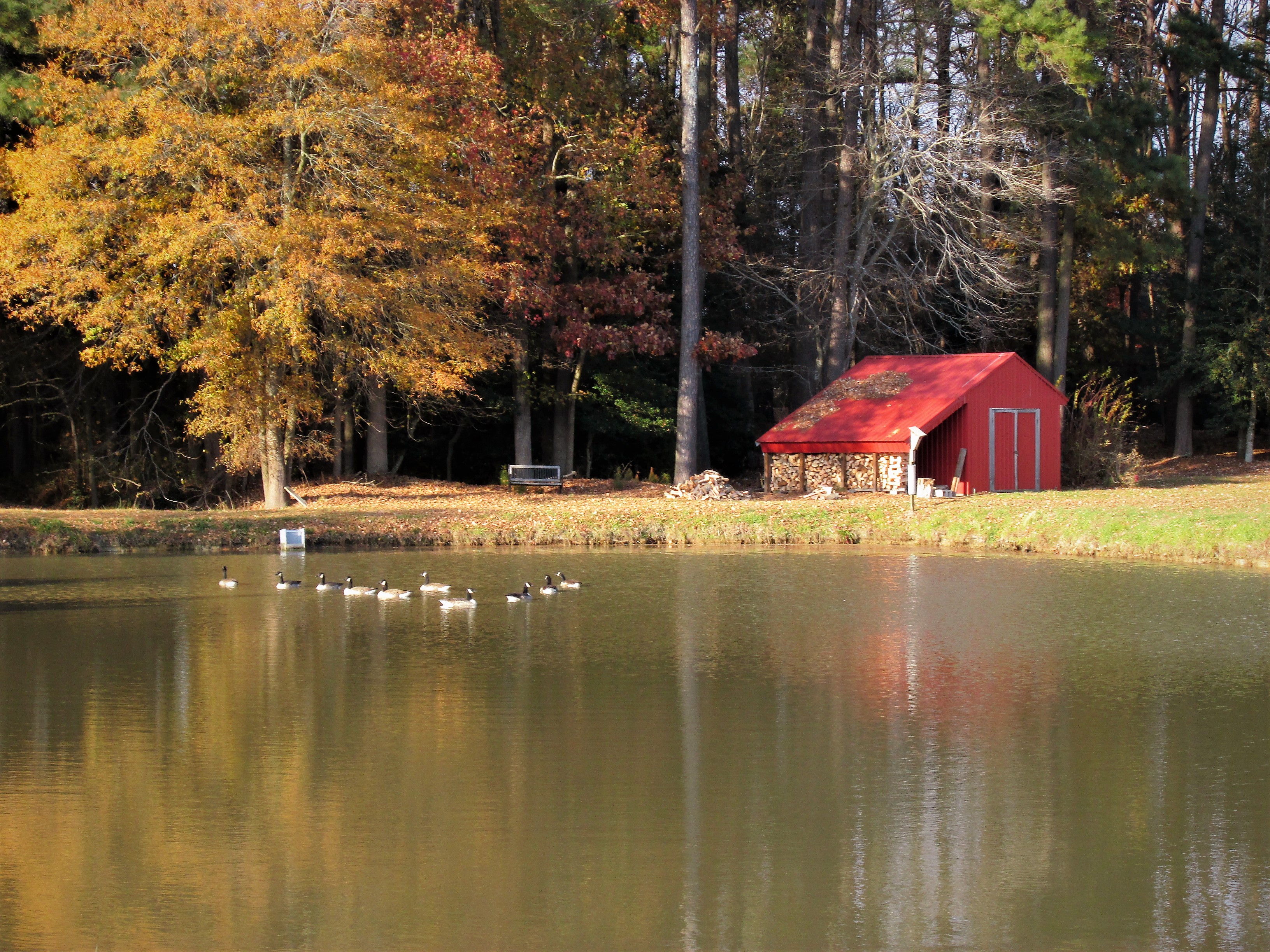
Pond and woodshed

Wind powered pump.
A couple of these photos I used a filter called sunscreen. Gives a softness to the pics that I like.
