Tags
Baltimore, engineering, FILTRATION, Lake Montebello, Montebello, photography, Public Works, water history
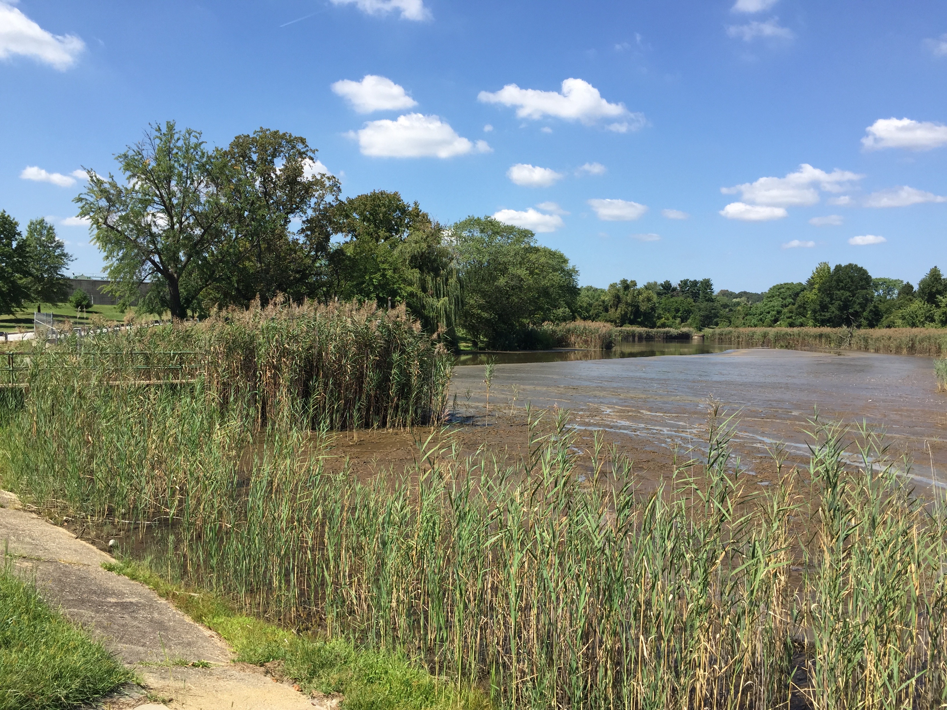
The contract has been completed. Here are the before and after photos.


05 Monday Dec 2016
Posted in Baltimore, filtration, water history
Tags
Baltimore, engineering, FILTRATION, Lake Montebello, Montebello, photography, Public Works, water history
The contract has been completed. Here are the before and after photos.
02 Friday Dec 2016
Posted in art, Baltimore, Photography, Sewage History
When not doing my regular job, I document archives and museum objects. Recently thinking of my retirement in a few years, I started to wonder what will happen to most of the stuff I have stored in a large garage at work. Most of the water archives were almost thrown out many years ago, but I stashed them away for a couple decades. So, with my leaving, what will happen to it? No one really knows or knows what to tell me. Some of the artwork doesn’t even belong to the City, so I decided to get in touch with the artist to see what they wanted me to do with it.
First up is Bobbi Mastrangelo who has a collection of manhole cover art. Both sculptures and art prints. I found her thru a Google search and we have been in contact for the past couple weeks. She will see first how to relocate the work and if she has no luck, I will ask around to see who may want to display or purchase the works. Below is a sampling of her work.

One of my favorites. Eureka Water American Flag.
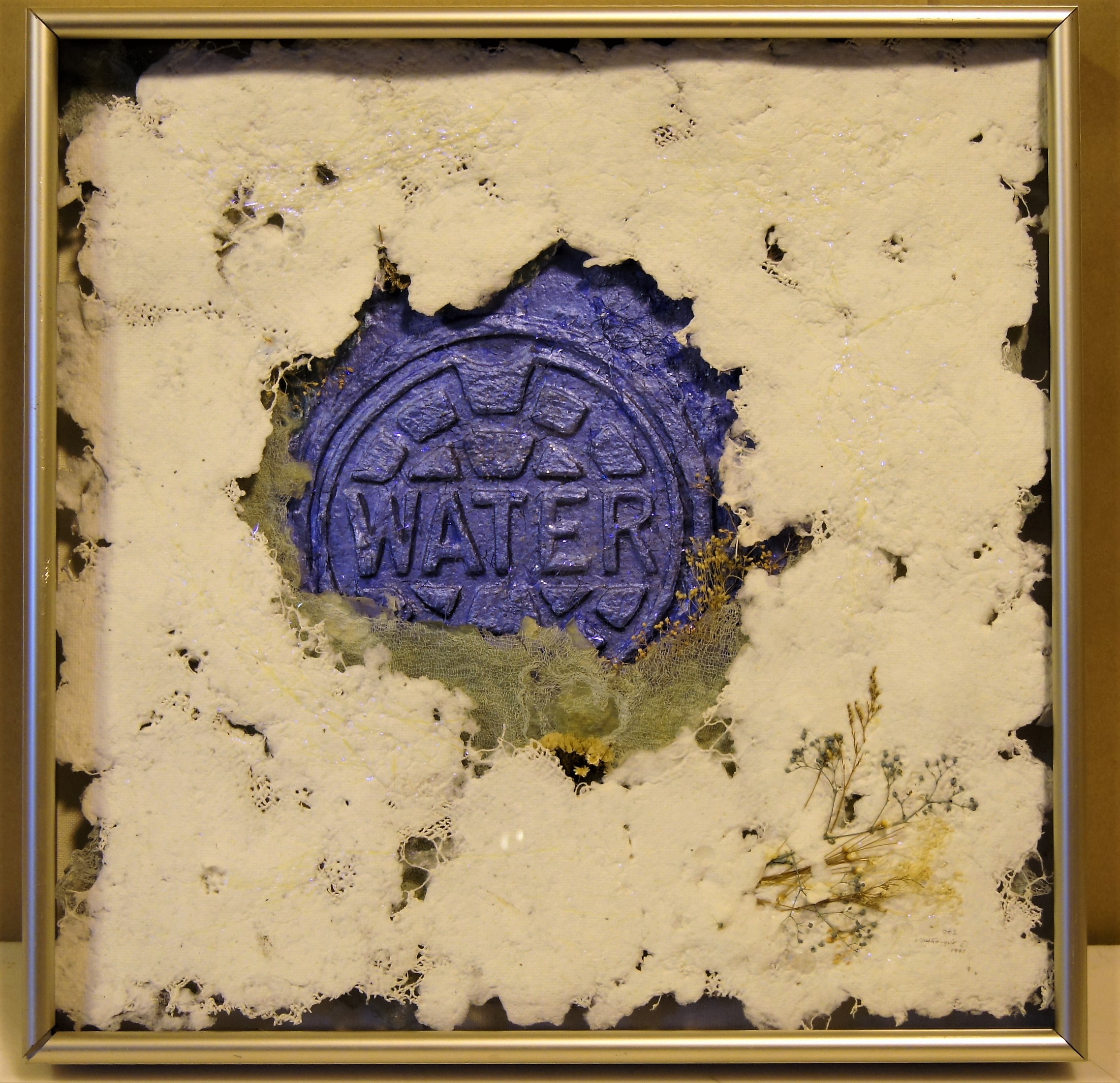
Another favorite. I think this one is called – Sparkling Blue Waters. (Mixed Media Relief) Some of the names I am unsure of. They have been stored at Back River WWTP for about 20 years. The transfer of loan paperwork is a mess.

The Great Wall Medallion.
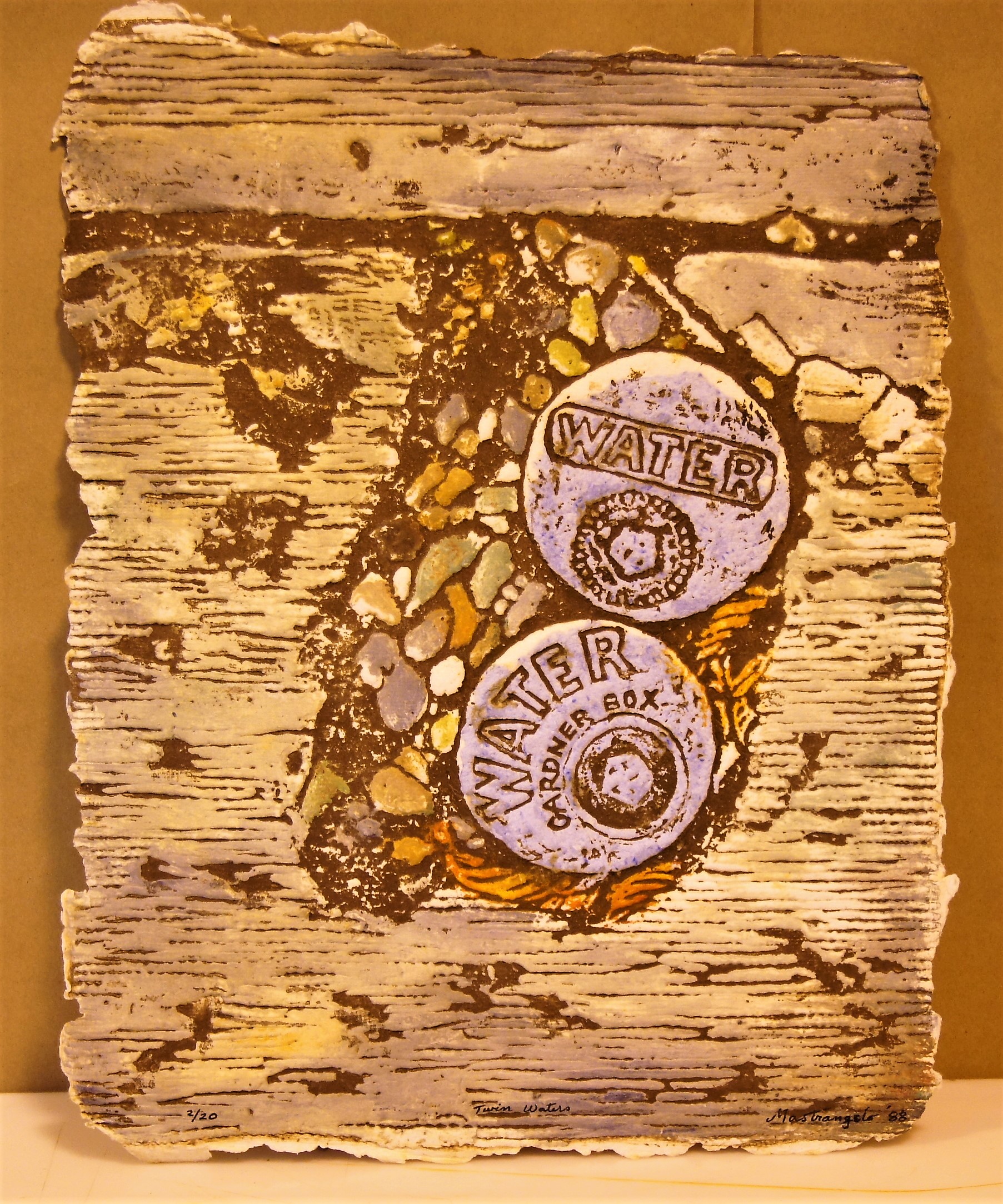
Twin Waters.
Another sculpture. People Start-Stop Pollution.
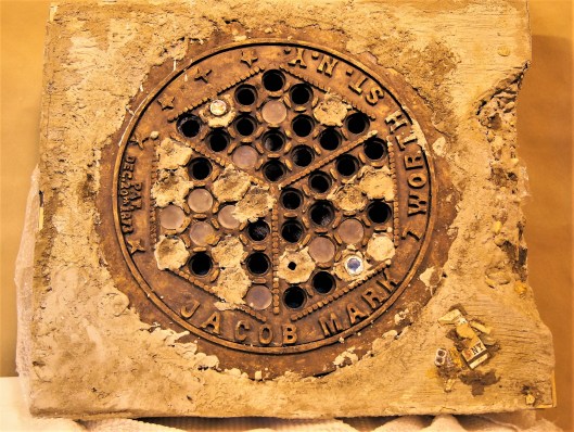
A few of these I had trouble photographing. The lights in the building are a mixture of incandescent, sodium vapor and fluorescent. I snapped off 20 before looking at them on the computer and realized they were all really yellow. I brought into work my good camera and messed with the white balance but still had trouble getting it right?? Any tips on this kind of lighting?
Here is Bobbi’s website if you are interested in her work: http://www.grateworks.com/
23 Wednesday Nov 2016
Posted in Baltimore, water history, Writing
Tags
Baltimore, engineering, FILTRATION, fluoride, Gunpowder Falls, Health, HISTORY, Lake Montebello, Montebello, POLITICS, Public Works, Research, water, water history, writing
Ok, time to order now for Christmas! Nothing like a little self promoting during the Holiday Season. (Thanks to the person(s) that bought 3 copies this month! My sales report does not list the buyers so I have no way to know who to thank)
These books are cheaper on Amazon than they are on the publisher’s pages. ALL proceeds from the sale of these books goes to Water For People.
This first book is a crazy story about Chuck and Gary and the misadventures that happen because of the fluoride in their toothpaste! I think this may have been an LSD induced novel. But more likely comes from all the research I did concerning the subject that I didn’t know what else to do with!
This next one is about, well, it’s about what the title says it’s about. Taken from the journals of the building inspectors. Ten miners killed in an explosion – called an accident, but I don’t think so…

And this last one is also about what the title implies. Over 400 pages of more information you will probably ever need concerning water history. Plus a bunch of tidbits thrown in.
21 Monday Nov 2016
Tags
Baltimore, bridges, engineering, Floods, HISTORY, Lake Montebello, Montebello, Public Works, water history
I was not the only one asked for information concerning Herring Run. All this info is for a walking tour on Black Friday. This instead of Mall Madness. Another submission of info:
The design for the Pedestrian Bridge at Sinclair Lane began in 2010 with final greenway plans dated on January 31, 2014. The bridge was designed by Wheeler in Bloomington, Minnesota and fabricated by Big R Bridge in Gresley, Colorado. A new pedestrian bridge was built in close proximity to Sinclair Road since the new ten foot wide greenway trail could not be accommodated using the existing Sinclair Road bridge. Also, the new pedestrian bridge location was selected to span the narrowest portion of the Herring Run Stream and the bridge length was determined to not encroach the Herring Run Stream’s 100 year flood elevation and cross over the existing DPW utility sanitary and 84” water pipes.
This info got me thinking about various reports I had read recently. Not concerning a 100 year flood, but about what would happen if the dam gave way at Montebello Lake??
August 2000 – Danger Reach Study for Lake Montebello MD Dam #107. Prepared for DPW, Bureau of Water and Wastewater. Has a lot of graphs, charts and data. ‘What if’ scenario of a dam failure at Lake Montebello, between Harford Rd and the Park. The consultants do not believe the water would go over the Harford Rd bridge, but under. They do believe it would overflow four feet above the Belair Rd bridge at Herring Run. It would overflow Manasota by two feet and Brehms lane by four feet. Sinclair Lane would be two feet under water. It would follow a path all the way to Moore’s Run. The dam is 600 feet long, 60 feet wide at top and 31 feet tall.
From the Emergency Action Plan 2016: Lake Montebello is an earthen dam built in 1880 as a water supply reservoir for the city of Baltimore. It contains approximately 410 million gallons of water, with a maximum storage of 606 million gallons. If the dam fails, this is what will be read by Emergency Management:
“Lake Montebello Dam, MD Dam No. 107, located northeast Baltimore City is failing. Repeat. Lake Montebello Dam, Dam No. 107, located northeast Baltimore City is failing. If you are in or near this area, proceed immediately to high ground away from Herring Run Park. Do not travel on the following roadways: Parkside Dr., Shannon Dr., Pulaski Hwy, North Point Rd, Bowleys Ln, Harford Rd, Mannasota Ave, Belair Rd and Sinclair Ln, in the vicinity of Herring Run Park. Avoid all residential roadways near the Park located in northeastern Baltimore City. Travel away from Herring Run Park. Avoid all residential roadways near the park. Do not return to your home to recover your possessions. You cannot outrun or drive away from the flood wave. Proceed immediately to high ground away from the area.”

The dam in question is to the right of the lake. Shows the Harford Road bridge to the far right.
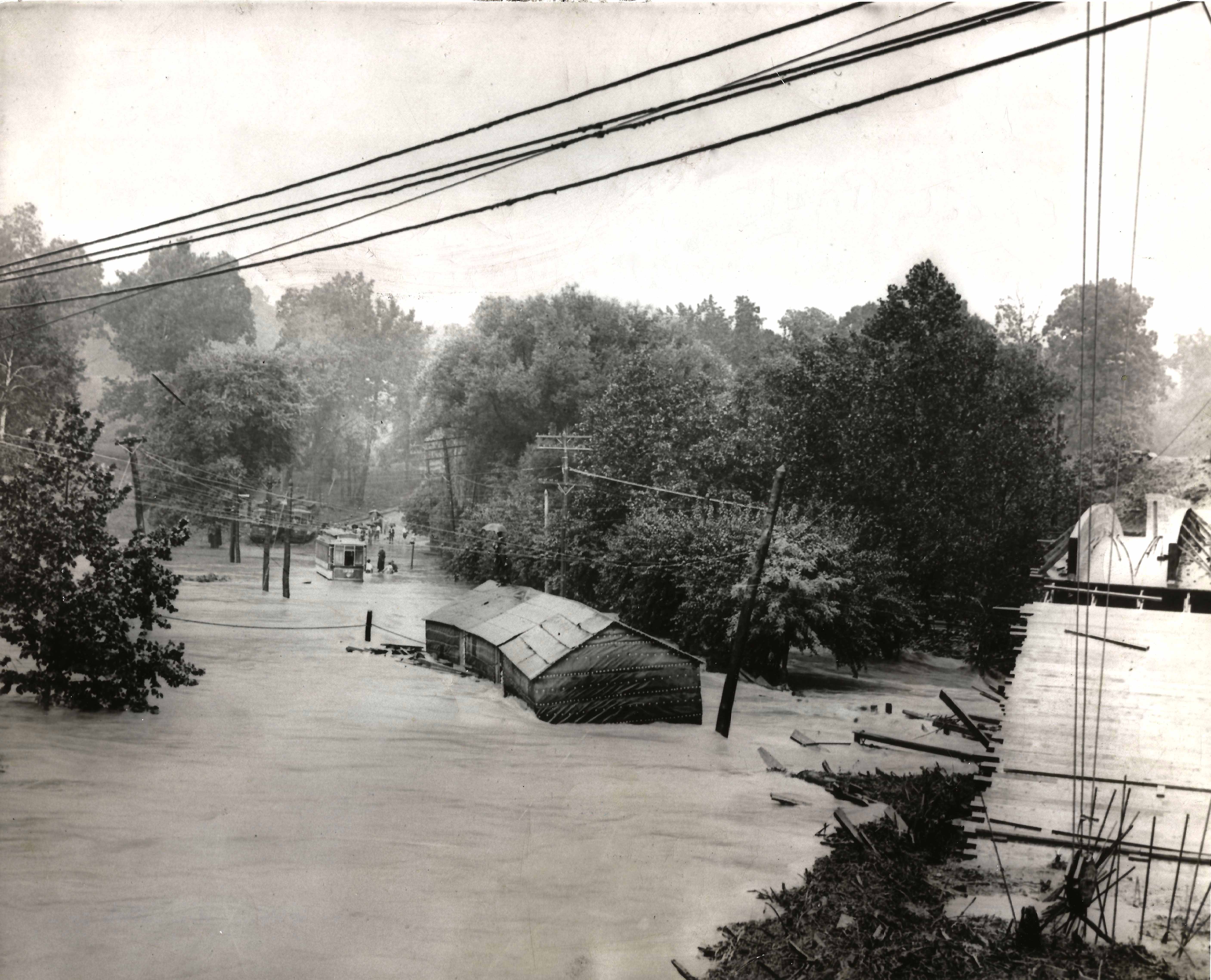
This is how a rain induced flood looked many years ago, Harford rd. bridge to the right.

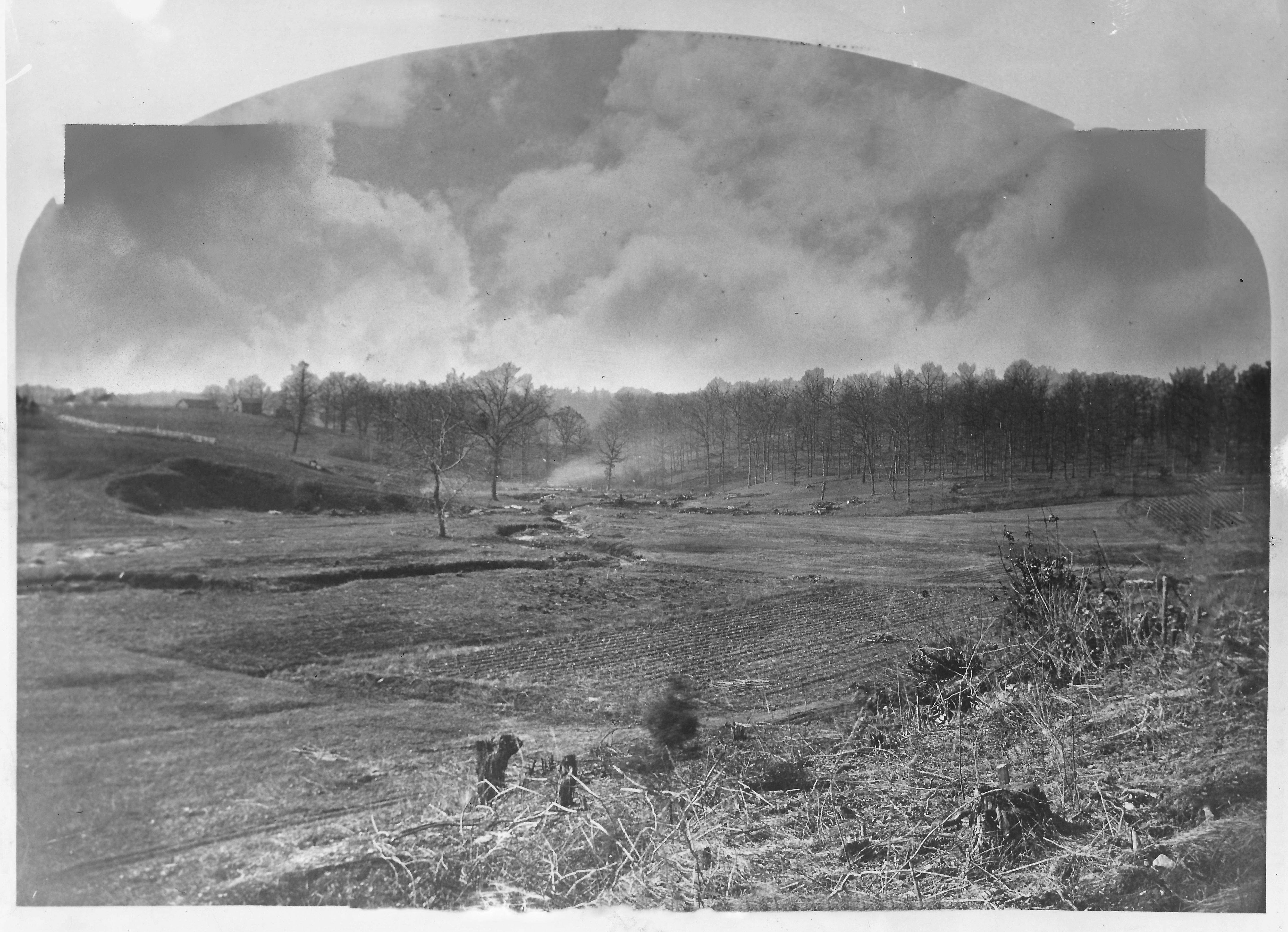
Belair road bridge would be flooded 4′ above roadway.

Brehms Lane bridge – would also be 4′ under. (Note: Bridge no longer looks like this and there are no longer any horse rides in the park)
17 Thursday Nov 2016
Posted in Baltimore, HISTORY, water history
Tags
Baltimore, engineering, glass plate negatives, Gunpowder Falls, HISTORY, Lake Montebello, Montebello, Public Works, Research, water history, writing
I was recently asked to do a brief history for the Friends of Herring Run Park, concerning the history of DPW activity in the park. More specifically – What is up with those concrete structures in the park that have pipes sticking out of them? They are air relief vaults for the Susquehanna pipeline. So, instead of a brief, one line answer, I decided to give them a Readers Digest version for the building of the Susquehanna pipeline.
As in most cases, when doing basic research, I always get distracted with other history facts I find. The story of my life (Well, the story of my life is another book I wrote, which is out of print. Too many people disagree with what I wrote about MY life and MY memories. I did however see a copy on Amazon for $354.00! Ha!)(See what I mean about getting distracted!!)
Anyway, I came across the below 1854 report that mentions Herring Run as a possible source of water for the City of Baltimore. If not a source, then possibly build a reservoir there. The author of the report, Alfred Duvall, who signs the report as a ‘Practical Engineer’ also suggests a reservoir on Tiffany Run, which is a stone’s throw away from Herring Run. By 1875 they decided on Tiffany Run for the new reservoir, that would be filled via tunnel from Loch Raven.

Duvall’s 1854 report. Interesting read.
Tiffany Run, prior to the 1875-1881 construction of Lake Montebello

Lake Montebello soon after construction. Gatehouse to the left received water from Loch Raven, where a dam was built during the same years.
13 Sunday Nov 2016
After 5 days my daughter finally got to go home today. The surgery was a success. Now for the road to recovery. I thank those who sent prayers. And thanks to most of the staff at Hopkins. They were very caring and helpful. On different days, I roamed around to see what I could see. I like the older hospital section best.
The evening sun brightening up the old building.
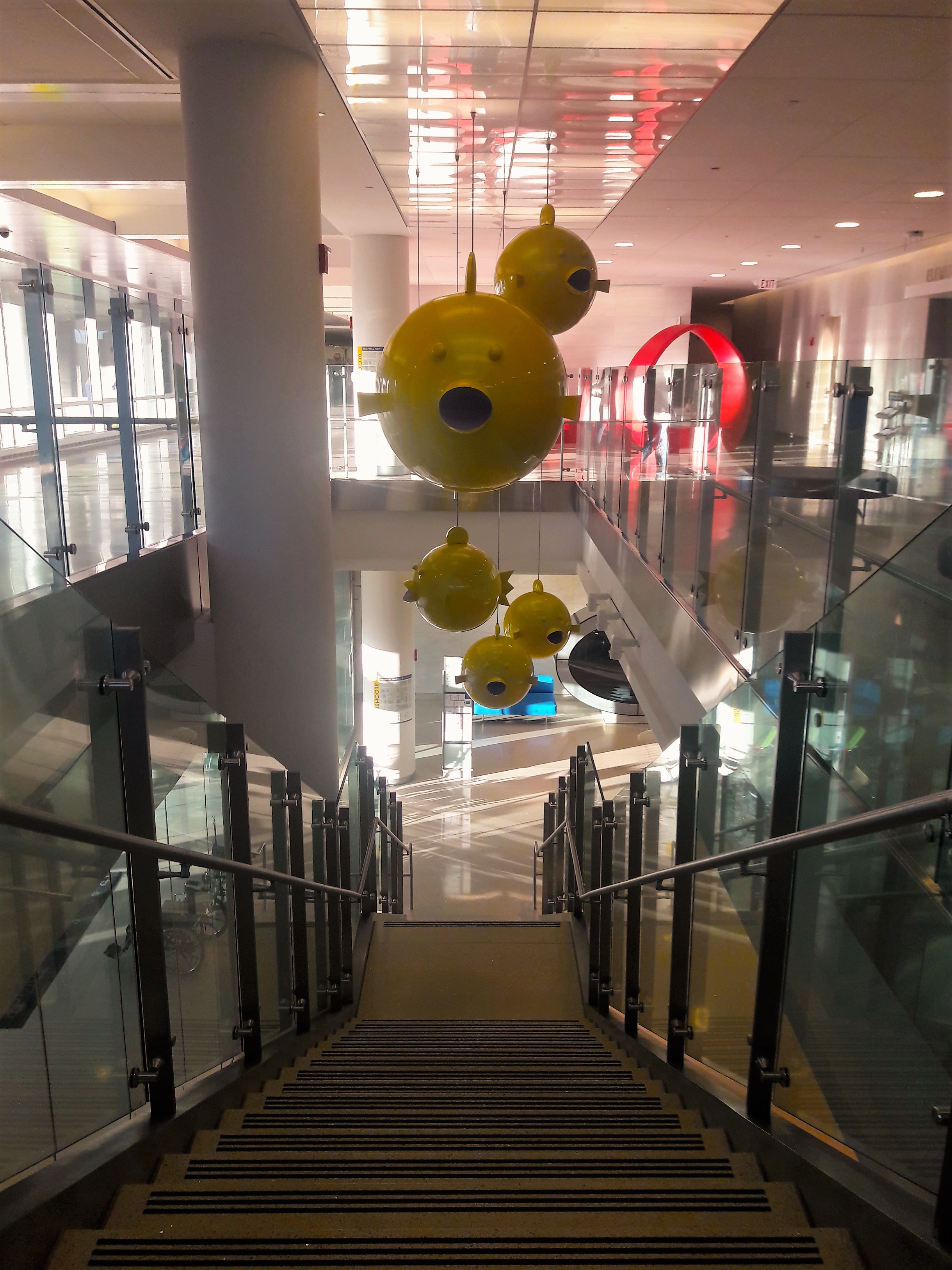
One of many walkways that connects the various sections together. Nice hike.
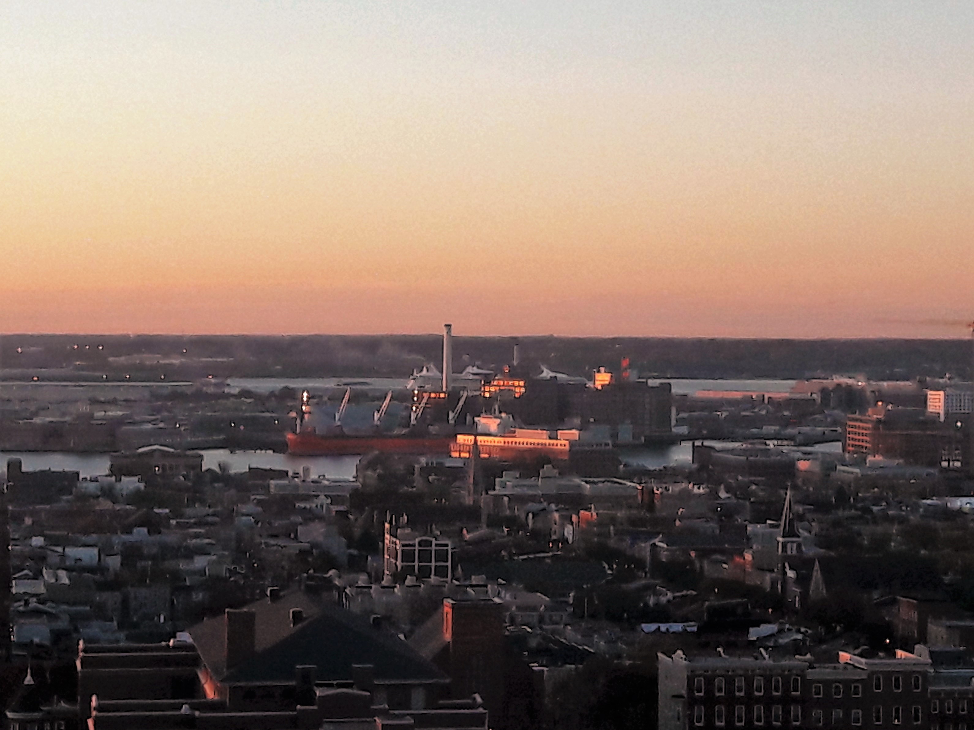
I see a cruise ship back there – that will be Kathy and I in a few months.
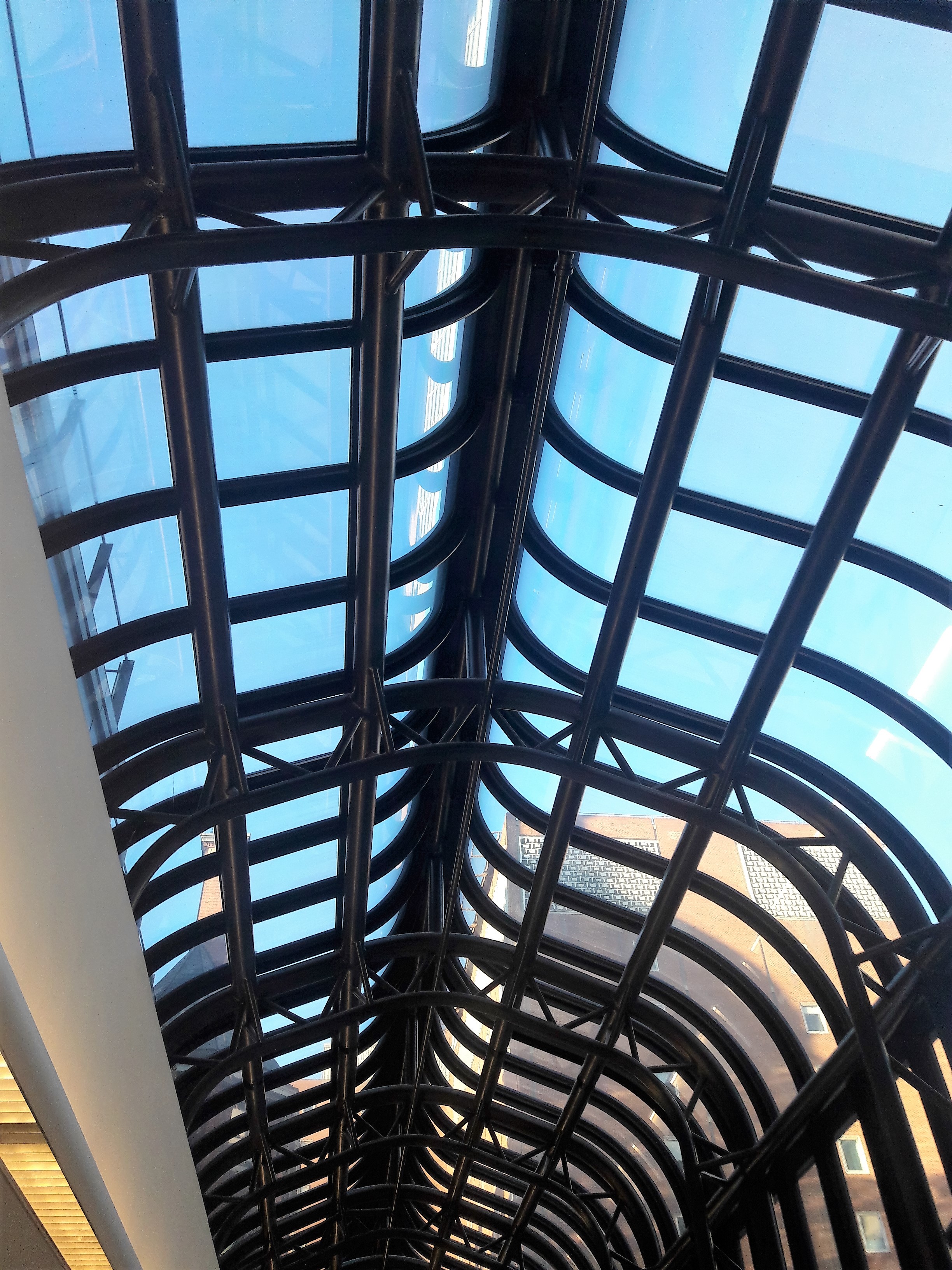
Levels of the dome.
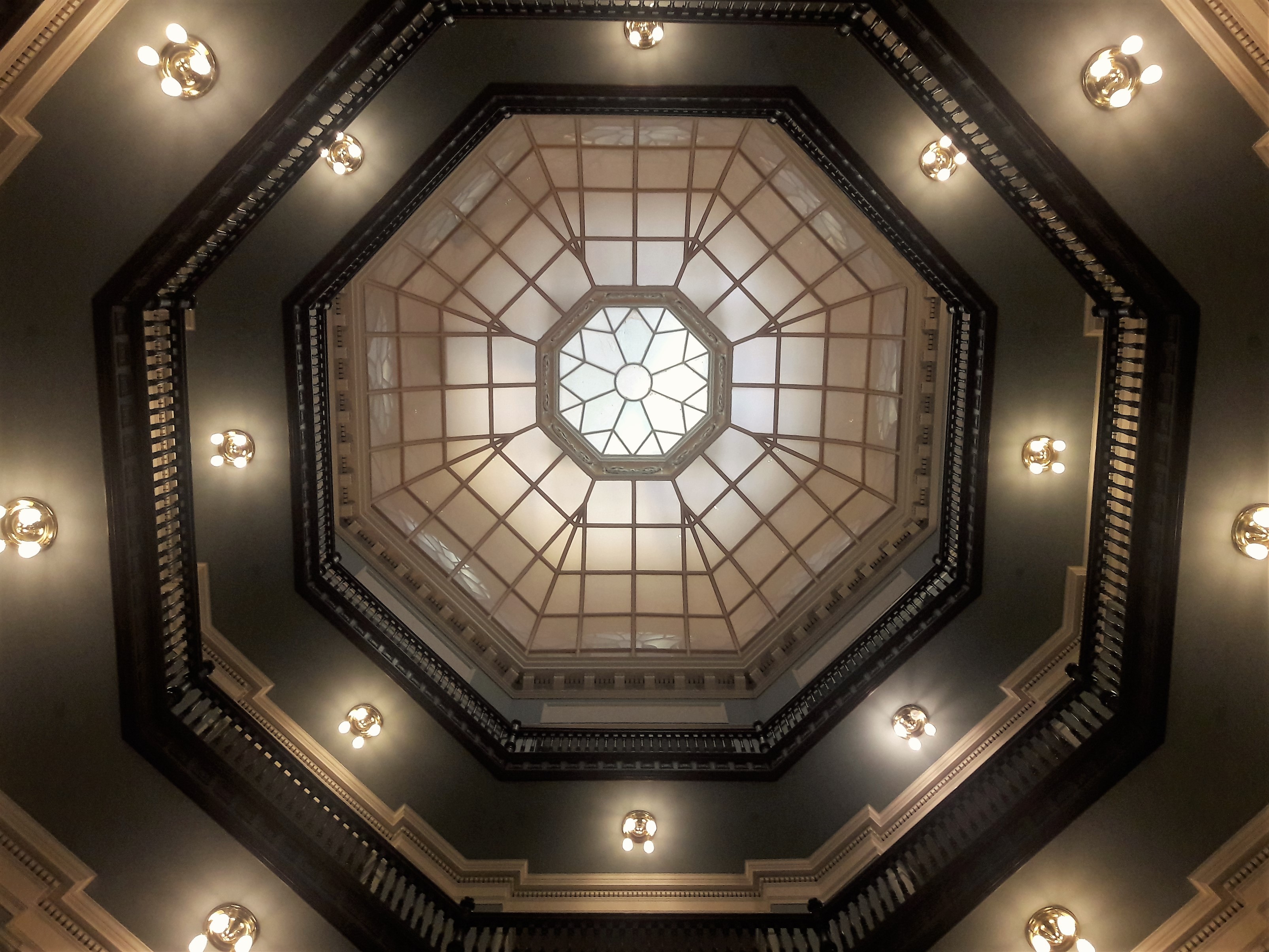
Looking up at the dome. They pretty much let you walk all over the place in here. I was only stopped once – security thought I had a drone controller in my hand.
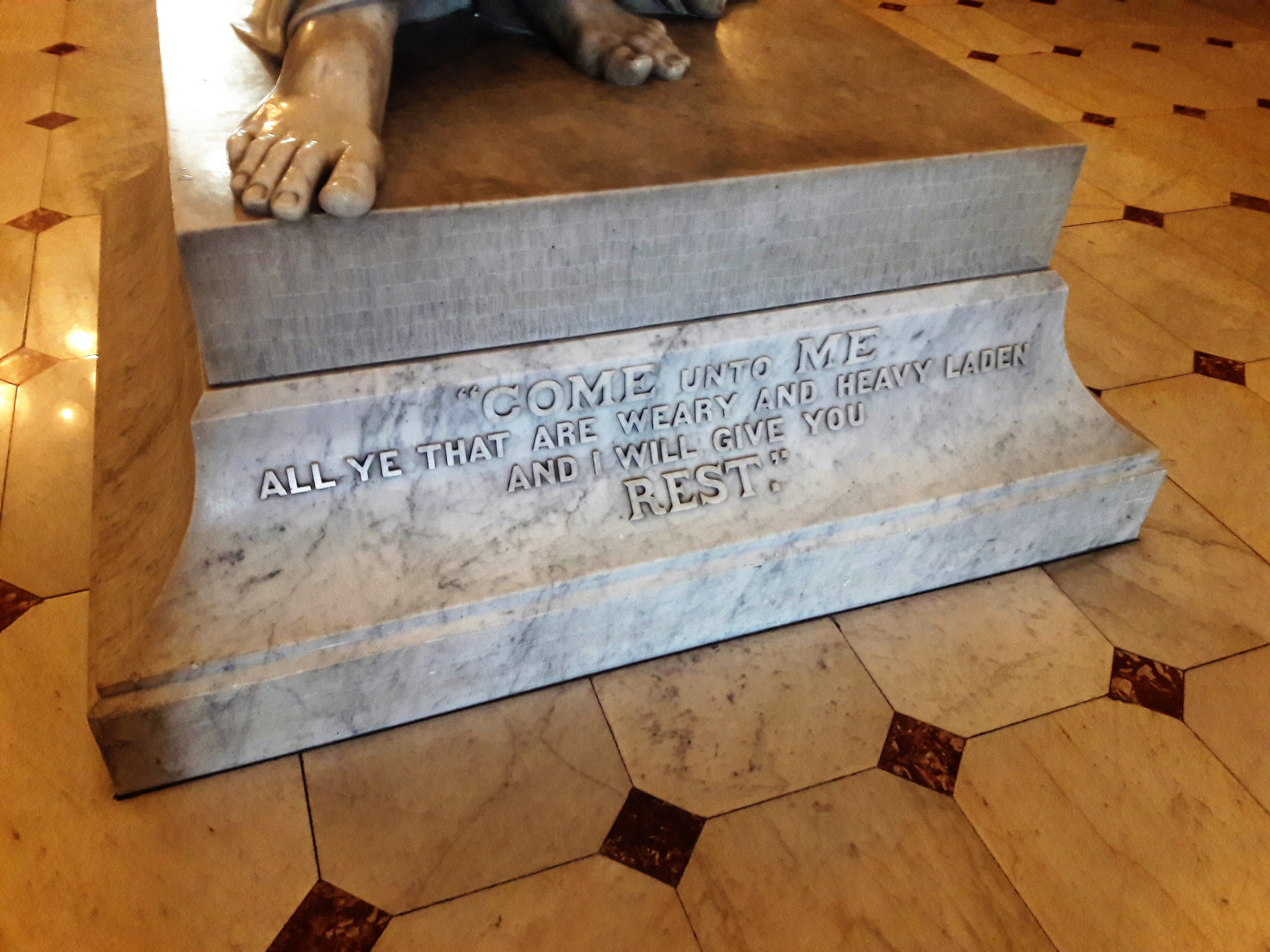
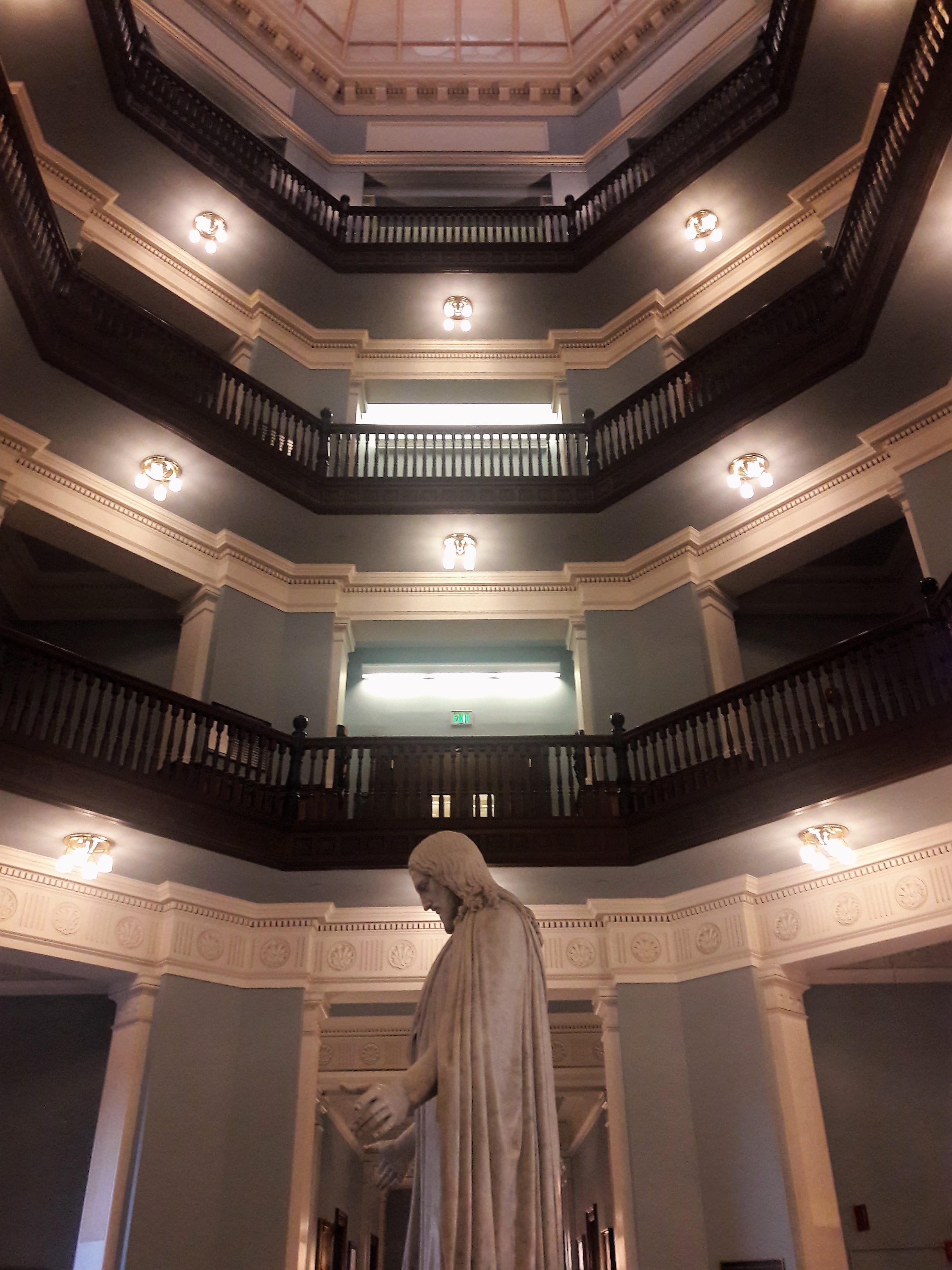
I was told that Jesus’ foot is worn down by all the people that touch it for luck – I guess like the bronze turtle at College Park – I think it worked better for my daughter than it did this weekend for the football team!!

Terps at Byrd Stadium
In the children’s hospital
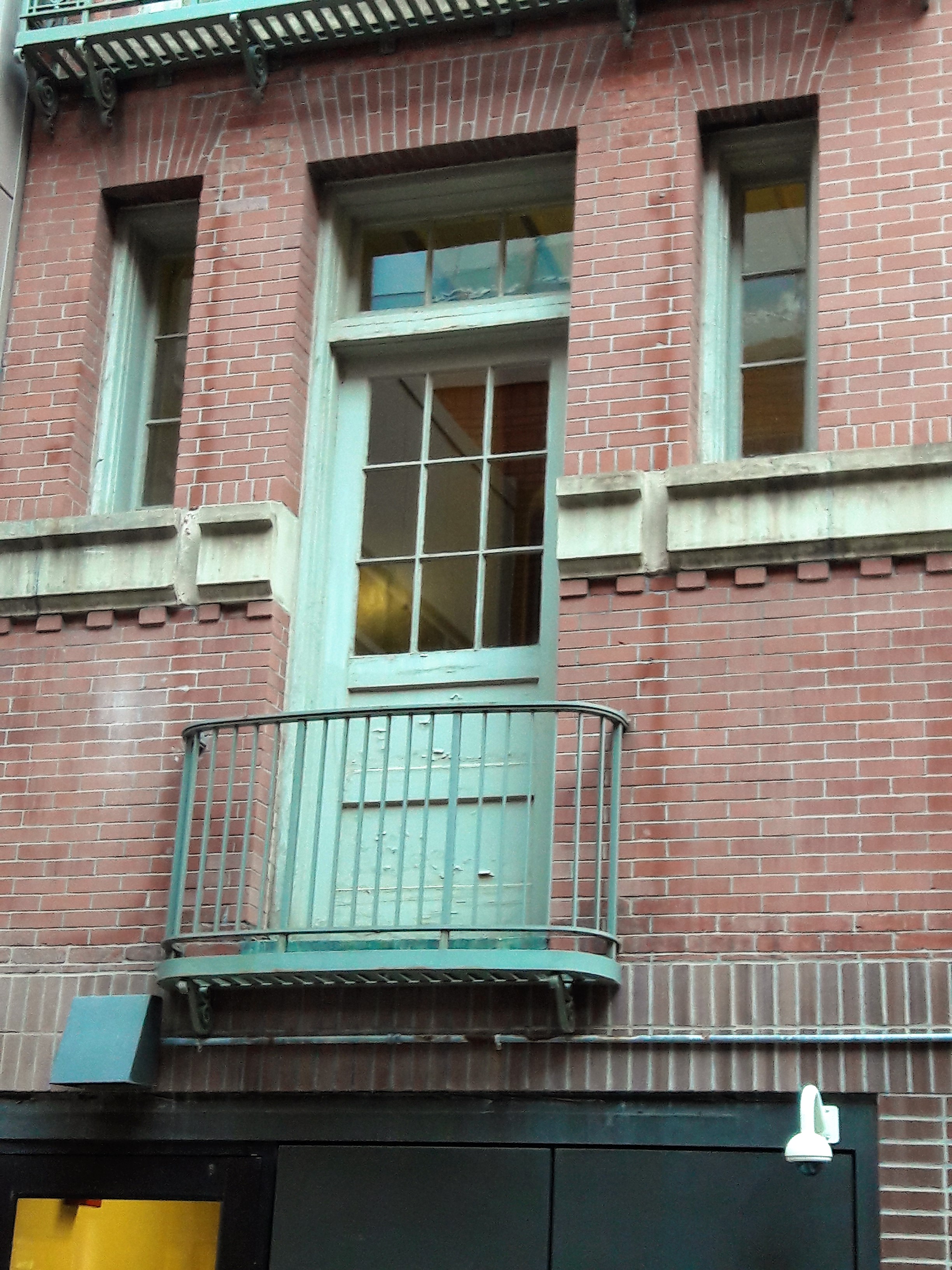
Nice balcony.
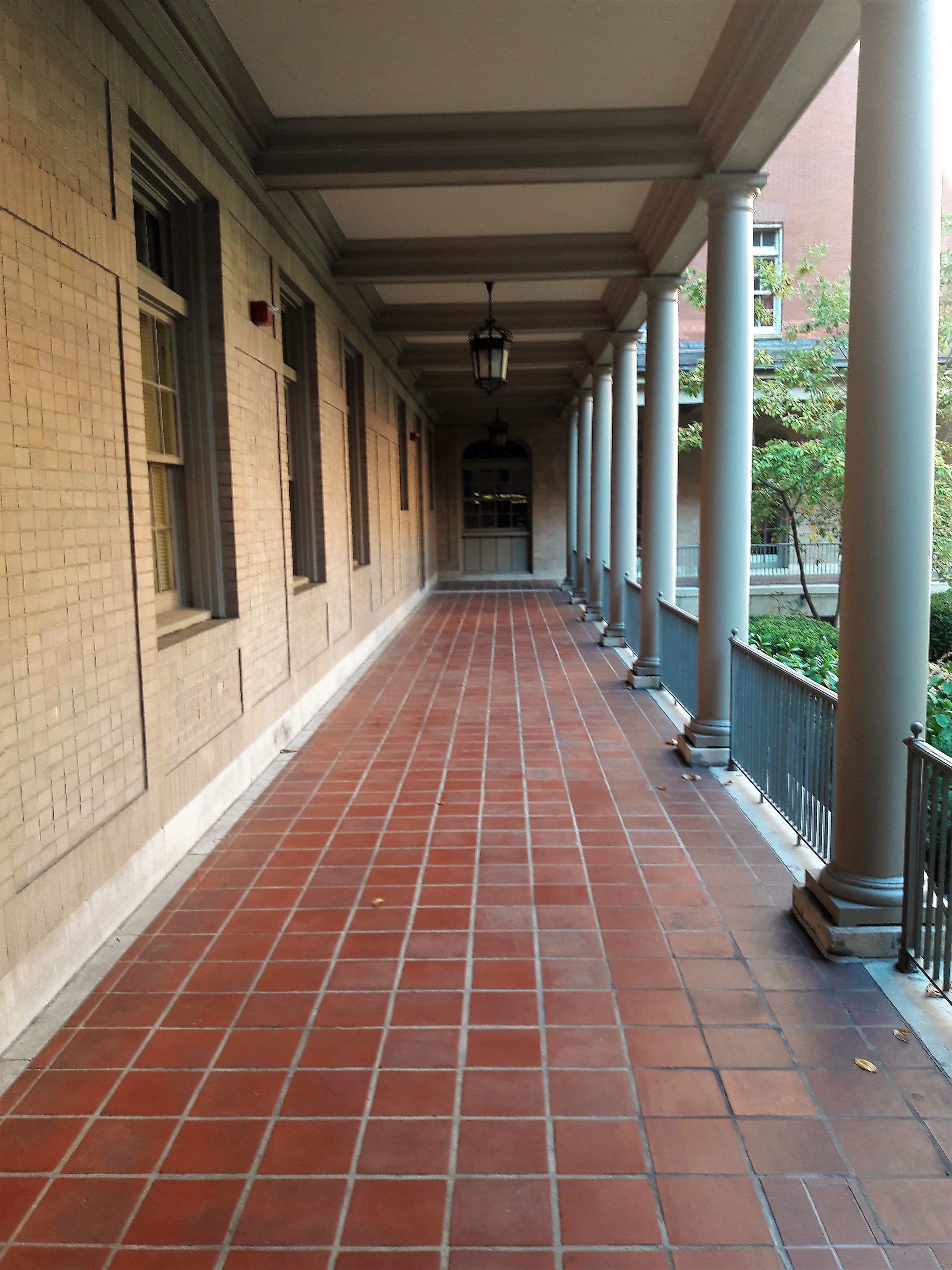
Reminds me of a fort
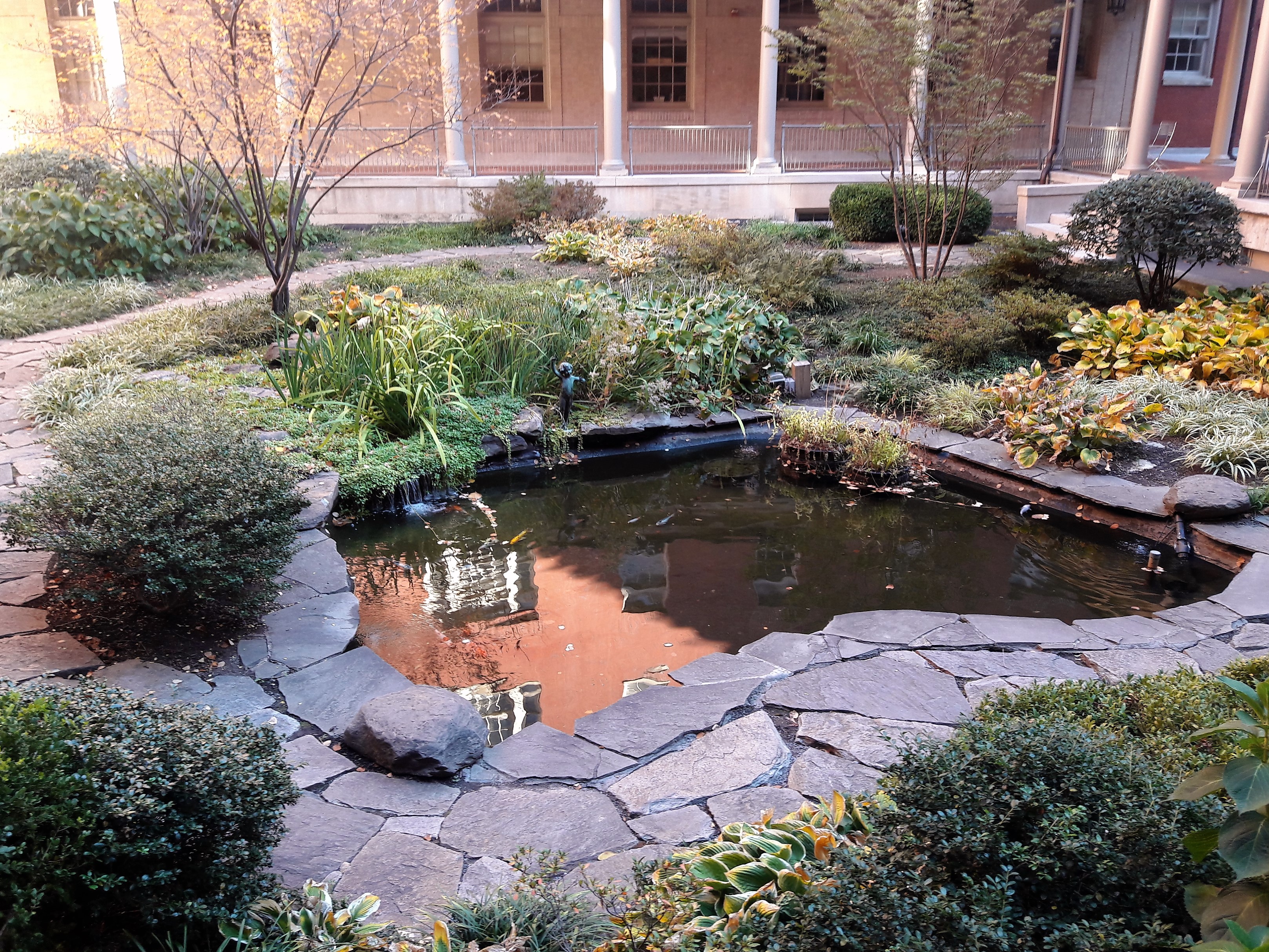
Nice little pond and garden
No plaque. Maybe the first source of water for the hospital when it was built?
My daughter was very strong through all this, considering what was involved. Thanks God!!
31 Monday Oct 2016
Posted in Baltimore, Hiking, water history
Tags
Baltimore, boats, engineering, FILTRATION, Hiking, HISTORY, Lake Montebello, Montebello, Public Works, water history
Checking on the contractors the other day, I saw that they had pretty much cleared most of the shoreline…nice day for a hike around the lake.

Started on the SW side looking towards Morgan State University.

Headed up to the far end, closest to Hillen Road. The old surge shaft from Loch Raven is to the right. The dredge and barges could not get this far up.

Looking down from on top – the sludge. This is a by-product of what goes on in the filtration plant. Lots of sand at this point. The sand is used to filter the drinking water and when the filter becomes clogged, we backwash it. Unfortunately the pressure from backwashing pushes sand into the drain and ends up here.

More sand and sludge.
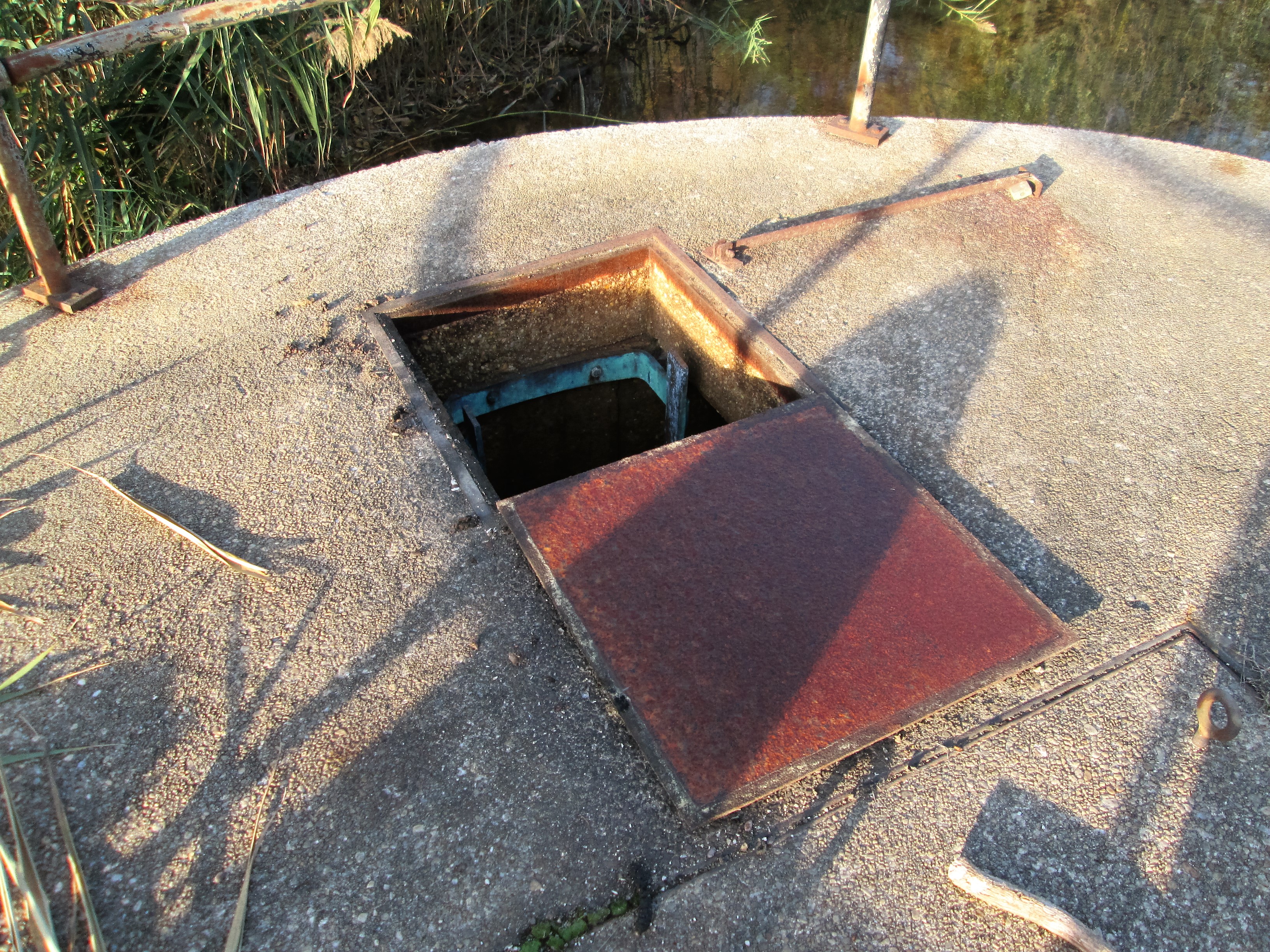
Since I was up here, I figured I would look down the hatch. The contractor had some concerns about getting too close to this structure. He said they could see a pipe that I told them to stay away from.

The pipe coming thru the wall at the top, is laid in the waste lake bed. It is about 10′ under the water surface. Although capped off, it would still cause problems if broken. I was supposed to climb out of this shaft a while ago…after an inspection of the old 1880 Loch Raven tunnel. (5-1/2 mile hike). Cancelled due to safety concerns.

Heading down the NE side. Watching the small barge and excavator get as close as he can.

The large excavator and barges. These barges are only about 5 feet tall. They displace only 2 feet of water. That just amazes me.

Soon, we will be testing pumps up on Deer Creek. This will be water from the Susquehanna River. It is very dirty water so we will just dump it instead of letting it go into the plant. See that tower in the background? That is the Susquehanna Surge shaft. When the DC pumps come on and the water flows 36 miles to this point, closing the valves to not let it in, well, the water has to go somewhere. It goes up that shaft and then out thru the drain you see to the left of the boat. 50-60mgd. The dredging should be done by then and their equipment removed. If not, they better tie that stuff down!

Continuing my hike down the shoreline.

Some spots were a little rough to navigate across.
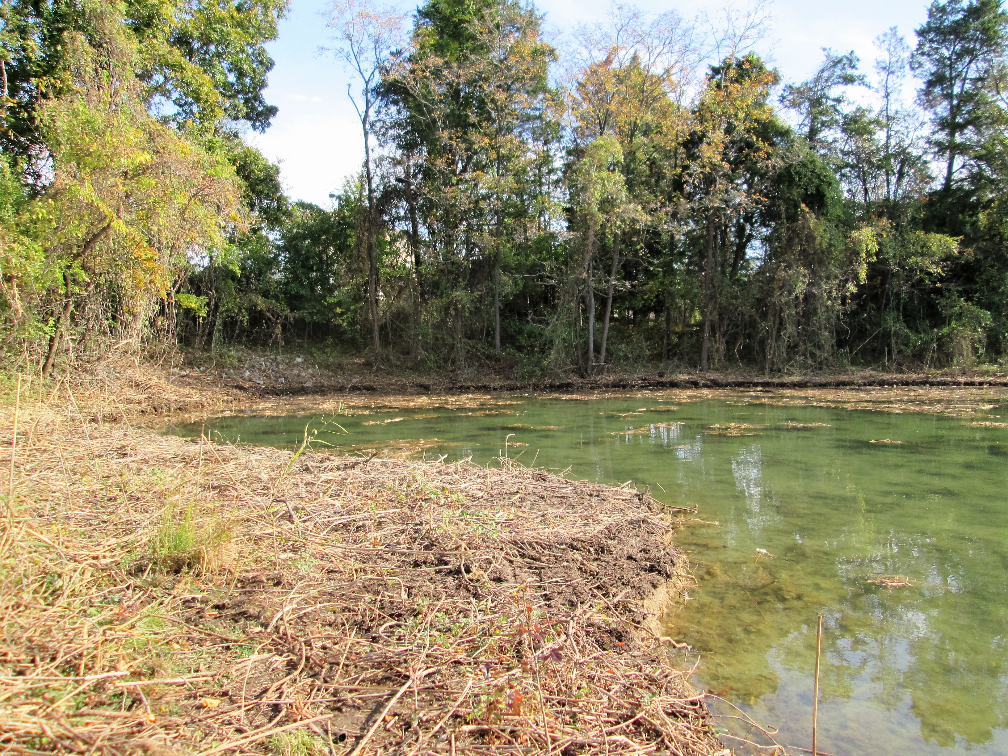
Here is that cove I mentioned in an earlier post. Deer tracks everywhere.

The 4 million dollar problem – already rearing its head in the warm sun!
24 Monday Oct 2016
Posted in Baltimore, engineering, HISTORY, water history
Tags
Baltimore, engineering, FILTRATION, HISTORY, Lake Roland, Montebello, POLITICS, Public Works, water, water history
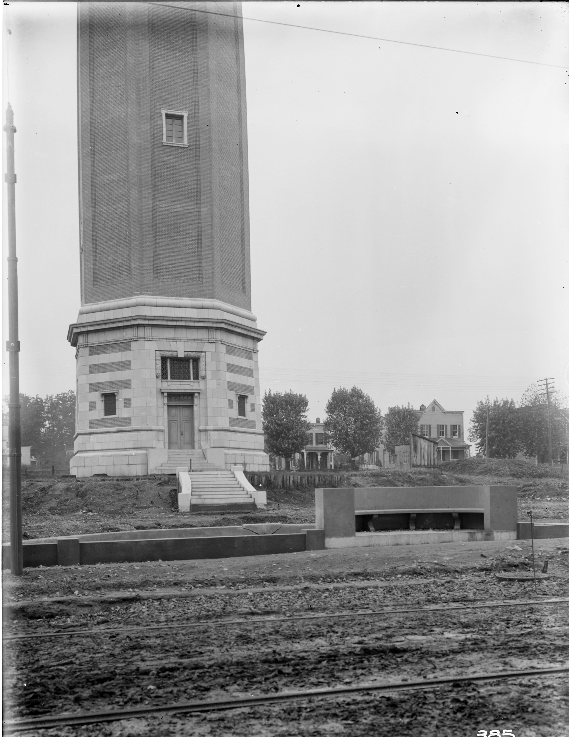
Received an email – you know the kind – a city resident has a complaint, goes to their City Council Person, goes to the Director of Public Works, goes to my boss – who sends it to me to investigate: The area around the Roland Water Tower is the site of 24/7 drug dealing activity. Shouldn’t this complaint have gone to the police? Being the good employee that I am, I went to investigate. For a 24/7 drug spot, the grounds looked clean and I saw only 2 people, walking their dogs. My mission was to see if there was any available electricity for new lighting? There are already 5 street lights surrounding the property. I could not get inside the tower itself to see if there was electric. I doubt it.
Time for a history lesson: The Tower was built, according to the bronze tablets, between 1904 and 1905. According to my records the contract was awarded to two contractors – one for the steel tower and one for the brick enclosure. Then later, another contractor for the concrete pool and steps.

The steel stand pipe being built by Tippett and Wood.
The brick enclosure by John Stack. The steps and pool by the Andrew Co.
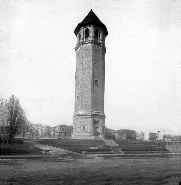
The finished tower.
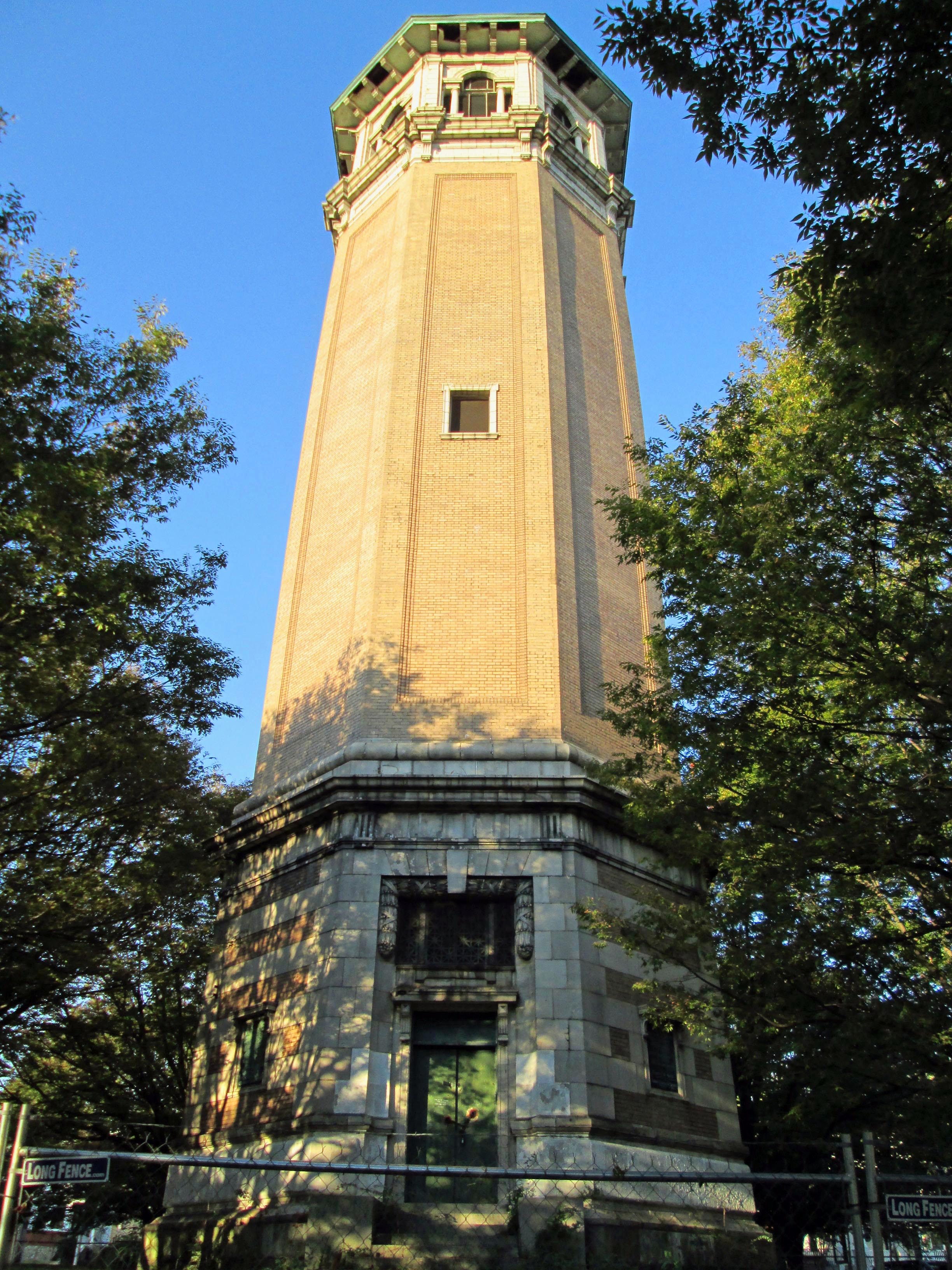
As it looked this morning. There is a fence around it, which I was able to go through.

Pieces of the tower are falling down. This is the purpose of the fence – to keep people out and to keep people away from the falling pieces.
The tower held about 213,000 gallons of water that it received from Druid Lake. The design was by William Fizone, who also designed the Montebello Filters. The pool has been filled in. In 1939 the Water Board turned the property over to the City Comptroller. In 2009 and again in 2011 consultants were hired to figure out what to do with this abandoned tower. It had a couple times been turned over to the Roland Park Community Association, who tried to raise funds to restore it. And it still sits – a magnet for the druggies and dog walkers.
21 Friday Oct 2016
Posted in 1972, Dams, engineering, Floods
Came across this Sun Paper photograph showing, what it says on the back, that all 53 gates of the dam were opened during the storm. It doesn’t look like all 53 are opened. In a 2008 interview, a former Conowingo Employee, Elder Silvercloud tells us that many of the flood gates wouldn’t open. They were stuck. Another article I read said they were going to dynamite a portion of the dam to relieve pressure? In 2011 another storm caused them to open 43 gates. For more info, Google Search Conowingo Dam Agnes.
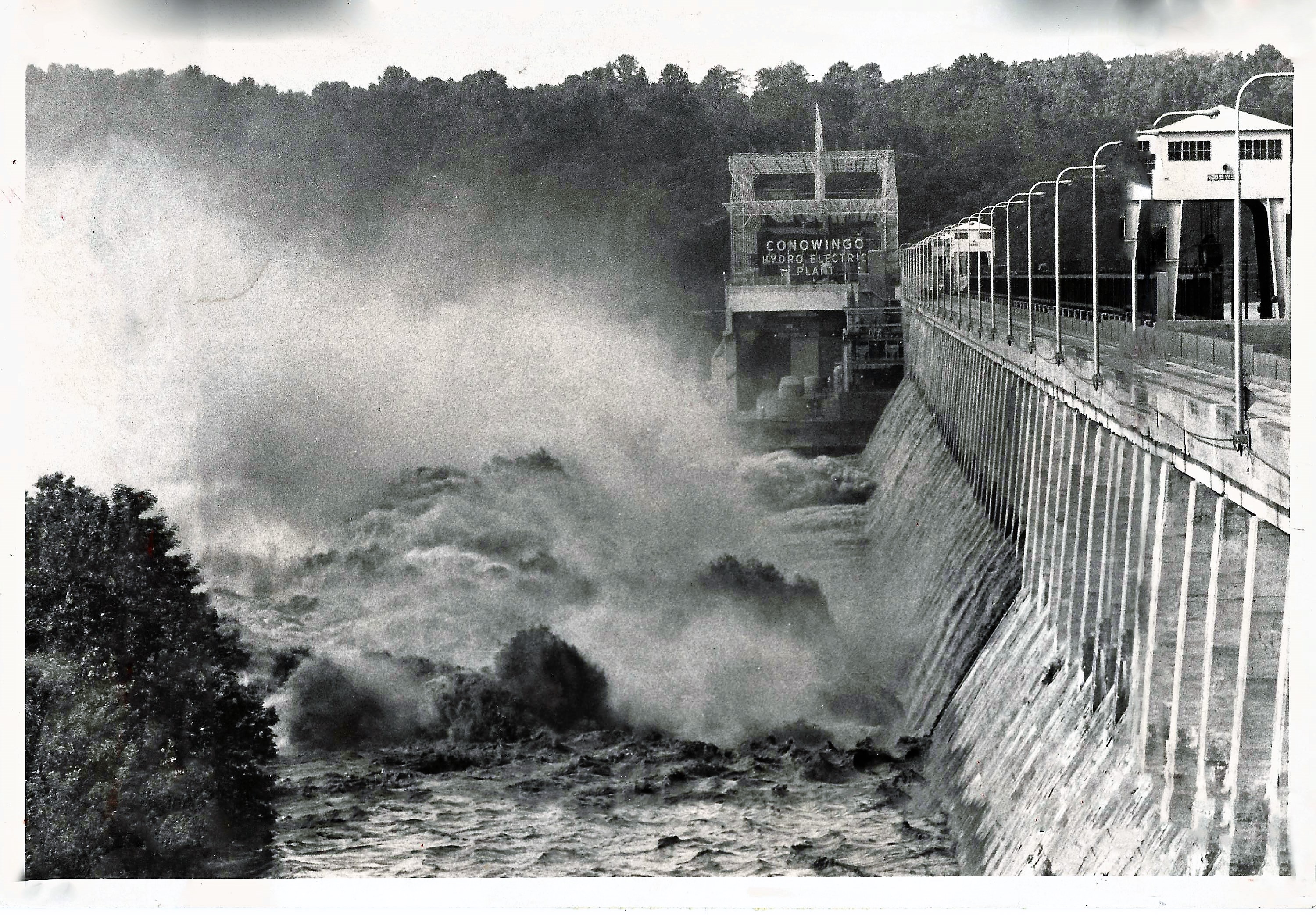
Notice there are no watermarks saying ebay or sun paper – that is because I do not steal these photos off the internet. They are in my personal collection.
19 Wednesday Oct 2016
Posted in engineering, filtration, water history
Tags
Baltimore, Dams, engineering, FILTRATION, kayaking, Lake Montebello, Montebello, Public Works, water, water history
Construction Management sent me this photo and asked if I know what lake this is! If you ever need a pond or lake dredged, these guys do it right. And ahead of schedule.
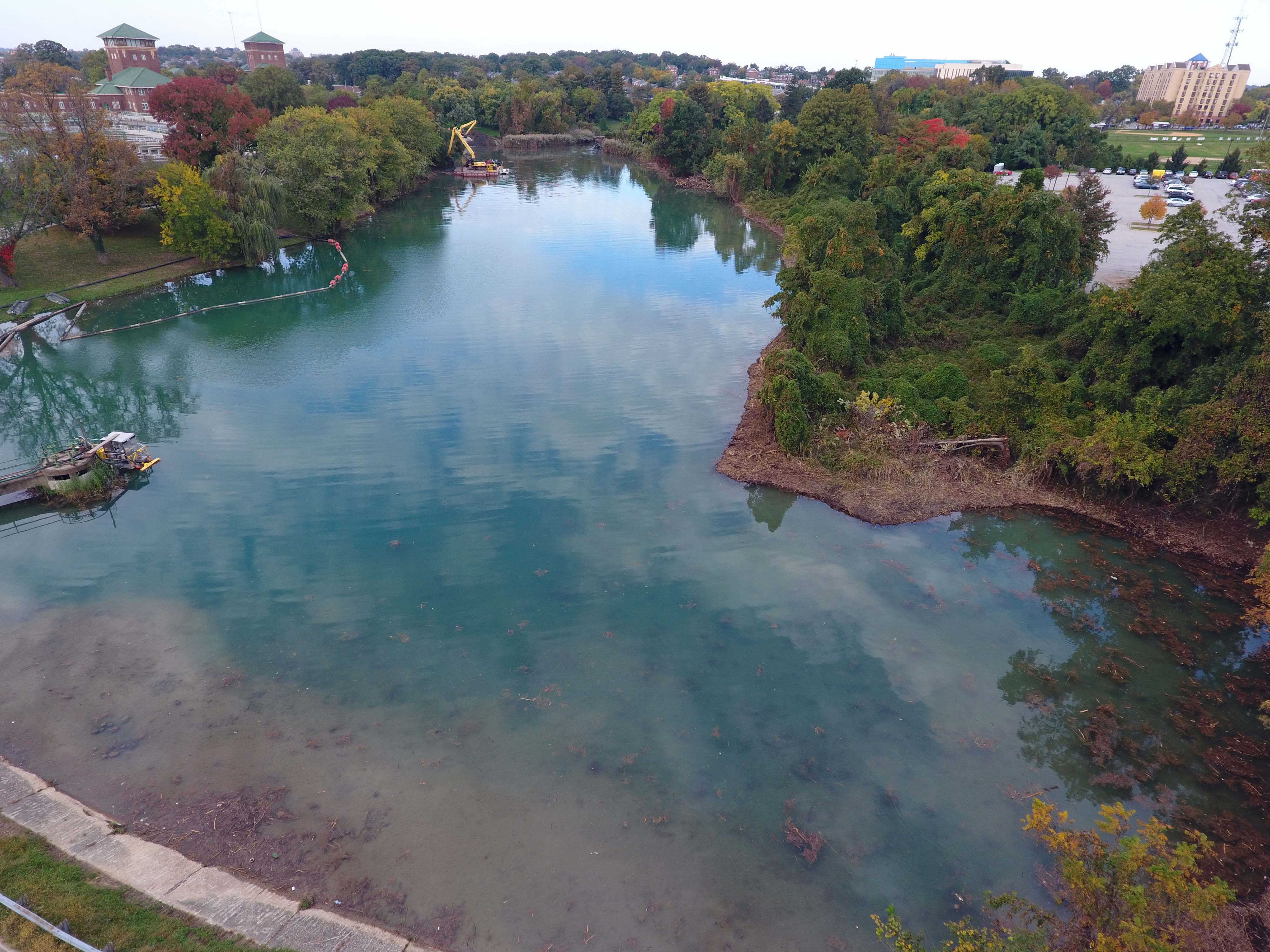
That cove on the right hasn’t been cleared in about 40 years! I need to bring my kayak to work! For inspection purposes of course!
