• About
  • History Writings

Water and Me

Water and Me

Category Archives: HISTORY

Scrap Booking DPW

20 Friday Jan 2017

Posted by Ronald Parks in Baltimore, HISTORY, POLITICS

≈ Leave a comment

Tags

Baltimore, city council, HISTORY, inauguration, mayor, POLITICS, Public Works, Snow

Scanned some scrap books from the Museum Archives. Most of the good stuff is usually on the reverse side of what the person glued, taped, stapled, into the book. On occasion, I do find some interesting and/or noteworthy articles. These two were from a DPW scrapbook that looks like the director put together. Mostly, the book documents snow storms and traffic.

In light of today’s events, I found this one interesting. While Baltimore was being covered by a snowstorm, the Mayor and his staff were in Washington DC for what is referred to as the “Kennedy Festivities”. The VP of the City Council tried to reach the acting mayor, who also left the city for DC. The Director and other higher ups in the political food chain were sleeping. So Willie D (William Donald Schaefer) took matters into his own hands. Schaefer later became the City Council President, followed by becoming Mayor and then Governor of Maryland.

sb8-014r

On the same page as this was an interesting article from the News Post. The title is a little confusing – if I take these pills, will I like my boss or ‘be’ like my boss?? In any event, Nation of Librium, enjoy your day and your new boss.

sb8-016a

Mrs. Jones, The Butcher, The Chicken and Hakeem

09 Monday Jan 2017

Posted by Ronald Parks in Baltimore, Health, HISTORY

≈ Leave a comment

Tags

Baltimore, DPW, Health, HISTORY, Museum, Research

Scanning scrap books from the museum. Weights and Measures.

sb7-018a

Mrs. Jones and the butcher.

sb7-018b

What about lead poisoning?

sb7-023

The Wise One!

Snow, Street Sweepers, Storm Water and Sewage

06 Friday Jan 2017

Posted by Ronald Parks in Baltimore, HISTORY, Sewage History

≈ Leave a comment

Tags

Baltimore, DPW, garbage, Jones Falls, POLITICS, Public Works, Sewage History, Street cleaning

The snows are upon us and as I drive to work and notice the gutters and storm drains, I think of what it was like years past…

1881 A great defect is observable in the streets of our city, namely: the surface drainage. House sweepings, kitchen slops, etc., find their way into the open gutters; pools of water collect at various depressed points, giving rise to miasms and odors that are anything but conducive to health during the hot weather, and in winter time invade the adjoining pavements by extension of layers, forming broad sheets of ice, dangerous to life and limb. All of this nuisance can be obviated, and the streets kept dry and free from offensive and pestilential odors, and sidewalks free from ice, by a proper system of sewerage. The present sewers of our city are not self-cleansing, and in consequence thereof there is imposed upon this department an immense amount of work, for which there should be given a sufficient sum to thoroughly clean and disinfect them.
1885 It occurs to me to say, that I think the emptying, during the winter season, of snow and ice out from the streets into the lower Falls, is a vicious practice, and should be henceforth prohibited. It creates bars of the filthiest street mud and refuse, which fill up the Falls and disfigure the walls until late in the Spring.
1908 Investigations show that large deposits (trash) are being formed in numbers of the existing drains, caused by street sweepings.
1911 A considerable portion of the dirt which finds its way into the sewers goes in through the un-trapped inlets, and it is a matter of common knowledge that the street cleaners, in order to lighten somewhat their labors, are accustomed to pushing the street sweepings into the inlets, thus allowing large quantities of dirt to be washed into the sewers. It must be borne in mind, however, that it is much more expensive to remove deposits of dirt from the sewers by hand than it is to remove them from the surfaces of the streets by carts.

img019b

Baltimore’s White Wing street sweepers.

img024b

Newer version, Hokey Cart street sweeper (Does he really look to be the type to just push his sweepings into the storm drains?)

184

That’s a lot of salt which will eventually head into the Chesapeake Bay.

Last Hike – First Hike

02 Monday Jan 2017

Posted by Ronald Parks in Hiking, HISTORY, Photography

≈ Leave a comment

Tags

Baltimore, Cromwell Park, engineering, Gunpowder Falls, Hiking, HISTORY, lime kiln, Loch Raven, nature, photography, Public Works, water history

The state parks around Maryland promote the First Hike of the year. The way Kathy and I look at it – any day is a good day to hike! And the weather couldn’t have been better! Last day of the year and the first day of the year hikes.

On Saturday we did a small hike at a park we never hiked before. Kathy came up with the idea to hike somewhere we never have for the last hike of the year and somewhere we have hiked for the first hike of the new year. Louis Krause Memorial Park was the last of 2016

001

When trees hunt no hunting signs

003

Small park wit a couple roundabout paths

006

After a complete circuit, leaving the woods we came upon these steps.

008

The top of a lime kiln

007

A kissing bench. (If you have been paying attention to my post, most hikes have benches)

013

An old kiln. This one is a lot smaller than the ones at Cromwell Valley Park.

016

Some history on the kiln

The next day, New Year’s, we took a hike at our favorite place to hike – Cromwell Valley Park. Lots of first day hikers there – it was crowded.

022

First stop – the big sycamore tree.

026

Kathy told me to lie down on the picnic table and take one straight up – ok, I’m easy!

030

Another type of view of the tree, using a filter.

031

A smaller kiln at CVP. A lot of people don’t even know this one is here. Can’t find any history on it.

036

Marble Spring. I’ve always called it bubbling brook. Usually there is some movement in here from the lime stone underneath meeting up with the spring. Watercress floating on top.

044

Almost done rebuilding the lime kilns. Just 6 years ago these were covered in vines and trees, crumbling apart. Amazing job these guys are doing.

045

New observation deck up on top.

047

The old log cabin

049

Simulated limestone in the top of the kiln. Across Mine Bank Run is the old Long Island Farm. Almost bought up by the City for Watershed property.

051

Steve Jobs first garage where he came up with the idea of a computer – I think? Maybe not!

1908 Baltimore

30 Friday Dec 2016

Posted by Ronald Parks in Baltimore, HISTORY

≈ Leave a comment

Tags

Baltimore, City Hall, glass plate negatives, HISTORY, Museum, POLITICS, Public Works, Trolley

More scanning of Museum stuff – came across this photo on pressed cardboard. Looking north on Guilford Street (Ave.)

misc010

Looking close you can see the elevated trolley tracks just past City Hall.

misc011

I use to be good at figuring out what the writing on the back of old photos said, but this I am unsure of? “View from ? Bank after ?” No idea of what it says in the circle? Bottom word looks like ‘subway’??

Loch Raven Property

10 Saturday Dec 2016

Posted by Ronald Parks in Baltimore, Dams, HISTORY

≈ 31 Comments

Tags

abandoned house, Baltimore, bricks, Eagles, engineering, FILTRATION, fishing, glass plate negatives, Gunpowder Falls, Hiking, HISTORY, Montebello, nature, photography, Public Works, water history

The day before taking off work for my daughter’s operation, I was contacted by CHAP – Commission for Historical and Architectural Preservation. They wanted to know if I knew anything about a fireplace mantle from Glenn Ellen Castle that was stored in a maintenance building downstream from the second dam? No. They were getting ready to tear down the buildings and were told by the contractors about the mantle.

tract2-3

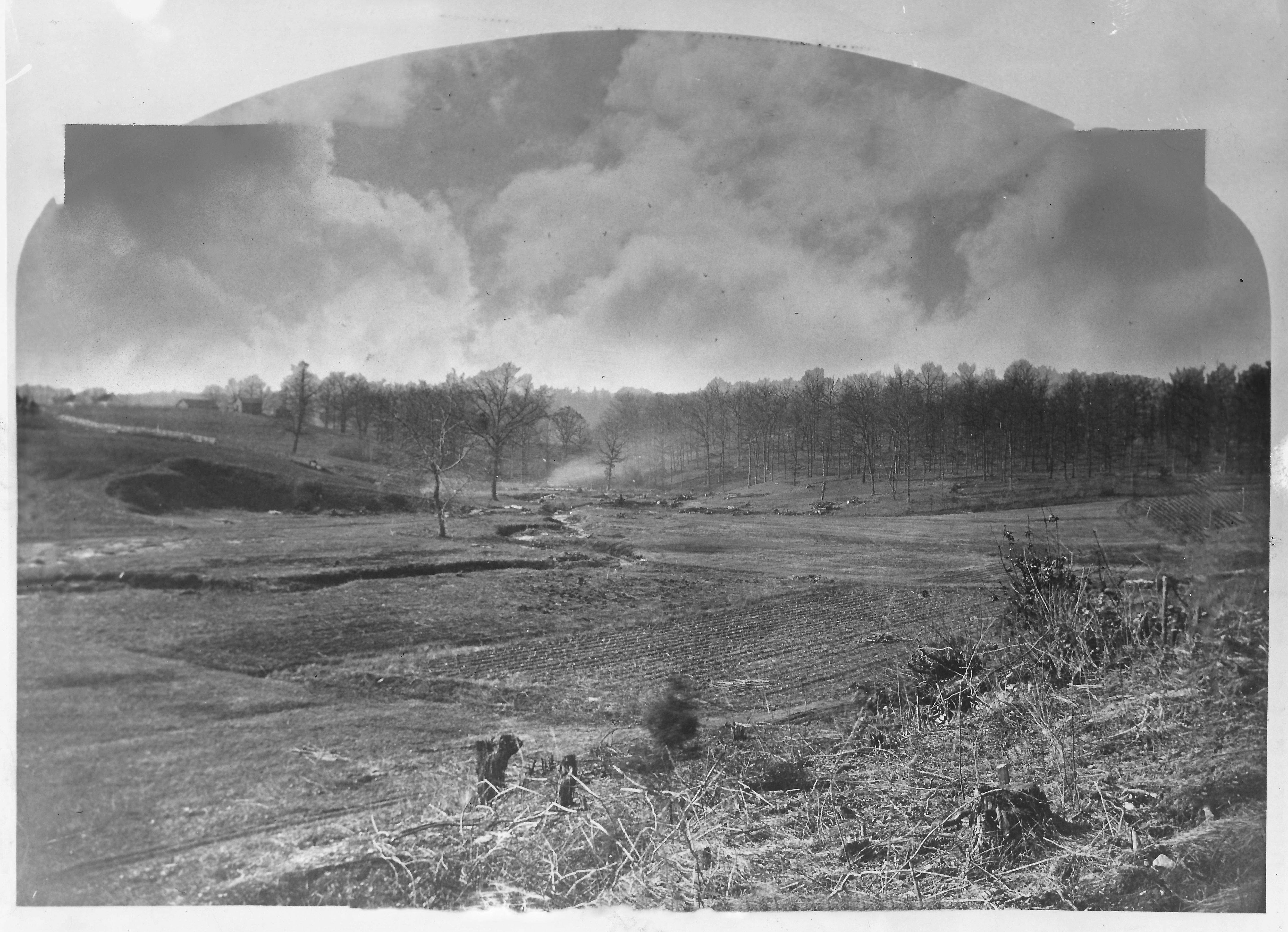
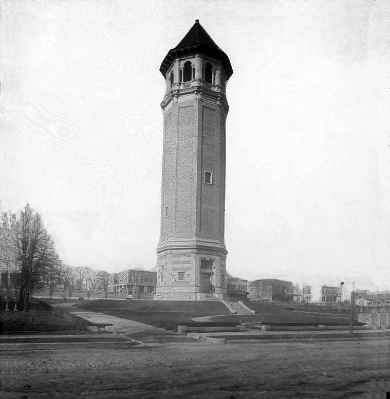
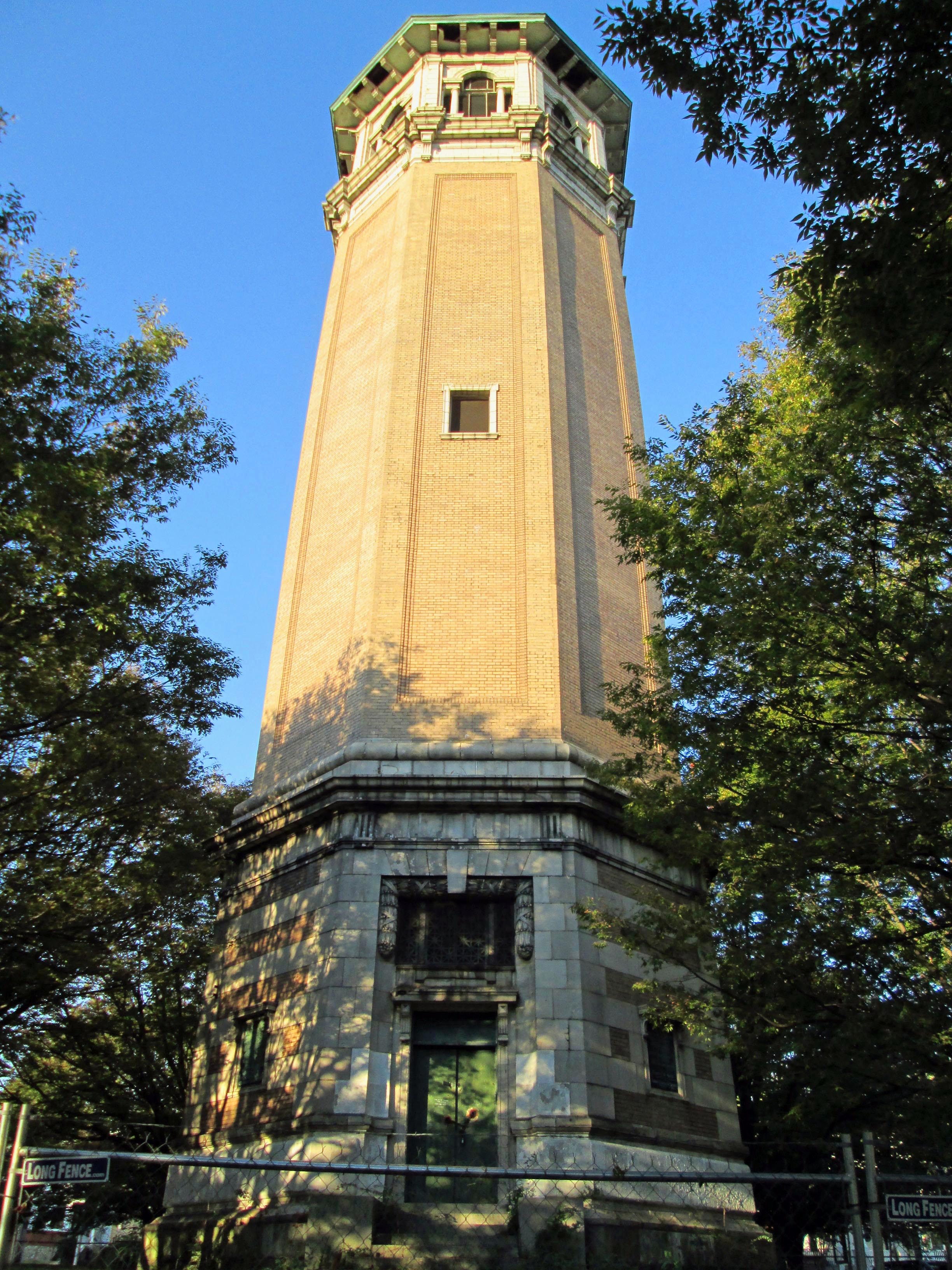
This was Glenn Ellen prior to raising the dam from elevation 188′ to 240′. The reservoir did not reach this height but it was still on watershed property and taken by the City. I think only the foundation exists now.

003

Earlier this week a friend of mine, Thom, contacted me and told me about some signs he saw on the property as he was hiking behind the construction site. At first glance I thought they were bronze plaques so I met him and Wayne to go exploring.

001

The hiking trail is on the hill behind the silt fence. This is where the signs were. Turned out to be steel and not bronze, but still worth keeping a couple for history’s sake!

011

Saw some interesting items so took a closer look. I thought it was odd that the contractor cut the beams instead of just knocking this building down. Come to find out a company called Bricks And Boards came up a removed the wood to re-purpose. The boxes contain core bore samples. Not sure why the City didn’t want to keep these? They do me no good without the engineer’s records saying where the samples came from.

017

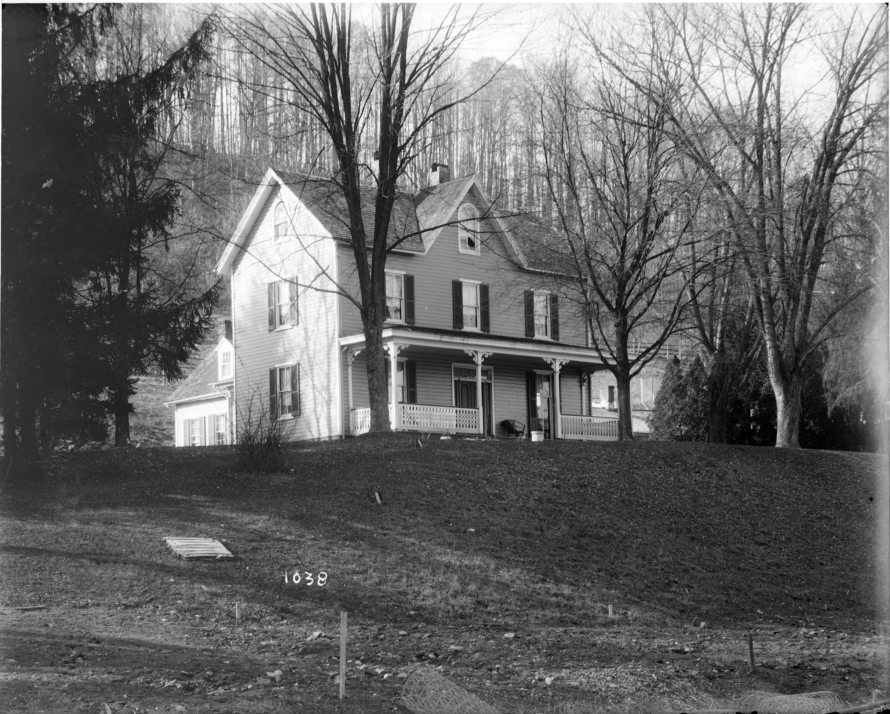
After rooting around in the barn we decided to head into the house. This is being knocked down also. A few years ago I was told there were lantern slides stored in here along with some old drawings. Back then, I wasn’t allowed in to look.

lochraven-1038

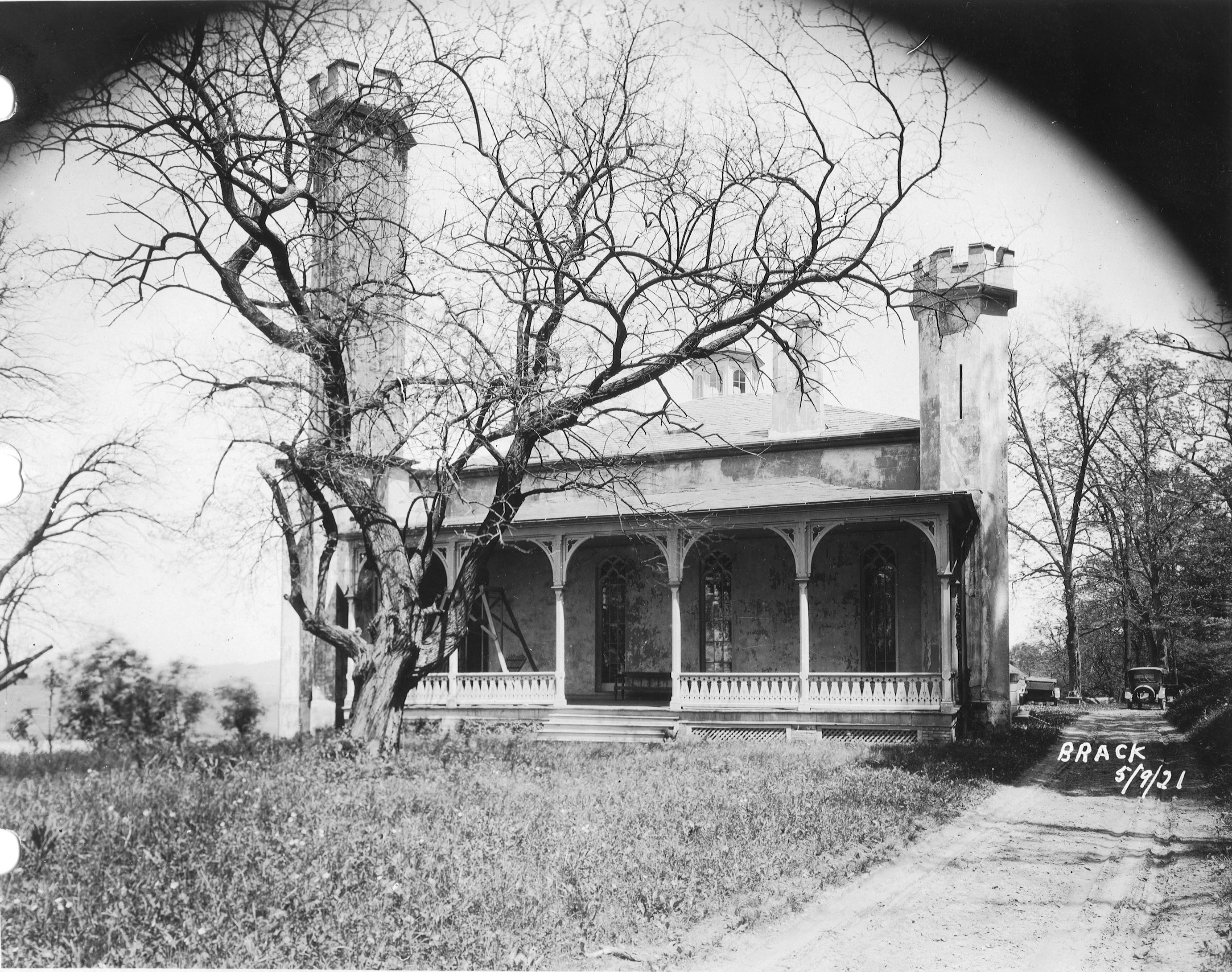
The house as it looked about the 1920-30s. I tried to find who was the original owner but had no luck. From a map of 1882 it has it listed as City Property. Adjacent to the Wisner, Shanklin properties. Further investigation is needed.

plate488

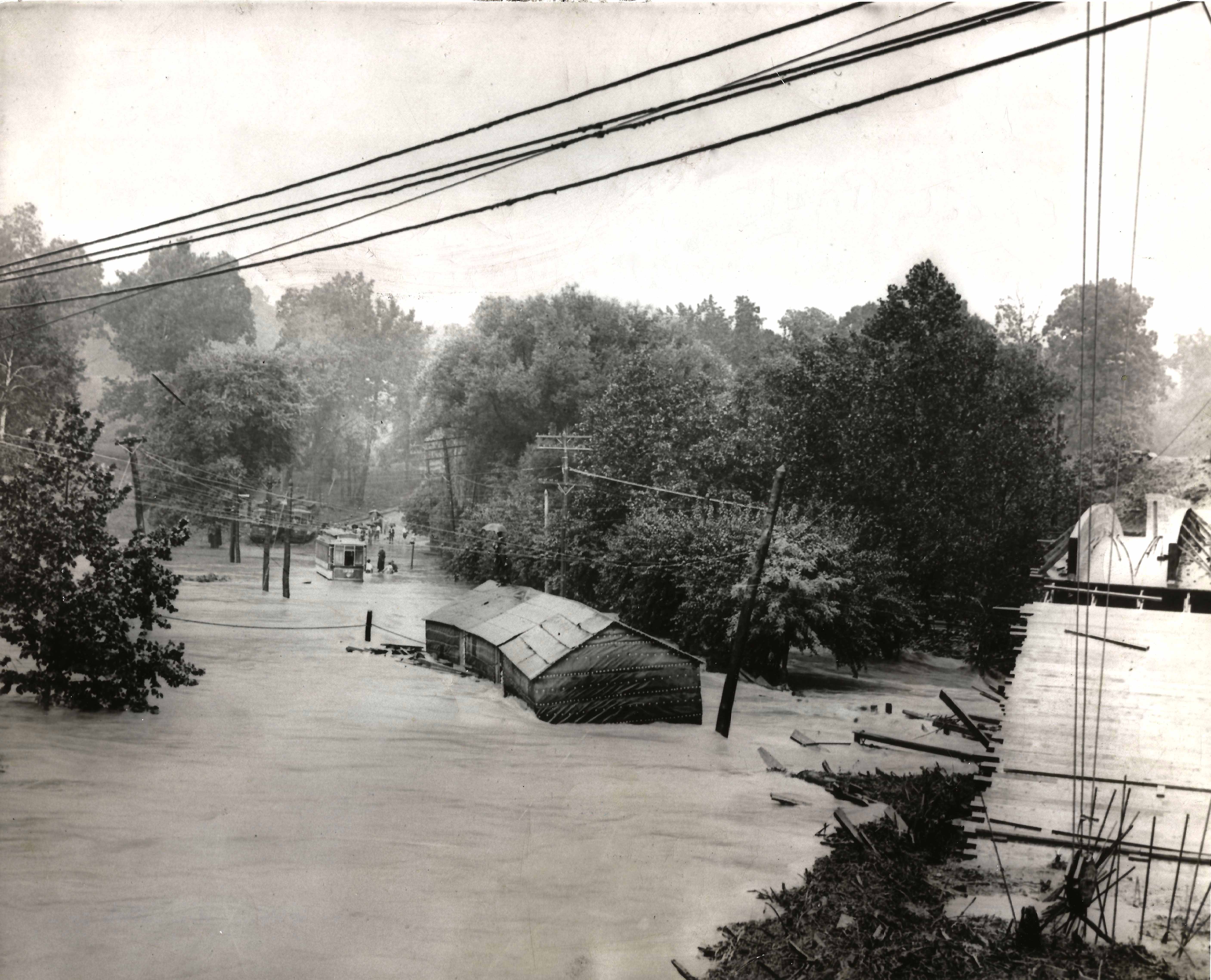
Wayne asked the date the house was built. Not sure but it shows up in a 1881 photo. Far right side just up from the Gunpowder River. This photo shows the dam near completion, ready to lay the last stone.

019

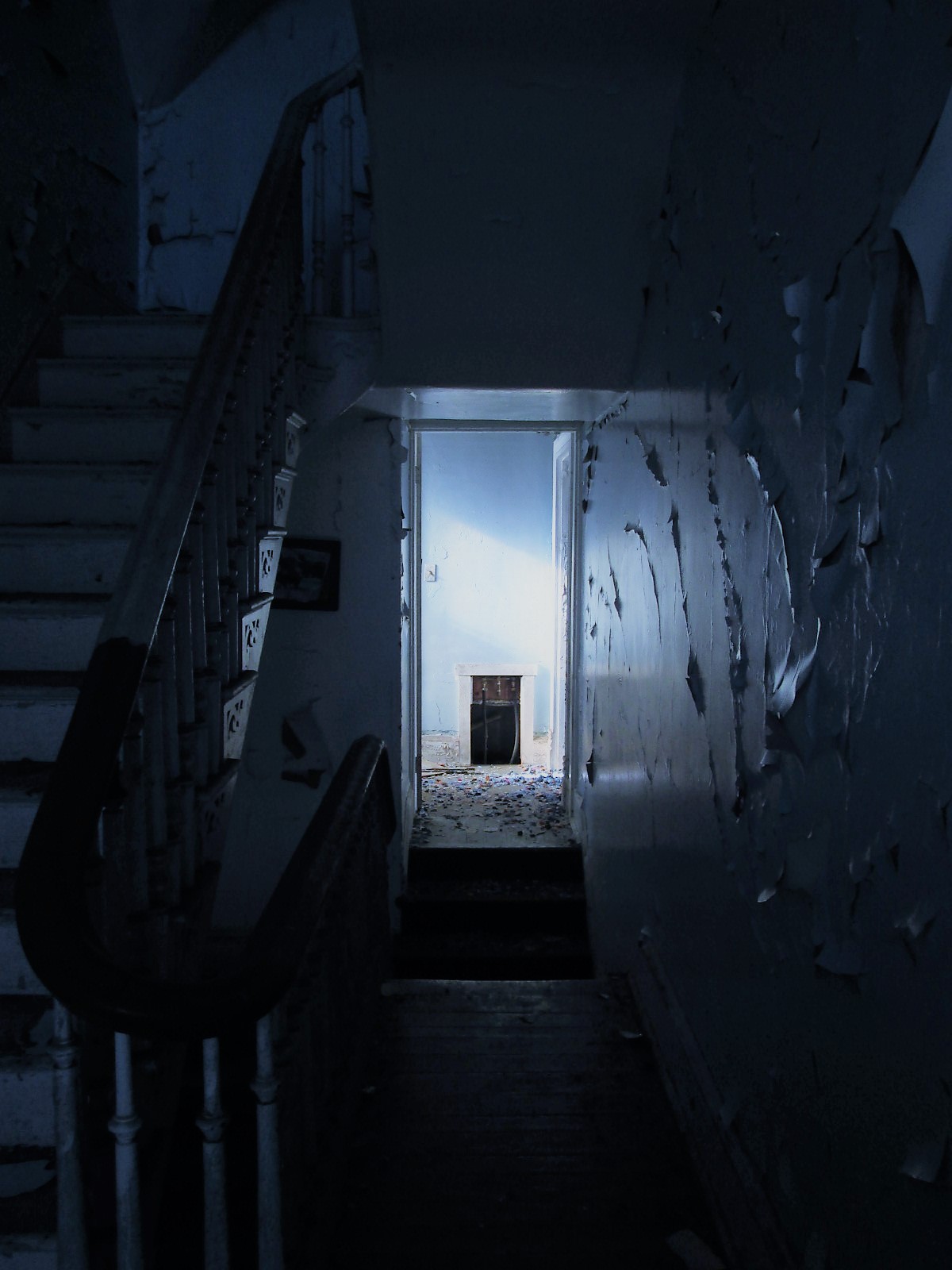
Back into the house. Entrance hall.

020

There are 3 fireplaces. One plastered over and two, like this one, with the mantles missing.
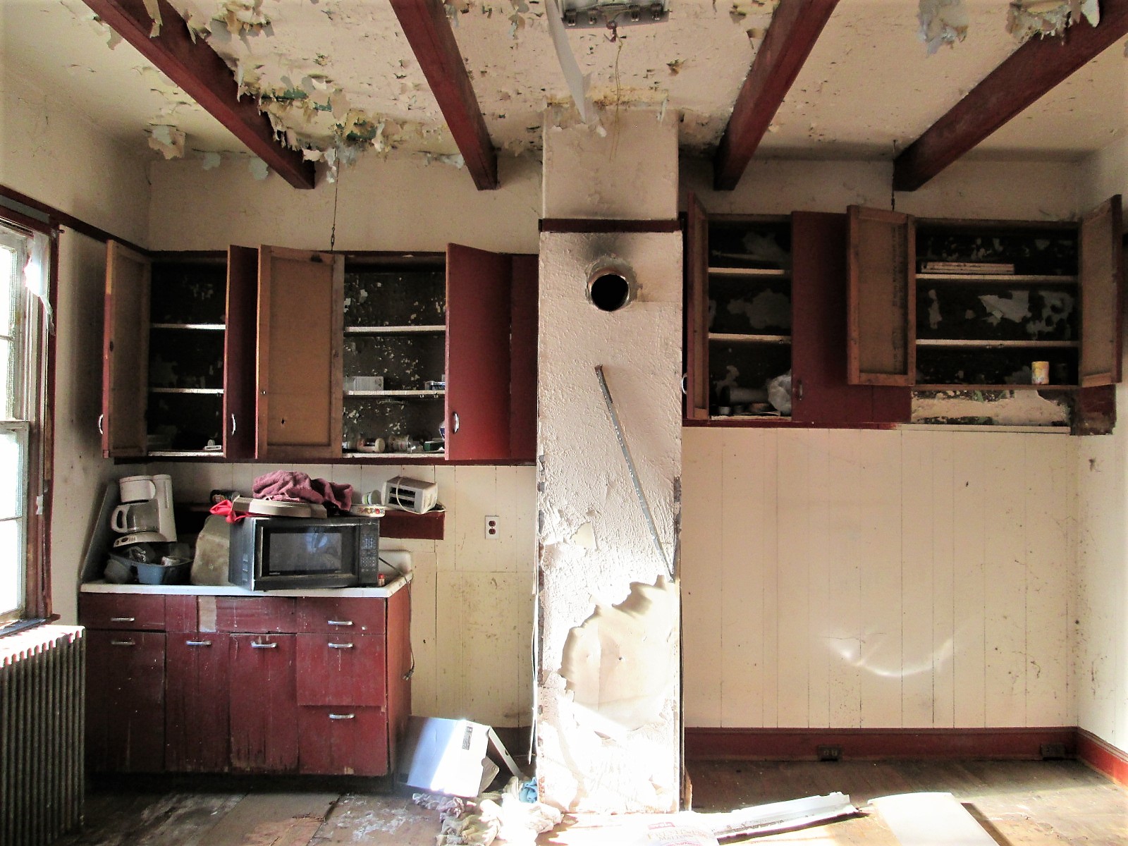
032

Kitchen.

034

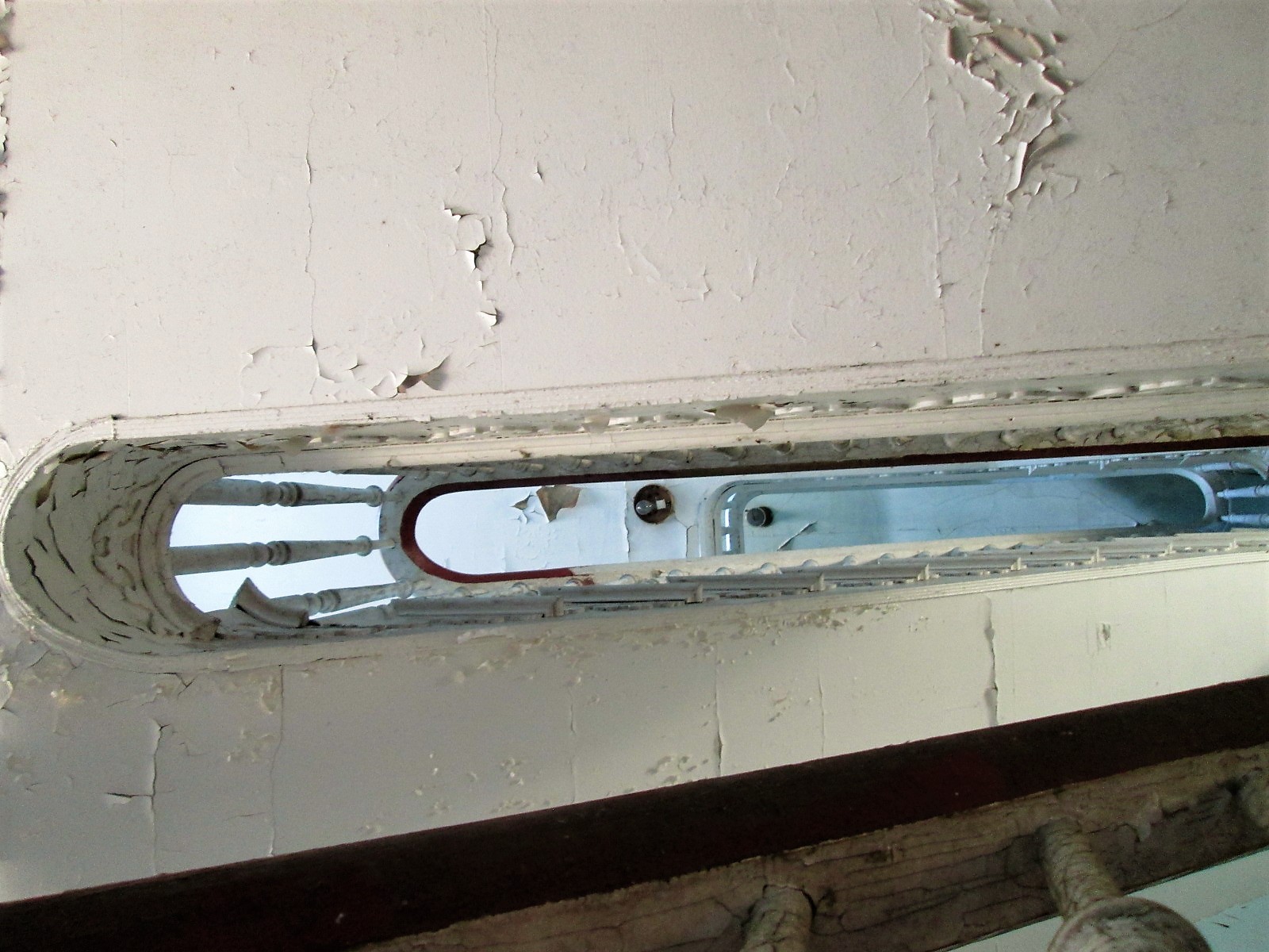
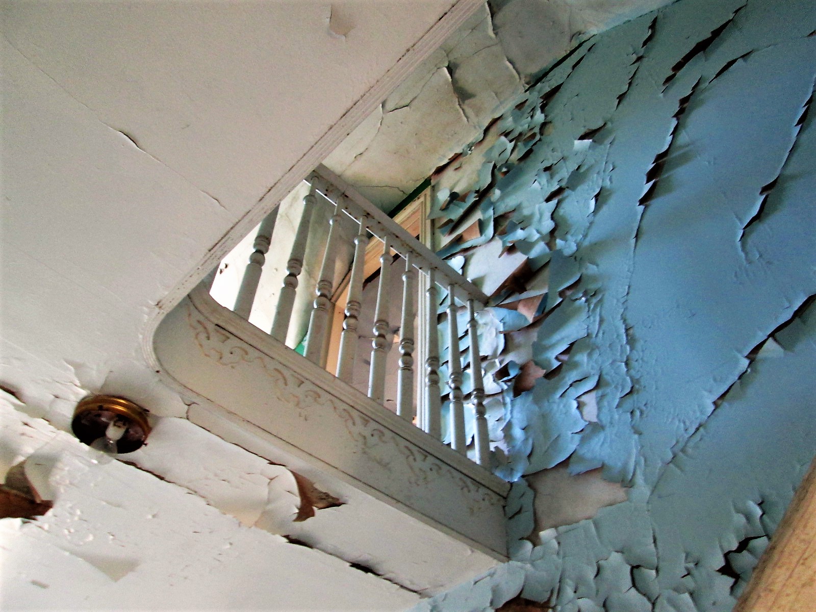
Looking up the stairwell. Three floors.

037

Second floor to third floor

042

This was a nice design – up the stairs to a landing that will take you in both directions. This is a huge house.

071

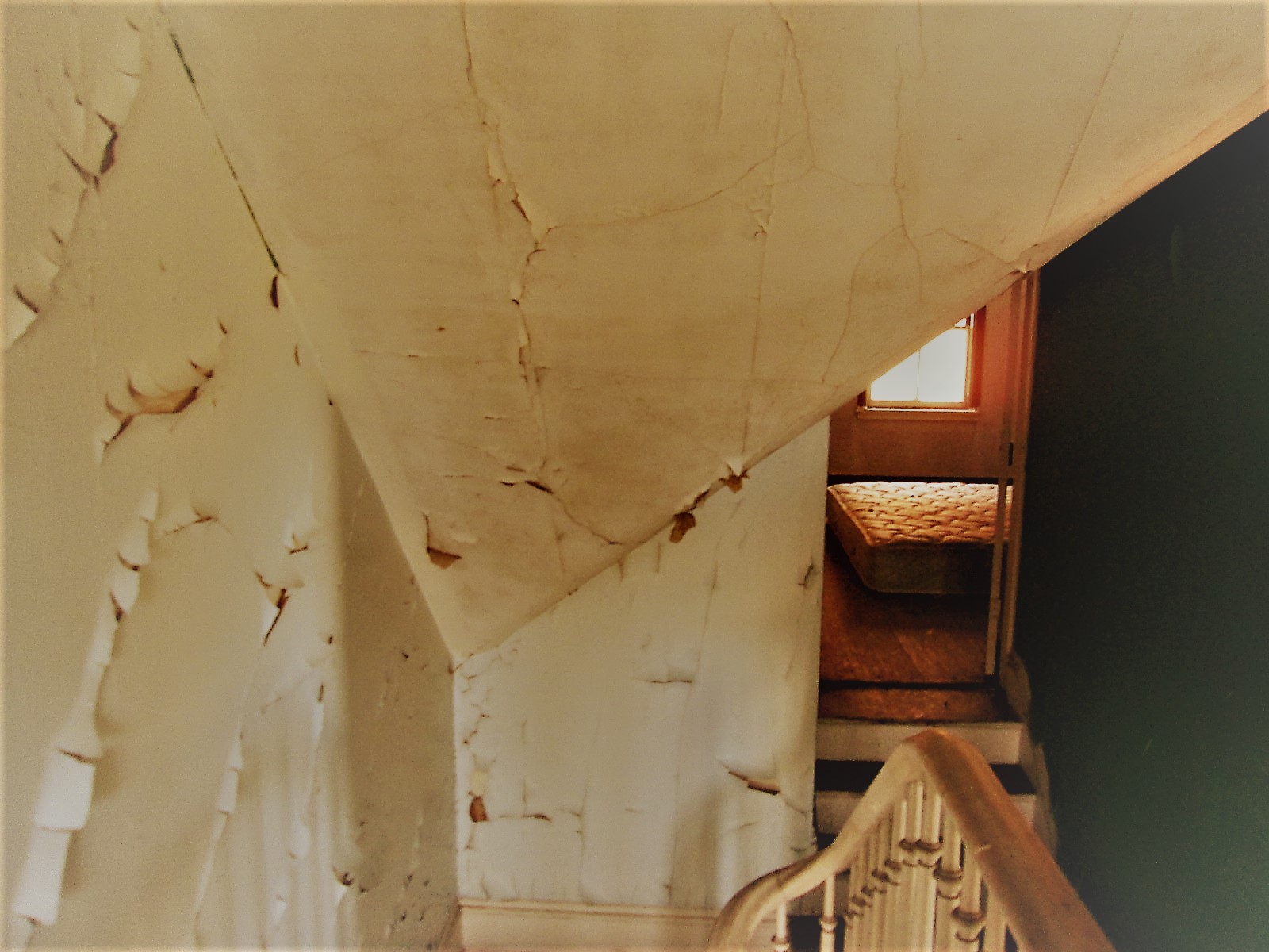
Lots of rooms – curves and angles.

049

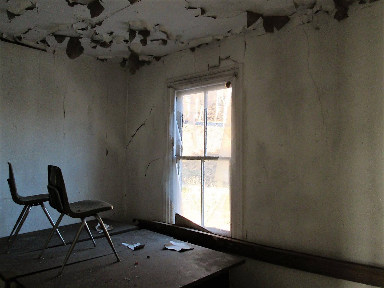
Chairs on a desk – watching…

067

One of the many views. Someone nailed a metal sign to the window? I would have loved to live here with this view. Two eagles were playing most of the morning over the lower reservoir. Nice!

072

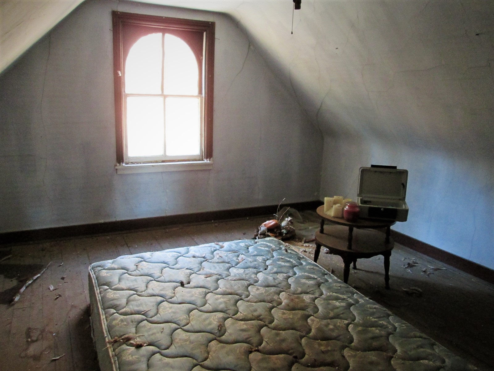
Another room. Candles, a bed, money box and stuffed ducks that look like the turkey buzzards tore open – must of thought they were real!

Prologue: I asked the contractor to hold two of the signs for me until I can come back up. He said ok…but, between my visit and when I sent off the email, Brick and Boards came up and took them. Talked to Max from there and he said they are in his warehouse and I can come pick them up!

Their site: https://baltimorebrickbybrick.com/2016/08/04/brick-board-is-here/

Random

30 Wednesday Nov 2016

Posted by Ronald Parks in Hiking, HISTORY, kayaking, Photography

≈ 1 Comment

Tags

golf, Hiking, HISTORY, kayaking, nature, photography

055

 NASSAWANGO IRON FURNACE:From 1828-1850 the Nassawango Iron Furnace was in its heyday. Many workers – miners, sawyers, colliers, molders, draymen, and bargemen – labored to make iron. They gathered bog ore from Nassawango swamp, brought clam and oyster shells up the canal via the Pocomoke River from the Chesapeake Bay, and made charcoal in the Pocomoke Forest. These raw materials were loaded into the Iron Furnace from the top, heated to 3,000 degrees, and the two resulting liquids were drawn off at the bottom of the furnace. Slag was cooled and tossed into the swamp. Iron was poured into molds and loaded onto barges which were towed down the canal by mule to waiting ships for transport to Baltimore, Philadelphia, and New York.

054

It was closed! Closed on October 31st.

079

Left there and went to Milburn Landing on the Pocomoke. Glad I don’t have to rake all those leaves!

076

The landing. A couple reviews I read said it doesn’t get crowded. Kayak time!

090

After that we found an abandoned golf course – Nassawango. The club house.

081

Leader board?

083

I prefer Putt-Putt

086

But I don’t remember seeing one of these at Putt-Putt? Ball warmer?

098

Then heading back to the farm we spotted a couple eagles – and this is why I’m not an animals in nature photographer!

130

Inside the barn. Nice visit with Kathy’s family.

Herring Run Walking (or running) Tour

21 Monday Nov 2016

Posted by Ronald Parks in Baltimore, HISTORY

≈ Leave a comment

Tags

Baltimore, bridges, engineering, Floods, HISTORY, Lake Montebello, Montebello, Public Works, water history

I was not the only one asked for information concerning Herring Run. All this info is for a walking tour on Black Friday. This instead of Mall Madness. Another submission of info:
The design for the Pedestrian Bridge at Sinclair Lane began in 2010 with final greenway plans dated on January 31, 2014. The bridge was designed by Wheeler in Bloomington, Minnesota and fabricated by Big R Bridge in Gresley, Colorado. A new pedestrian bridge was built in close proximity to Sinclair Road since the new ten foot wide greenway trail could not be accommodated using the existing Sinclair Road bridge. Also, the new pedestrian bridge location was selected to span the narrowest portion of the Herring Run Stream and the bridge length was determined to not encroach the Herring Run Stream’s 100 year flood elevation and cross over the existing DPW utility sanitary and 84” water pipes.
This info got me thinking about various reports I had read recently. Not concerning a 100 year flood, but about what would happen if the dam gave way at Montebello Lake??
August 2000 – Danger Reach Study for Lake Montebello MD Dam #107. Prepared for DPW, Bureau of Water and Wastewater. Has a lot of graphs, charts and data. ‘What if’ scenario of a dam failure at Lake Montebello, between Harford Rd and the Park. The consultants do not believe the water would go over the Harford Rd bridge, but under. They do believe it would overflow four feet above the Belair Rd bridge at Herring Run. It would overflow Manasota by two feet and Brehms lane by four feet. Sinclair Lane would be two feet under water. It would follow a path all the way to Moore’s Run. The dam is 600 feet long, 60 feet wide at top and 31 feet tall.
From the Emergency Action Plan 2016: Lake Montebello is an earthen dam built in 1880 as a water supply reservoir for the city of Baltimore. It contains approximately 410 million gallons of water, with a maximum storage of 606 million gallons. If the dam fails, this is what will be read by Emergency Management:
“Lake Montebello Dam, MD Dam No. 107, located northeast Baltimore City is failing. Repeat. Lake Montebello Dam, Dam No. 107, located northeast Baltimore City is failing. If you are in or near this area, proceed immediately to high ground away from Herring Run Park. Do not travel on the following roadways: Parkside Dr., Shannon Dr., Pulaski Hwy, North Point Rd, Bowleys Ln, Harford Rd, Mannasota Ave, Belair Rd and Sinclair Ln, in the vicinity of Herring Run Park. Avoid all residential roadways near the Park located in northeastern Baltimore City. Travel away from Herring Run Park. Avoid all residential roadways near the park. Do not return to your home to recover your possessions. You cannot outrun or drive away from the flood wave. Proceed immediately to high ground away from the area.”

dam-breach2

The dam in question is to the right of the lake. Shows the Harford Road bridge to the far right.

dam-breach5

This is how a rain induced flood looked many years ago, Harford rd. bridge to the right.

dam-breach3

Belair road bridge would be flooded 4′ above roadway.

dam-breach4

Brehms Lane bridge – would also be 4′ under. (Note: Bridge no longer looks like this and there are no longer any horse rides in the park)

Herring Run or Tiffany Run

17 Thursday Nov 2016

Posted by Ronald Parks in Baltimore, HISTORY, water history

≈ Leave a comment

Tags

Baltimore, engineering, glass plate negatives, Gunpowder Falls, HISTORY, Lake Montebello, Montebello, Public Works, Research, water history, writing

I was recently asked to do a brief history for the Friends of Herring Run Park, concerning the history of DPW activity in the park. More specifically – What is up with those concrete structures in the park that have pipes sticking out of them? They are air relief vaults for the Susquehanna pipeline. So, instead of a brief, one line answer, I decided to give them a Readers Digest version for the building of the Susquehanna pipeline.
As in most cases, when doing basic research, I always get distracted with other history facts I find. The story of my life (Well, the story of my life is another book I wrote, which is out of print. Too many people disagree with what I wrote about MY life and MY memories. I did however see a copy on Amazon for $354.00! Ha!)(See what I mean about getting distracted!!)
Anyway, I came across the below 1854 report that mentions Herring Run as a possible source of water for the City of Baltimore. If not a source, then possibly build a reservoir there. The author of the report, Alfred Duvall, who signs the report as a ‘Practical Engineer’ also suggests a reservoir on Tiffany Run, which is a stone’s throw away from Herring Run. By 1875 they decided on Tiffany Run for the new reservoir, that would be filled via tunnel from Loch Raven.

1854

Duvall’s 1854 report. Interesting read.

2bw

Tiffany Run, prior to the 1875-1881 construction of Lake Montebello

montgatehouse1u

Lake Montebello soon after construction. Gatehouse to the left received water from Loch Raven, where a dam was built during the same years.

Roland Water Tower

24 Monday Oct 2016

Posted by Ronald Parks in Baltimore, engineering, HISTORY, water history

≈ 3 Comments

Tags

Baltimore, engineering, FILTRATION, HISTORY, Lake Roland, Montebello, POLITICS, Public Works, water, water history

Received an email – you know the kind – a city resident has a complaint, goes to their City Council Person, goes to the Director of Public Works, goes to my boss – who sends it to me to investigate: The area around the Roland Water Tower is the site of 24/7 drug dealing activity. Shouldn’t this complaint have gone to the police? Being the good employee that I am, I went to investigate. For a 24/7 drug spot, the grounds looked clean and I saw only 2 people, walking their dogs. My mission was to see if there was any available electricity for new lighting? There are already 5 street lights surrounding the property. I could not get inside the tower itself to see if there was electric. I doubt it.

Time for a history lesson: The Tower was built, according to the bronze tablets, between 1904 and 1905. According to my records the contract was awarded to two contractors – one for the steel tower and one for the brick enclosure. Then later, another contractor for the concrete pool and steps.

rsp02

The steel stand pipe being built by Tippett and Wood.

rsp01

The brick enclosure by John Stack. The steps and pool by the Andrew Co.

rsp06

The finished tower.

rsp04

As it looked this morning. There is a fence around it, which I was able to go through.

rsp05

Pieces of the tower are falling down. This is the purpose of the fence – to keep people out and to keep people away from the falling pieces.

The tower held about 213,000 gallons of water that it received from Druid Lake. The design was by William Fizone, who also designed the Montebello Filters. The pool has been filled in. In 1939 the Water Board turned the property over to the City Comptroller. In 2009 and again in 2011 consultants were hired to figure out what to do with this abandoned tower. It had a couple times been turned over to the Roland Park Community Association, who tried to raise funds to restore it. And it still sits – a magnet for the druggies and dog walkers.

← Older posts
Newer posts →

Blogroll

  • Flouride Action Network
  • lulu
  • My Book
  • WordPress.com
  • WordPress.org

Recent Posts

  • Bermuda 2023
  • ICELAND April 2023
  • George Chalmers of Fochabers
  • In Search of The Skipjack Ada Mae
  • Trap Pond Kayak

Blog at WordPress.com.

  • Subscribe Subscribed
    • Water and Me
    • Join 231 other subscribers
    • Already have a WordPress.com account? Log in now.
    • Water and Me
    • Subscribe Subscribed
    • Sign up
    • Log in
    • Report this content
    • View site in Reader
    • Manage subscriptions
    • Collapse this bar
 

Loading Comments...